Loading
by BlastRoom
A cumulative review bank covering ocean floor features, seawater properties, currents, waves and coasts, and ocean resources.
#earth_space_science
40 questions
One question set, multiple game modes. Tap any game to see it in action. Not sure which to pick?
Answer to place stones and capture territory.
Outrun the snow together.
Earn blasts, then hunt the other team.
Answer to earn energy, then climb.

The class blasts through walls together.
Bid on mystery lots. Most money wins.
Sell tours. Nice, standard, or a total scam.

Answer, restock, and serve the rush.
More correct answers pulls the rope your way.
Answer, then shoot down the alien wave.
Answer, then tap to leap the frozen ridge.
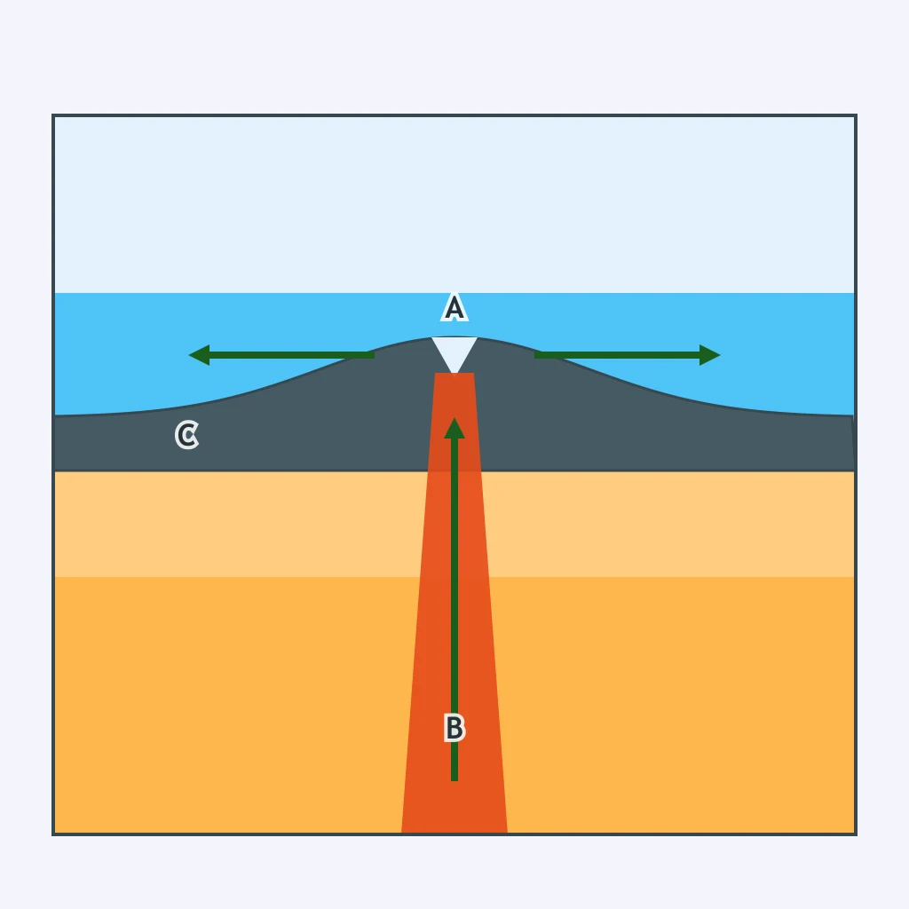
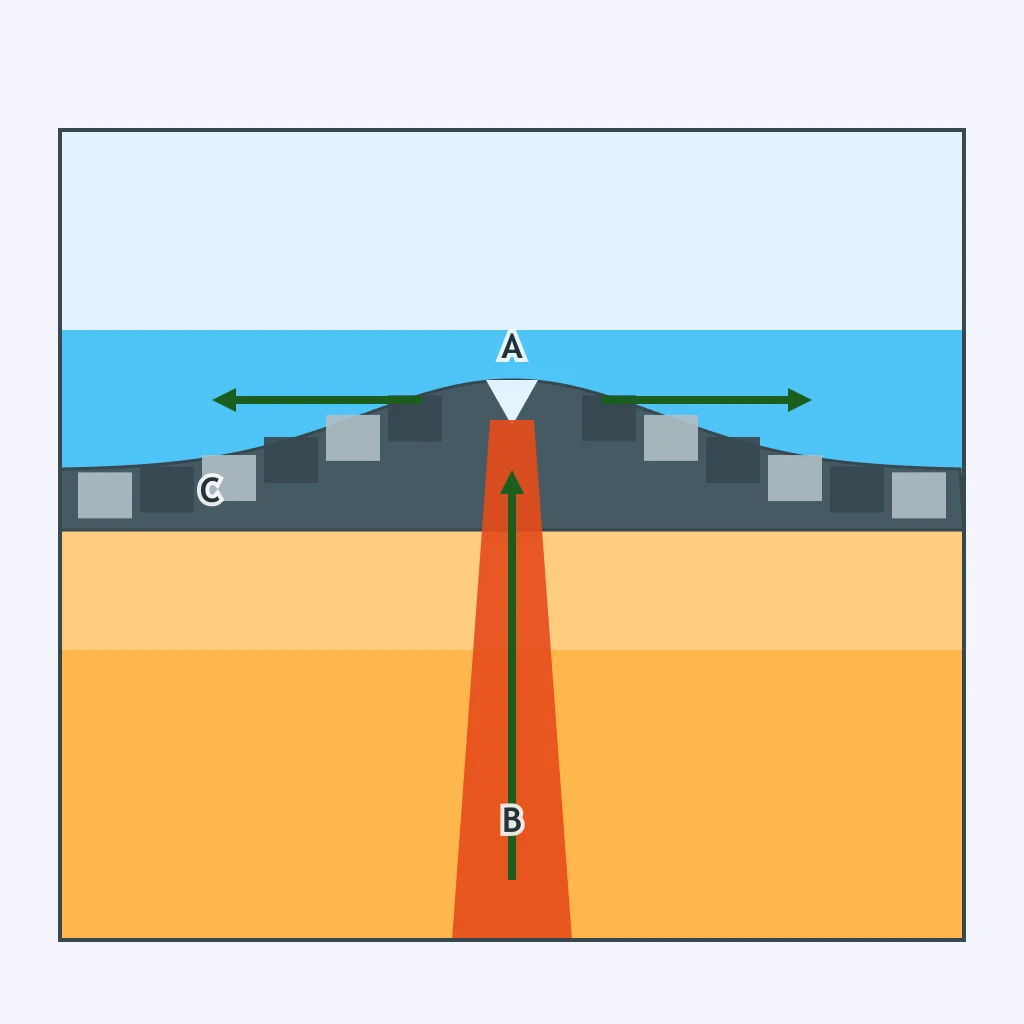
In the cross section, letter A marks a narrow valley splitting the ridge crest where magma rises to form new crust. What is that valley called?
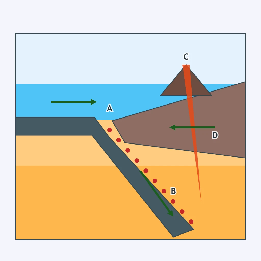
In the cross section, letter A marks a deep, narrow trough where an oceanic plate first bends downward beneath a lighter plate. What is that trough called?
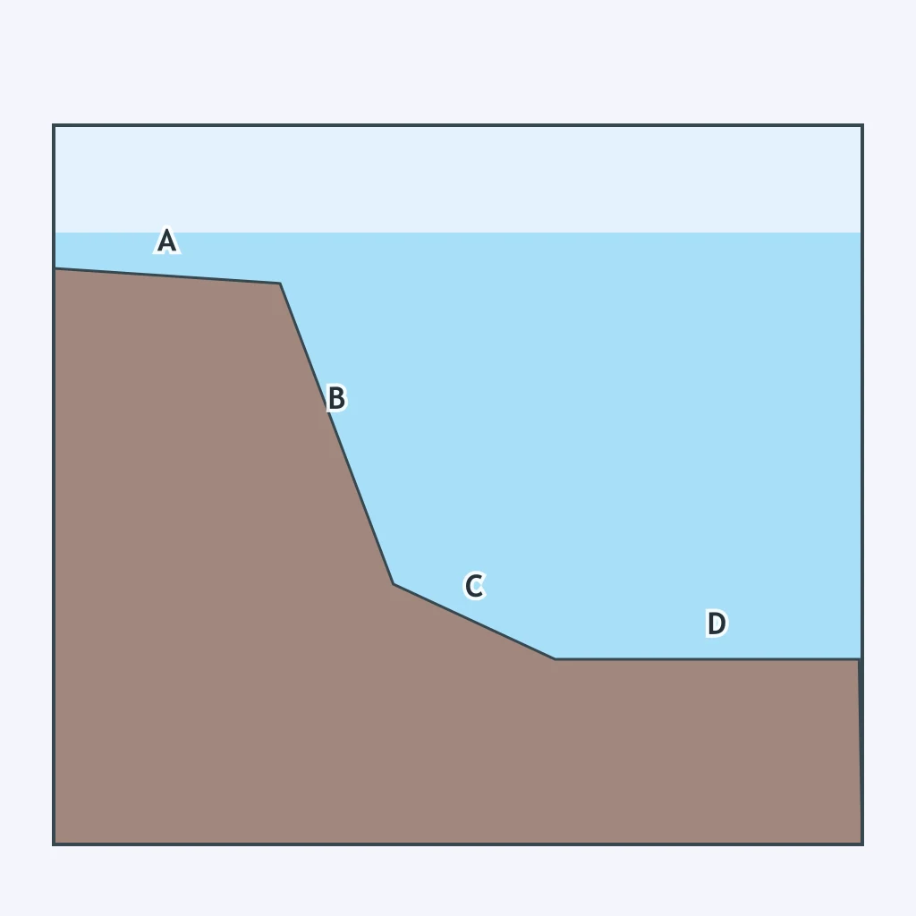
In the profile, letter A marks a gently sloping, shallow zone that extends out from the coastline before the sea floor drops off. What is this zone called?
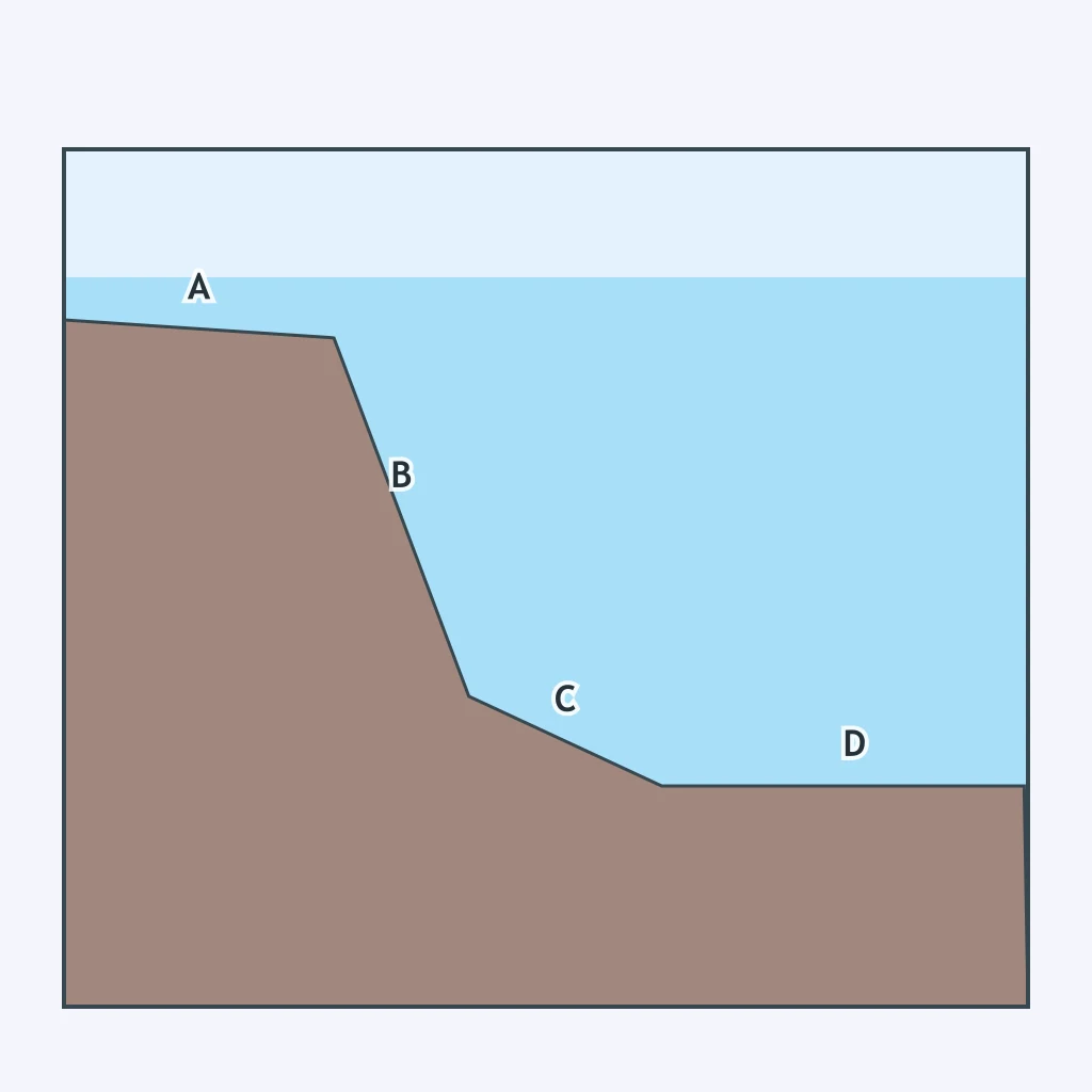
In the same kind of profile, letter B marks a steep drop where the sea floor plunges quickly toward the deep ocean basin. What is this feature called?
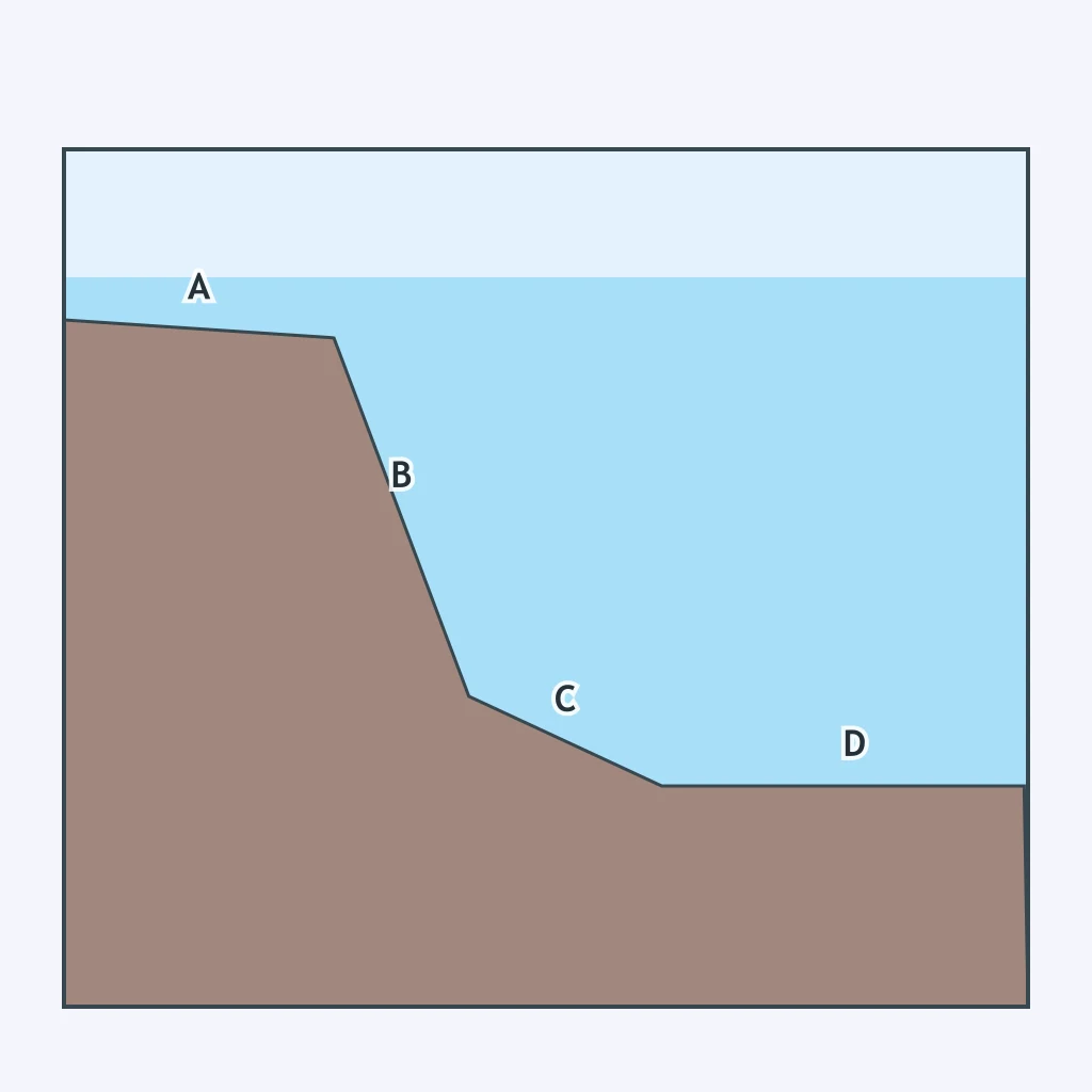
Letter C marks a gentler apron of sediment lying between the steep drop-off and the flat deep-ocean floor. What is this feature called?
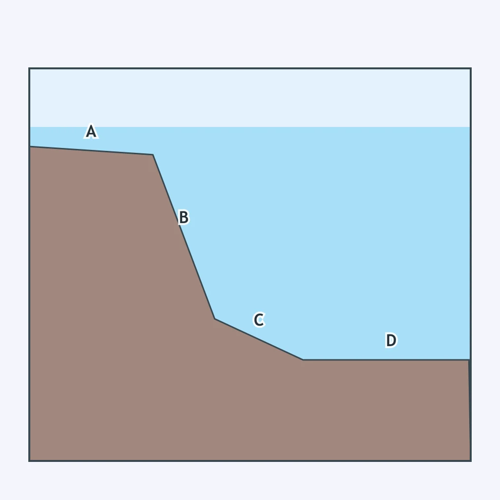
Letter D marks the broad, nearly flat floor of the deep ocean basin, far from any coastline. What is this feature called?
About how deep is the Challenger Deep, the lowest known point of Earth's ocean floor, located in the Mariana Trench?
Marie Tharp's 1950s mapping of the Atlantic Ocean floor revealed a continuous mountain range split by a deep valley running down its length. What feature had she discovered?
In the cross section, the mid-ocean ridge shows bands of crust with alternating magnetic polarity in a symmetric pattern on both sides of the rift valley. What does this pattern provide evidence for?
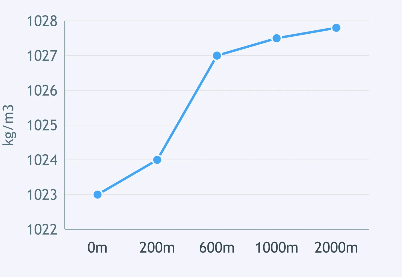
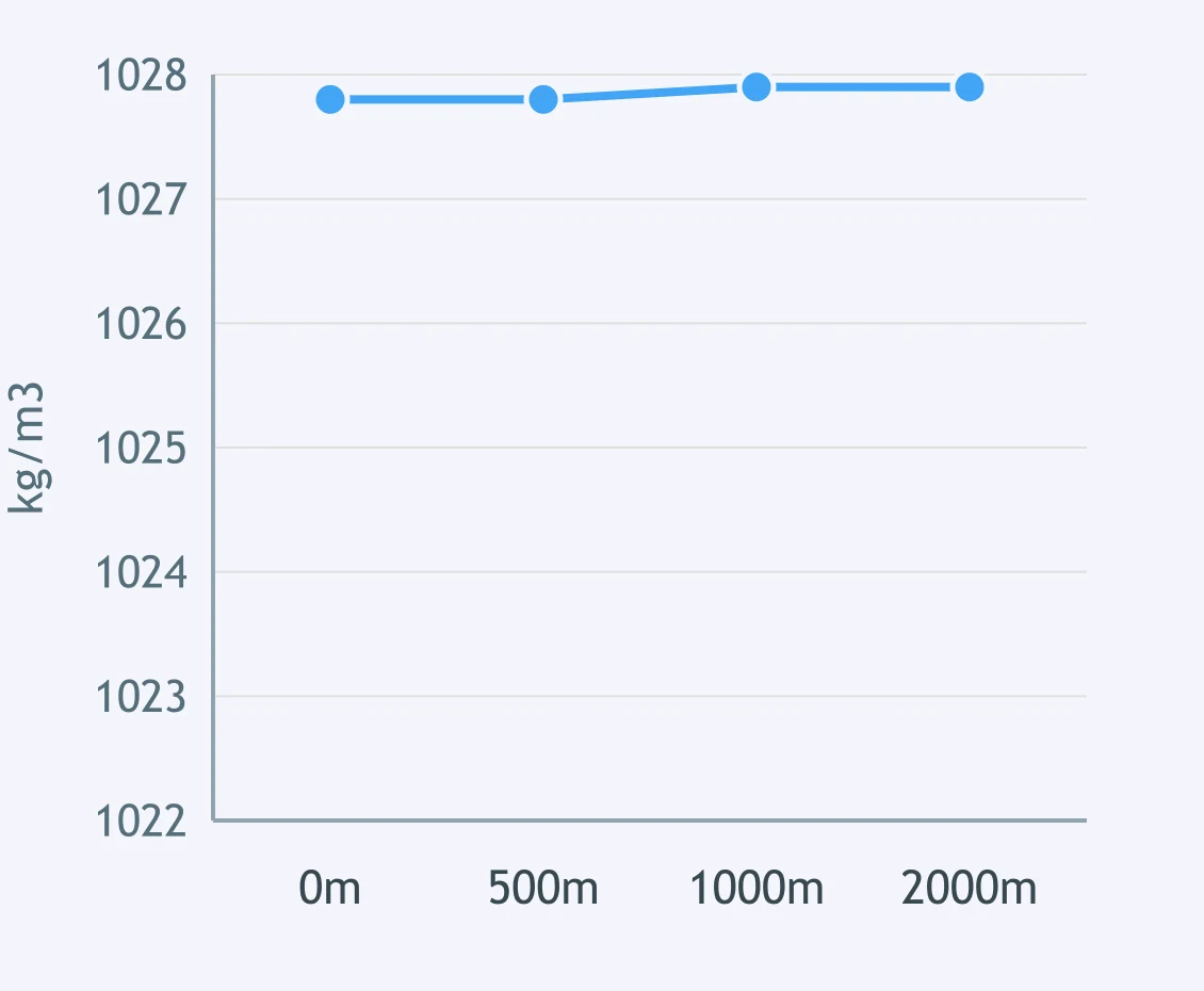
The graph plots seawater density against depth in the open tropics. What mainly causes density to rise so steeply in the depth band where the graph is steepest?
A graph plots salinity against depth near a river mouth. Salinity is low at the surface and rises quickly across a narrow band before leveling off below it. What is that narrow band of rapid salinity increase called?

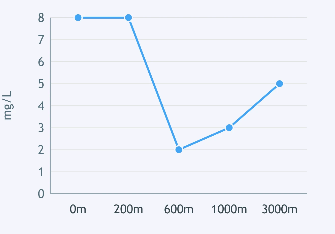
A graph shows dissolved oxygen against depth in the open ocean. Oxygen is high near the surface, drops to a minimum around 500 to 1,000 meters, then rises again at great depth. What mainly causes the mid-depth minimum?
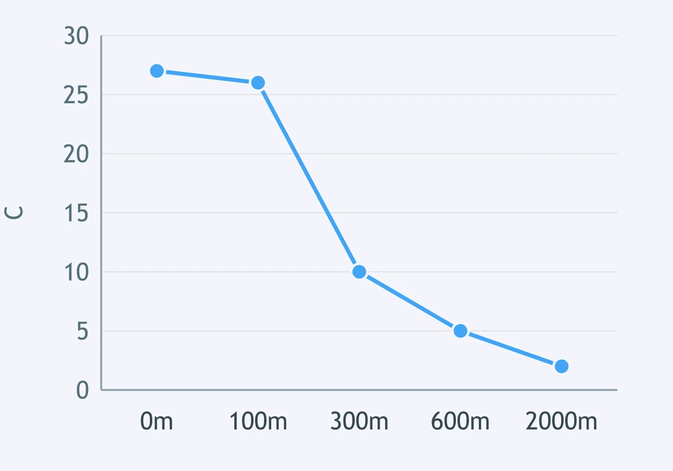
A graph plots ocean temperature against depth in the tropics. Temperature stays warm near the surface, falls sharply between about 100 and 300 meters, then levels off in cold deep water. What is the sharply falling zone called?
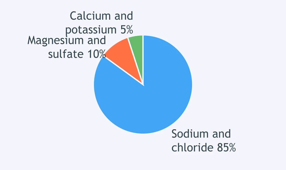
A pie chart shows the major dissolved solids in seawater by mass. Which ion pair dominates seawater's dissolved salts?
Ocean pressure increases by about 1 atmosphere for every 10 meters of depth. About how many atmospheres of pressure exist at a depth of 4,000 meters?
A graph plots seawater density against depth in the North Atlantic near Greenland in winter. Density is nearly uniform and already very high at the surface, unlike the sharp rise seen in the tropics. What does this pattern show?
What is the average salinity of open ocean seawater, expressed in parts per thousand?
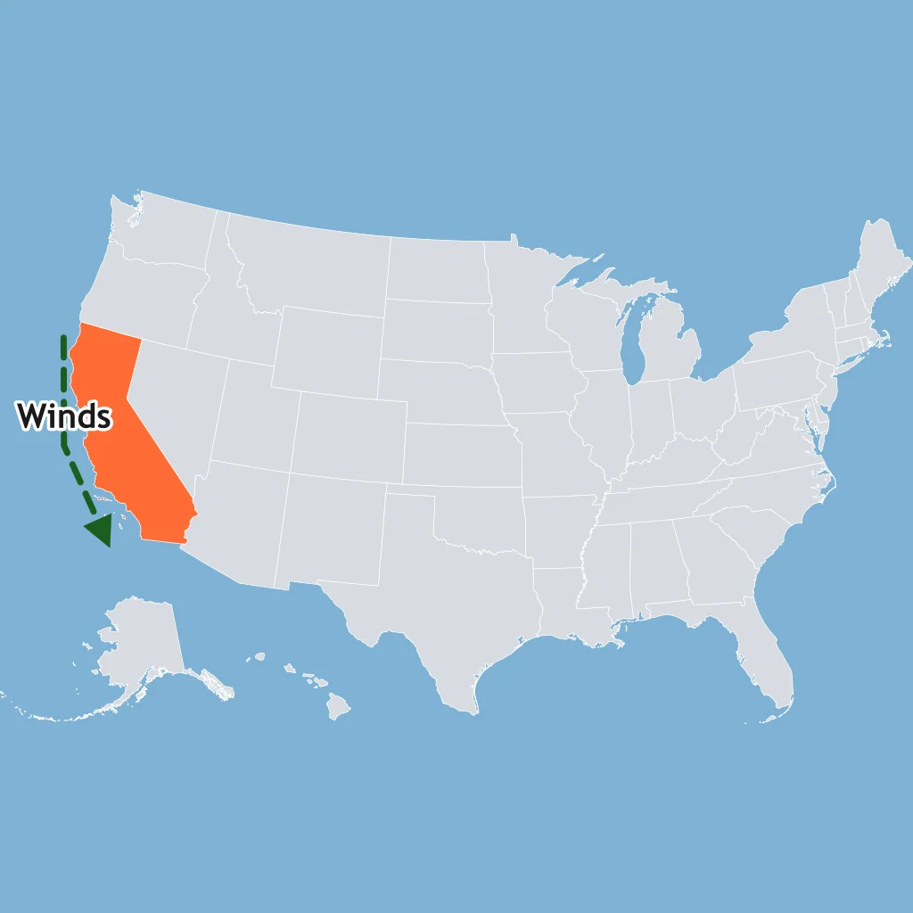
A map shows steady winds blowing along the California coast from the north, pushing surface water away from the shore. The water that replaces it at the surface is cold and rich in nutrients. What is this called?
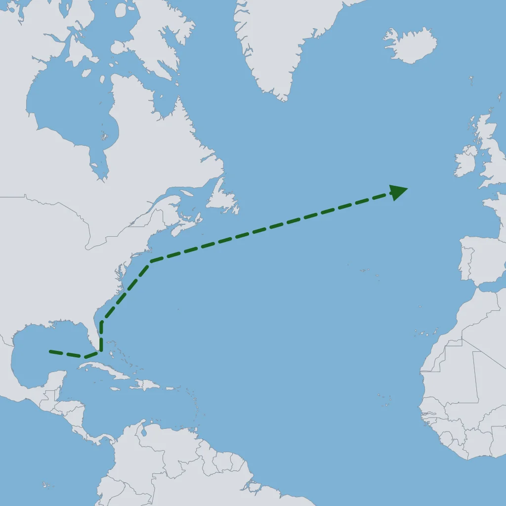
A map traces a band of warm surface water flowing from the Gulf of Mexico northeast along the U.S. Atlantic coast, then across the North Atlantic toward Europe. Which current does this route show?
A large, roughly circular loop of surface currents surrounds a calm central region of the North Atlantic where mats of floating brown seaweed collect. What is this calm central region called?
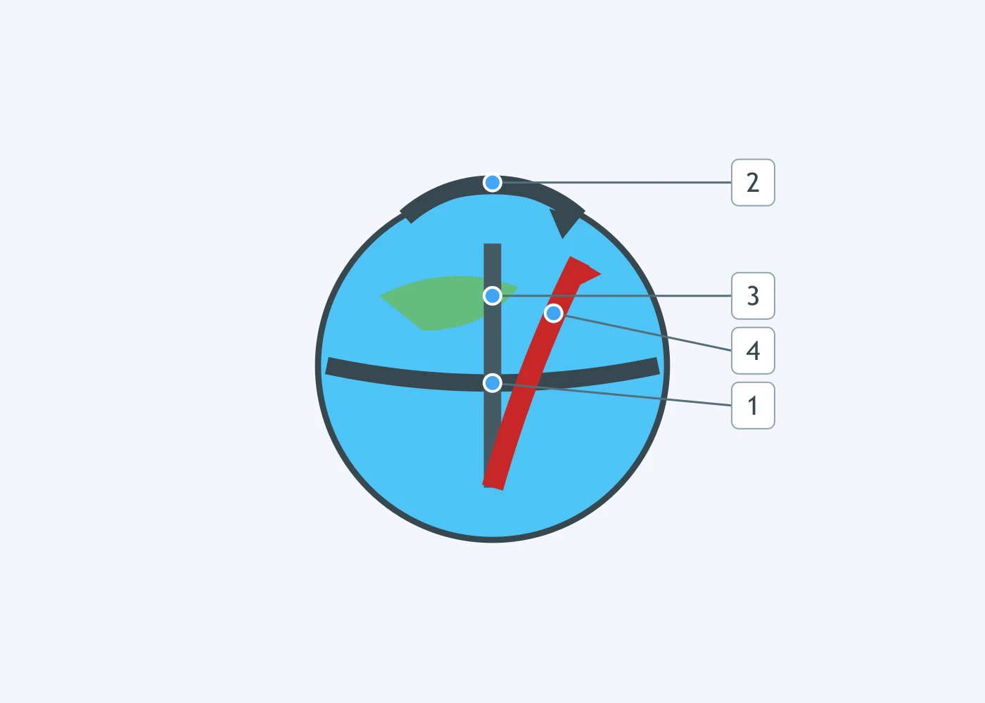
Use the diagram of a ball rolling across the rotating Earth. One numbered line shows the path it would take with no rotation, and another shows the path it actually follows. Which number marks the path the ball actually follows?
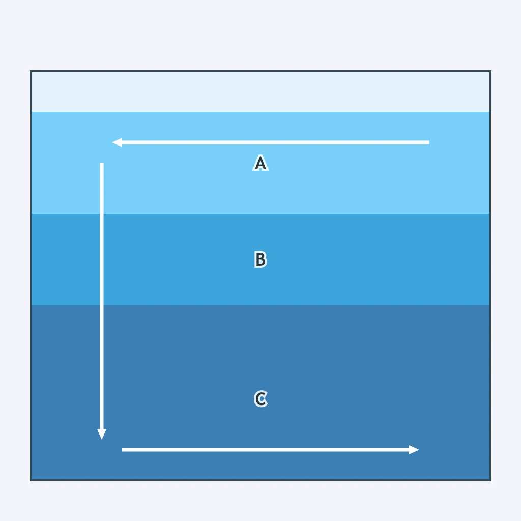
Along a coast, steady winds push surface water toward the shore and pile it up there. Which process then happens to that piled-up water?
In the cross section, letter C marks the deepest of three stacked water masses, colder and saltier than the layers above it. What global process does this dense layer sinking near the poles help drive?
Waves hit a beach at an angle, pushing water in a steady stream that moves parallel to the shore within the surf zone. What is this moving band of water called?
At a gap in a sandbar, water piled up by breaking waves rushes back out to sea in a narrow, fast channel that runs perpendicular to the beach. What is this dangerous return flow called?
In the Northern Hemisphere, the Coriolis effect curves major ocean gyres so they rotate clockwise. Which way do the major gyres rotate in the Southern Hemisphere?
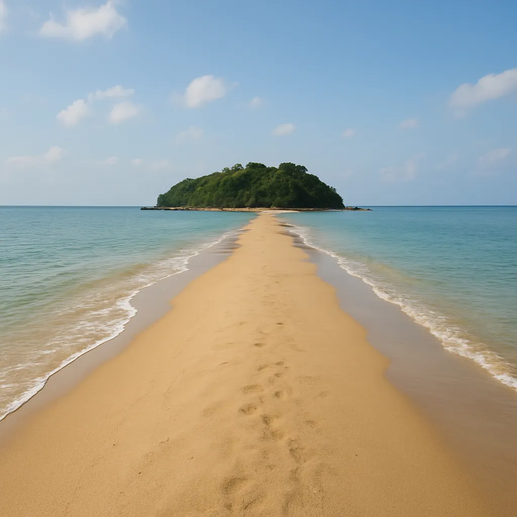
An offshore island lies half a kilometer from a straight beach. Longshore drift has built a continuous ridge of sand running from the shoreline out to the island, joining the two. Which landform has formed?
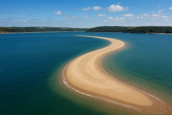
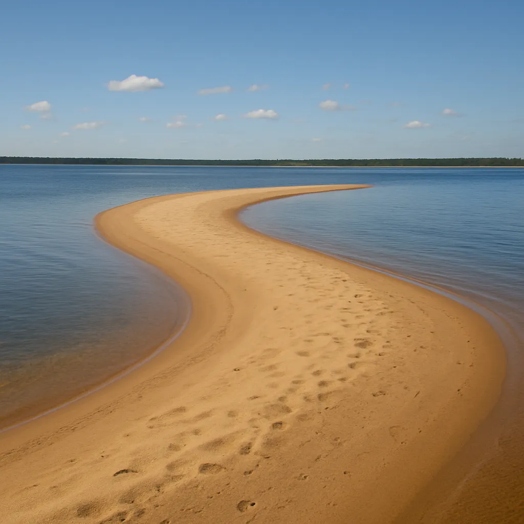
Longshore drift has built a long, curving finger of sand that extends from the shoreline out into open water but does not reach any far shore. What is this landform called?
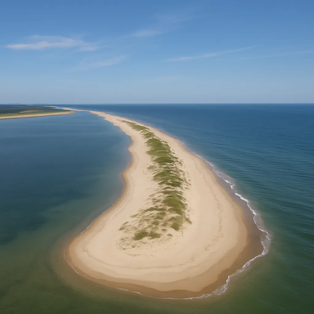
A narrow strip of sand runs parallel to the mainland coast, separated from it by a shallow lagoon, and takes the full force of ocean waves and storms. What is this landform called?
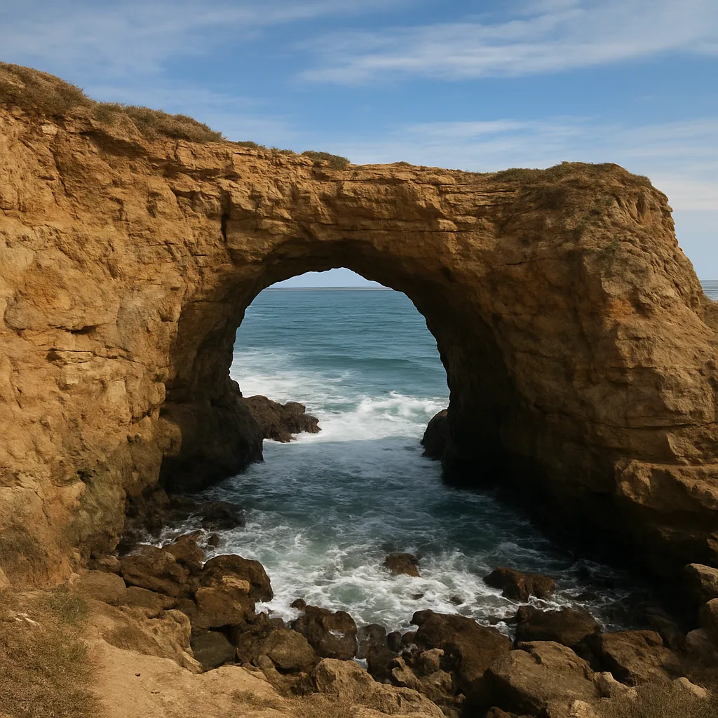
Waves have worn completely through a rocky headland, leaving an opening you can see the sky and sea through. What is this landform called?
Continued erosion has collapsed the top of a former sea arch, leaving an isolated pillar of rock standing apart from the cliff in the surf. What is this landform called?
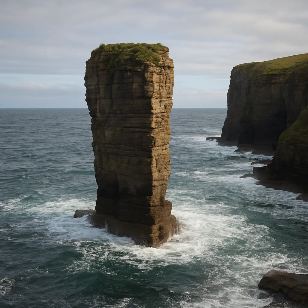
A river slows as it enters the ocean and drops its sediment load in a fan-shaped deposit that builds new land at its mouth. What is this landform called?
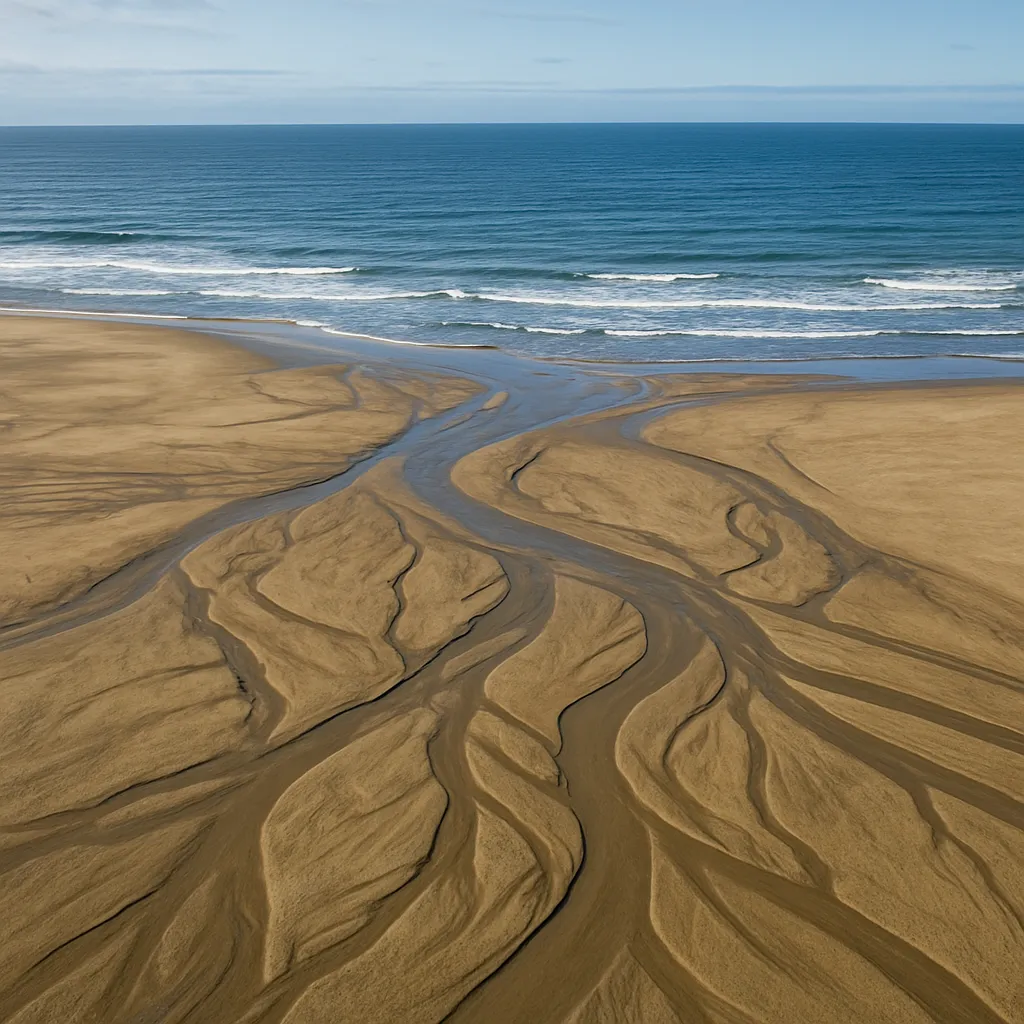
Waves refract around a point of resistant rock jutting into the sea, concentrating their energy there while their energy spreads out and weakens in the curved shoreline next to it. What is the jutting point of rock called?
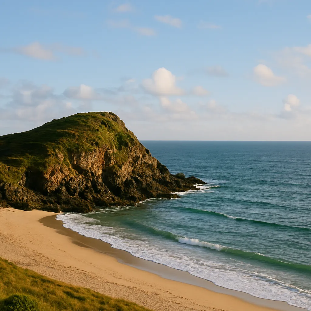
Where a river meets the ocean, fresh water mixes with salt water in a partly enclosed body that serves as a nursery habitat for many marine species. What is this coastal feature called?
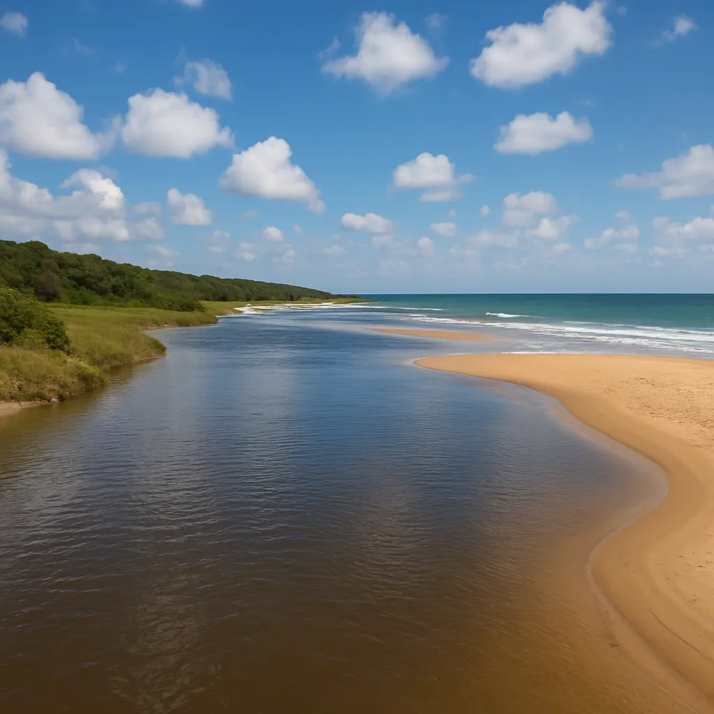
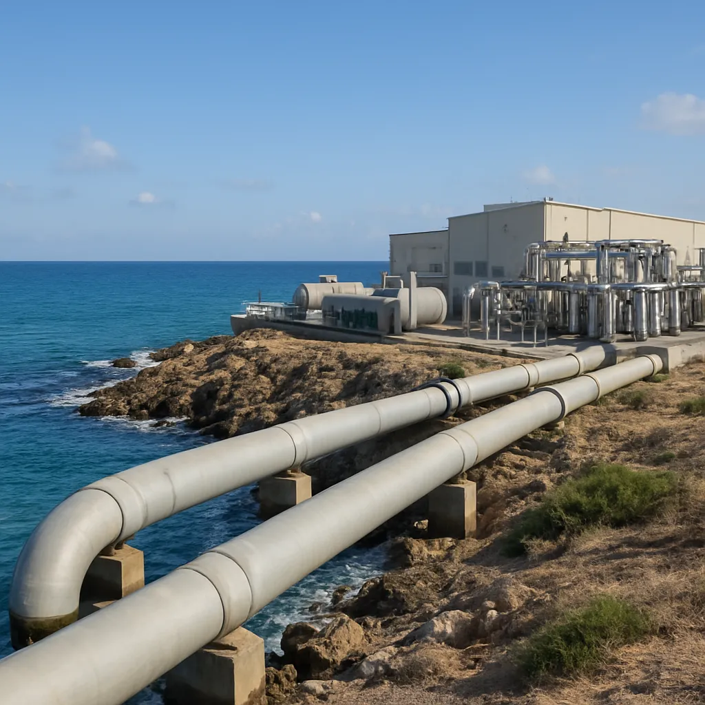
A coastal desert city with no rivers builds a plant that draws in seawater, forces it under high pressure through very fine membranes, and delivers fresh water to homes. Which process does the plant use?
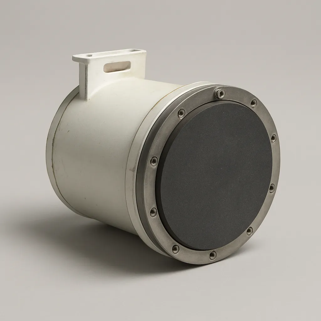
A ship's hull-mounted device sends a pulse of sound toward the sea floor and times how long the echo takes to return, then calculates the depth below from the travel time. What is this device called?
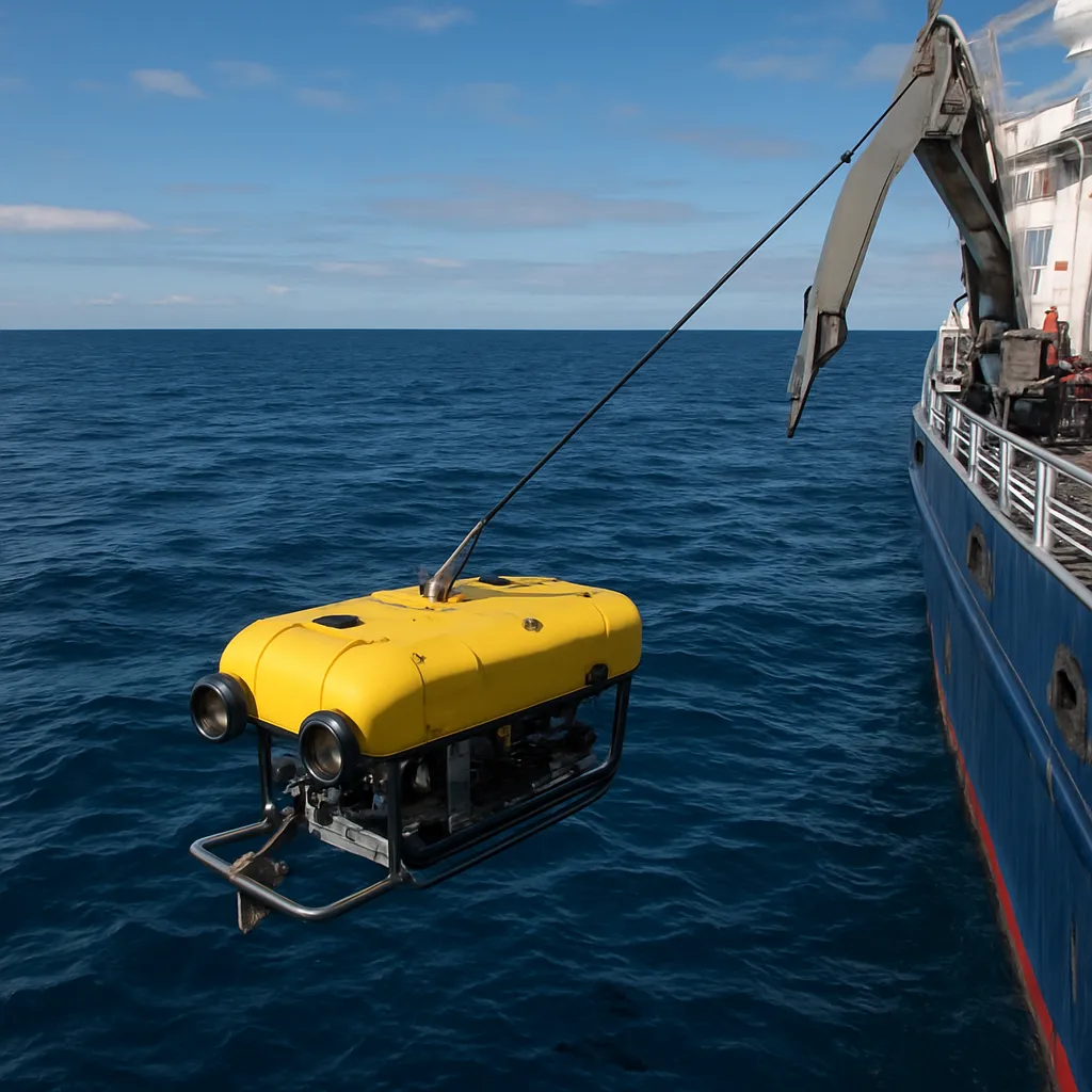
In 1986, a small robot named Jason Jr. explored the wreck of the Titanic with no one aboard, linked by a cable and steered by pilots nearby. What kind of vehicle was it?
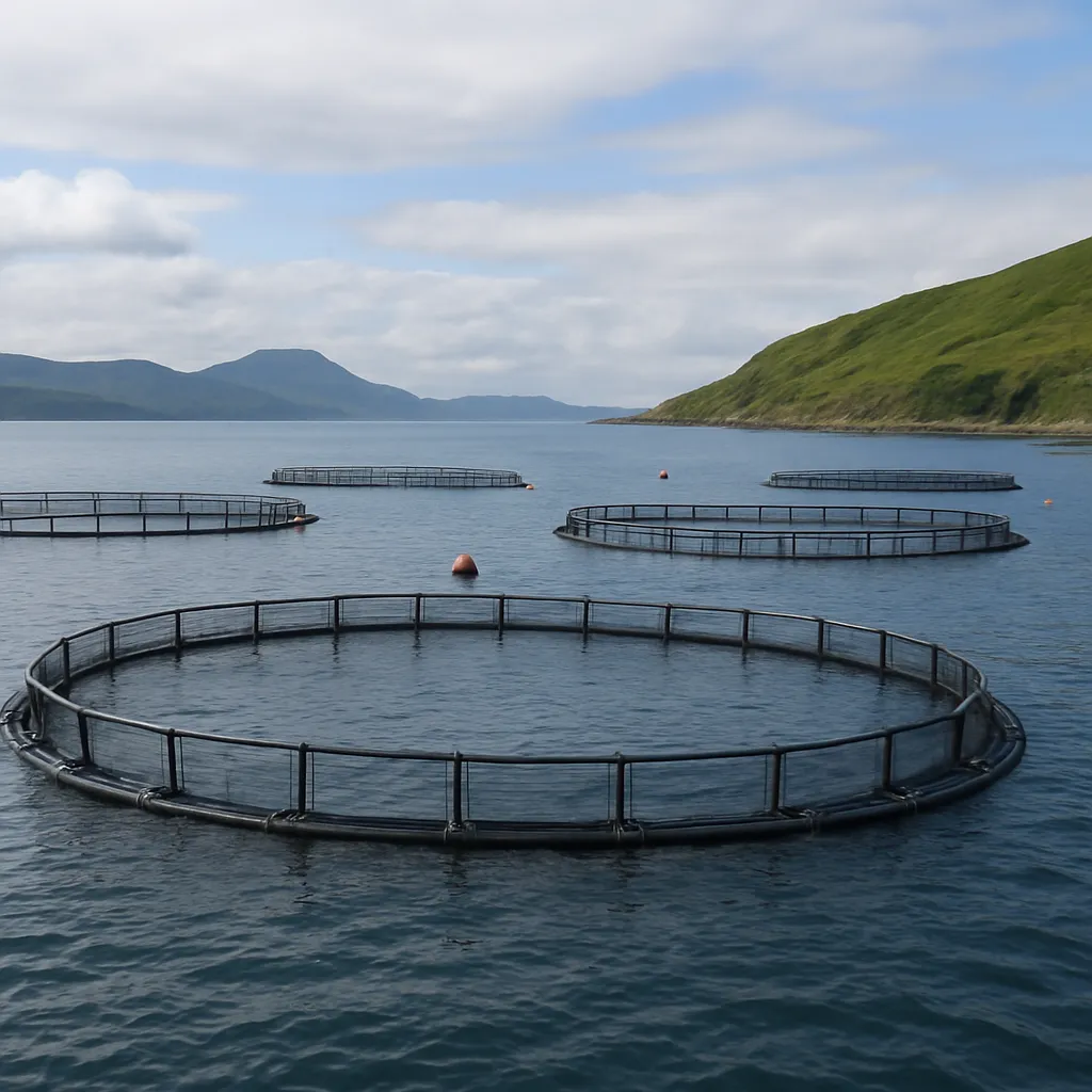
A company raises salmon in large net pens anchored in a coastal bay, feeding and harvesting the fish there rather than catching them in the wild. What is this practice called?
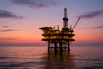
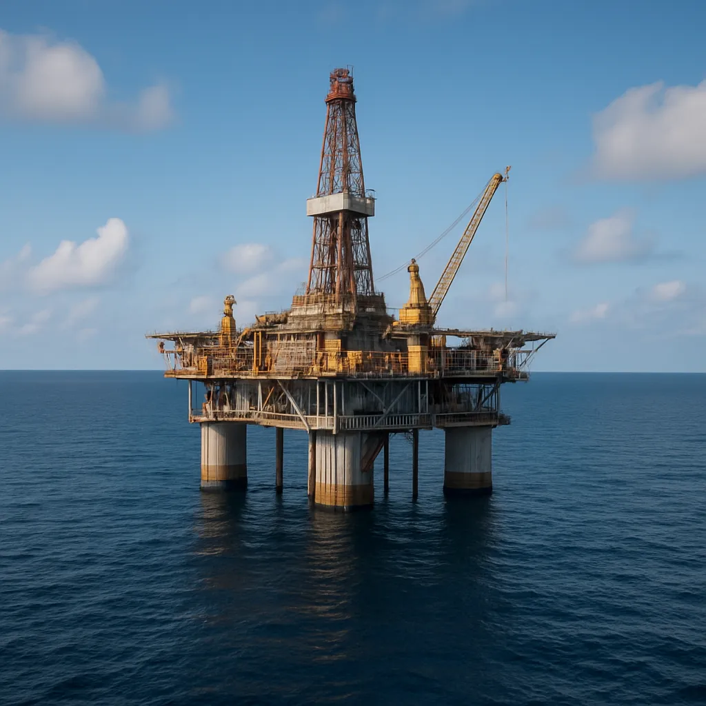
A large fixed structure stands in the open ocean above a seabed drill site, extracting petroleum from rock layers far below the sea floor. What is this structure called?
A dam-like structure built across a bay with a large tidal range uses the rise and fall of tides passing through turbines to generate electricity. What is this structure called?
Crack the passcode before the zombies get in.
Answer, then swat bugs for bonus points.
Race through questions at your own speed.
Same question on every screen. Fastest wins.

Pick a tile, answer, hit bonuses and steals.
30 questions