Loading
by BlastRoom
Practice interpreting climatographs and maps with Köppen-Geiger climate criteria.
#earth_space_science
30 questions
One question set, multiple game modes. Tap any game to see it in action. Not sure which to pick?
Answer to place stones and capture territory.
Outrun the snow together.
Earn blasts, then hunt the other team.
Answer to earn energy, then climb.

The class blasts through walls together.
Bid on mystery lots. Most money wins.
Sell tours. Nice, standard, or a total scam.

Answer, restock, and serve the rush.
More correct answers pulls the rope your way.
Answer, then shoot down the alien wave.
Answer, then tap to leap the frozen ridge.
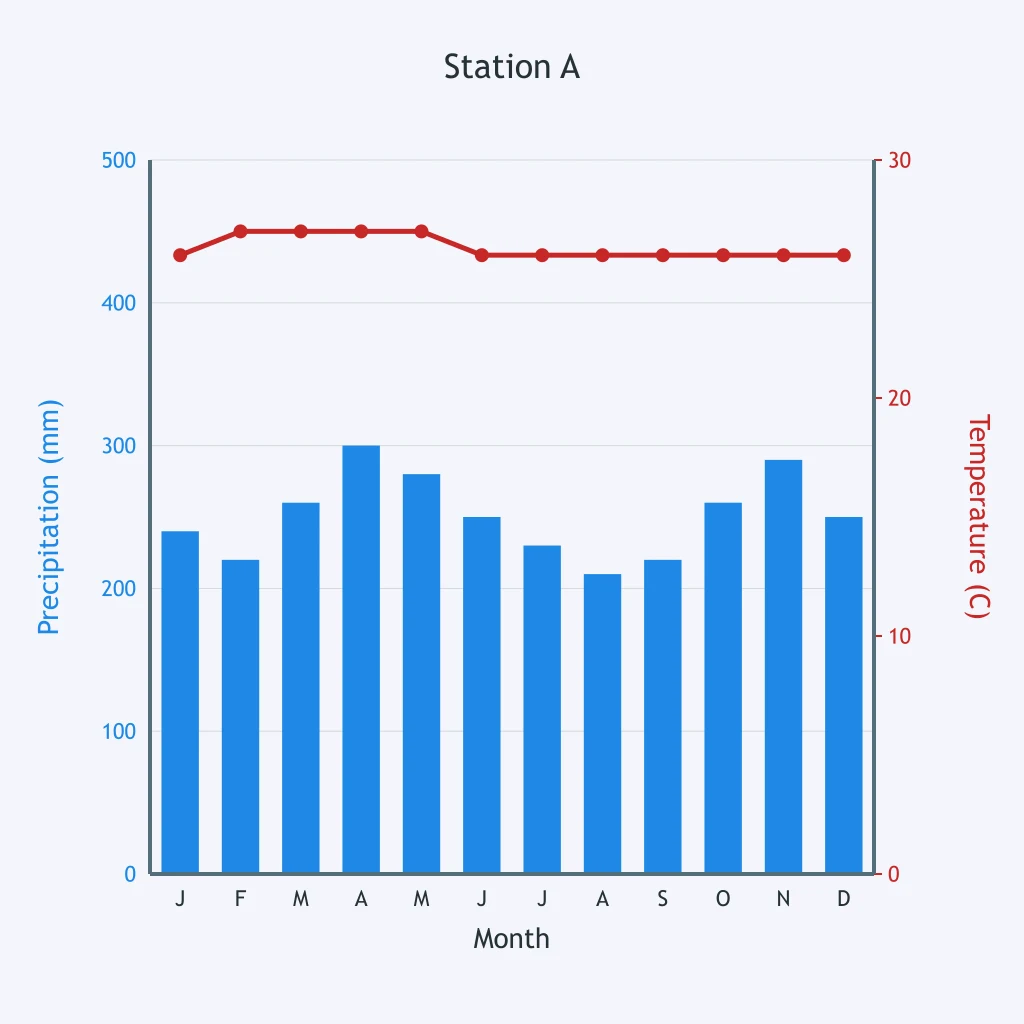
Use the climatograph for Station A to classify its climate zone.
Use the climatograph for Station B to classify its climate zone.
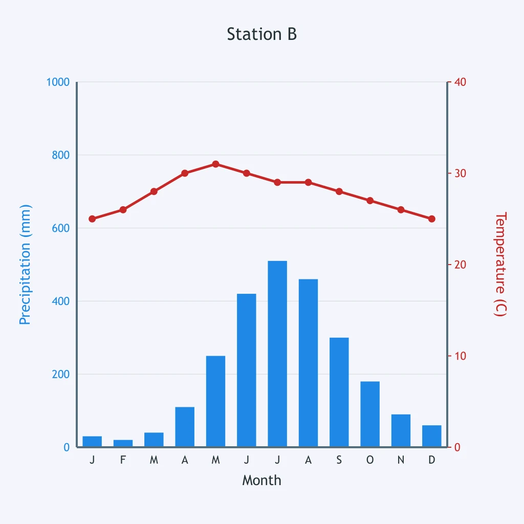
Read Station C's climatograph. Which climate zone is shown?
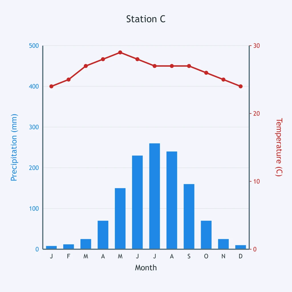
Use the climatograph for Station D to classify its climate zone.
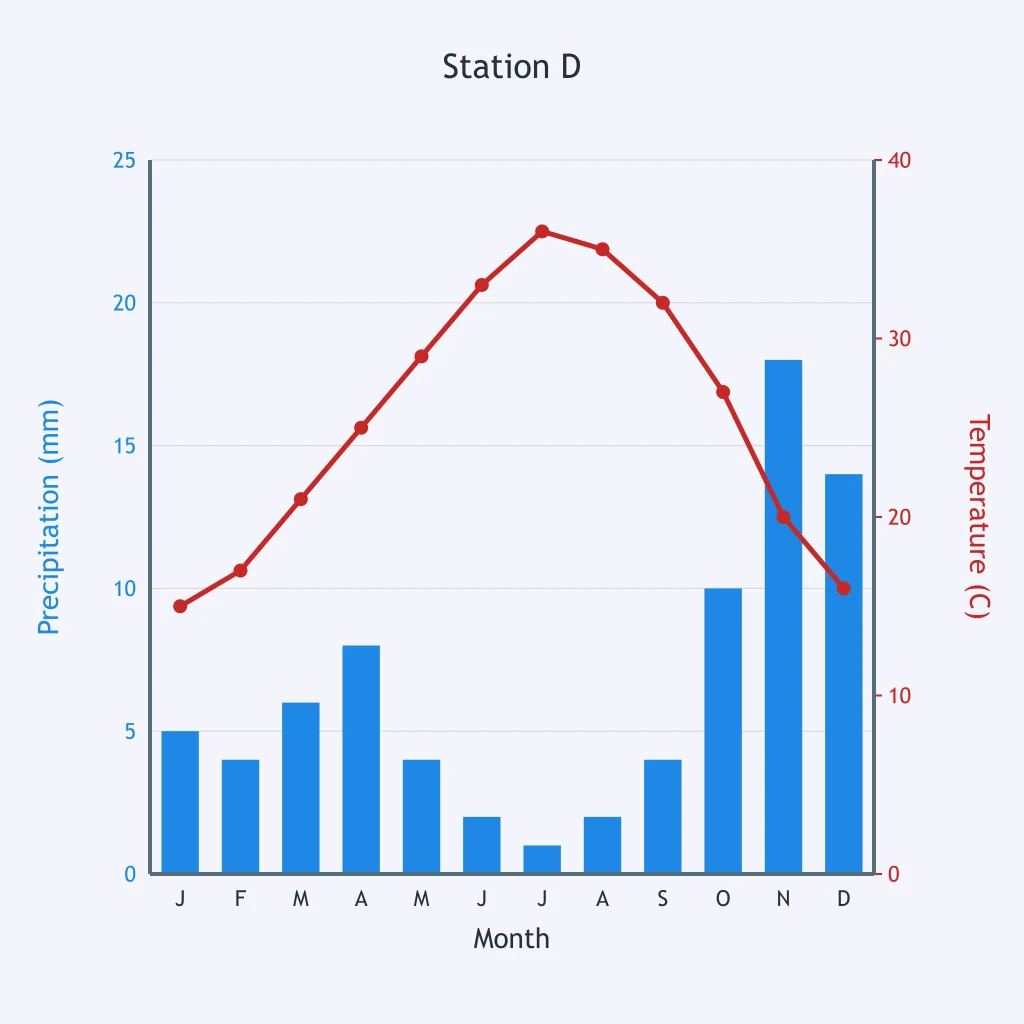
Station E has a dry climate. Classify its climate zone from the climatograph.
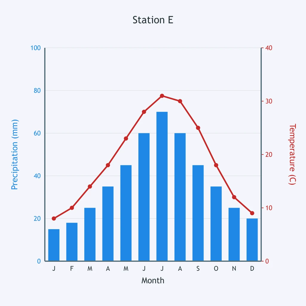
Use Station F's climatograph. Which climate zone matches it?
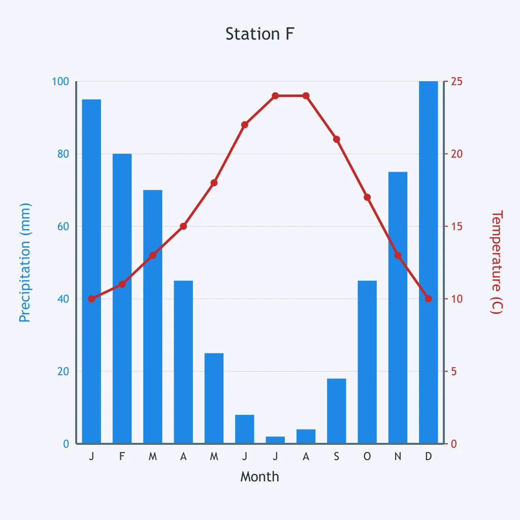
Use Station G's climatograph. What climate zone is most consistent with it?
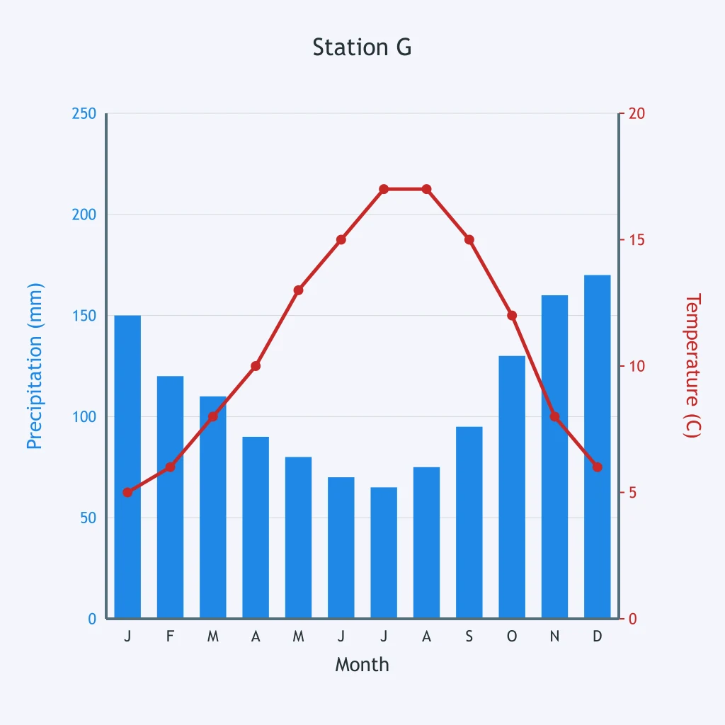
Use Station H's climatograph. Which climate zone does it show?
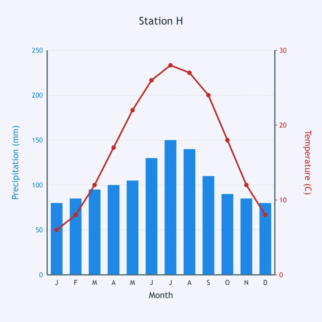
Use Station I's climatograph to classify the climate zone.
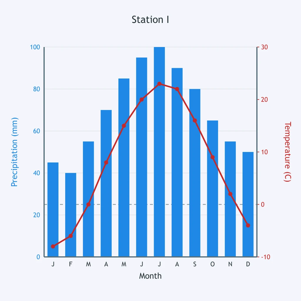
Use Station J's climatograph. Which polar climate zone is shown?
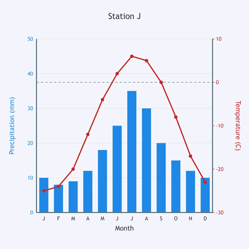
Use Station K's temperature curve. What does it show about where the station lies?
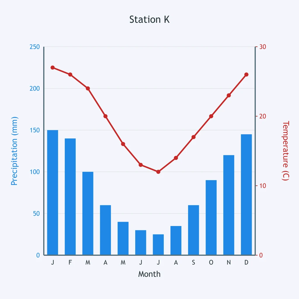
Use Station L's temperature curve. What hemisphere pattern is shown?
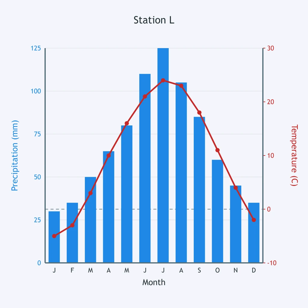
Use Station M's precipitation bars. During which months does the main wet season occur?
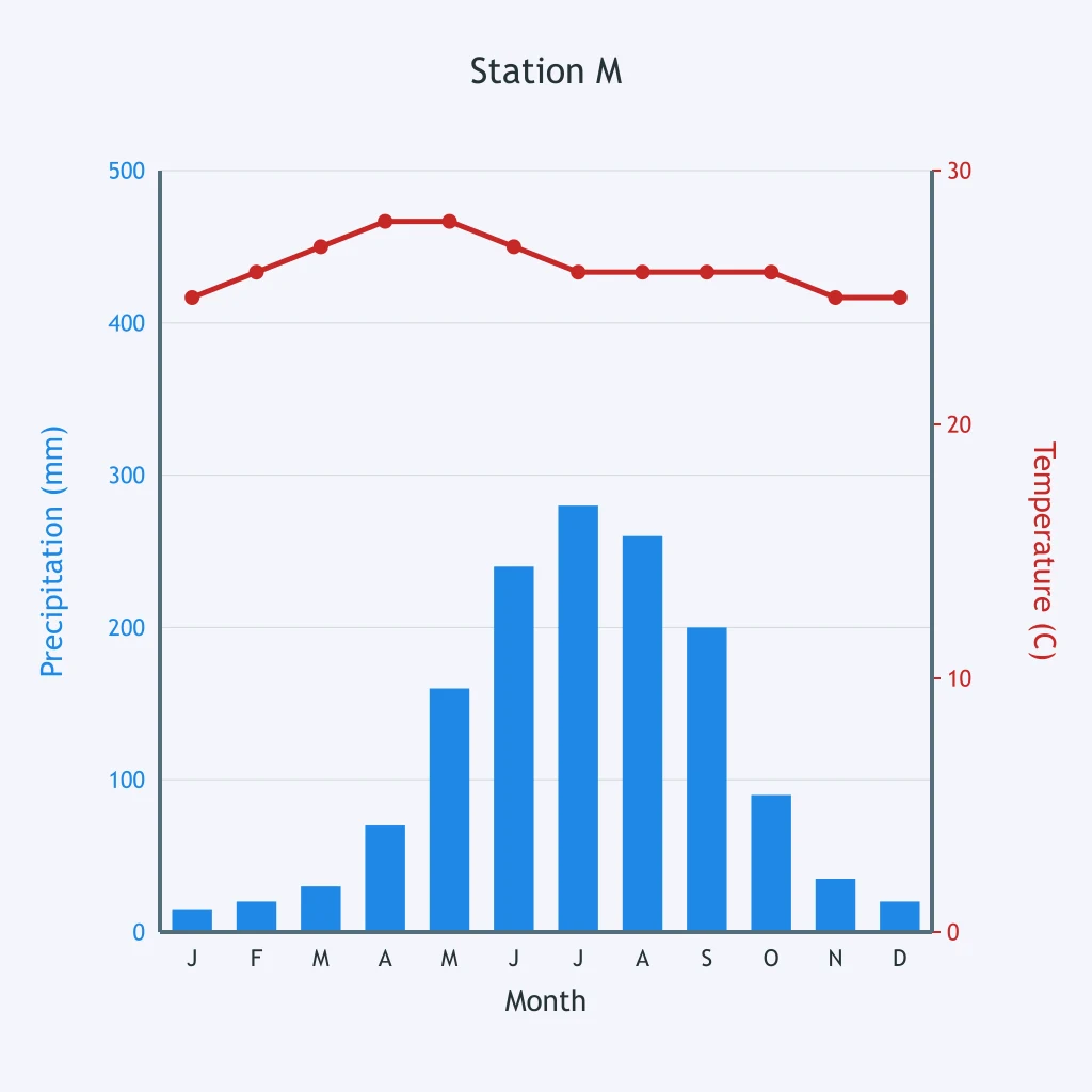
Station N is in the Southern Hemisphere. Use its precipitation bars. What season is dry there?
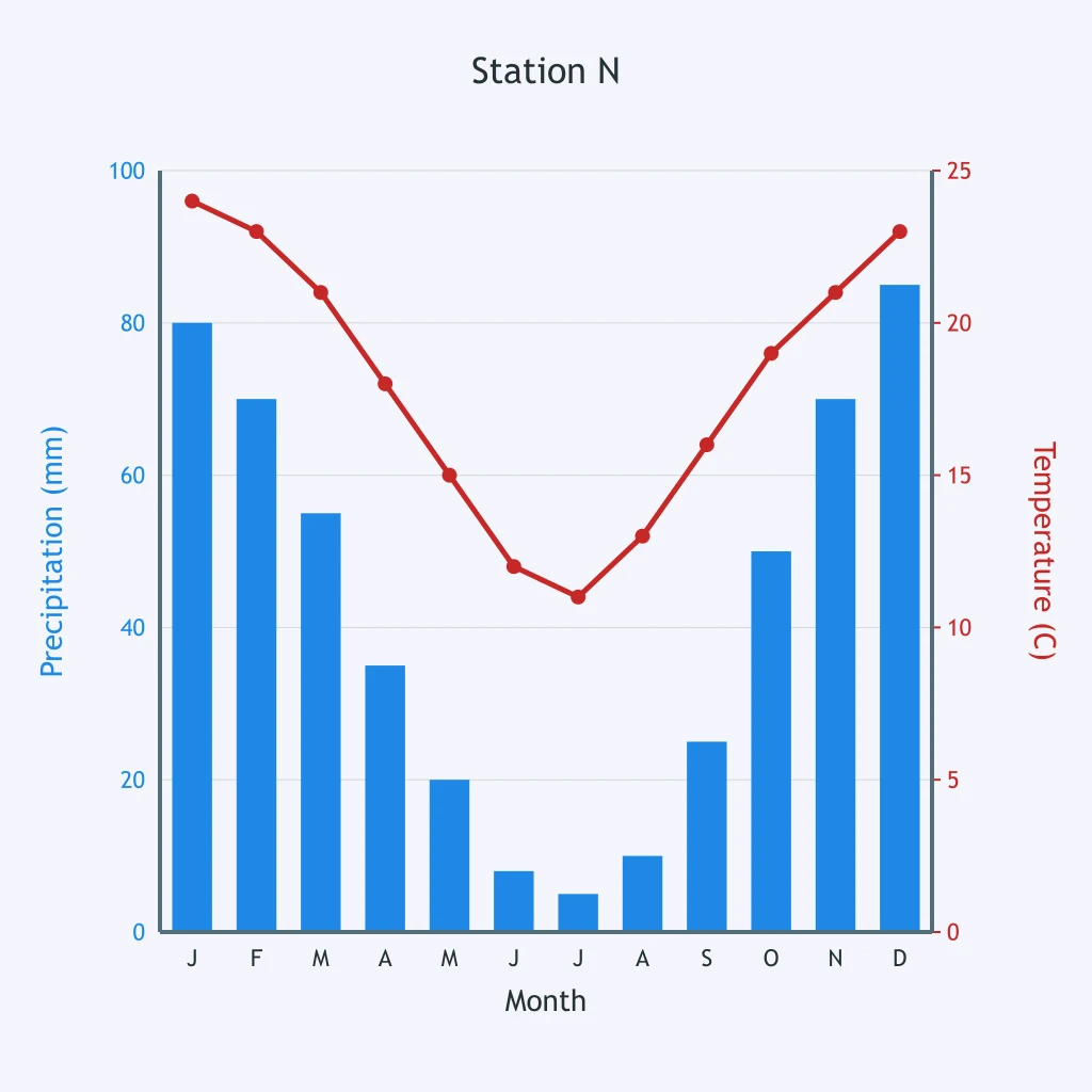
Use Station O's climatograph. Which hemisphere is the station most likely in?
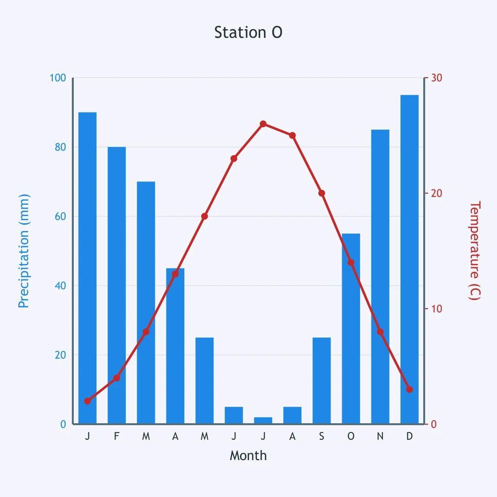
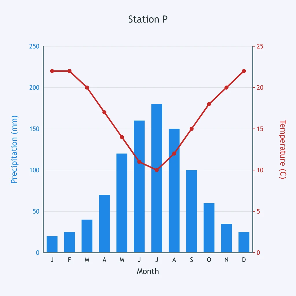
Use Station P's climatograph. What season is wettest at this Southern Hemisphere station?
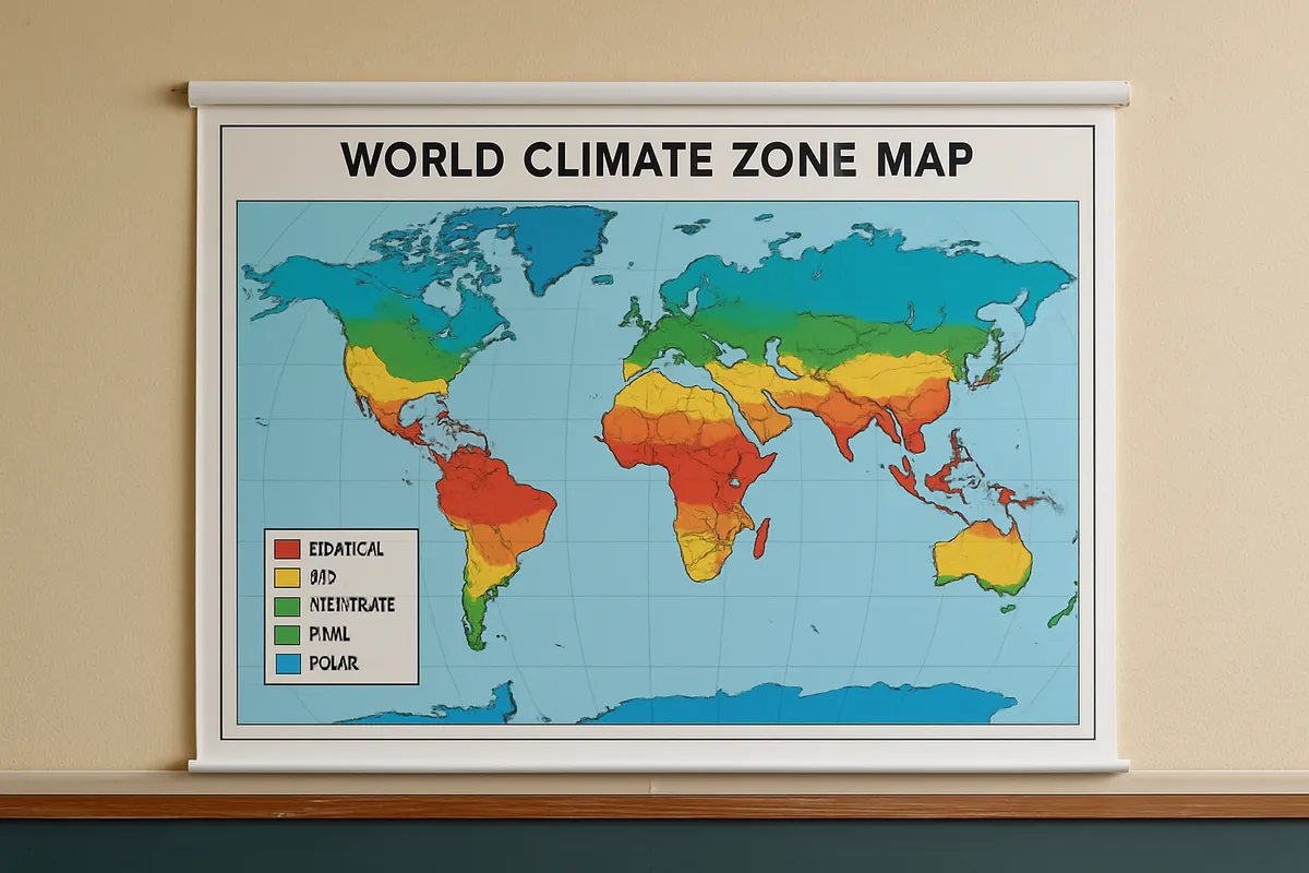
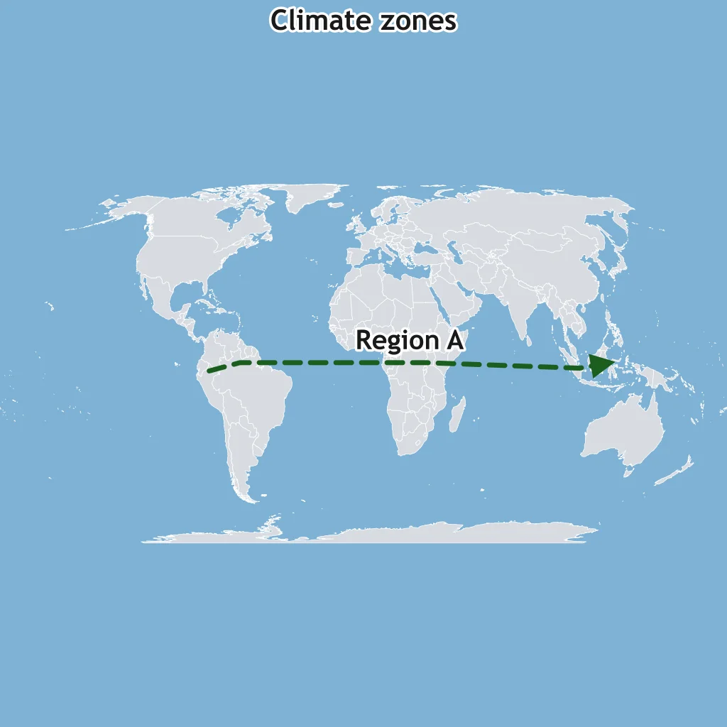
On the climate map, Region A follows the equatorial belt through the Amazon Basin, Congo Basin, and Indonesia. What climate zone is Region A?
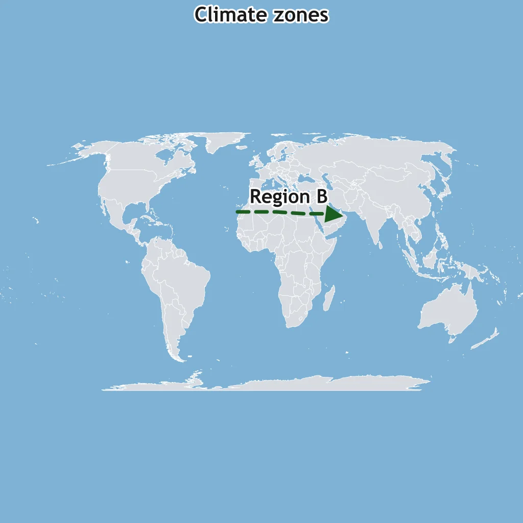
Region B is the broad subtropical belt centered near 25° N across northern Africa and Arabia. Which climate zone does that belt represent?
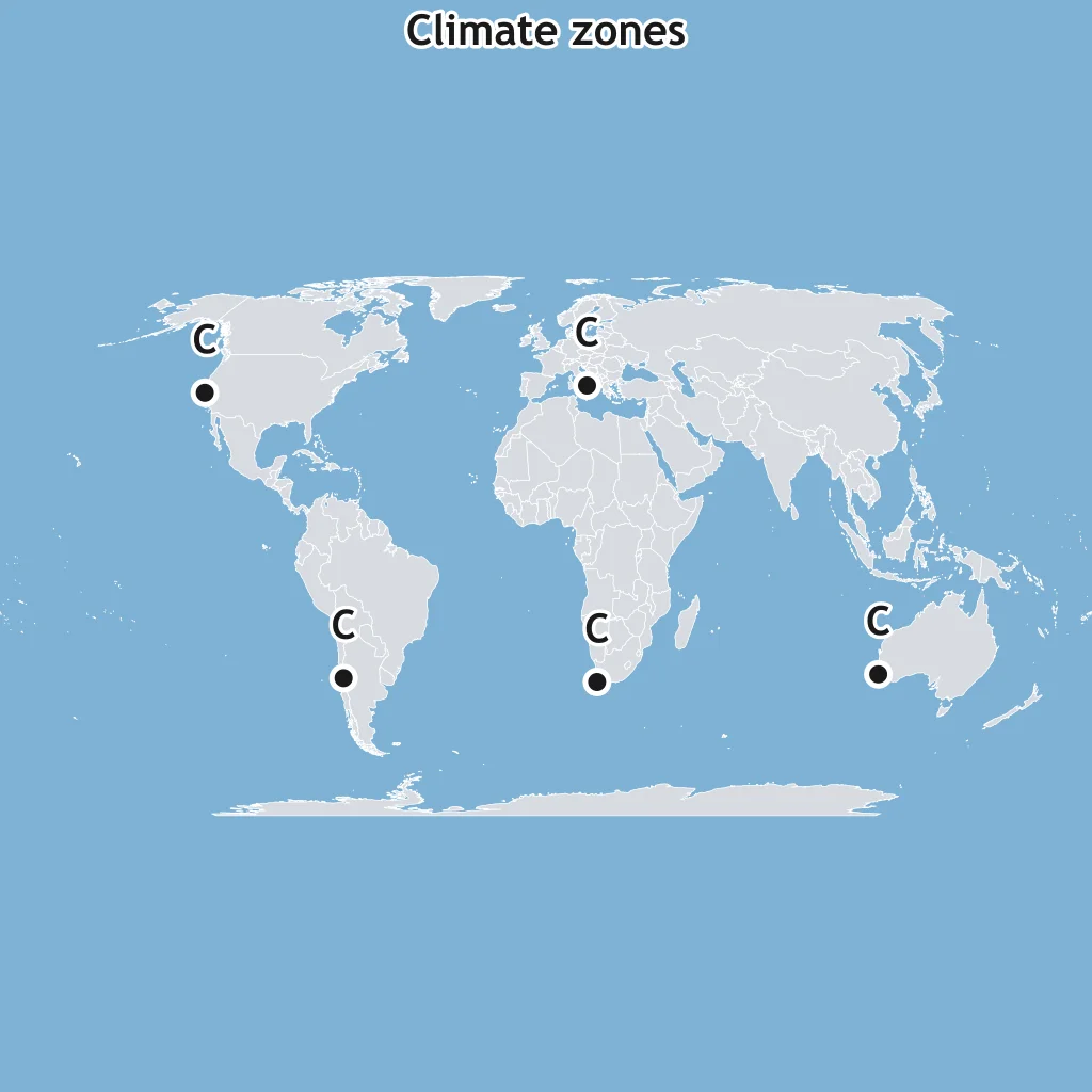
The points labeled C mark west-coast areas near 30° to 40° latitude, including California, central Chile, and the Mediterranean Basin. Name the climate zone.
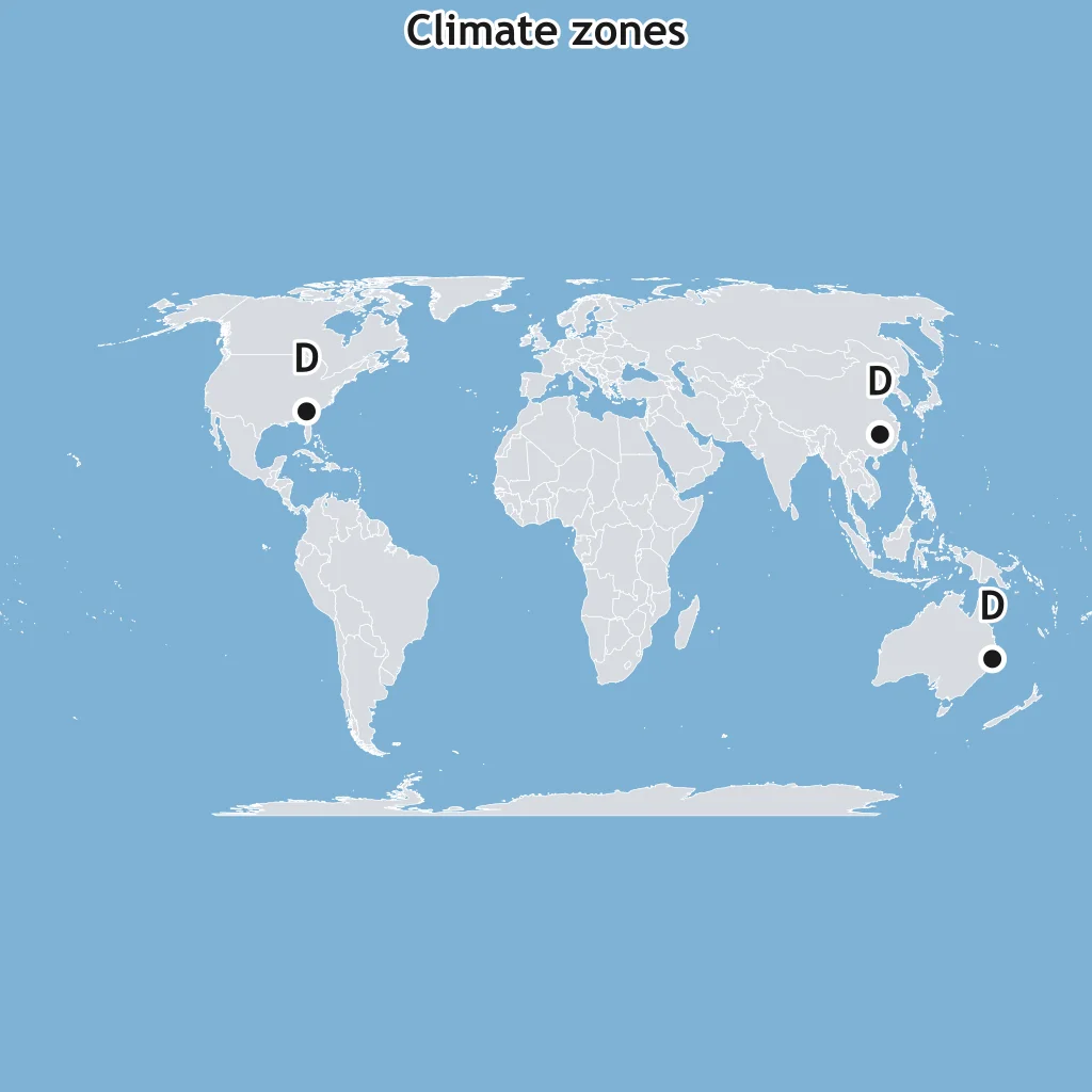
The points labeled D mark warm eastern margins such as the southeastern United States, southeast China, and eastern Australia. What climate zone is shown?
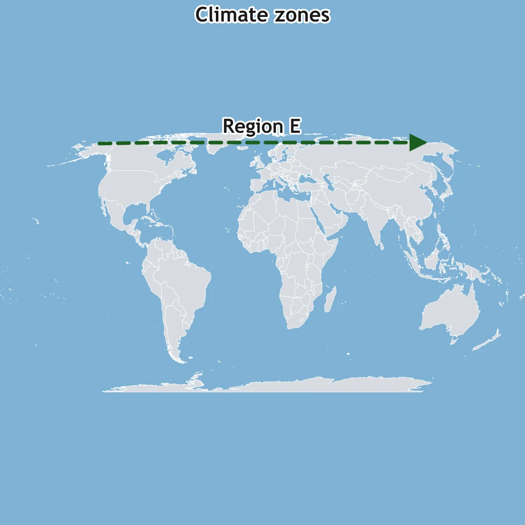
Region E traces a treeless high-latitude coastal fringe around the Arctic Ocean. Which climate zone does Region E identify?
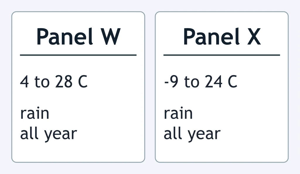
Compare the two climate panels. Which climate zone does Panel X represent?
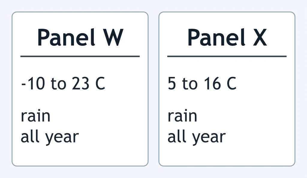
Compare Panels W and X. What climate zone is Panel X?
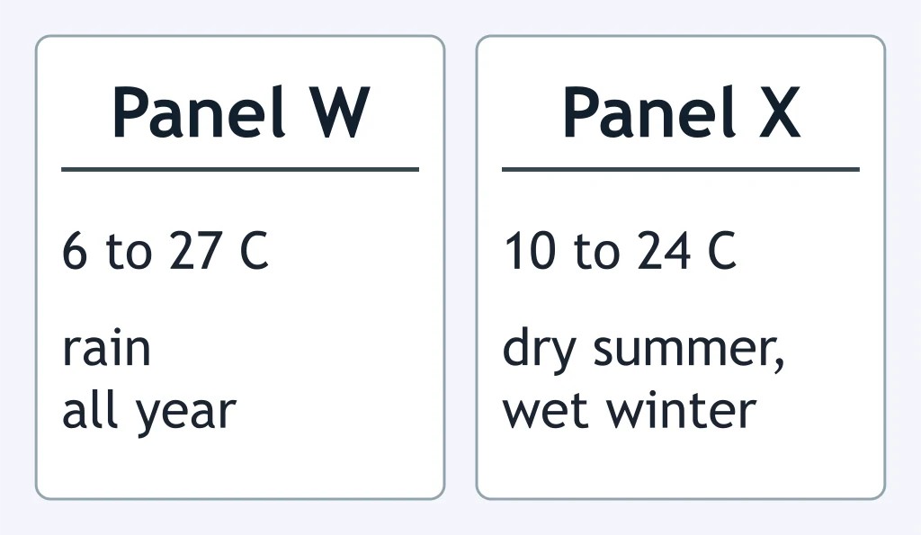
Compare Panels W and X. What climate zone is Panel X?
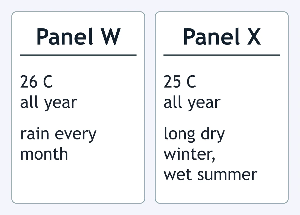
Compare Panels W and X. Which climate zone does Panel X represent?
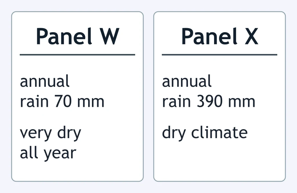
Compare Panels W and X. What climate zone is Panel X?
Under the Köppen system, what monthly temperature condition is required for a climate to be tropical?
For a tropical rainforest climate, what precipitation condition must the driest month meet?
What temperature condition defines the polar climate group in the Köppen system?
What condition separates ice cap climate from tundra climate?
Crack the passcode before the zombies get in.
Answer, then swat bugs for bonus points.
Race through questions at your own speed.
Same question on every screen. Fastest wins.

Pick a tile, answer, hit bonuses and steals.
40 questions