Loading
by BlastRoom
Practice using latitude, elevation, water, currents, winds, and mountains to explain climate.
#earth_space_science
40 questions
One question set, multiple game modes. Tap any game to see it in action. Not sure which to pick?
Answer to place stones and capture territory.
Outrun the snow together.
Earn blasts, then hunt the other team.
Answer to earn energy, then climb.

The class blasts through walls together.
Bid on mystery lots. Most money wins.
Sell tours. Nice, standard, or a total scam.

Answer, restock, and serve the rush.
More correct answers pulls the rope your way.
Answer, then shoot down the alien wave.
Answer, then tap to leap the frozen ridge.
Two cities are near 40°N and at low elevation. One is 15 km from the ocean; the other is 900 km inland and has hotter summers and colder winters. Which control best explains the difference?
Two coastal cities lie at the same latitude and elevation. One has much milder winters because water flowing north from the tropics passes along its shore. What climate control is most directly involved?
A plateau town is much cooler than a nearby lowland town even though both are in the same latitude band. Which control explains the cooler plateau climate?
Station A is near 5°N, while Station B is near 55°N; both are at sea level and far from cold currents. Which control explains A's greater average insolation?
A city east of a north-south mountain range is dry, while the ocean-facing west slope is wet. Which climate control produces this pattern?
During winter, the most common winds carry moist ocean air onto a coast for many weeks. Which climate control is acting in this case?
Two sea-level cities are equally far from the ocean. The one near 60°N has a much bigger gap between summer and winter temperatures than the one near the equator. Why?
A lakeshore town and an inland town are at the same latitude, but the lakeshore town has a smaller yearly temperature range. What term names this distance-from-water effect?
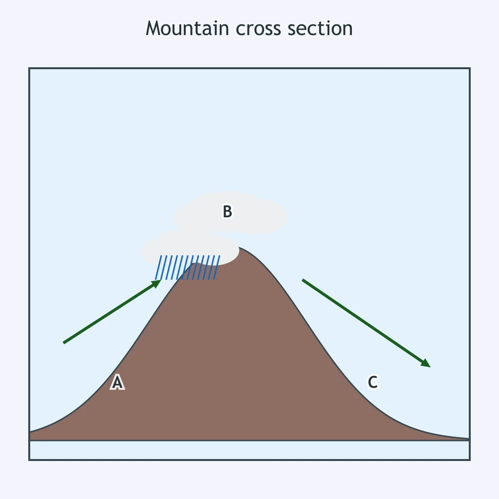
Use the cross section. Moist air moves from the ocean up the windward slope. What happens to that rising air before heavy precipitation forms?
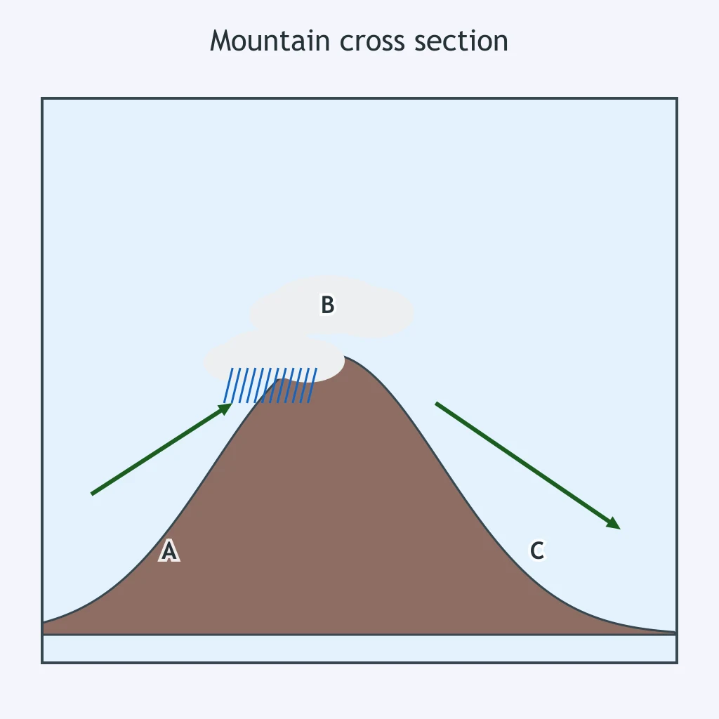
The cross section shows wet conditions on the ocean-facing slope and a dry basin beyond the range. Which control explains the dry basin?
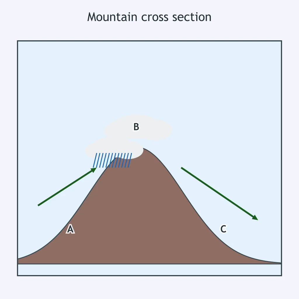
In the cross section, moist air from an ocean to the left crosses the range from left to right. Where would the greatest annual precipitation most likely occur?
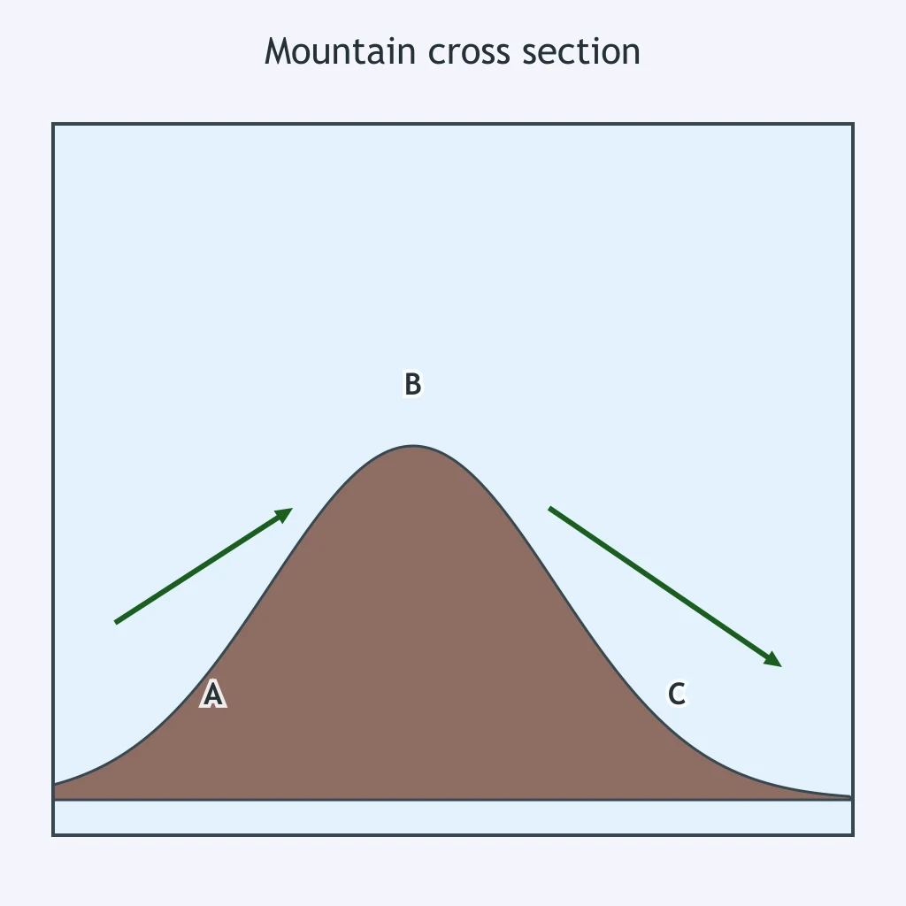
Use the mountain cross section. As air descends toward location C, what change makes the leeward side dry?
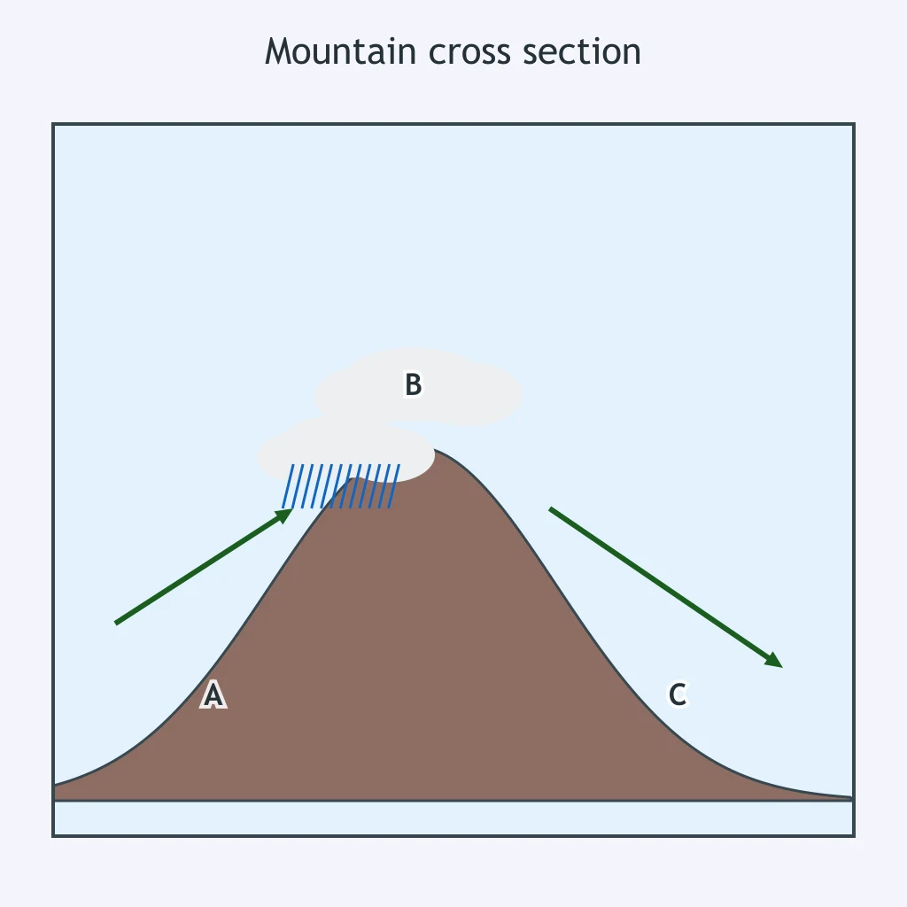
A desert forms at location C in the cross section, on the far side of the mountains. What name describes that dry climate region?
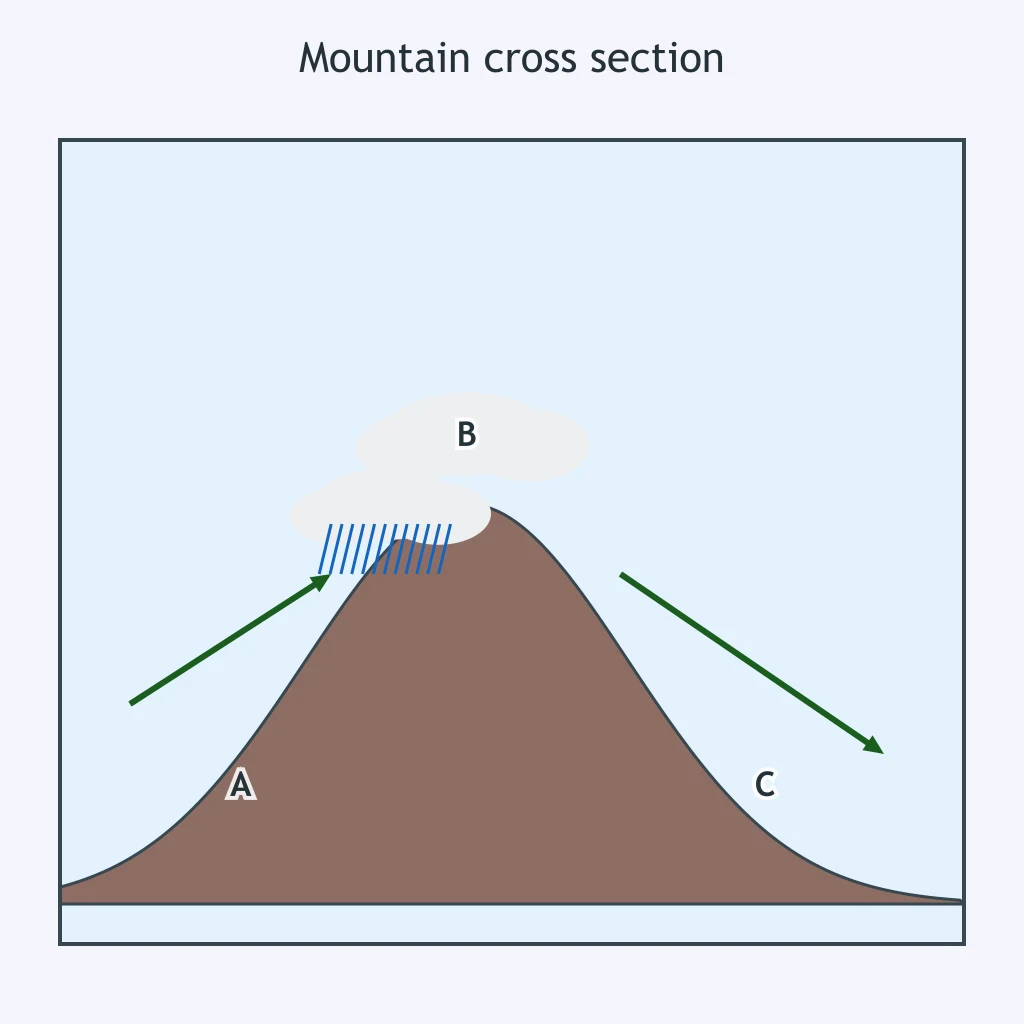
If the prevailing winds in the cross section reversed direction for most of the year, which area would likely become wetter?
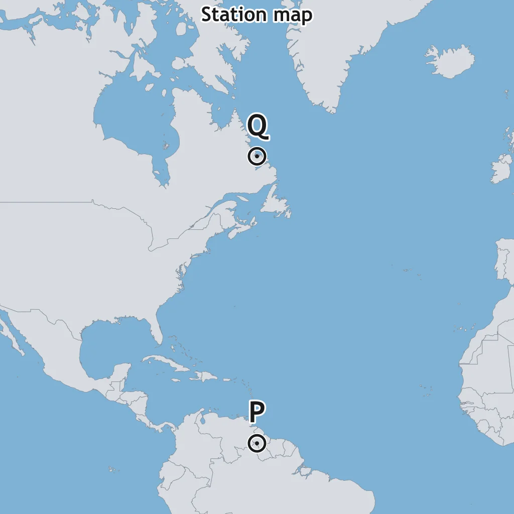
Use the map. Station P is much nearer the equator than Station Q. Why does P receive more average insolation per square meter?
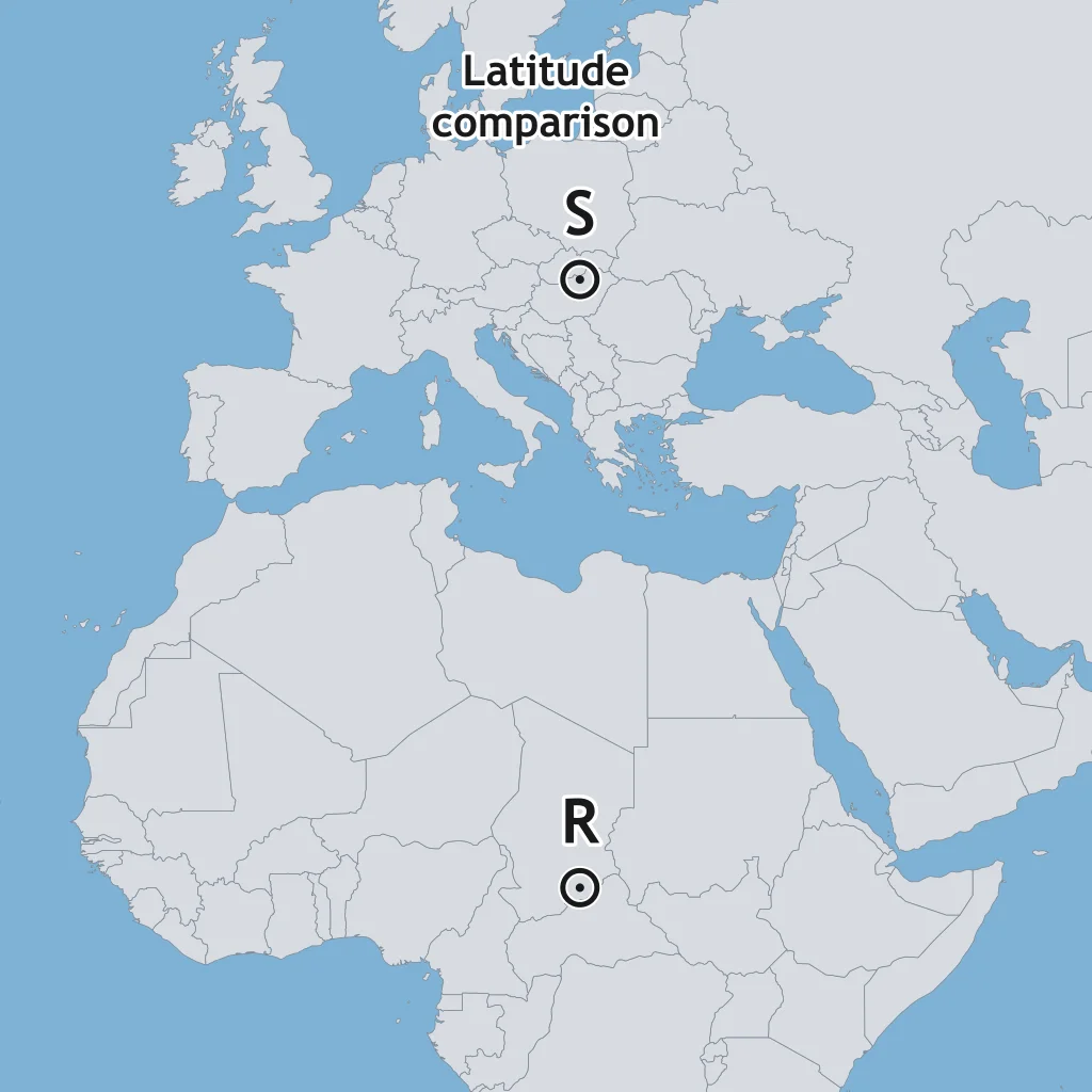
On the map, Station R is in the tropics and Station S is in the mid-latitudes. Which station should have the warmer annual average if elevation and currents are alike?
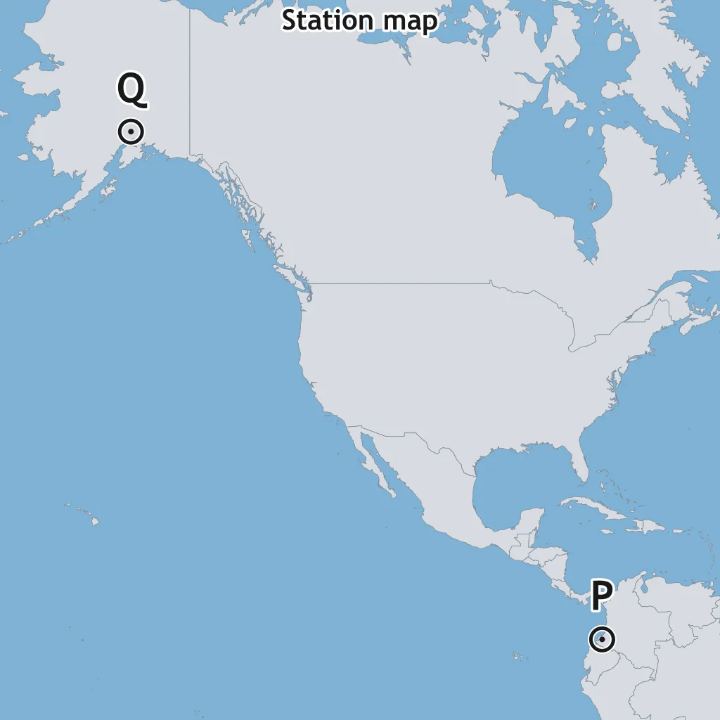
Use the station map. What climate control is being compared when P and Q are both at sea level but at very different distances from the equator?
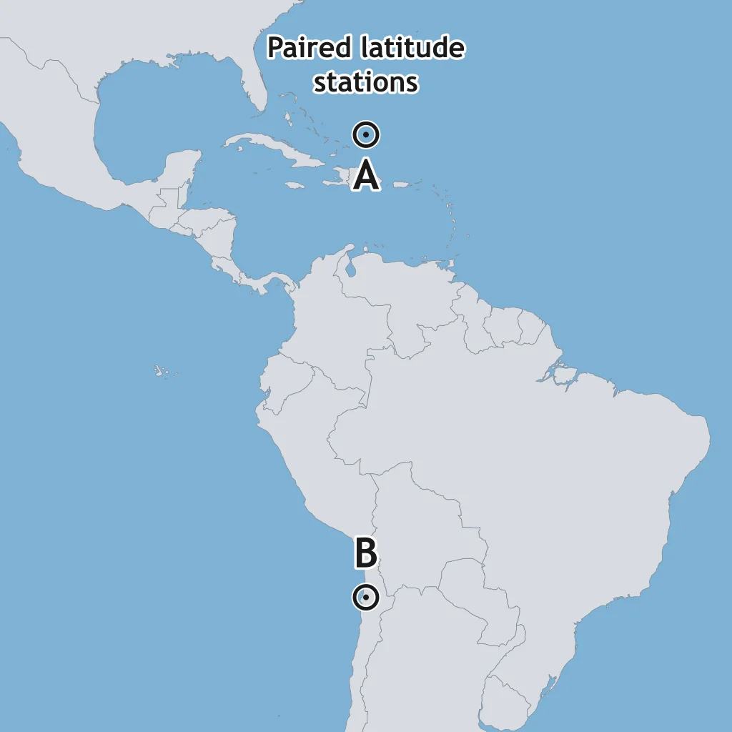
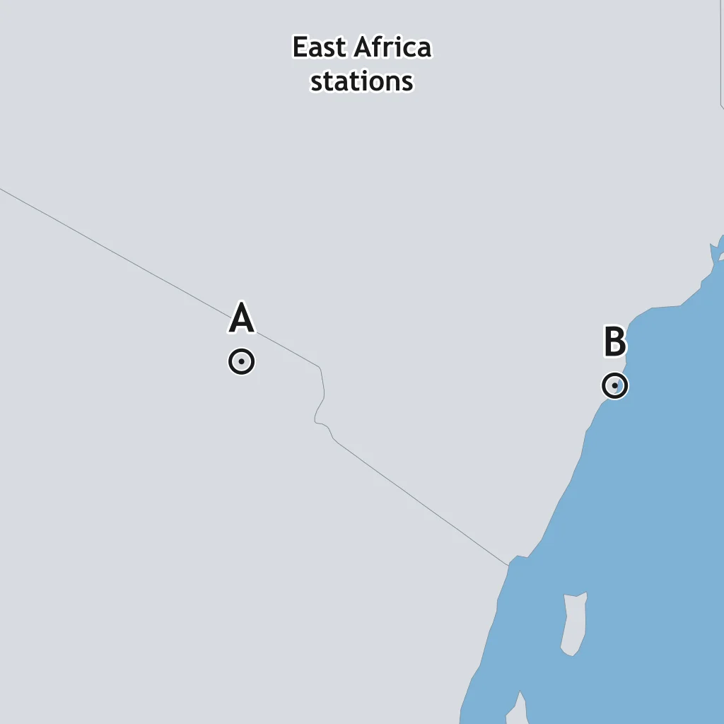
Use the map. Stations A and B are the same distance from the equator but in opposite hemispheres. Over a whole year, why are their average insolation amounts similar?
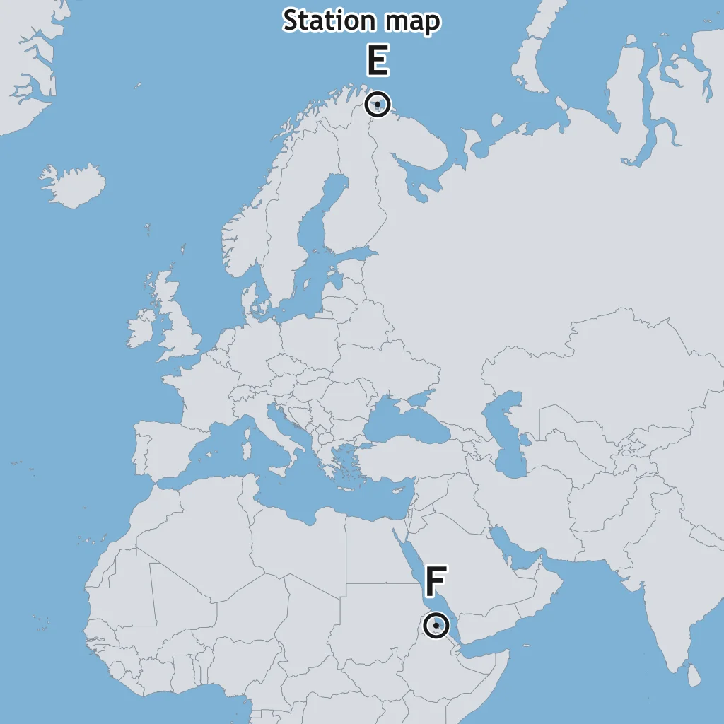
The map places Station E near 70°N and Station F near 15°N. Why is E likely colder on average if both are coastal and near sea level?
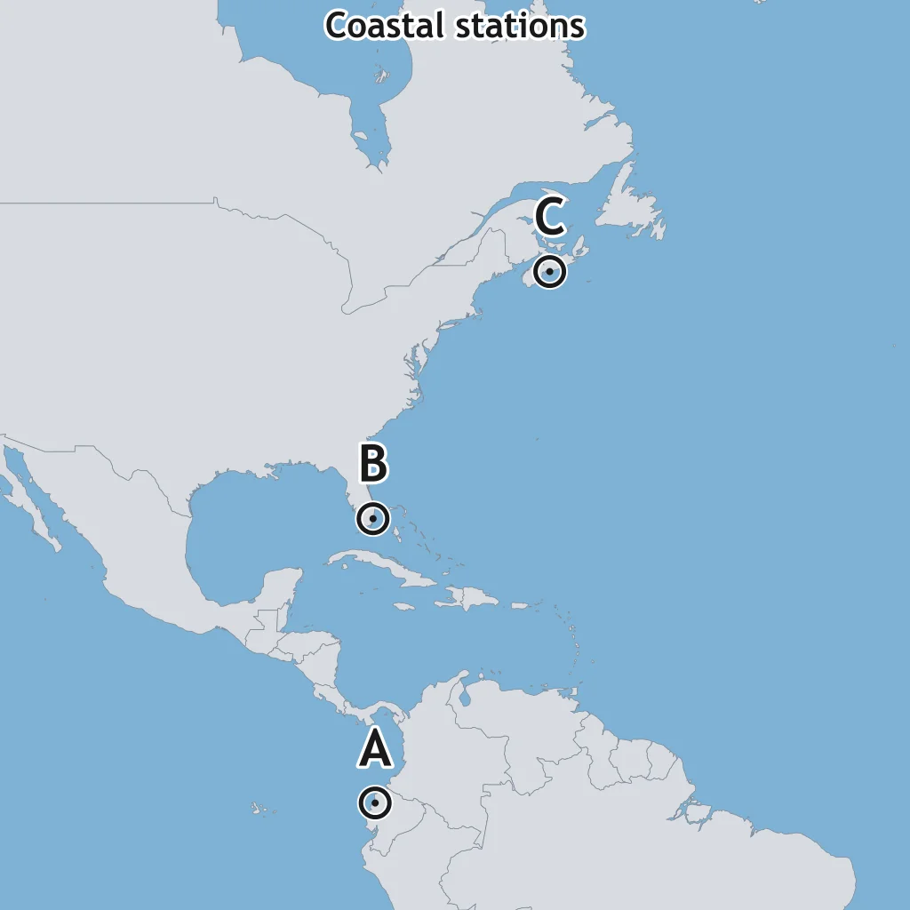
Use the map with three sea-level coastal stations. Which station should receive the most concentrated average insolation?
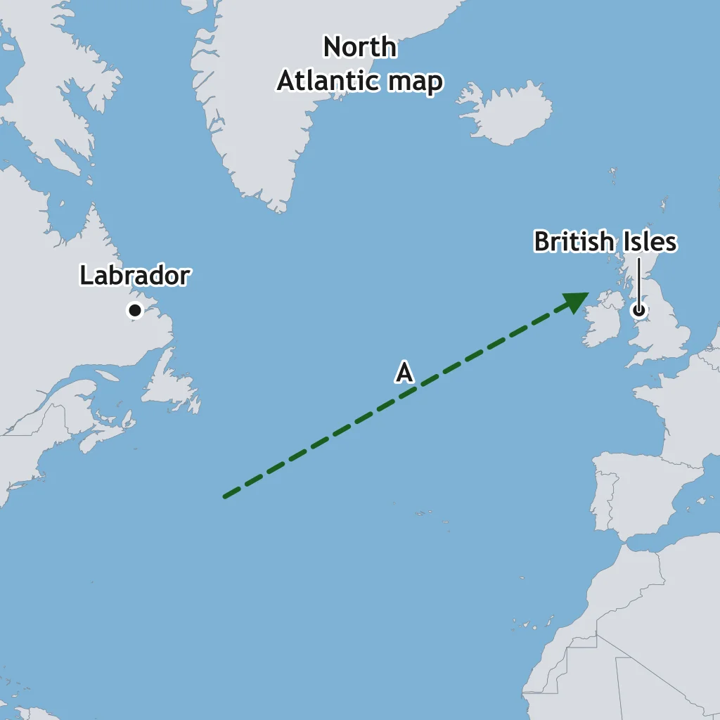
Use the North Atlantic map. Line A carries warm water toward the British Isles. Which named current is Line A?
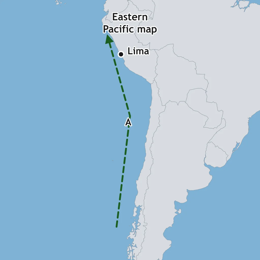
On the current map, Line A flows northward along the west coast of South America and cools the nearby Pacific coast. Which current is Line A?
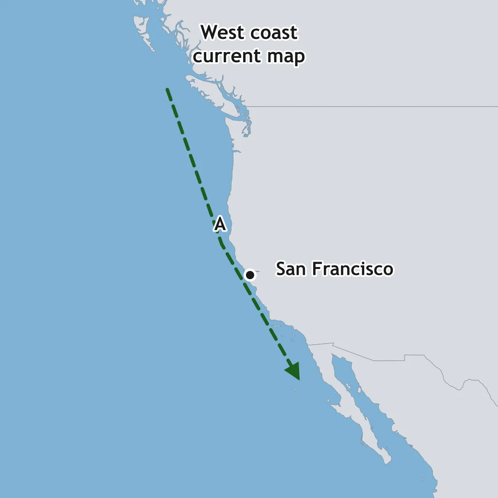
Line A on the map flows south along the west coast of North America. Which current helps keep that coast cooler than inland areas at the same latitude?
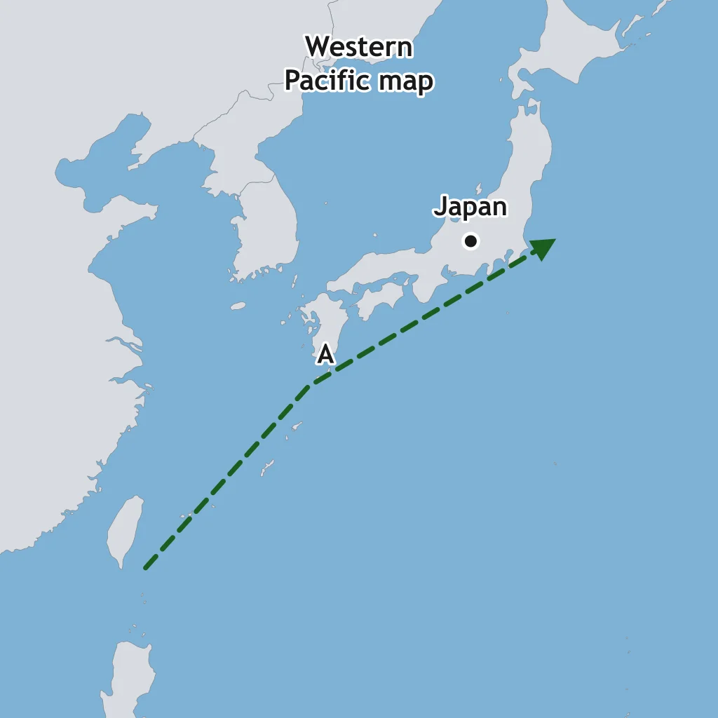
Use the western Pacific map. Line A flows northeastward past Taiwan and Japan. Which warm current is Line A?
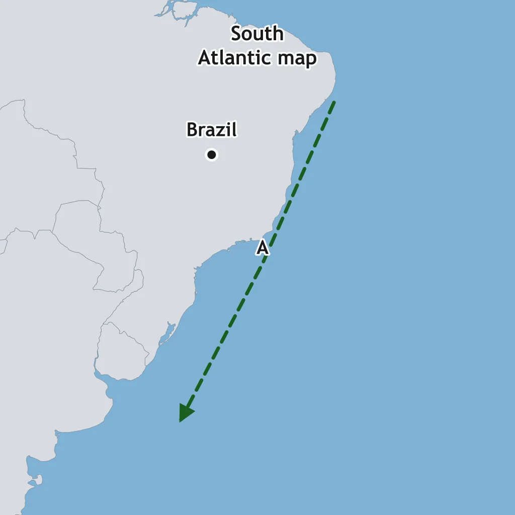
On the South Atlantic map, Line A carries warm water southwestward along the east coast of South America. Which current is shown?
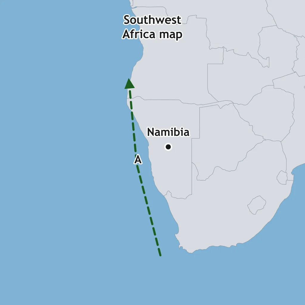
Use the southwest Africa map. Line A flows northward along the coast near Namibia and cools the adjacent shoreline. Which current is Line A?
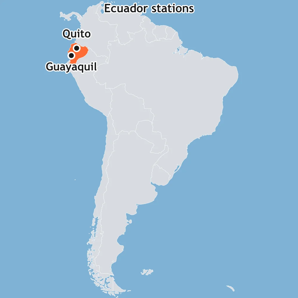
Quito, about 2,850 m up, is cooler than Guayaquil near sea level, though both are near the equator. What control best explains this?
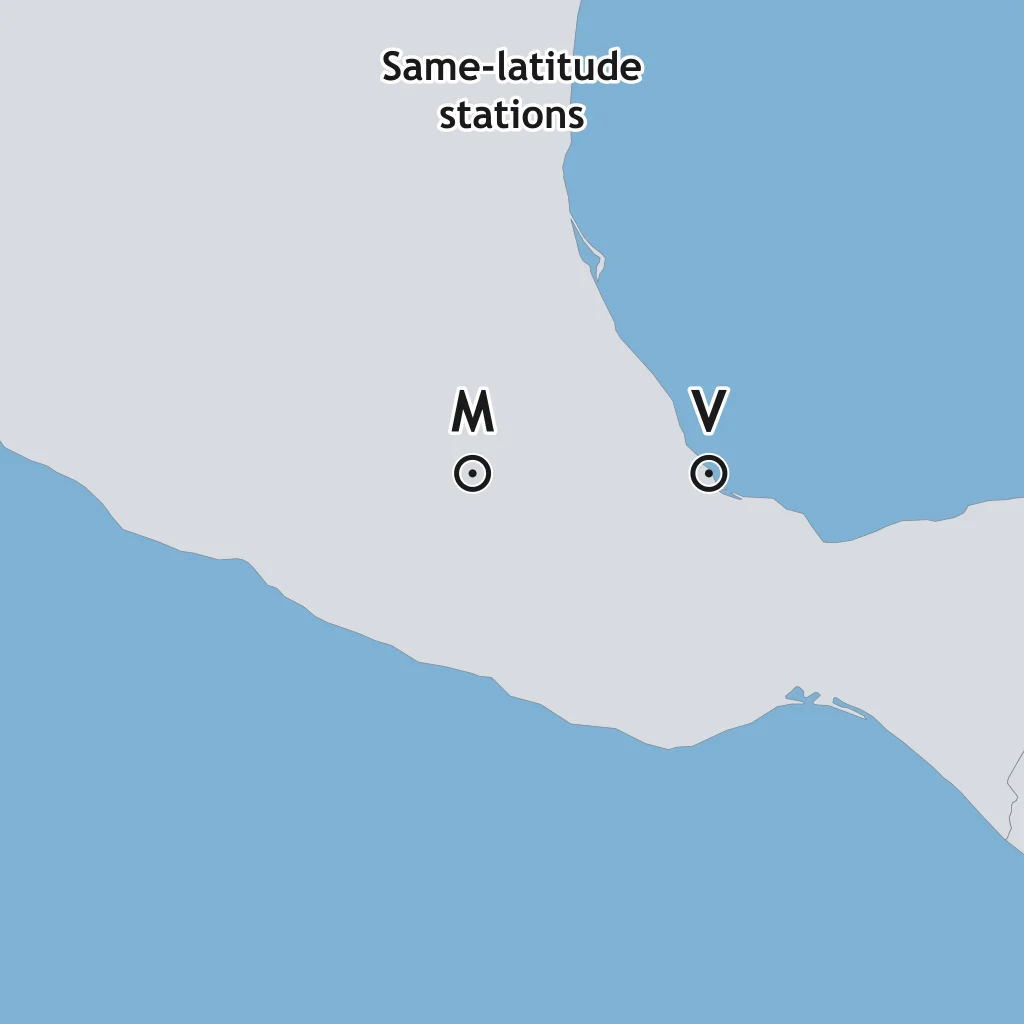
Use the map. Station M is on a high plateau at 2,200 m; Station V is near sea level at the same latitude. Which control should make M cooler?
The map shows Station A on a mountain and Station B on a coast at the same latitude. If A has a lower mean temperature, which control is most important?
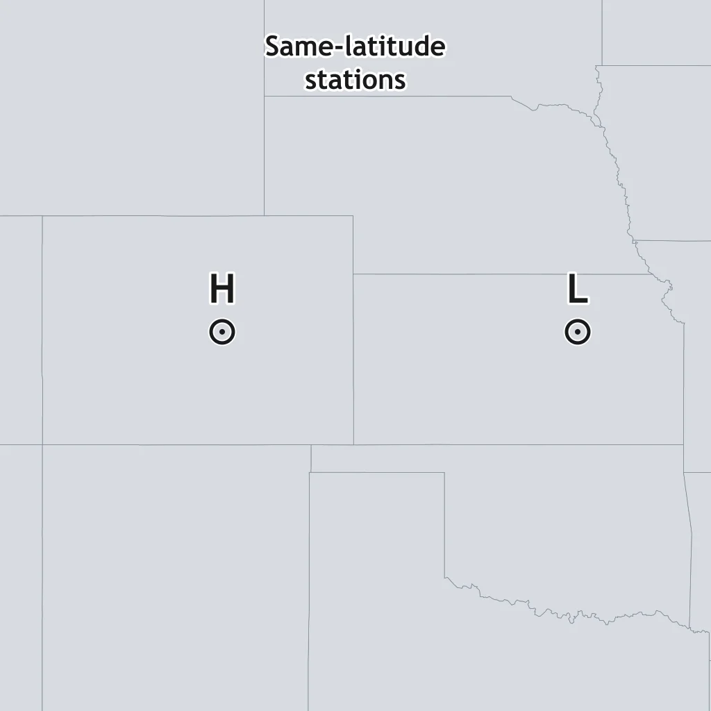
Use the map. Station H is at 2,600 m in the Rockies; Station L is at 300 m on plains at the same latitude and far inland. Why is H cooler?
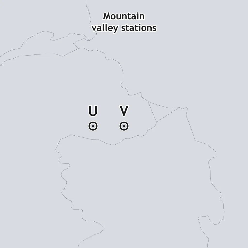
On the map, Station U is on a high plateau and Station V is in a valley at the same latitude and similar distance from water. What control explains U's cooler climate?
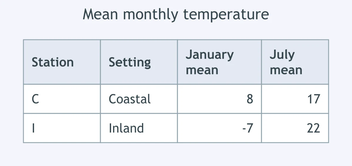
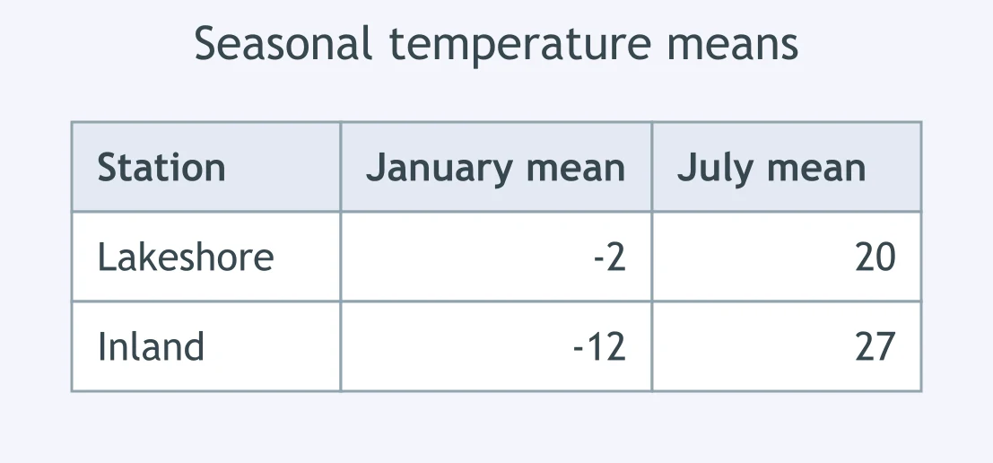
Use the table. Which property of water explains why Station C has the smaller annual temperature range?
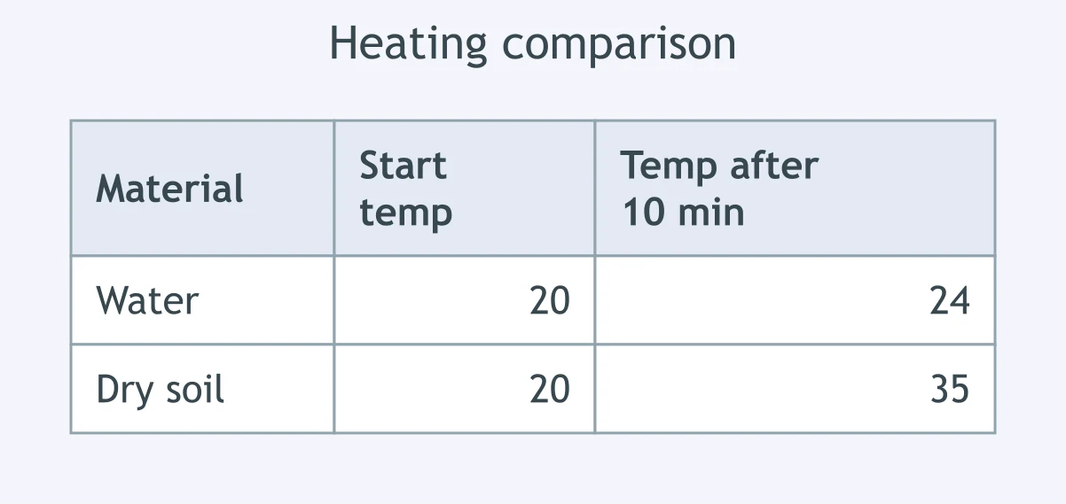
The table compares equal masses heated by the same lamp. Why does the water sample change temperature less than the dry soil?
Use the table. A lakeshore station changes less from winter to summer than an inland station. What best explains the lakeshore pattern?
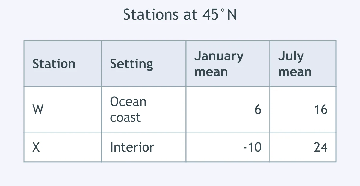
Use the table for two stations at 45°N. What explains the smaller annual range at Station W?
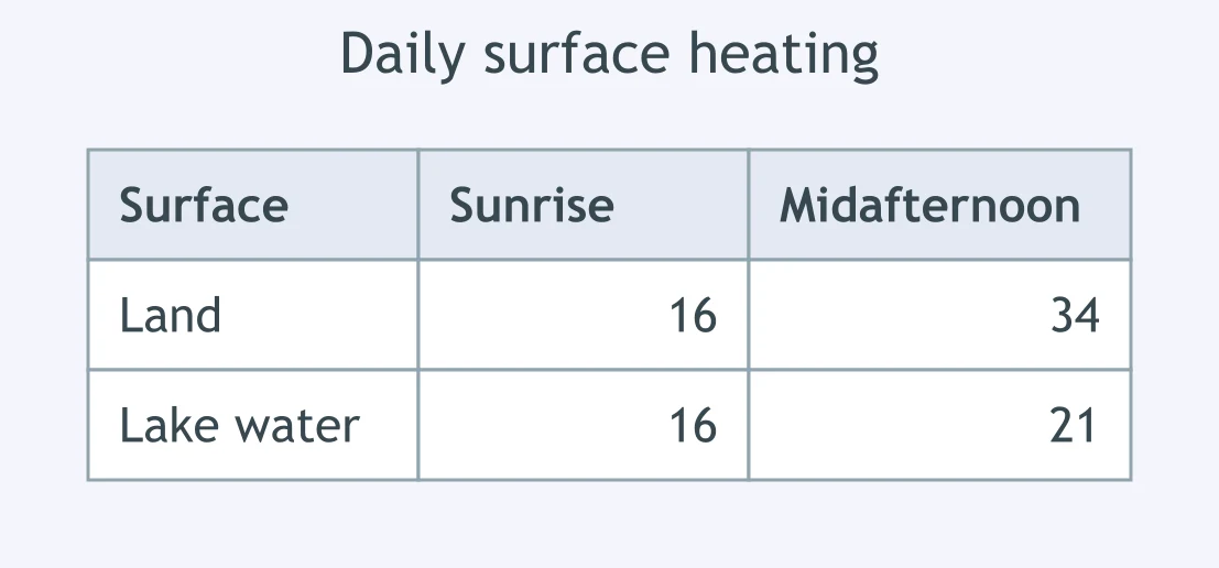
The table shows surface temperatures after sunrise and midafternoon. Which property explains land's larger temperature change?
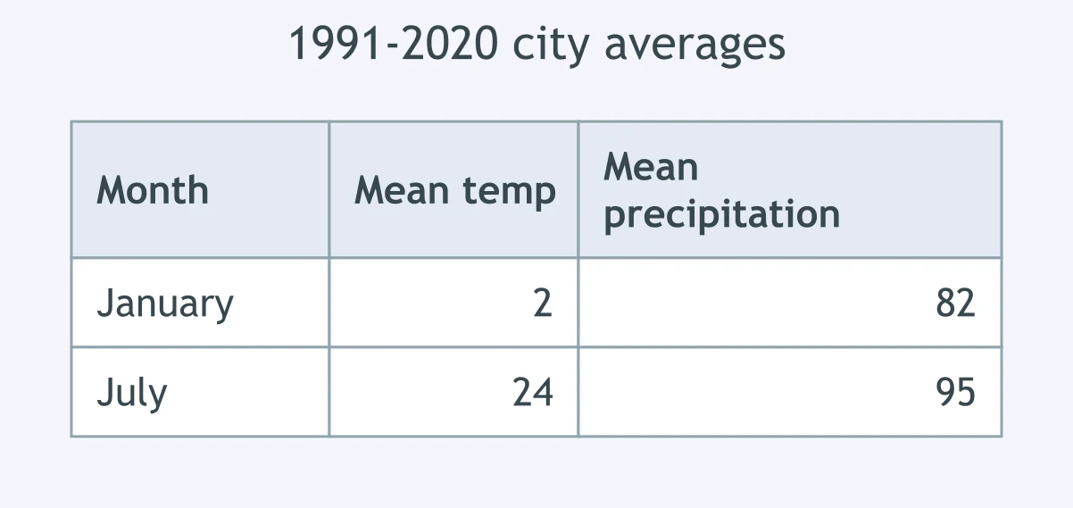
Use the record of 1991-2020 averages. What kind of description do these long-term monthly values provide for the city?
The table records conditions at one station during a single afternoon. What do those observations describe?
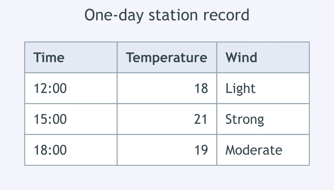
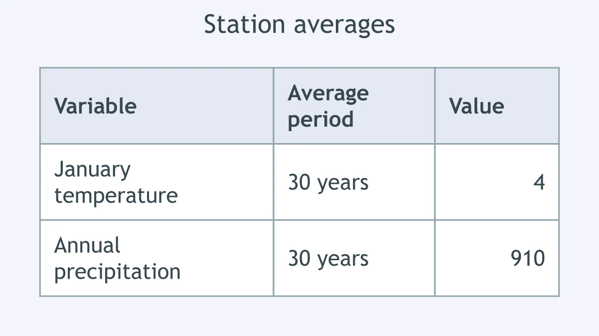
Use the table of long-term station values. What term fits the 30-year average January temperature shown?
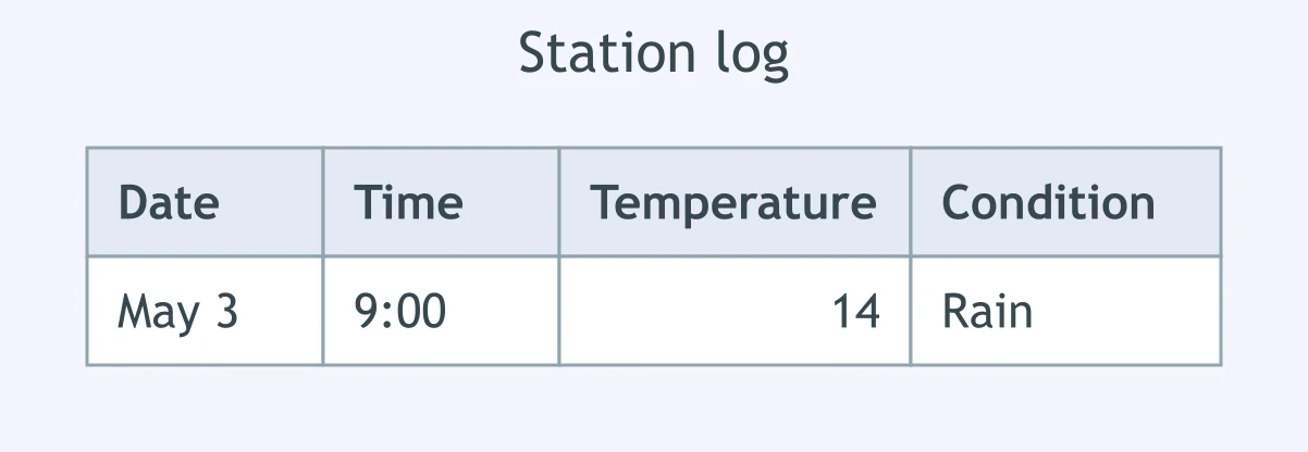
A station log is shown. Is that log describing weather or climate?
Crack the passcode before the zombies get in.
Answer, then swat bugs for bonus points.
Race through questions at your own speed.
Same question on every screen. Fastest wins.

Pick a tile, answer, hit bonuses and steals.
25 questions