Loading
by BlastRoom
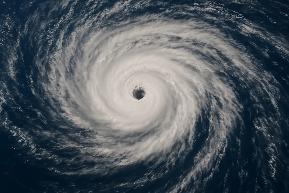
Questions on hurricane formation, structure, tracking, categories, hazards, and weakening.
#earth_space_science
40 questions
One question set, multiple game modes. Tap any game to see it in action. Not sure which to pick?
Answer to place stones and capture territory.
Outrun the snow together.
Earn blasts, then hunt the other team.
Answer to earn energy, then climb.

The class blasts through walls together.
Bid on mystery lots. Most money wins.
Sell tours. Nice, standard, or a total scam.

Answer, restock, and serve the rush.
More correct answers pulls the rope your way.
Answer, then shoot down the alien wave.
Answer, then tap to leap the frozen ridge.
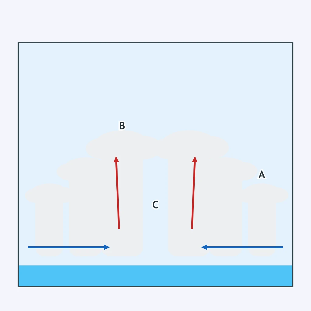
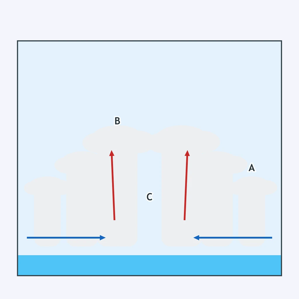
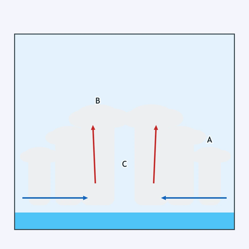
The hurricane cross section letters regions A through C. Which region has the strongest winds and heaviest rain?
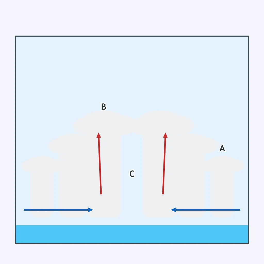
A dropsonde falls through the calm center in the hurricane cross section. Which letter marks the eye?
Outer squalls arrive before the center in the cross section. Which letter marks the outer rainband region?
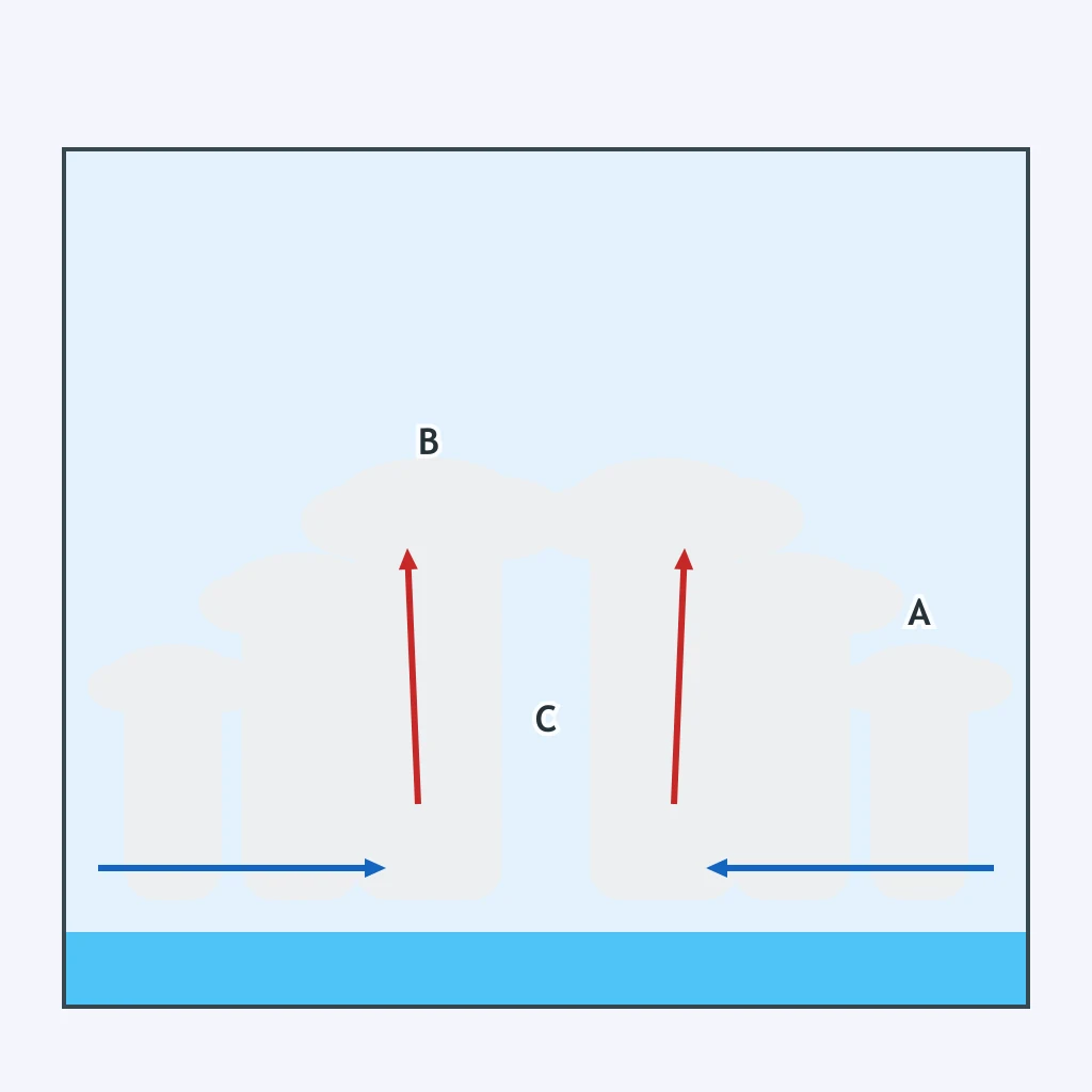
In a mature hurricane, high-altitude outflow vents air away from the storm top. What effect does this outflow have on the storm below?
A pressure sensor in one hurricane region reads the lowest pressure but not the highest wind speed. Which region is it?
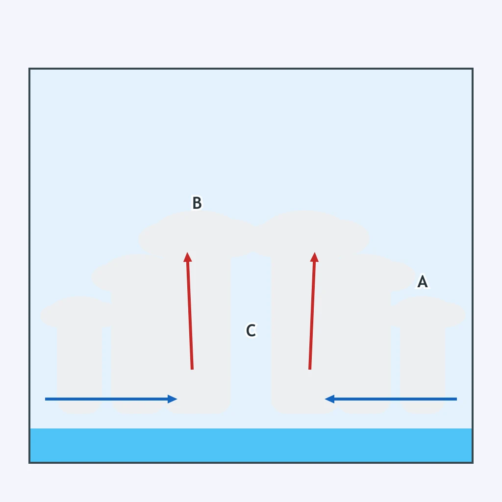
The most destructive wind belt is just outside the calm center. Which letter marks that belt in the cross section?
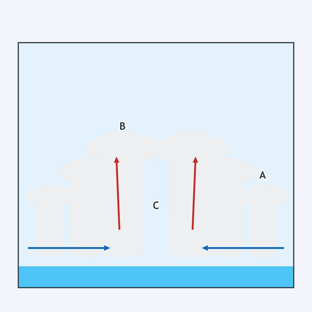
Where is air rising most violently to build tall cumulonimbus clouds in the hurricane cross section?
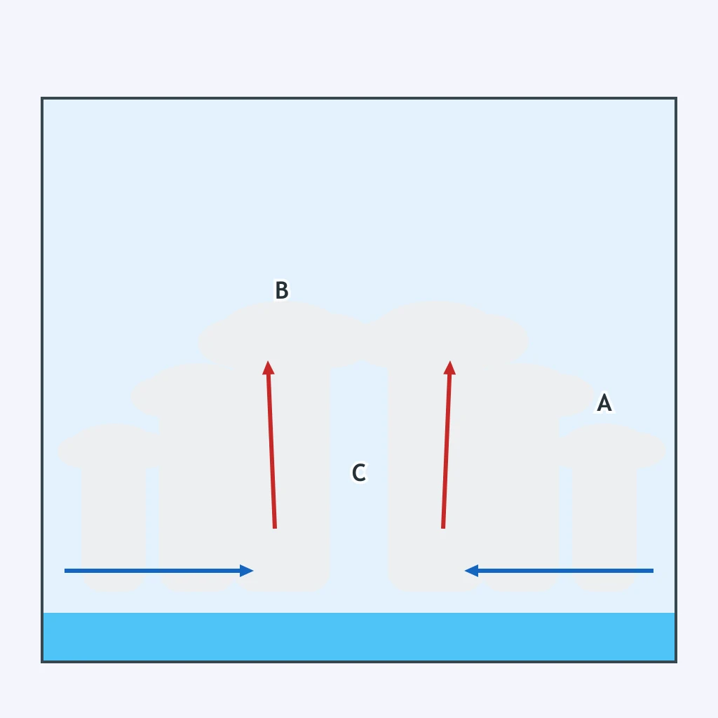
Which region would likely show clearer sky or broken low clouds as the storm center passes directly overhead?
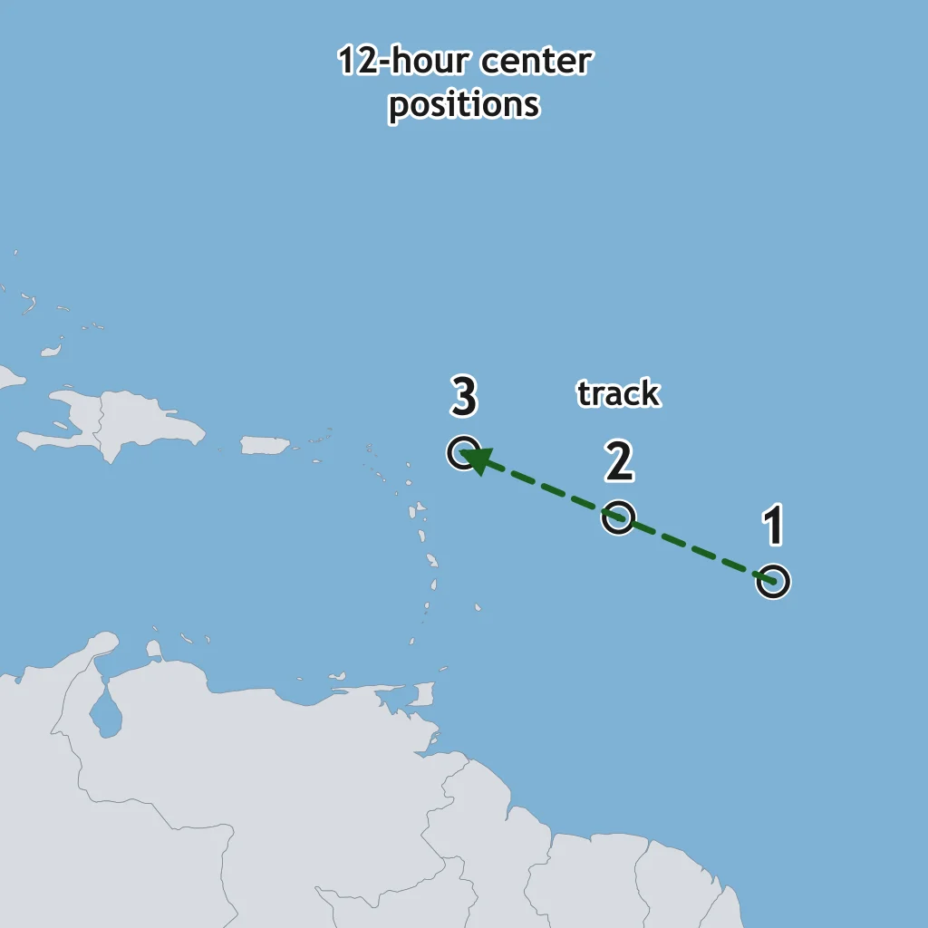
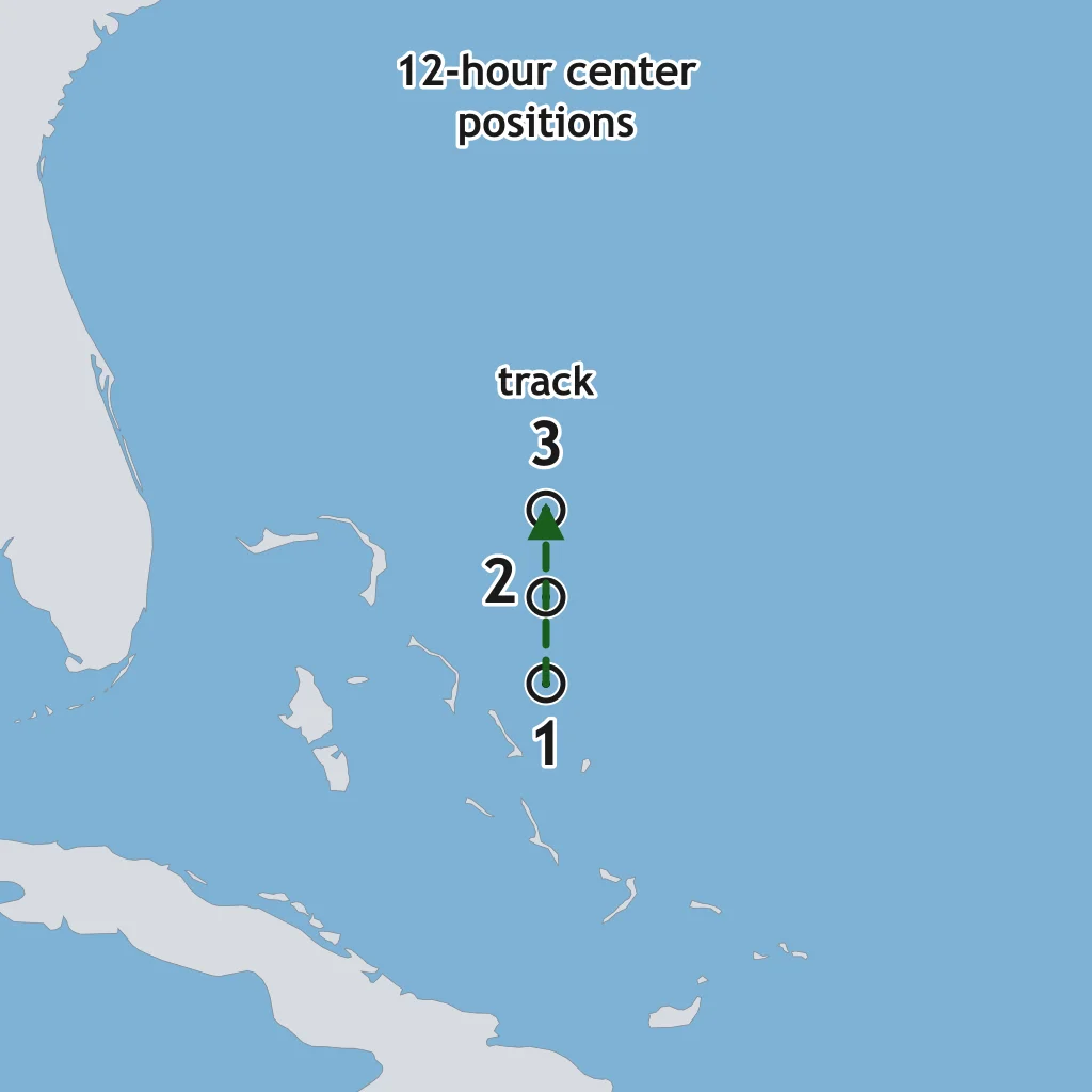
The map plots a hurricane center every 12 hours. If the track holds, where is the center 24 hours after point 3?
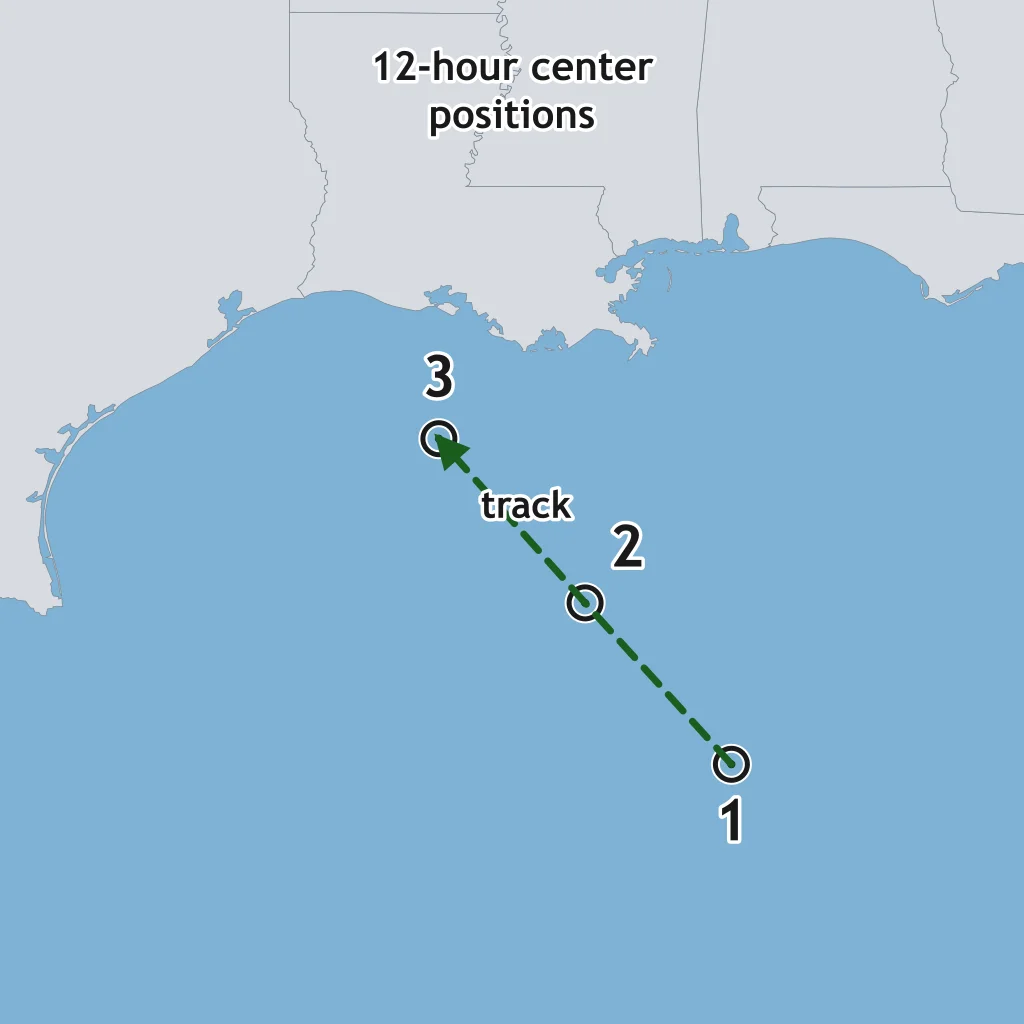
The Gulf track points are 12 hours apart. If the same motion continues, where is the center 12 hours after point 3?
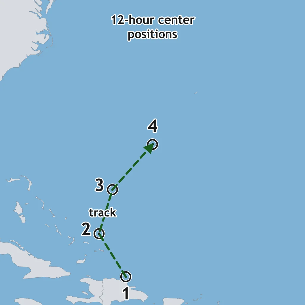
The map shows a hurricane recurving after point 2. If the trend continues, where is the center 24 hours after point 4?
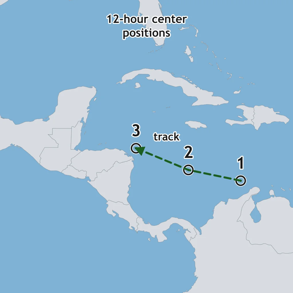
Centers on the Caribbean map are 12 hours apart. If the track holds, where is the center 24 hours after point 3?
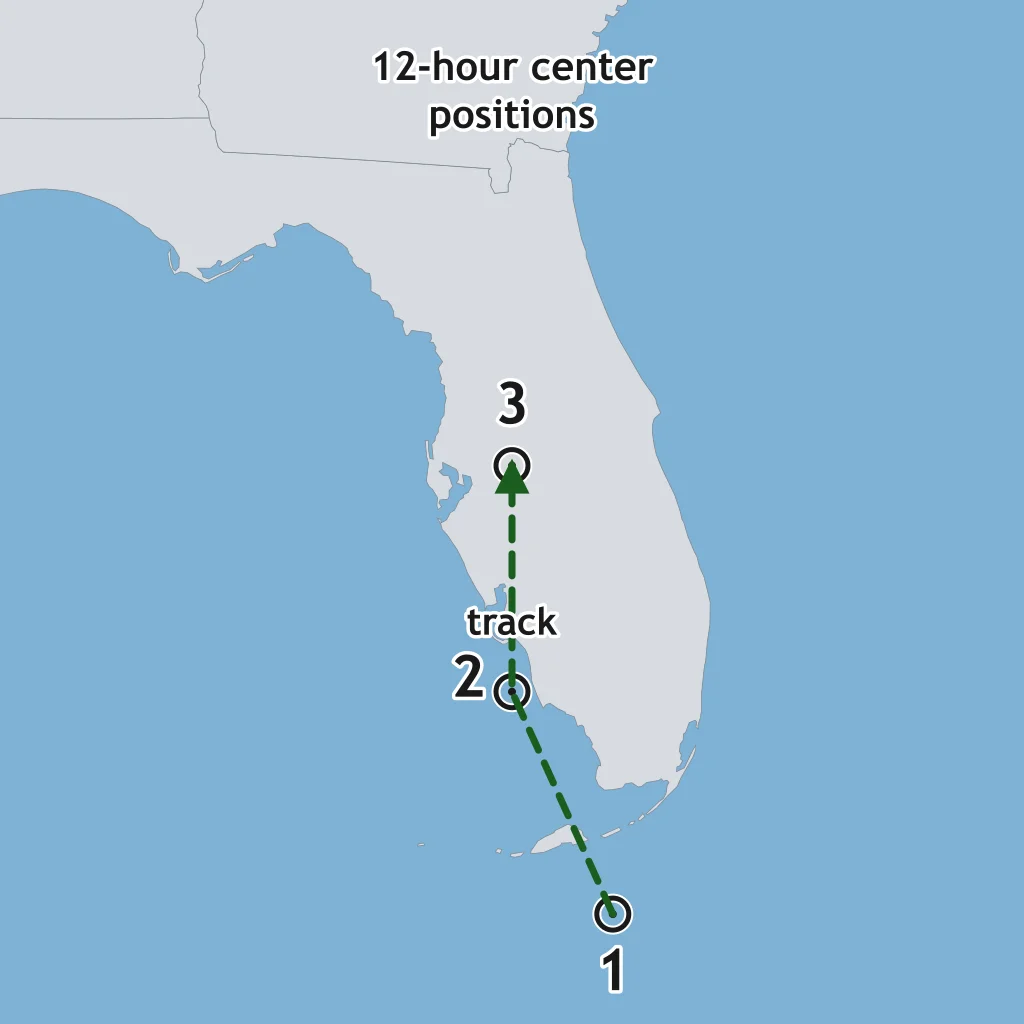
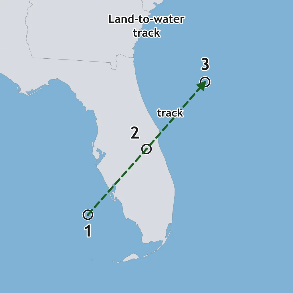
The map plots 12-hour positions as a storm crosses Florida. If motion stays the same, where is the center 12 hours after point 3?
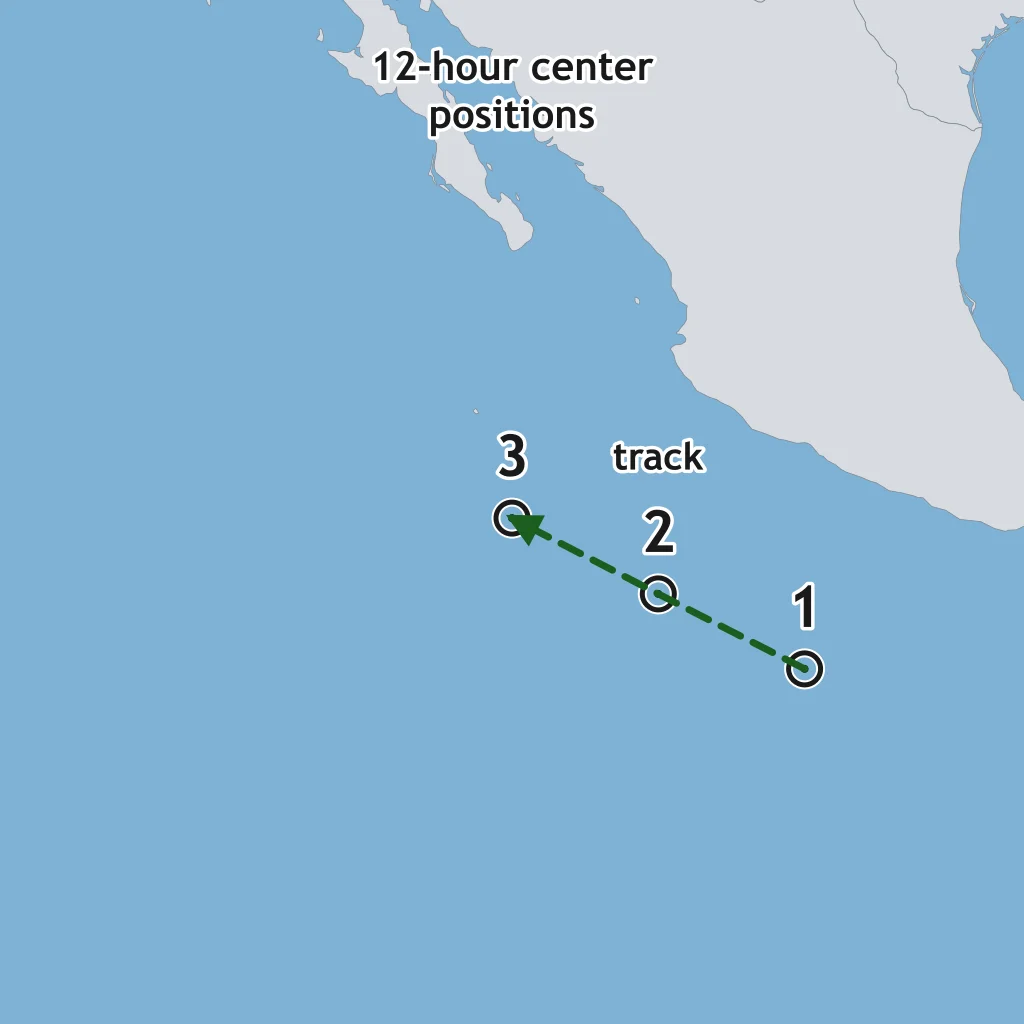
The east Pacific map shows 12-hour positions. If the same motion continues, where is the center 24 hours after point 3?
The plotted centers are 12 hours apart. Where is the center 24 hours after point 3 if speed and direction stay steady?
A tropical disturbance strengthens only over ocean water warmer than about 26.5 °C. What does that warm water supply?
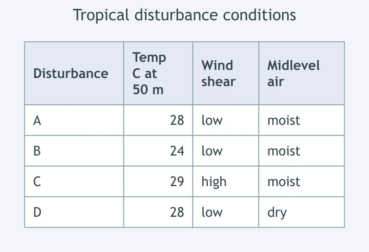
Use the conditions table. Which disturbance has the best set of ingredients for hurricane development?
A storm cluster sits over 29 °C water directly on the equator. Why is hurricane development unlikely there?
Satellite loops show thunderstorms being blown east of a low-level circulation center. What condition is limiting strengthening?
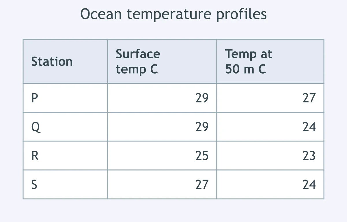
Use the ocean profile table. Which station has water warm enough through 50 m to best sustain a hurricane?
In a developing hurricane, condensation in tall clouds releases latent heat. What does that heat do to the storm?
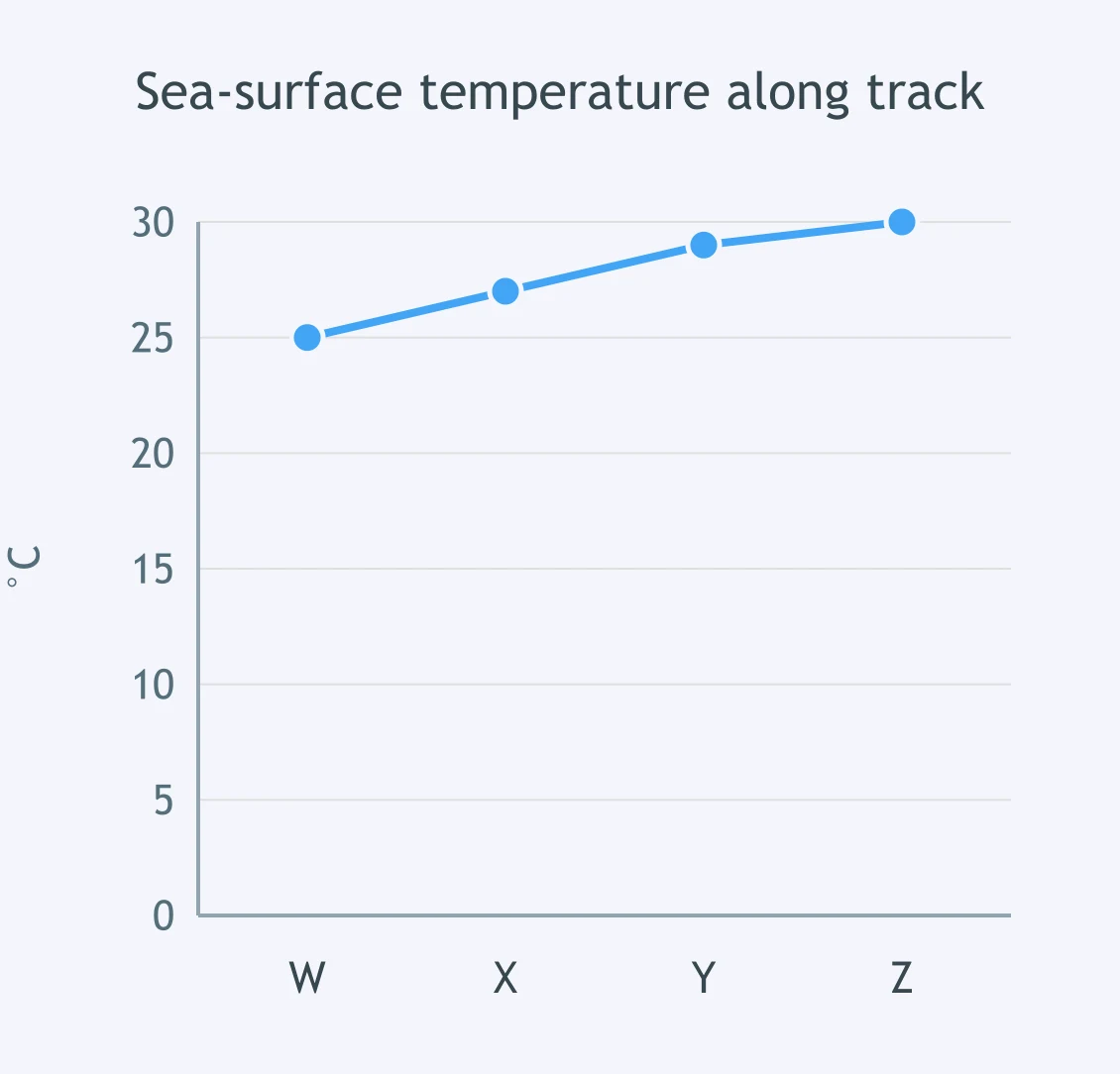
The formation threshold is about 26.5 °C. On the graph, which plotted point first reaches water warm enough for strengthening?
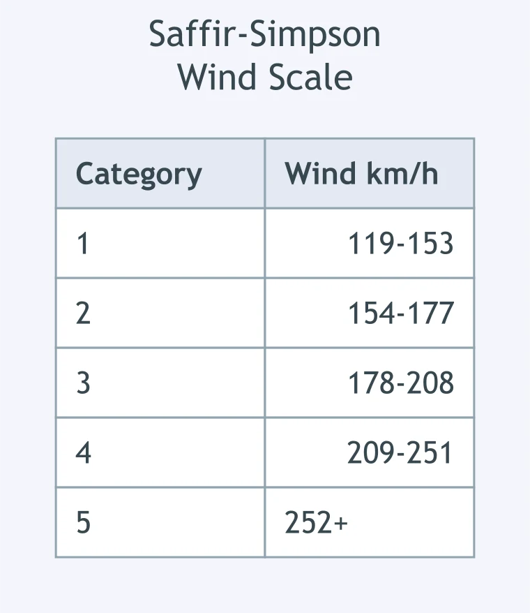
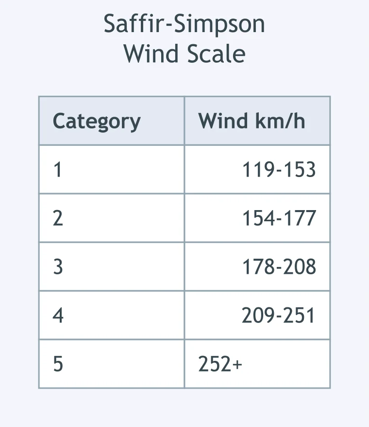
A hurricane's maximum sustained wind is 145 km/h. Using the table, what Saffir-Simpson category is it?
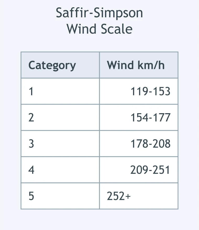
A hurricane's maximum sustained wind is 165 km/h. Using the table, what category is it?
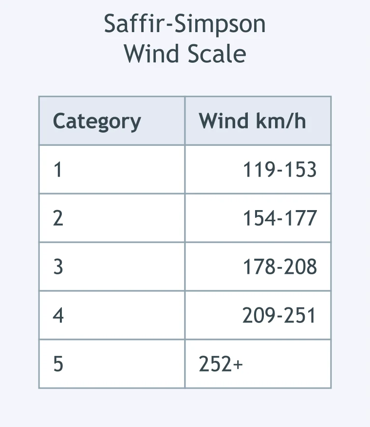
Aircraft measure maximum sustained winds of 190 km/h. Using the table, what Saffir-Simpson category is this storm?
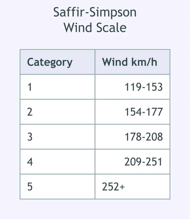
A hurricane has maximum sustained winds of 230 km/h. Using the table, what category should forecasters assign?
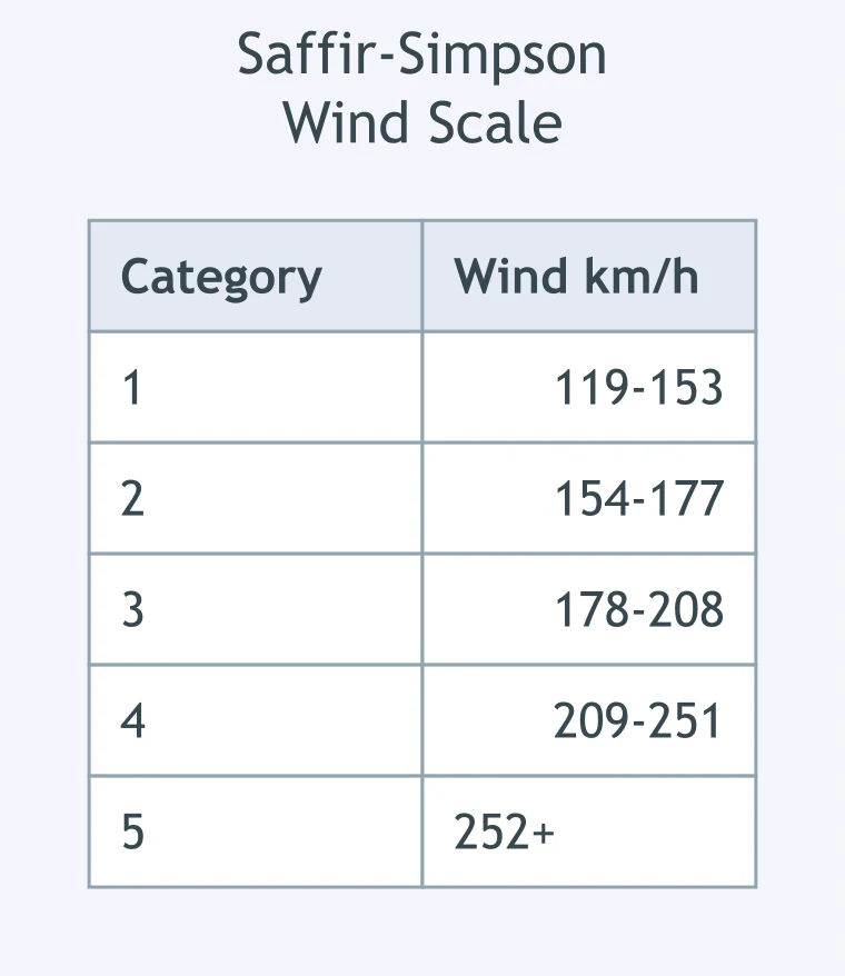
A hurricane's maximum sustained winds reach 253 km/h. Using the table, what category is it?
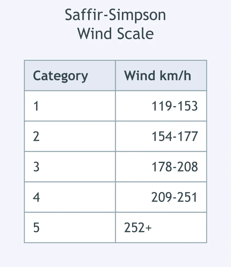
A storm's maximum sustained wind is exactly 178 km/h. Using the table, what Saffir-Simpson category is it?
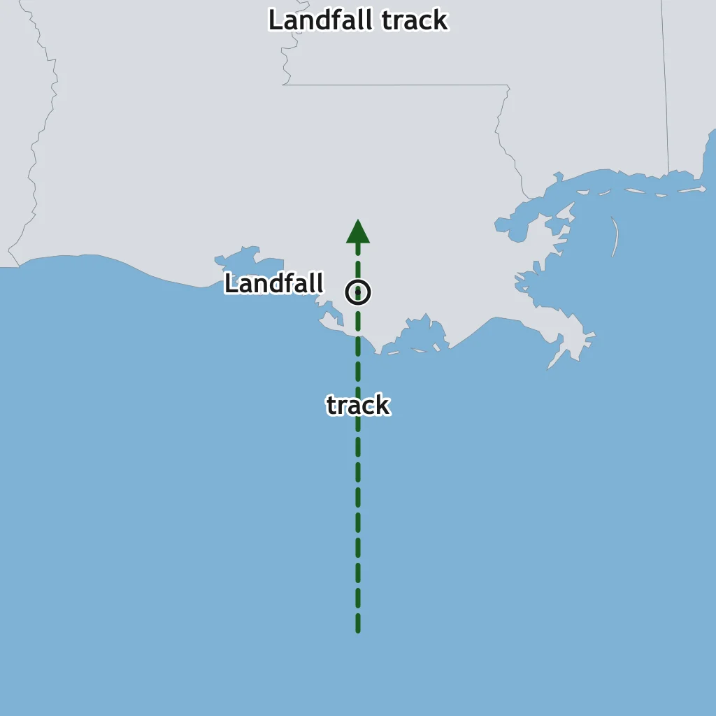
The map shows a hurricane moving due north at landfall. Which coast has the highest storm surge risk?
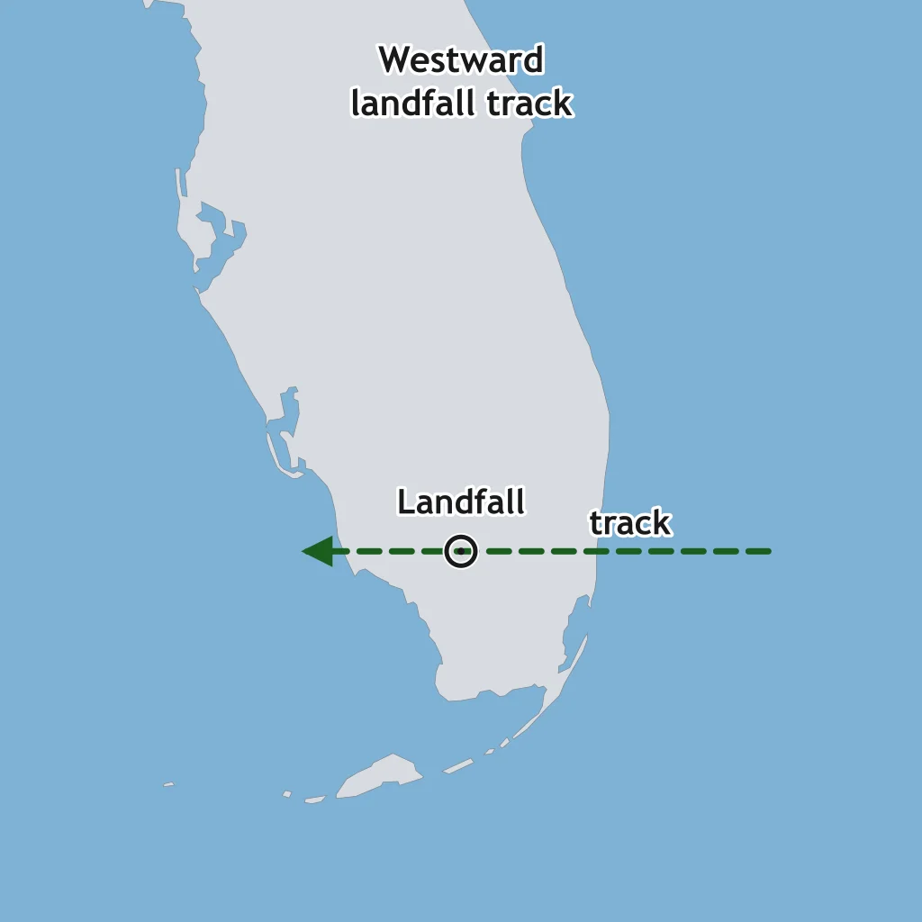
The map shows a hurricane moving west onto a coast. Which side of the track is the right-front side with greater surge risk?
Use the wind-scale table. Why can a Category 1 hurricane still require evacuation from low coastal neighborhoods?
A barrier island lies just under the eyewall as the hurricane reaches shore. Which region in the cross section most directly drives surge water onshore?
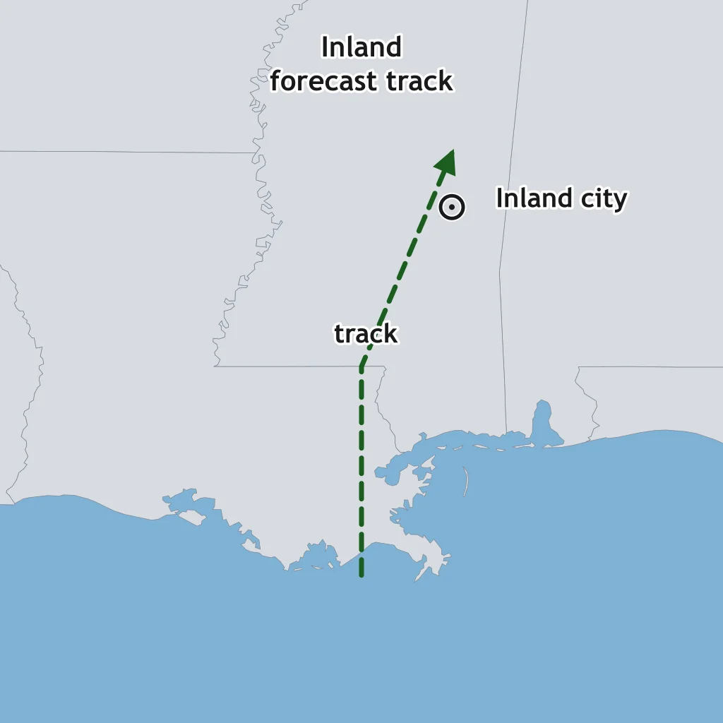
The map shows a hurricane track continuing inland after landfall. What hazard can remain high 150 km from the coast?
At landfall, why is the eyewall usually more damaging than the eye?
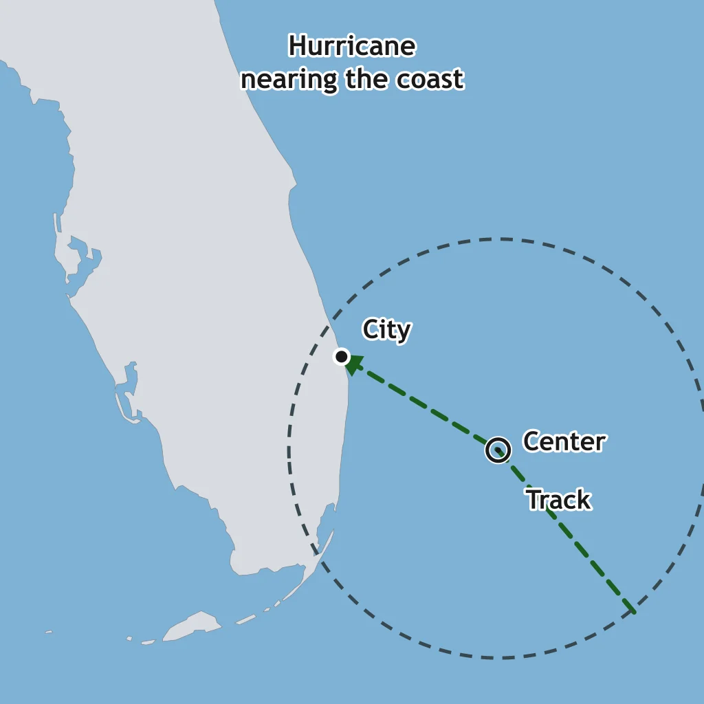
The map shows a hurricane's center offshore. The dashed ring marks how far its outer rainbands reach, and they already cross the coast at the city. What hazard can the city face before the eye arrives?
A hurricane crosses Florida and weakens over Georgia. What is the main reason it loses strength inland?
The map shows a weakened storm crossing land and then moving over warm water again. What change is possible after point 3?
A hurricane moves over cold water upwelled by an earlier storm. What effect does that cooler surface water usually have?
The timeline shows when the hurricane seasons begin and end. On what date does the Atlantic season reach its climatological peak?
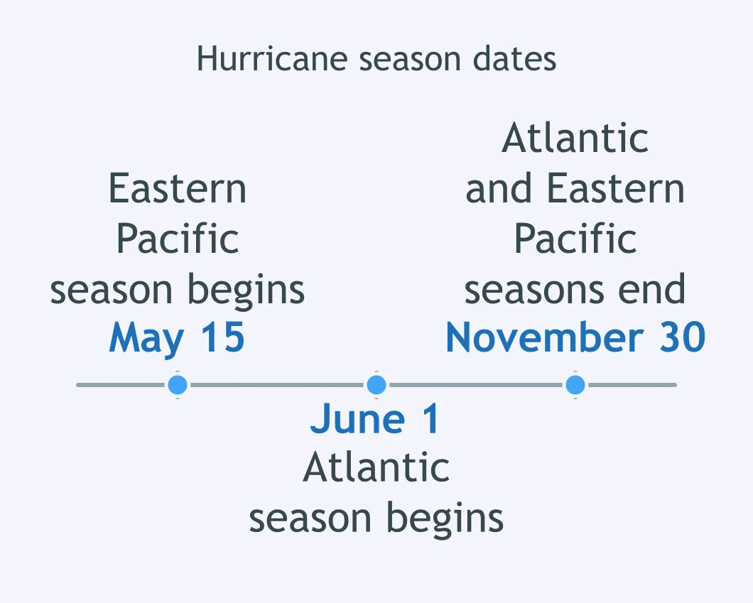
Why does Atlantic hurricane activity usually peak weeks after the June solstice instead of on the longest day?
Crack the passcode before the zombies get in.
Answer, then swat bugs for bonus points.
Race through questions at your own speed.
Same question on every screen. Fastest wins.

Pick a tile, answer, hit bonuses and steals.
40 questions