Loading
by BlastRoom
Naming a border by how it relates to the landscape and to the people it divides.
#us_hs_human_geography
40 questions
One question set, multiple game modes. Tap any game to see it in action. Not sure which to pick?
Answer to place stones and capture territory.
Outrun the snow together.
Earn blasts, then hunt the other team.
Answer to earn energy, then climb.

The class blasts through walls together.
Bid on mystery lots. Most money wins.
Sell tours. Nice, standard, or a total scam.

Answer, restock, and serve the rush.
More correct answers pulls the rope your way.
Answer, then shoot down the alien wave.
Answer, then tap to leap the frozen ridge.
A border follows the highest crest of the Andes, turning as the mountain divide turns. Classified by what it follows on the ground, what is it?
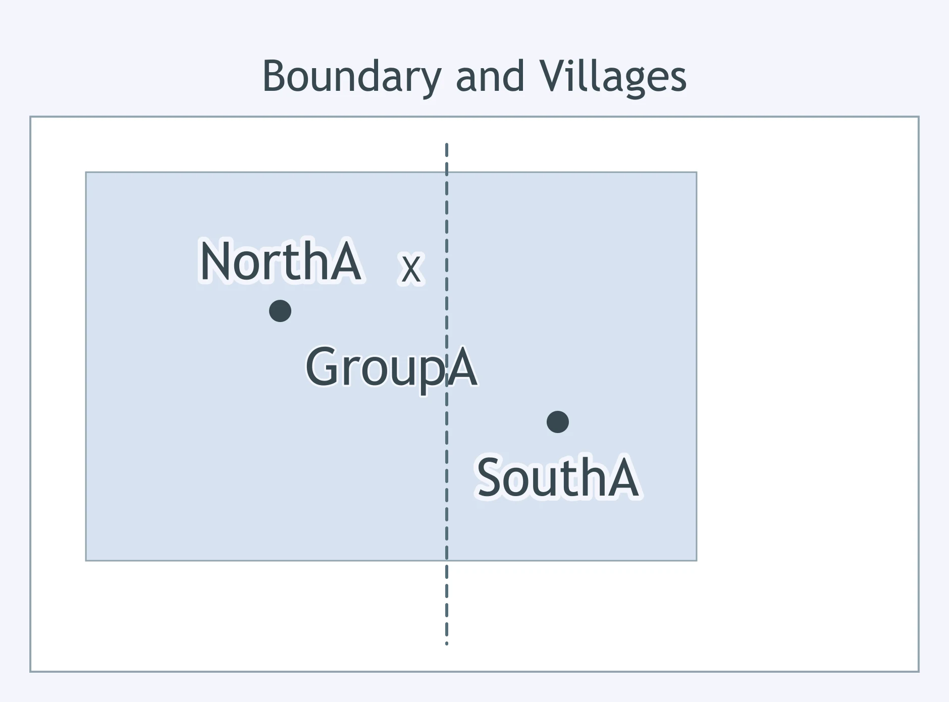
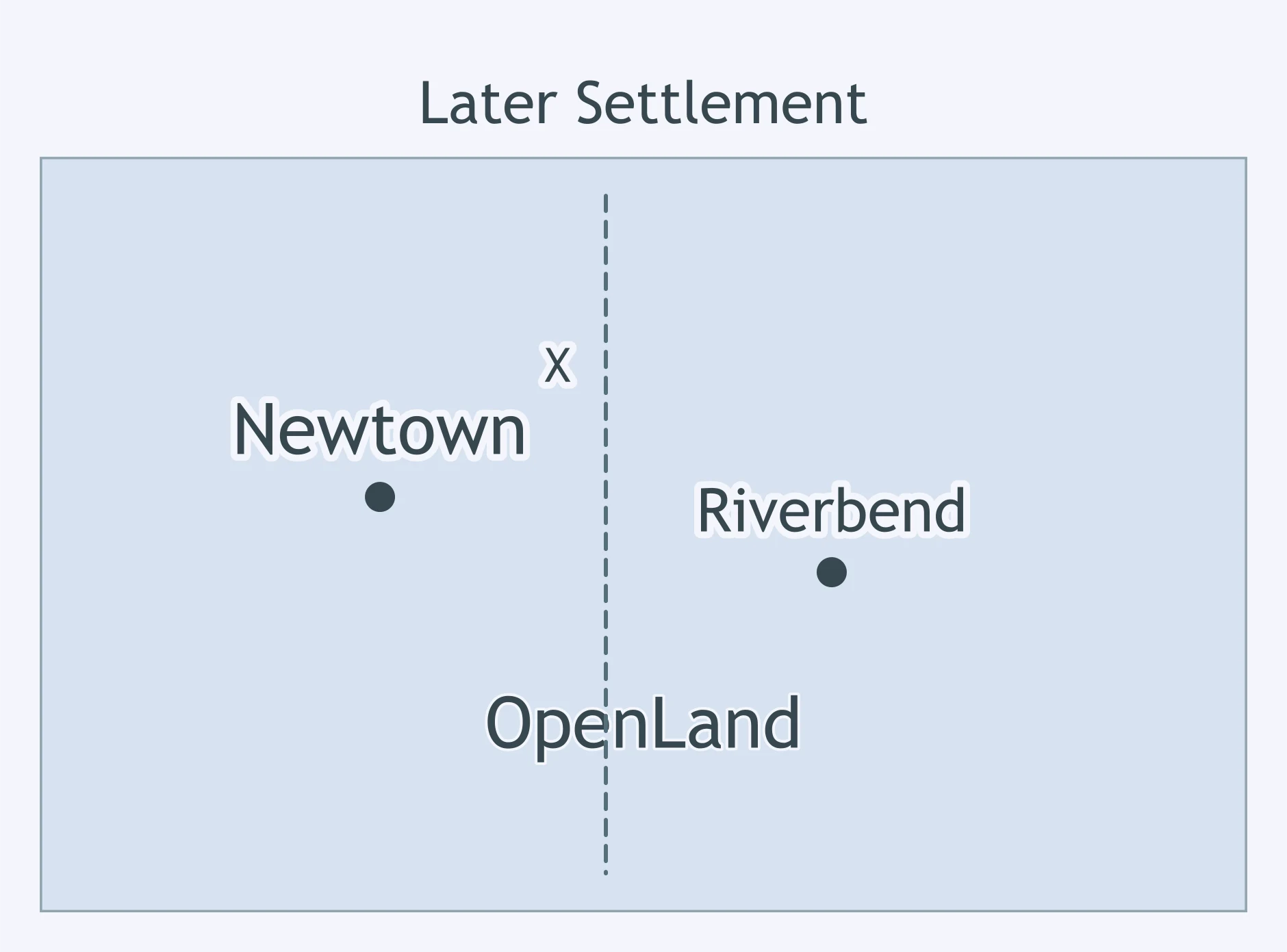
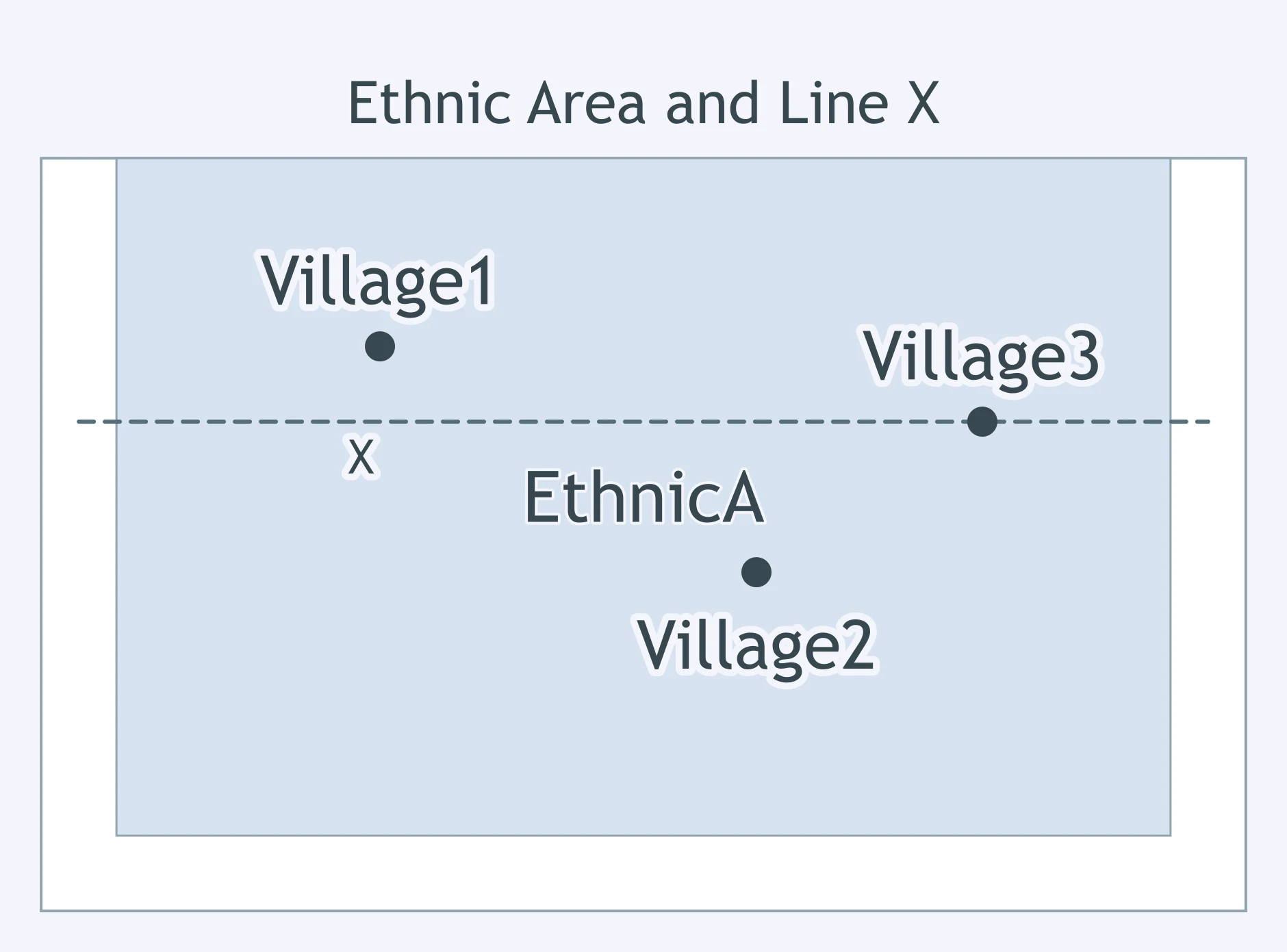
Use the map. Line X was set by an outside empire after the shaded settlement pattern already existed. What kind of boundary is it?
Survey crews set numbered concrete pillars along a treaty line that had already been drawn on official maps. Which stage is this?
The 49th parallel was agreed on before most farms and towns developed along that part of the U.S.-Canada border. Relative to later settlement, it is what type?
A treaty says a desert border will run north-south along a fixed meridian, even where no visible landform lies there. By its ground course, what is it?
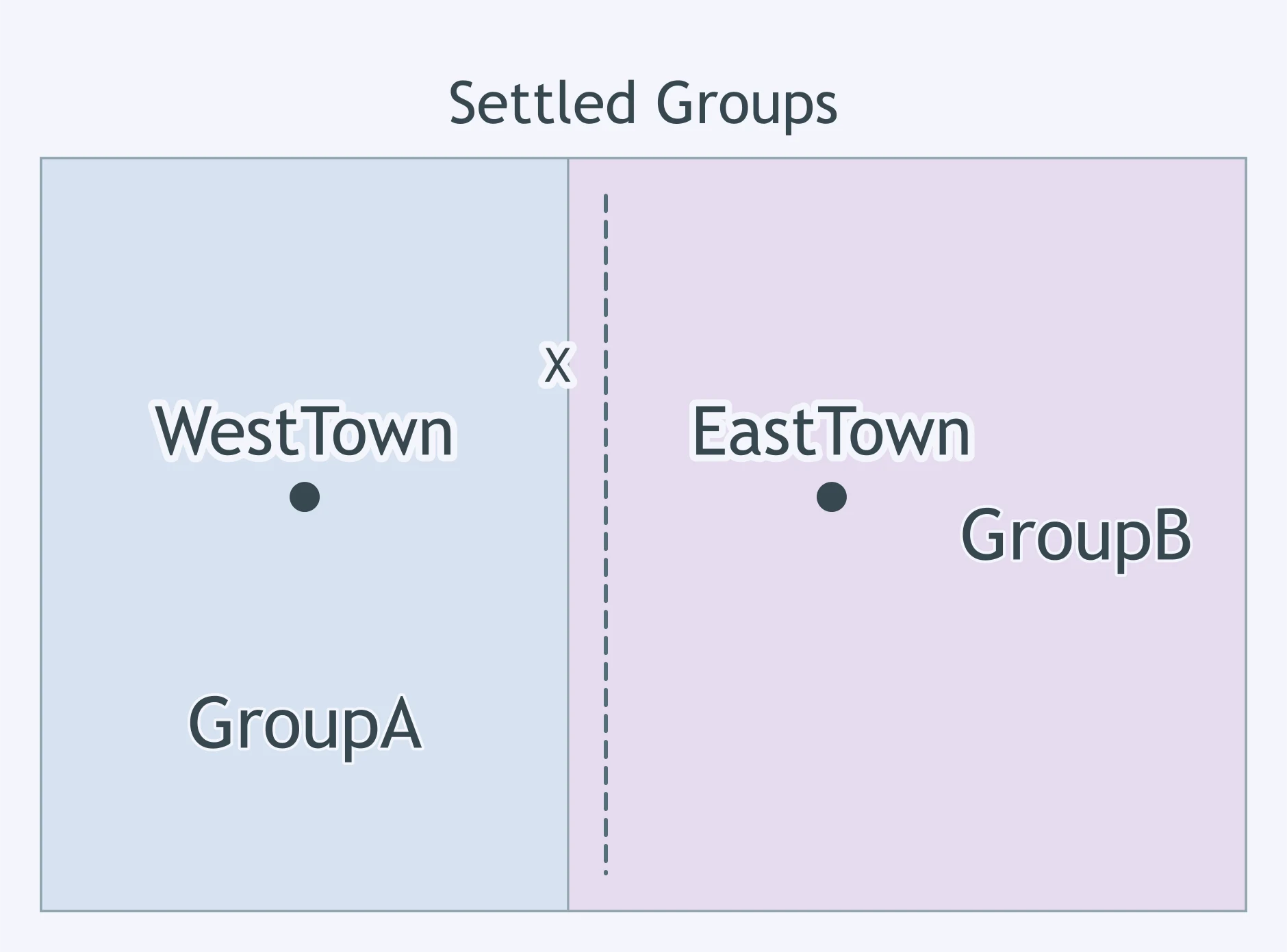
Use the map. Local leaders placed Line X along the contact zone between the two settled groups. How is the boundary classified?
Cartographers transfer a legally described border onto an agreed official map, but no posts have been placed in the field yet. Which stage is this?
A border follows the center channel of the Rio Grande where the river separates two states. Classified by what it follows, what is it?
Use the map. A treaty fixed Line X before the towns shown on either side were founded. What kind of boundary is it?
Negotiators write that a boundary will follow the river's deepest channel from its source to the coast. Which stage of boundary creation is this?
A border runs along a line of latitude for hundreds of miles across plains and forests. Classified by its course on Earth, what is it?
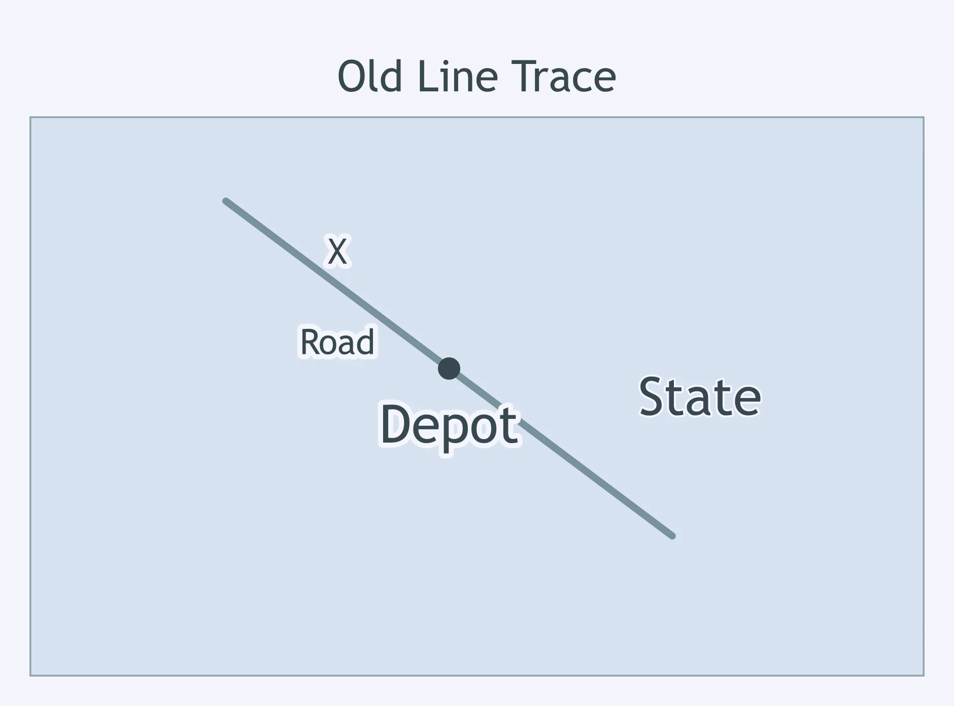
Use the map. Line X no longer marks sovereignty, but roads and property lines still follow its trace inside one state. What type is it?
Border officials issue crossing permits, maintain inspection stations, and settle routine disputes after the line is marked. Which stage is this?
Two settled language communities gradually developed apart, and a new border was later drawn between them. Relative to the cultural pattern, what is it?
A border follows the Great Lakes and then the St. Lawrence River for part of its route. Classified by what it follows, what is it?
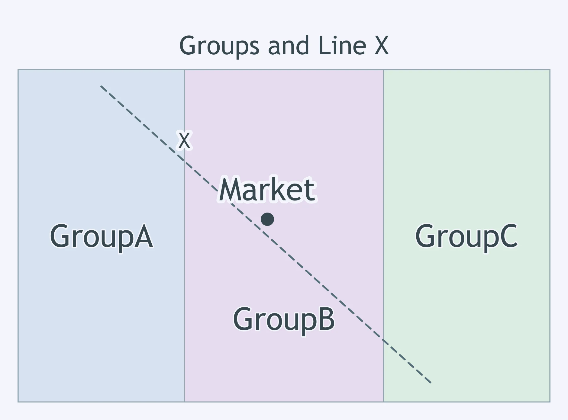
Use the map. A colonial administration drew Line X across the settled groups shown, ignoring their distribution. How should it be classified?
In the usual order of boundary making, which stage comes first?
A border in a dry interior is a straight survey line between two coordinates rather than a river, ridge, or coast. By its ground course, what is it?
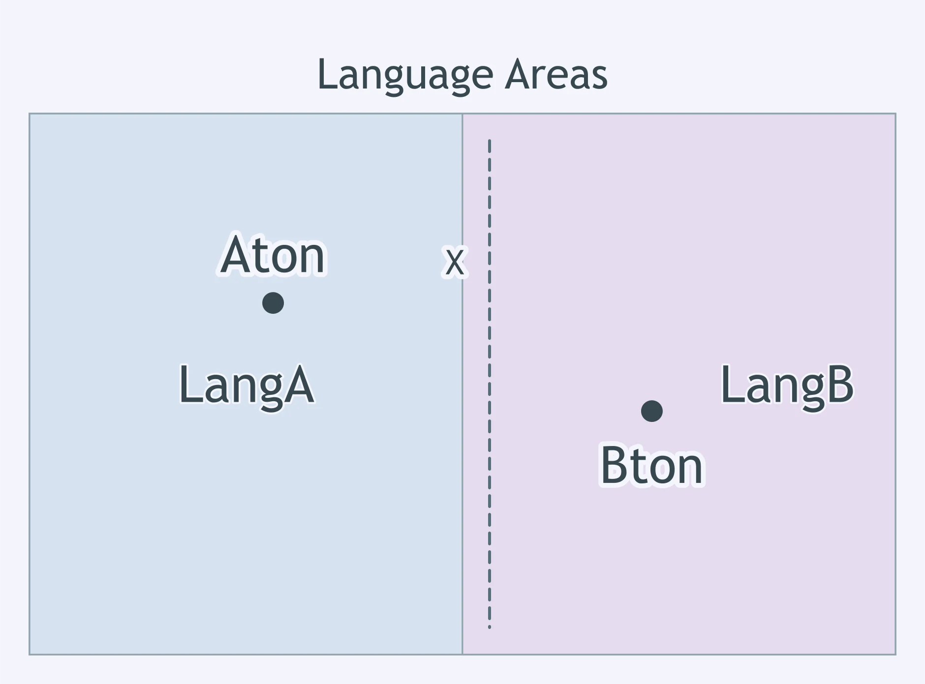
Use the map. Residents drew Line X after the two language areas shown had formed on either side. What boundary type fits best?
Mountain ranges such as the Pyrenees have often made effective physical boundaries between states. Why?
A border has been defined by treaty and drawn on official maps, but nothing marks it on the ground yet. Which stage comes next?
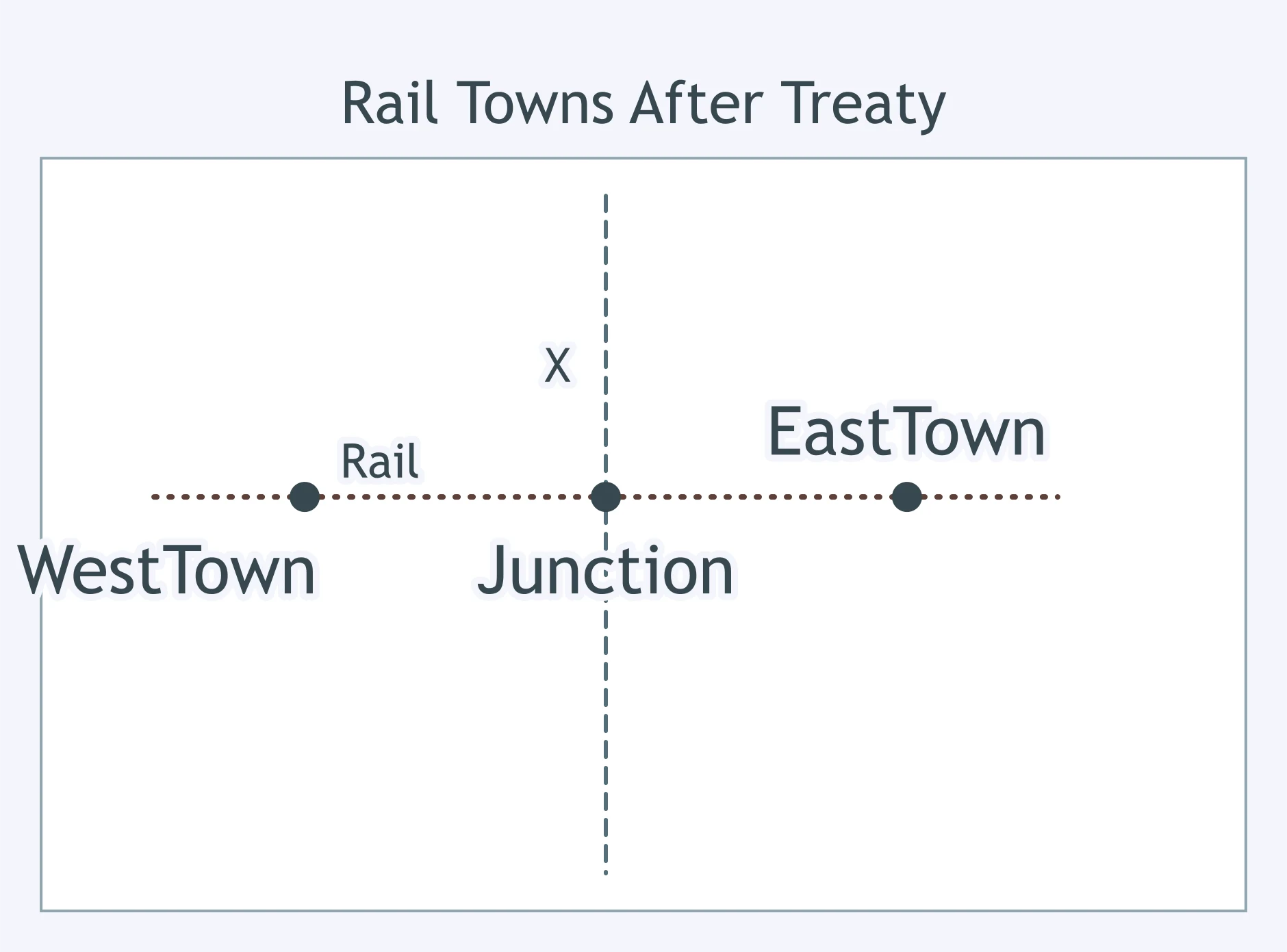
Use the map. Line X was agreed on before the rail towns shown grew along it. How is the boundary classified by timing?
A colonial power drew a straight border across the homeland of a people whose villages already extended across both sides. Relative to that pattern, what is it?
Which of these borders is a geometric boundary?
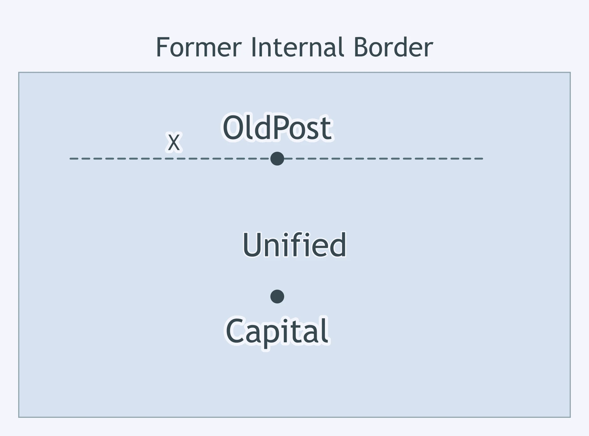
Use the map. Line X is a former border inside a unified state; no customs post operates there now, but the trace remains. What is it?
Negotiators have agreed on the legal wording of a border, but no official map shows the line yet. Which stage comes next?
A river's thalweg forms a border that shifts only when the main channel is legally recognized as shifting. By its ground basis, what is it?
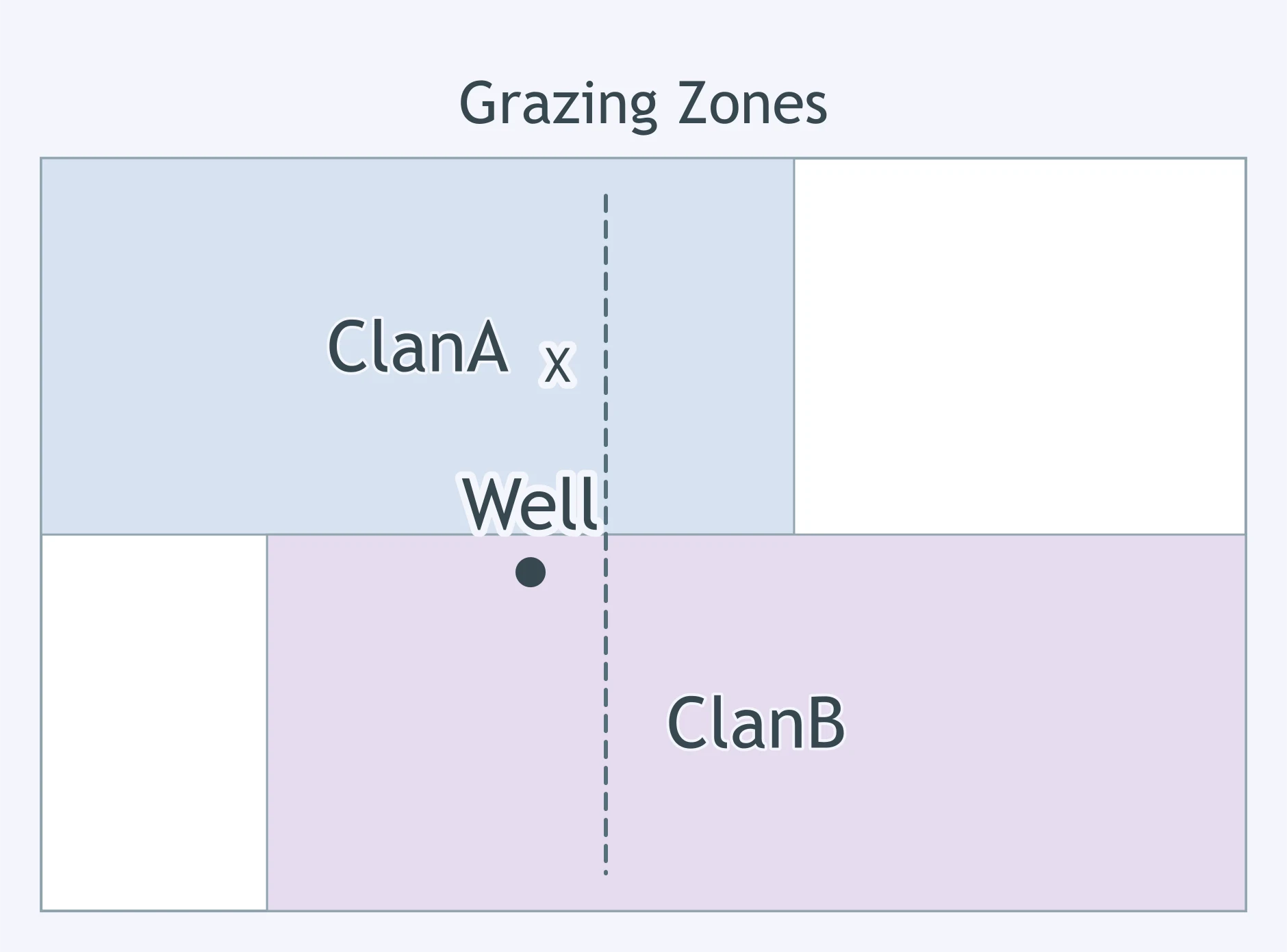
Use the map. Line X was drawn on a colonial office map across the clan grazing zones shown. How is the boundary best classified?
A border is marked with posts along its whole length, but neither state staffs crossings or patrols it, so goods pass unchecked. Which stage is missing?
Why are geometric boundaries common in places such as North Africa and the western United States?
Use the map. Communities on each side of Line X developed separately first, and the line was later adopted between them. What is the type?
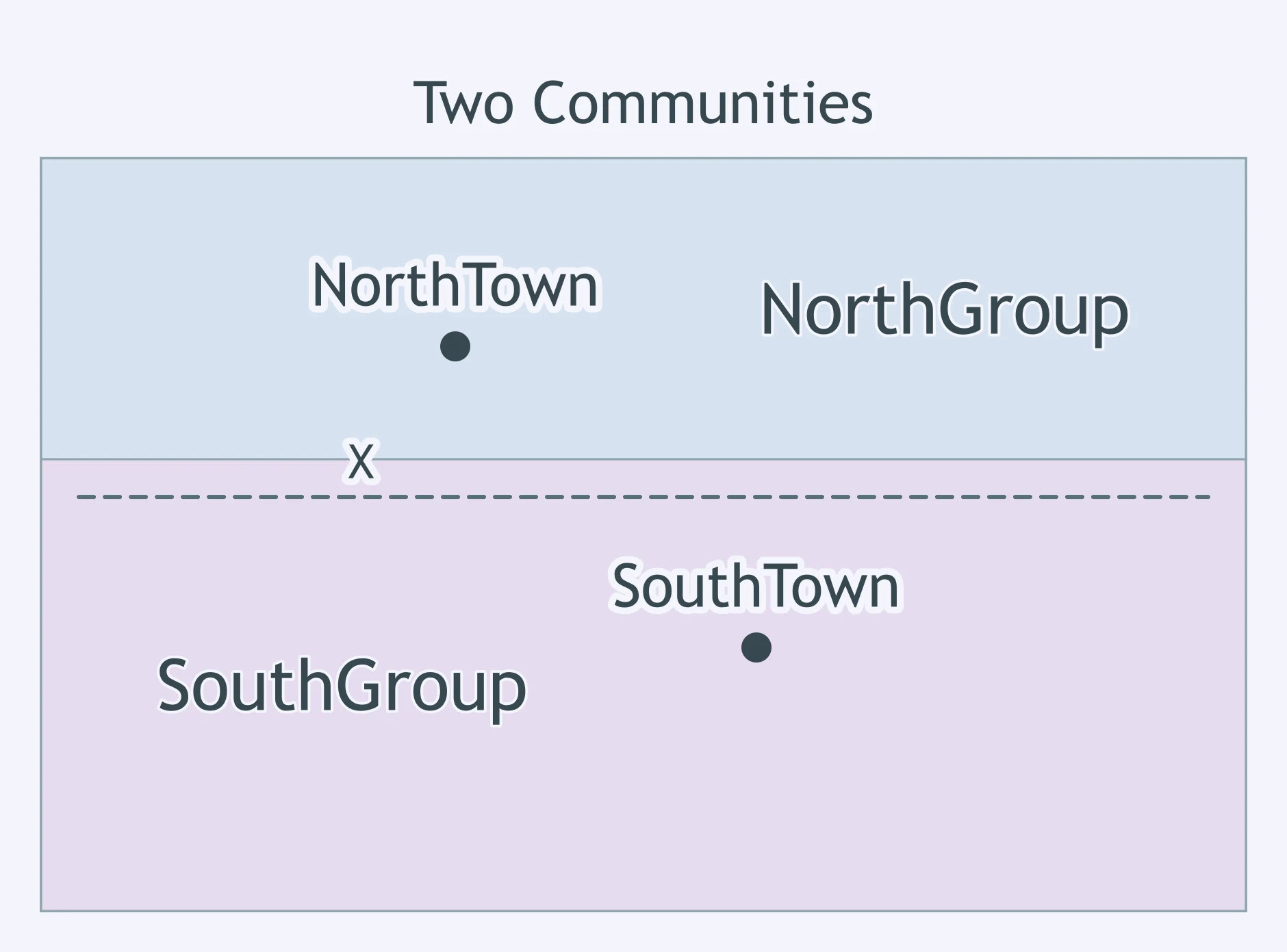
The Berlin Wall no longer divides sovereign states, but parts of its route remain visible in Berlin's urban landscape. What boundary type does this illustrate?
Use the map. Line X was fixed while the area was mostly open land; the farm villages shown appeared later. What kind of boundary is it?
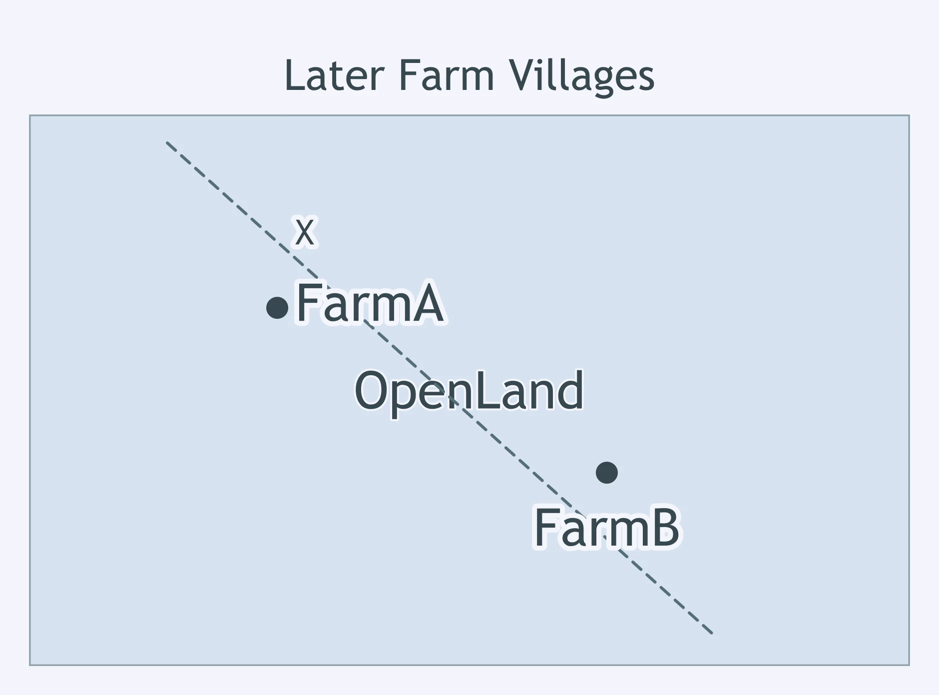
Use the map. Line X is a defunct boundary; new districts ignore it, but a ditch still follows the same path. What is the classification?
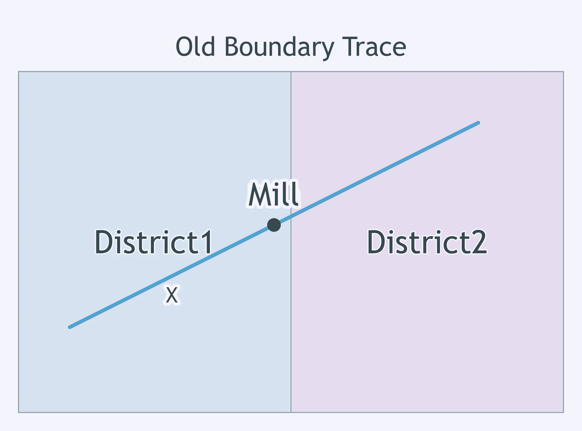
Use the map. A mandate authority placed Line X across one religious community whose towns were already connected. What kind of boundary is shown?
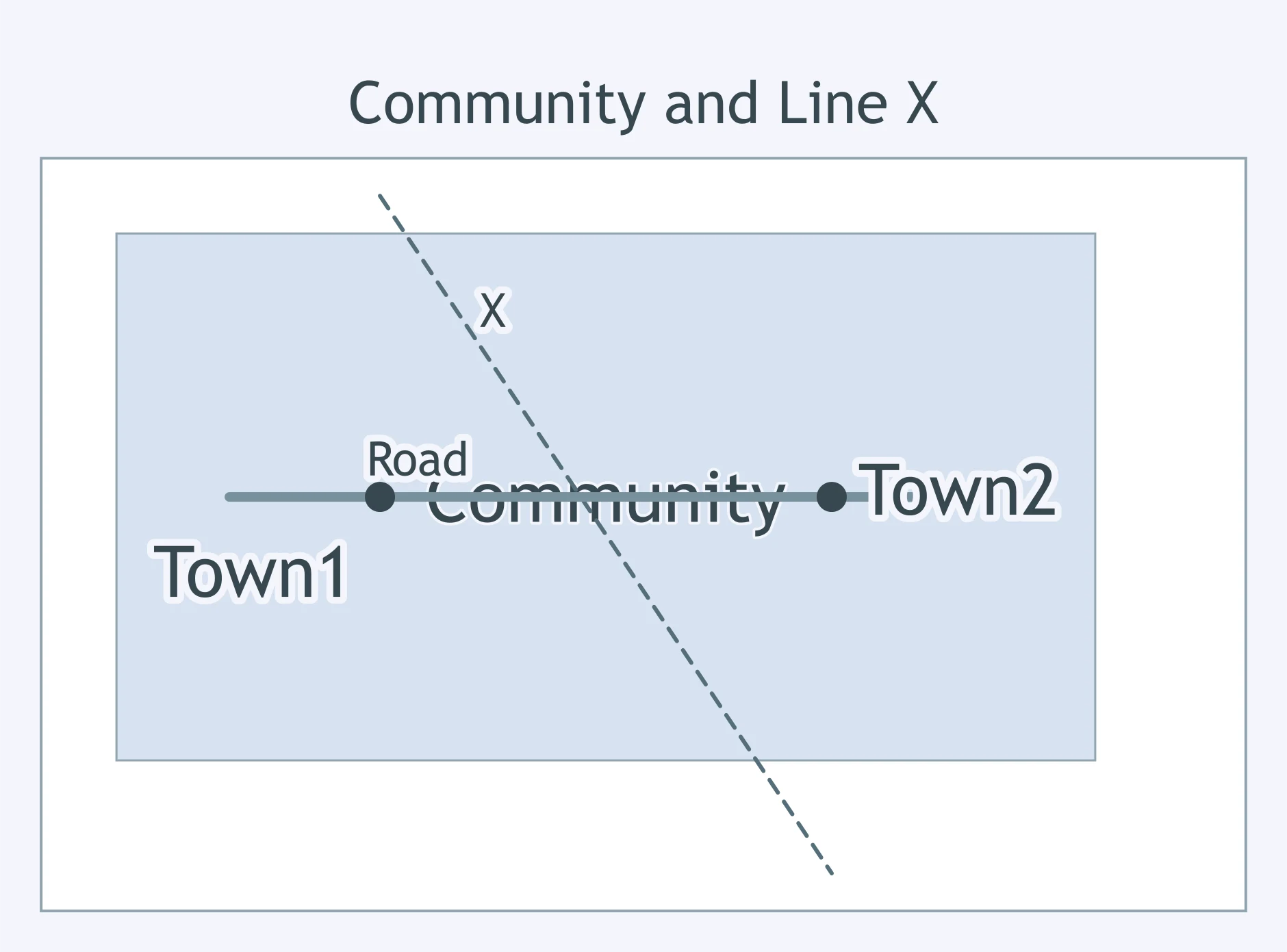
Use the map. After two language groups occupied separate valleys, Line X was drawn along the ridge between them. What type is it?
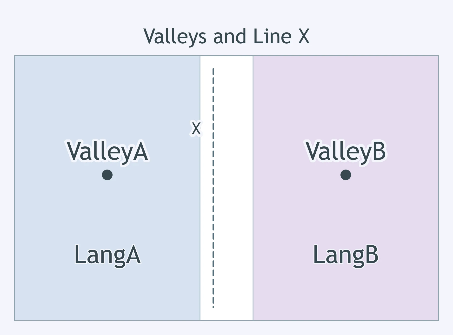
Use the map. Line X was surveyed before the irrigation towns shown were founded on either side. Which classification fits?
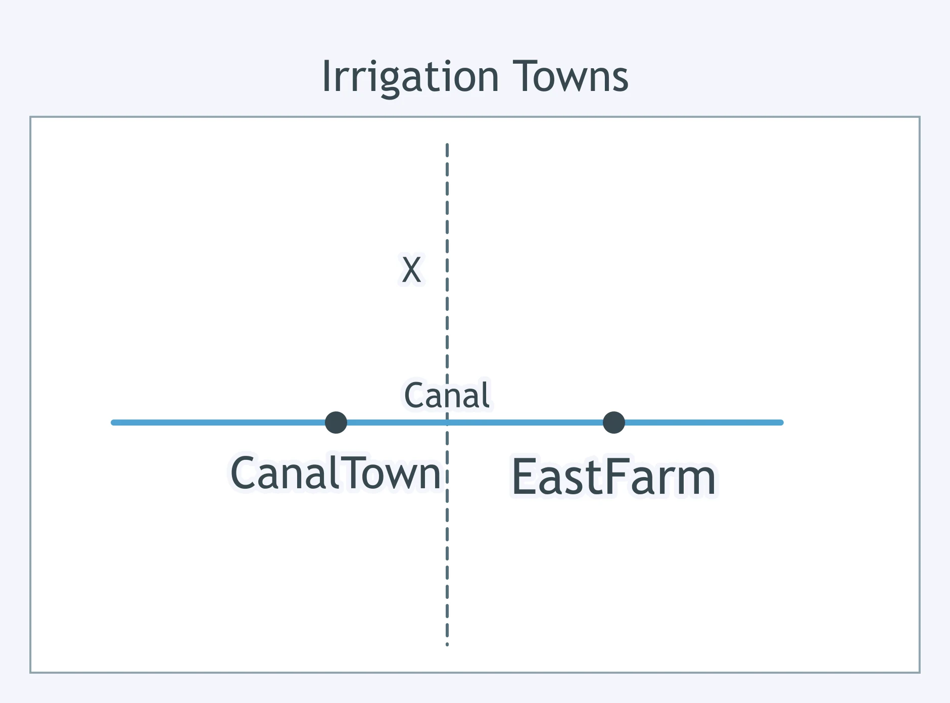
Use the map. Line X is no longer an international border, but a line of old watchtowers still marks it. What type is it?
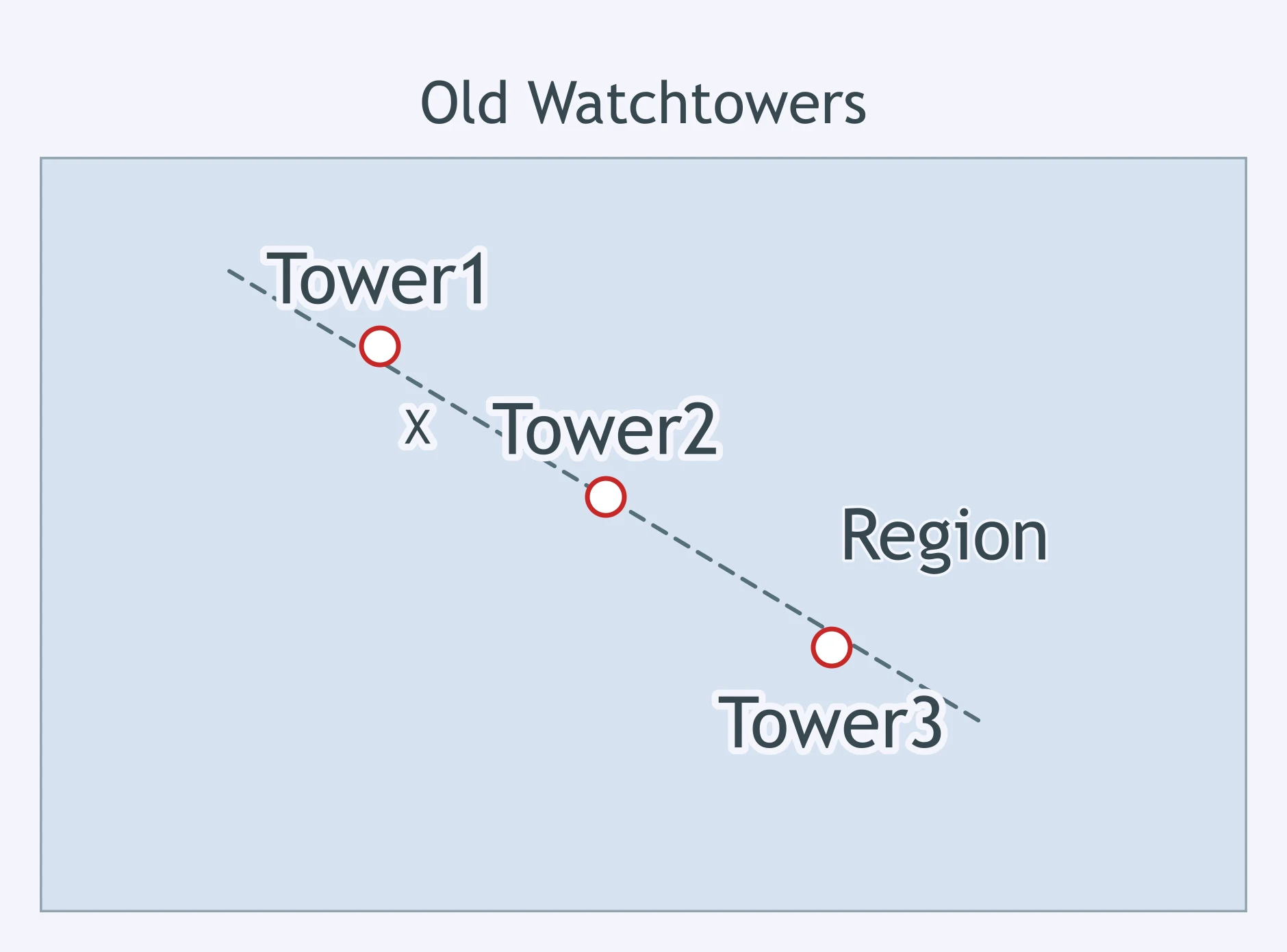
Use the map. Line X was adjusted to match a long-standing divide between the two ethnic regions shown. How is it classified?
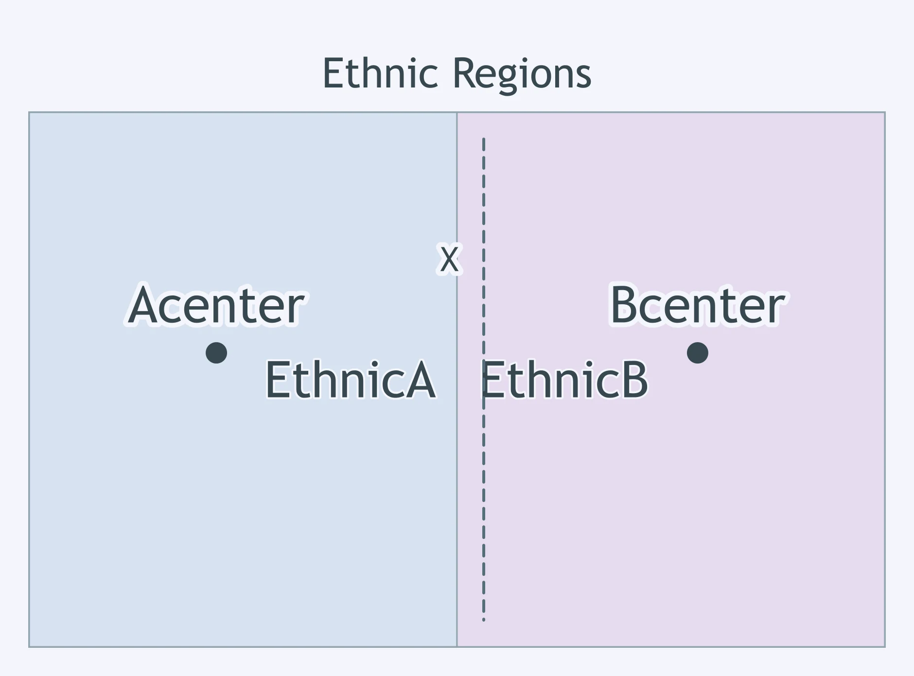
Use the map. An outside peace conference drew Line X straight across the shaded ethnic area after its villages already existed. What is it?
Sovereignty, Self-Determination and Territoriality
30 questions
Colonialism and Imperialism
30 questions
Independence, Decolonization and Neocolonialism
30 questions
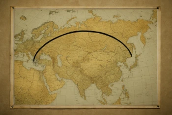
Geopolitical Theories: Heartland, Rimland and Organic Theory
20 questions
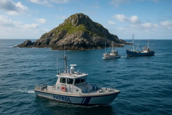
The Functions of Boundaries: Disputes, Buffers and the Law of the Sea
35 questions
Crack the passcode before the zombies get in.
Answer, then swat bugs for bonus points.
Race through questions at your own speed.
Same question on every screen. Fastest wins.

Pick a tile, answer, hit bonuses and steals.