Loading
by BlastRoom
How European powers took territory, and the map they left behind.
#us_hs_human_geography
30 questions
One question set, multiple game modes. Tap any game to see it in action. Not sure which to pick?
Answer to place stones and capture territory.
Outrun the snow together.
Earn blasts, then hunt the other team.
Answer to earn energy, then climb.

The class blasts through walls together.
Bid on mystery lots. Most money wins.
Sell tours. Nice, standard, or a total scam.

Answer, restock, and serve the rush.
More correct answers pulls the rope your way.
Answer, then shoot down the alien wave.
Answer, then tap to leap the frozen ridge.
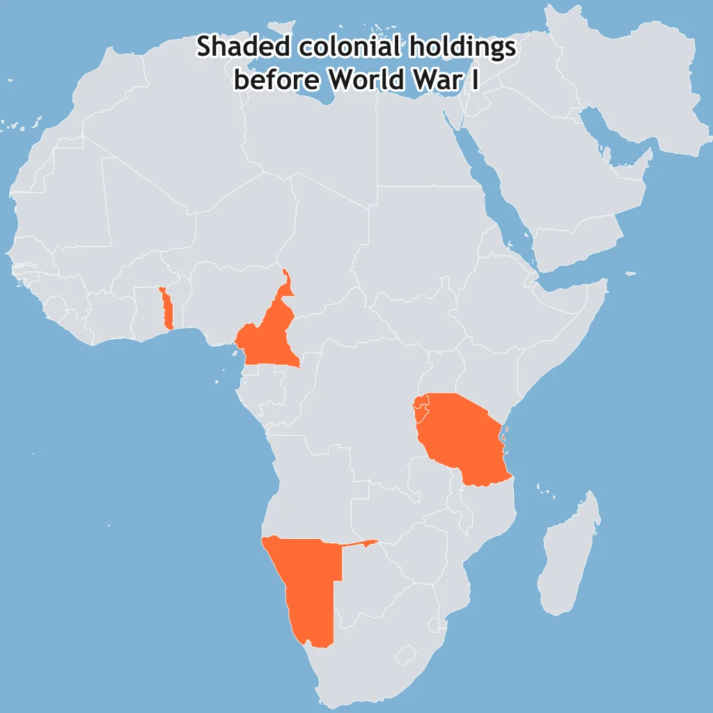
At the 1884-1885 Berlin Conference, European states set rules for claiming African land without African rulers at the table. This arrangement is best described as
A European state announced a claim to an African coast and then had to show administration or military control there to make the claim accepted. The rule being applied was
A local ruler kept a throne, but a foreign empire controlled defense, foreign relations, and major policy decisions. That colonial arrangement was a
In parts of China, a foreign power gained privileged trade and railroad rights without fully annexing the territory. That type of control is called a
The British East India Company collected taxes, maintained armies, and governed territory before direct Crown rule in India. This is an example of
After World War I, some former German and Ottoman territories were assigned to victorious powers under League of Nations supervision. These territories were called
A colonial power ruled through appointed governors and civil servants sent from the metropole, replacing most local political authority. This system was
An empire governed a colony by working through chiefs and existing local institutions while keeping final authority for itself. The governing method was
Use the map. The shaded African territories were controlled by one European empire around 1913. Name that power.
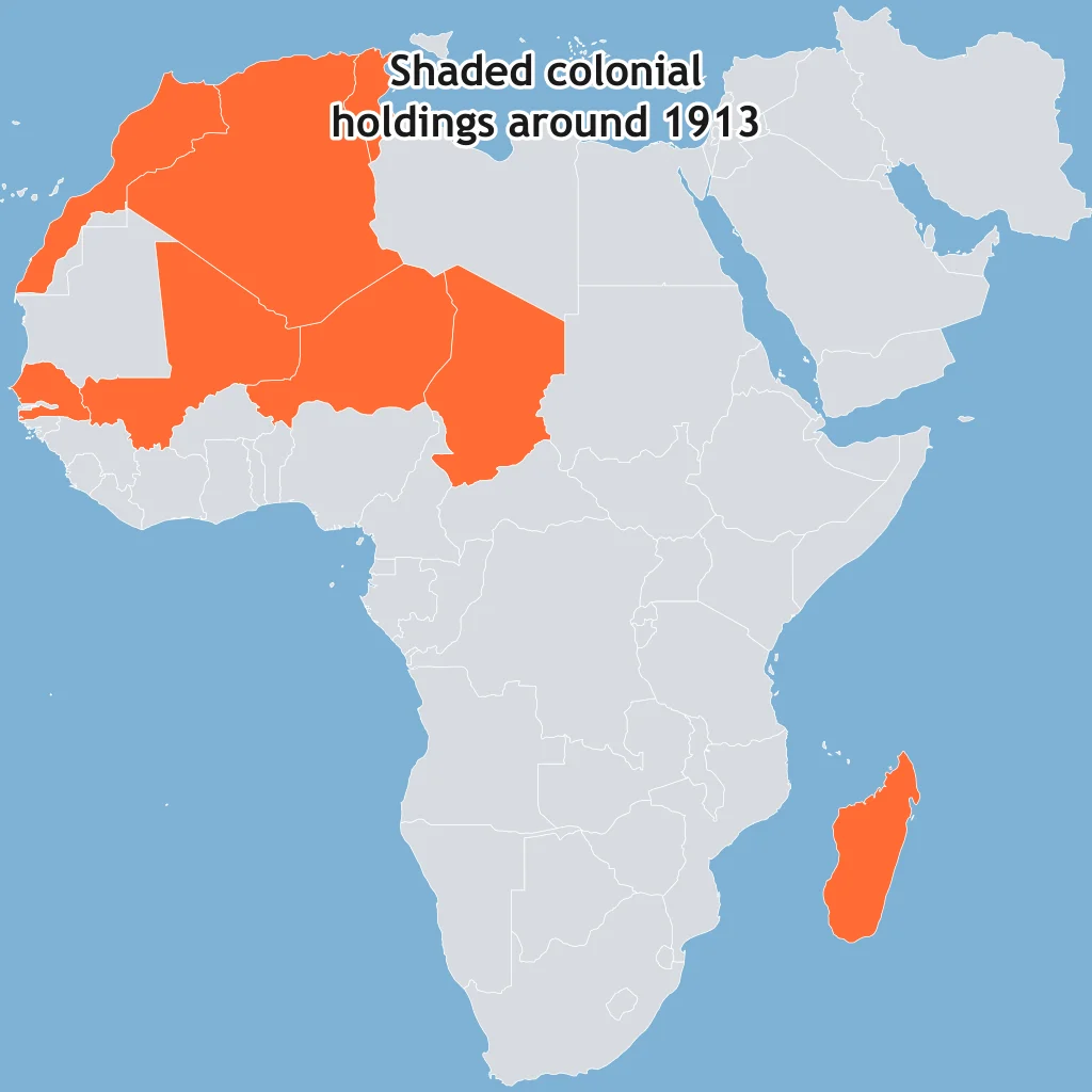
The map shades colonies and protectorates of one empire in Africa around 1913. The European power was
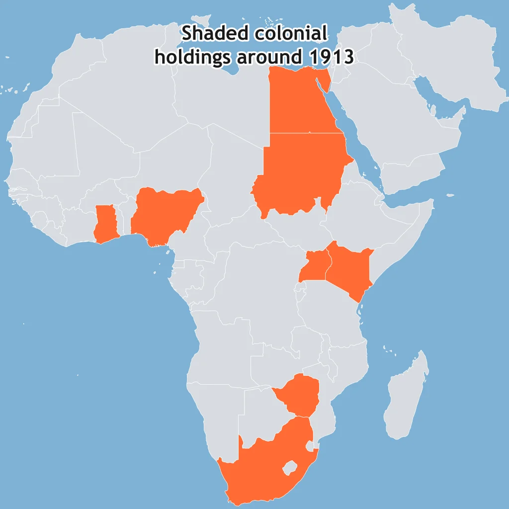
The shaded central African territory on the map was the main colony of one European state. That state was
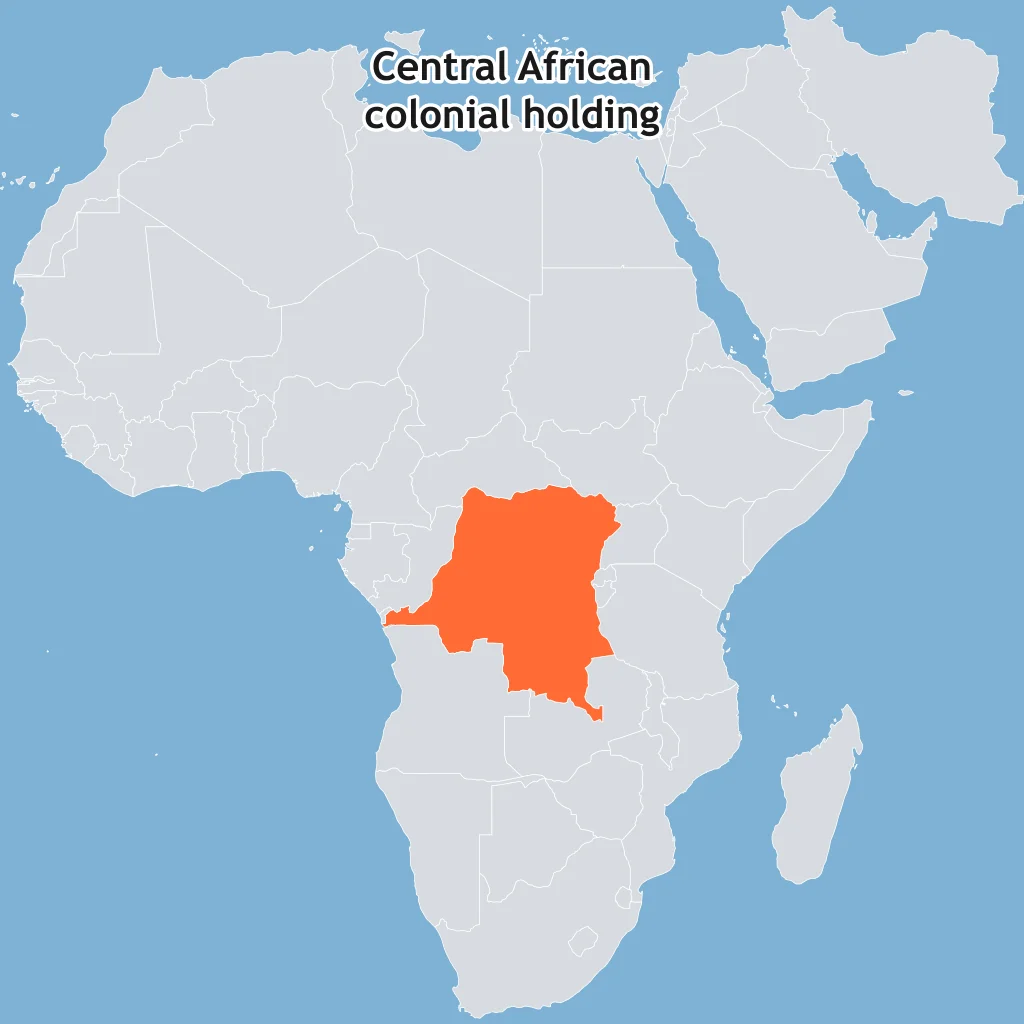
The map shades three African colonies that belonged to the same European empire. The empire was
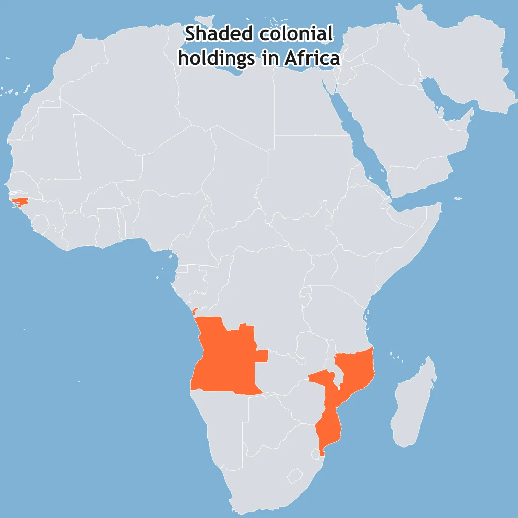
The shaded African territories belonged to a European power shortly before World War I. The power was
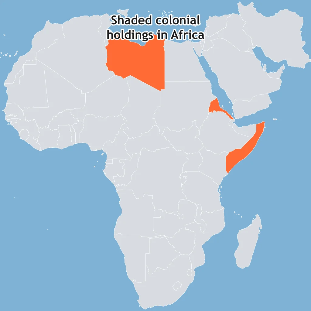
The map shades Libya, Eritrea, and Somalia as colonies held by the same European state in the early twentieth century. That state was
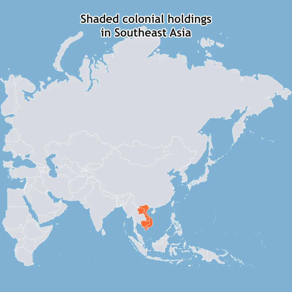
Use the Southeast Asia map. The shaded mainland territories formed a colonial federation under which European power?
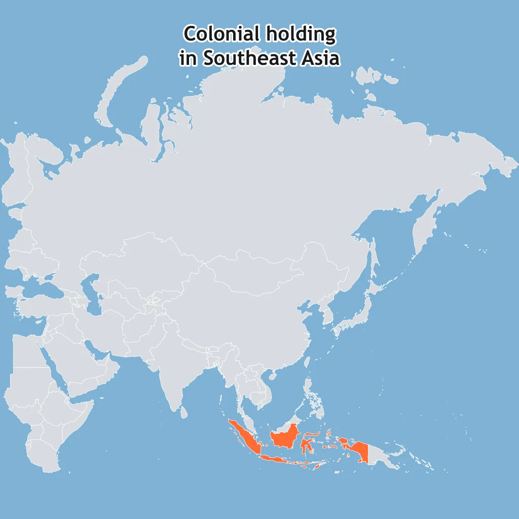
The map shades one country. Which European power colonized it?
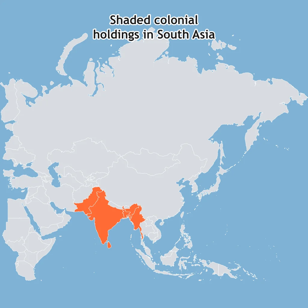
The shaded South Asian territories were ruled as part of or alongside one empire before mid-twentieth-century independence. The empire was
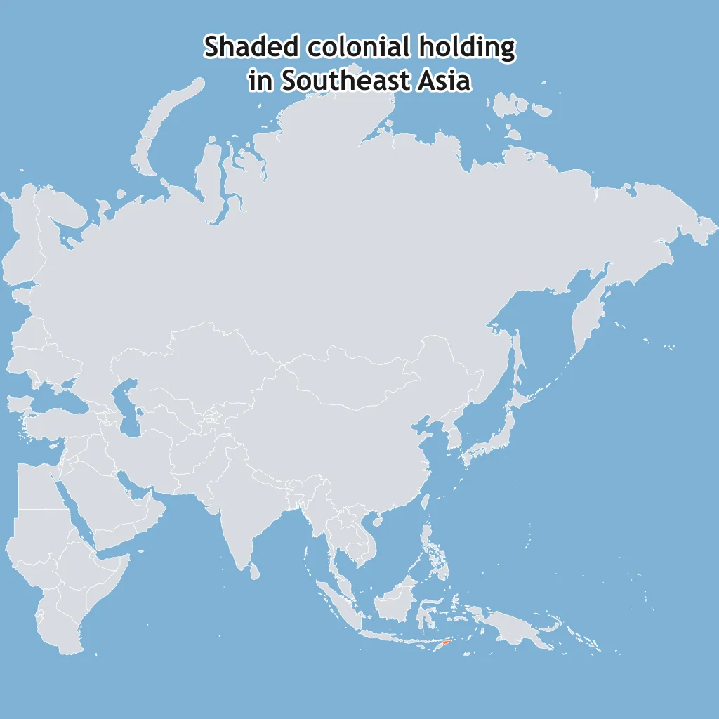
The shaded Southeast Asian territory was a colony of one European power until 1975. That power was
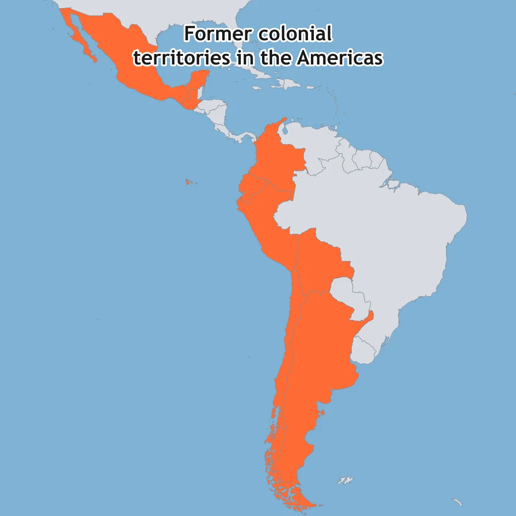
The shaded American countries were once part of a large European empire before nineteenth-century independence movements. The empire was
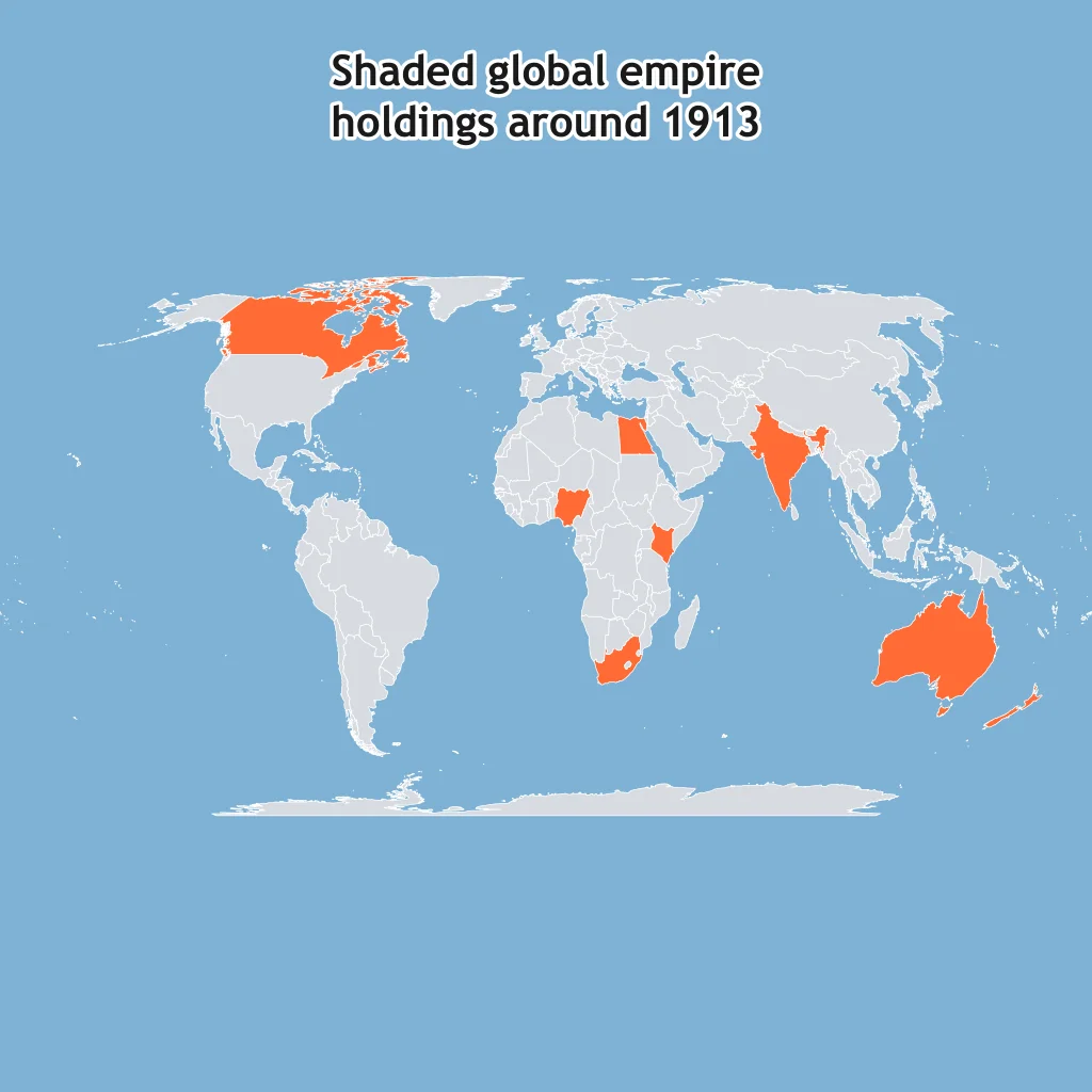
The map shows widely separated territories that were part of one global empire around 1913. The empire was
Several African borders run as long straight segments through deserts rather than following rivers or ethnic territories. The best explanation is
The border between Kenya and Tanzania separates some Maasai communities that had moved across the area. This pattern is best explained by
Nigeria contains many ethnic nations within one state, partly because British rule joined different regions into a single colony. In human geography, Nigeria is best described as
Colonial-era borders give the Democratic Republic of the Congo a narrow strip of land along the Congo River that reaches the Atlantic Ocean. A state with an extension like this is
When British India was partitioned in 1947, Pakistan was created in two parts, West and East Pakistan, separated by India. That shape made Pakistan a
The borders of Vietnam, Laos, and Cambodia follow the former French Indochina division more than a single ethnic distribution. This illustrates
Many former colonies kept export economies centered on minerals or plantation crops after independence. In political geography, that legacy is often linked to
In colonial Rwanda, Belgian officials issued identity cards labeling people Hutu, Tutsi, or Twa and favored Tutsi elites. In political geography, this sharpened division is an example of
A border drawn by colonial officials splits an ethnic group between two modern states, creating demands for autonomy on both sides. In AP Human Geography terms, the split group may be a
A modern border in North Africa follows a straight surveyed line through sparsely populated desert. The boundary type most directly shown by its shape is

Effects of Diffusion: Acculturation, Assimilation, Syncretism and Multiculturalism
35 questions
Cultural Patterns and Processes: Mixed Review
70 questions
States, Nations, Nation-States and Stateless Nations
40 questions
Sovereignty, Self-Determination and Territoriality
30 questions
Independence, Decolonization and Neocolonialism
30 questions
Crack the passcode before the zombies get in.
Answer, then swat bugs for bonus points.
Race through questions at your own speed.
Same question on every screen. Fastest wins.

Pick a tile, answer, hit bonuses and steals.