Loading
by BlastRoom
The planning answers to sprawl, and what each one actually does.
#us_hs_human_geography

30 questions
One question set, multiple game modes. Tap any game to see it in action. Not sure which to pick?
Answer to place stones and capture territory.
Outrun the snow together.
Earn blasts, then hunt the other team.
Answer to earn energy, then climb.

The class blasts through walls together.
Bid on mystery lots. Most money wins.
Sell tours. Nice, standard, or a total scam.

Answer, restock, and serve the rush.
More correct answers pulls the rope your way.
Answer, then shoot down the alien wave.
Answer, then tap to leap the frozen ridge.
Since 1979, the Portland, Oregon, region has used a line on the map that keeps new subdivisions off the farms and forests around it. This policy is:
Residents make many short car trips because homes, stores, and bus stops are separated into distant zones. The most direct planning response is:
A city wants a permanent unbuilt band separating its main urban area from nearby towns. The policy name for that protected open-space band is:
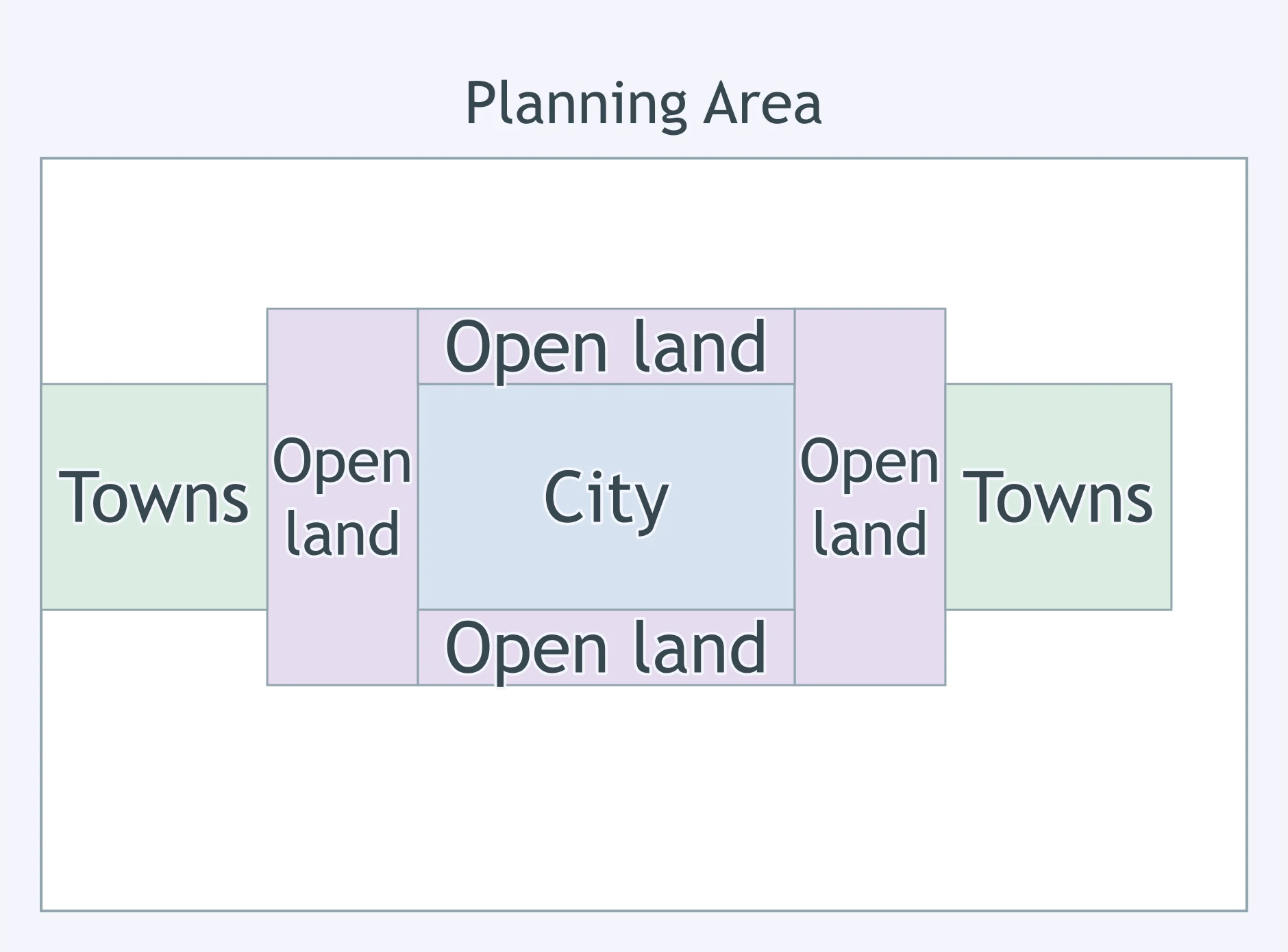
A city has vacant lots near existing bus lines while new housing keeps spreading outward. The policy that best targets this pattern is:
A neighborhood plan uses small blocks, front porches, sidewalks, and nearby shops to make daily errands walkable. The planning approach is:
A county wants to stop sewer and water extensions from pulling subdivisions farther into farmland. The strongest fit is:
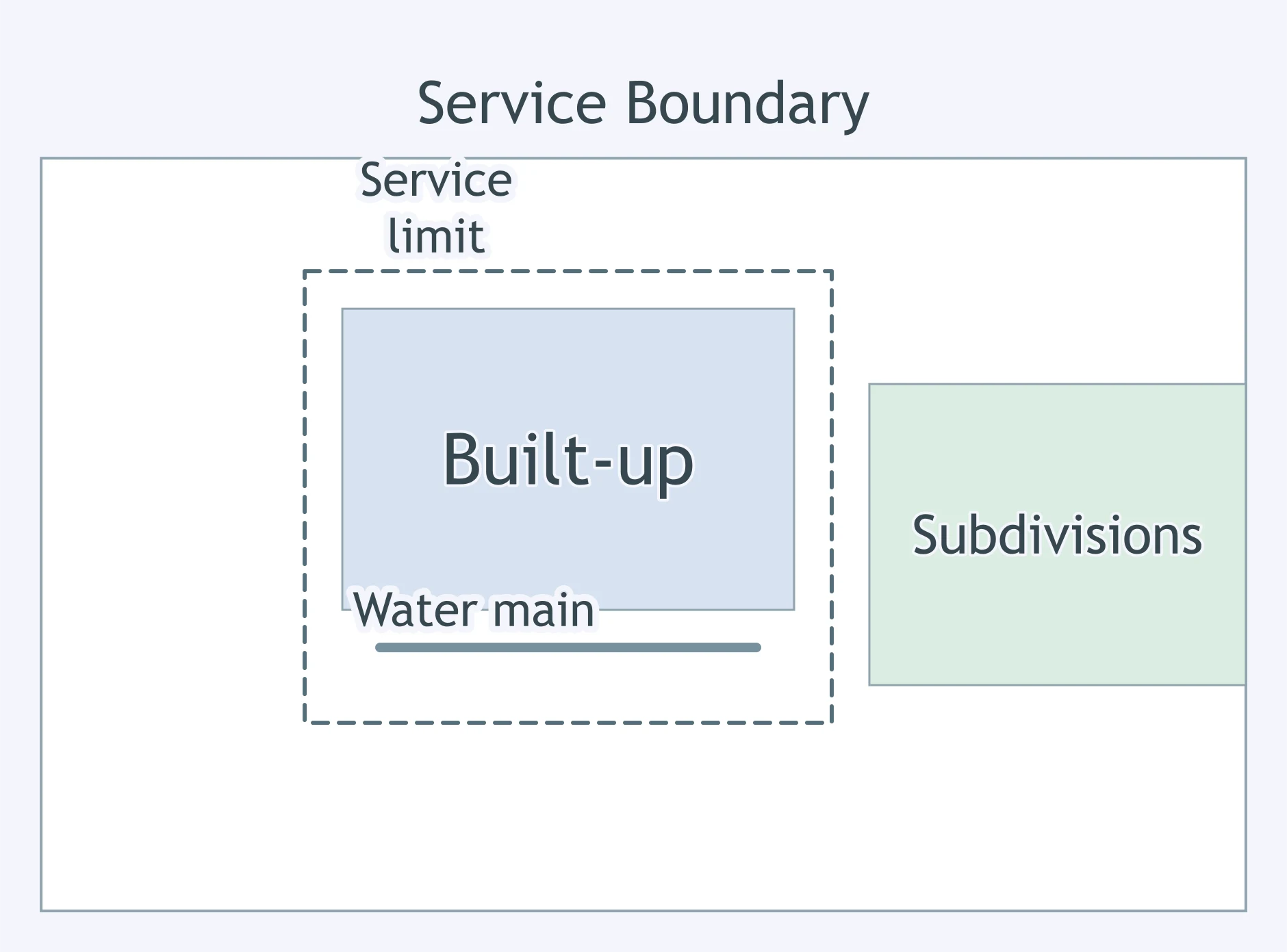
A suburb's code puts houses in one zone, shops in another, and offices in a third, so residents drive for most errands. This type of zoning is called:
A city wants to reuse abandoned industrial parcels near downtown rather than let housing spread to farms. The best policy match is:
Both greenbelts and urban growth boundaries limit sprawl. How does a greenbelt differ from an urban growth boundary?
Seaside, Florida, begun in 1981 with narrow streets, porches near sidewalks, and a walkable town center, is a famous early example of which planning movement?
Apartments and offices are concentrated within a short walk of a rail station, with limited parking and frequent trains. This design is:
A corridor plan adds protected bike lanes, safer crosswalks, bus priority, and wider sidewalks for many users. The design approach is:
Critics say this movement builds charming, walkable towns with porches and town squares, but many are on former farmland and cost too much for most families. Which movement is it?
Planners put dense housing, offices, and shops around a bus rapid transit stop. What is the main goal of this transit-oriented design?
A zoning code allows apartments over ground-floor stores in the same buildings along a main street. The design pattern is:
New urbanist plans use walkable blocks, rear-lane garages, front doors facing streets, and a neighborhood center. What is the main goal of these features?
A regional plan directs growth to existing towns, encourages compact neighborhoods, and protects farmland at the edge. The planning approach is:
A region holds a firm growth boundary for twenty years while population rises. The most likely side effect inside the boundary is:
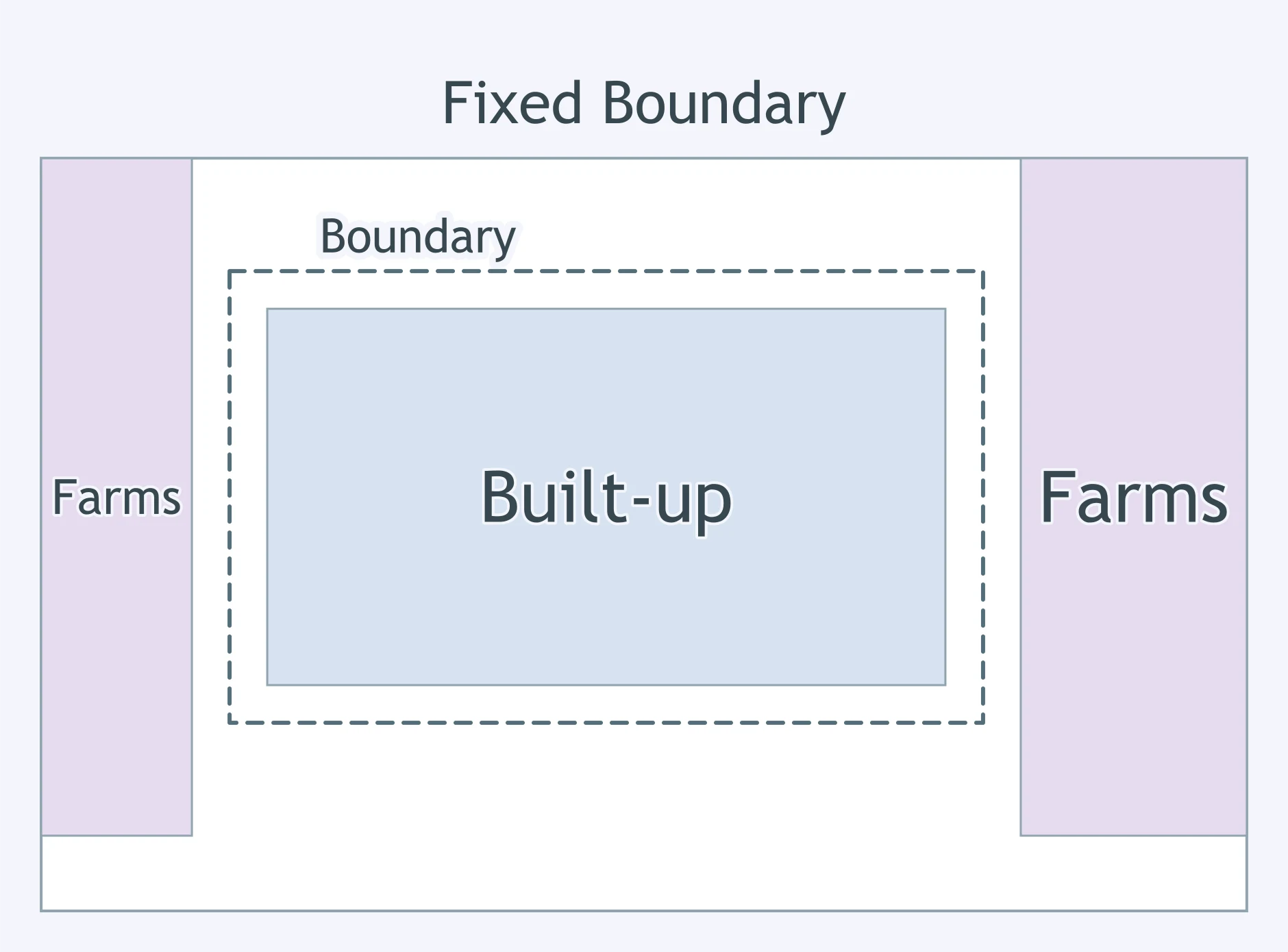
A rail station district is rezoned for dense apartments and shops. A common unintended effect nearby is:
A city protects a ring of open land but allows construction beyond the ring. A likely long-term side effect is:
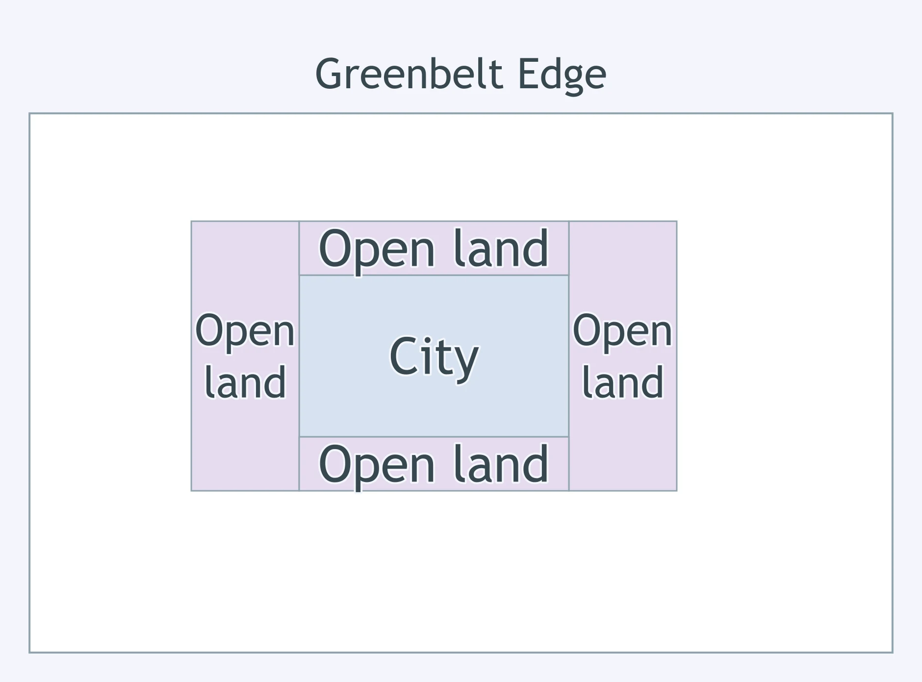
A downtown removes minimum parking requirements and caps new parking supply. A likely side effect is:
An infill program adds many apartments on vacant city lots. A likely sustainability benefit is:
A road diet adds bike lanes, wider sidewalks, and shorter crossings on a busy arterial. The most likely tradeoff is:
Cleaning and redeveloping old industrial land near downtown often improves land use efficiency, but it can also lead to:
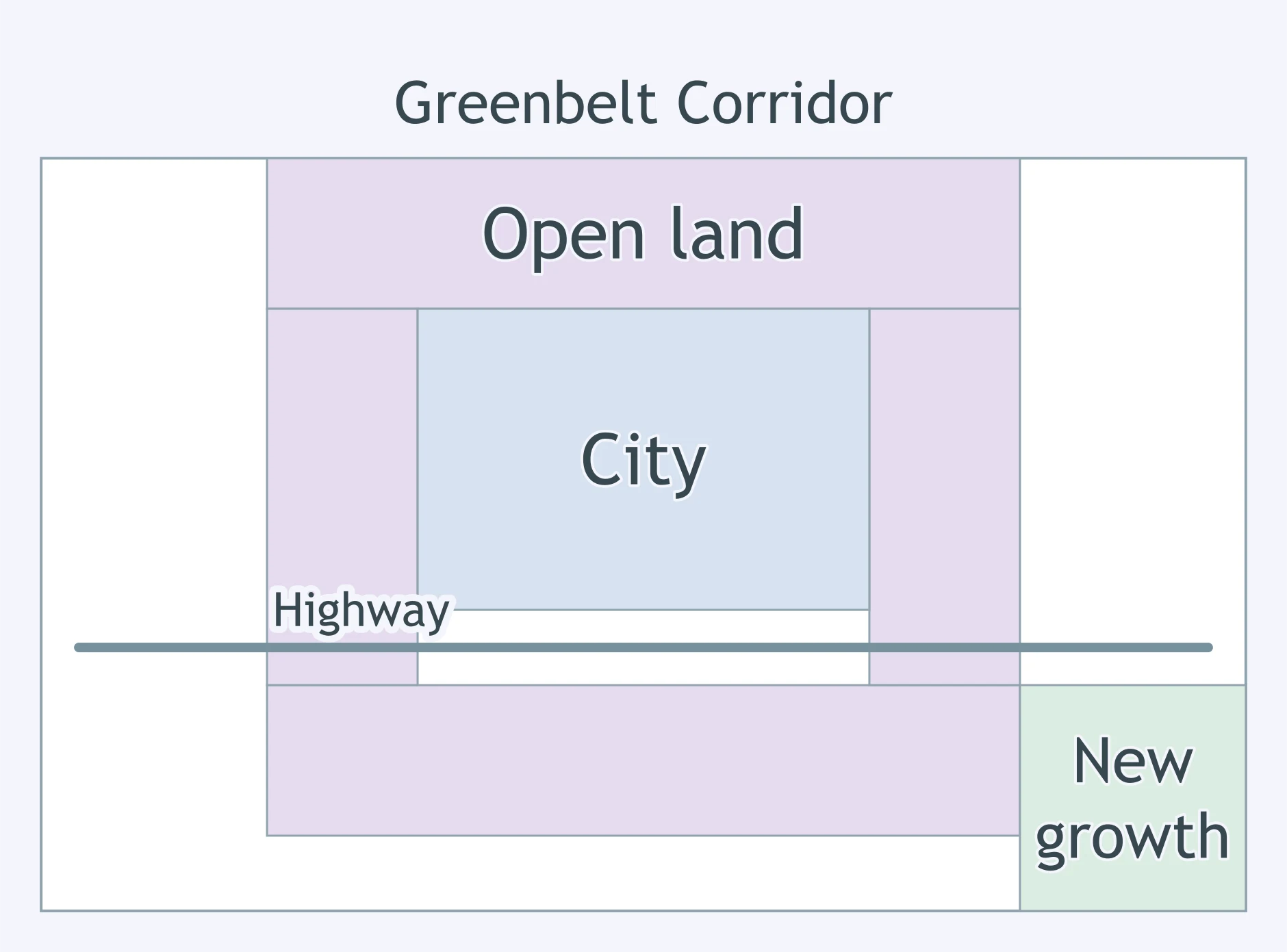
Use the map. What conclusion does the pattern around the protected open land support?
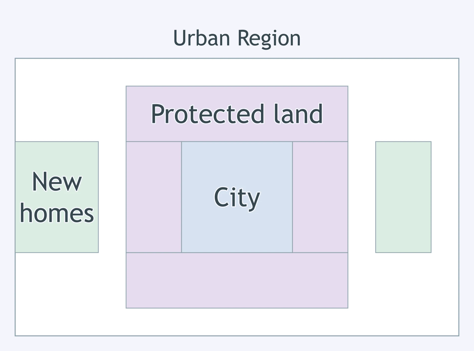
Use the map. What has the boundary done to the location of most new urban development?
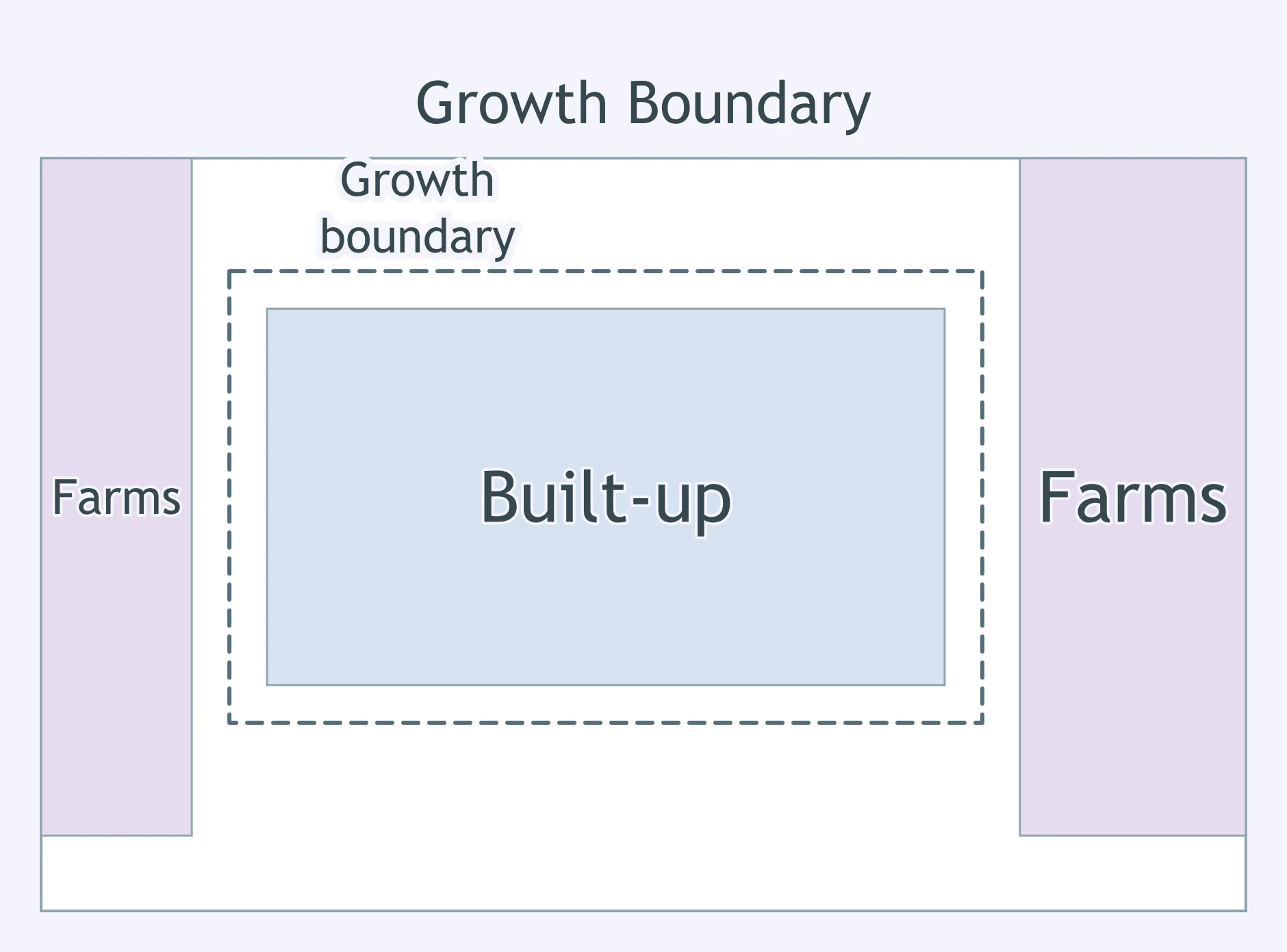
Use the map. What pattern is shown along the road outside the boundary?
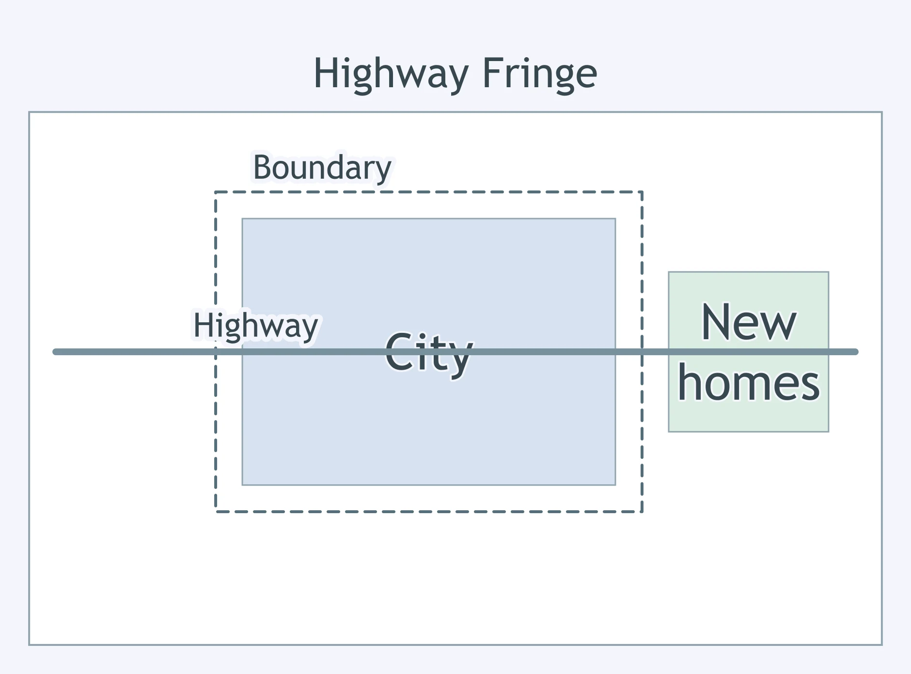
Use the map. What purpose of the open-space band is shown?
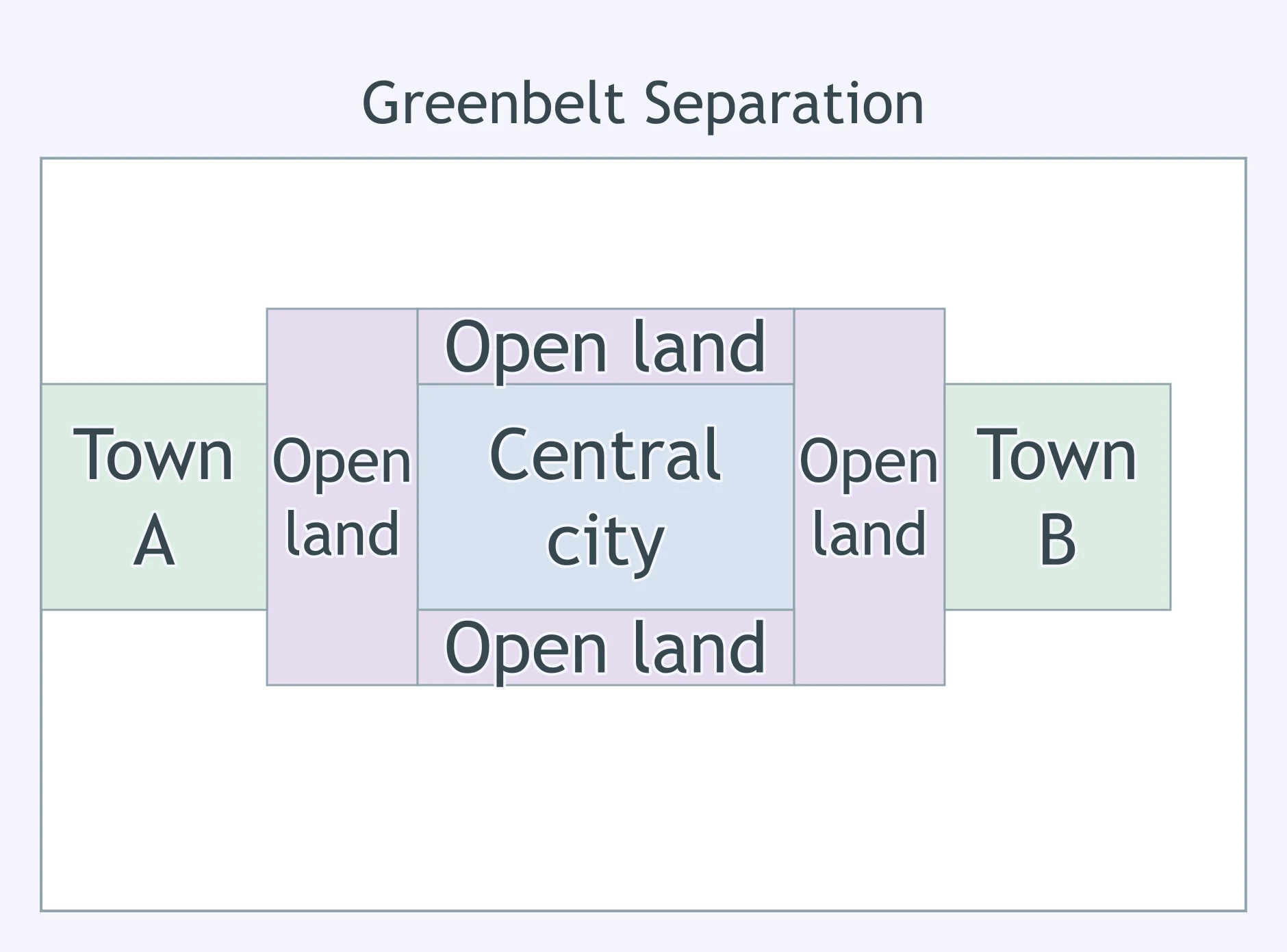
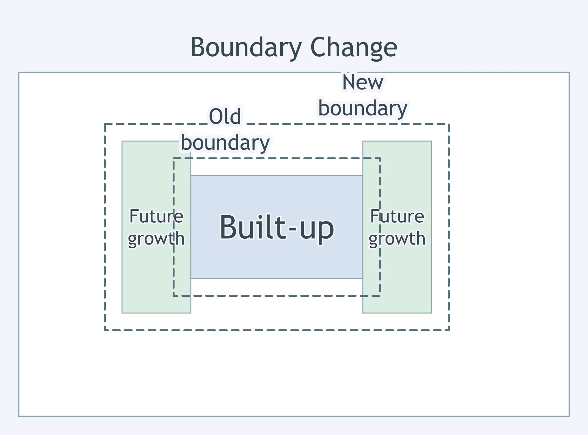
Use the map. What change to the growth boundary is shown?
Use the map. What does the road corridor through the open-space band suggest?
World Urban Models: Latin American, African, Southeast Asian and European
35 questions
Density, Land Use and Zoning
30 questions
Urban Infrastructure and Transportation
25 questions
Challenges of Urban Change: Gentrification, Segregation, Housing and Squatter Settlements
40 questions
Reading Urban Data: Census, Density and Land-Use Figures
25 questions
Crack the passcode before the zombies get in.
Answer, then swat bugs for bonus points.
Race through questions at your own speed.
Same question on every screen. Fastest wins.

Pick a tile, answer, hit bonuses and steals.