Loading
by BlastRoom
The networks a city runs on, and what happens where they do not reach.
#us_hs_human_geography
25 questions
One question set, multiple game modes. Tap any game to see it in action. Not sure which to pick?
Answer to place stones and capture territory.
Outrun the snow together.
Earn blasts, then hunt the other team.
Answer to earn energy, then climb.

The class blasts through walls together.
Bid on mystery lots. Most money wins.
Sell tours. Nice, standard, or a total scam.

Answer, restock, and serve the rush.
More correct answers pulls the rope your way.
Answer, then shoot down the alien wave.
Answer, then tap to leap the frozen ridge.
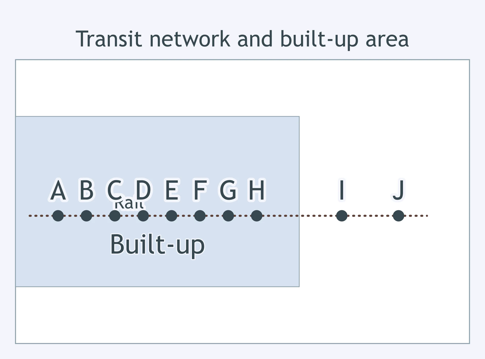
Use the figure. What does it suggest about the rail line and development?
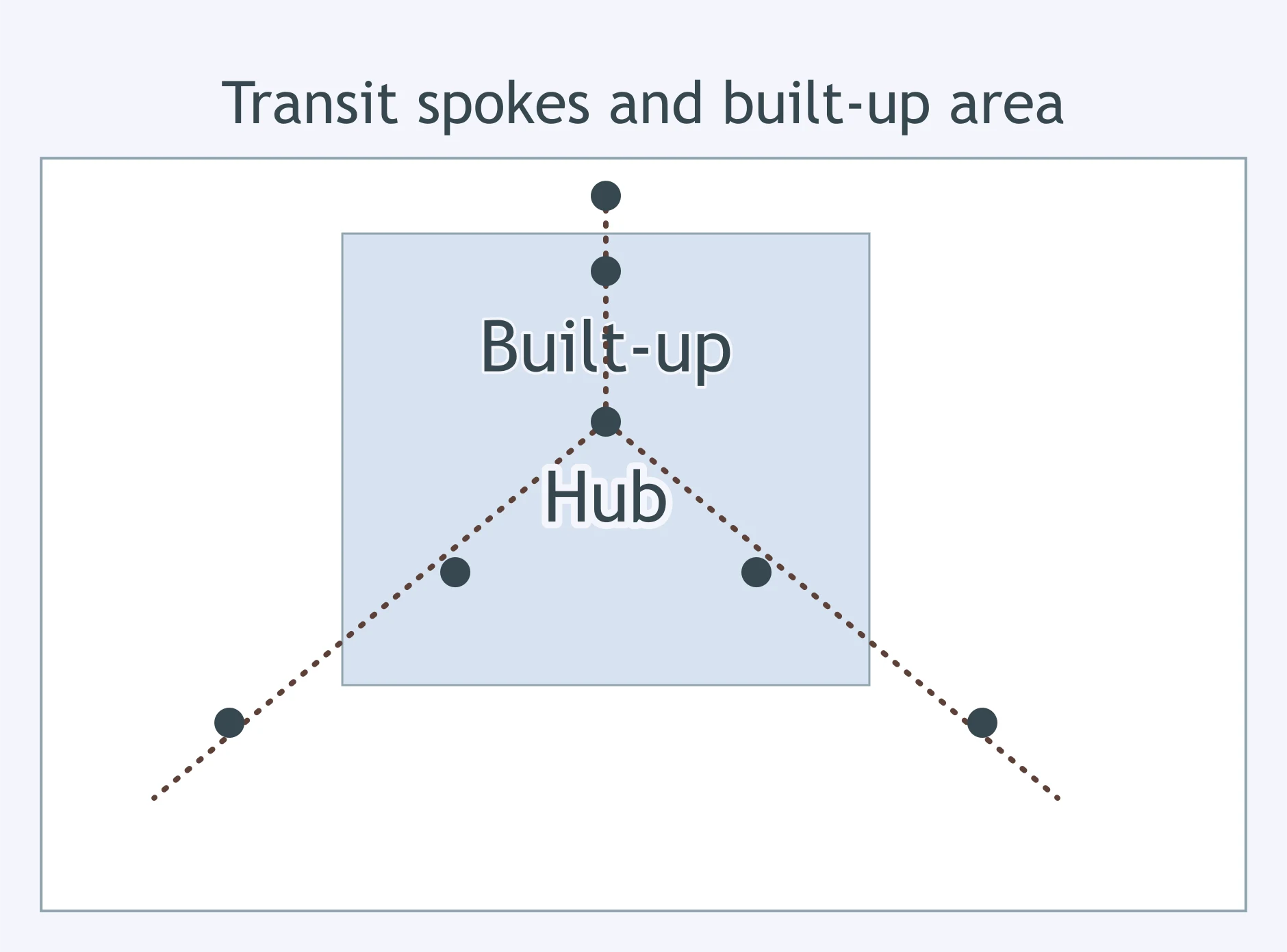
Use the figure. What urban form does it support?
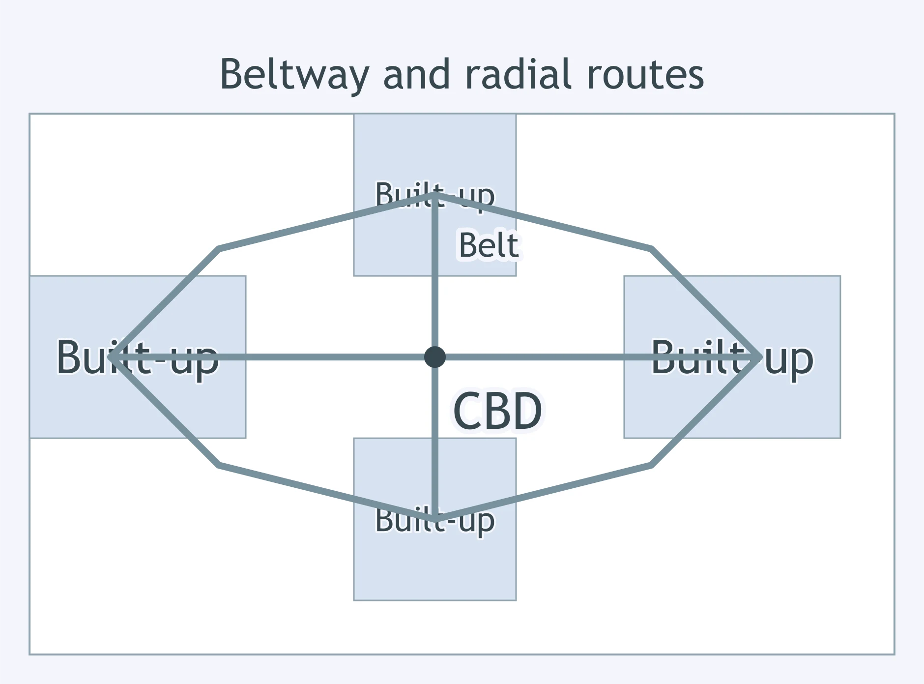
Use the figure. What land-use pattern does it show along the beltway?
Use the network figure. What does the pattern of links and built-up nodes suggest?
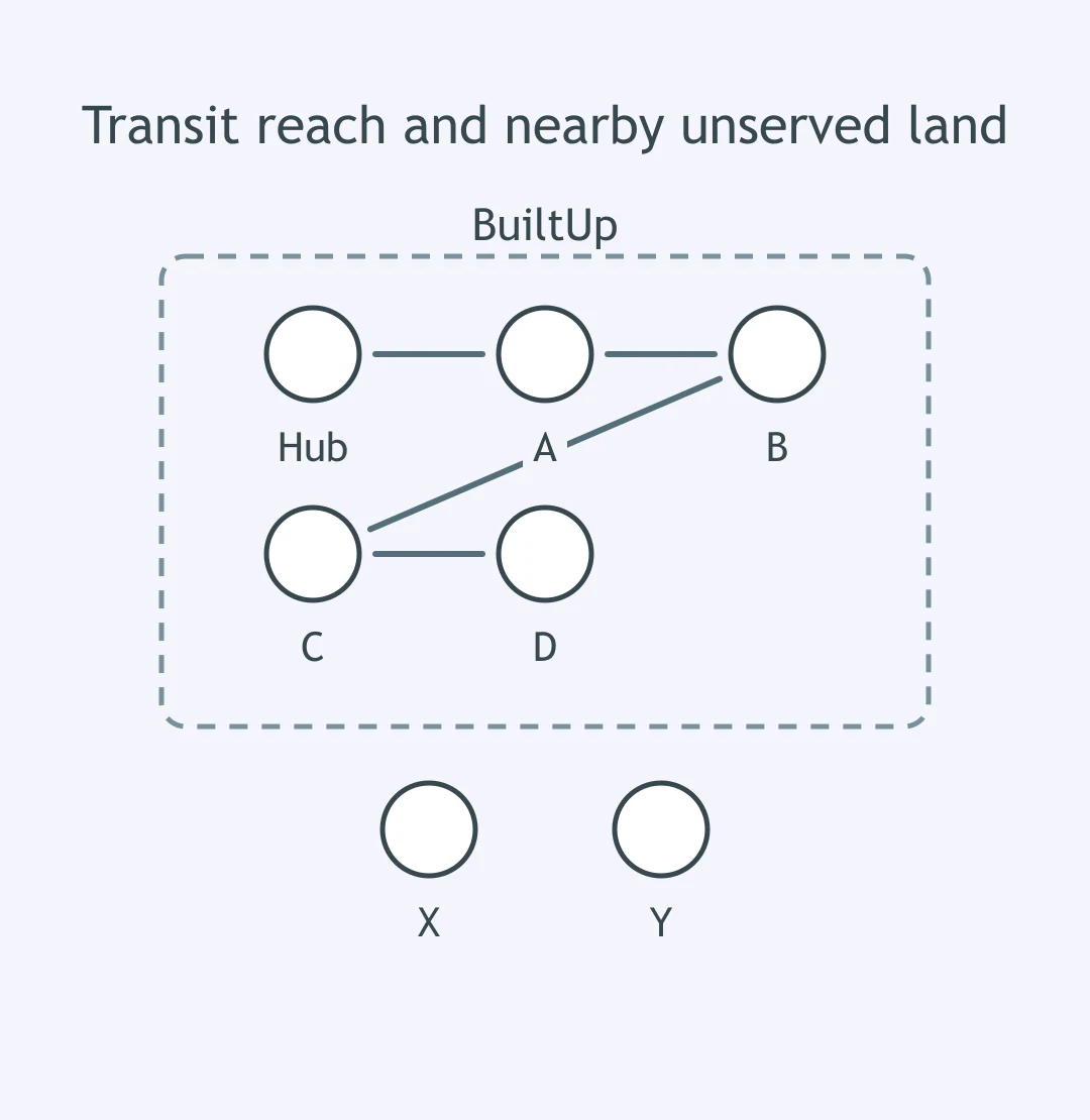
Use the network figure. Where does the built-up area end, and why?
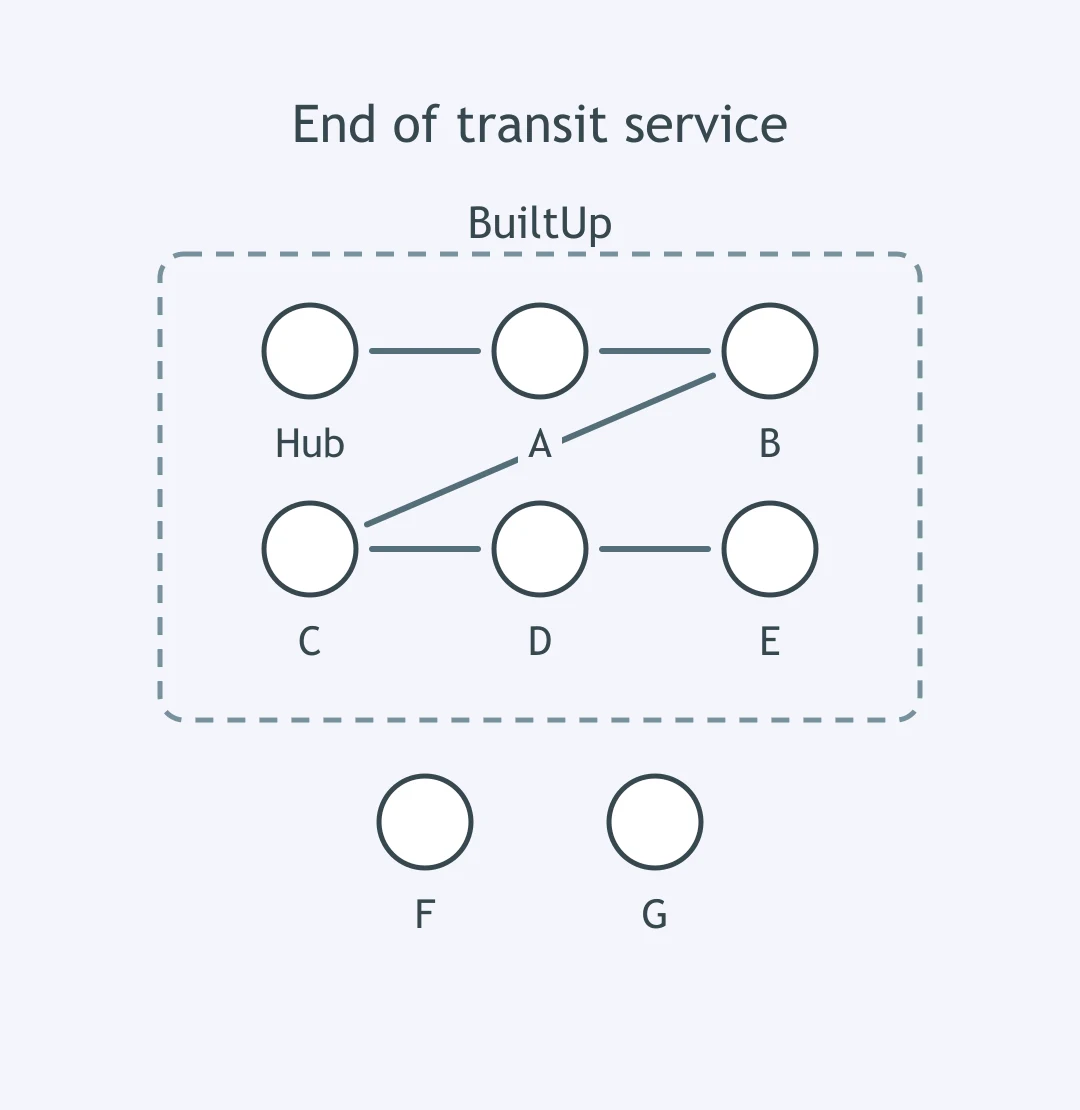
Use the figure. What model-like pattern does this resemble?
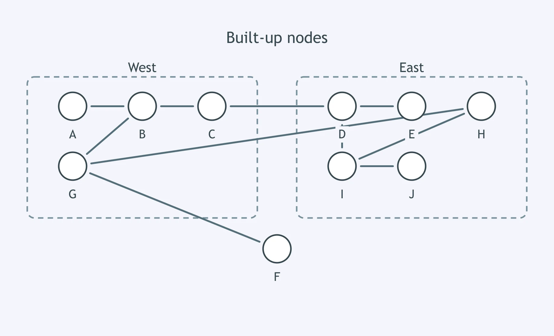
Use the figure. What statement best fits the evidence?
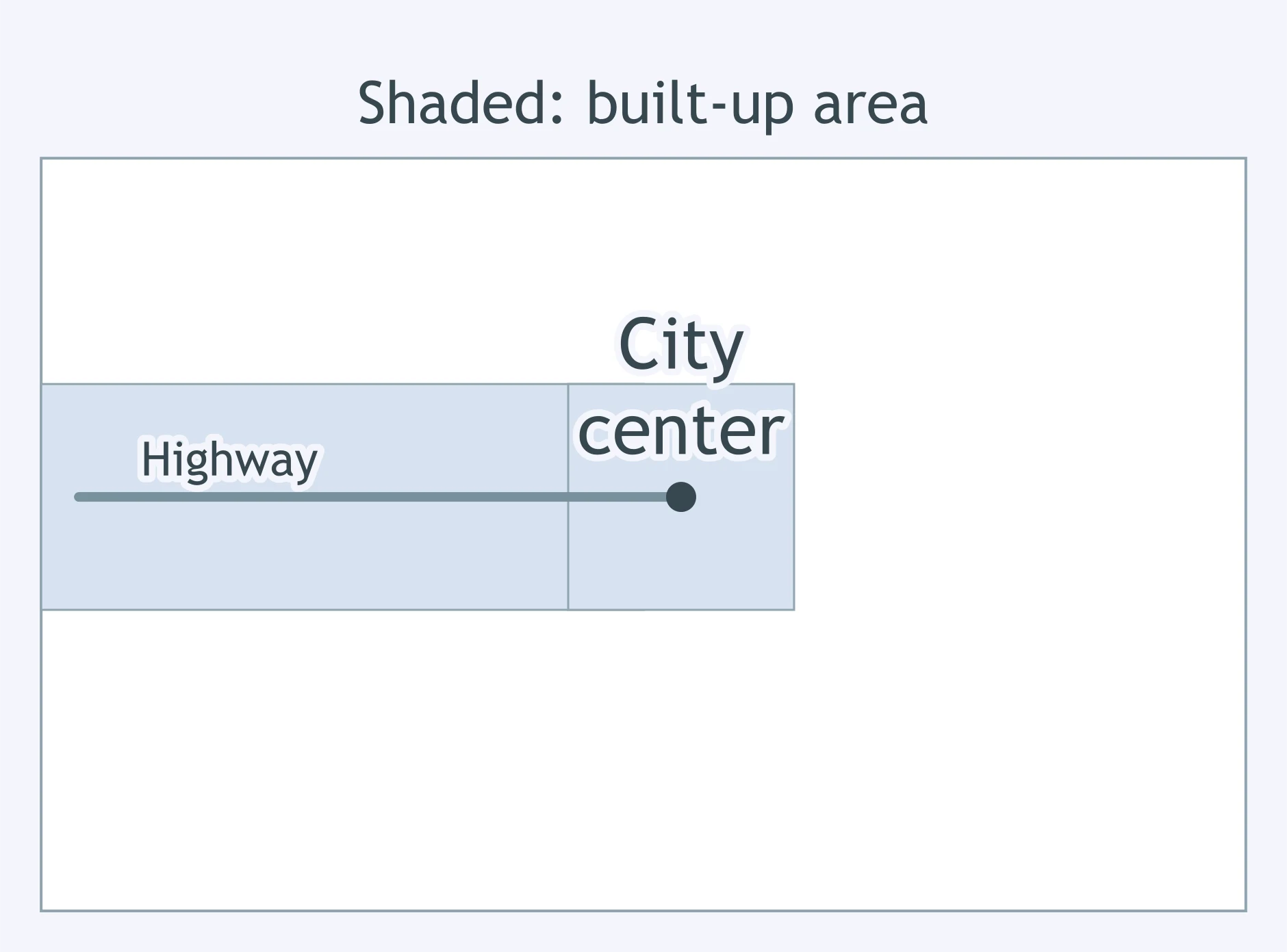
Use the figure. What pattern is shown?
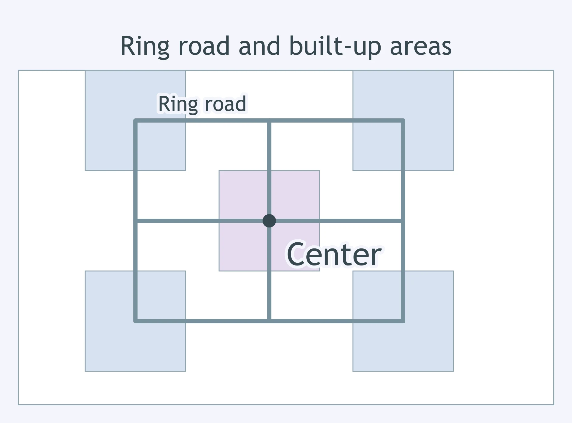
Before electric streetcars, most workers had to live near workplaces. What urban change did streetcars make possible?
A city grew rapidly after limited-access highways connected downtown to cheap land at the edge. What form is most associated with that transport era?
Factories in an older industrial city clustered near rail yards and port facilities. Which transport logic best explains that pattern?
Why did many nineteenth-century cities remain relatively compact before mass transit spread?
A metropolitan area adds commuter rail stations in former small towns, and those towns grow as bedroom communities. What process is this?
After beltways and airports expand, offices and malls cluster outside the old downtown near highway junctions. What term best describes those clusters?
A fast-growing neighborhood has houses but no piped water, so residents buy water from trucks at high prices. What does this illustrate?
In an informal settlement outside a megacity, wastewater runs in open drains because the sewer system stops nearby. What is the main urban issue?
A hillside district has electricity only through illegal hookups that fail often. What does this reveal about the city's service network?
A bus map shows no routes into a low-income edge neighborhood, and residents spend hours walking to distant stops. What is the likely effect?
New apartments are built beyond the stormwater drainage network, and streets flood after heavy rain. What explains the problem?
Some households in a peripheral settlement lack broadband even though the central city is connected. What geographic pattern is this?
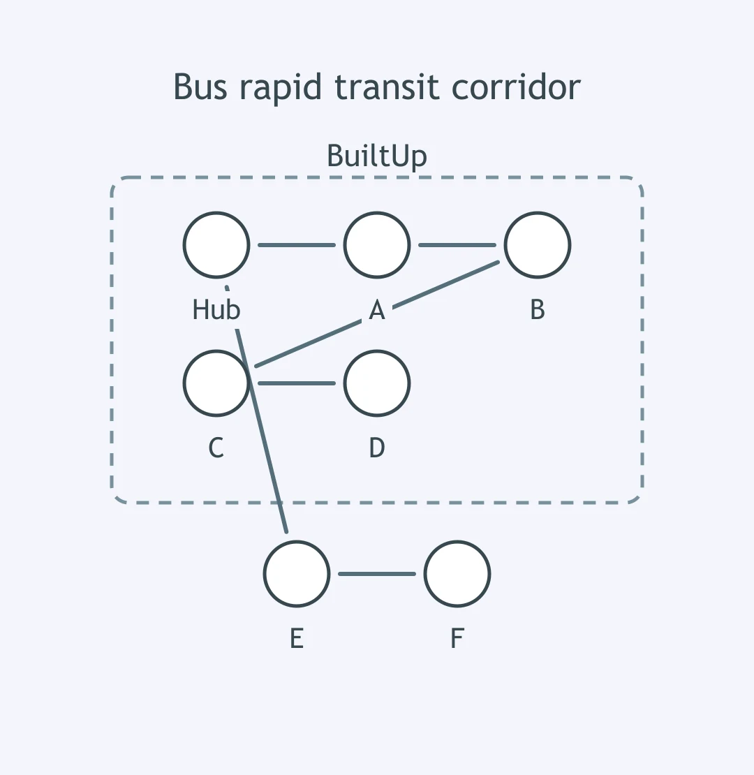
The figure shows a new bus rapid transit line from Hub to D through built-up stops. If service becomes faster and cheaper, what is most likely?
A city charges cars to enter downtown at rush hour and uses the money to improve buses. What effect is most likely?
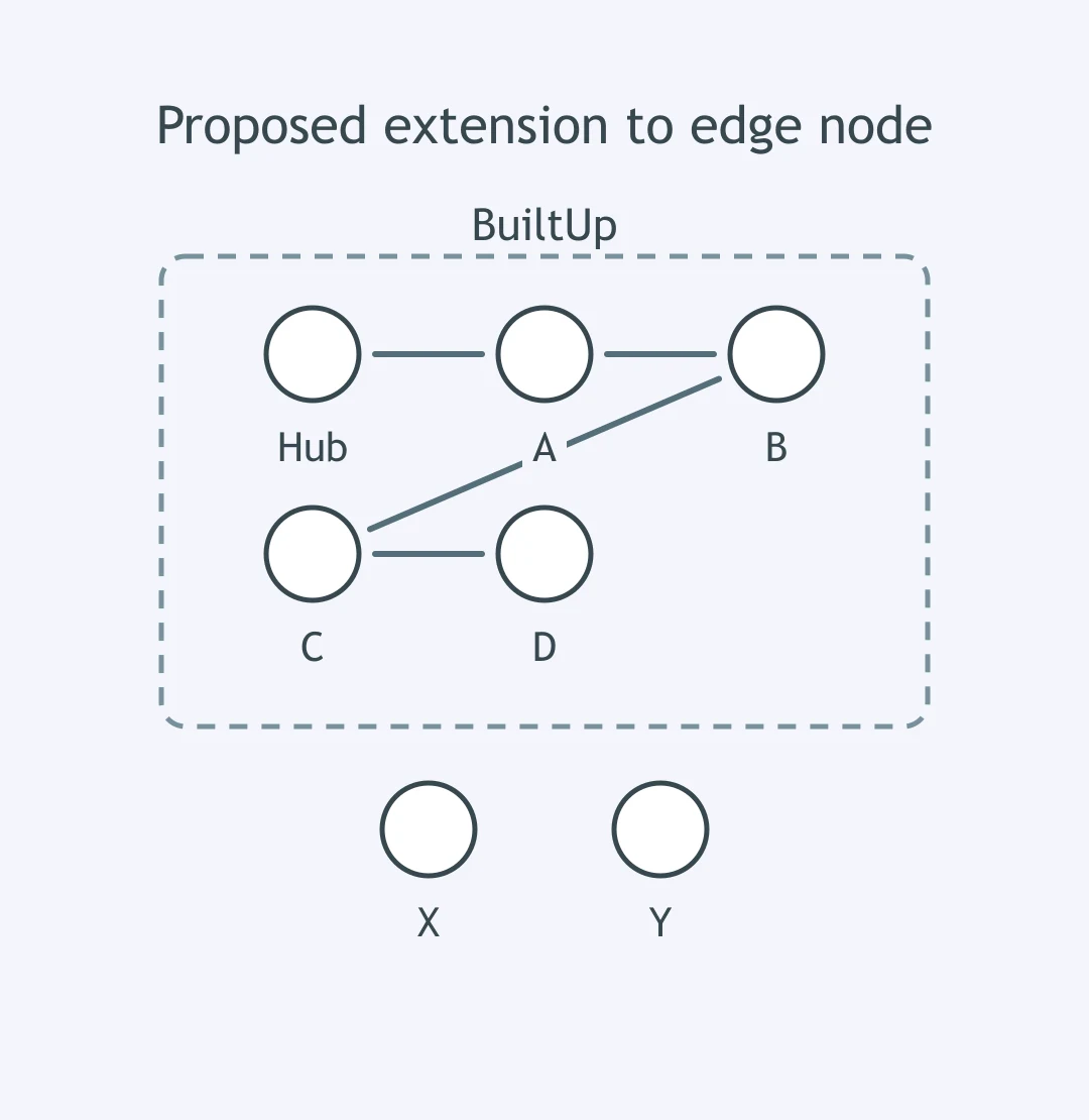
Use the figure. The city plans a new link from Stop D to unserved Node X. What land-use change would planners most expect near X?
A metropolitan plan limits new roads beyond a greenbelt and invests in infill transit inside it. What outcome is the policy designed to encourage?
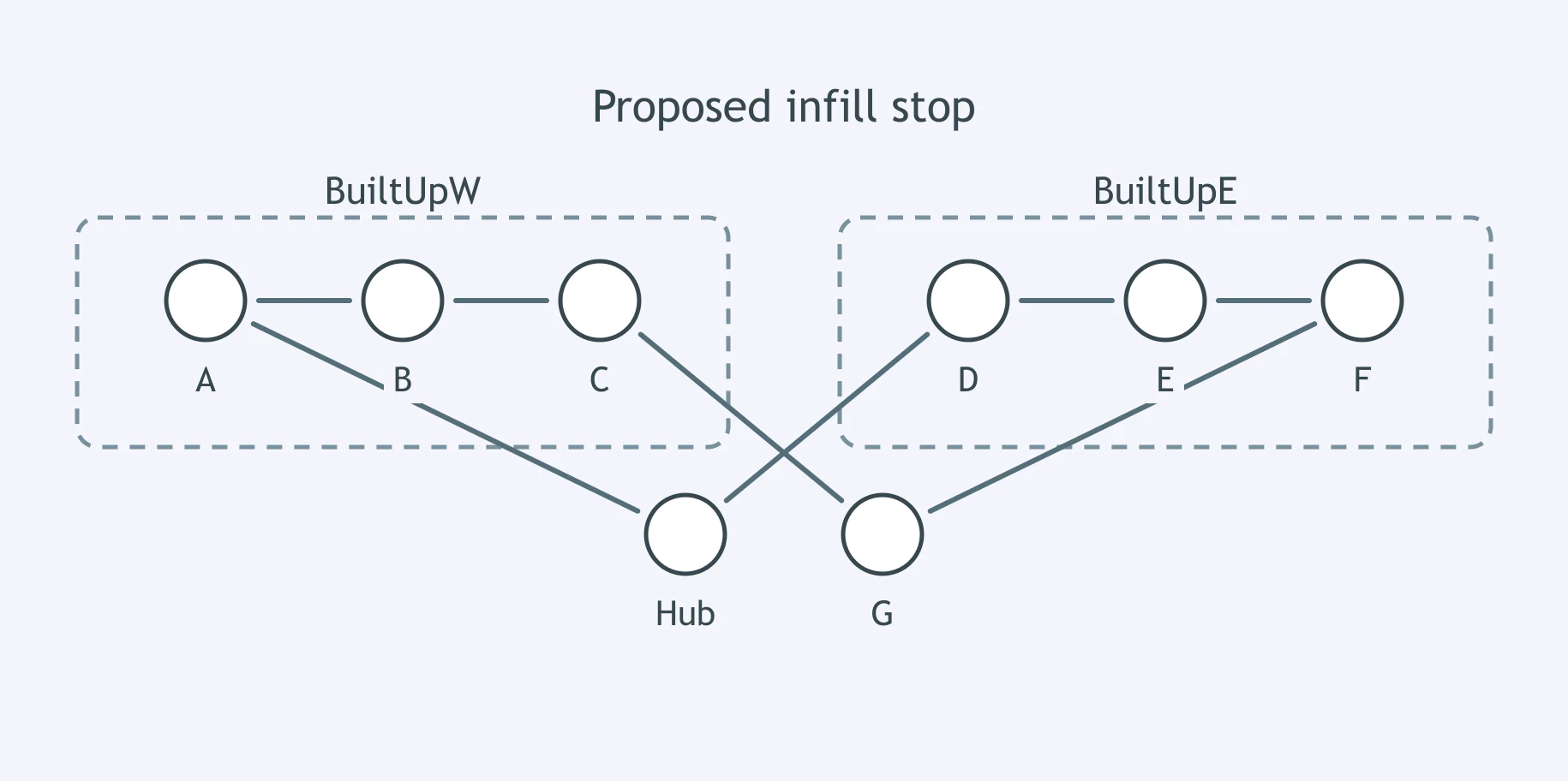
The figure shows a planned rail stop at Node G between two built-up corridors. What policy goal would adding the stop most directly support?
The Gravity Model and Urban Interaction
25 questions
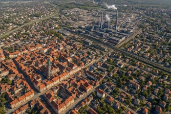
North American Urban Models: Concentric Zone, Sector, Multiple Nuclei and Galactic
35 questions
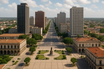
World Urban Models: Latin American, African, Southeast Asian and European
35 questions
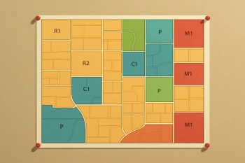
Density, Land Use and Zoning
30 questions
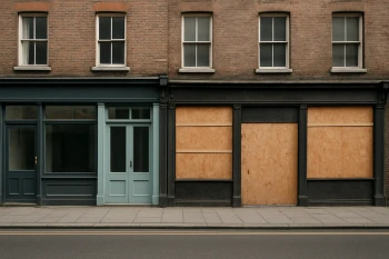
Challenges of Urban Change: Gentrification, Segregation, Housing and Squatter Settlements
Crack the passcode before the zombies get in.
Answer, then swat bugs for bonus points.
Race through questions at your own speed.
Same question on every screen. Fastest wins.

Pick a tile, answer, hit bonuses and steals.
40 questions