Loading
by BlastRoom
A mixed review across urbanization, city systems, urban models and urban challenges.
#us_hs_human_geography

70 questions
One question set, multiple game modes. Tap any game to see it in action. Not sure which to pick?
Answer to place stones and capture territory.
Outrun the snow together.
Earn blasts, then hunt the other team.
Answer to earn energy, then climb.

The class blasts through walls together.
Bid on mystery lots. Most money wins.
Sell tours. Nice, standard, or a total scam.

Answer, restock, and serve the rush.
More correct answers pulls the rope your way.
Answer, then shoot down the alien wave.
Answer, then tap to leap the frozen ridge.
A town grew where a river was shallow enough to cross and several trails met. What pair best explains its early growth?
Early cities could support full-time rulers, artisans, and priests who did not farm. What condition made this possible?
Factories in the 1800s drew many rural workers into dense settlements near mills and rail yards. What process is described?
A sheltered harbor becomes a warehouse and exchange point for goods moving between ships and inland merchants. What urban function is most central?
A country's total population grows slowly, but the share living in cities rises from 35% to 58%. What term names that shift?
After highways expand, many middle-income households leave the central city for single-family houses beyond it. What process is this?
An urban agglomeration passes 12 million residents and dominates its region's labor market. What label fits its population size?
A city is not the largest by population, but it hosts major stock exchanges, corporate headquarters, and global legal services. What is it?
A settlement at a river confluence collects crops from a broad farming hinterland and ships them downstream. What best explains its growth?
John Borchert divided the growth of U.S. cities into a series of epochs. What defined each epoch?
A city grew at a river's fall line, where boats could go no farther and cargo had to be unloaded and moved around the rapids. What advantage did it have?
Migrants in many less-developed countries keep moving to cities even when housing is scarce and slums are growing. What pull factor most attracts them?
A country's cities have populations near 8 million, 4 million, 2.7 million, and 2 million. What urban pattern is most closely shown?
One city has 9 million people, while the next largest has 1.4 million and far fewer services. What city-system pattern does this show?
In central place theory, small towns are spaced close together, while large cities are spaced far apart. Why?
A dry cleaner needs at least 2,000 regular customers to stay open. What central-place concept is this number?
Shoppers will drive 4 miles for bread but 60 miles for a specialized surgery. What central-place concept do these distances measure?
Four cities all have equal populations. The two cities in Pair A are 30 miles apart, and the two in Pair B are 90 miles apart. Which pair does the gravity model predict will interact more?
City X is twice as large as City Y, and both are the same distance from City Z. The gravity model predicts City Z interacts more with which city?
In , distance doubles while both populations stay the same. What happens to predicted interaction?
Christaller used hexagons instead of circles for service areas mainly because hexagons do what?
A small grocery store appears in nearly every village, but a trauma hospital appears only in the largest regional center. What explains the difference?
A map shows villages clustered around a town, towns around a city, and cities around a metropolis. What city-system idea is being shown?
For decades, a national government concentrates ministries, universities, airports, and media in the capital. What city-system pattern is most likely to result?
Los Angeles and San Diego are large and close, so flows between them exceed flows between two smaller distant cities. What model best predicts this?
Under the rank-size rule, a country's largest city has 6 million people. About how many people would its third-largest city have?
A city has a CBD, then a transition zone, then working-class, middle-class, and commuter rings. What model fits this pattern?
High-income housing extends outward from downtown along a lakefront and transit corridor rather than forming a full ring. What model fits?
An airport, university district, old downtown, and suburban mall each anchor nearby specialized land uses. What model fits best?
A North American metro area has beltways, office parks, malls, and low-density subdivisions spread across a wide region. What model describes it?
In the Latin American city model, elite housing and high-end shops extend outward from the CBD along a major boulevard. What is this feature?
In the Griffin-Ford model, a wedge of very poor housing extends out from the center onto steep slopes, floodplains, or land near dumps. What is that area called?
The African city model often includes a colonial CBD, a traditional CBD, and a market zone. What does this structure reflect?
A city's focal point is its port zone, with an alien commercial district and a Western commercial zone nearby instead of one formal CBD. What model fits this pattern?
Offices pay the highest prices for downtown land, while warehouses and homes locate farther out where land costs less. What concept explains this pattern?
A downtown loses its department stores to suburban malls, but bank headquarters, government offices, and law firms stay. What kind of functions remain strongest in the CBD?
Factories and worker housing line a rail corridor extending from the center to the edge of an older city. What model feature does this show?
A wealthy district lines a scenic coastline while heavy industry lines freight yards on the opposite side. Why does the concentric zone model describe this city poorly?
A new research campus becomes a center for apartments, cafes, and laboratories far from the old downtown. What model concept explains it?
A city ordinance permits apartments above stores near a rail stop but bars factories from the same block. What land-use tool is being used?
A suburb requires large lots and separates houses from shops and offices. What outcome is most likely?
A city allows apartments, grocery stores, and offices on the same blocks around a subway station. What planning goal does this serve?
Minimum parking requirements force every new building to provide off-street spaces. What effect do they commonly have?
A city changes a six-lane arterial by adding bus lanes, bike lanes, safer crossings, and wider sidewalks. What approach is this?
A metropolitan plan reserves a ring of open land around the built-up area to limit outward expansion. What policy is this?
A city raises development density near rail stations and lowers it far from transit. What land-use principle guides this?
A bus rapid transit line gets dedicated lanes and platform-level boarding. What problem is it mainly designed to reduce?
A city narrows travel lanes and adds protected bike lanes on a corridor with many short trips. What transportation shift is it encouraging?
A former rail yard is cleaned up and reused for housing and offices instead of building on farmland. What type of redevelopment is this?
A city charges drivers to enter the most crowded downtown streets during peak hours. What policy is this?
A developer replaces one house on a large lot with four townhouses near a frequent bus route. What planning aim does this support?
Real estate agents spread fear that Black families were moving in, bought homes cheaply, then resold them at high prices. What practice was this?
Banks denied mortgages in minority neighborhoods by marking them as risky on maps. What practice is described?
A low-income neighborhood gains cafes and renovated apartments, rents rise, and longtime tenants are displaced. What process is occurring?
Older housing once occupied by wealthy households becomes cheaper as they move to newer units elsewhere. What process is this?
A city clears a dense low-income district for highways and civic buildings, displacing residents. What policy history does this reflect?
Migrants build homes without formal title on unused public land and gradually add water and electricity. What settlement type is this?
Factories and highways are concentrated near low-income neighborhoods, where asthma rates are higher. What concept best fits this pattern?
Residents oppose a homeless shelter in their neighborhood while saying the city needs one somewhere. What political response is this?
A neighborhood's population changes as one group leaves and another group moves in, reshaping businesses and housing demand. What model term applies?
Housing costs rise fastest where new rail access meets older, undervalued buildings close to downtown. What explanation fits the investment pattern?
A city finds 62% of trips are by car and only 9% by transit, while most jobs sit near two rail corridors. What policy best addresses emissions?
Neighborhoods with 35% tree canopy average 5 °F cooler than nearby areas with 5% canopy. What policy best targets the heat problem?
Storm overflows are highest where impervious cover exceeds 70%. What urban design response best reduces runoff?
A metro area has 18,000 vacant lots inside the city but keeps approving fringe subdivisions on farmland. What policy best supports smart growth?
Walking rates are highest in districts with short blocks and connected streets, and lowest where cul-de-sacs dominate. What design change fits the data?
On one corridor, bus speeds rise from 8 mph to 15 mph and ridership grows, while buses on other routes see no change. What investment most likely produced the improvement?
An energy audit shows old apartment buildings use twice as much heat per square foot as renovated ones. What policy best cuts emissions?
Downtown parking garages are only 40% full on weekdays, but zoning still requires new projects to build more spaces. What reform fits the data?
A city maps crashes and finds most pedestrian injuries occur on wide roads near schools and bus stops. What safety policy best matches the data?
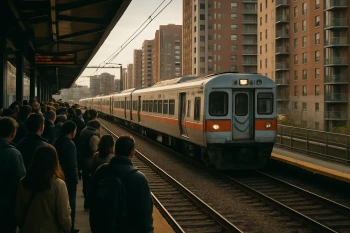
Urban Infrastructure and Transportation
25 questions
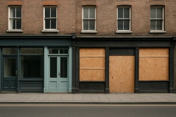
Challenges of Urban Change: Gentrification, Segregation, Housing and Squatter Settlements
40 questions

Urban Sustainability: Smart Growth, New Urbanism and Greenbelts
30 questions
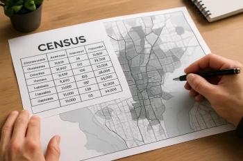
Reading Urban Data: Census, Density and Land-Use Figures
25 questions
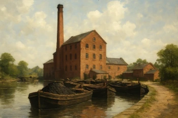
The Industrial Revolution and Its Diffusion
35 questions
Crack the passcode before the zombies get in.
Answer, then swat bugs for bonus points.
Race through questions at your own speed.
Same question on every screen. Fastest wins.

Pick a tile, answer, hit bonuses and steals.