Loading
by BlastRoom
Where industry started, what it ran on, and how it spread outward.
#us_hs_human_geography
35 questions
One question set, multiple game modes. Tap any game to see it in action. Not sure which to pick?
Answer to place stones and capture territory.
Outrun the snow together.
Earn blasts, then hunt the other team.
Answer to earn energy, then climb.

The class blasts through walls together.
Bid on mystery lots. Most money wins.
Sell tours. Nice, standard, or a total scam.

Answer, restock, and serve the rush.
More correct answers pulls the rope your way.
Answer, then shoot down the alien wave.
Answer, then tap to leap the frozen ridge.
A map shows cotton mills clustered near shallow coal seams, Pennine streams, canals, and Liverpool's port. Which industrial region is described?
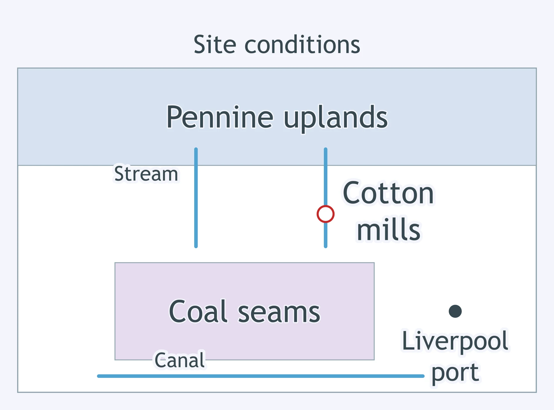
Use the map. Which industrial region does it show?
Factories around Liege and Charleroi used coal deposits near navigable rivers and were among the first on mainland Europe to copy British methods. Which region is described?
Early textile mills stood at river falls near Atlantic ports and drew farm labor from a surrounding rural hinterland. Which US industrial region is described?
A heavy-industry district formed in the late 1800s where coal mines near Yuzovka met iron ore moved by rail from Kryvyi Rih. Which industrial region is described?
Coalfields around Katowice, near the headwaters of the Oder River, supported ironworks and zinc smelting between German and Polish markets. Which industrial region is described?
Textile towns such as Roubaix and Tourcoing, along with nearby ironworks, grew beside a coal basin close to Belgian and British industrial links. Which region is described?
A mill left a river fall for a site beside a coal depot, then kept looms running in dry seasons. Which input explains the move?
In the 1700s, iron furnaces shifted from scattered woodlands to coalfield towns. Which change explains this siting?
In the 1850s, a factory owner chose an inland junction site over a canal town because coal, ore, and finished goods could move faster year-round, even when water froze. Which technological input mattered most?
After 1900, small workshops no longer needed a waterwheel or a single belt shaft, because each machine could run from a powered line. Which input changed factory siting?
A cotton producer moved work from rural cottages into one building because new frames and mules needed central power and supervision. Which change explains the move?
A steel plant expanded near coal and rail lines after a process made large batches of steel cheaper and faster than earlier methods. Which innovation fits?
In the late 1800s, a port-side factory began processing imported raw materials after the cost of moving bulky cargo across oceans fell sharply. Which input explains this location?
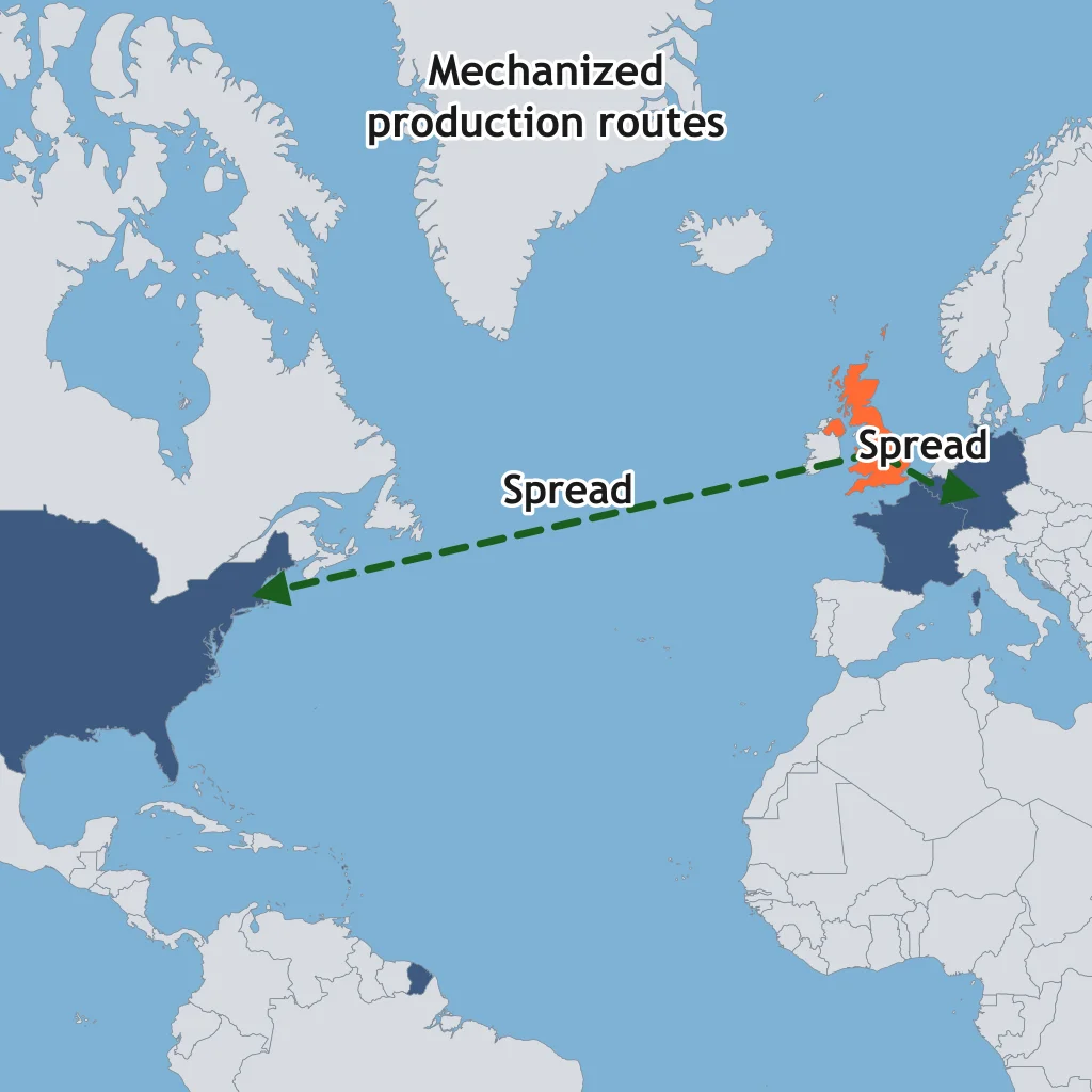
The map traces mechanized textile and iron production from Britain to Belgium, northern France, Germany, and the northeastern United States. What process is shown?
Skilled British mechanics moved to Belgian mills and carried machine knowledge with them. What type of diffusion best describes this transfer?
Large port cities and capitals adopted factory production before nearby small towns did. What diffusion process fits that settlement pattern?
On the map, industrial methods appear first in a core hearth, next in nearby states, and later in Japan and Russia. Which pattern does this sequence show?
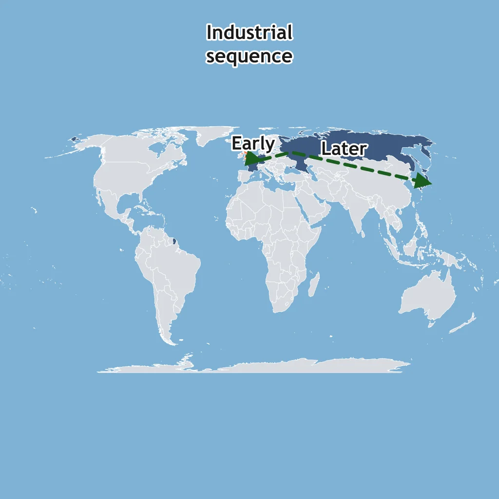
Japan imported Western machines but reorganized production through state-backed firms and local institutions. What diffusion type names adopting the idea with changes?
Industrial techniques spread from Manchester to nearby mill towns as entrepreneurs copied machinery from places they could visit easily. Which process fits?
In the 1700s, Britain banned the emigration of skilled mechanics and the export of textile machinery. What effect did these laws aim to have on the diffusion of industry?
A map shows routes from surrounding villages into Manchester as mills hire wage workers. What demographic change followed industrialization?
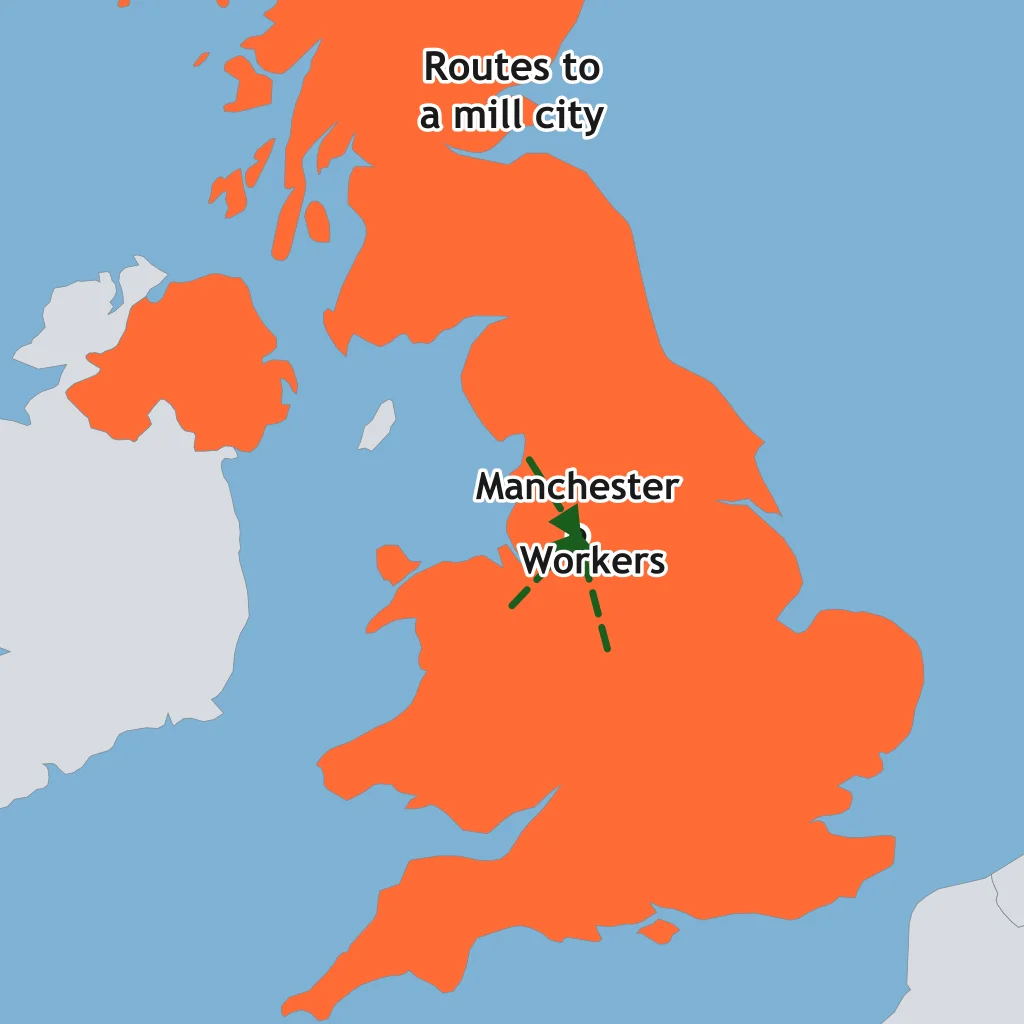
A coalfield town adds mines, ironworks, worker housing, and rail yards within a few decades. What settlement consequence is most likely?
Factory jobs concentrated thousands of workers near mills instead of in home workshops. Which demographic outcome best fits?
Canals and railroads connect several manufacturing towns until their built-up areas nearly meet. What settlement pattern is emerging?
A city grows around a textile district. Workers live in dense row housing close to the mills because commuting options are limited. What urban change does this show?
As farm families send young adults to mill towns for wages, the rural share of the population falls. Which process does this describe?
Industrial cities often had crowded housing, smoke, and polluted water before public health reforms. Which consequence is being described?
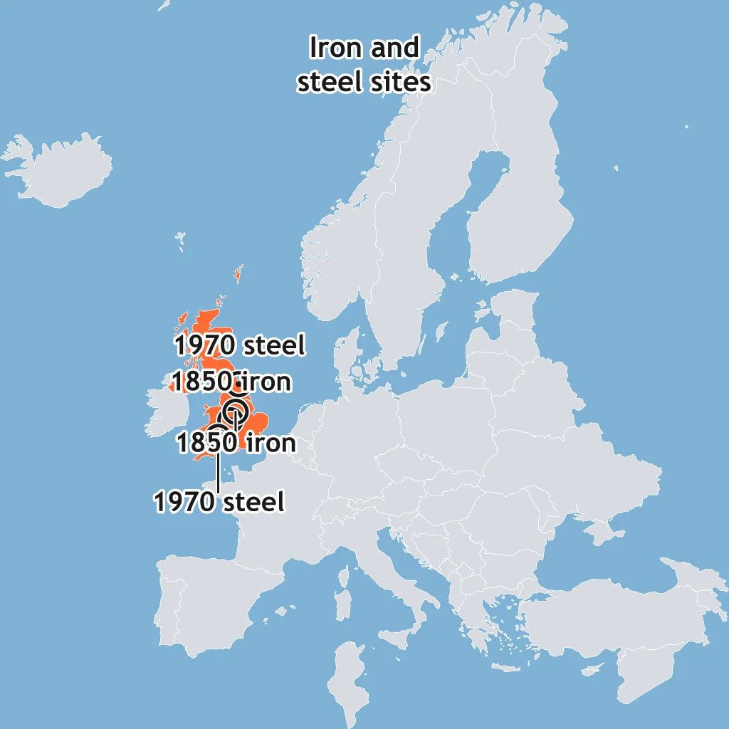
The map compares inland ironworks of the 1850s with coastal steel plants of the 1970s. What best explains the newer coastal sites?
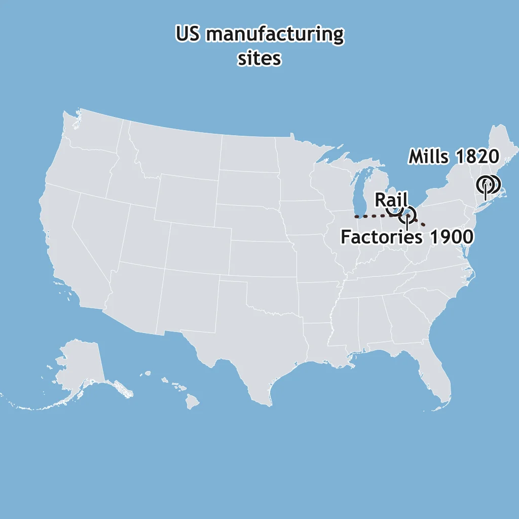
The map shows 1820 textile mills at New England falls and 1900 factories in Great Lakes coal and rail cities. What changed?
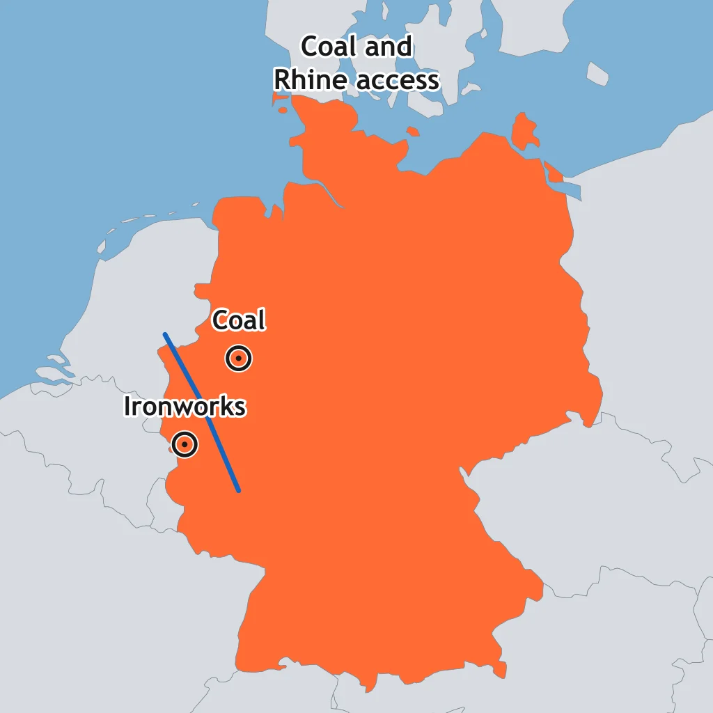
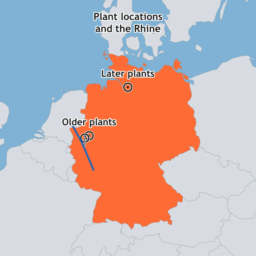
The map shows older factories near the Ruhr coalfield and later plants closer to Rhine and coastal transport nodes. What does the shift imply?
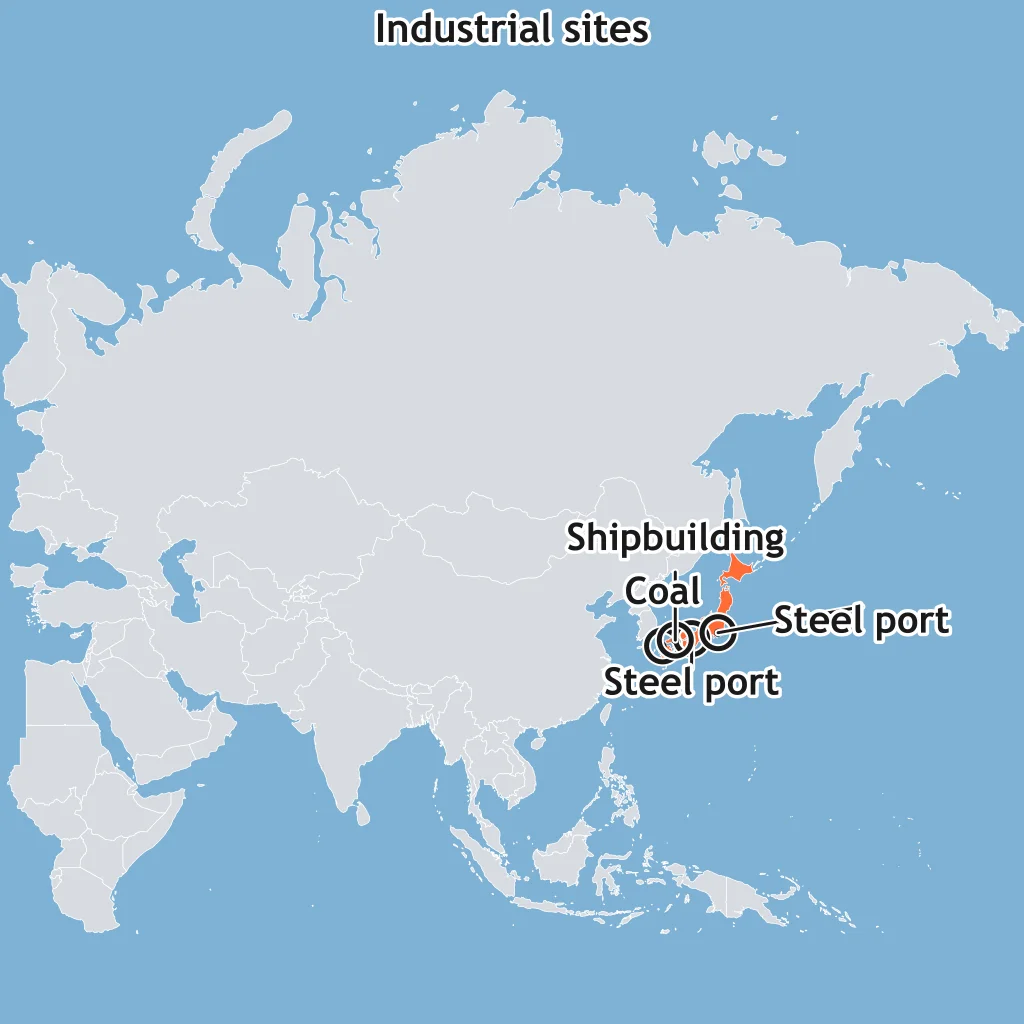
The map shows later Japanese steel and shipbuilding sites clustered on coasts rather than deep inland. Which location factor does that pattern emphasize?
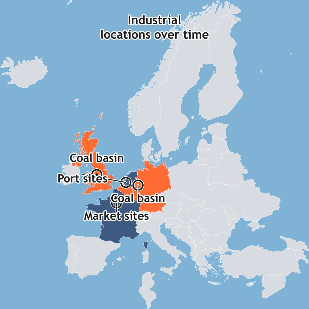
On the map, early industrial districts overlap coal basins, while later sites spread toward ports and large markets. What input changed most in importance?
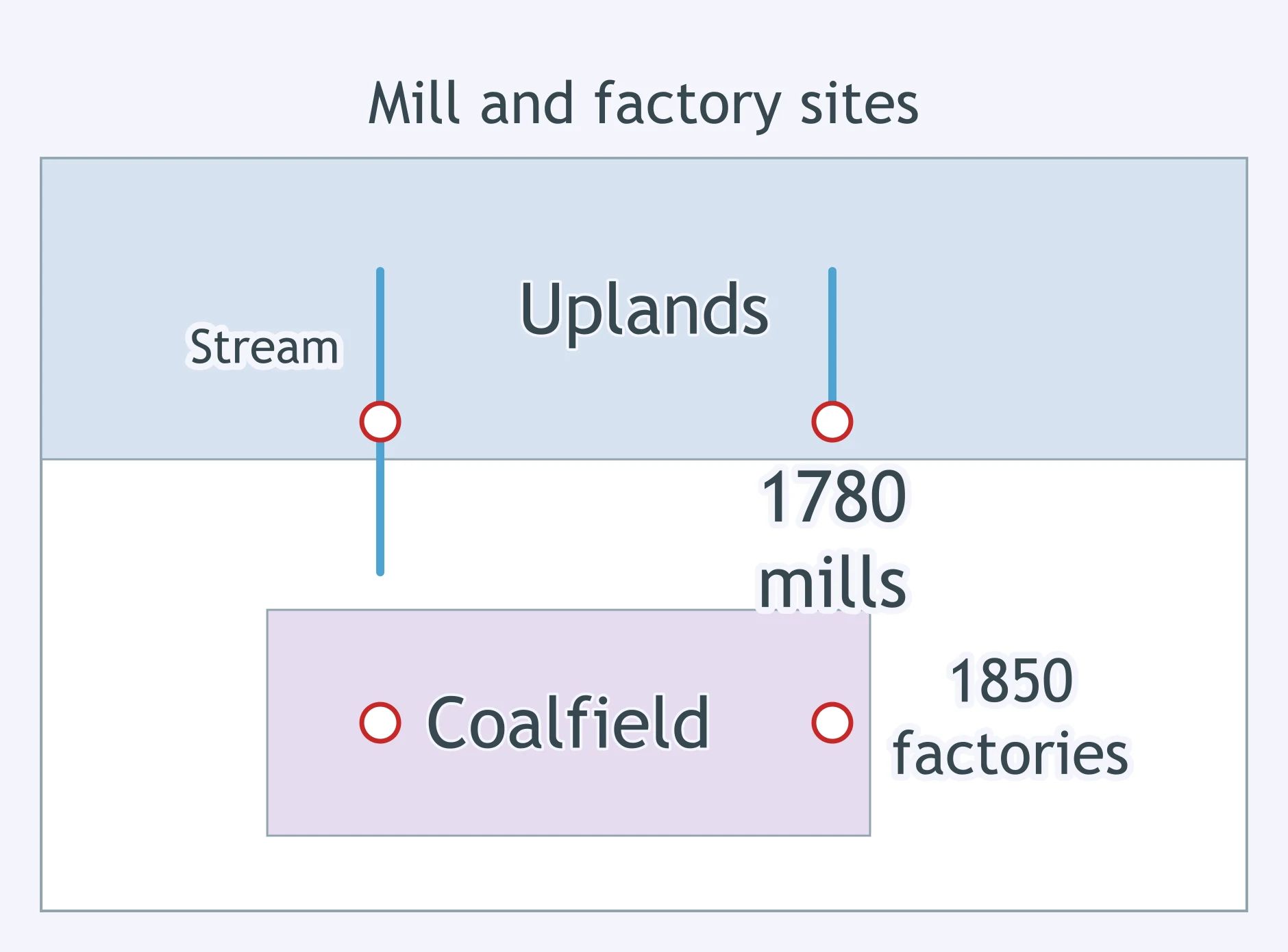
The map separates 1780 mill sites along upland streams from 1850 factory sites near coal basins. What does that shift imply?
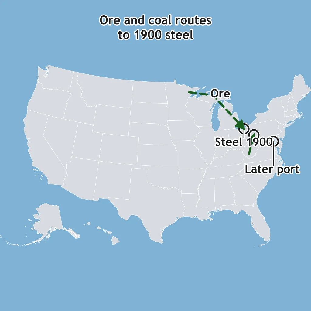
The map shows 1900 steel centers where Great Lakes ore routes met Appalachian coal, and later plants at coastal ports. What explains the later change?
Challenges of Urban Change: Gentrification, Segregation, Housing and Squatter Settlements
40 questions
Urban Sustainability: Smart Growth, New Urbanism and Greenbelts
30 questions
Reading Urban Data: Census, Density and Land-Use Figures
25 questions
Cities and Urban Land Use: Mixed Review
70 questions
Weber's Least Cost Theory and Industrial Location
30 questions
Crack the passcode before the zombies get in.
Answer, then swat bugs for bonus points.
Race through questions at your own speed.
Same question on every screen. Fastest wins.

Pick a tile, answer, hit bonuses and steals.