Loading
by BlastRoom
A cumulative review bank covering earthquake causes, seismic waves, epicenter location, and magnitude and intensity.
#earth_space_science
40 questions
One question set, multiple game modes. Tap any game to see it in action. Not sure which to pick?
Answer to place stones and capture territory.
Outrun the snow together.
Earn blasts, then hunt the other team.
Answer to earn energy, then climb.

The class blasts through walls together.
Bid on mystery lots. Most money wins.
Sell tours. Nice, standard, or a total scam.

Answer, restock, and serve the rush.
More correct answers pulls the rope your way.
Answer, then shoot down the alien wave.
Answer, then tap to leap the frozen ridge.
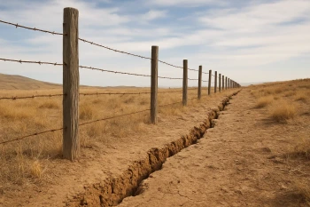
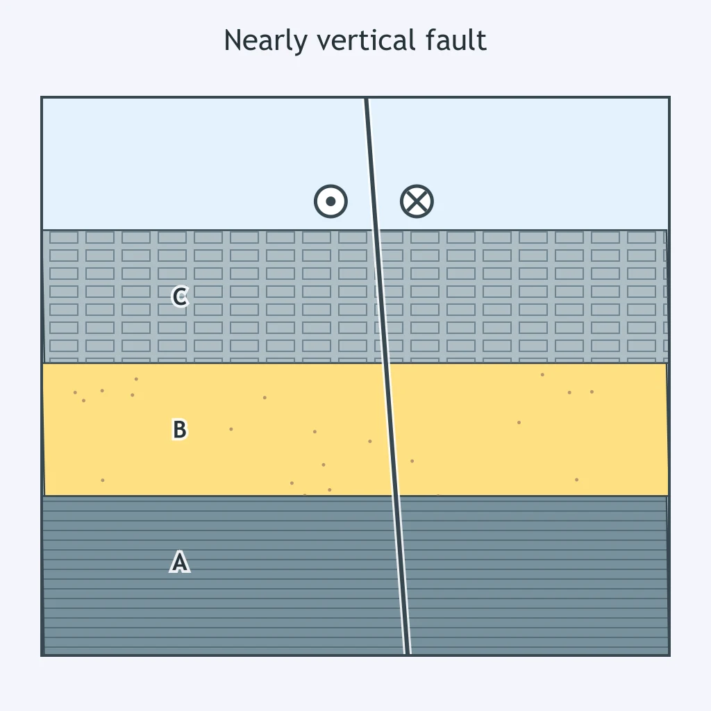
The cross section shows a nearly vertical fault. A wooden fence that once ran straight across it is now offset several meters sideways, with no vertical drop on either side. Which fault type produced this offset?
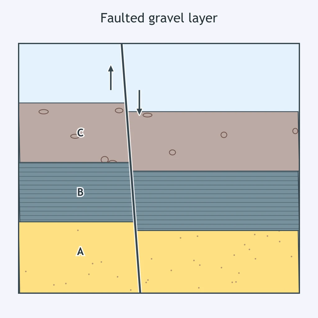
In the cross section, a buried gravel layer sits lower on one side of a dipping fault, and the upper block has visibly slid down along the incline. Which fault type is shown?
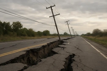
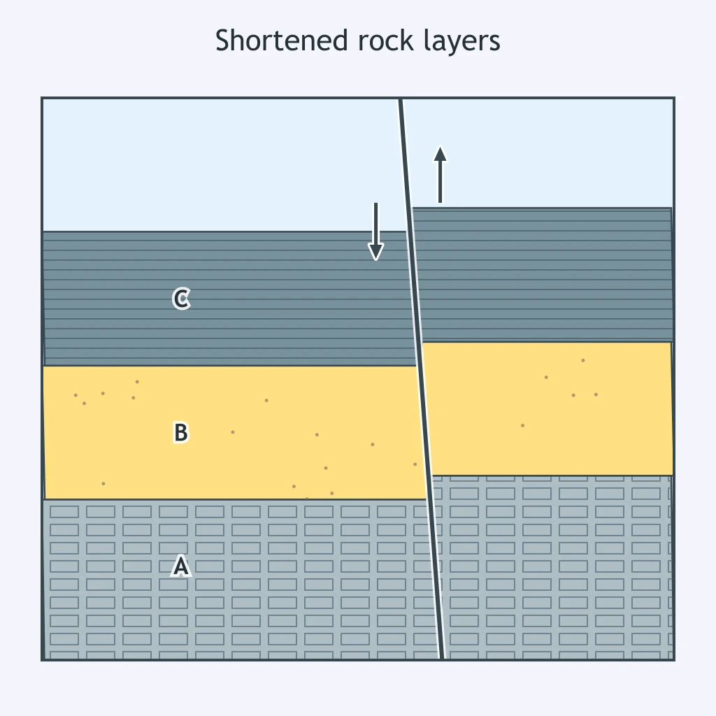
A section shows a road cut where rock layers are shortened, and the uphill block has been pushed up and over the downhill block along a dipping fault. Which fault type produced this offset?
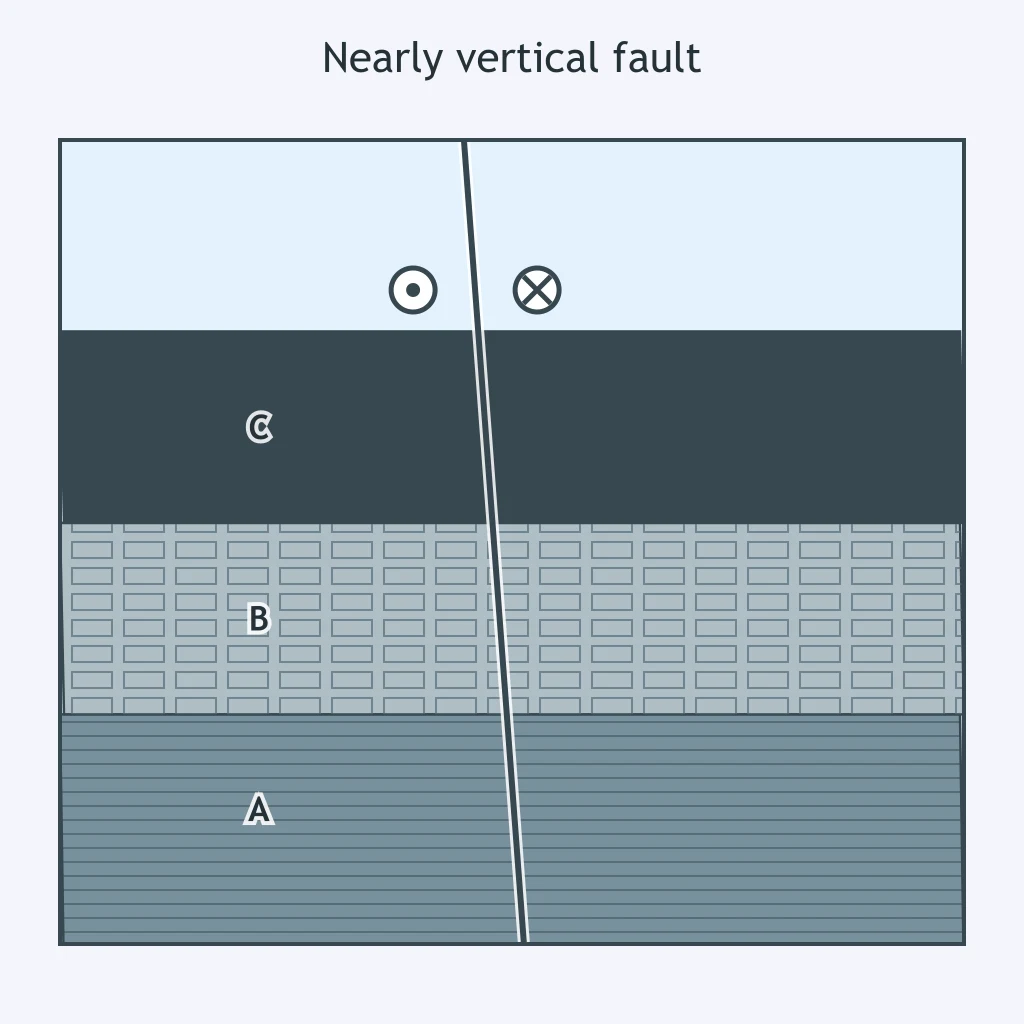
The cross section shows a nearly vertical fault. A dry stream channel crossing it has been offset sideways by several meters, with no significant vertical displacement on either bank. Which fault type caused this offset?
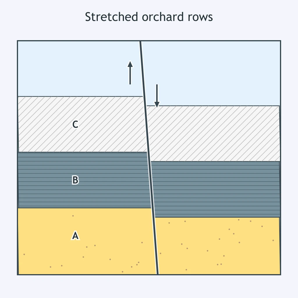
Rows of an orchard that once lined up across a dipping fault are now separated by a gap, with the block above the fault dropped down and pulled apart from the block below. What fault type explains this offset?
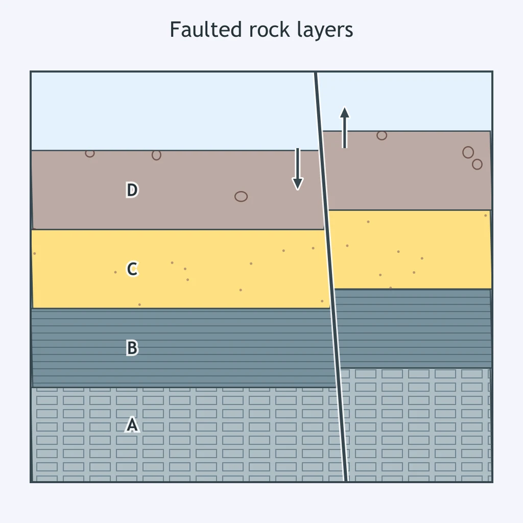
In the cross section, the upper block has ridden up and over the lower block along a dipping fault. Faults like this can stack older rock on top of younger rock. Which fault type is shown?
Matching bands of rock on either side of a nearly vertical fault line up again only after sliding sideways past one another, with neither side higher than its match. Which fault type produced this offset?
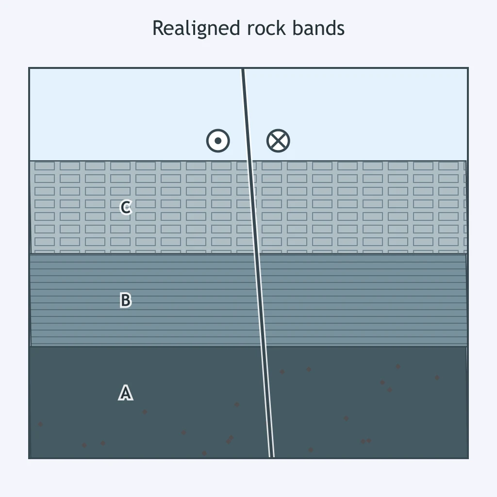
A ridge crest broken by a dipping fault shows the uphill block dropped down relative to the block below it, stretching the crest apart. Which fault type is shown?
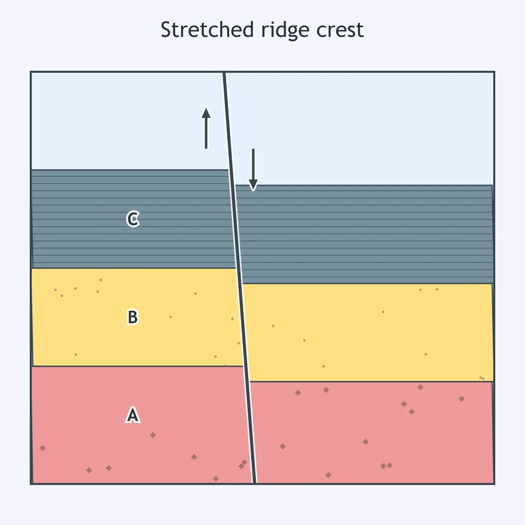
During a quake, people on the top floor of an office tower feel a long, slow side-to-side sway that continues well after the first sharp jolts stop. Which waves cause this swaying?
A person standing in an open parking lot feels one quick vertical jolt arriving before any side-to-side shaking begins. Which wave caused that first jolt?
A driver feels their car rock side to side several seconds after an initial sharp jolt has already passed. Which wave produces this later side-to-side rocking?
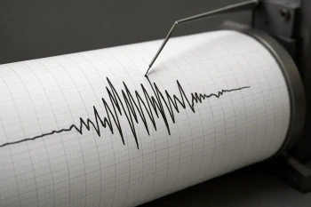
Use Station N's seismogram. The trace stays flat until one small tick, and no other arrival appears before it. Which wave produces that first tick?
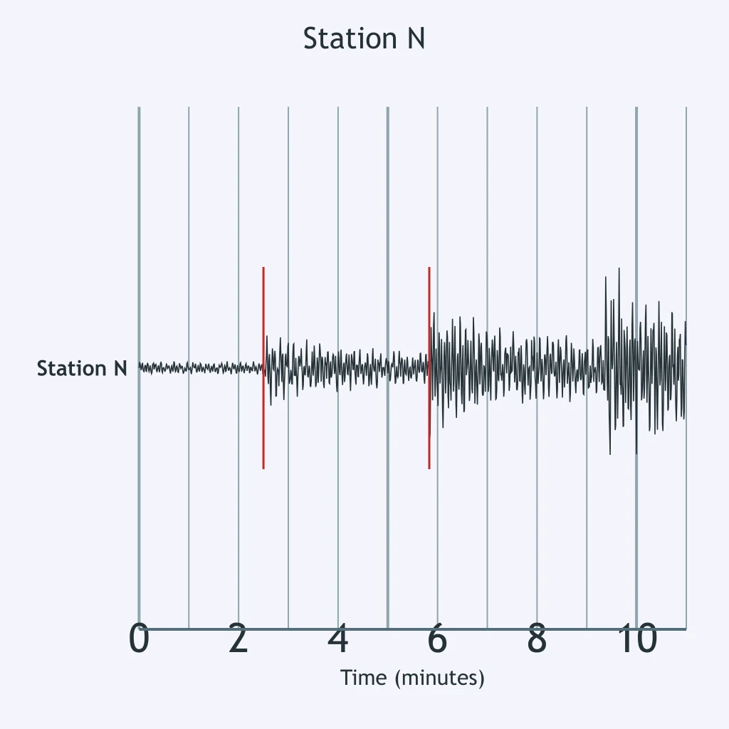
On the Station O seismogram, the trace grows noticeably larger at the second tick than at the first. What wave begins at the second tick?
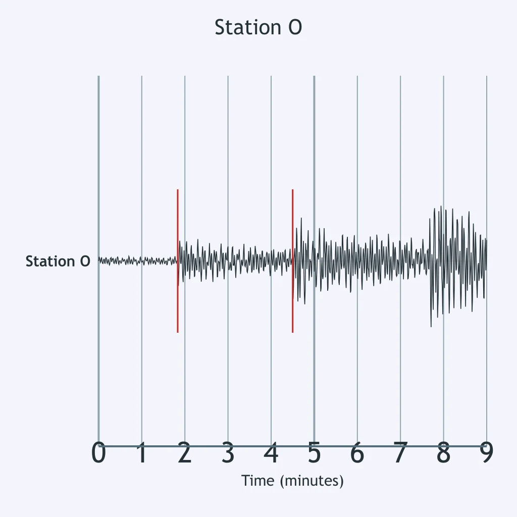
Stations located between about 103 and 180 degrees from an earthquake's focus record no direct arrivals of one wave type, even though refracted P waves still reach them. Which wave is missing in that band?
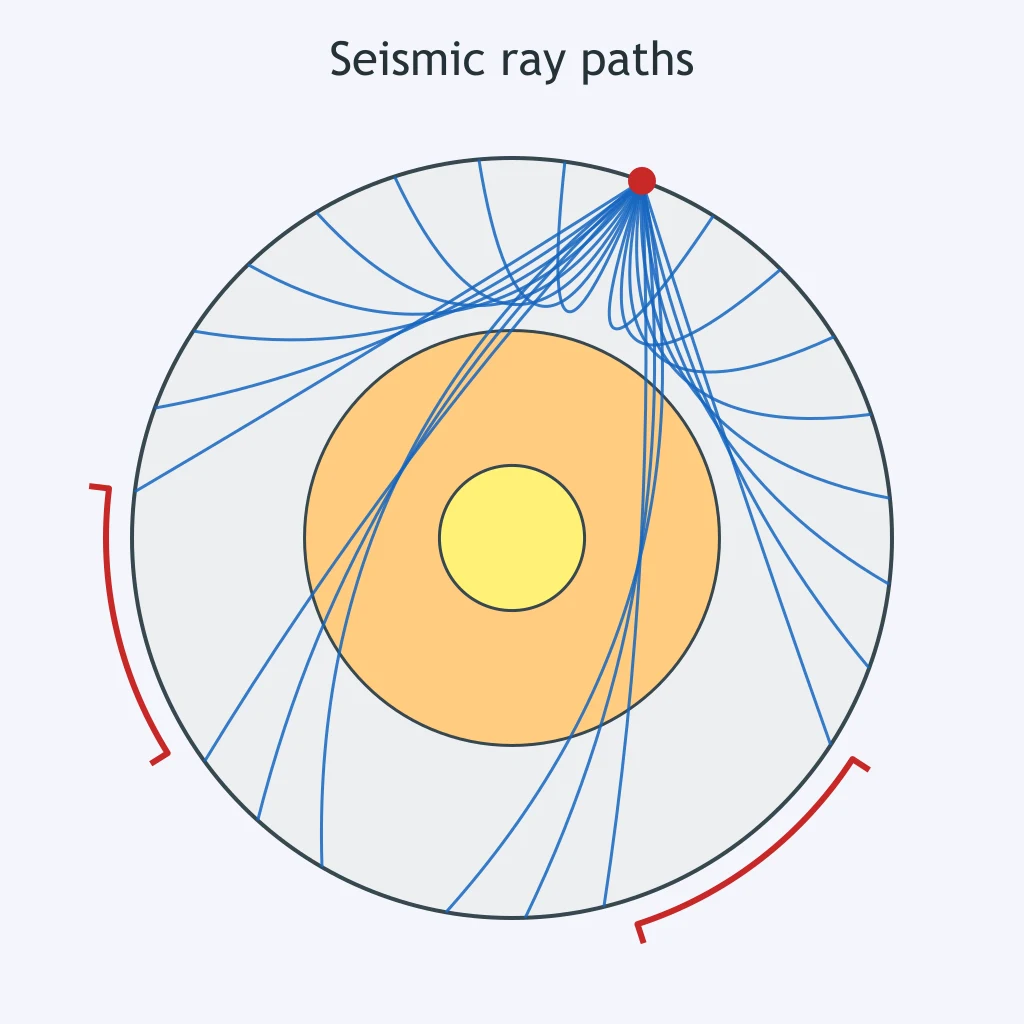
A seismograph shows ground motion moving back and forth parallel to the direction the wave travels, alternately compressing and stretching the rock. Which wave produces this motion?
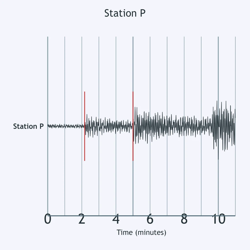
On the Station P seismogram, the largest and slowest shaking arrives last, well after the two earlier body-wave ticks. What kind of wave produces this final, largest arrival?
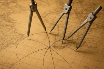
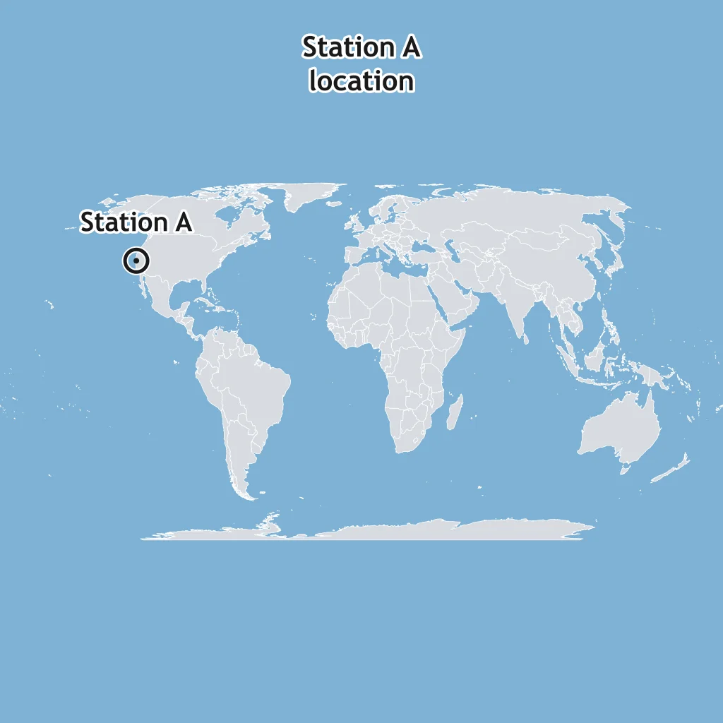
The map marks Station A near the coast. Station A records a P-S interval of 4 minutes, and the travel-time graph gives 3,200 km for that interval. What radius circle should be drawn around Station A?
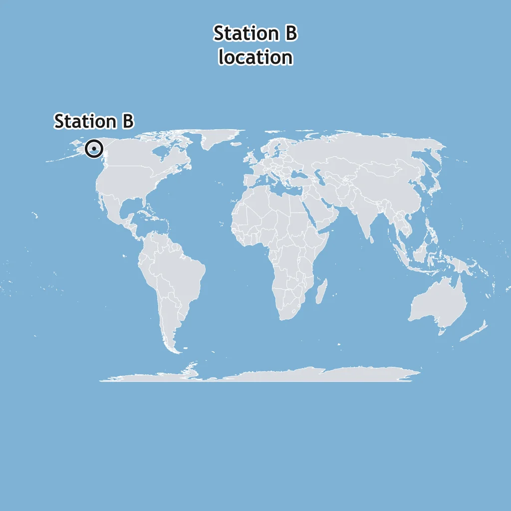
The map marks Station B in Alaska. Station B records a P-S interval of 8 minutes, and the travel-time graph gives 6,000 km for that interval. What radius circle should be drawn around Station B?
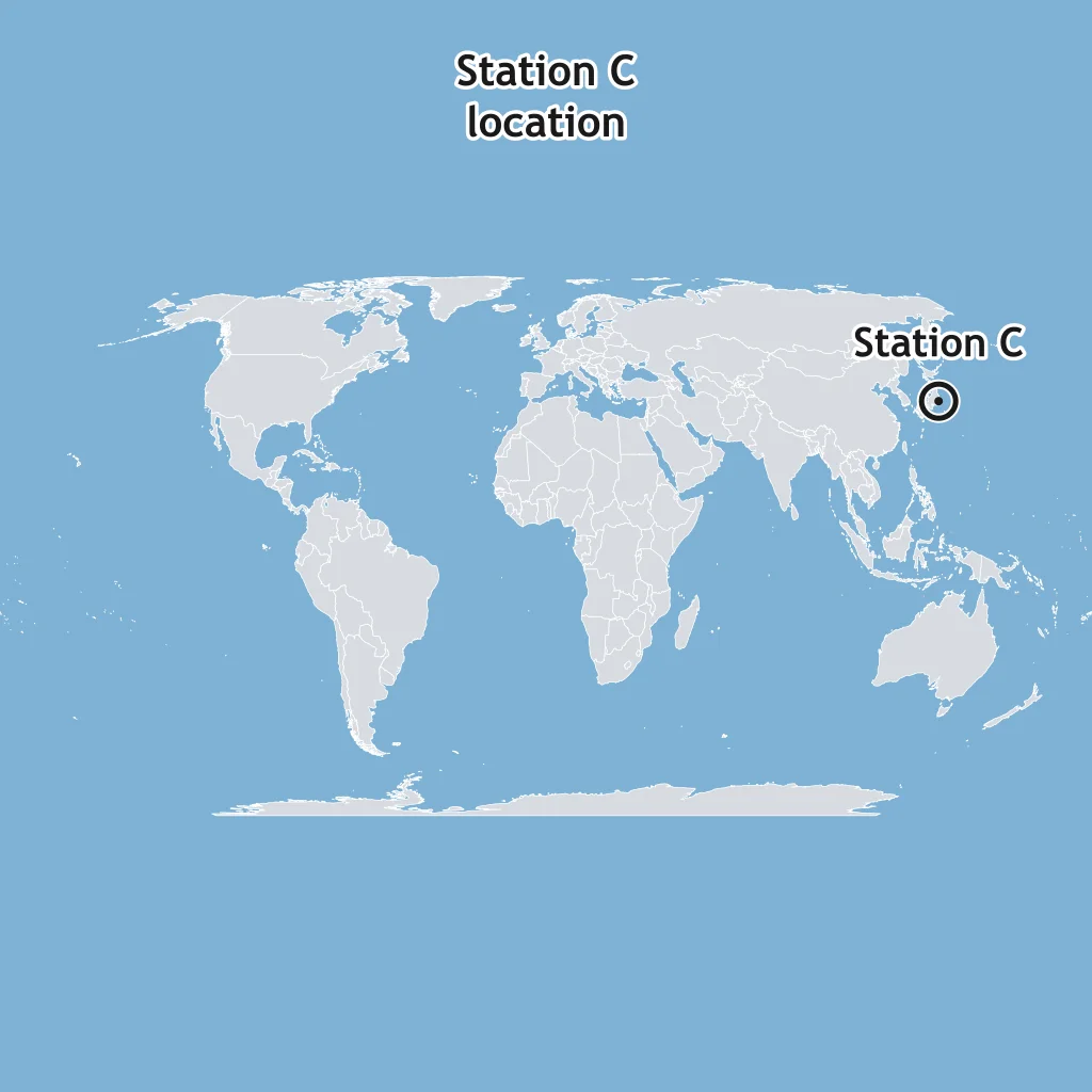
The map marks Station C in Japan. Station C records a P-S interval of 3 minutes, and the travel-time graph gives 2,100 km for that interval. What radius circle should be drawn around Station C?
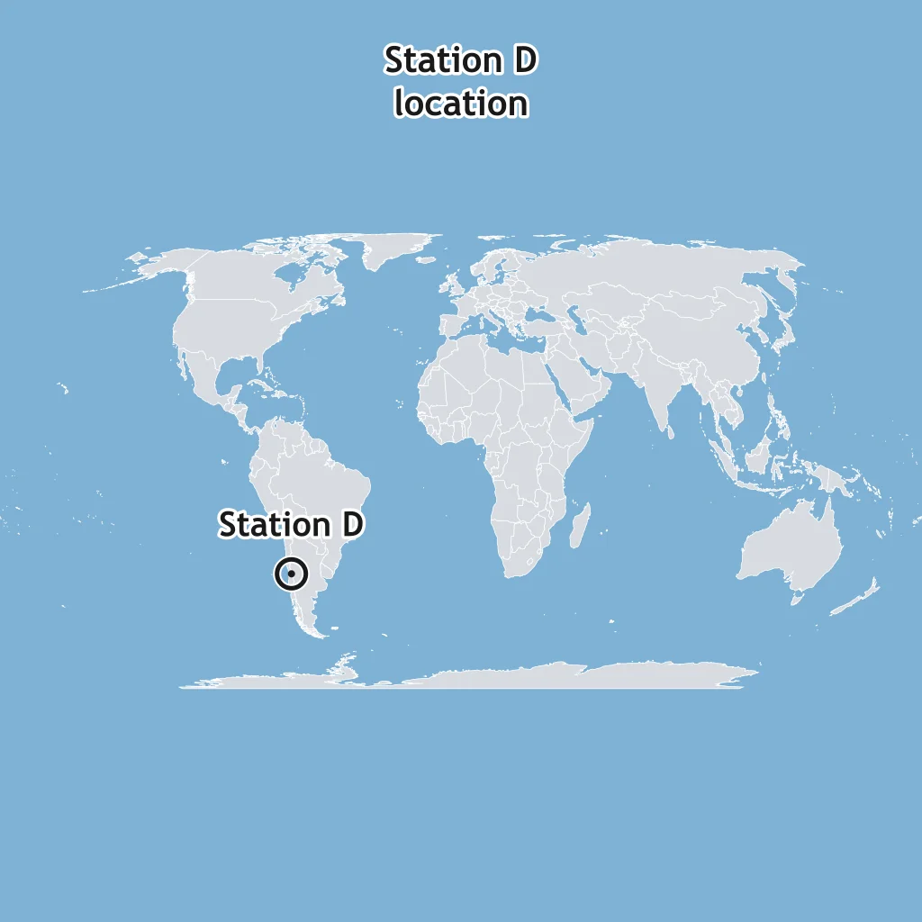
The map marks Station D in Chile. Station D records a P-S interval of 10 minutes, and the travel-time graph gives 7,200 km for that interval. What radius circle should be drawn around Station D?
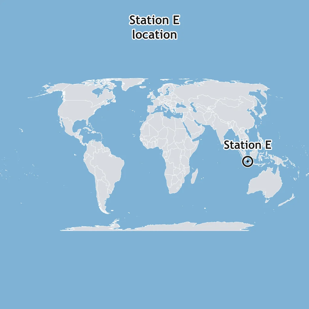
The map marks Station E in Indonesia. Station E records a P-S interval of 2 minutes, and the travel-time graph gives 1,400 km for that interval. What radius circle should be drawn around Station E?
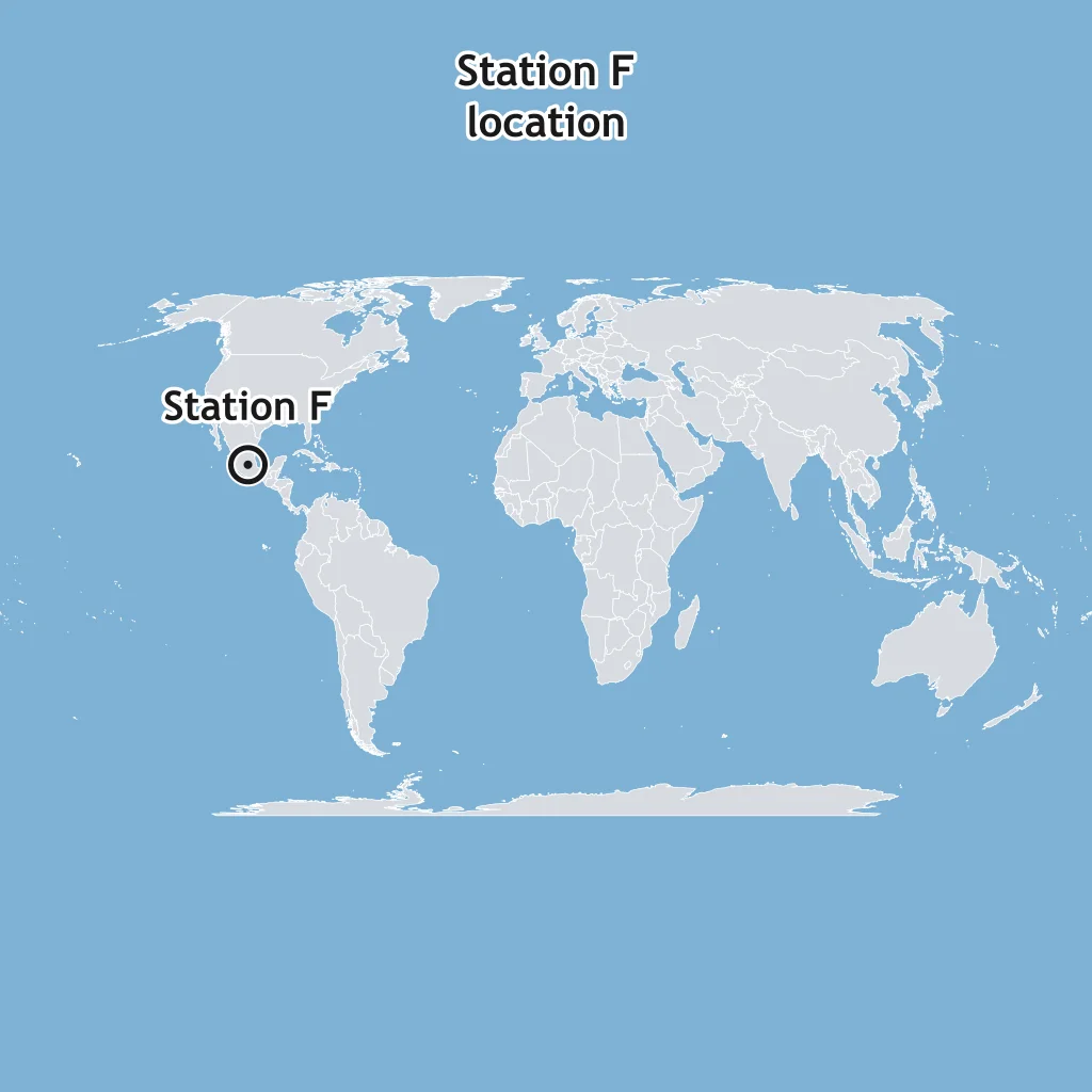
The map marks Station F in Mexico. Station F records a P-S interval of 7 minutes, and the travel-time graph gives 5,200 km for that interval. What radius circle should be drawn around Station F?
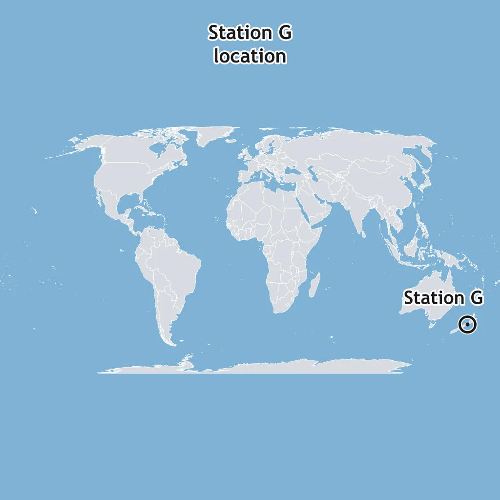
The map marks Station G in New Zealand. Station G records a P-S interval of 5 minutes, and the travel-time graph gives 3,800 km for that interval. What radius circle should be drawn around Station G?
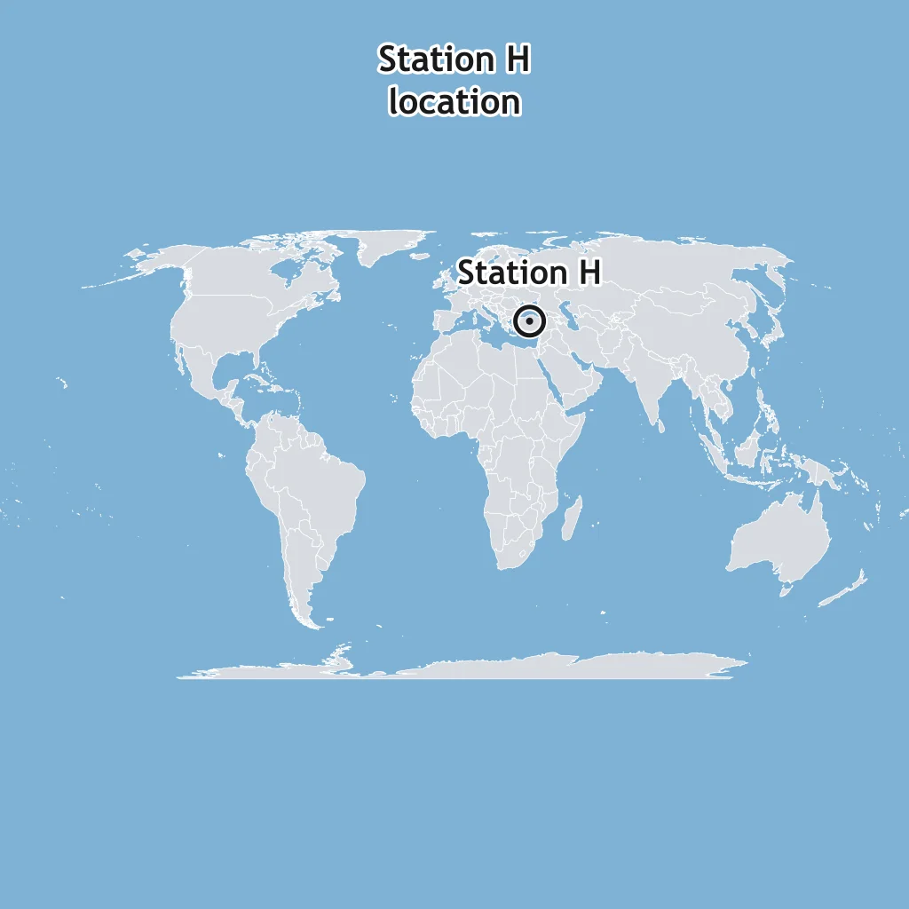
The map marks Station H in Turkey. Station H records a P-S interval of 9 minutes, and the travel-time graph gives 6,600 km for that interval. What radius circle should be drawn around Station H?
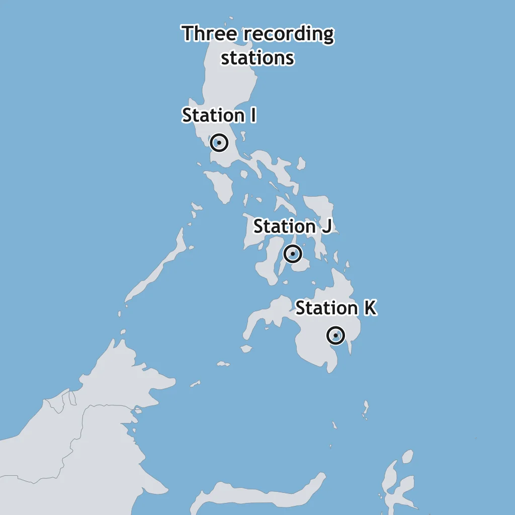
The map marks three stations near the Philippines. Each draws a circle whose radius equals the epicentral distance found from its own P-S interval. Where the three circles cross marks what point?
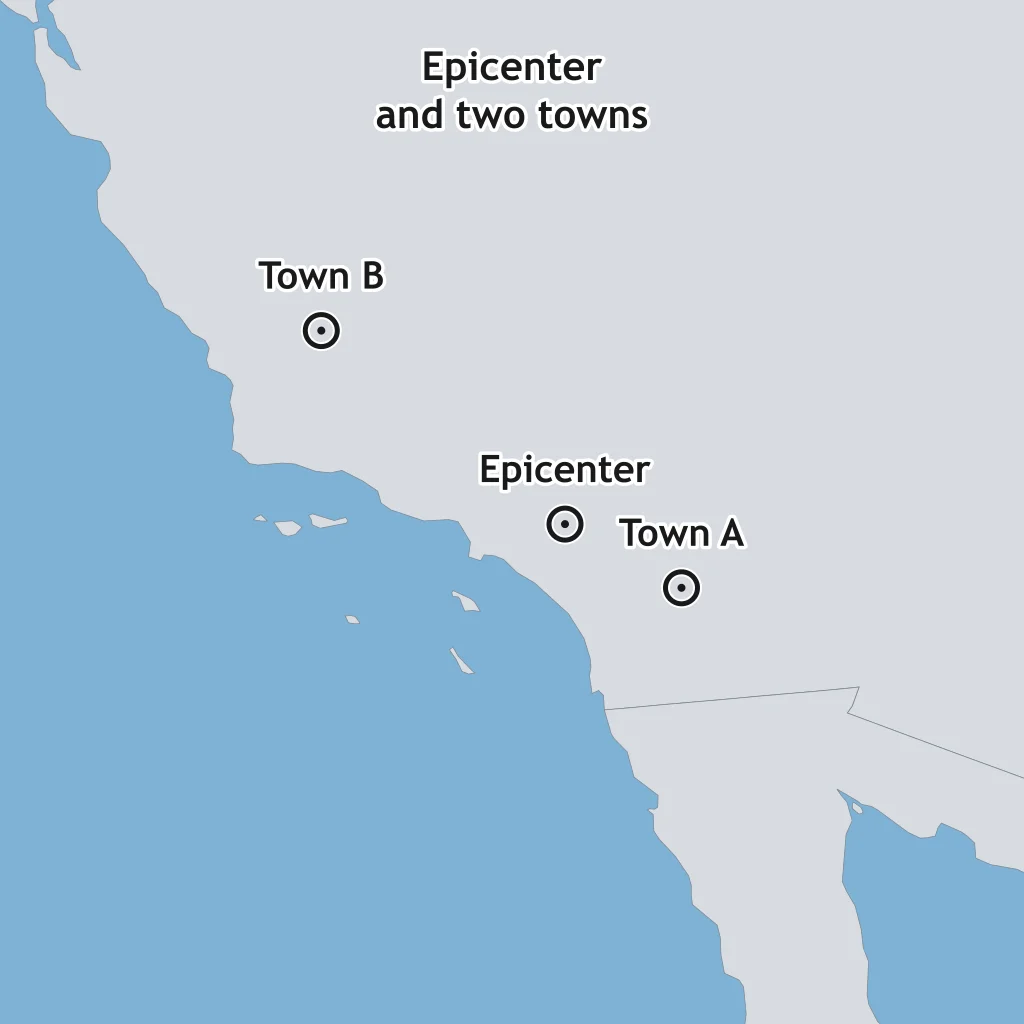
The map marks an earthquake's epicenter and two towns on similar bedrock. Which town should report the higher Modified Mercalli intensity?
Two towns are the same distance from an earthquake's epicenter. Town C sits on loose, water-saturated sediment, and Town D sits on solid bedrock. Which town most likely reports the higher Modified Mercalli intensity?
Two earthquakes of the same magnitude share the same epicenter location, but one has a focus 5 km deep and the other has a focus 60 km deep. At a town directly above the epicenter, which earthquake produces the higher intensity?
The same earthquake shakes two neighborhoods equally hard, but a district of unreinforced brick buildings suffers far more collapse than a nearby district of wood-frame houses. What best explains the difference in reported intensity?
Two towns are the same distance from an epicenter and built on similar bedrock, but Town E is built on a steep hillside and Town F is built on a flat plain. Which town more likely reports higher intensity?
A coastal town built on filled harbor land reports much heavier damage than an inland town on granite bedrock, even though both are the same distance from the earthquake's epicenter. What explains the coastal town's higher intensity?
Instrument records show two earthquakes had the same moment magnitude, yet the closer town to one epicenter reported a much higher Modified Mercalli intensity than any town near the other. What is the best explanation?
A map plots epicenters ringing the Pacific Ocean basin, tracing the trenches and volcanic arcs behind them. What does this belt of earthquakes mark?
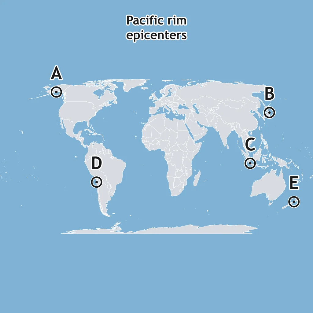
A map plots a narrow line of shallow epicenters running down the middle of the Atlantic Ocean, far from any continent. What kind of plate boundary does this line mark?
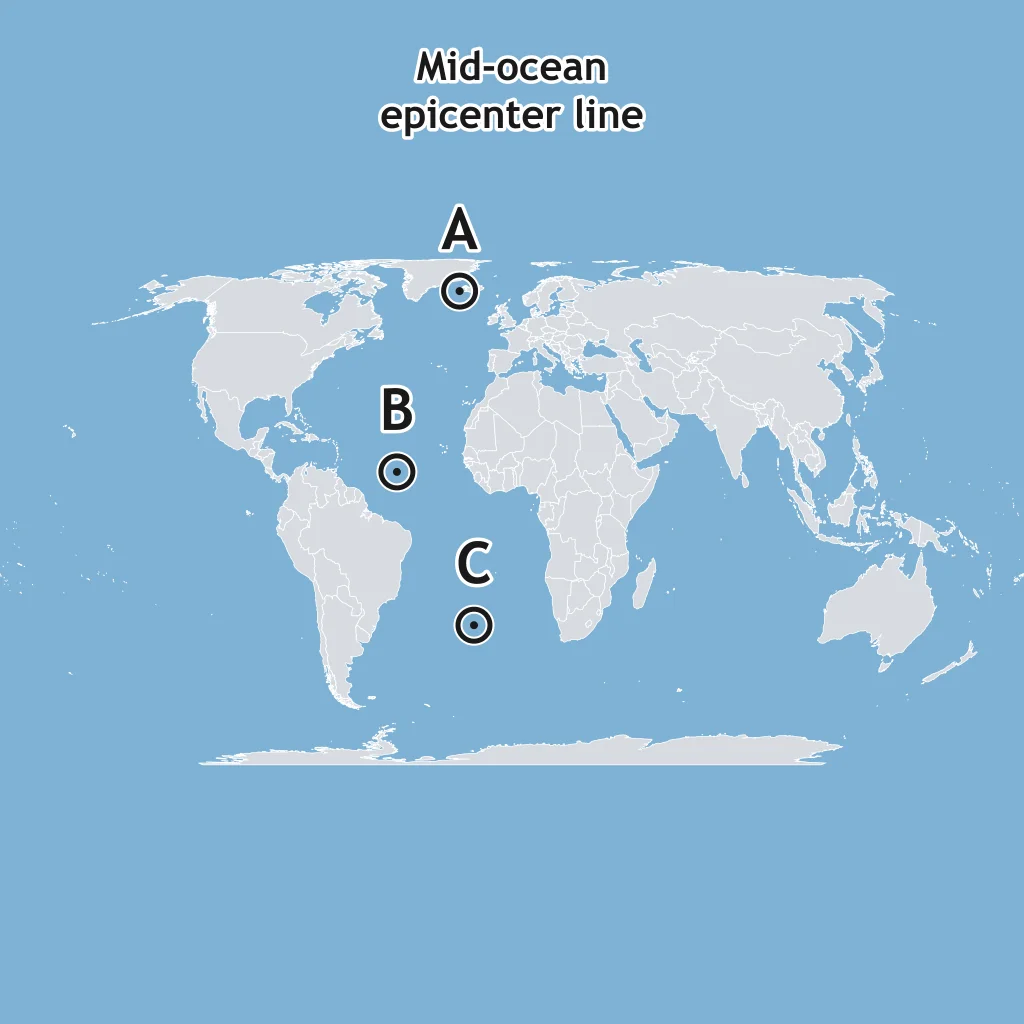
A map plots a narrow band of shallow epicenters along a single fault line through California, with plates sliding horizontally past each other. What kind of plate boundary does this pattern mark?
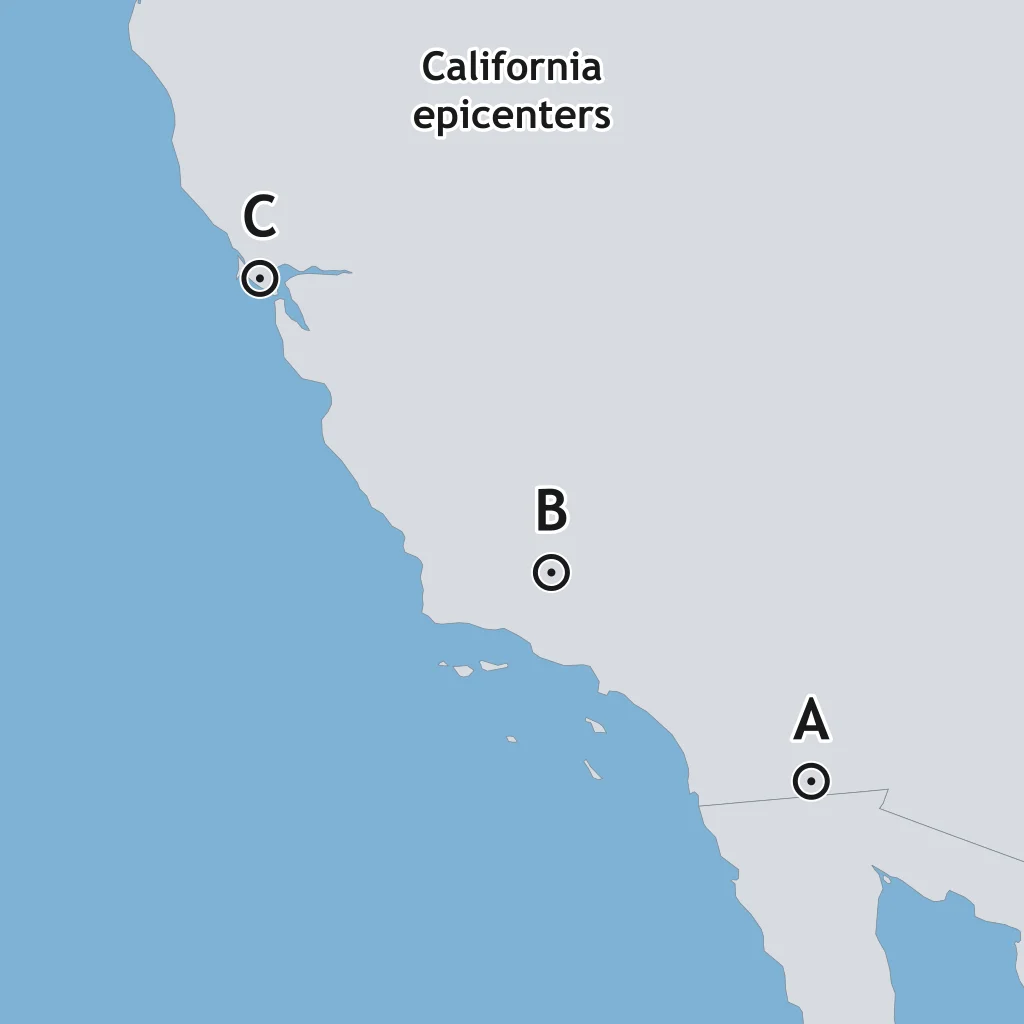
The map shows the depths of three earthquakes, from near the ocean trench west of Sumatra toward the island. What structure does this depth pattern trace?
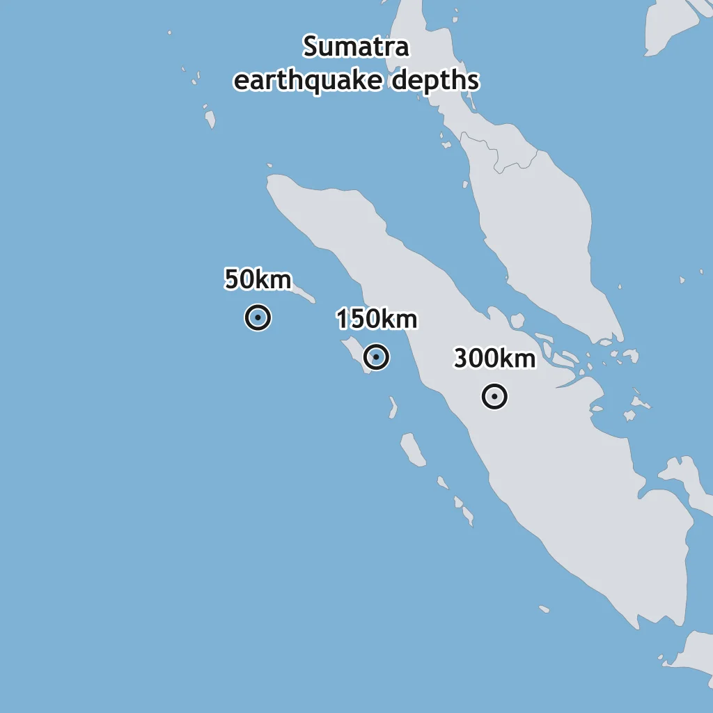
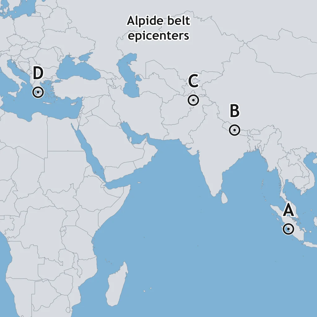
A map plots a broad belt of epicenters running from Indonesia through the Himalayas and into the Mediterranean, where two continents press together. What kind of plate boundary produces much of this belt?
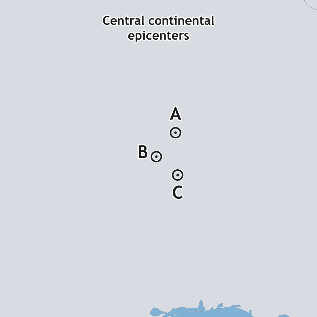
A map plots scattered epicenters near the middle of a continent, hundreds of kilometers from the nearest plate boundary. What term describes earthquakes occurring in this setting?
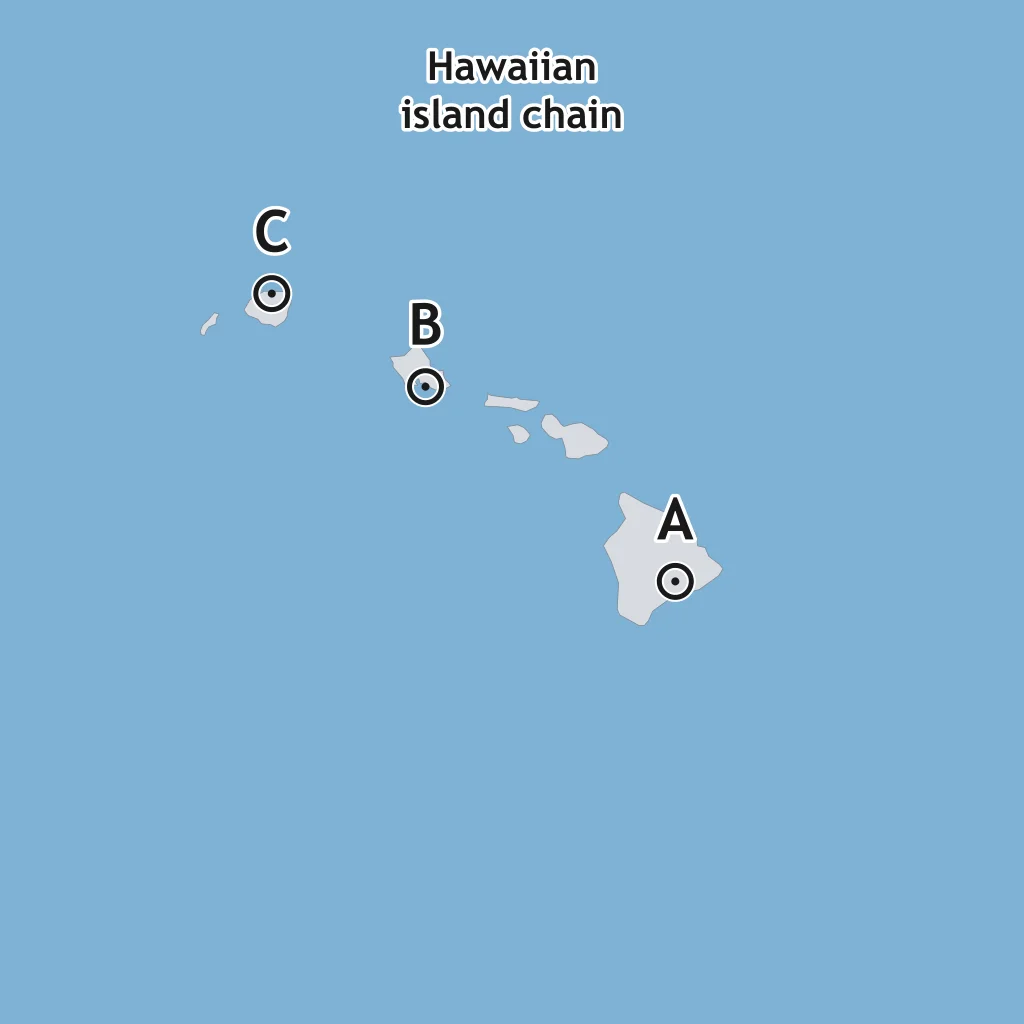
A map plots a chain of volcanic islands with earthquake activity concentrated at one end near an active volcano, while islands at the other end are older and quiet. What process produced this chain?
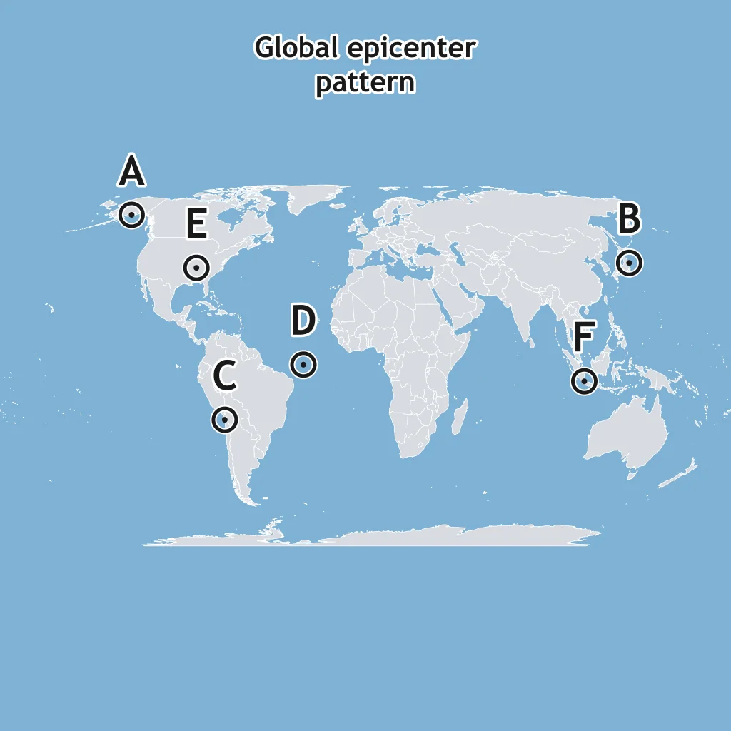
A world map shows epicenters densely packed along the outlines of plate boundaries, with only a few scattered events in the middle of continents and ocean basins. What does this global pattern show?
Crack the passcode before the zombies get in.
Answer, then swat bugs for bonus points.
Race through questions at your own speed.
Same question on every screen. Fastest wins.

Pick a tile, answer, hit bonuses and steals.
Magma and Lava
25 questions