Loading
by BlastRoom
Identify plate boundary types and the features they produce.
#earth_space_science
50 questions
One question set, multiple game modes. Tap any game to see it in action. Not sure which to pick?
Answer to place stones and capture territory.
Outrun the snow together.
Earn blasts, then hunt the other team.
Answer to earn energy, then climb.

The class blasts through walls together.
Bid on mystery lots. Most money wins.
Sell tours. Nice, standard, or a total scam.

Answer, restock, and serve the rush.
More correct answers pulls the rope your way.
Answer, then shoot down the alien wave.
Answer, then tap to leap the frozen ridge.
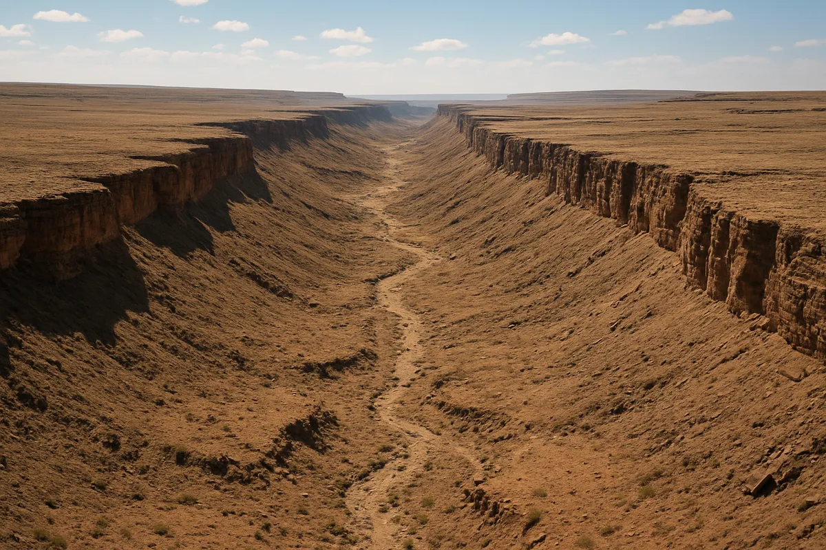
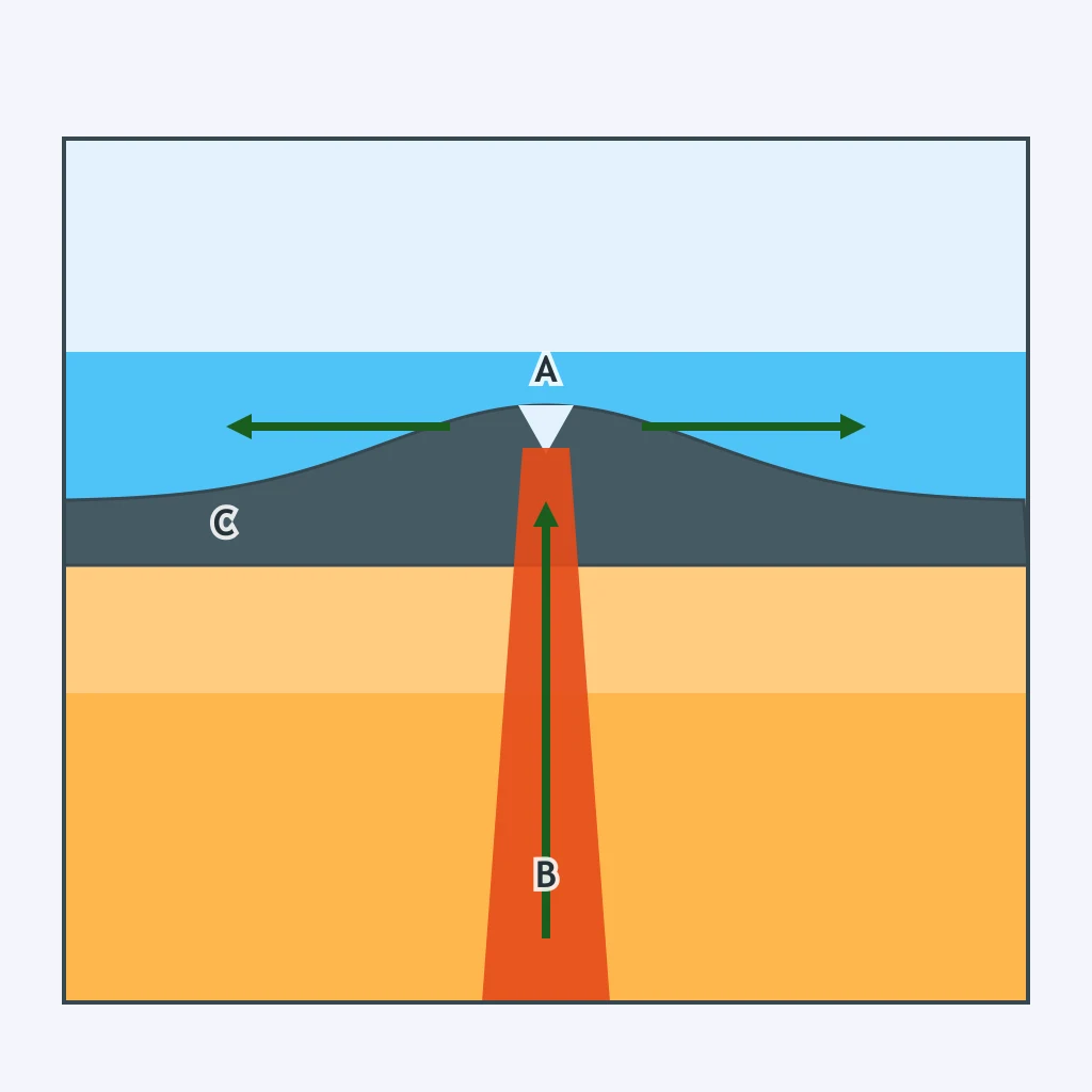
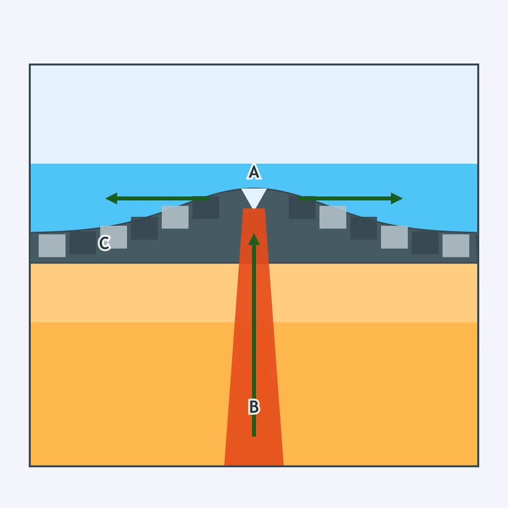
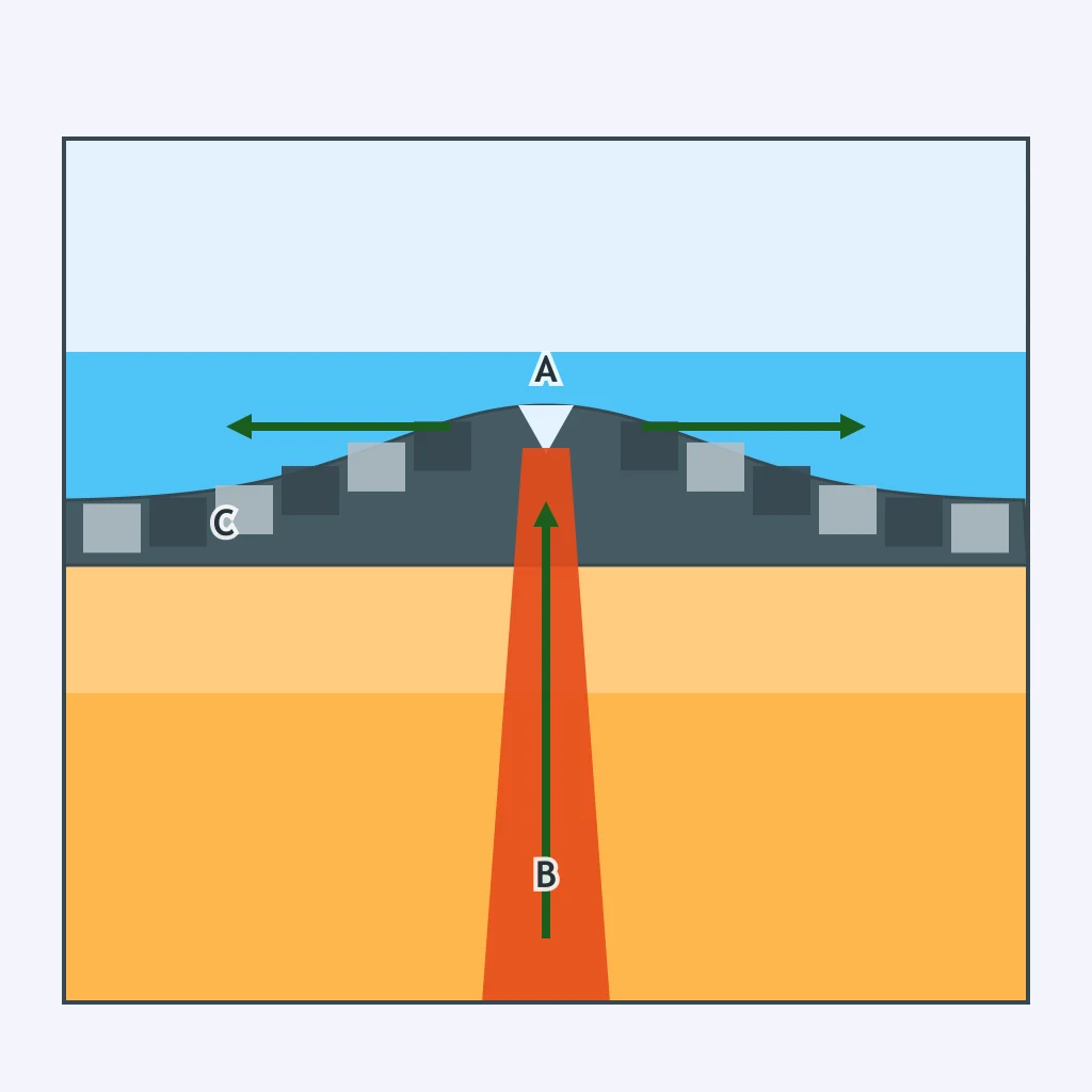
A section shows two oceanic slabs moving apart while magma rises into the opening. Which boundary type is drawn?
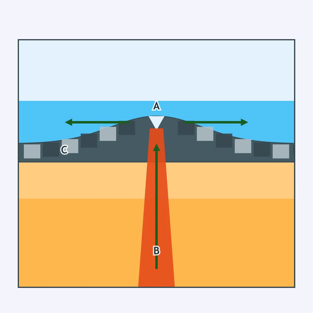
In the section, continental lithosphere is being stretched apart and a central down-dropped rift is opening. What boundary type is this?
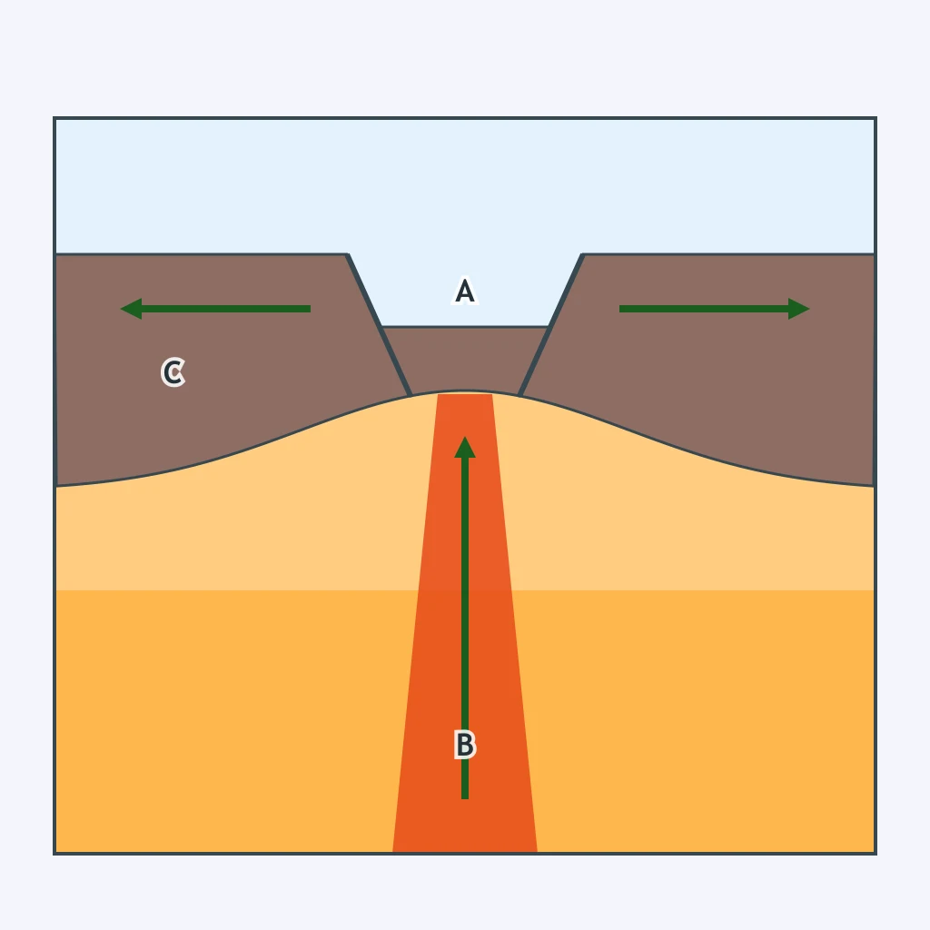
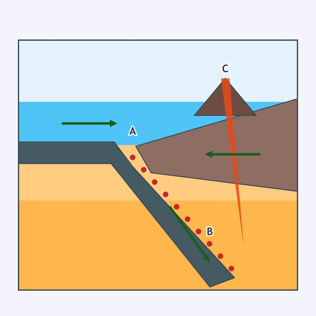
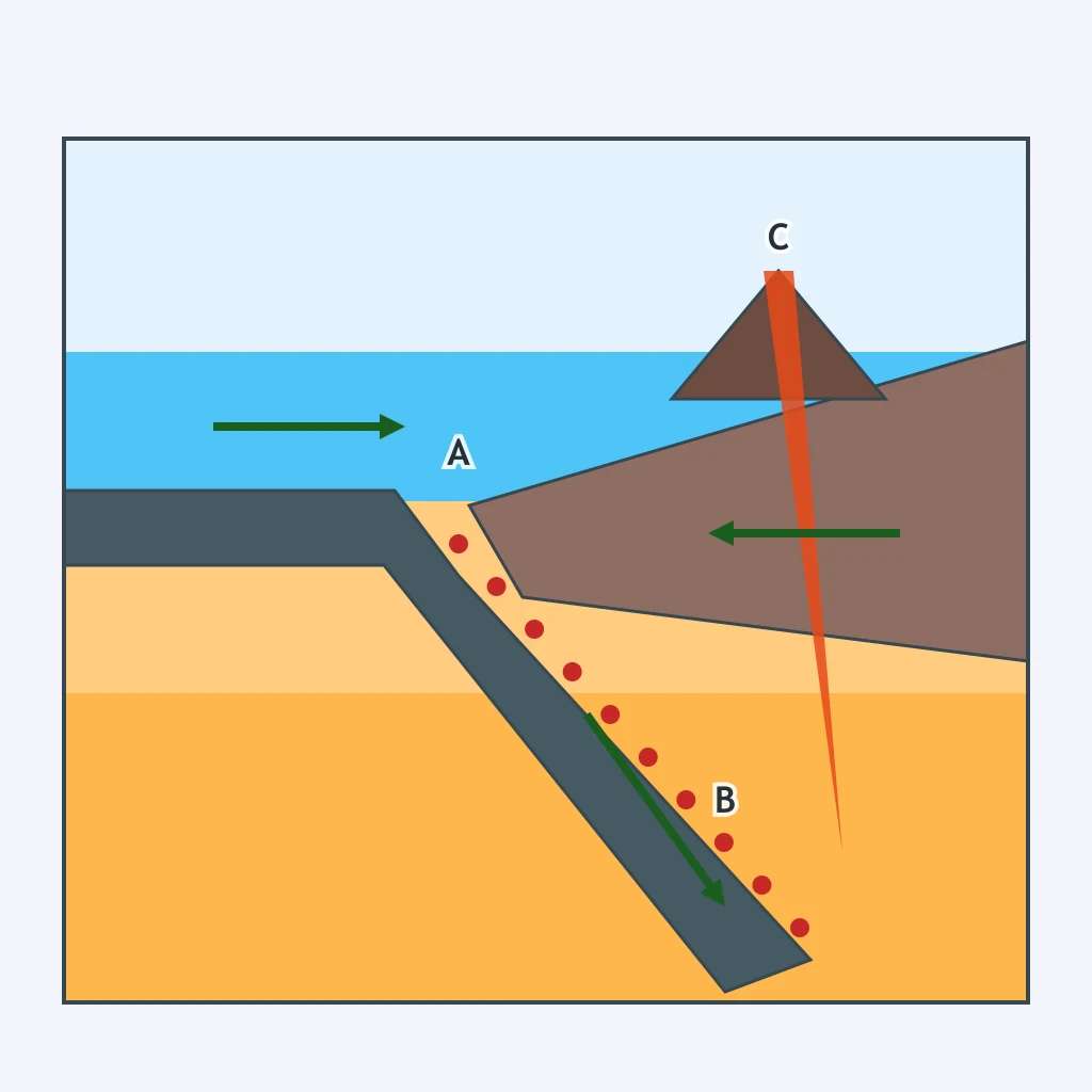
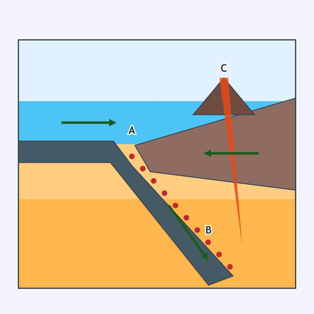
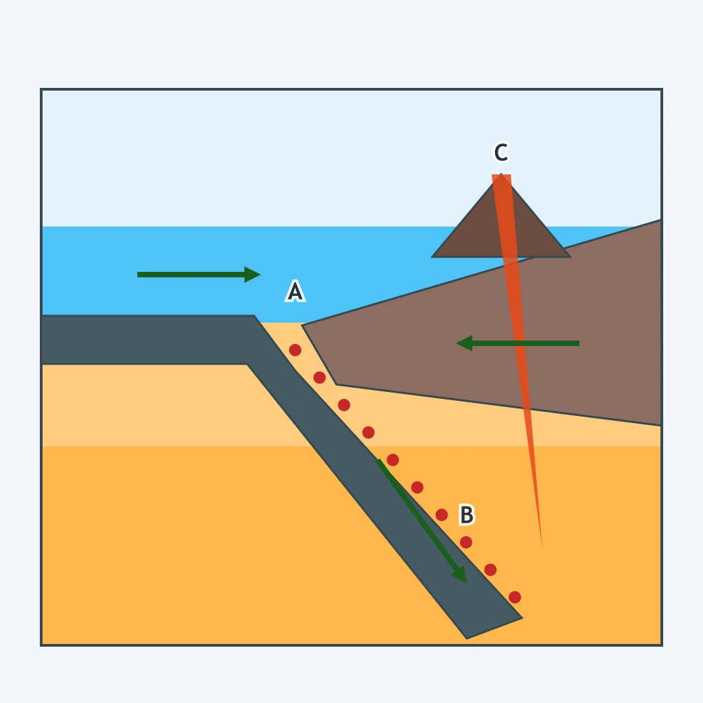
The section shows an oceanic plate bending downward beneath a continental plate at a trench. Which boundary type is drawn?
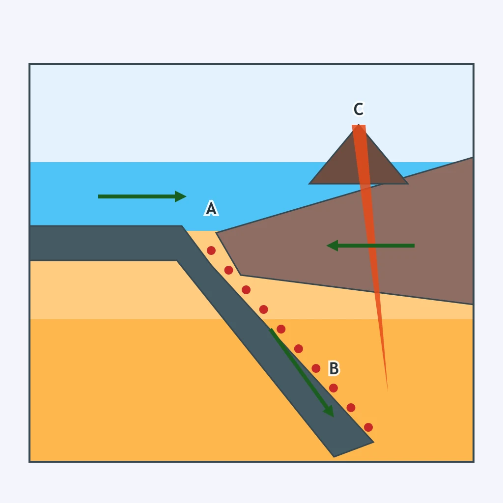
Two oceanic plates meet in the section, and one slab descends beneath the other beside a narrow trench. Which boundary type is shown?
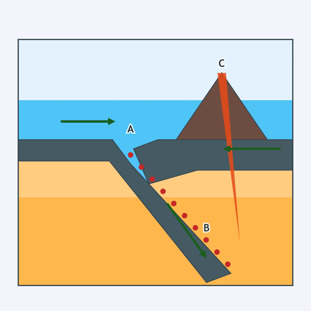
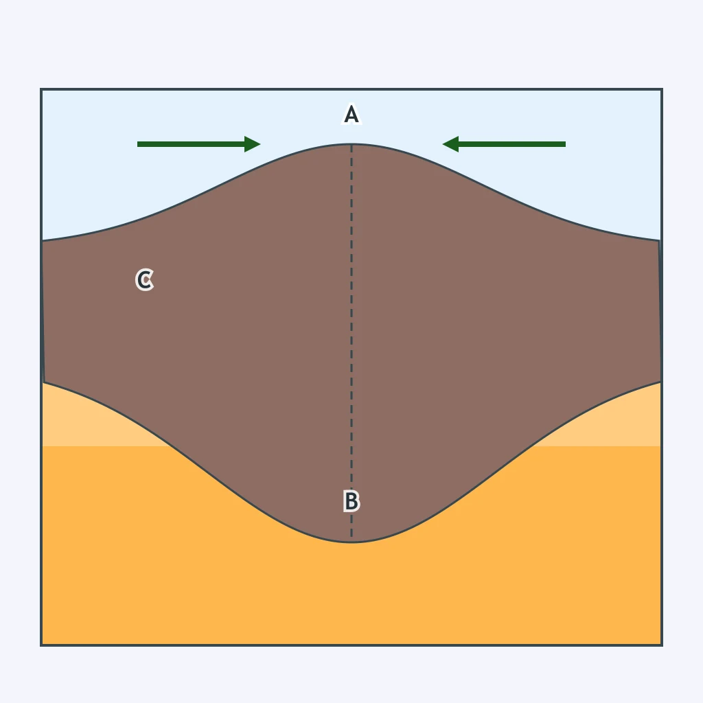
A section shows two thick continental plates pushing together with crumpled crust between them and no oceanic slab sinking. Which boundary is drawn?
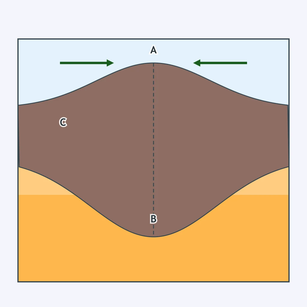
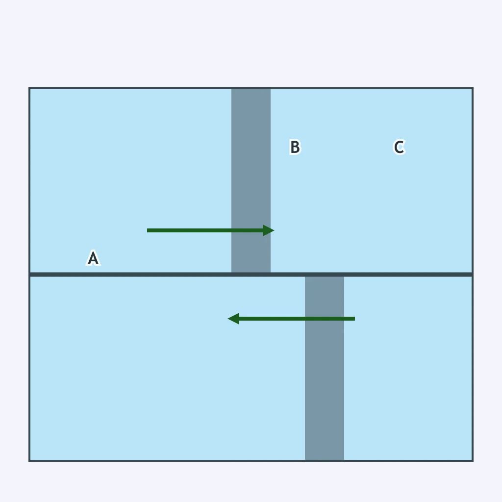
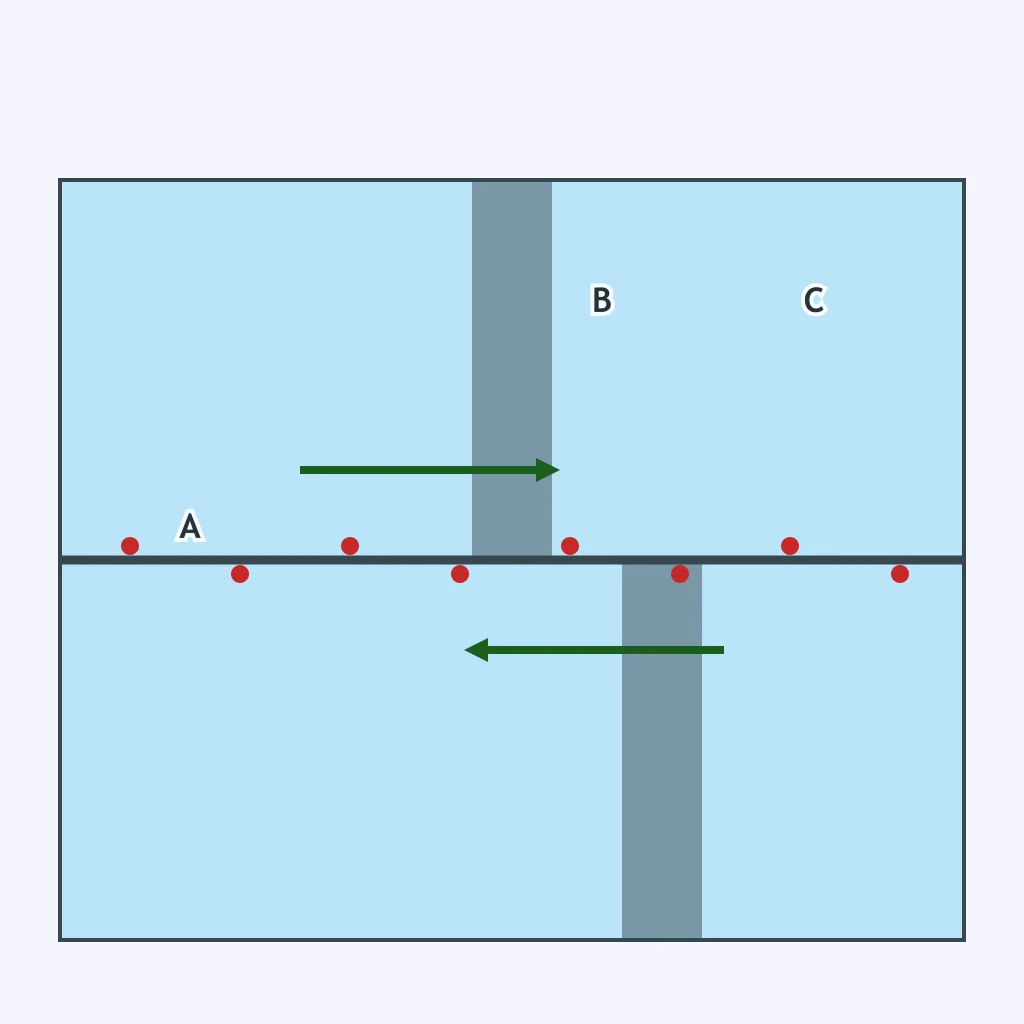
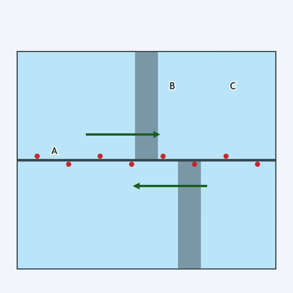
The top-view diagram shows two plates sliding horizontally past one another along a straight fault. Which boundary type is drawn?
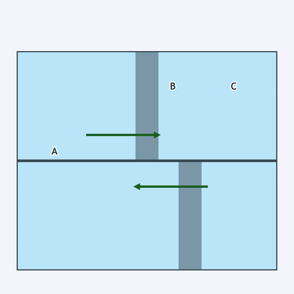
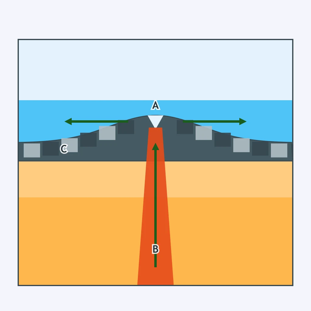
A section shows a central ridge with matching magnetic stripes on both sides and arrows pointing away from the center. Which boundary is drawn?
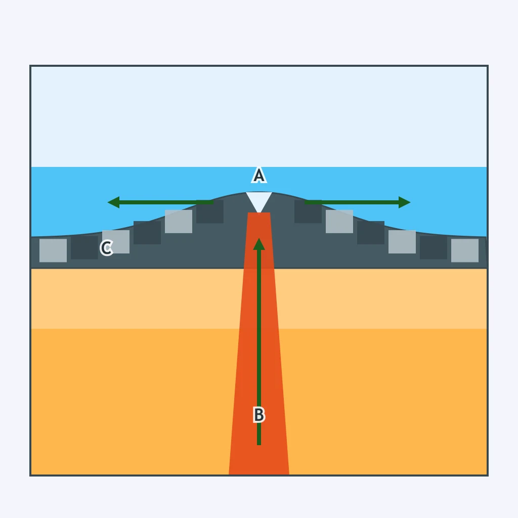
A map-view boundary offsets a ridge segment and shows opposite arrows on either side of the fault. What boundary type is represented?
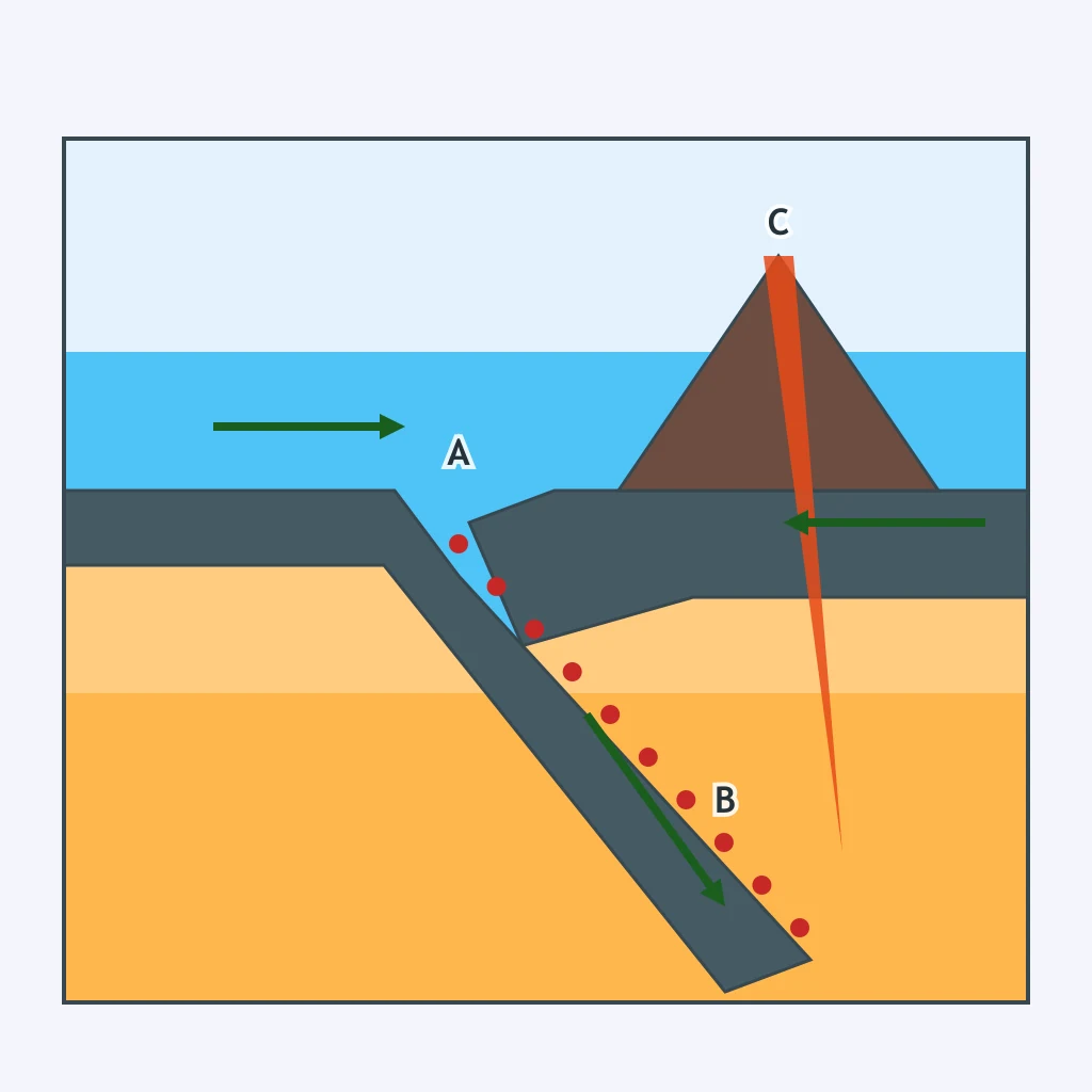
The section shows a trench, a descending slab, and earthquake foci that get deeper inland. Which boundary type is shown?
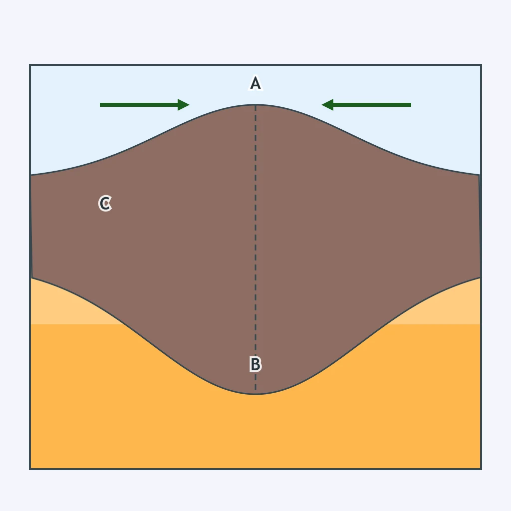
A section shows crust thickening where two continental plates push together, forming a high uplifted zone. Which boundary type is drawn?
The section shows plates pulling apart above rising mantle material and new crust forming at the surface. Which boundary type is this?
In the section, arrows point toward each other and one plate sinks beneath the other into the asthenosphere. Which boundary is drawn?
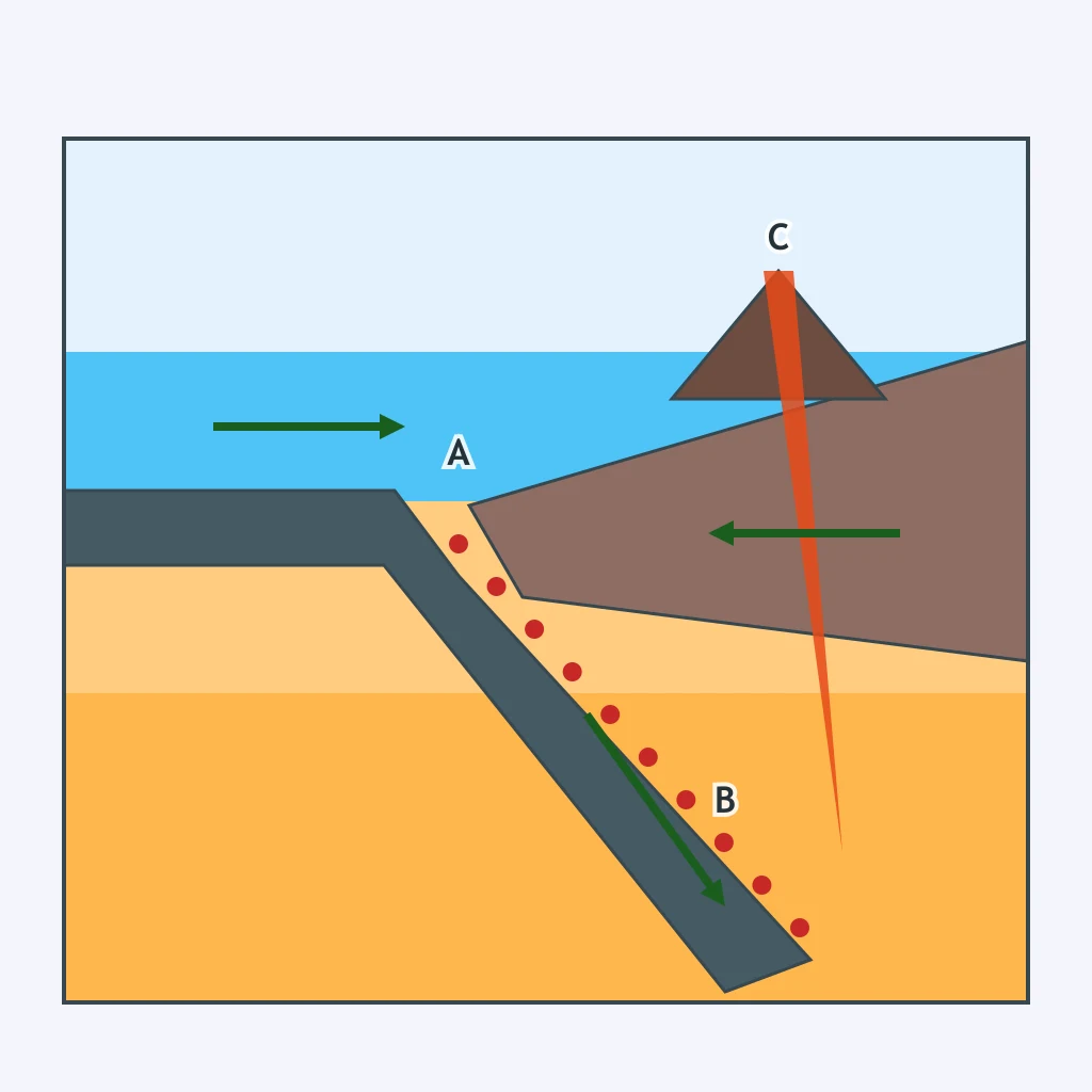
The section shows oceanic plates spreading apart with magma solidifying at the center. What feature forms along the boundary?
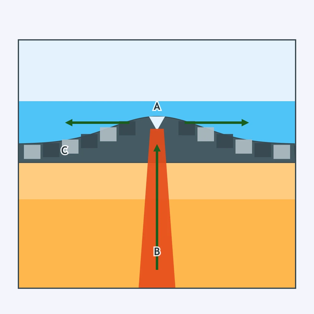
A continental plate is being pulled apart in the section, with normal faults dropping the center block. What surface feature is forming?
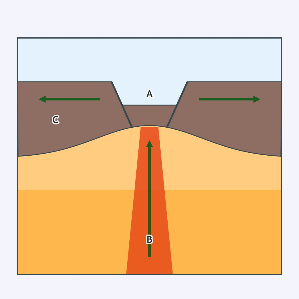
A dense oceanic plate descends beneath a continent in the section. Which feature forms at the seafloor where bending begins?
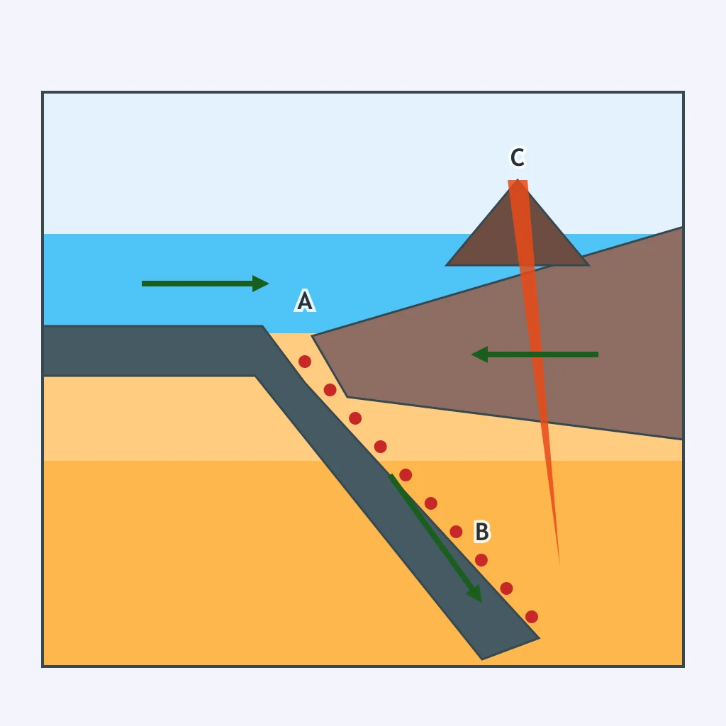
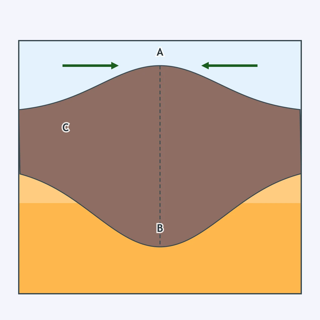
The section shows one oceanic plate subducting beneath another, with magma rising through the overriding plate. What feature forms at C?
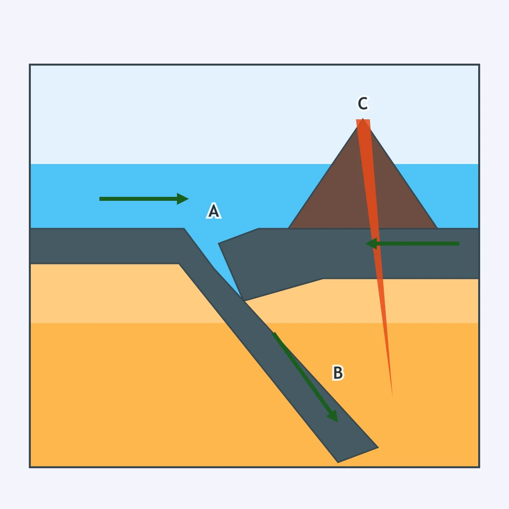
Two continents collide in the section after ocean crust has been consumed. What forms along the collision zone?
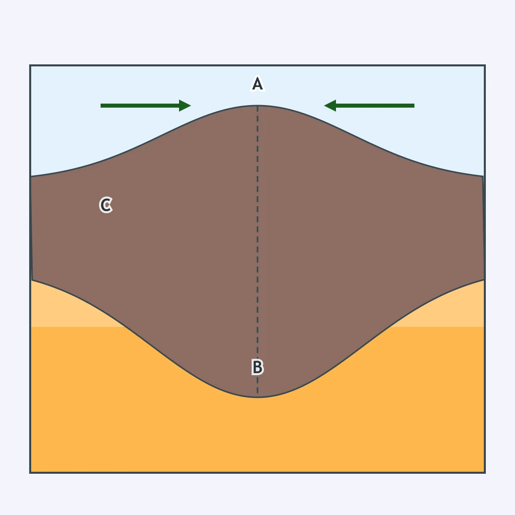
A map-view diagram shows plates sliding past each other and offsetting a strip of sea floor along a narrow line. What feature is produced?
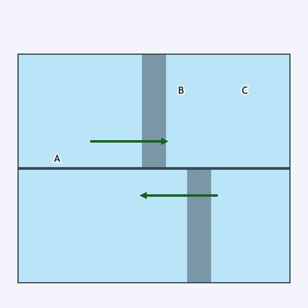
The ridge section shows equal-width magnetic bands mirrored on both sides of the ridge crest. What feature records seafloor spreading?
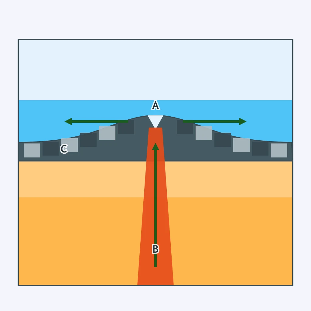
A section shows oceanic lithosphere subducting beneath a continent and magma rising inland from the trench. What landform belt develops on the continent?
The boundary diagram shows plates sliding sideways, with no slab descending and no new crust forming. Which hazard pattern is most typical?
The spreading section shows magma cooling between plates that are moving apart. What material is added at the boundary?
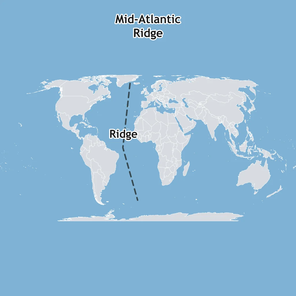
The map line marks the Mid-Atlantic Ridge between the Americas and Europe-Africa. What plate boundary type runs there?
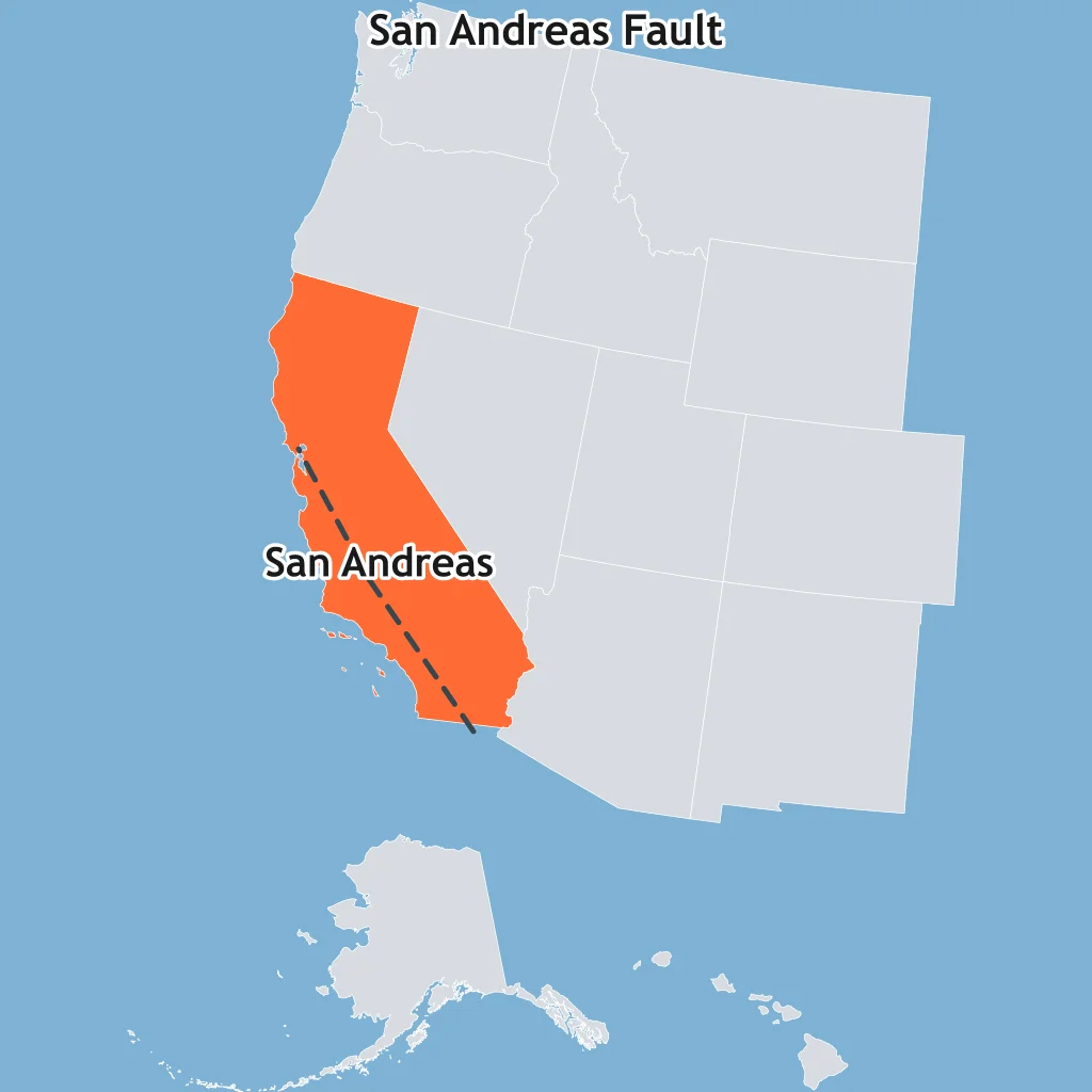
The California map marks the San Andreas Fault, where the Pacific and North American plates slide past each other. Which boundary type is it?
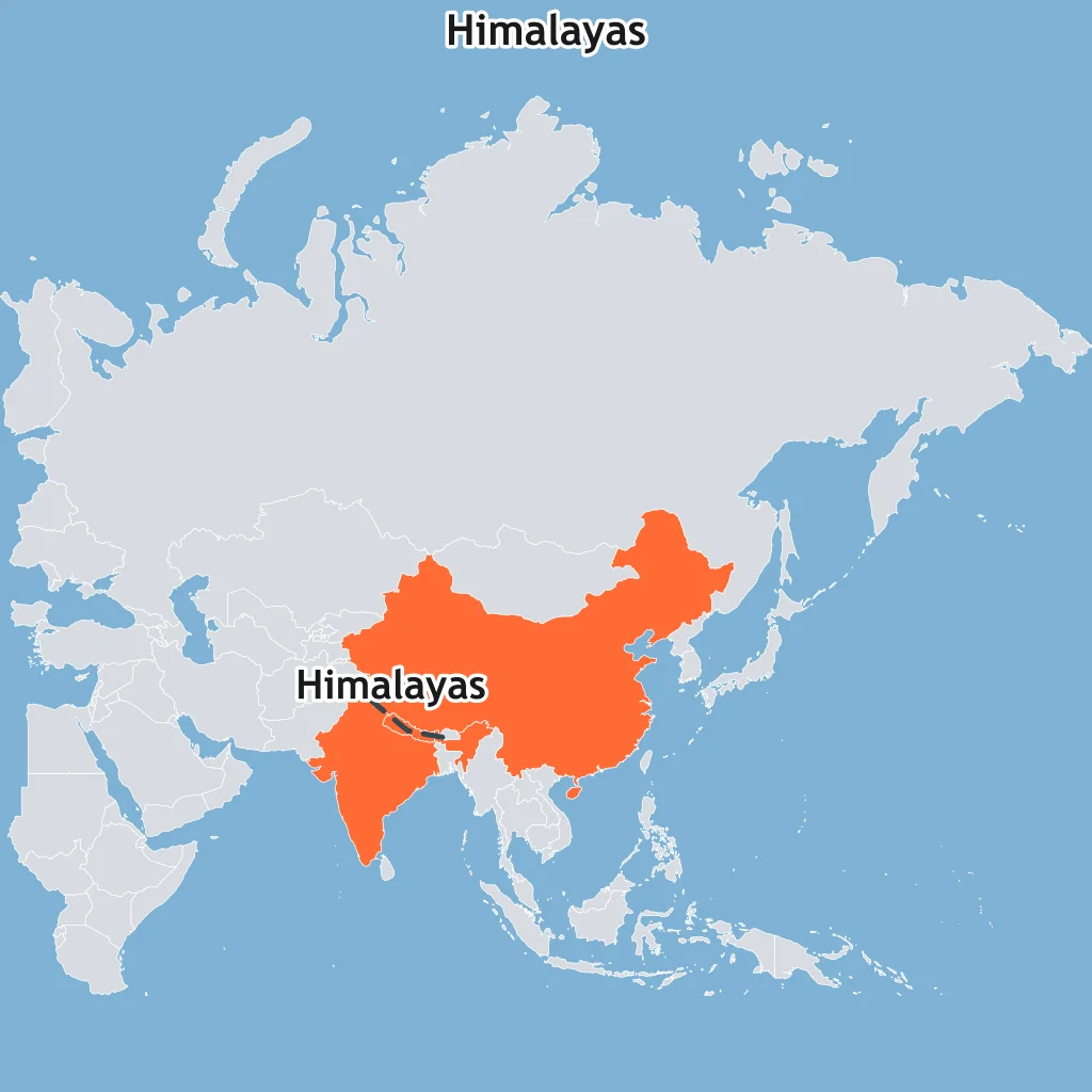
The map marks the Himalayas along the India-Eurasia collision zone. Which boundary type built this mountain belt?
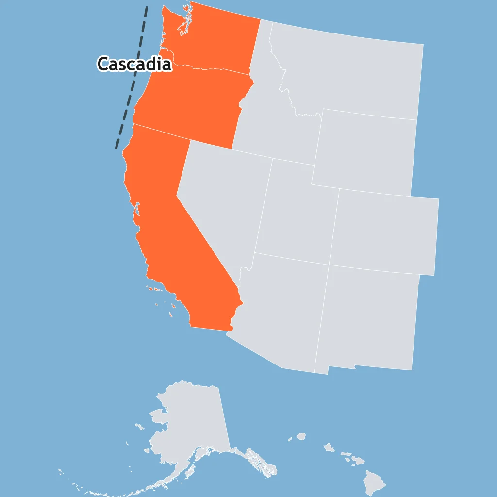
The map marks the Cascadia margin off Washington and Oregon, where Juan de Fuca oceanic lithosphere sinks beneath North America. What boundary type is it?
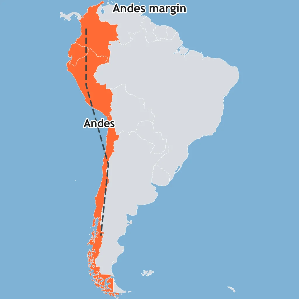
The map marks the Andes along western South America, where the Nazca Plate descends beneath South America. Which boundary type is shown?
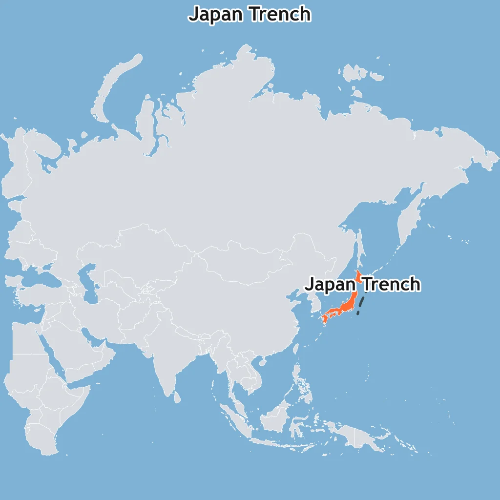
The map marks the Japan Trench east of Honshu, where the Pacific Plate begins descending beneath Japan. Which boundary type is this?
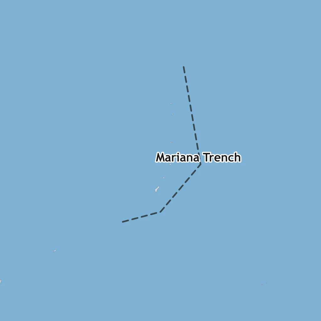
The map marks the Mariana Trench, where the Pacific Plate passes beneath the Philippine Sea Plate. What boundary type is it?
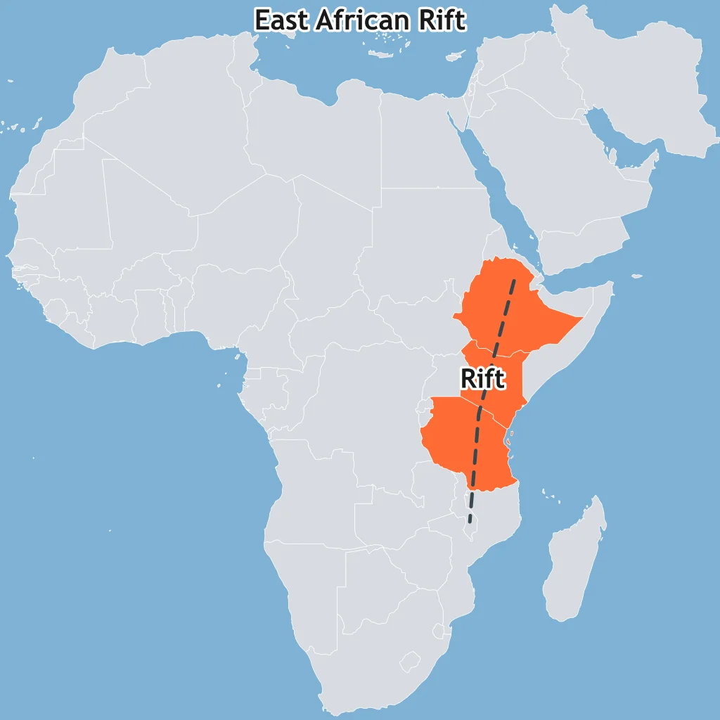
The map marks the East African Rift, where continental lithosphere is splitting into plates that move away from one another. Which boundary type fits?
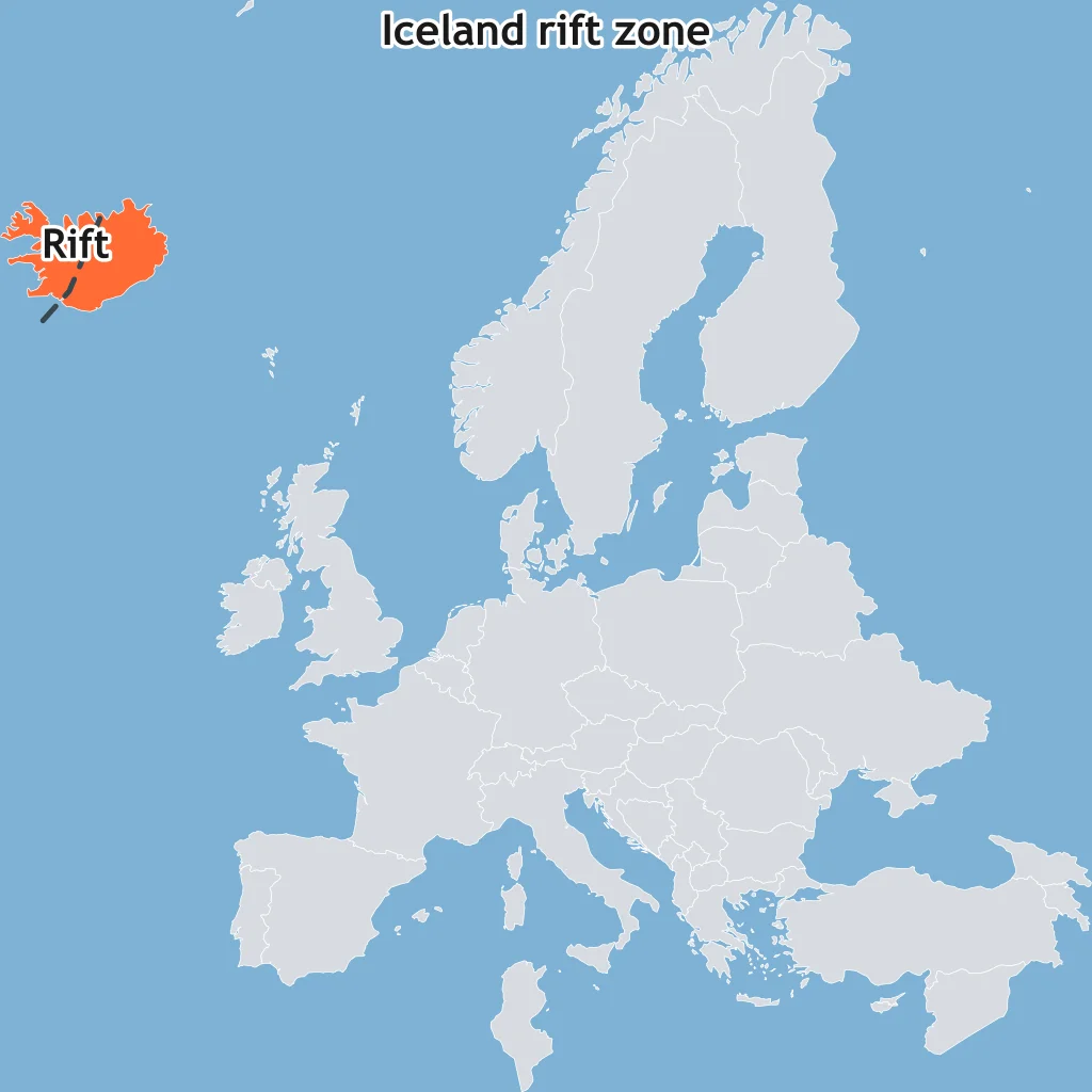
The map marks Iceland on the Mid-Atlantic Ridge, where plates spread apart through the island. Which boundary type crosses Iceland?
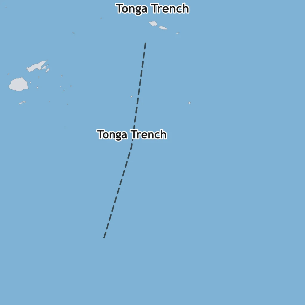
The map marks the Tonga Trench, where old dense Pacific oceanic lithosphere subducts westward. Which boundary type is shown?
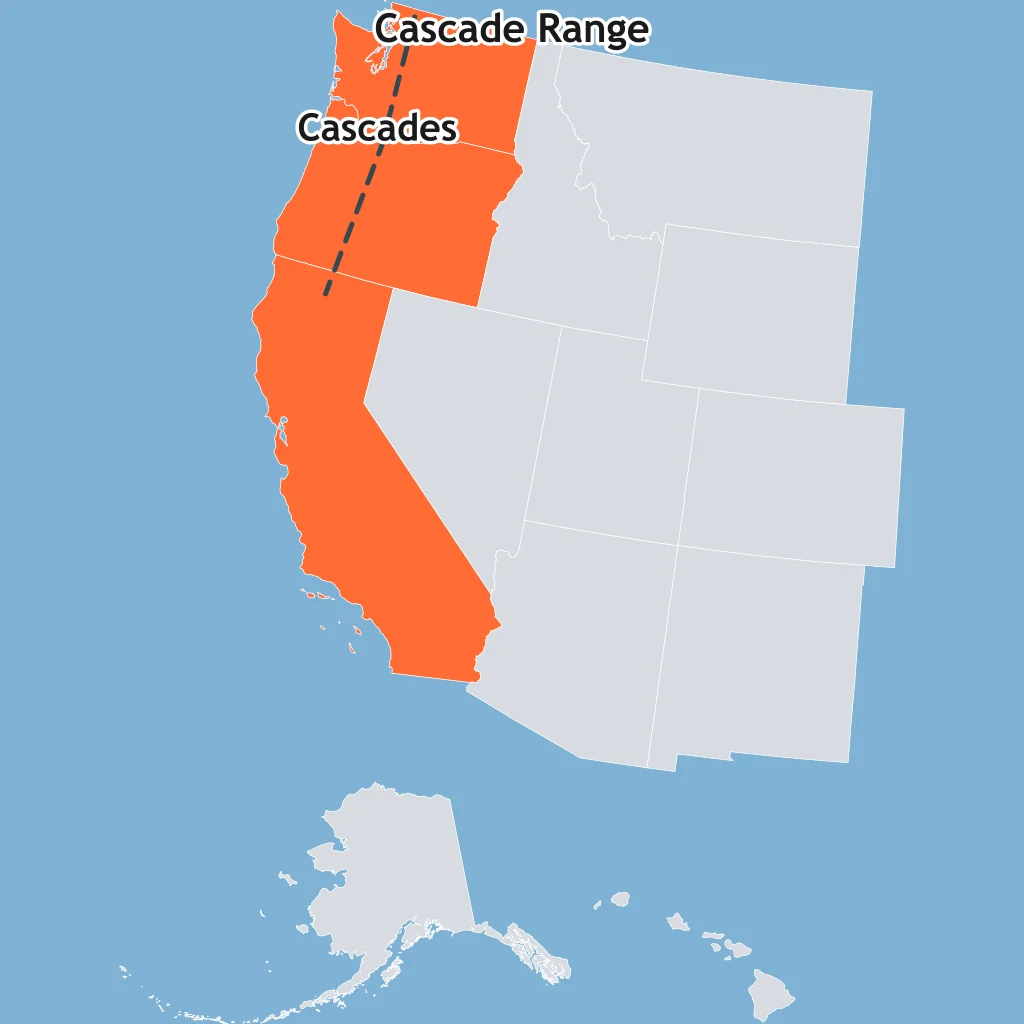
The map marks the Cascade Range inland from the Pacific Northwest trench. The volcanoes are fed by subduction offshore. What boundary type is nearby?
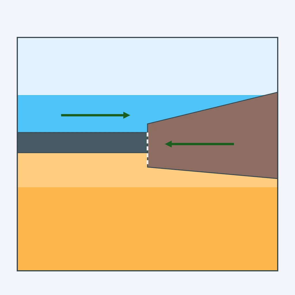
Oceanic crust with density 3.0 grams per cubic centimeter meets continental crust with density 2.7. Which crust descends at the trench?
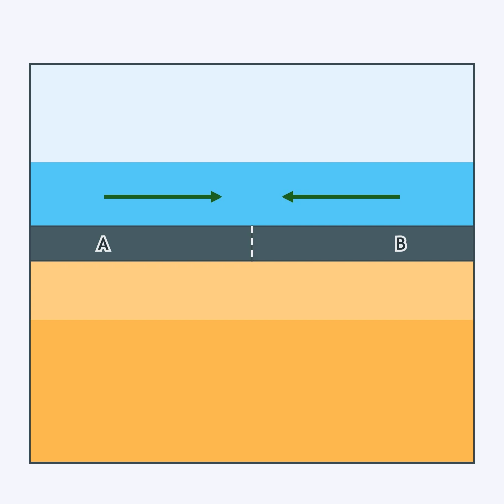
The section shows two oceanic plates converging. Plate A is older and colder with a density of 3.2, while Plate B is younger with a density of 2.9. Which plate subducts?
Two continents, both about density 2.7 grams per cubic centimeter, collide after the ocean between them closes. What happens instead of one slab sinking deep?
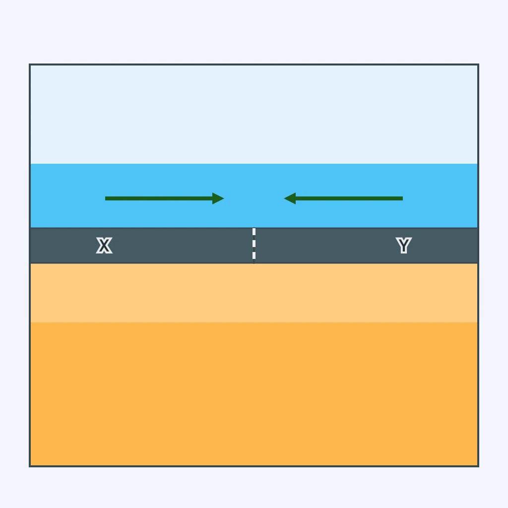
At an ocean-ocean boundary, Plate X has density 3.2 and Plate Y has density 3.0. Which slab is most likely to descend?
A thin oceanic plate with density 3.1 meets a thicker continental plate with density 2.8. Which plate goes down, and why?
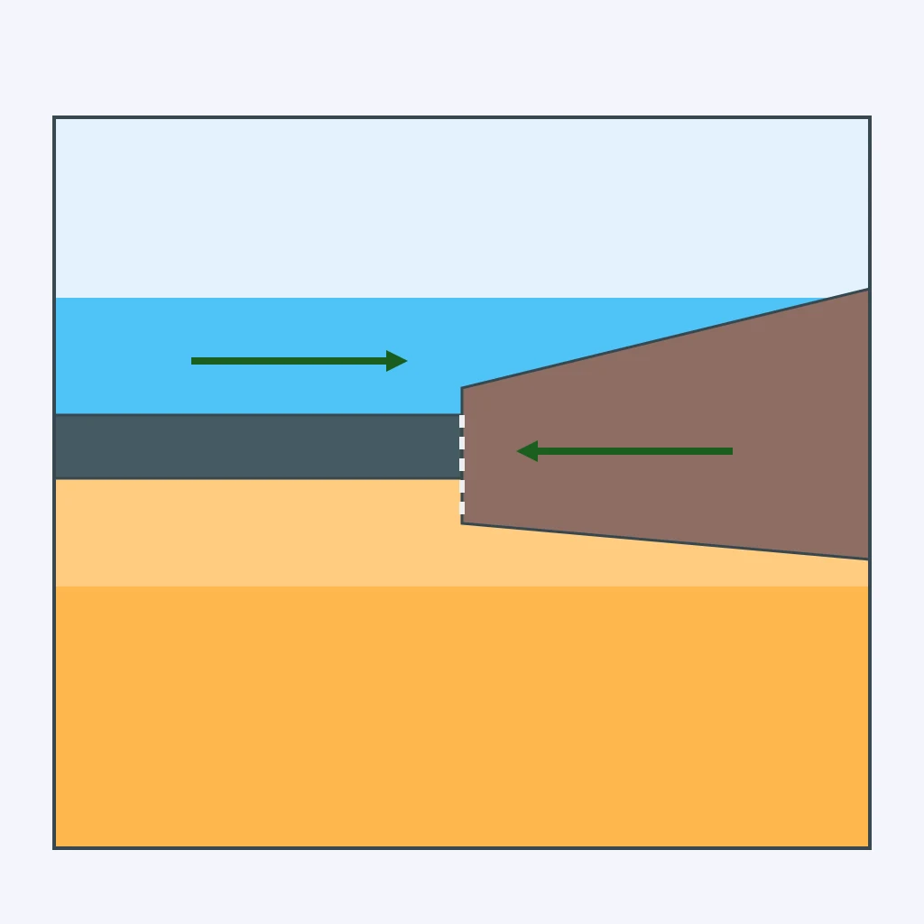
Plate A is oceanic with a density of 3.1, and Plate B is oceanic with a density of 2.9. At their convergent boundary, which plate forms the dipping earthquake zone?
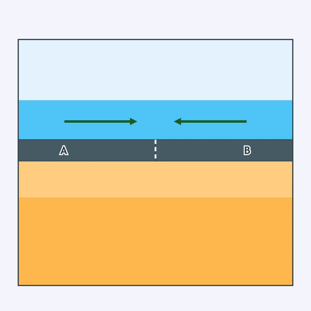
A continent with density 2.7 faces an ocean floor plate with density 3.0, and arrows show convergence. Which plate becomes the subducting slab?
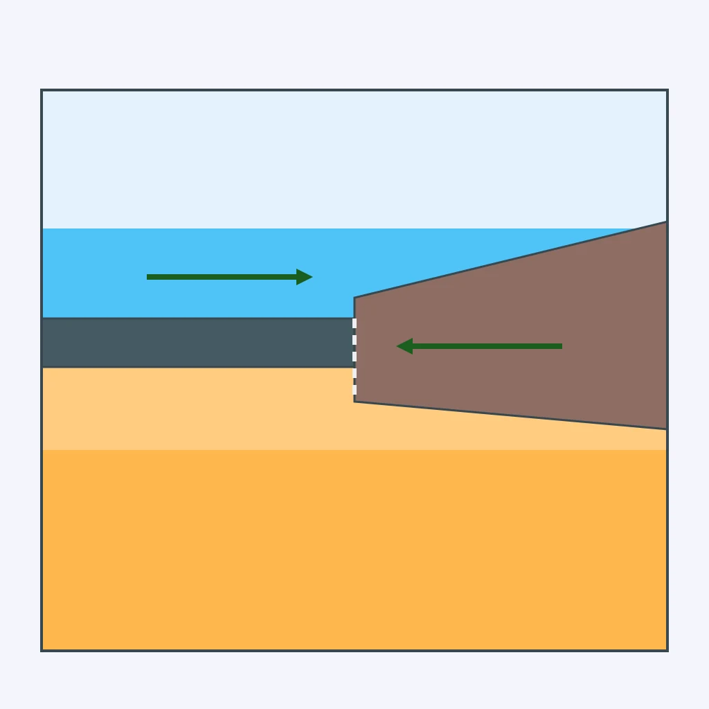
A young oceanic plate of density 2.9 meets continental crust of density 2.7 at a trench. Which crust still tends to subduct?
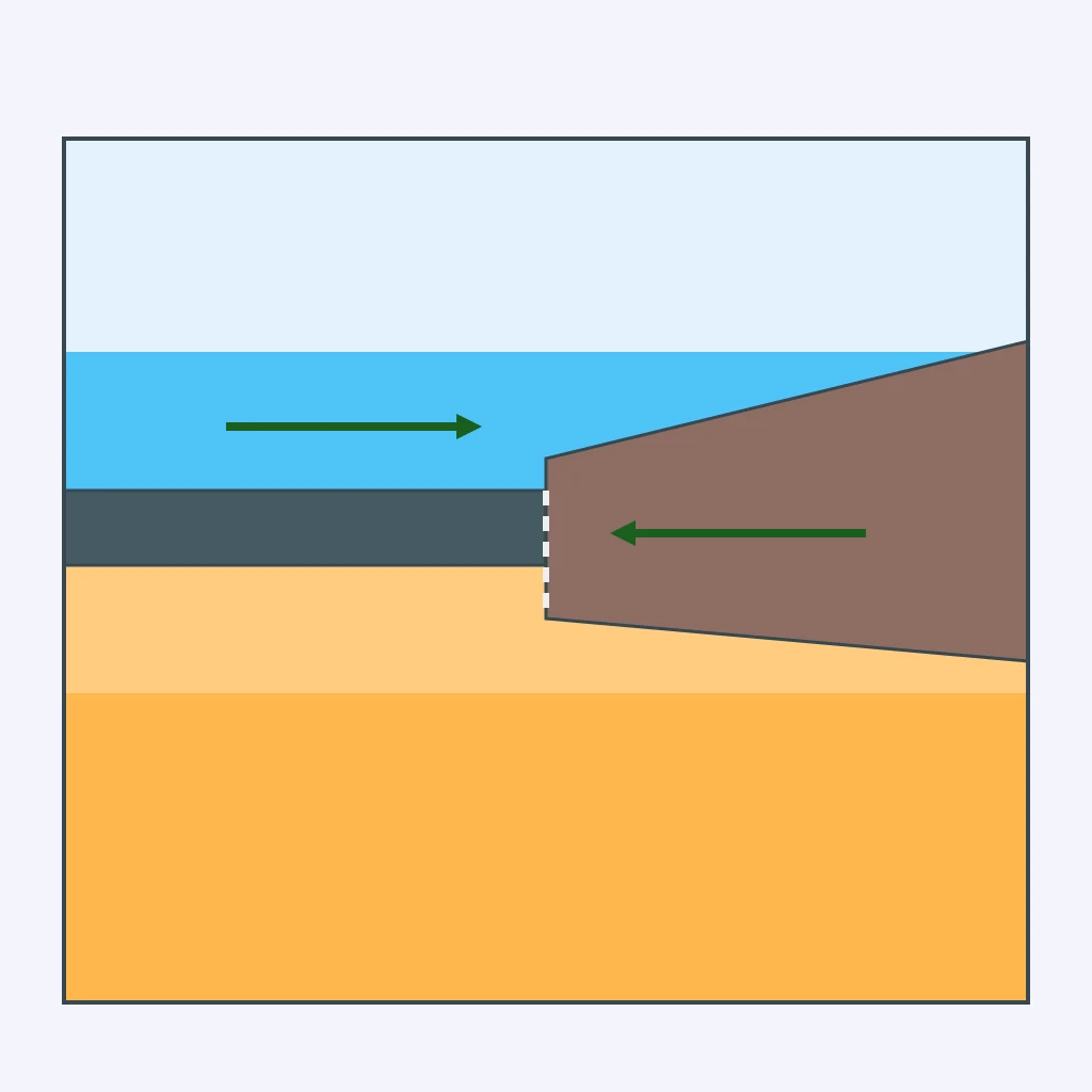
The section shows oceanic Plate P, with density 3.05, converging with continental Plate Q, with density 2.8. Which plate sinks when they collide?
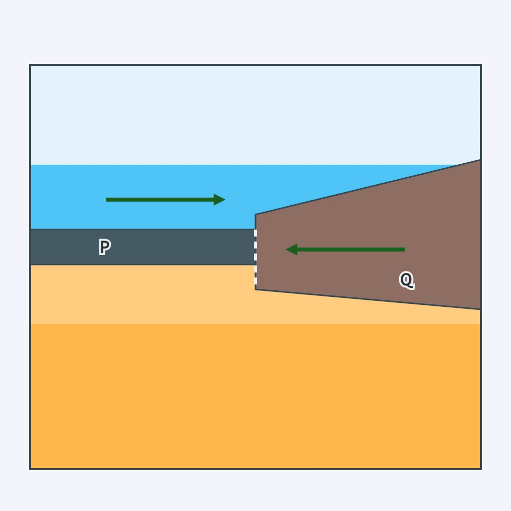
The section shows two oceanic plates converging, with west on the left. The east plate has density 3.3 and the west plate has density 3.0. Which plate descends beneath the other?
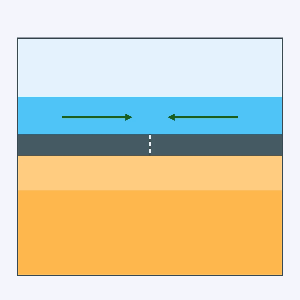
The section shows earthquake foci deepening from 20 kilometers near a trench to 600 kilometers inland. What does that pattern show?
A boundary diagram shows only shallow earthquakes along a straight side-slipping fault and no volcanic arc. What boundary behavior is most likely?
The ridge diagram shows magma rising and earthquakes limited to the upper 30 kilometers. Which activity should be expected there?
The section shows a trench offshore and a line of volcanoes on the overriding continent. What process explains the volcanoes?
The collision section shows thick continental crust, no trench, and no deep earthquake zone. What volcanic pattern is most likely along the collision?
The diagram shows an island arc with earthquake foci continuing down to about 500 kilometers beneath it. Which boundary process is indicated?
A boundary section shows plates moving apart, magma rising, and no earthquakes deeper than 30 kilometers. What earthquake pattern fits this boundary?
Crack the passcode before the zombies get in.
Answer, then swat bugs for bonus points.
Race through questions at your own speed.
Same question on every screen. Fastest wins.

Pick a tile, answer, hit bonuses and steals.
Folding, Faulting and Mountains
30 questions