Loading
by BlastRoom
Review Earth's interior, continental drift, seafloor spreading, plate boundaries, driving forces and hot spots, and deformation structures across lettered diagrams, maps and graphs.
#earth_space_science
50 questions
One question set, multiple game modes. Tap any game to see it in action. Not sure which to pick?
Answer to place stones and capture territory.
Outrun the snow together.
Earn blasts, then hunt the other team.
Answer to earn energy, then climb.

The class blasts through walls together.
Bid on mystery lots. Most money wins.
Sell tours. Nice, standard, or a total scam.

Answer, restock, and serve the rush.
More correct answers pulls the rope your way.
Answer, then shoot down the alien wave.
Answer, then tap to leap the frozen ridge.
In the diagram, layer B lies directly beneath layer A and makes up most of Earth's volume, flowing slowly as solid rock over millions of years. Which layer is B?
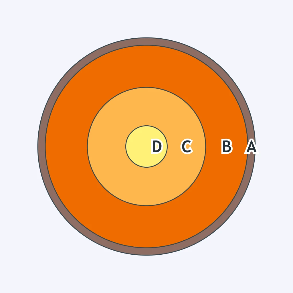
In the diagram, layer C is liquid iron and nickel whose convecting motion generates Earth's magnetic field. Which layer is C?
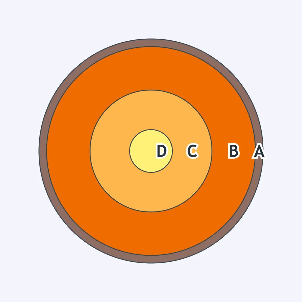
In the diagram, layer D sits at Earth's center and stays solid even though it is hotter than layer C above it. Which layer is D?
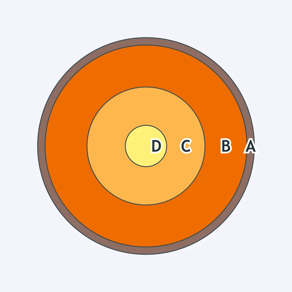
According to the diagram's depth data, about how thick is layer A, Earth's outermost layer?
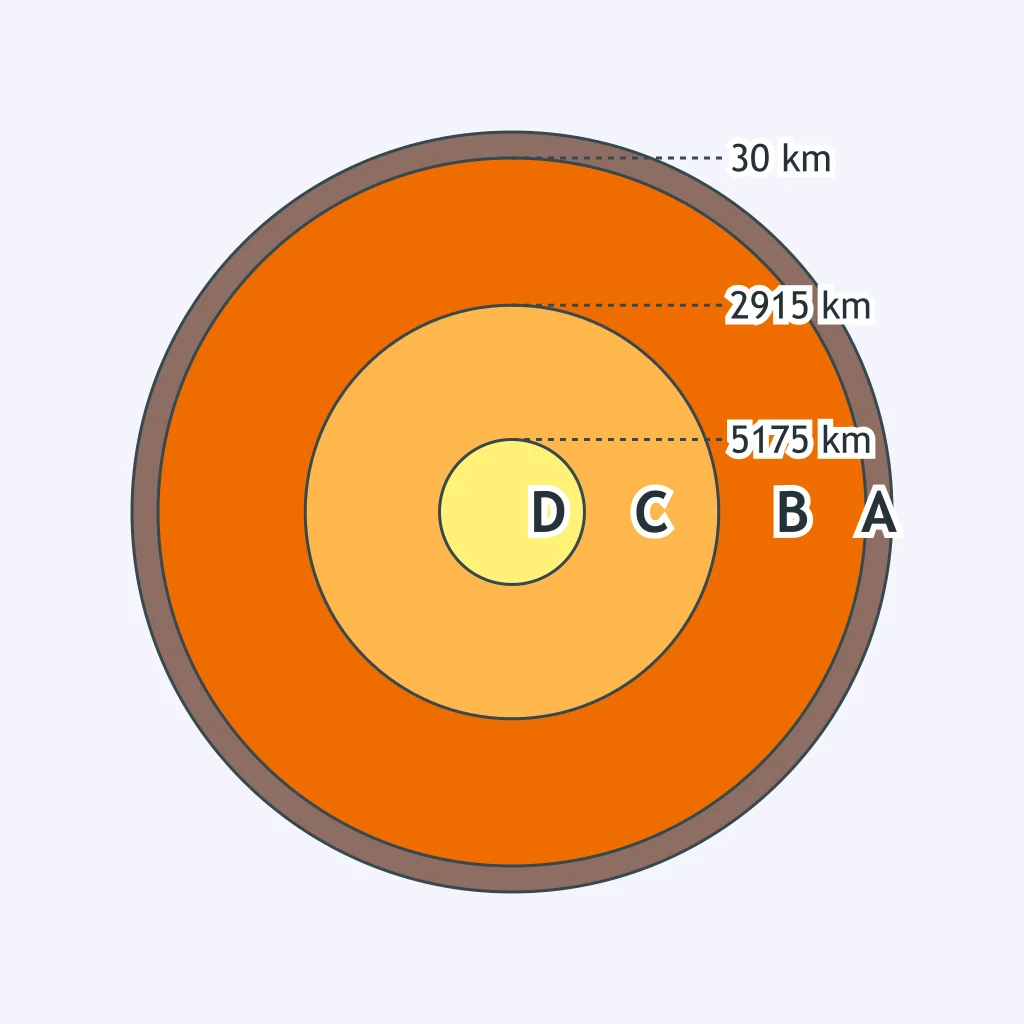
In the diagram, layer B behaves rigidly near the top, but a softer zone within B just beneath that rigid part flows plastically, letting rigid material glide above it. What is this flowing zone within B called?
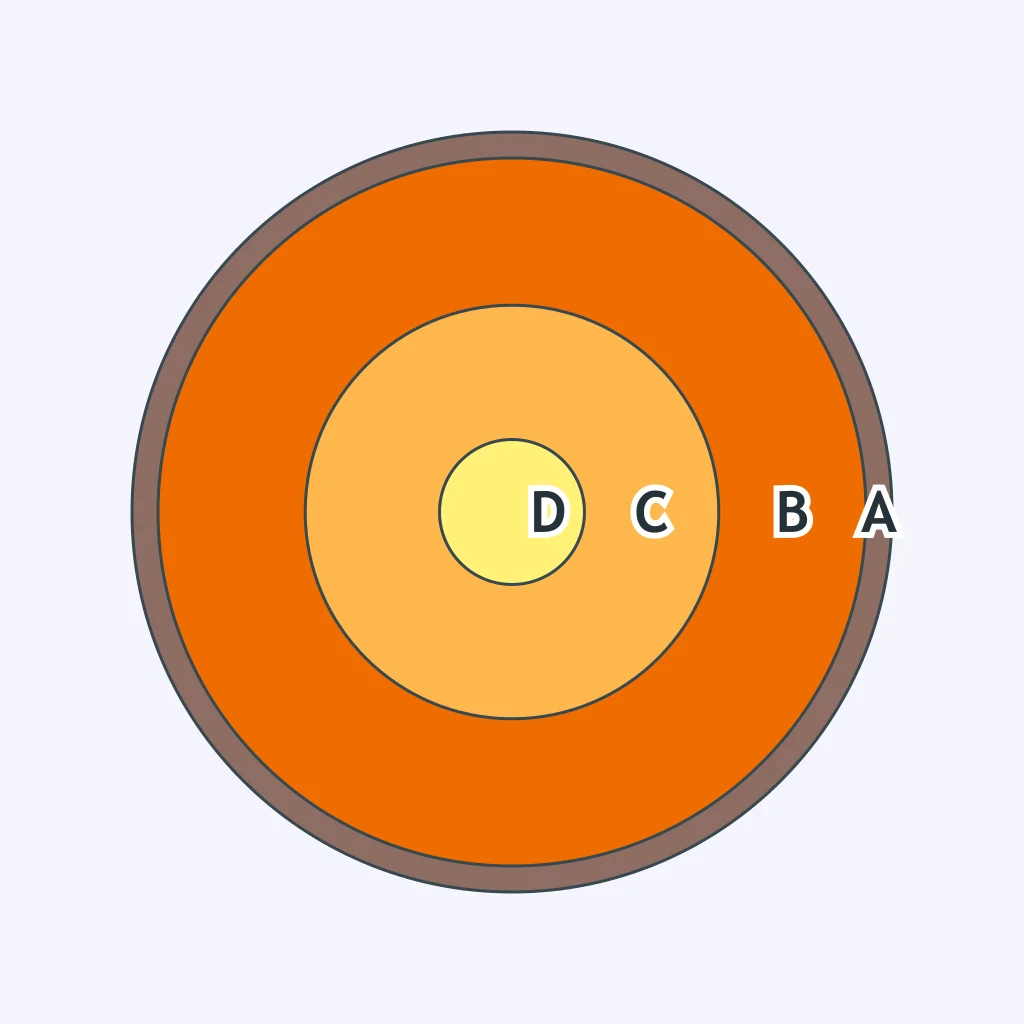
True or False: The outer core is liquid, while the inner core is solid despite reaching a higher temperature.
Which seismic wave can travel through both solid and liquid material, letting scientists detect Earth's liquid outer core?
In 1909, Andrija Mohorovicic studied seismic records from a Croatian earthquake and found P waves arriving in two separate sets at the same stations. Which boundary did this pattern reveal?
Which scientist calculated the depth of Earth's core-mantle boundary, at about 2900 kilometers, using the size of the P-wave shadow zone?
In 1936, Inge Lehmann showed that Earth's core has a separate inner core. What kind of evidence did she use?
The Cape Fold Belt of South Africa matches in rock type, age, and fold structure with the Sierra de la Ventana range of Argentina, continents an ocean apart today. What did this matching mountain belt provide evidence for?
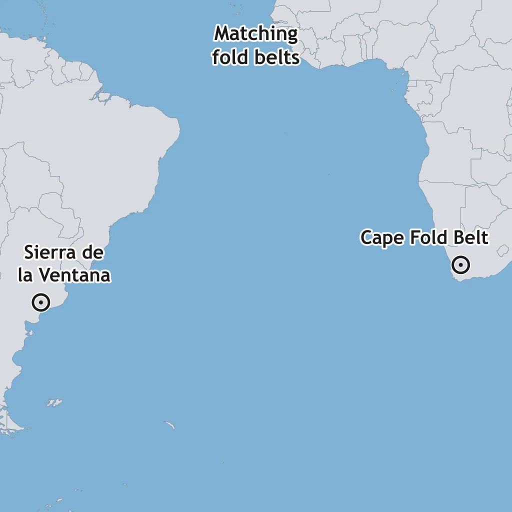
Wegener named his single ancient supercontinent Pangaea, using a Greek term he chose to mean what?
Wegener's reconstruction placed present-day India, Antarctica, and Australia together along one edge of Pangaea, based on shared fossils and glacial deposits linking them. Which present-day ocean now separates these three landmasses from each other?
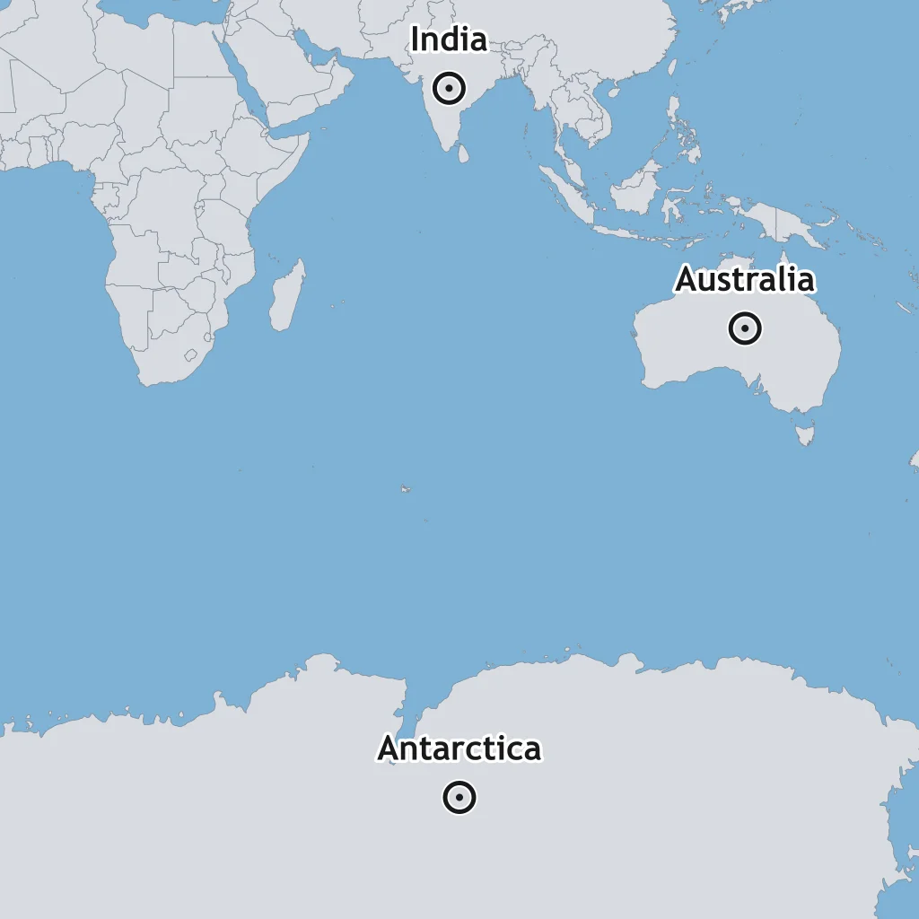
Which term names the single global ocean that Wegener's reconstruction shows surrounding Pangaea?
When mapped along the edges of the continental shelves rather than the modern shorelines, the coastlines of South America and Africa align with about 97 percent accuracy. What did this close jigsaw fit suggest to Wegener?
True or False: Wegener's assembled evidence included matching glacial striations, scratch marks left by ice flow, found across now widely separated continents such as South America, Africa, India, and Australia.
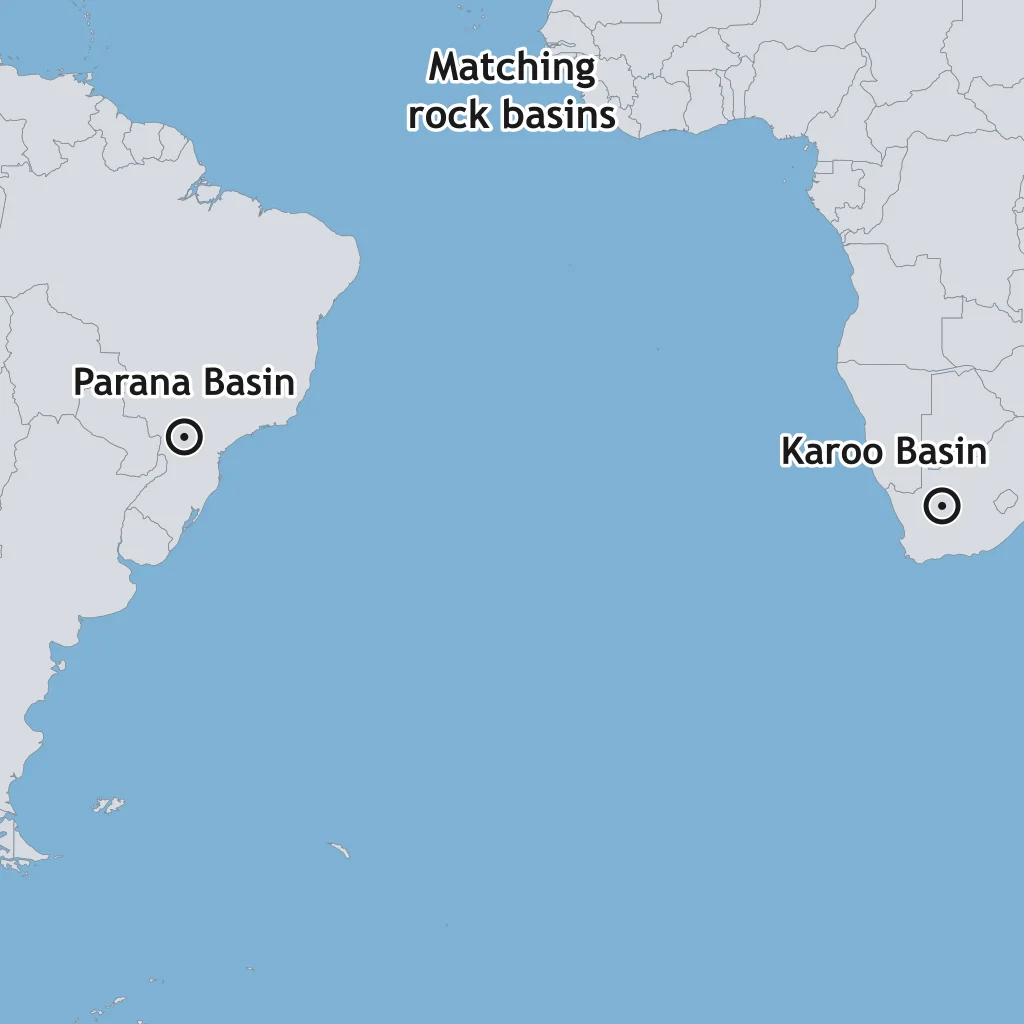
Layered rock sequences of matching sandstone, shale, and coal occur in the Karoo Basin of South Africa and the Parana Basin of Brazil, formed under the same ancient climate. What did this matching sequence show?
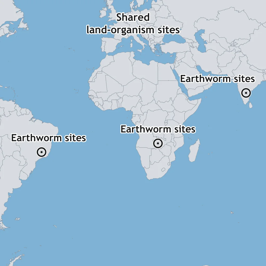
Certain species of freshwater earthworms and land snails live today only in parts of South America, Africa, and India, separated by open ocean they could never cross alive. What did this distribution show Wegener about these landmasses?
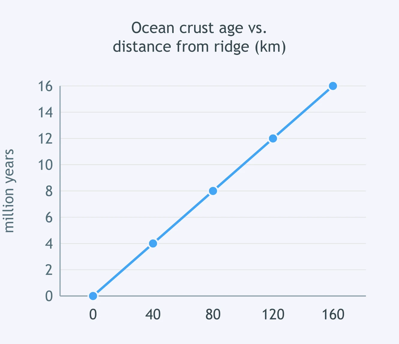
The graph plots ocean crust age, in millions of years, against distance from a ridge crest, in kilometers, along a steady, straight-line trend. About how old is crust located 120 kilometers from the ridge?
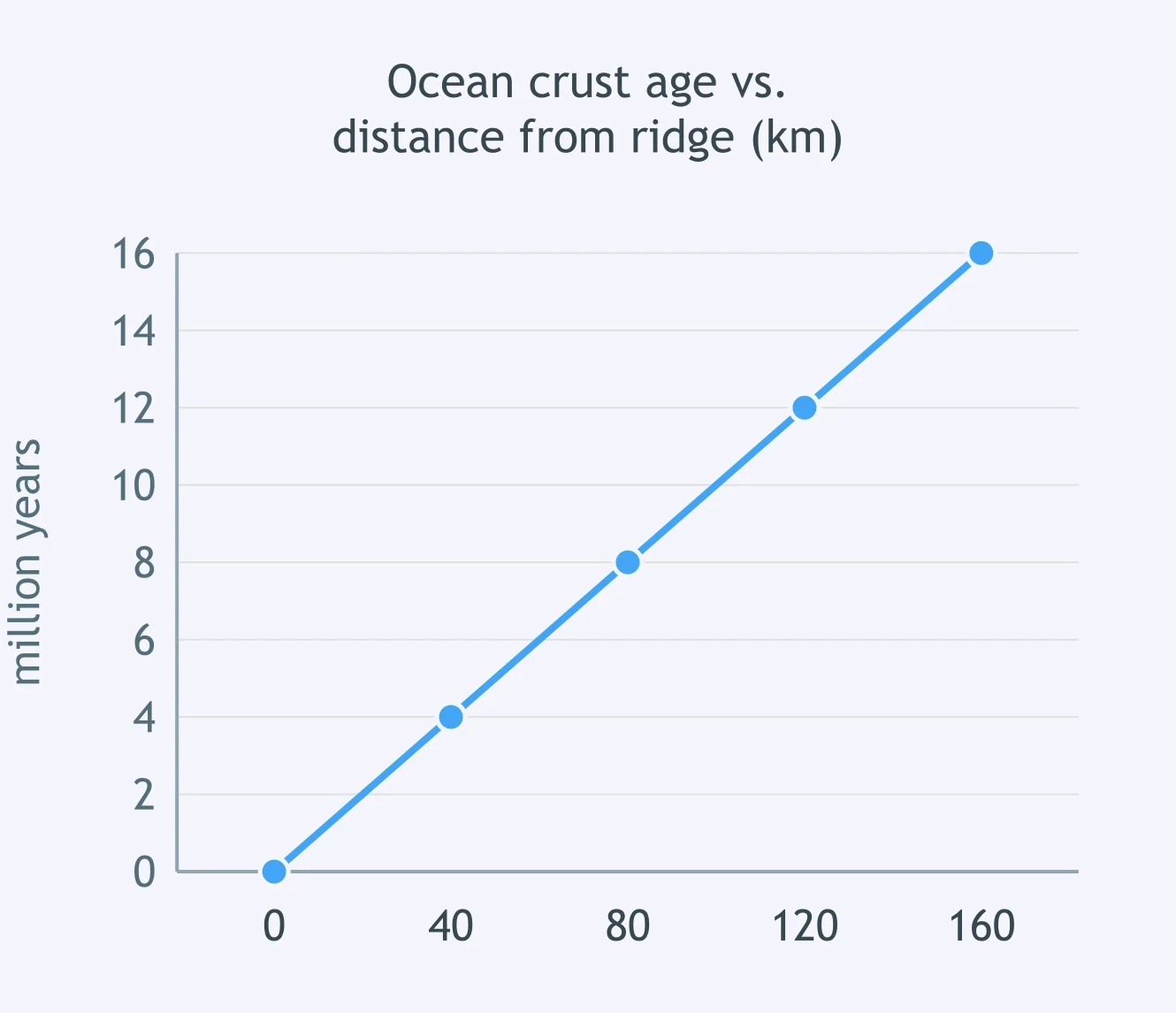
Using the same graph of ocean crust age against distance from the ridge, what is the approximate spreading rate, in kilometers per million years?
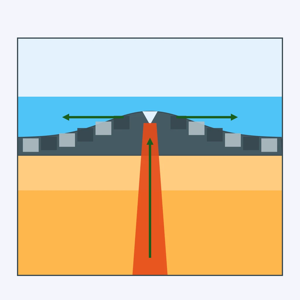
The section shows magnetic stripes in the seafloor on both sides of a mid-ocean ridge. What does the pattern of stripes on the two sides of the ridge indicate?
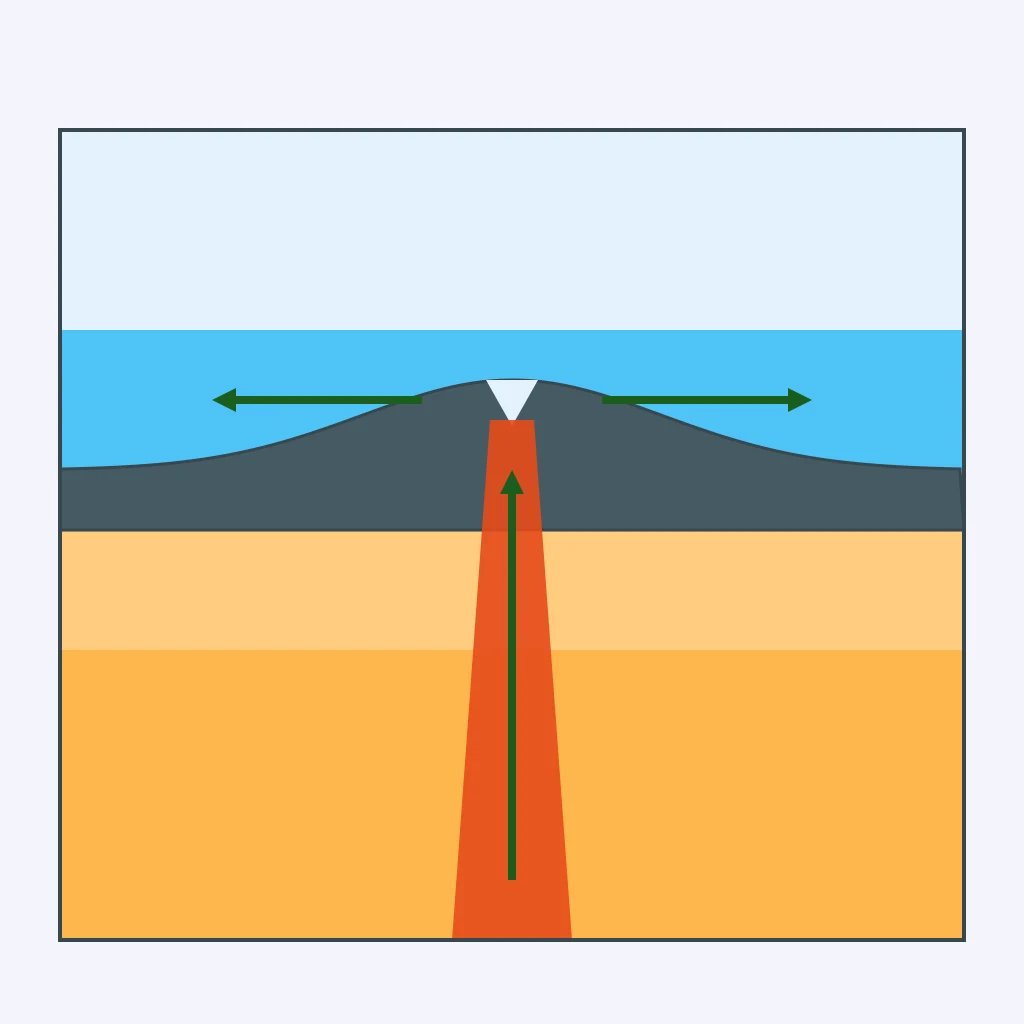
True or False: Ocean crust is destroyed and recycled at spreading ridges, the same place where it forms.
A drill core taken 90 kilometers from a mid-ocean ridge crest is dated at 3 million years old. Using 1 kilometer = 100,000 centimeters, what is the spreading rate on that side of the ridge, in centimeters per year?
Two drill cores are taken from the same side of a mid-ocean ridge: one 40 kilometers from the crest, the other 160 kilometers from the crest. Which core has the older crust?
At a mid-ocean ridge like the one in the section, fresh, dark basaltic rock is exposed right at the ridge axis, and a blanket of sediment on the crust gets thicker farther from the axis. What does this sediment pattern show about crust age?
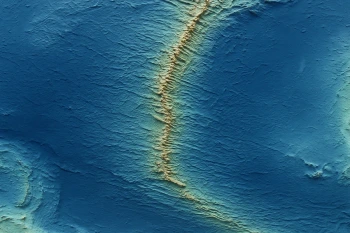
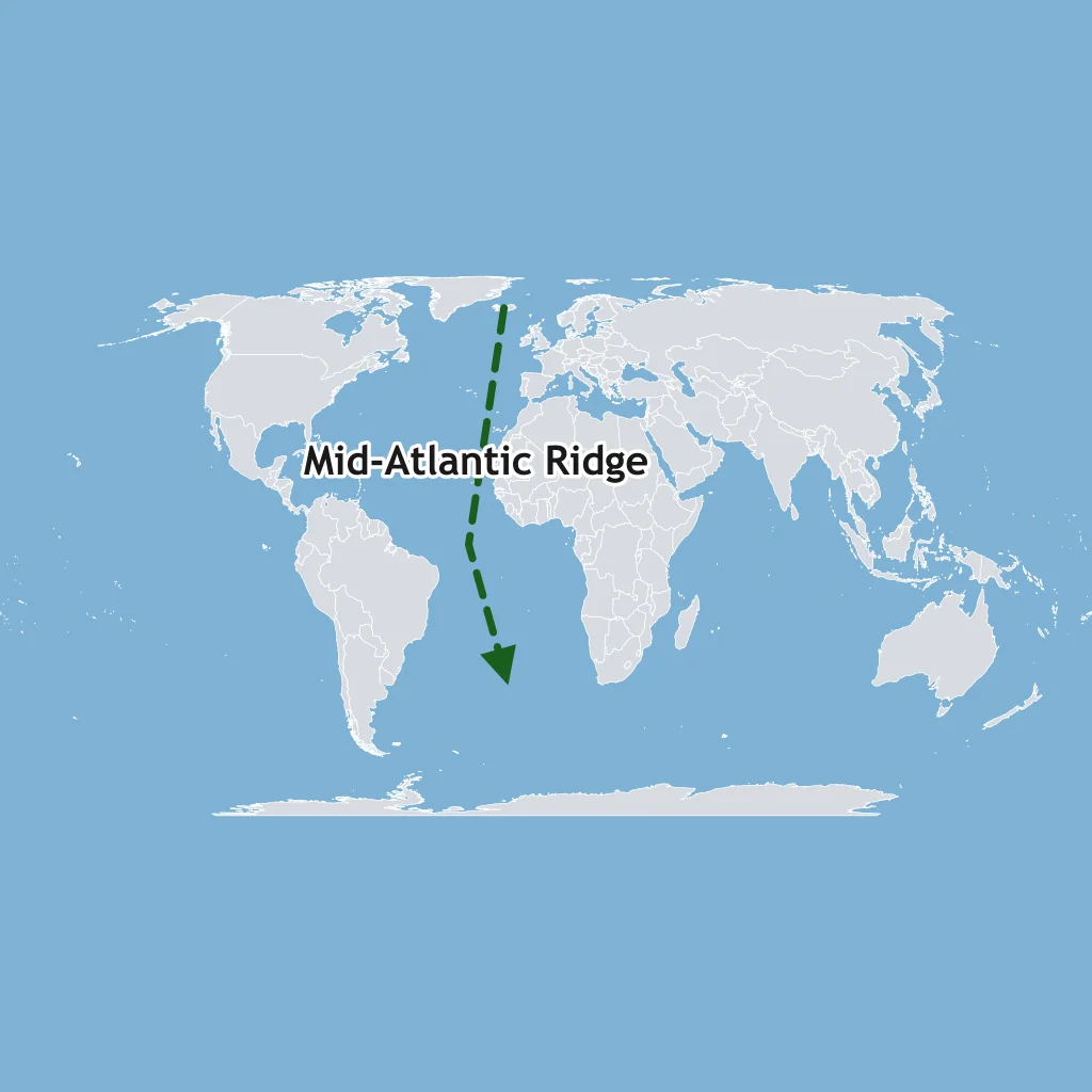
The map shows the Mid-Atlantic Ridge running down the center of the Atlantic Ocean floor. The oldest ocean crust in the Atlantic is found nearest the coastlines of the Americas, Europe, and Africa. What does this pattern confirm about seafloor spreading?
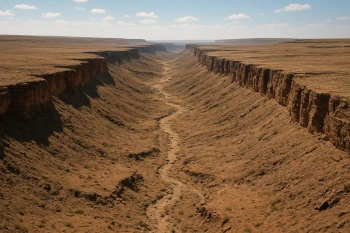
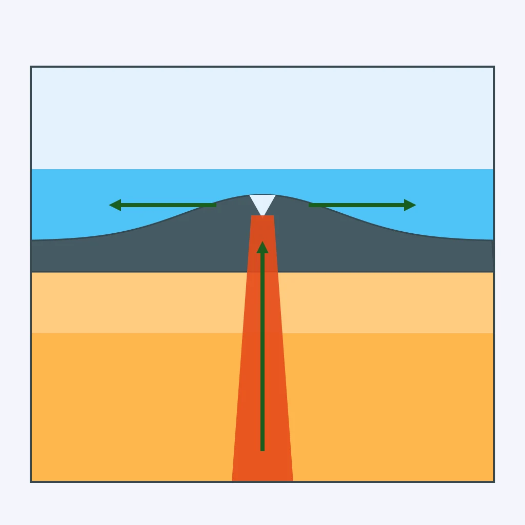
The section shows two plates pulling apart along a central rift, with fresh basalt filling the widening gap between them. Which boundary type is this?
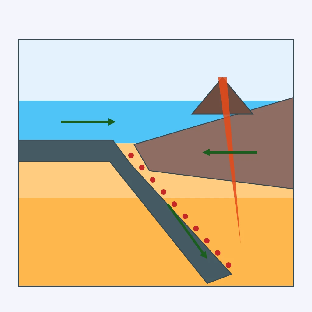
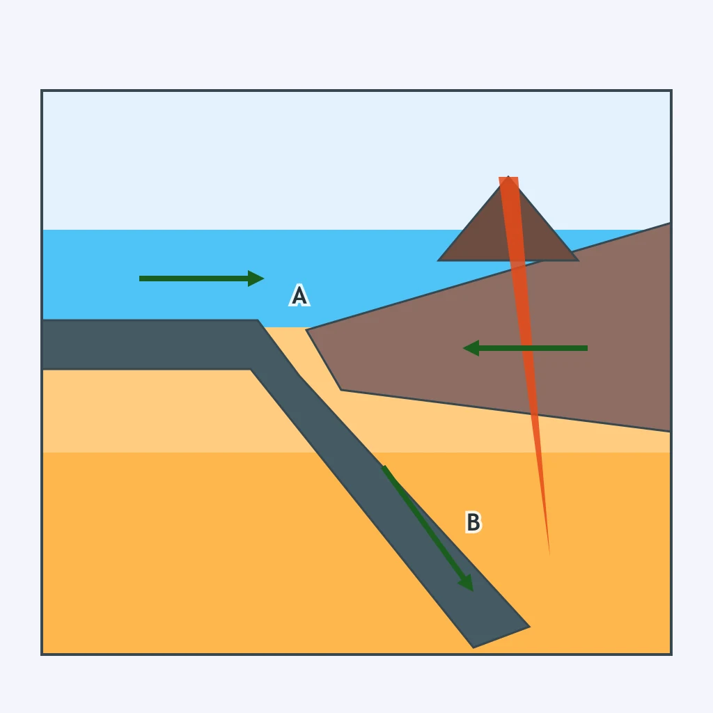
One ocean plate curves steeply downward beneath another in the section, with a deep trench at the bend and earthquake foci deepening inland. Which boundary type does this pattern mark?
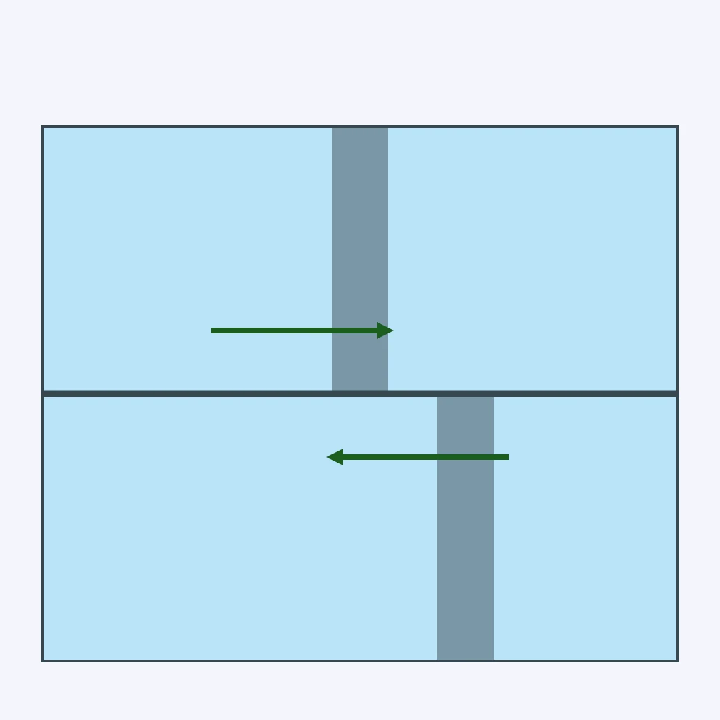
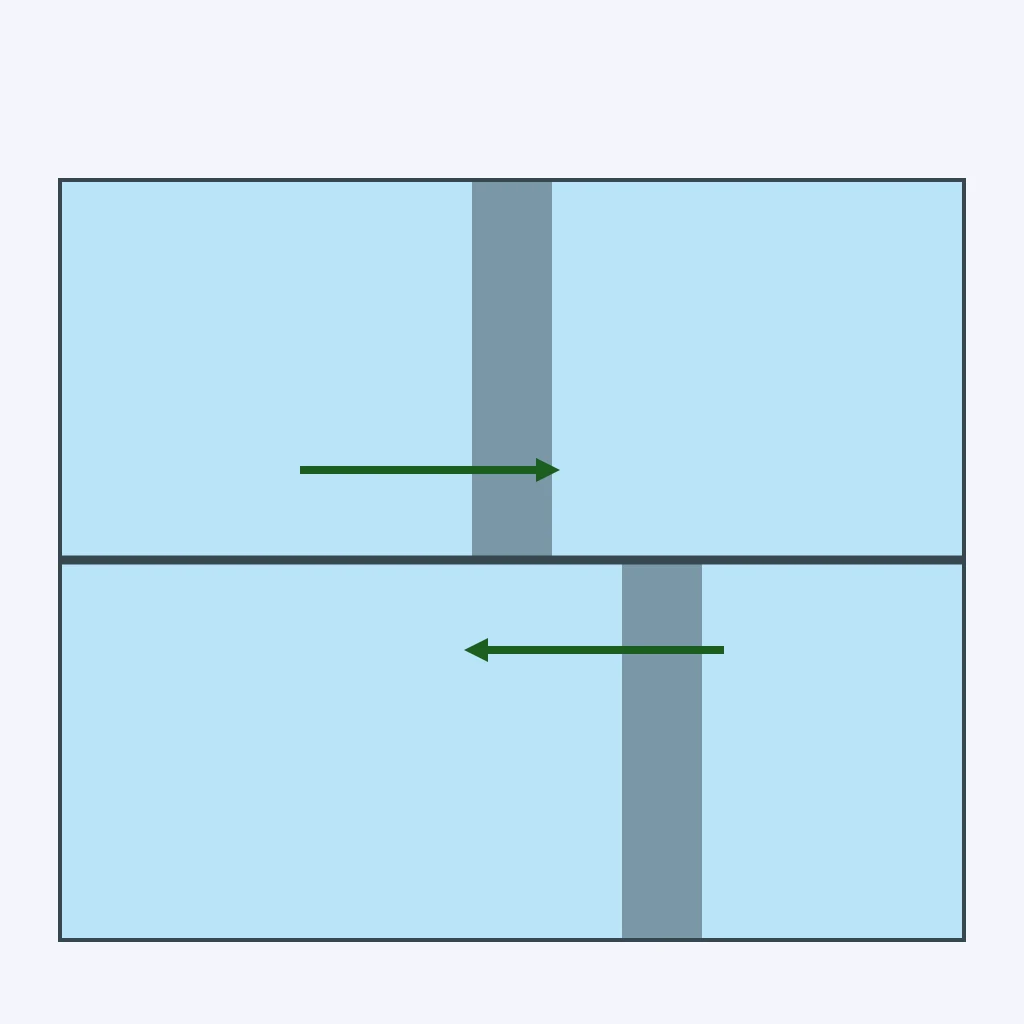
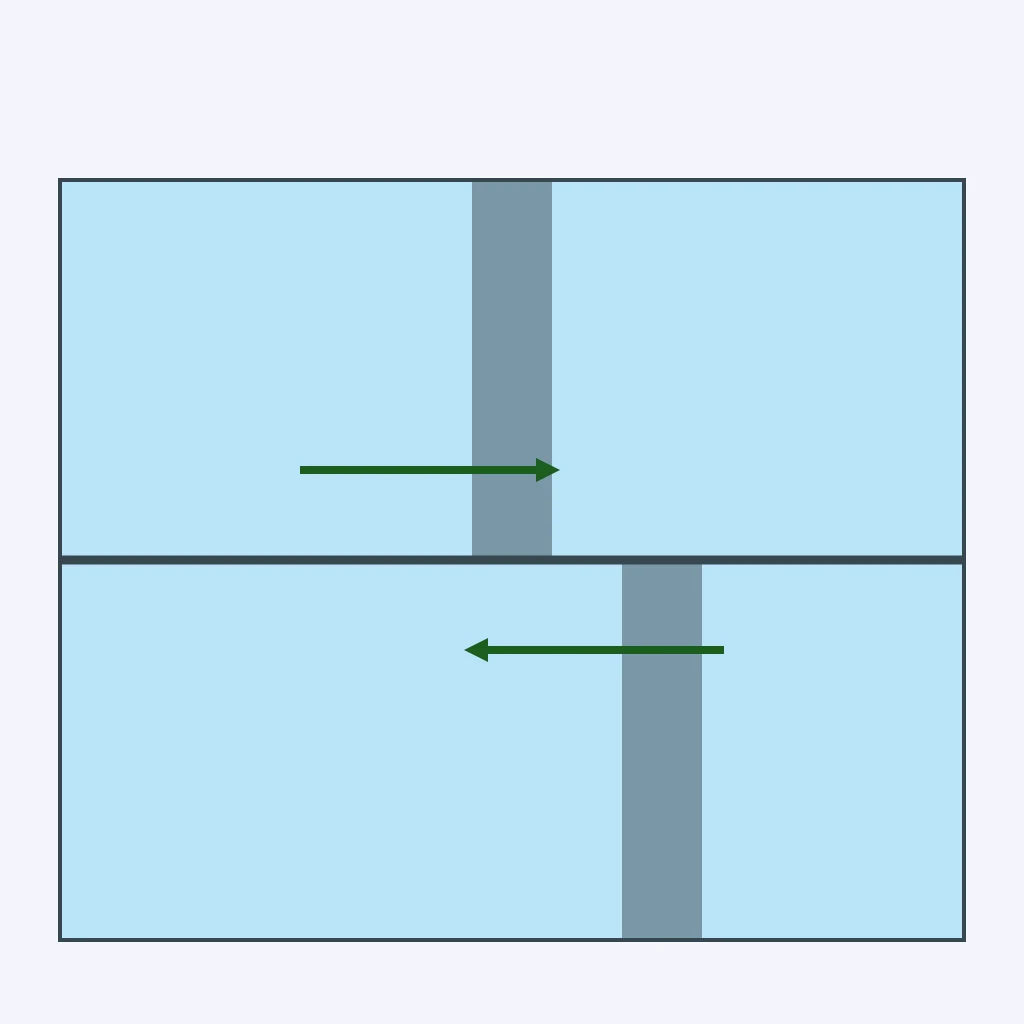
Two plates in the section slide horizontally past each other along a near-vertical fault, with neither plate rising, sinking, or being destroyed. What kind of boundary is drawn?
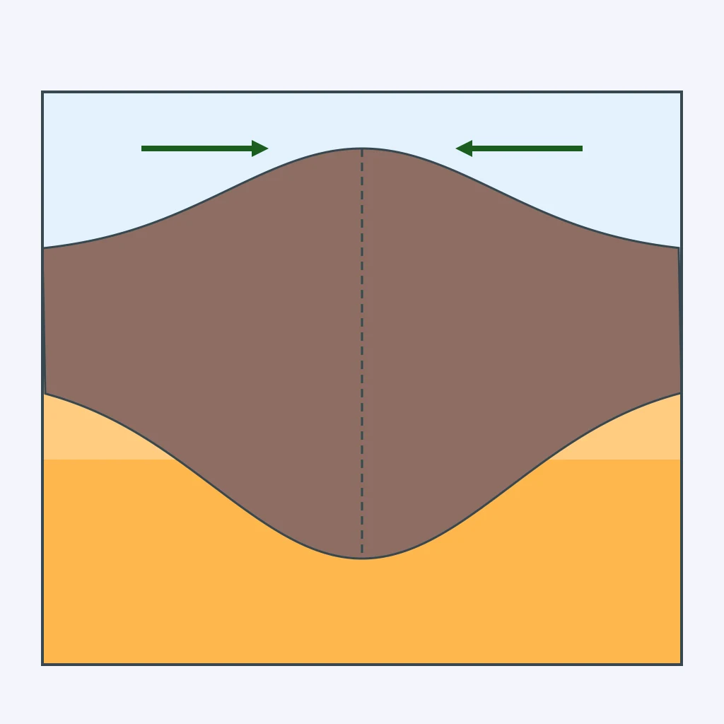
Two blocks of continental crust in the section press together, thickening and folding upward with no slab descending into the mantle. This pattern marks which boundary type?
True or False: A transform boundary typically produces a chain of active volcanoes along the fault, the same way a subduction zone does.
In the section, the plate first bends downward at feature A, forming a deep trench, then continues sinking to feature B at greater depth inland. Which boundary type produces this pattern?
The two blocks on either side of the fault in the diagram move in opposite horizontal directions, with neither block thickening or being destroyed. What boundary type is this?
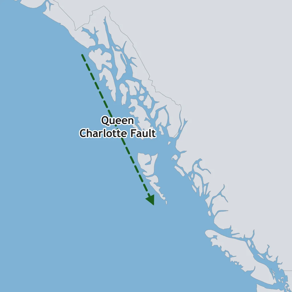
The Queen Charlotte Fault off the coast of British Columbia lets the Pacific Plate slide horizontally past the North American Plate, producing large earthquakes but no chain of volcanoes. Which boundary type runs along it?
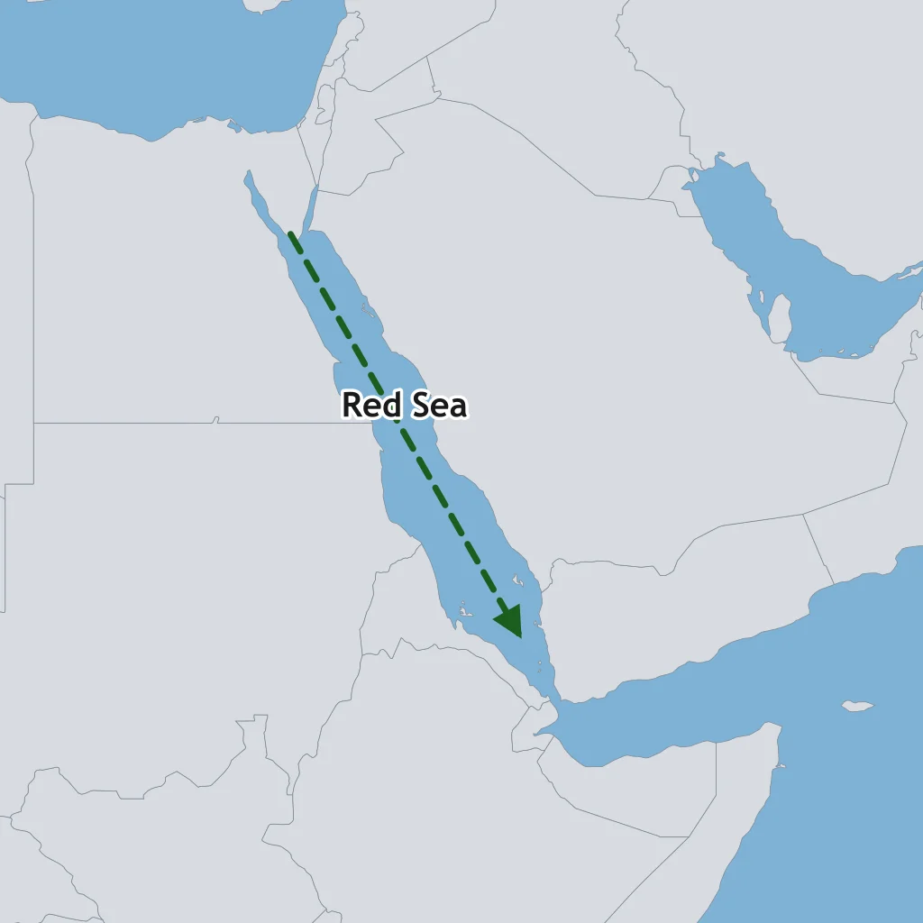
The Red Sea is widening as the Arabian and African plates pull apart, with new oceanic crust beginning to form along its length. Which boundary type is forming there?
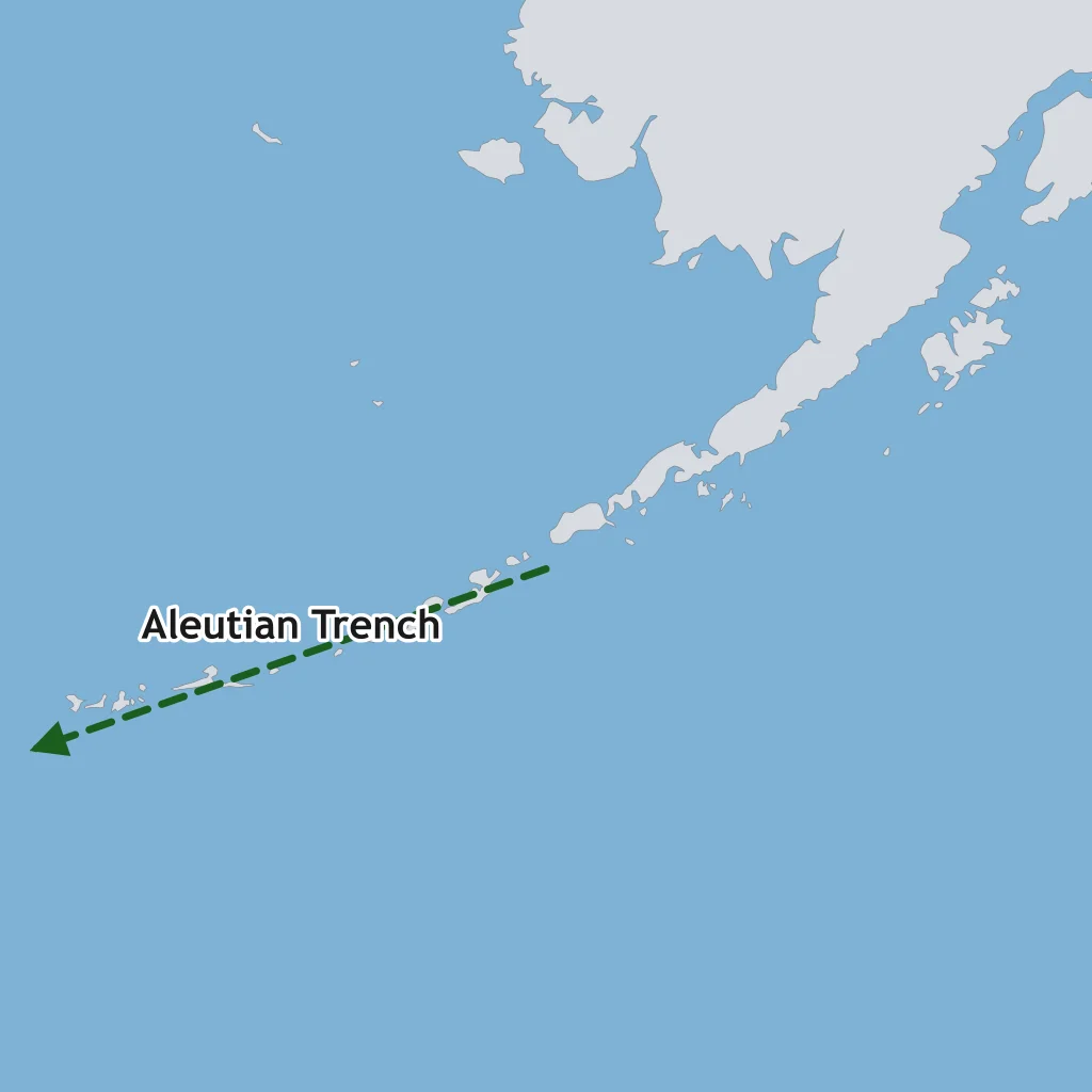
Along the Aleutian Trench, the Pacific Plate bends downward beneath the North American Plate, producing a curved chain of volcanic islands. Which boundary type is this?
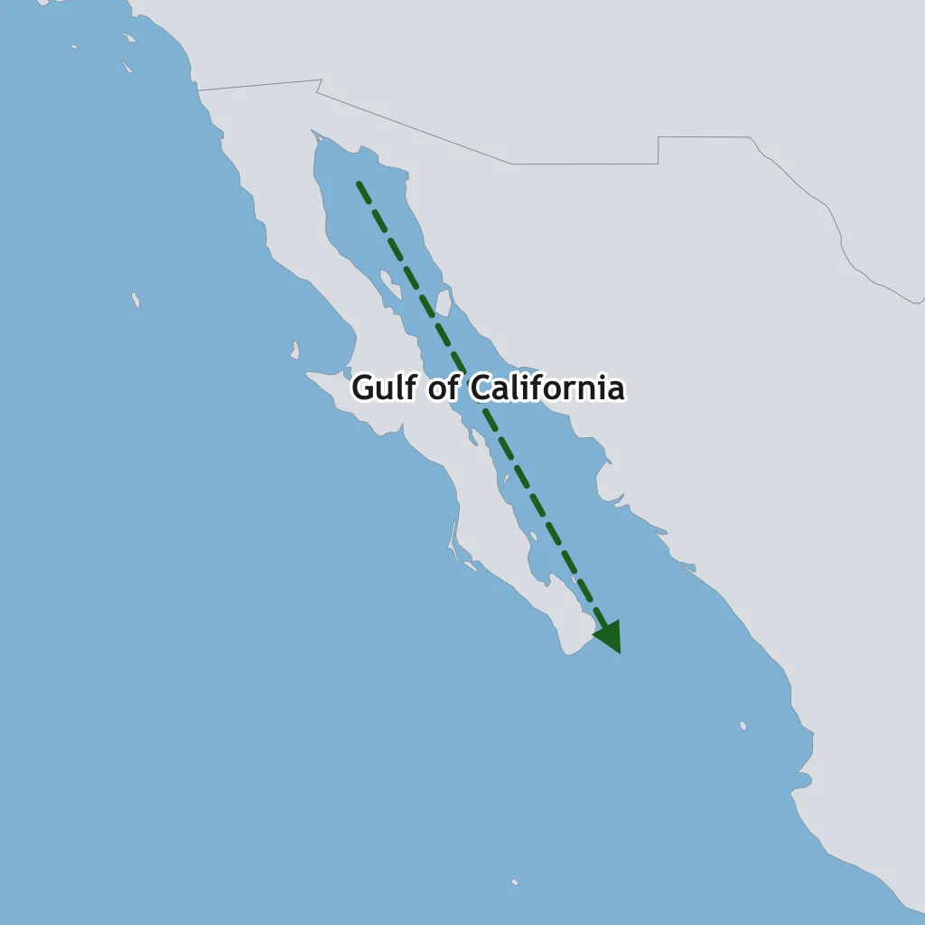
The Gulf of California is widening as the Baja California peninsula pulls away from mainland Mexico, with new oceanic crust forming along the spreading center between them. Which boundary type is this?
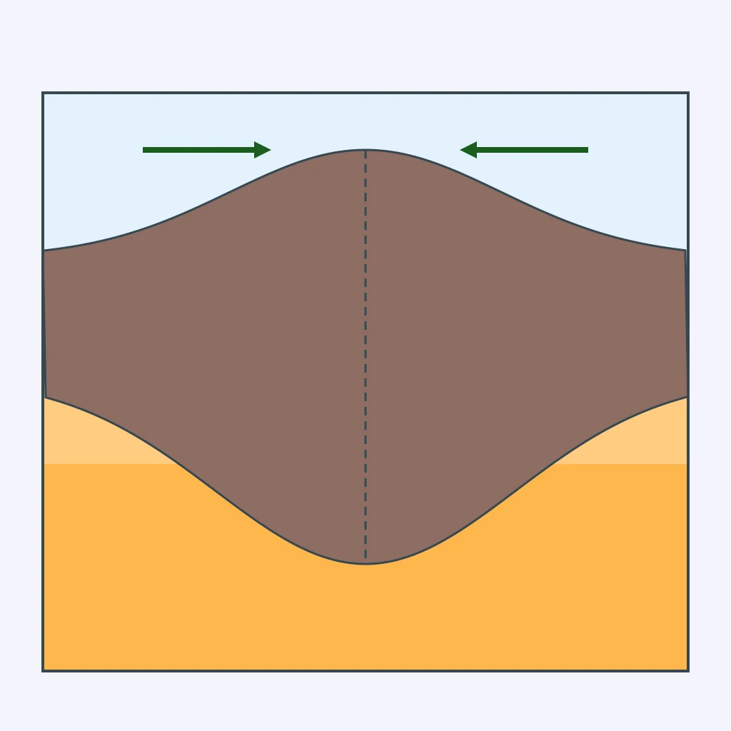
The section shows two continental plates pressed together, with neither slab descending into the mantle, as the crust thickens and rises into a high plateau. Which boundary type produced this pattern?
The diagram shows mantle rock rising beneath a ridge, spreading sideways, cooling, and sinking again in a continuous loop. What is this circulating pattern called?
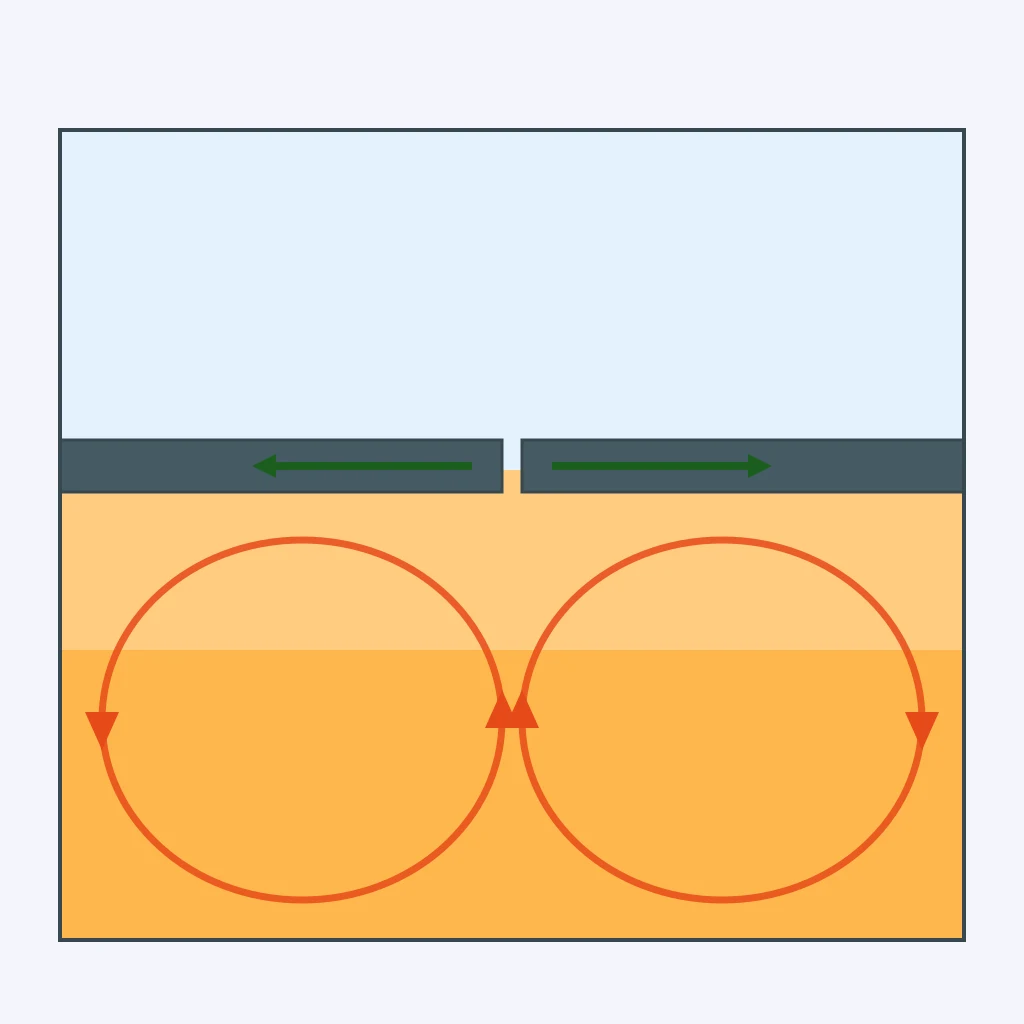
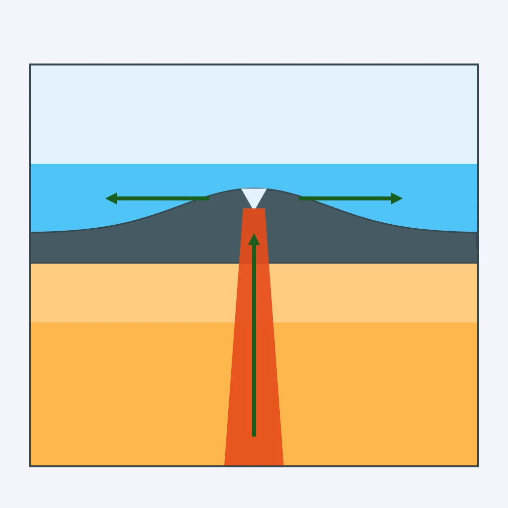
In the diagram, newly formed lithosphere at the ridge is elevated and slides downhill away from the ridge as it cools and thickens. Which driving force does this describe?
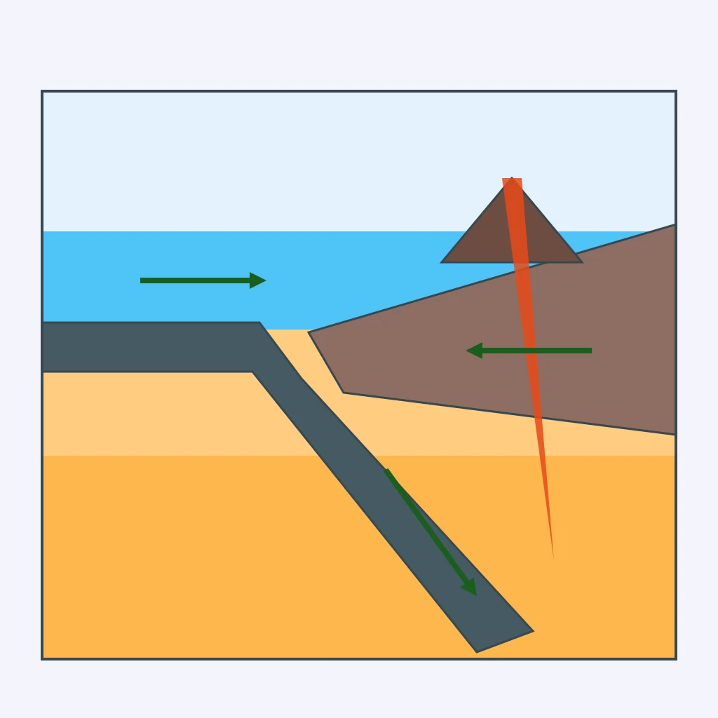
In the diagram, a cold, dense slab sinks into the mantle at the trench, dragging the rest of the plate along behind it. Which driving force does this describe?
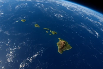
The map shows the ages of extinct calderas along the Snake River Plain, ending at Yellowstone. What does this age pattern show?
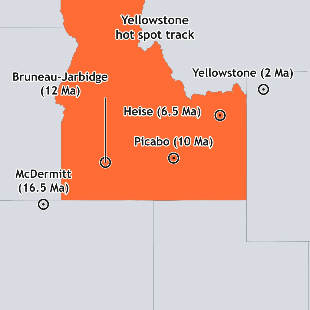
Using the ages marked on the map of the hot spot track, which caldera site is the oldest?
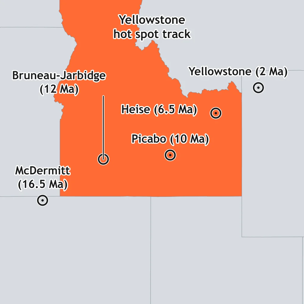
Which observation is the strongest evidence that a hot spot's heat source lies deep in the mantle rather than in the shallow crust beneath a plate boundary?
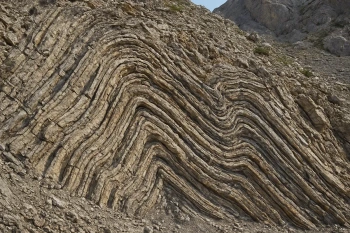
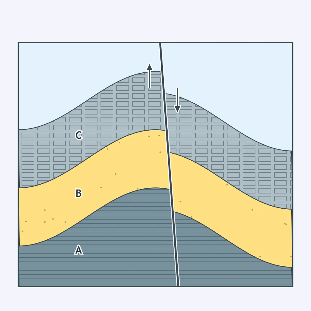
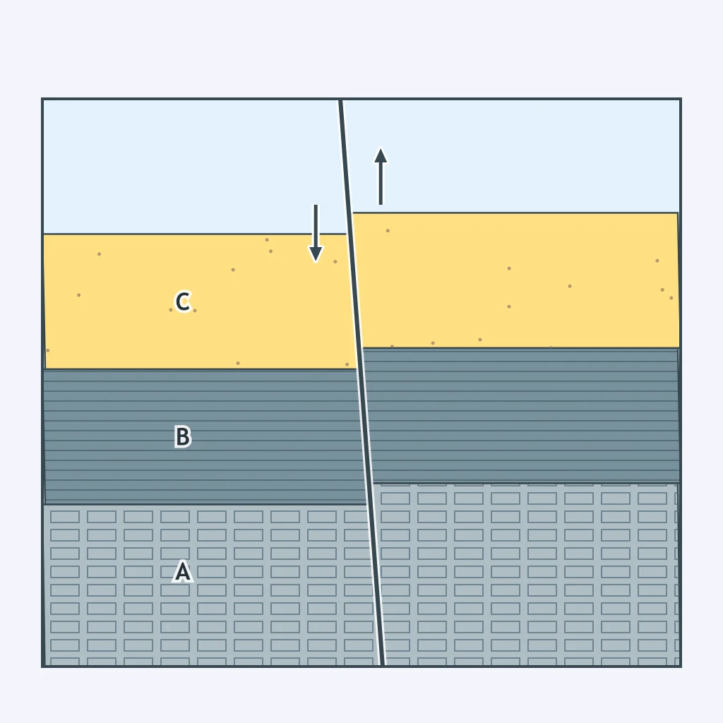
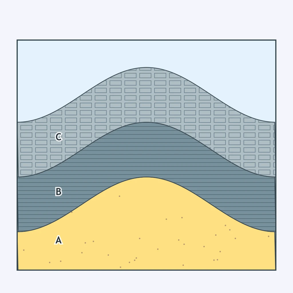
The cross section shows sedimentary layers folded into an arch, then cut by a fault where the upper block slid down along a steep plane. In what order did these two events happen?
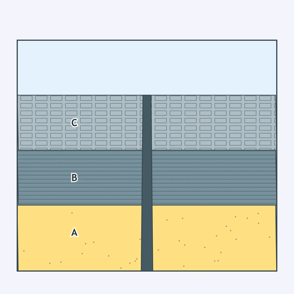
A cross section shows a dark igneous rock body cutting directly across horizontal sedimentary layers, with the layers undisturbed everywhere else. What does this cross-cutting relationship show about the igneous body's age?
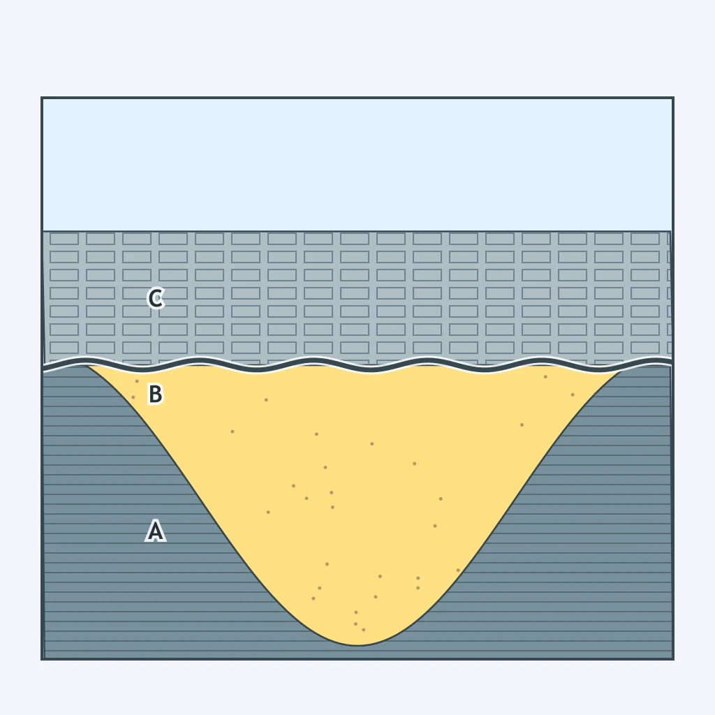
The cross section shows tilted, eroded rock layers overlain by flat-lying younger layers, with an erosional surface between them. What is this surface called?
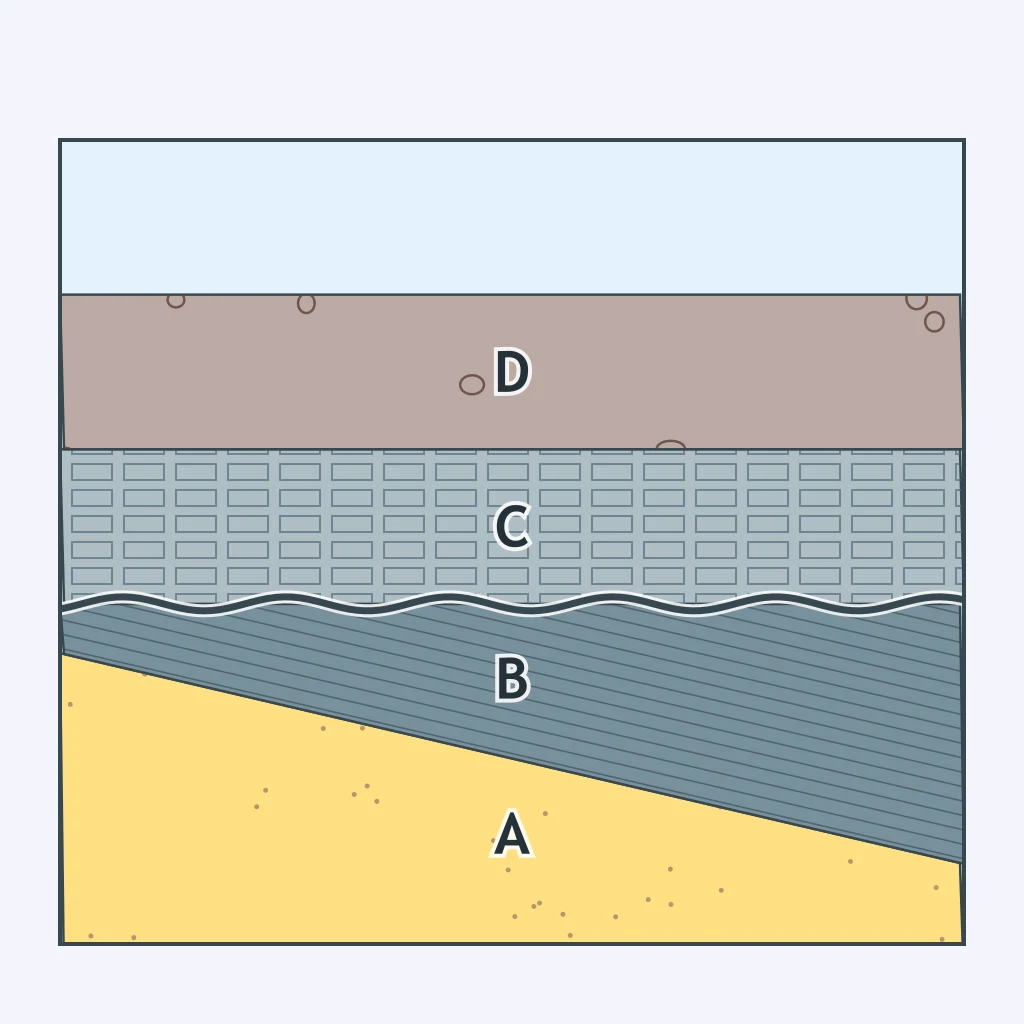
The cross section shows folded layers truncated at an erosional surface, above which flat younger beds lie undisturbed. Which happened first: the folding, or the deposition of the upper flat layers?
The cross section shows a reverse fault cutting through and offsetting all the sedimentary layers, including the youngest one at the top. What does this show about the fault's age relative to the layers?
The layers in the cross section were deposited flat and later folded. According to the principle of superposition, which layer is oldest?
Crack the passcode before the zombies get in.
Answer, then swat bugs for bonus points.
Race through questions at your own speed.
Same question on every screen. Fastest wins.

Pick a tile, answer, hit bonuses and steals.
Seismic Waves
40 questions