Loading
by BlastRoom
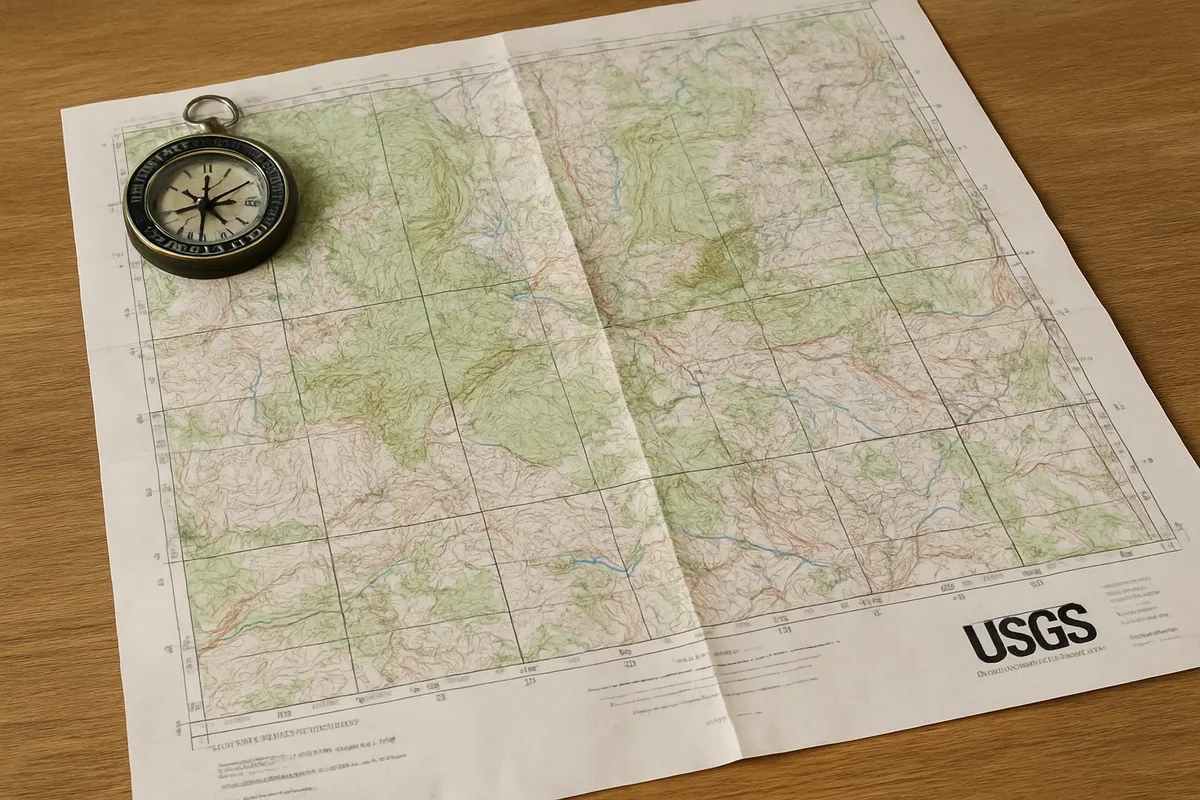
Practice interpreting contour lines, elevation, relief, slope, stream direction, depressions, benchmarks, and map symbols.
#earth_space_science
60 questions
One question set, multiple game modes. Tap any game to see it in action. Not sure which to pick?
Answer to place stones and capture territory.
Outrun the snow together.
Earn blasts, then hunt the other team.
Answer to earn energy, then climb.

The class blasts through walls together.
Bid on mystery lots. Most money wins.
Sell tours. Nice, standard, or a total scam.

Answer, restock, and serve the rush.
More correct answers pulls the rope your way.
Answer, then shoot down the alien wave.
Answer, then tap to leap the frozen ridge.
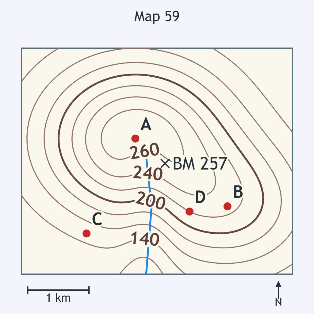
Use the map. What is the best estimate of the elevation of point A?
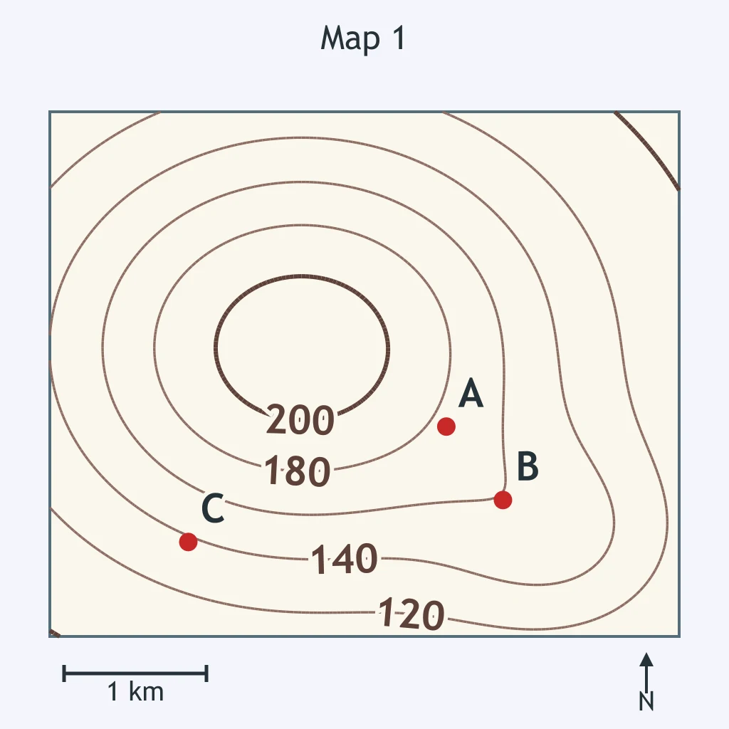
Use the map. What is the most reasonable estimate of the elevation of point B?
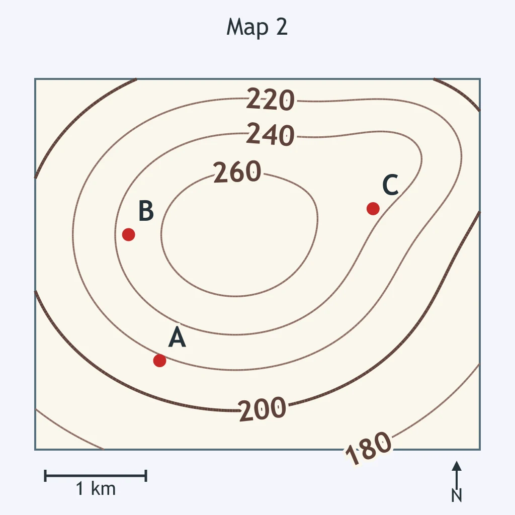
Use the map. Which estimate best fits the elevation of point C?
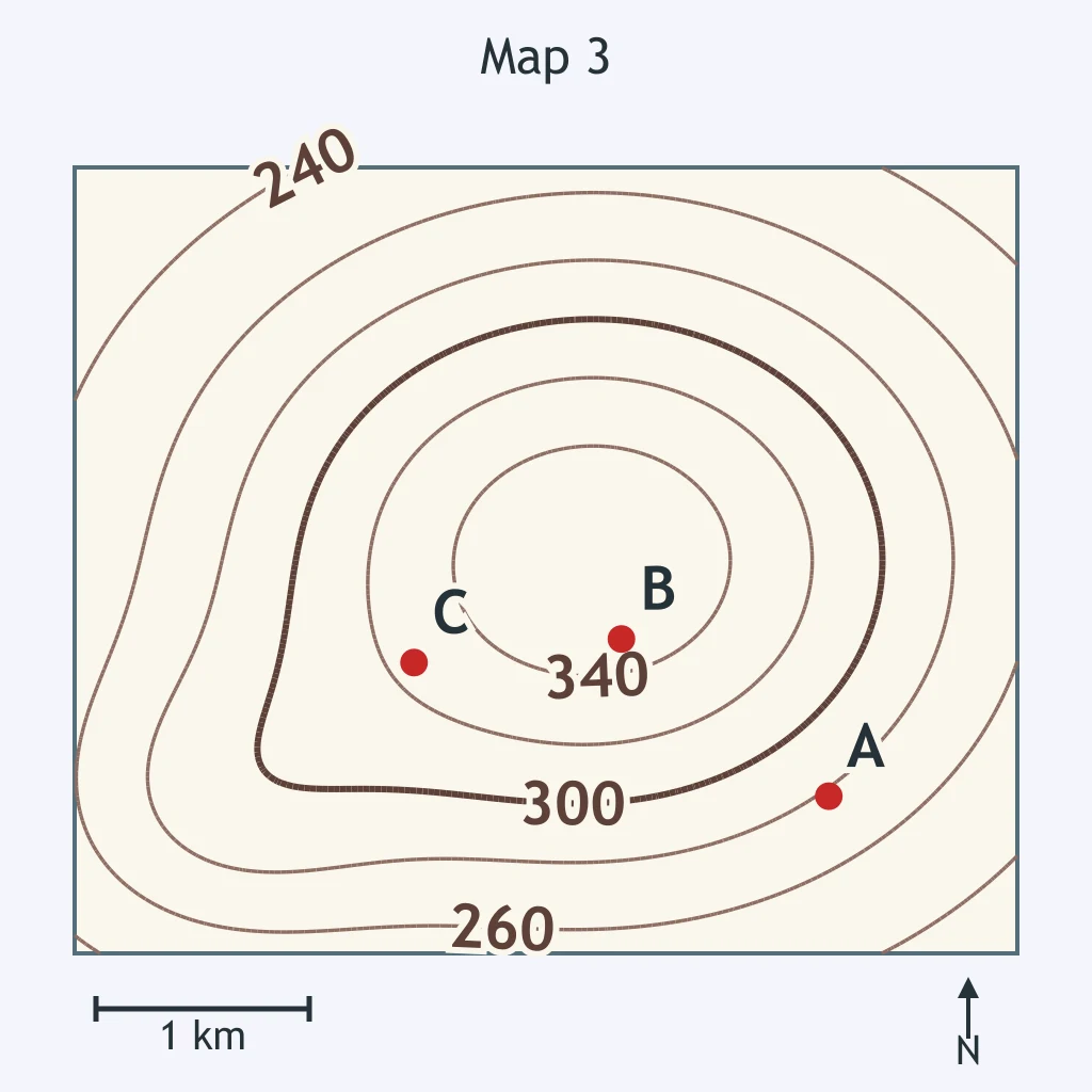
Use the map. What is the best estimate of the elevation of point D?
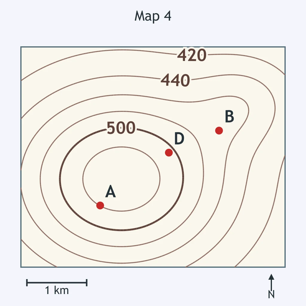
Use the map. Point E marks the top of the hill. What is a possible elevation at E?
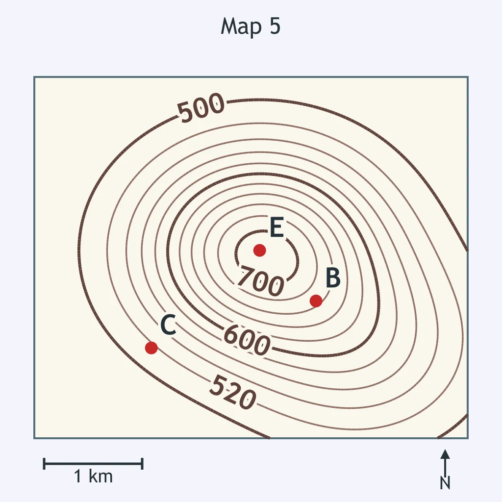
Use the map. Which estimate is best for the elevation of point F?
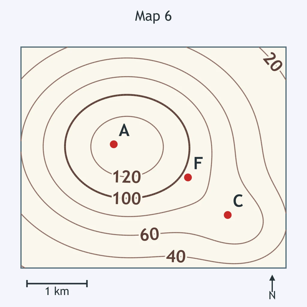
Use the map. What is the best estimate of the elevation of point G?
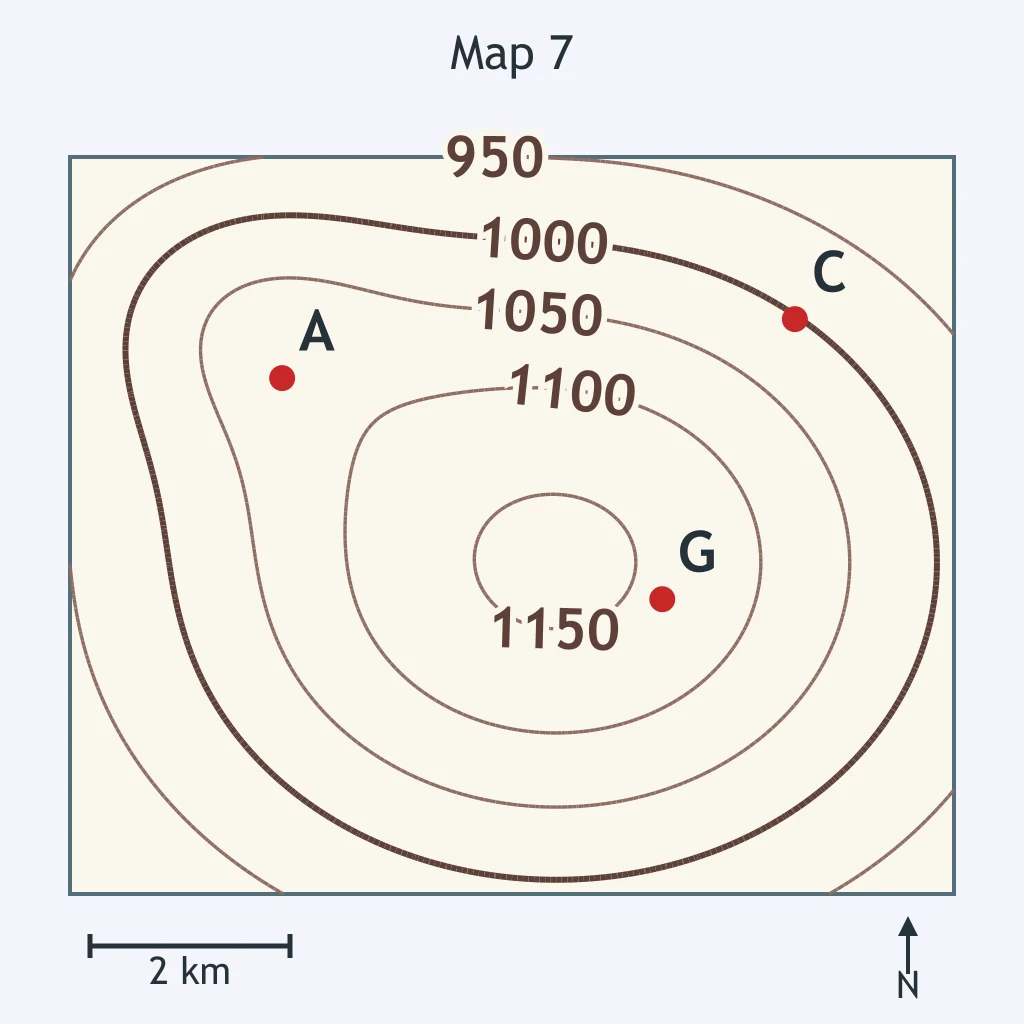
Use the map. What is the best estimate of the elevation of point H?
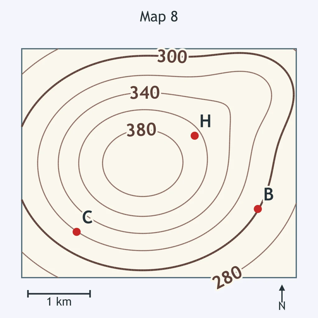
Use the map. What is the most likely elevation of point J?
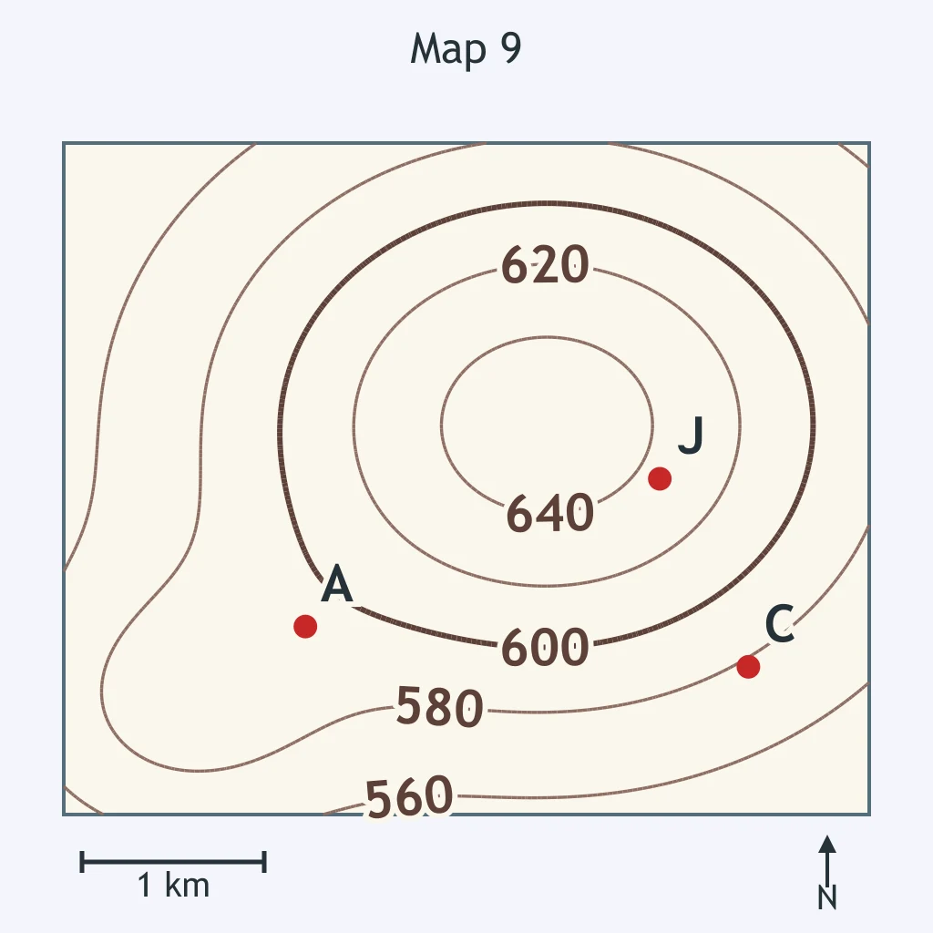
Use the map. What is the best estimate of the elevation of point K?
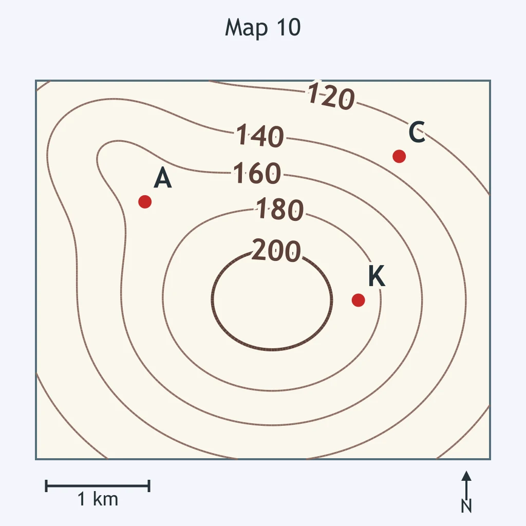
Use the map. Which estimate is most reasonable for the elevation of point L?
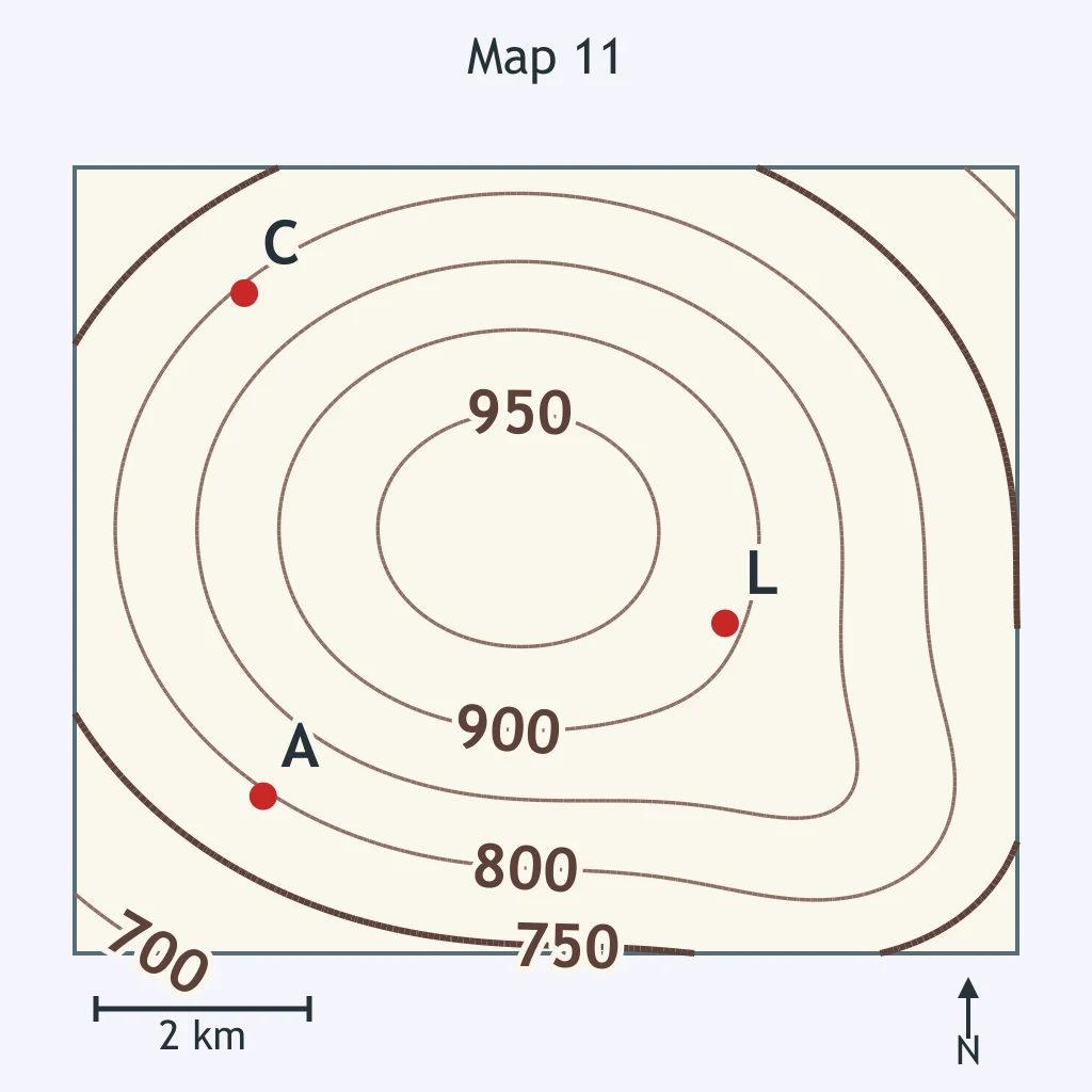
Use the map. What is the best estimate of the elevation of point M?
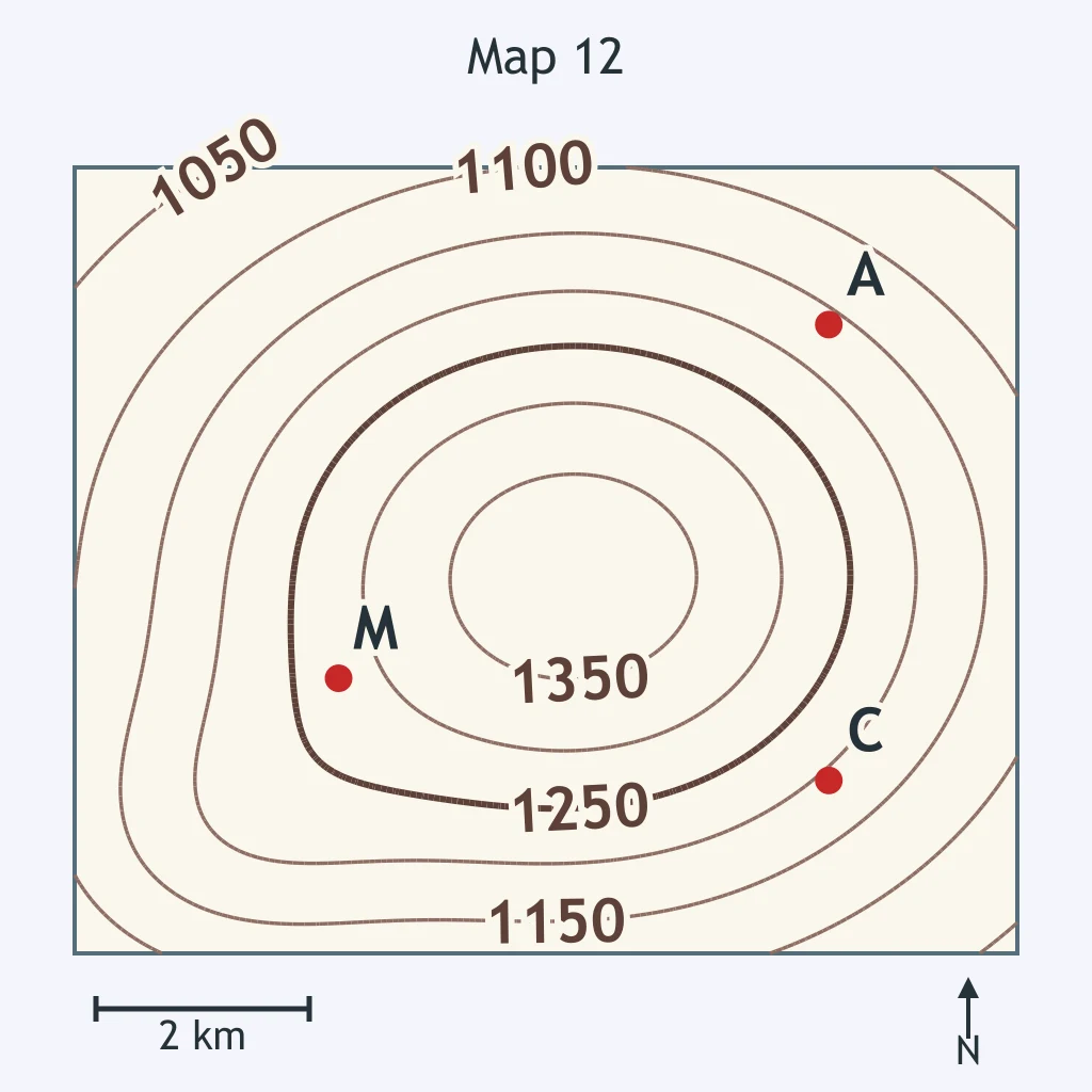
Use the labeled contour lines on the map. What contour interval does the map use?
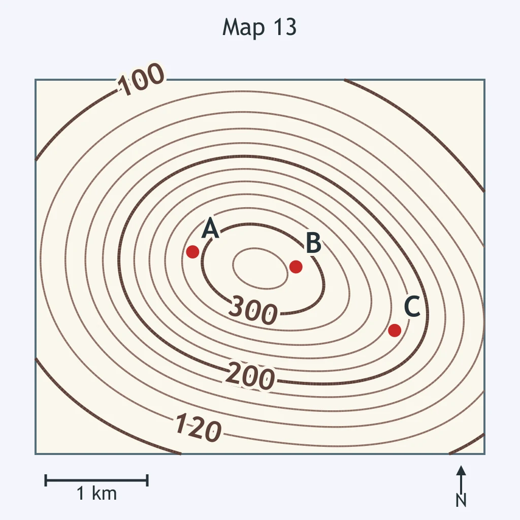
Use the labeled contour lines on the map. What contour interval does the map use?
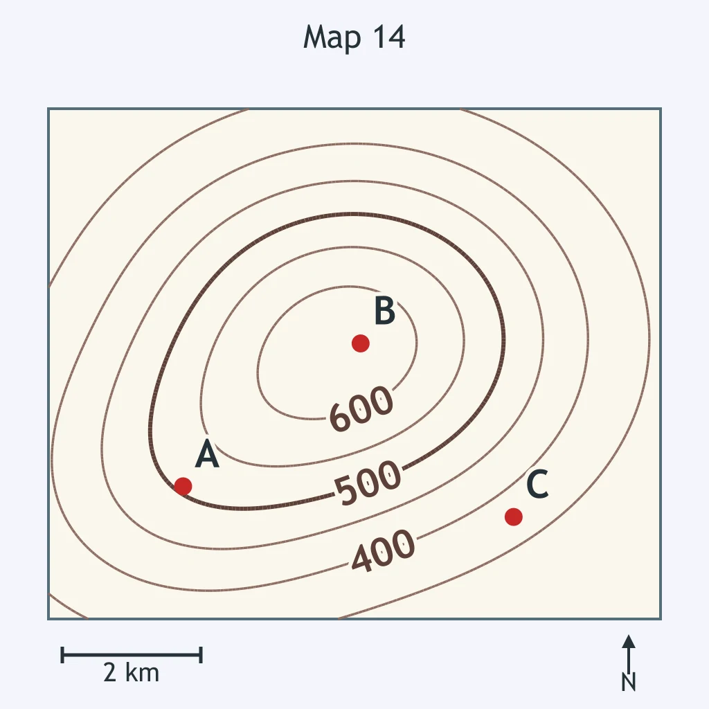
Use the labeled contour lines on the map. What contour interval does the map use?
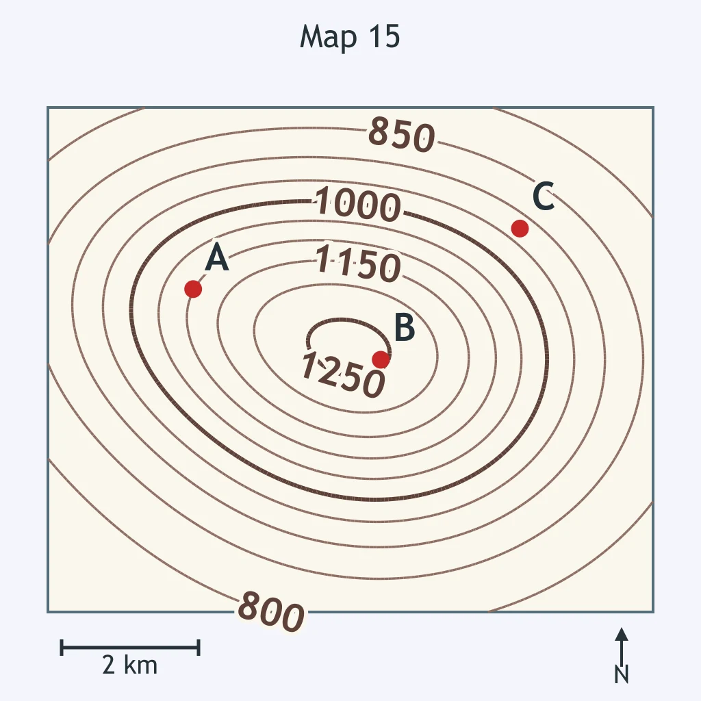
Use the labeled contour lines on the map. What contour interval does the map use?
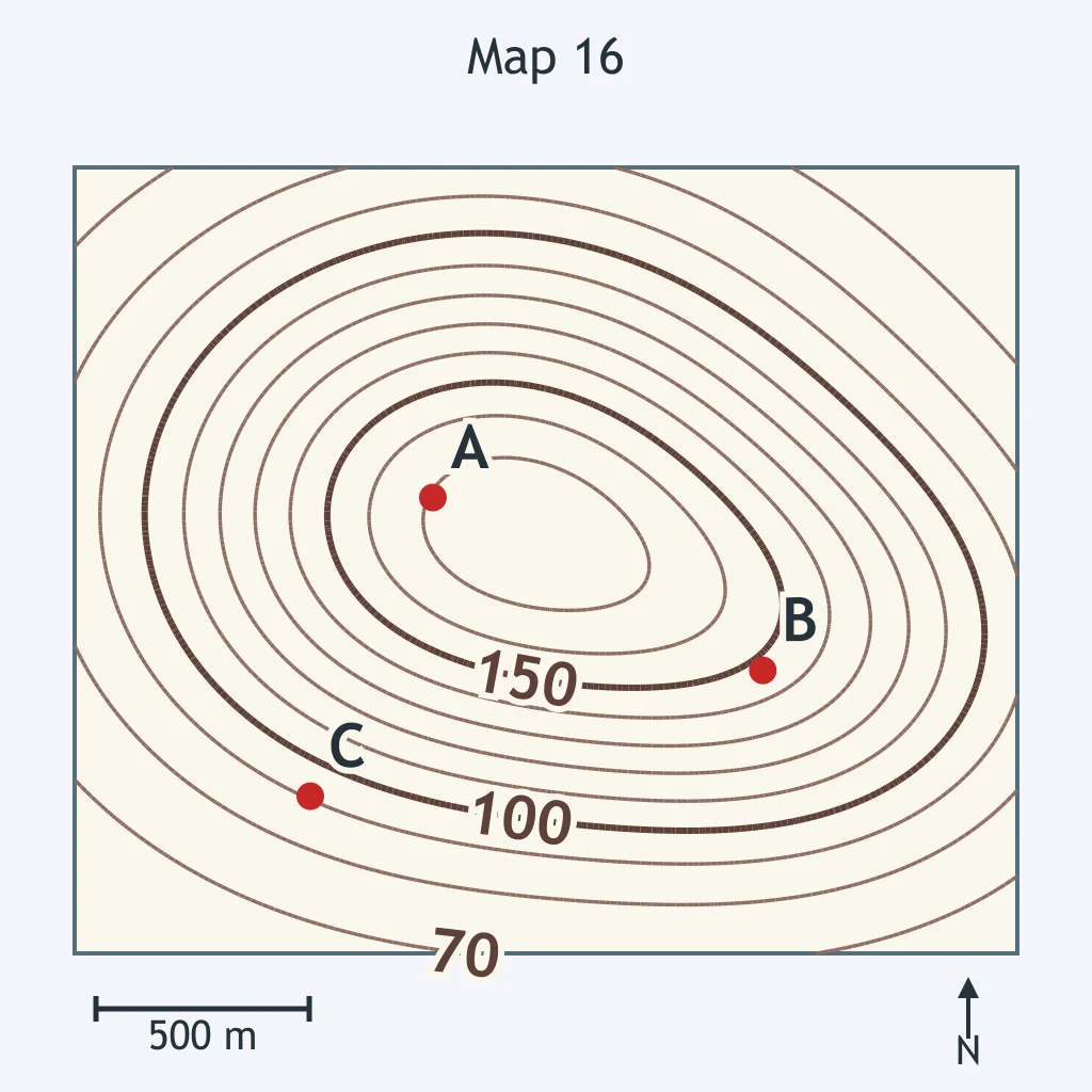
Use the labeled contour lines on the map. What contour interval does the map use?
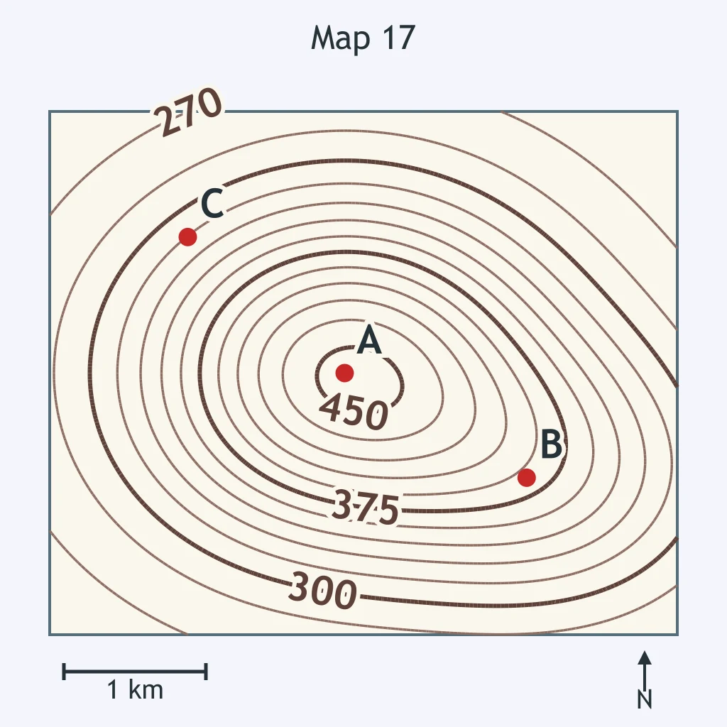
Use the labeled contour lines on the map. What contour interval does the map use?
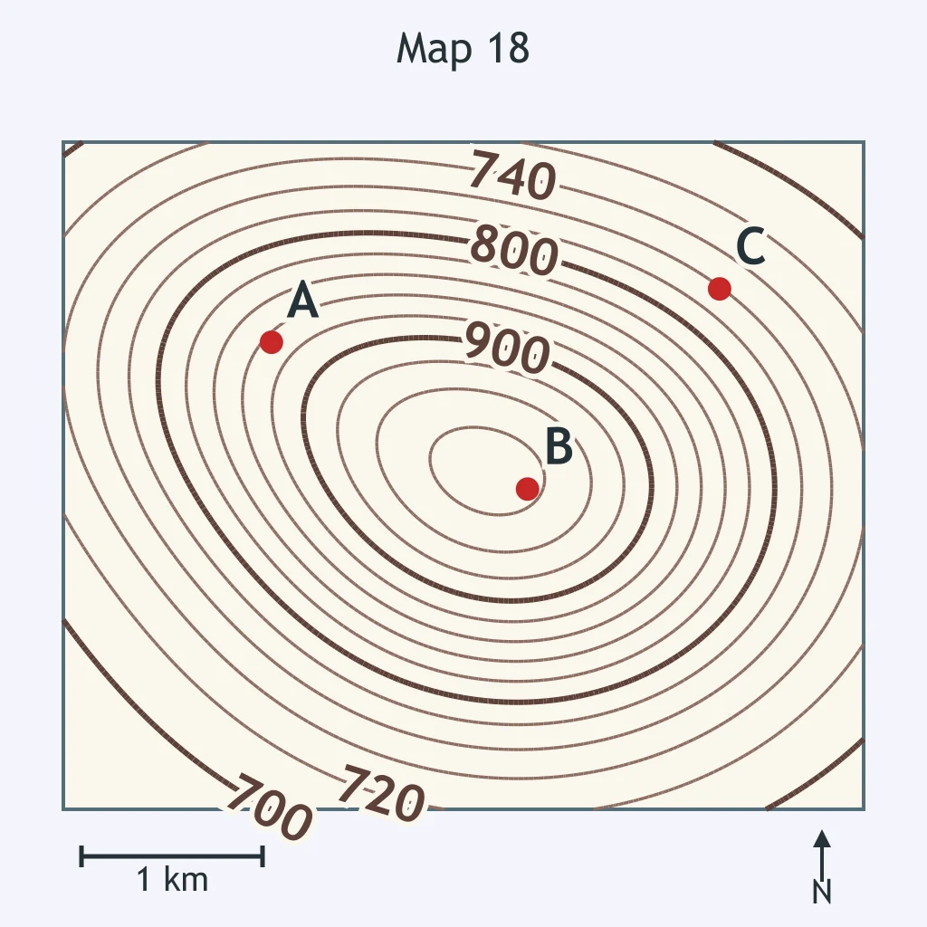
Use the labeled contour lines on the map. What contour interval does the map use?
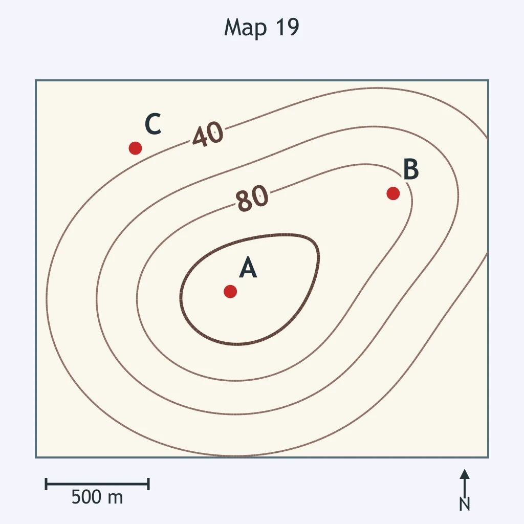
Use the labeled contour lines on the map. What contour interval does the map use?
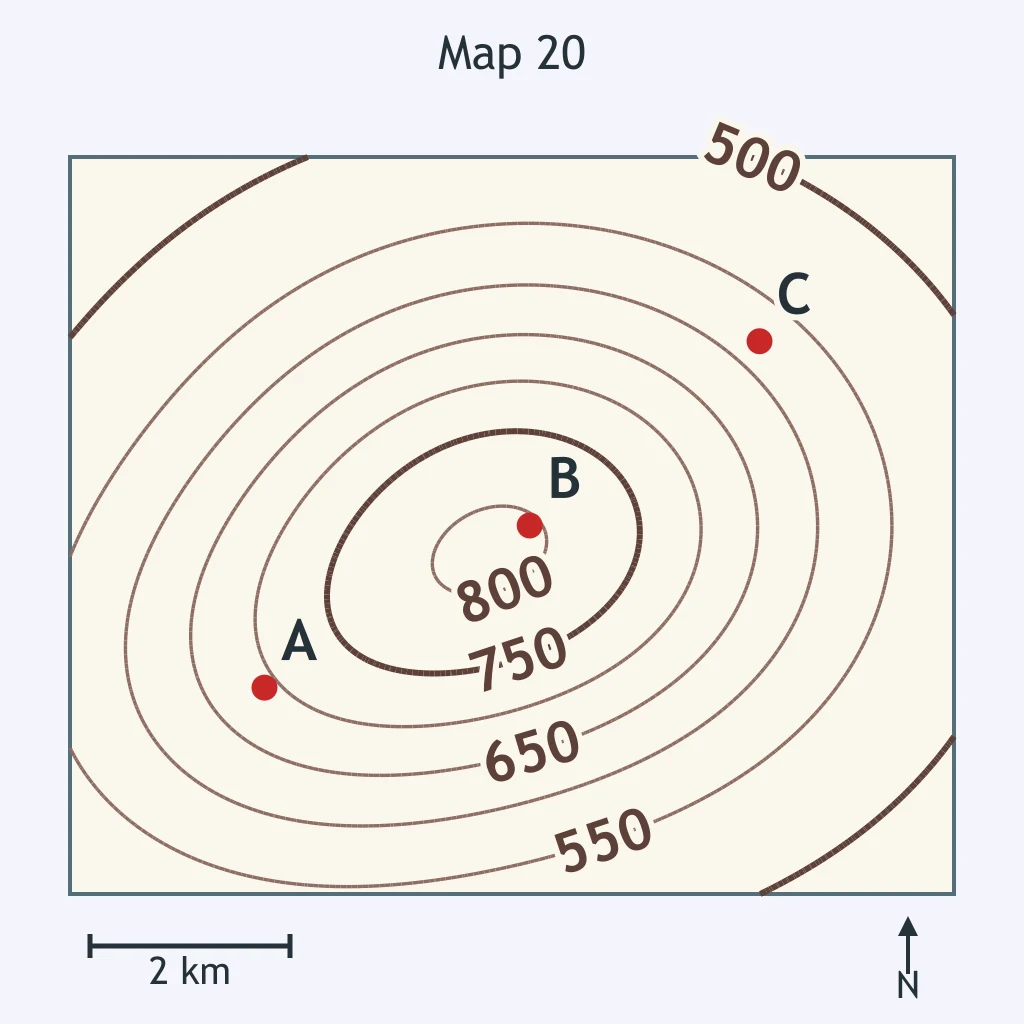
Use the map. What is the relief between the benchmark on the summit and the lowest contour line on the map?
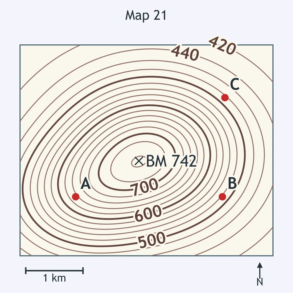
Use the map. What is the relief between the benchmark on the summit and the lowest contour line on the map?
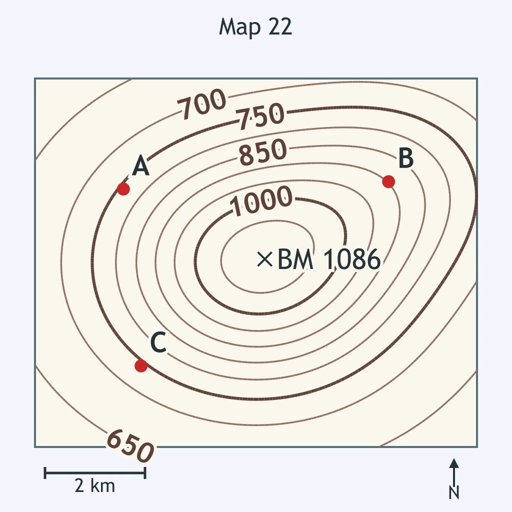
Use the map. What is the difference in elevation between the highest contour line and the lowest contour line on the map?
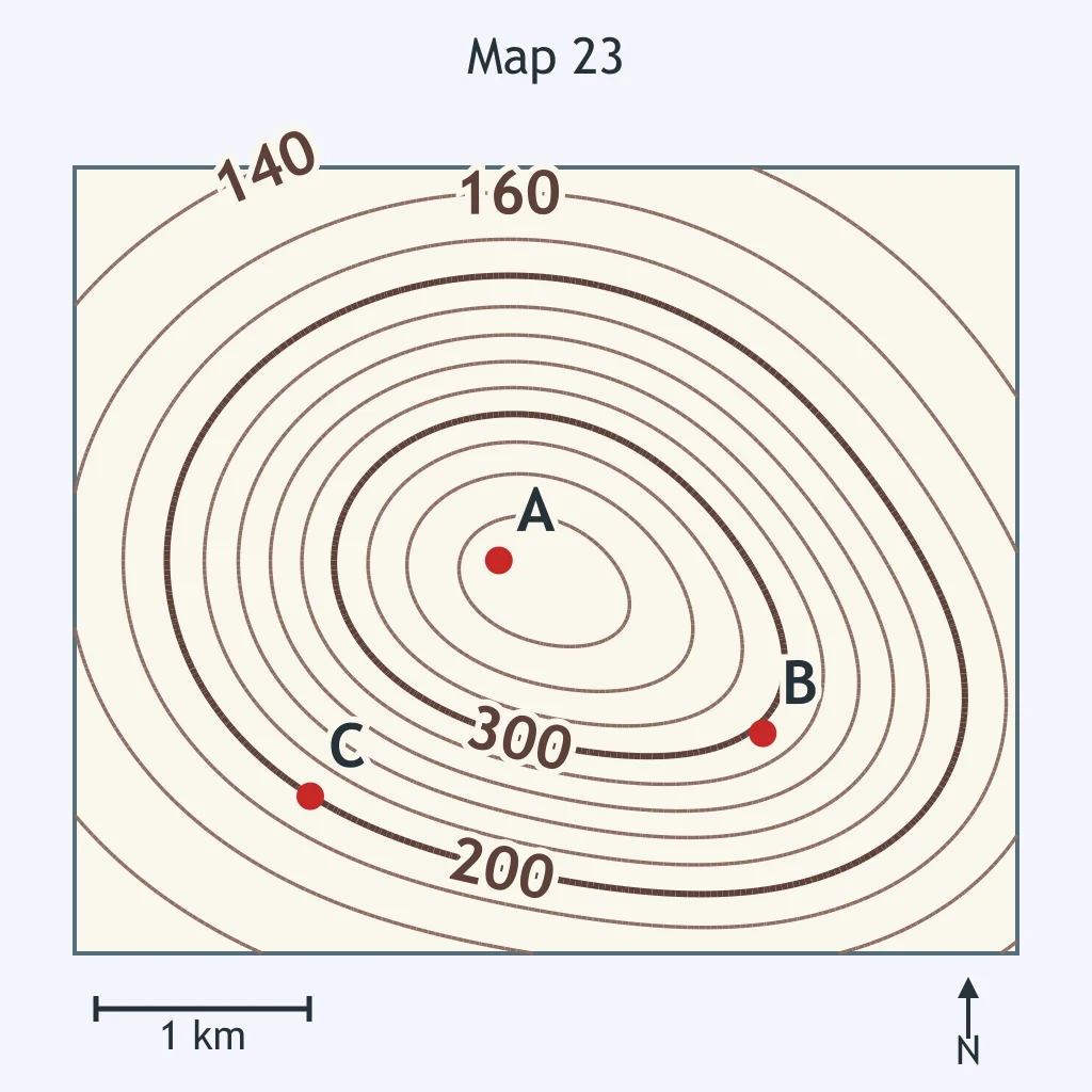
Use the map. What is the relief between the benchmark on the summit and the lowest contour line on the map?
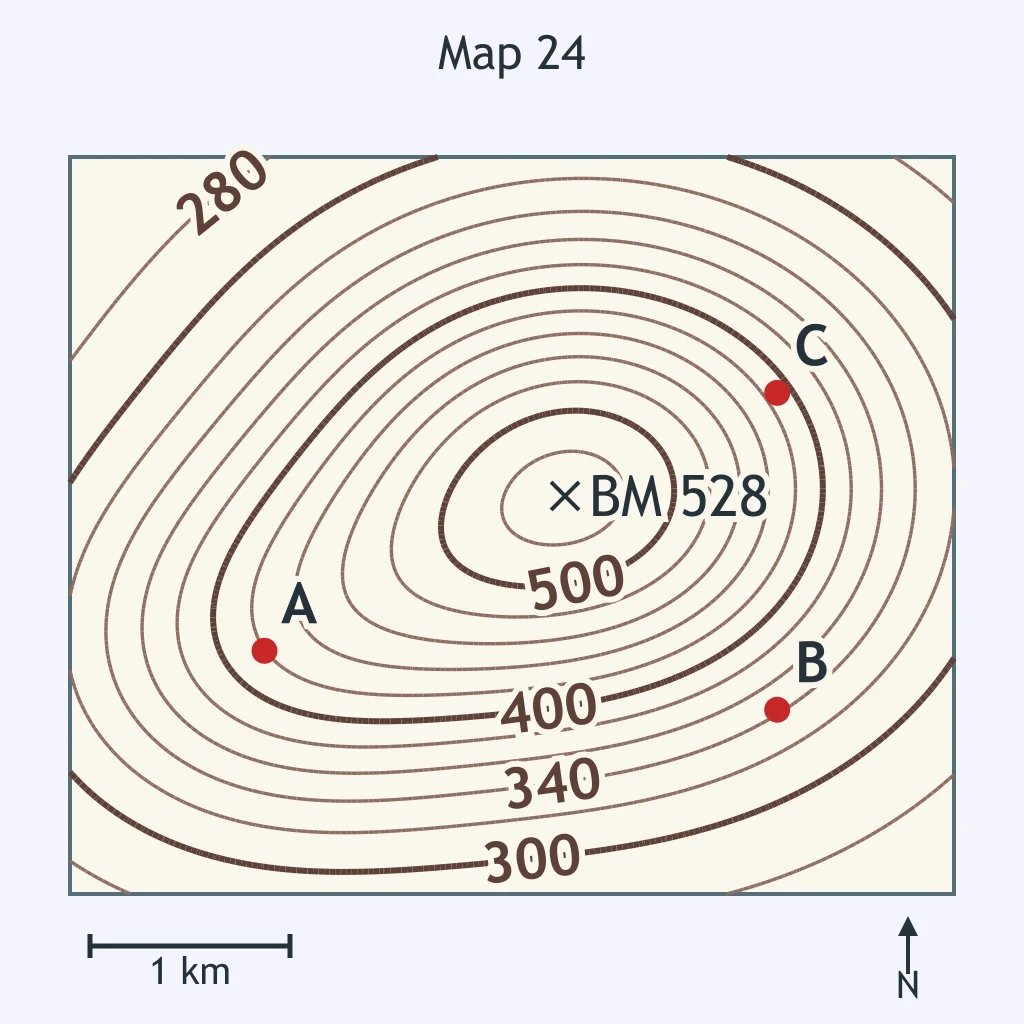
Use the map. What is the relief between the benchmark on the summit and the lowest contour line on the map?
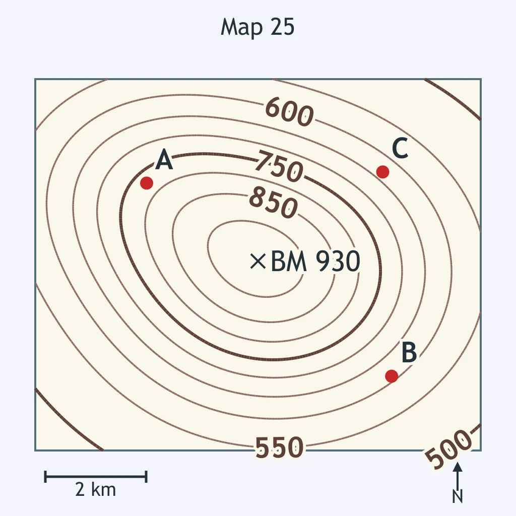
Use the map. What is the difference in elevation between the highest contour line and the lowest contour line on the map?
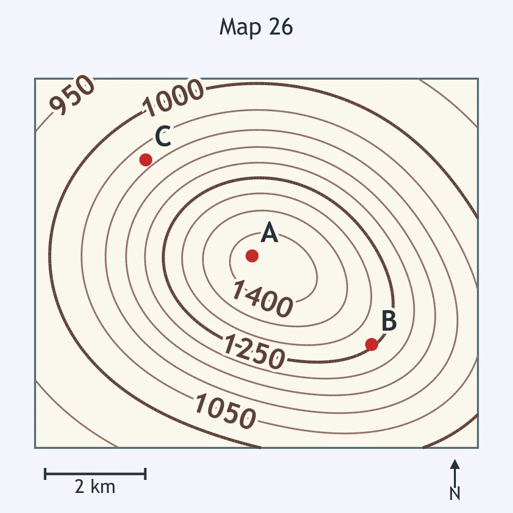
Use the map. What is the relief between the benchmark on the summit and the lowest contour line on the map?
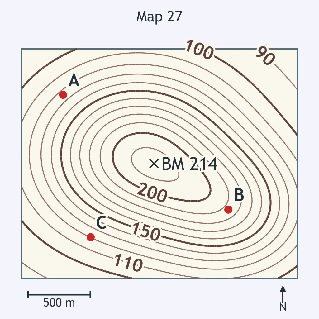
Use the map. What is the relief between the benchmark on the summit and the lowest contour line on the map?
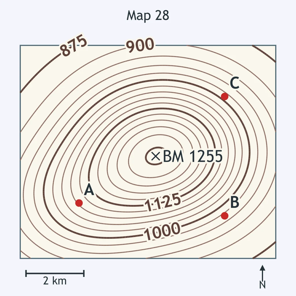
Use the map. At which point is the slope steepest?
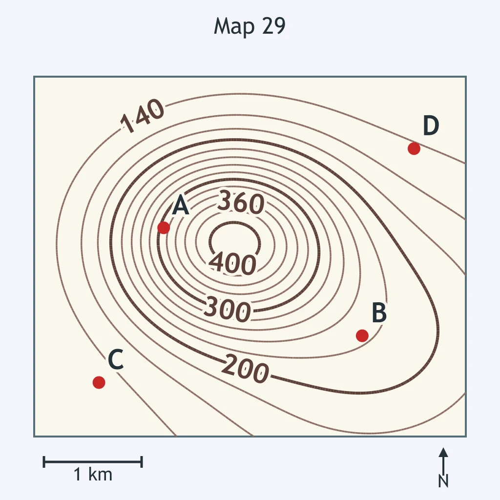
Use the map. Which point marks the steepest ground?
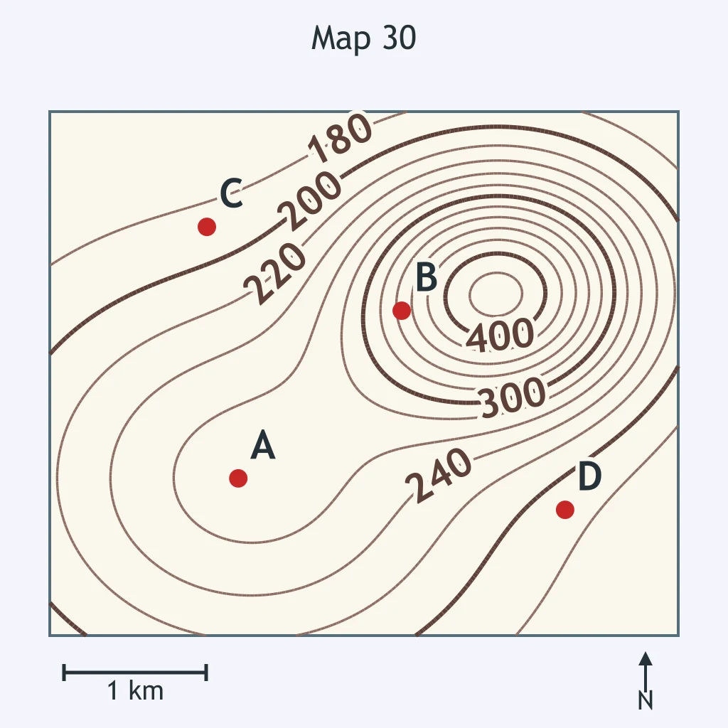
Use the map. Which point has the greatest gradient?
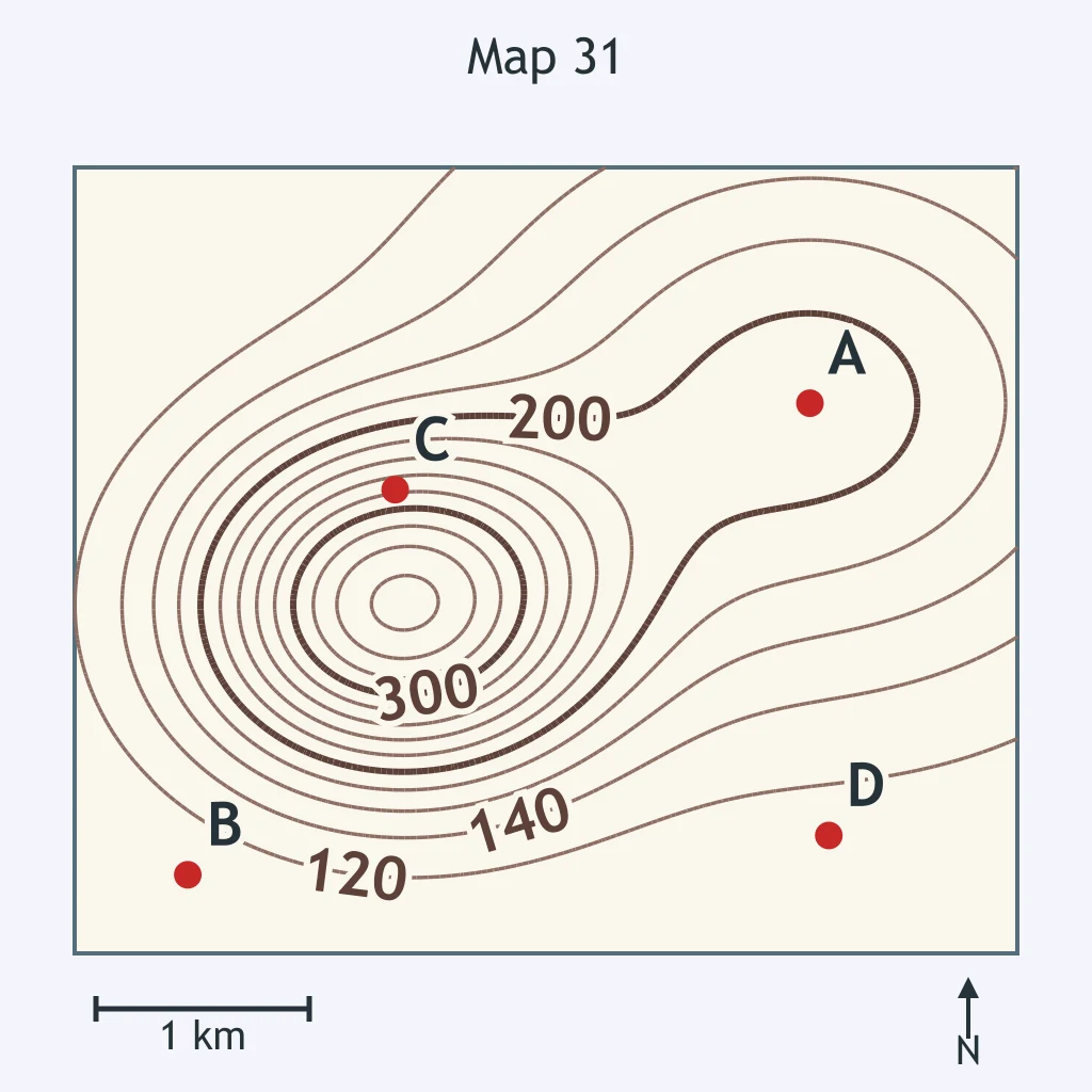
Use the map. Where is the slope steepest?
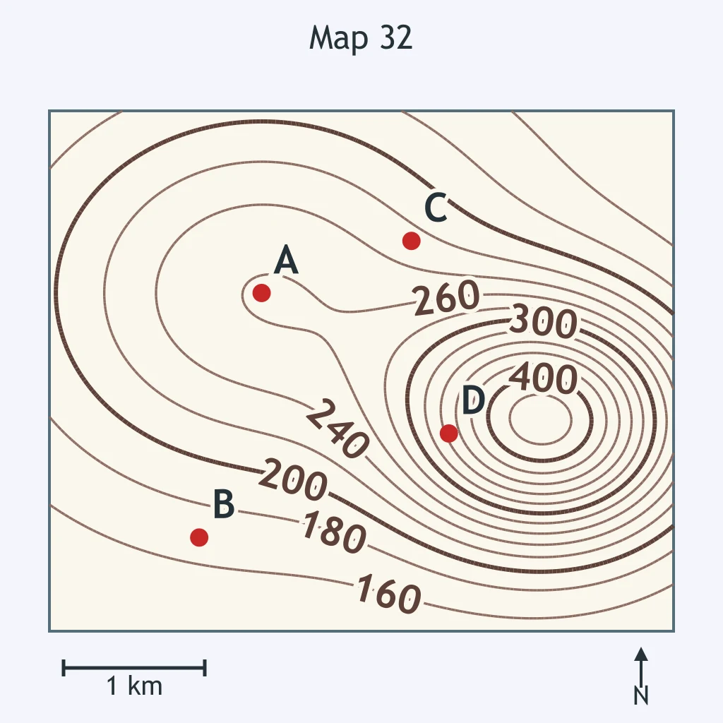
Use the map. Which point, A or B, is on the steeper slope?
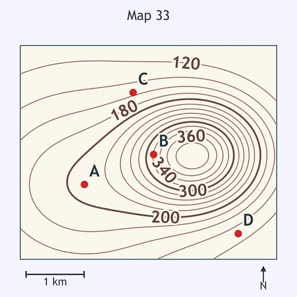
Use the map. A hiker walks past points C and D. Compared with point D, what terrain should the hiker expect at point C?
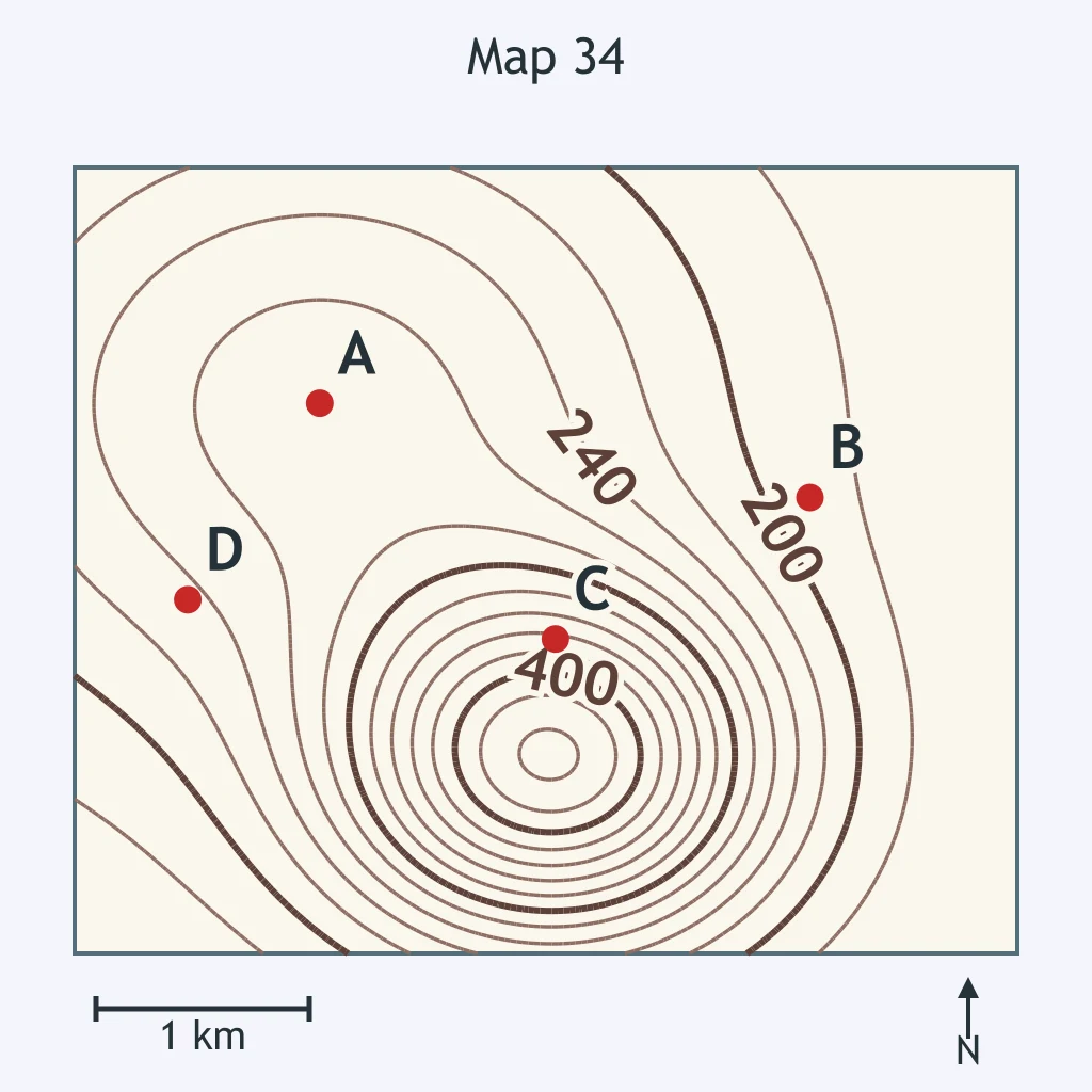
Use the map. Which location is steeper, point A or point D?
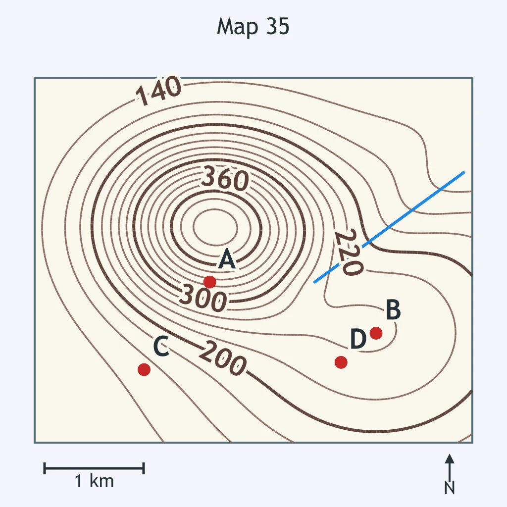
Use the map. Which point, B or C, has the gentler slope?
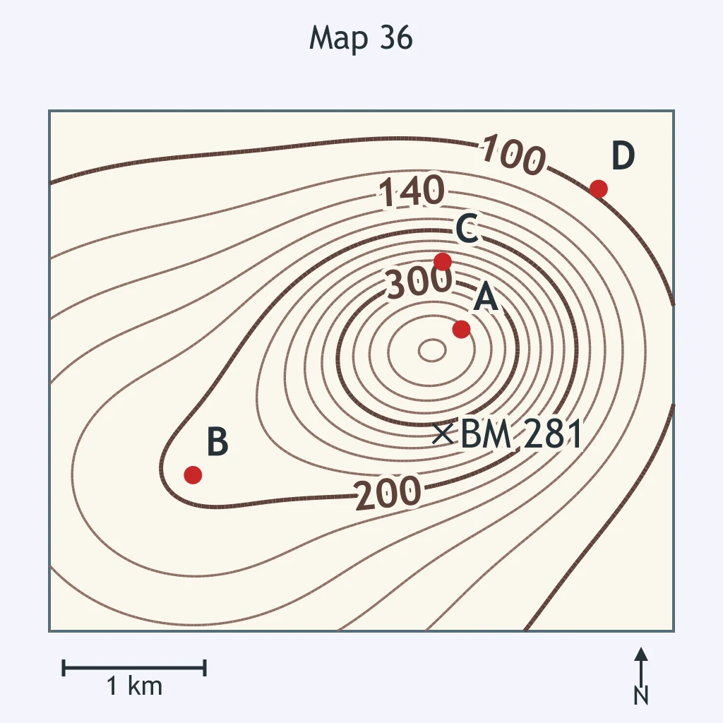
Use the map. Which part of the map has the steepest slope?
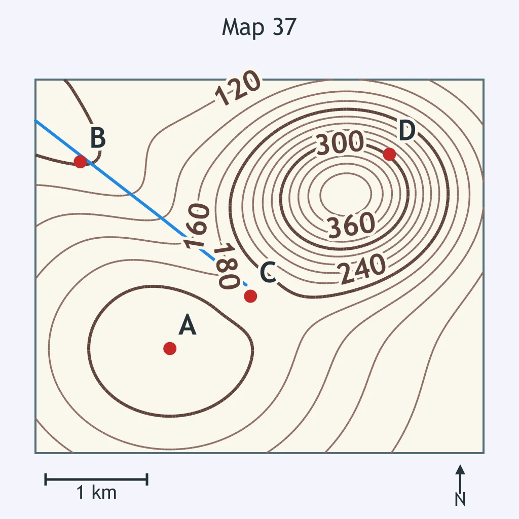
Use the map. Which of points A and C is on steeper ground?
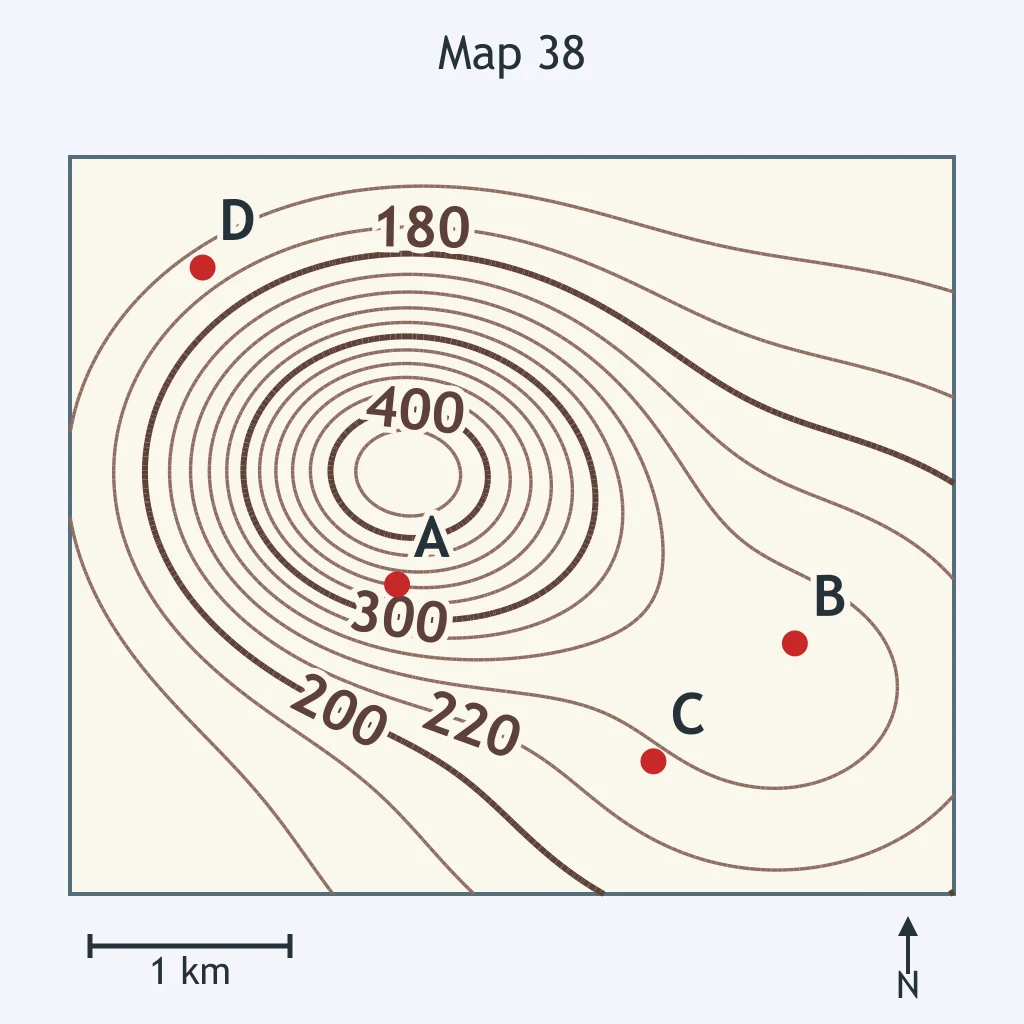
Use the map. Which direction does the stream flow?
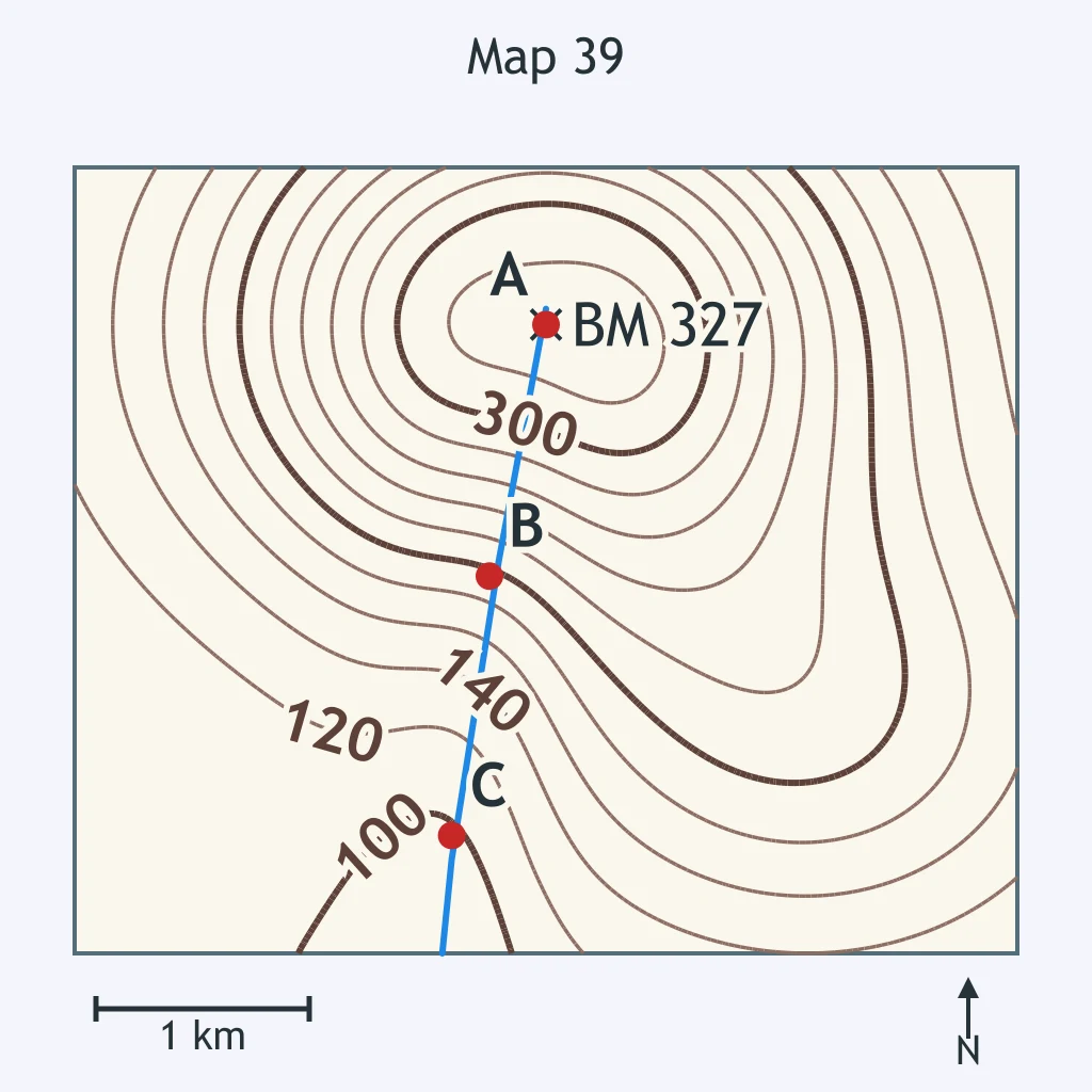
Use the map. Which way does Pine Run, the stream on the map, flow?
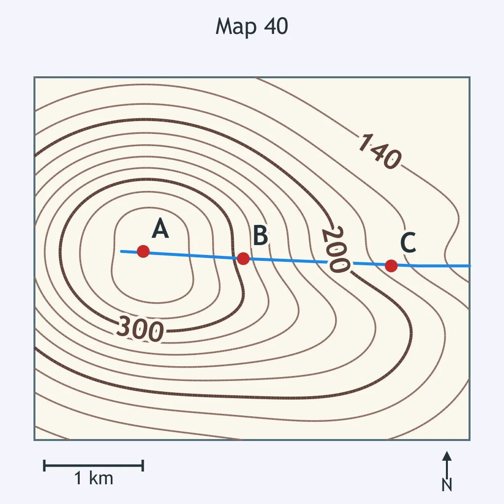
Use the map. What is the creek's flow direction?
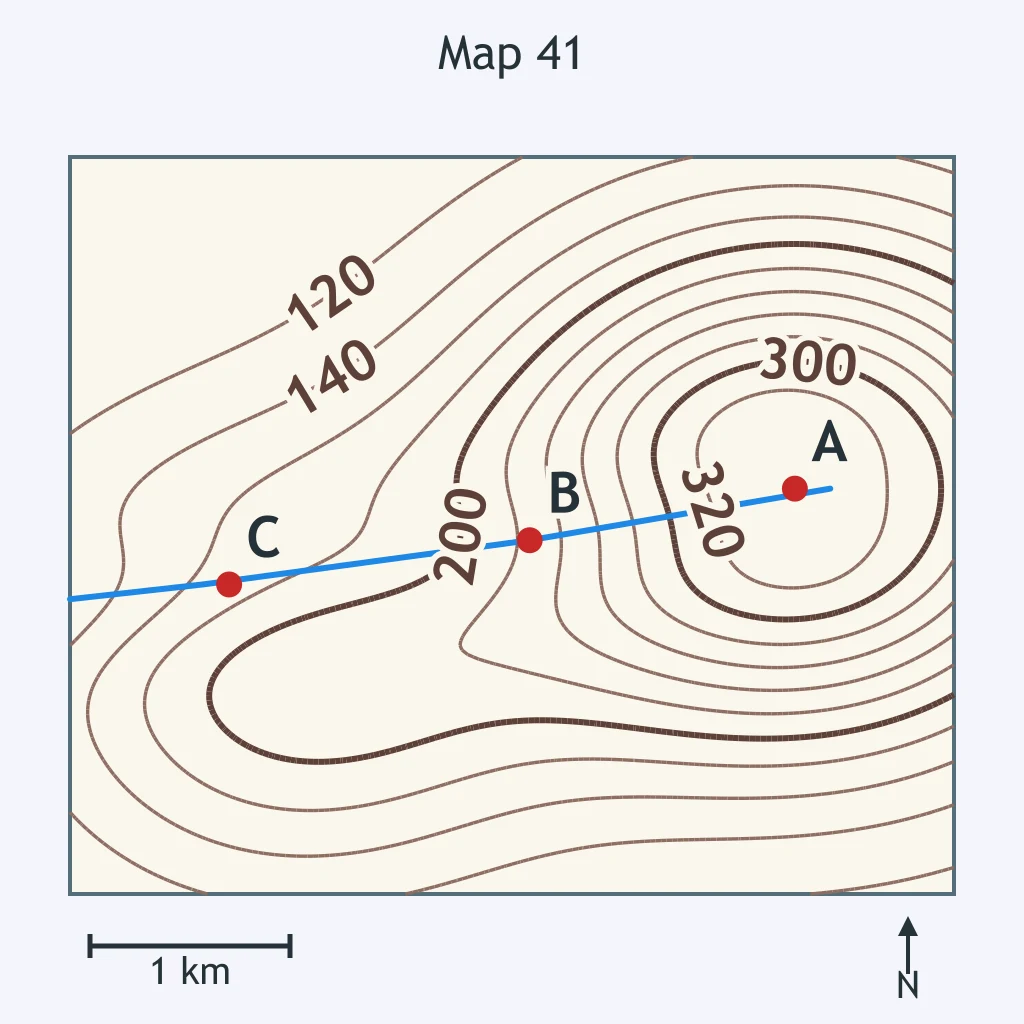
Use the map. Toward which direction is the stream flowing?
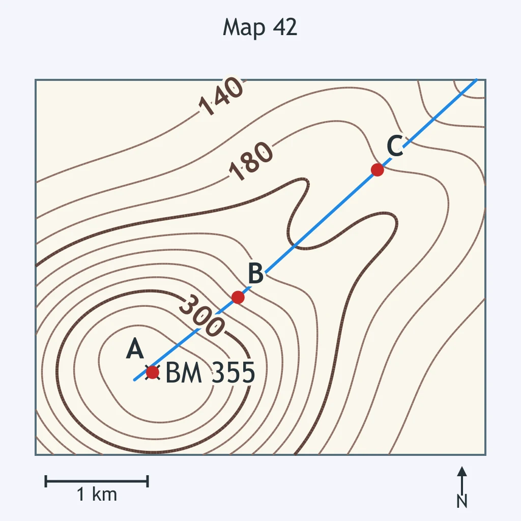
Use the map. Mill Brook is the stream shown. Which direction is downstream?
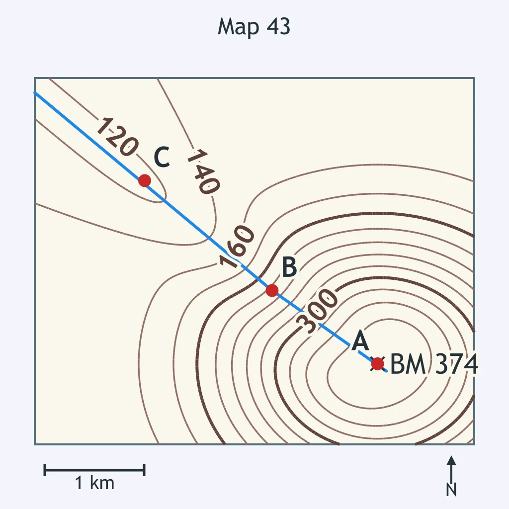
Use the map. The stream crosses both the 260 m and the 220 m contours. In which direction is the water moving?
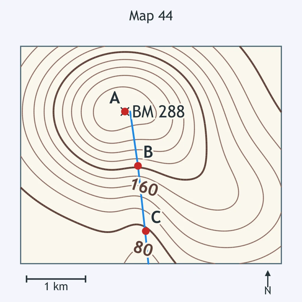
Use the map. Bear Creek is the stream shown. Which answer gives the correct downstream direction?
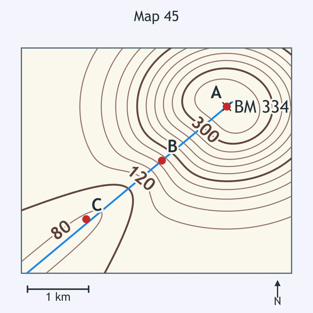
Use the map. The stream crosses the 480 m and 440 m contours. How does the stream flow?
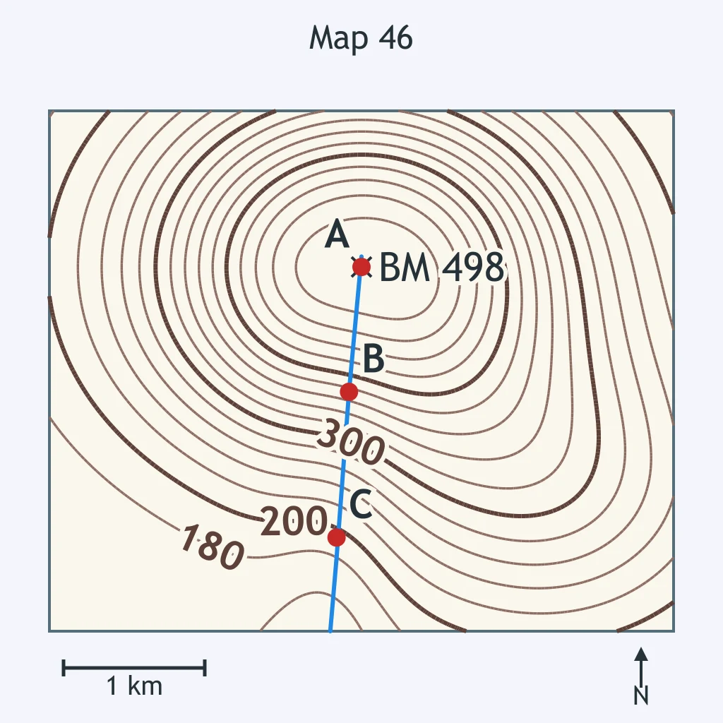
Use the map. What is the ground inside the closed contour around point A?
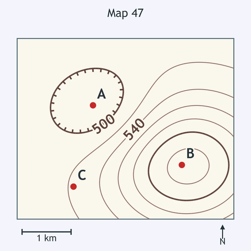
Use the map. Point A marks the hilltop. What elevation range fits the hilltop?
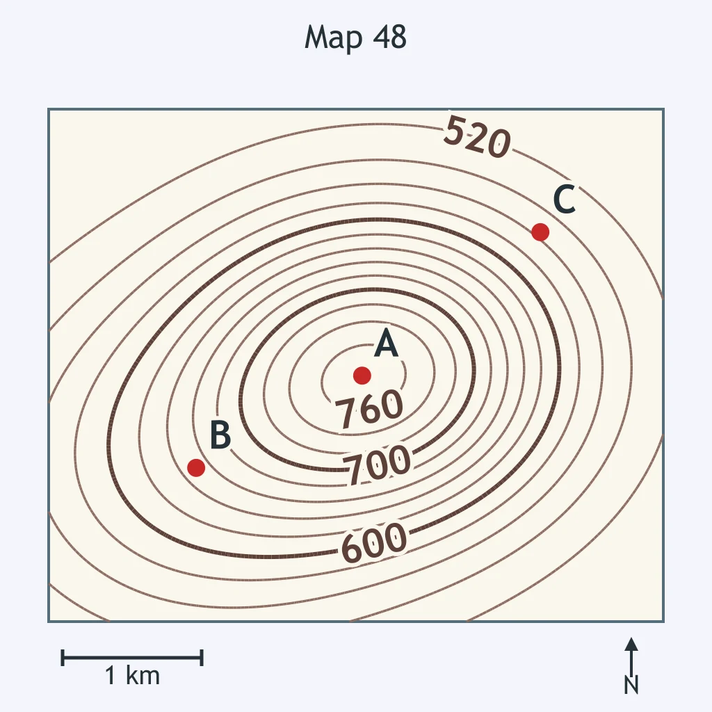
Use the map. The contour interval is 10 m. What feature is inside the closed contour around point A, and what is its elevation range?
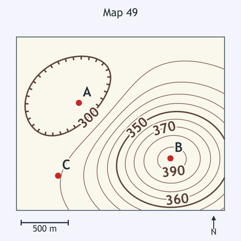
Use the map. Which elevation range fits point D?
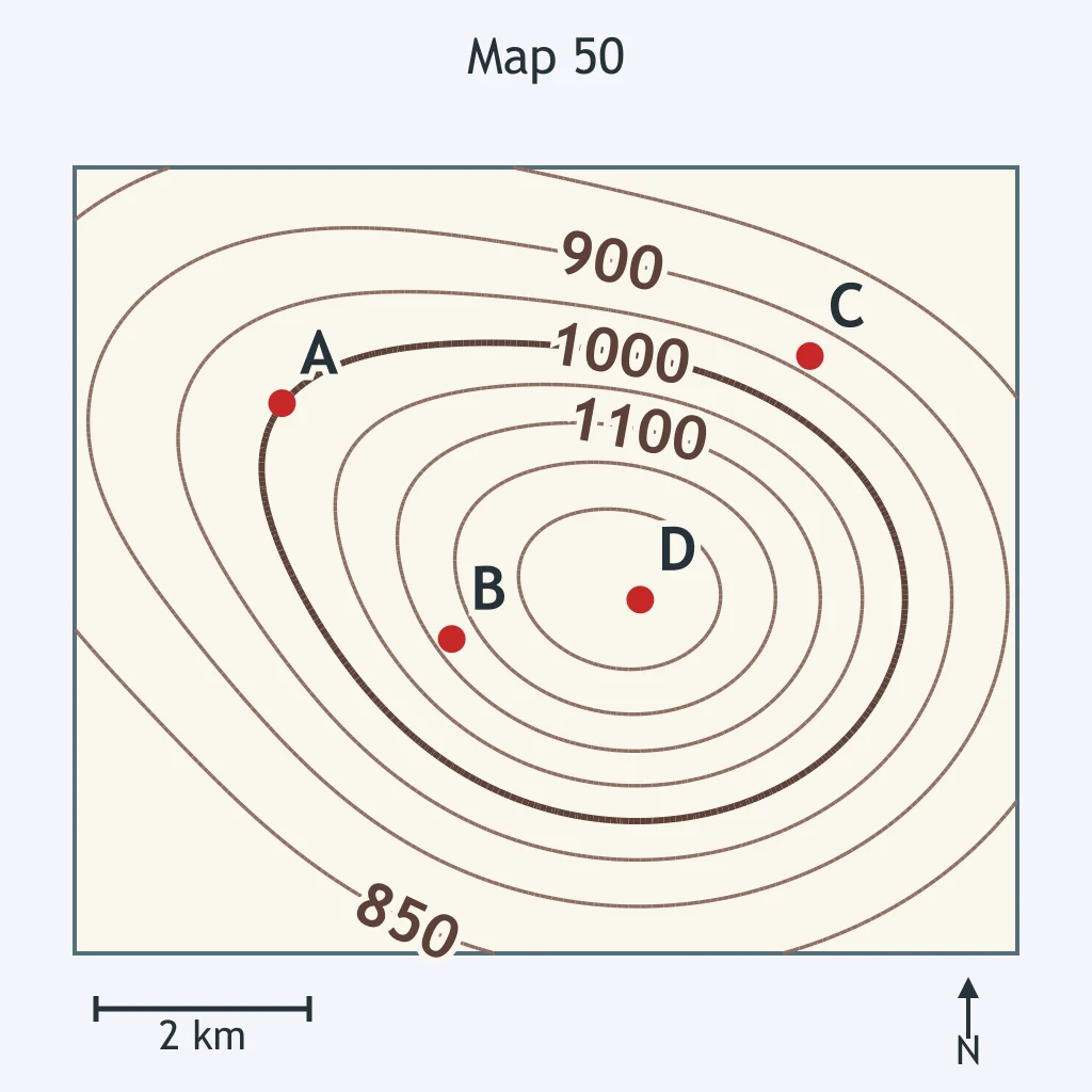
Use the map. What is true of the lowest ground inside the closed contours around point A?
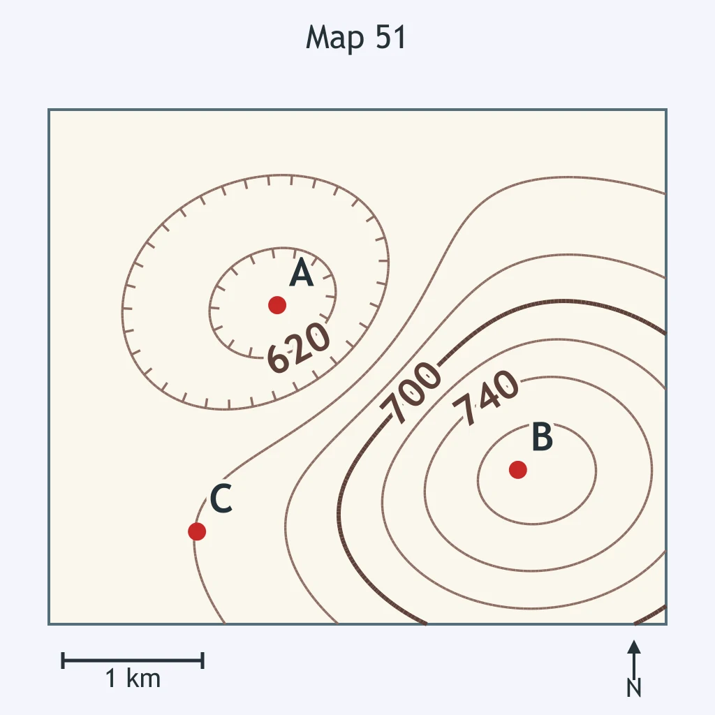
Use the map. Which elevation could point B have?
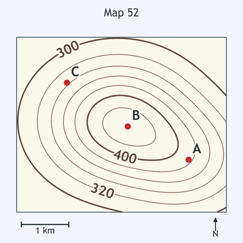
Use the map. Which statement matches the feature around point A?
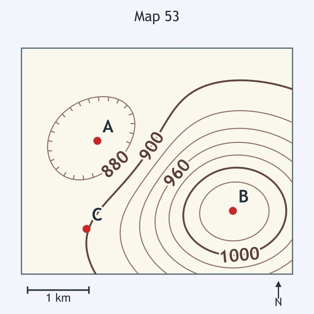
The map marks a small cross with the printed value 614 m beside it. What does that benchmark report?
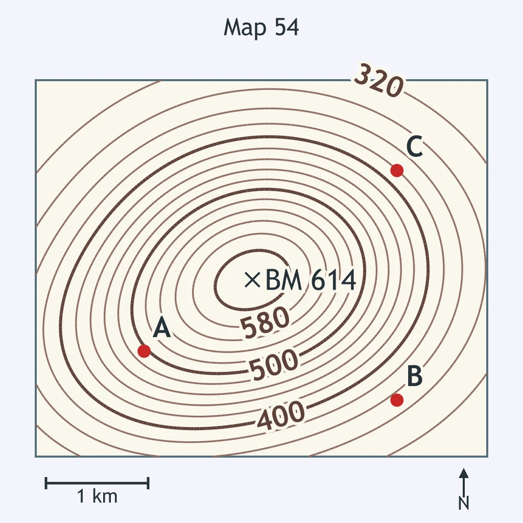
On the topographic map, the solid blue line follows the lowest part of a valley. What map feature does that symbol show?
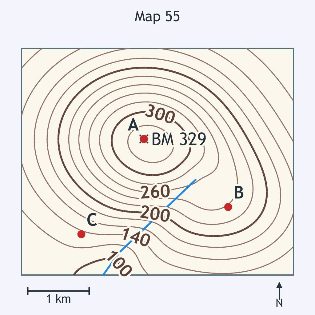
Brown lines on the map connect places with the same elevation above sea level. What are those lines called?
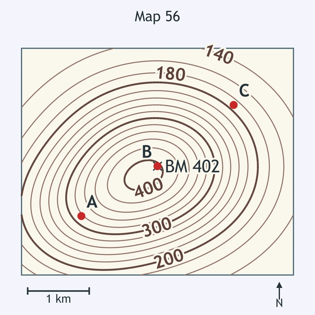
One heavier brown contour is labeled 400 m, while nearby thinner brown lines are unlabeled. What is the heavier labeled line?
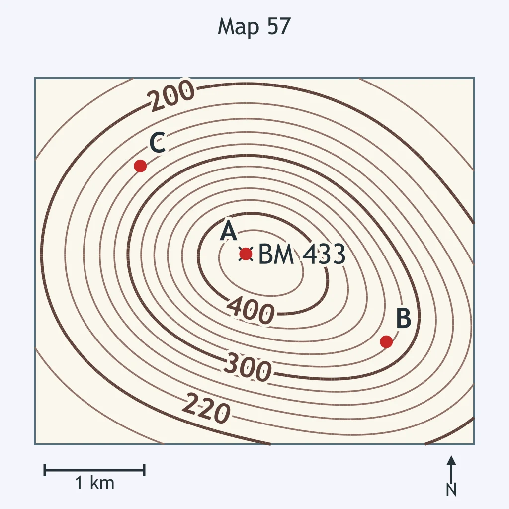
The map's scale bar says 1 km. What does that symbol help a student measure?
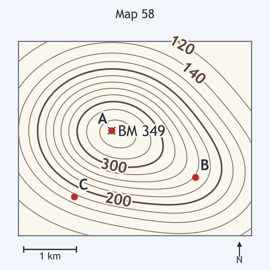
How many meters higher is the benchmark than point D?
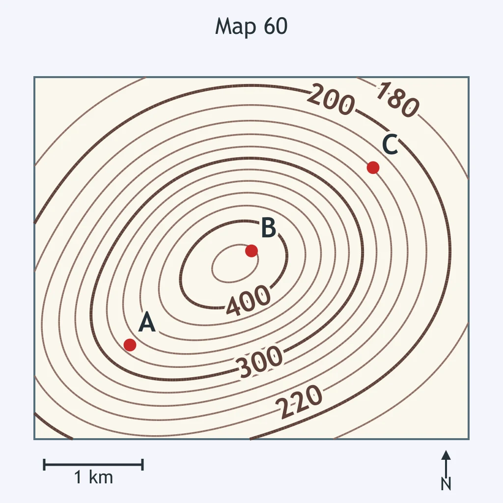
A thin brown line lies between the heavier labeled 300 m and 400 m contours. What does that thin line represent?
Crack the passcode before the zombies get in.
Answer, then swat bugs for bonus points.
Race through questions at your own speed.
Same question on every screen. Fastest wins.

Pick a tile, answer, hit bonuses and steals.
Isolines and Field Maps
30 questions