Loading
by BlastRoom
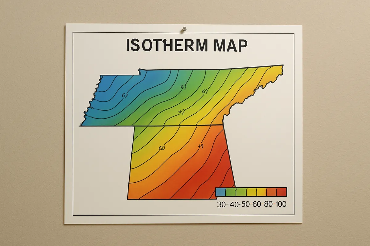
Read isolines and field maps and use map scale to quantify patterns.
#earth_space_science
30 questions
One question set, multiple game modes. Tap any game to see it in action. Not sure which to pick?
Answer to place stones and capture territory.
Outrun the snow together.
Earn blasts, then hunt the other team.
Answer to earn energy, then climb.

The class blasts through walls together.
Bid on mystery lots. Most money wins.
Sell tours. Nice, standard, or a total scam.

Answer, restock, and serve the rush.
More correct answers pulls the rope your way.
Answer, then shoot down the alien wave.
Answer, then tap to leap the frozen ridge.
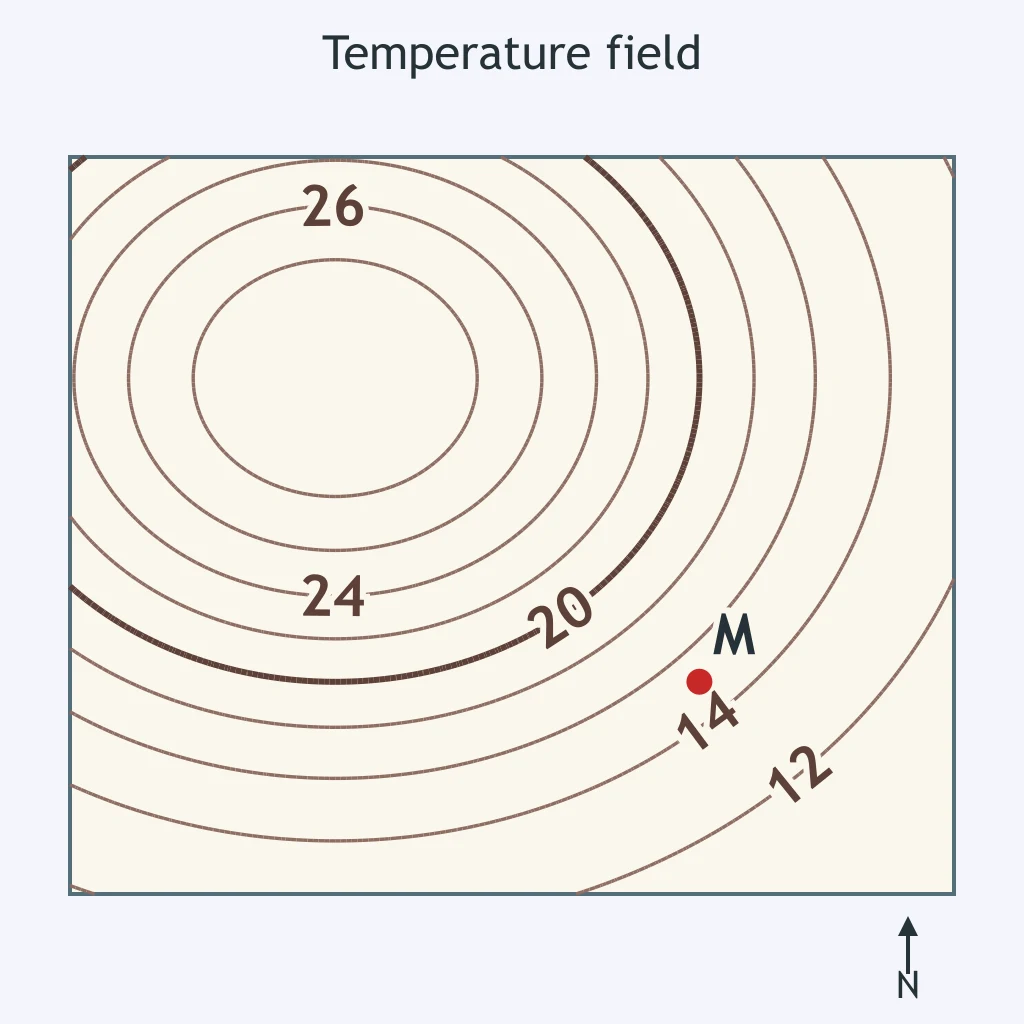
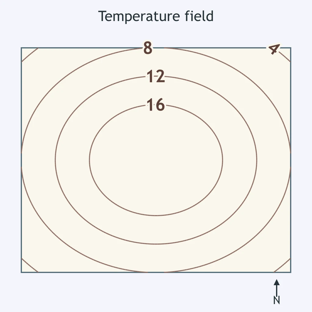
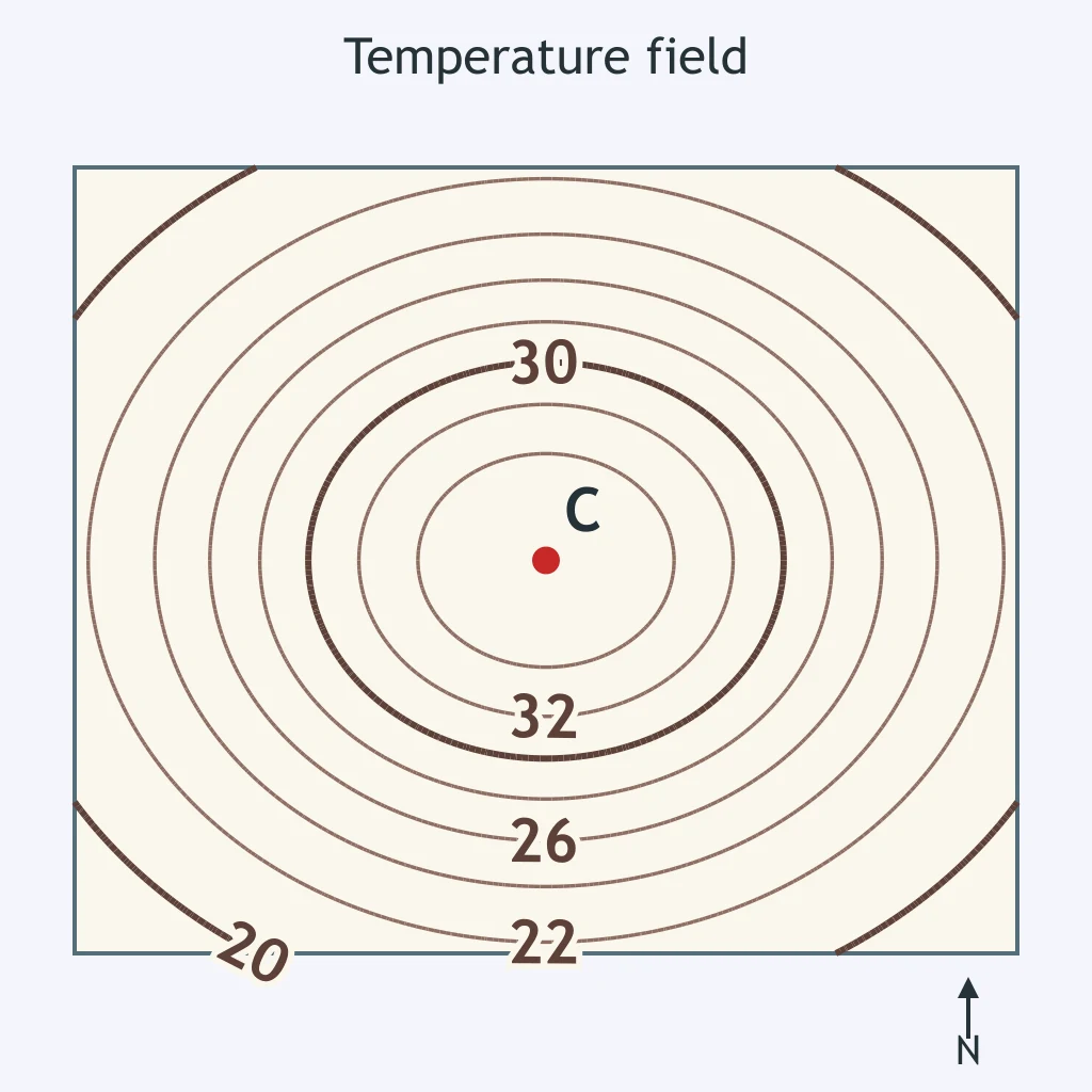
On the temperature field map, isotherms are drawn every 2 °C. What is the best estimate of the temperature at point M?
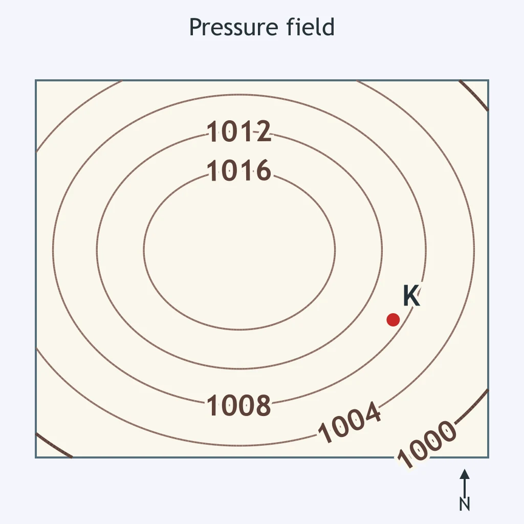
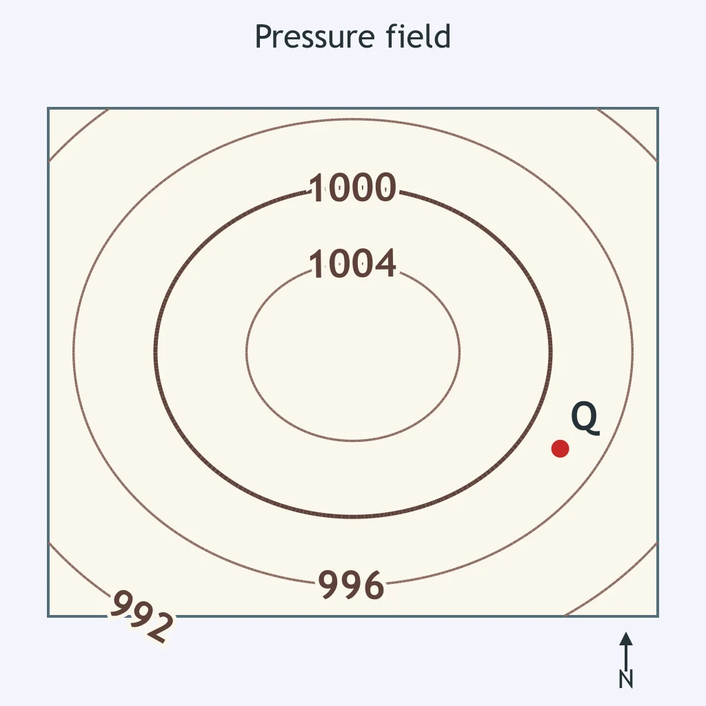
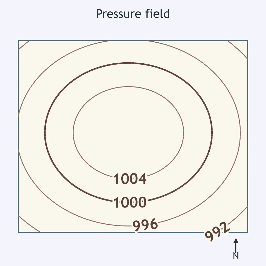
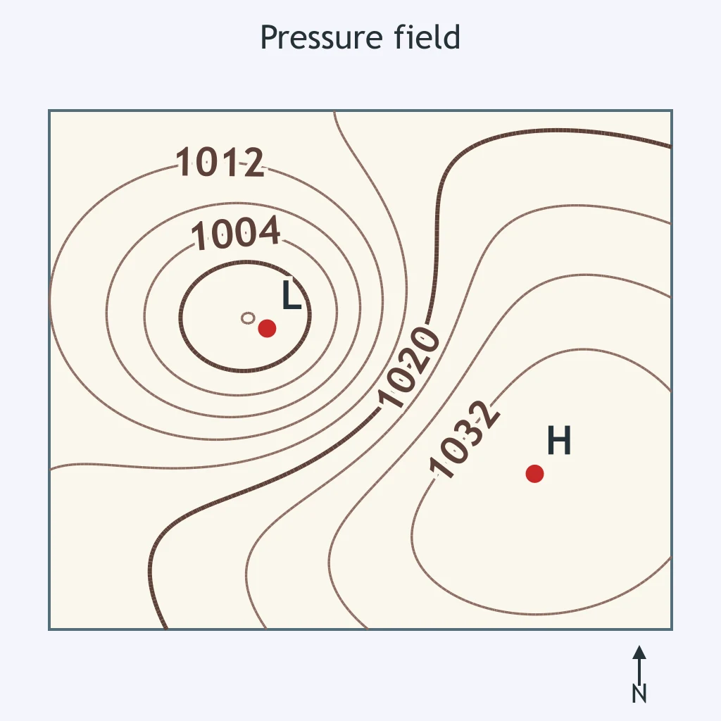
On the pressure field map, isobars are drawn every 4 millibars. What pressure best fits point K?
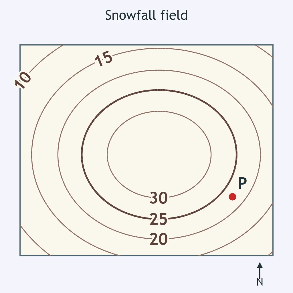
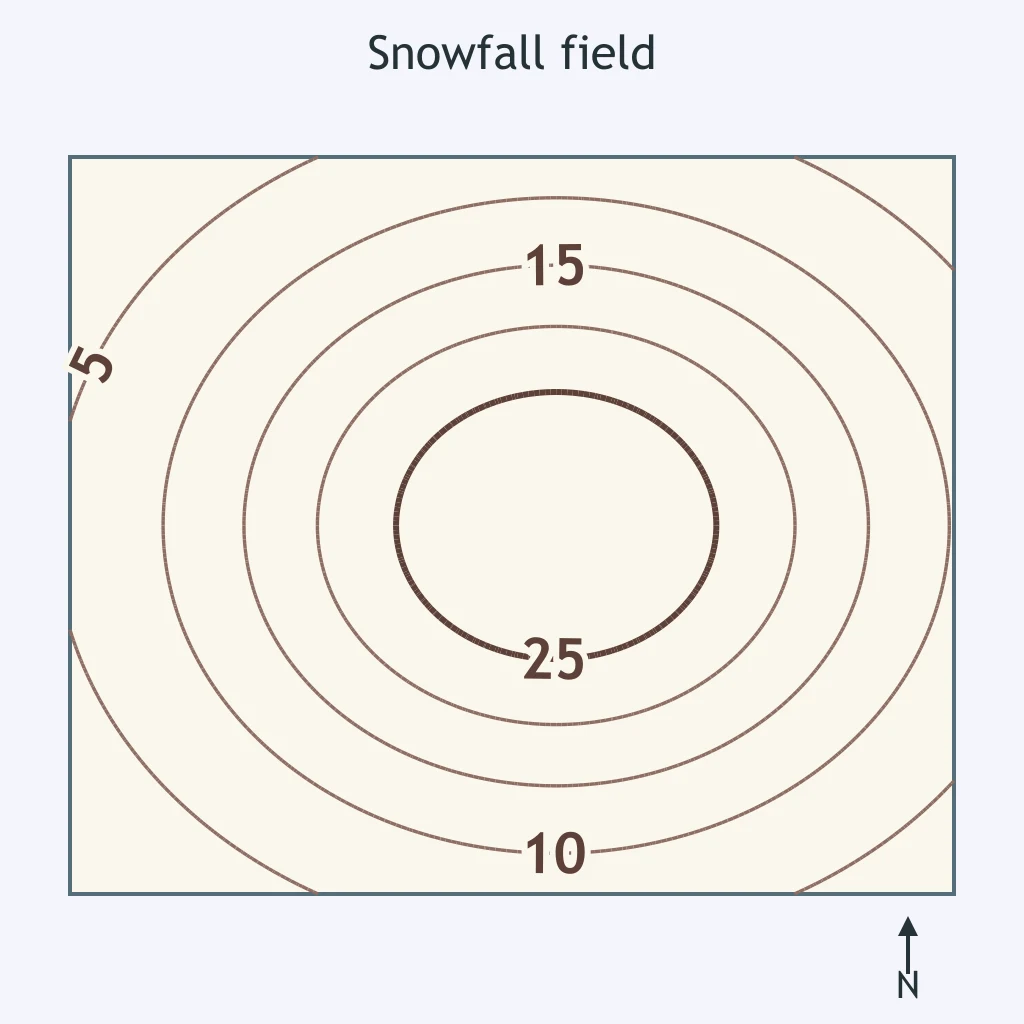
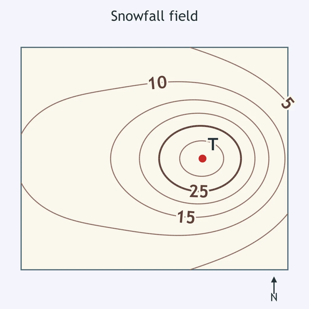
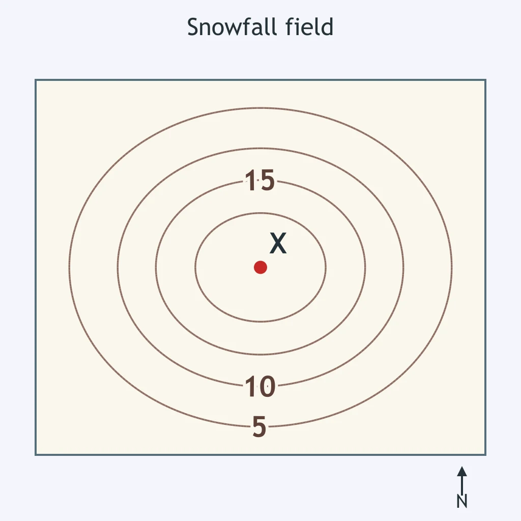
A snowfall field map has isolines every 5 cm. What snowfall amount should be interpolated for point P?
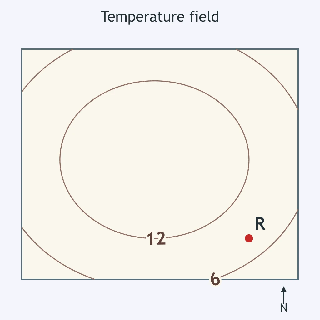
On the temperature field map, isotherms are drawn every 6 °C. What value should be assigned to point R?
On the isobar map, isobars are drawn every 4 millibars. What pressure is most reasonable at point Q?
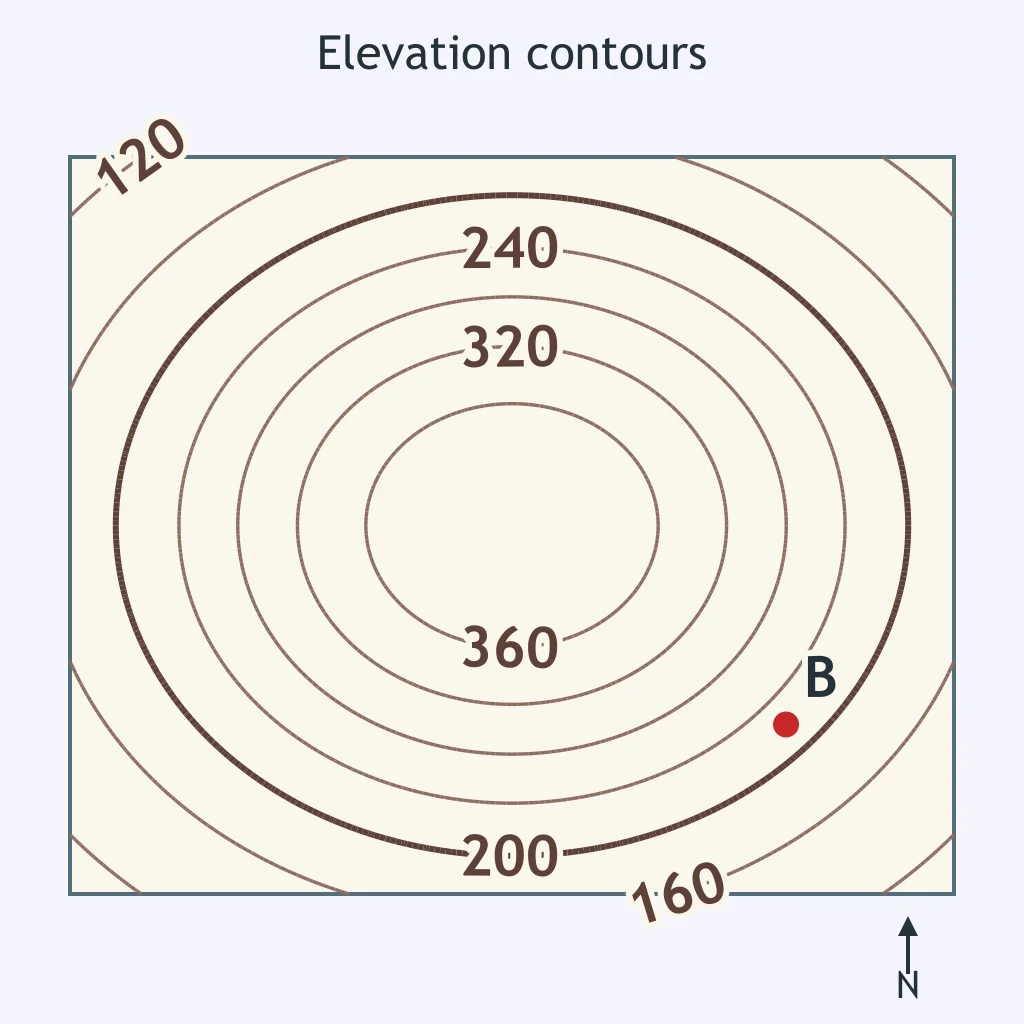
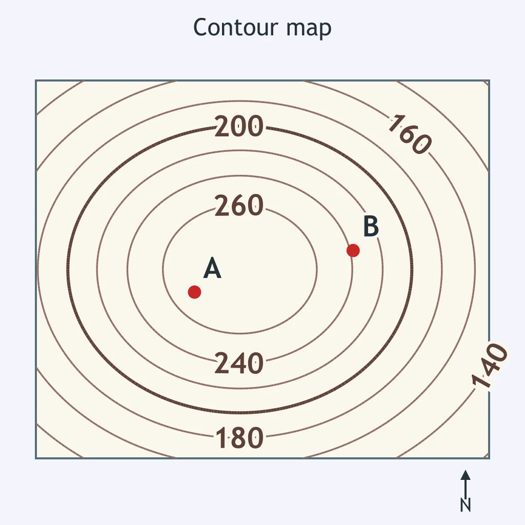
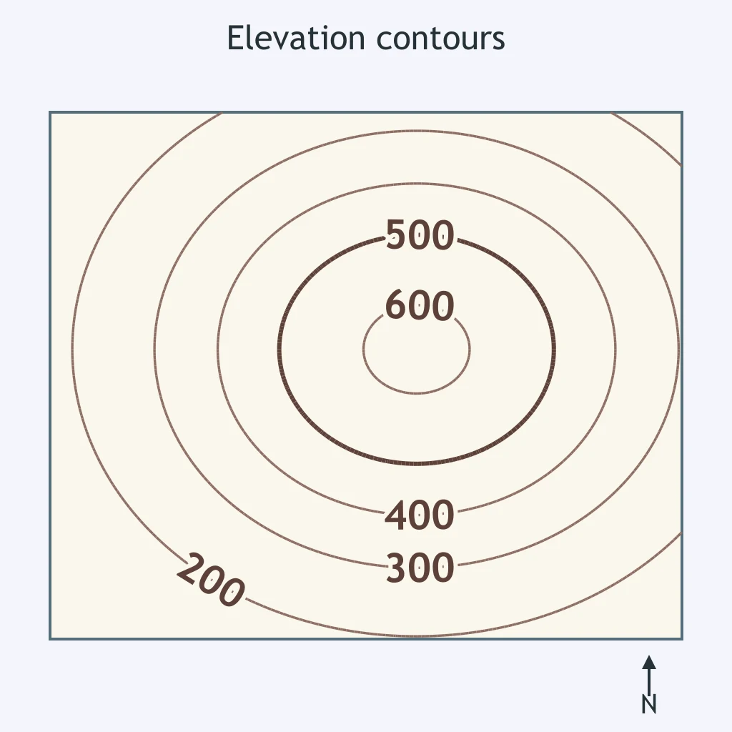
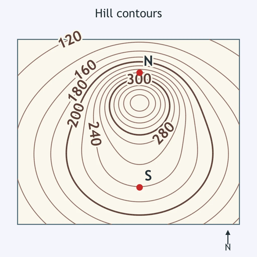
On the contour map, the contour interval is 40 m. What elevation should be interpolated for point B?
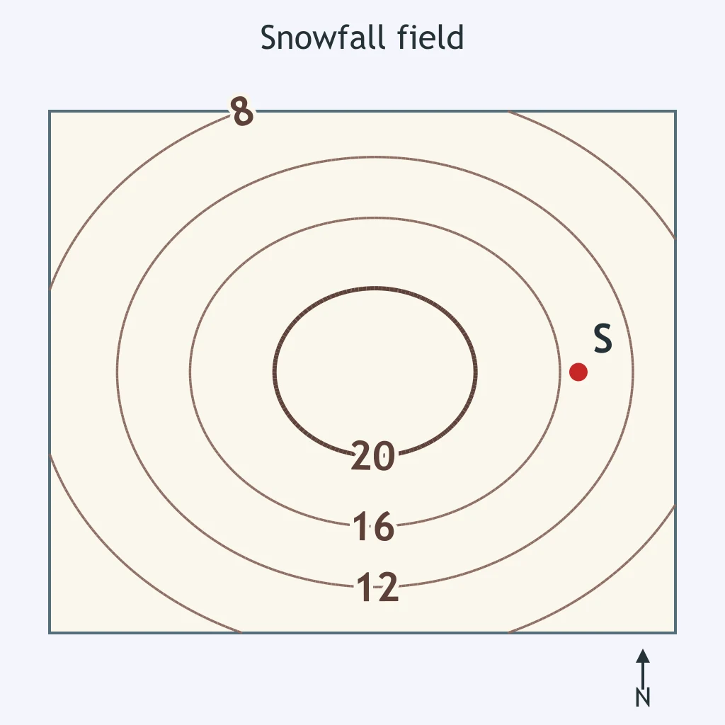
A snowfall map has isolines every 4 cm. What amount best fits point S?
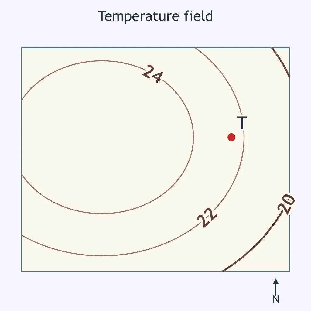
On the temperature field map, isotherms are drawn every 2 °C. What temperature best fits point T?
A student's snowfall field map has two isolines crossing directly over one town. Why is that drawing wrong?
What does the contour interval tell a map reader?
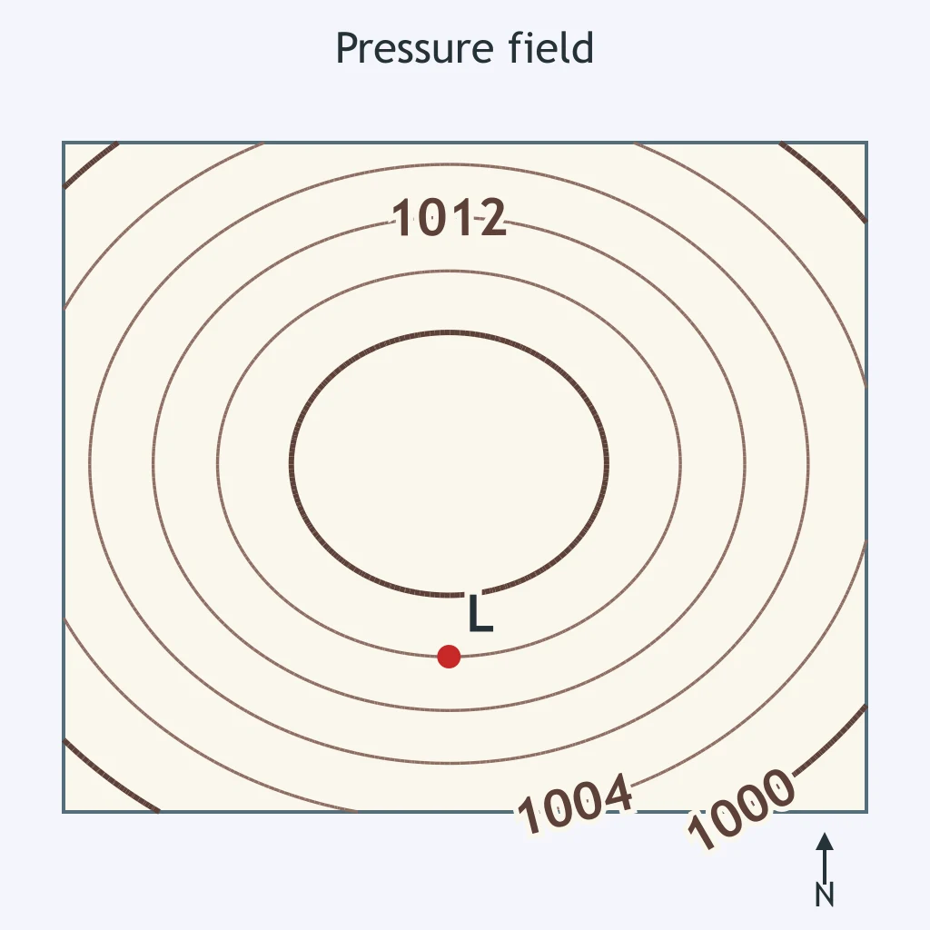
On the pressure field map, isobars are drawn every 4 millibars. What pressure should be recorded at point L?
A line on a weather map connects stations that all have 18 °C air temperature. What kind of isoline is it?
A student draws the 8 °C isotherm through stations labeled 8 °C, 8 °C, and 12 °C. Which station does not belong on that isotherm?
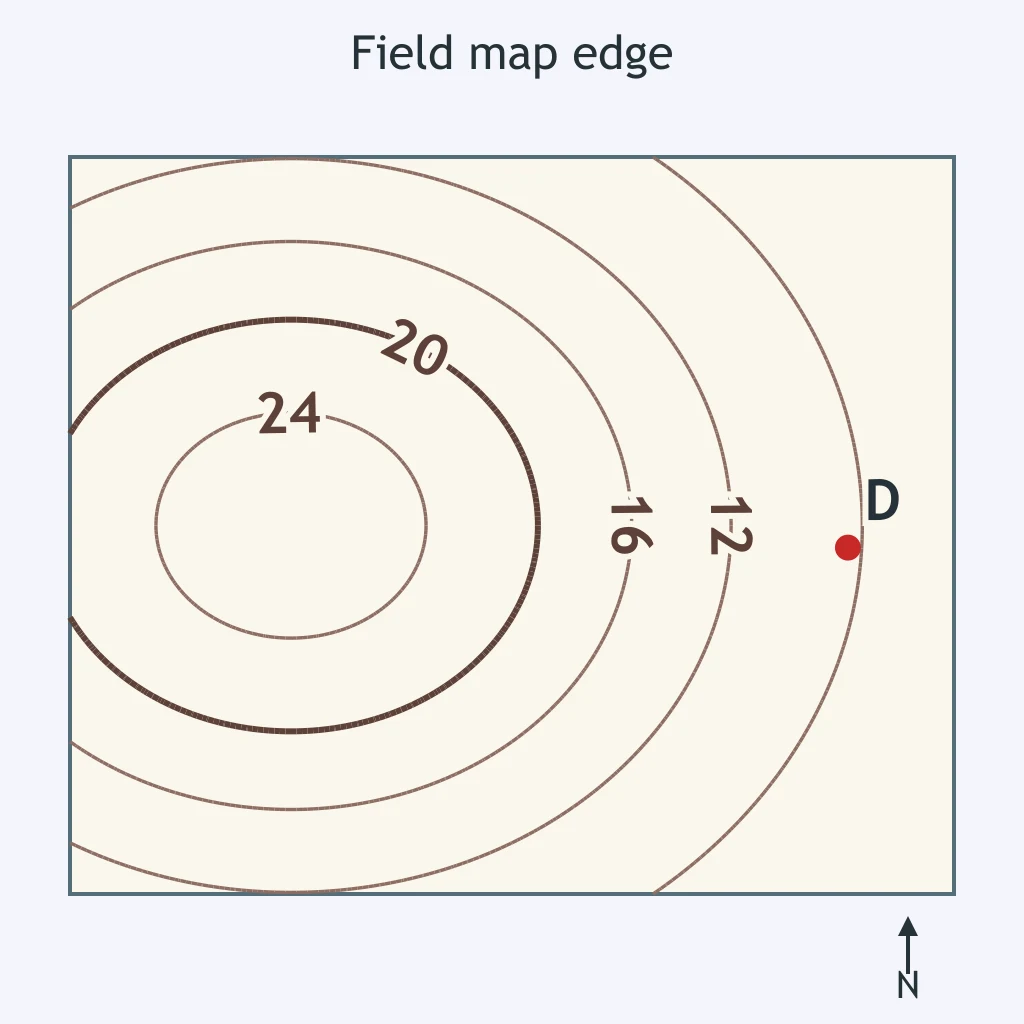
On a field map, an isoline approaches the edge of the mapped area without closing. What should it do at the edge?
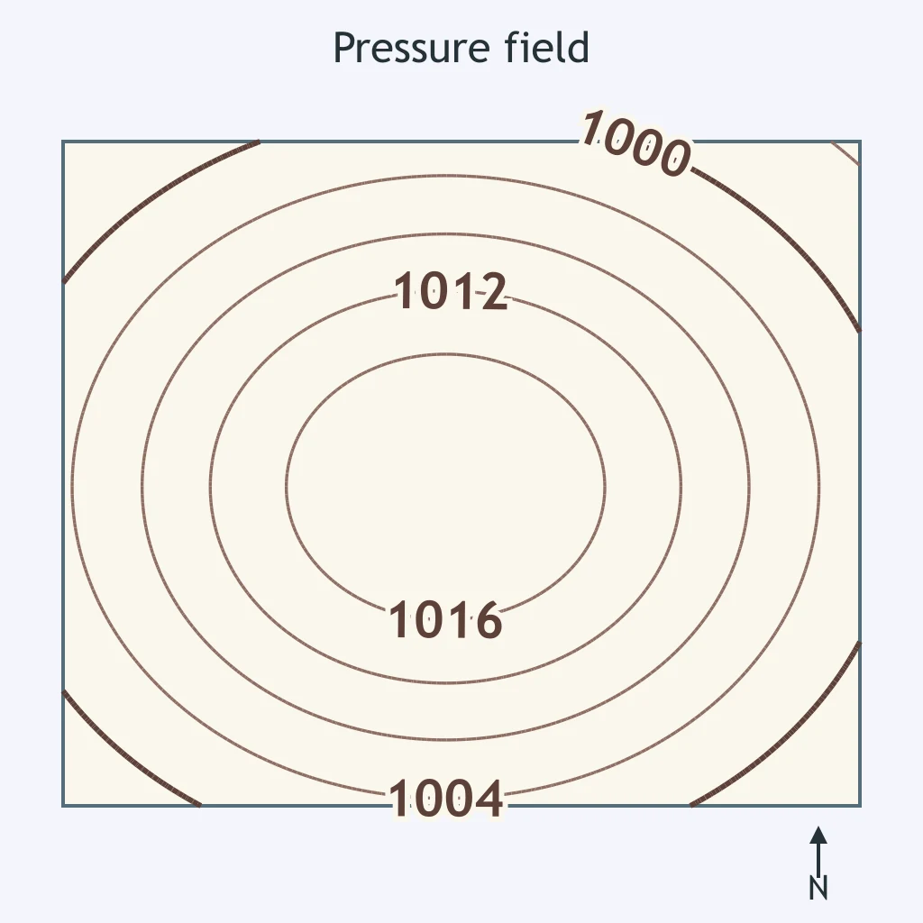
Why are isolines usually drawn as smooth curves when the measured field changes gradually?
On a pressure field map, the 1004 and 1016 millibar isobars are 300 km apart. What is the pressure gradient between them?
A temperature field changes from 4 °C to 16 °C over 120 km. What is the temperature gradient?
On a snowfall field map, the 5 cm and 25 cm isolines are 50 km apart along a road. What is the snowfall gradient along the road?
On a contour map, the elevation changes from 200 m to 500 m over 6 km. What is the gradient between those two points?
The pressure changes from 992 millibars to 1000 millibars over a distance of 80 km. What is the pressure gradient?
Use the snowfall field map. Where is snowfall changing fastest near town T?
On the contour map, which side of the hill has the steeper slope?
A temperature field has closed isotherms labeled 24 °C, 26 °C, and 28 °C, with values increasing toward the center. What does the center mark?
On a pressure field map, isobars are packed tightly near a low-pressure center and spread out near a high-pressure center. Where is the pressure gradient largest?
A field map has closed snowfall isolines of 5 cm, 10 cm, 15 cm, and 20 cm, with larger totals toward the center. Where is the maximum snowfall most likely found?
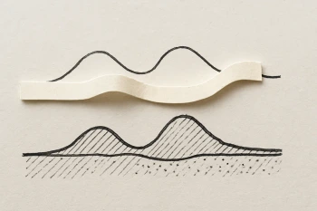
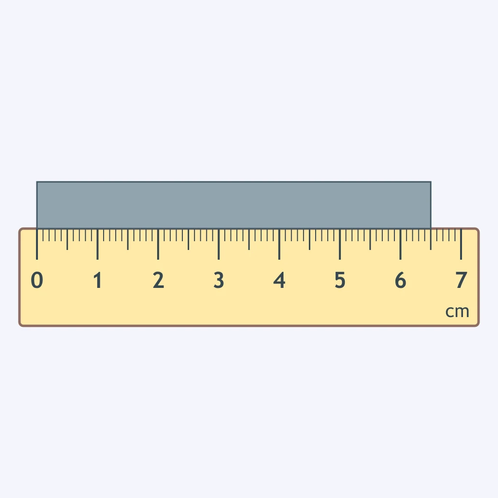
A student marks the distance between two towns on a map onto a strip of paper and lays it along a ruler, as shown. The map's bar scale shows 1 cm represents 4 km. How far apart are the towns on the ground?
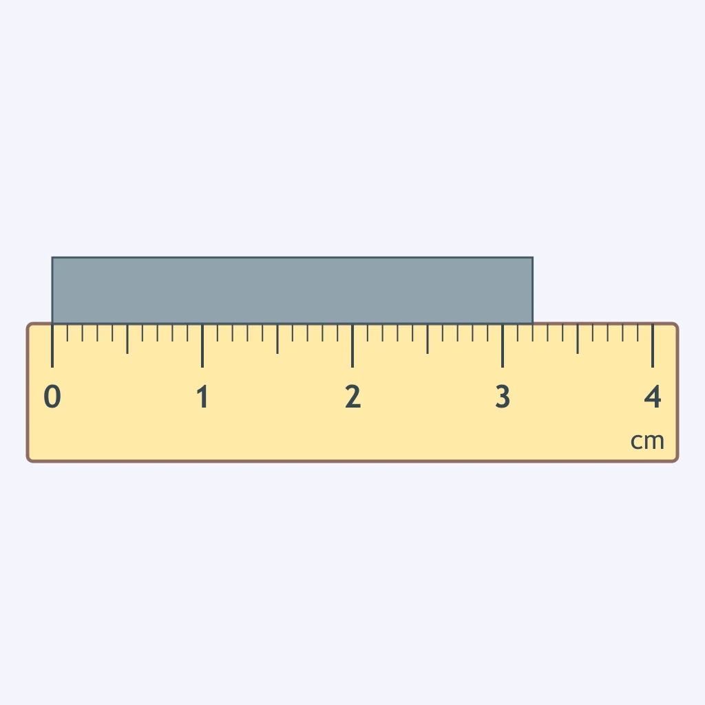
A student marks a trail's length on a map onto a strip of paper and lays it along a ruler, as shown. The map's bar scale shows 1 cm represents 10 km. What ground distance does the trail represent?
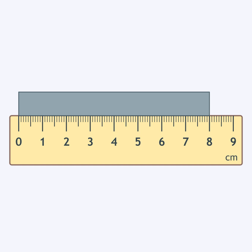
A student traces a shoreline's length on a map onto a strip of paper and lays it along a ruler, as shown. The map's bar scale shows 2 cm represents 5 km. How long is the shoreline on the ground?
A student marks a route's length on a regional map onto a strip of paper and lays it along a ruler, as shown. The map's bar scale shows 5 cm represents 100 km. What ground distance does the route represent?
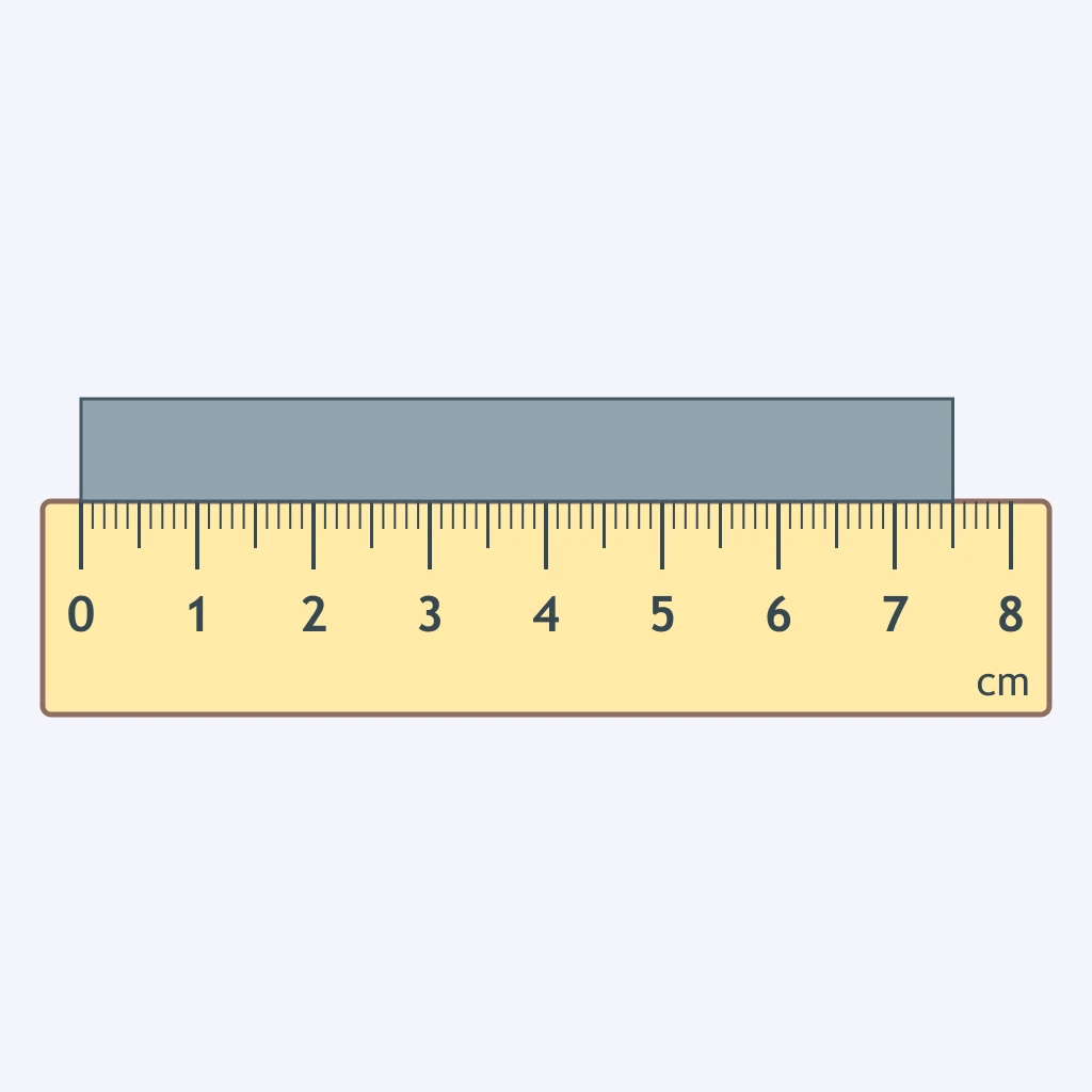
A student marks the straight-line distance between two cities on a map onto a strip of paper and lays it along a ruler, as shown. The map scale states 1 cm represents 25 km. What is the cities' ground distance?
Crack the passcode before the zombies get in.
Answer, then swat bugs for bonus points.
Race through questions at your own speed.
Same question on every screen. Fastest wins.

Pick a tile, answer, hit bonuses and steals.
Earth's Rotation and Revolution
40 questions