Loading
by BlastRoom
Students read topographic maps and profiles to calculate and compare gradients.
#earth_space_science

40 questions
One question set, multiple game modes. Tap any game to see it in action. Not sure which to pick?
Answer to place stones and capture territory.
Outrun the snow together.
Earn blasts, then hunt the other team.
Answer to earn energy, then climb.

The class blasts through walls together.
Bid on mystery lots. Most money wins.
Sell tours. Nice, standard, or a total scam.

Answer, restock, and serve the rush.
More correct answers pulls the rope your way.
Answer, then shoot down the alien wave.
Answer, then tap to leap the frozen ridge.
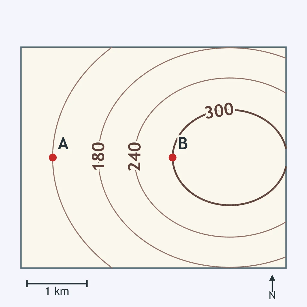
Use the contour lines and the scale bar. What is the gradient from A to B?
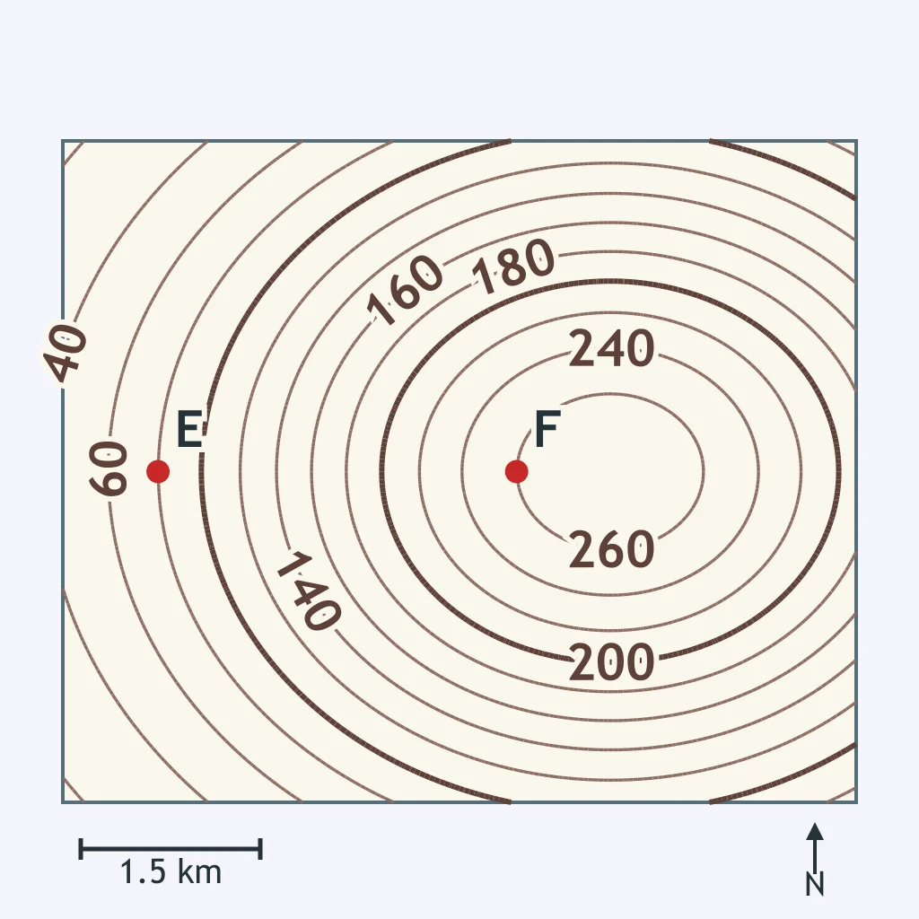
Read the elevations of E and F from the contour lines and measure EF with the scale bar. What is the gradient from E to F?
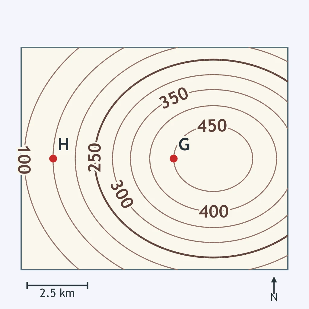
Use the contour lines and the scale bar. What is the gradient between G and H?
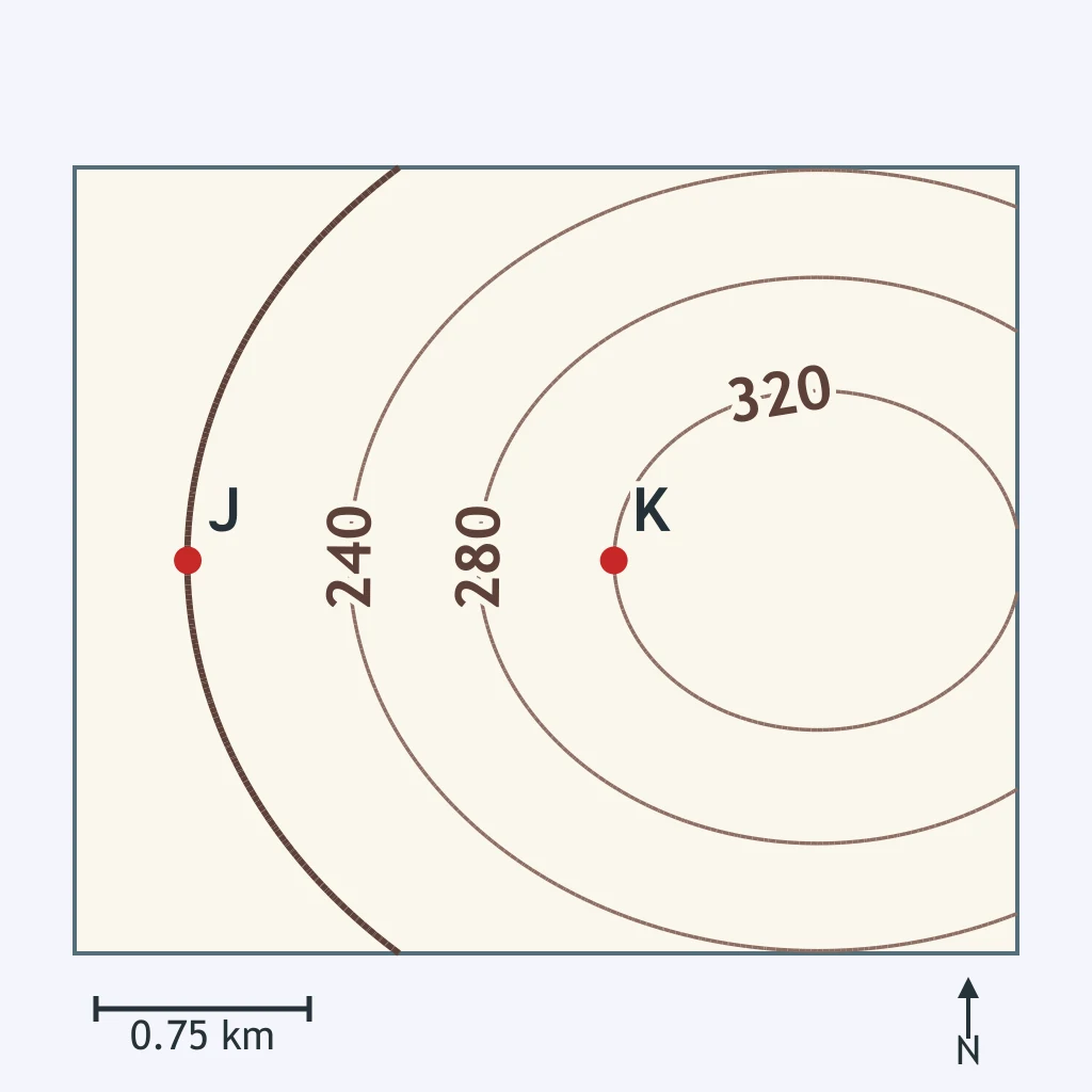
Use the contours to find the elevations of J and K and the scale bar to find the distance. What is the gradient along JK?
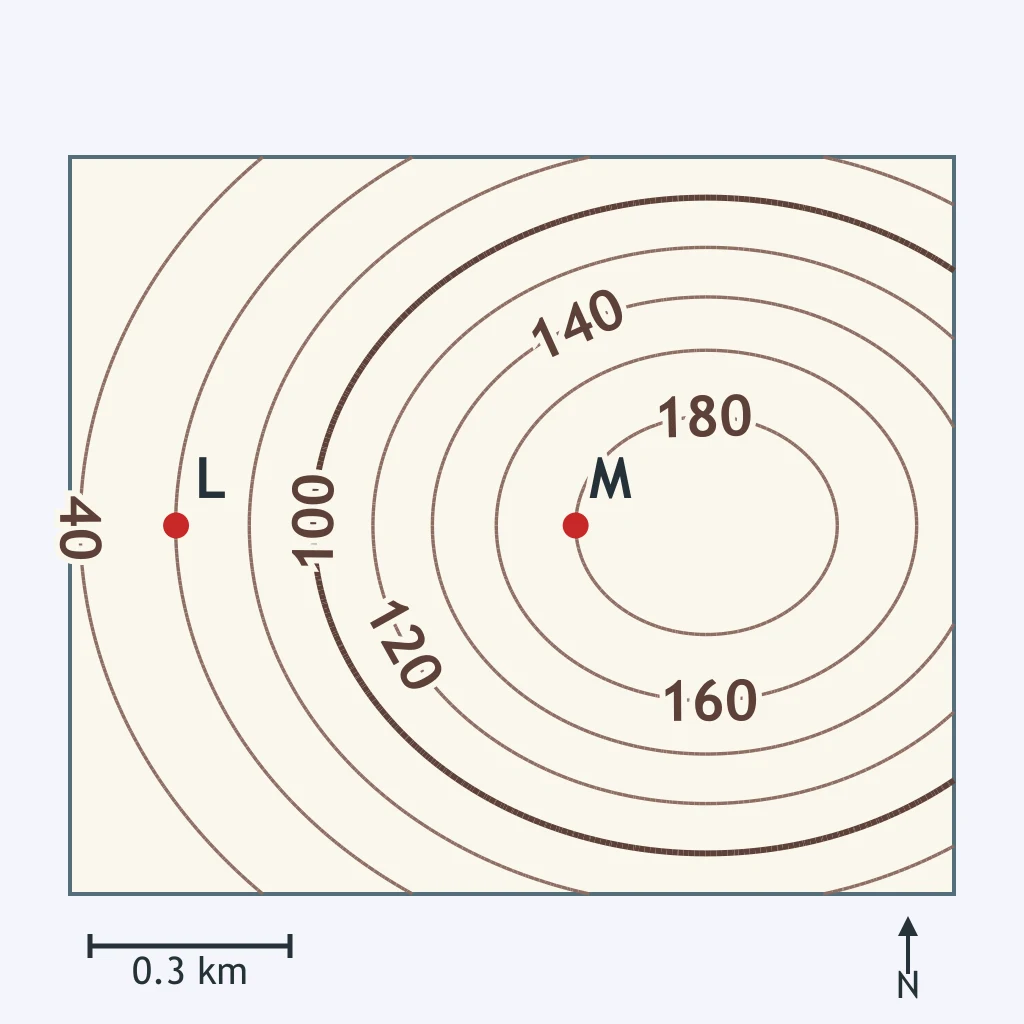
Find the elevations of L and M from the contours and the L-M distance from the scale bar. What is the gradient from L to M?
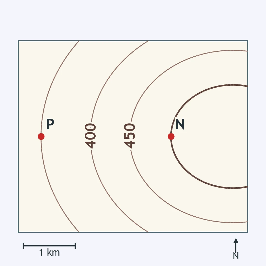
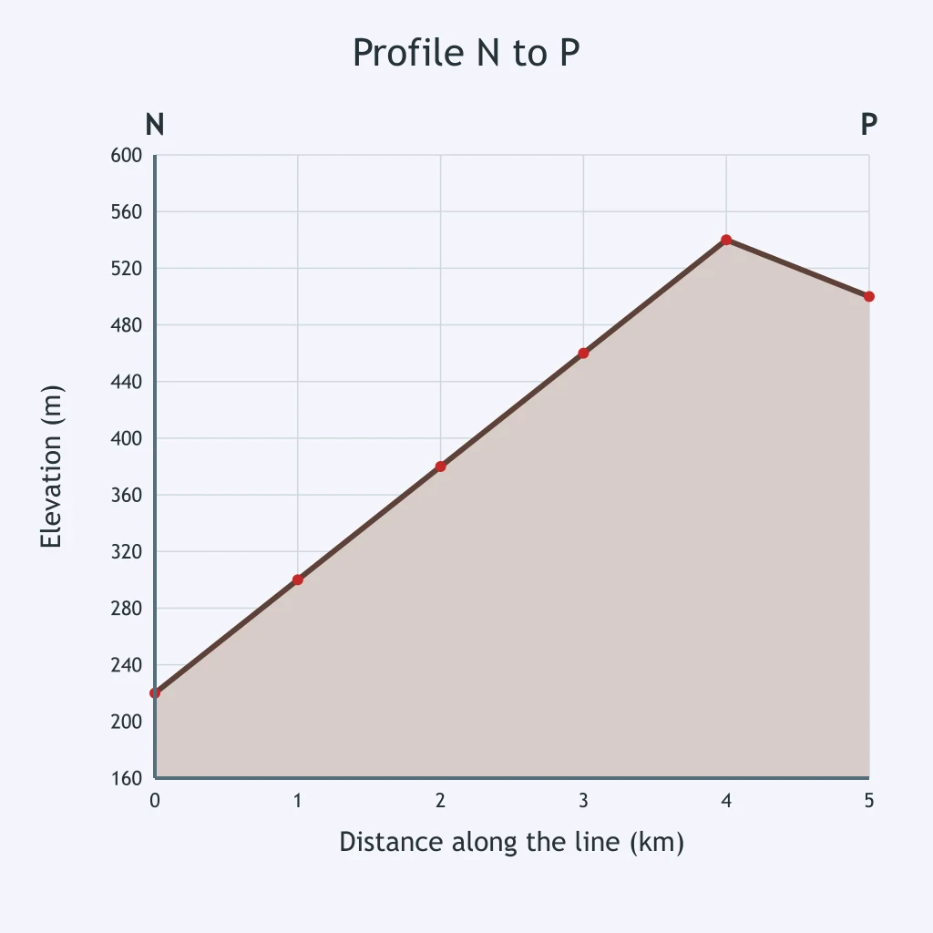
Use the contour lines and the scale bar. What is the gradient along NP?
Use the contour lines and the scale bar. What is the gradient along QR?
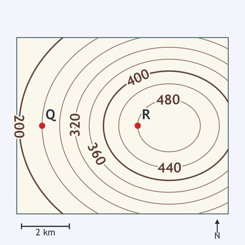
Read the elevations of S and T from the contours and measure ST with the scale bar. What is the gradient along ST?
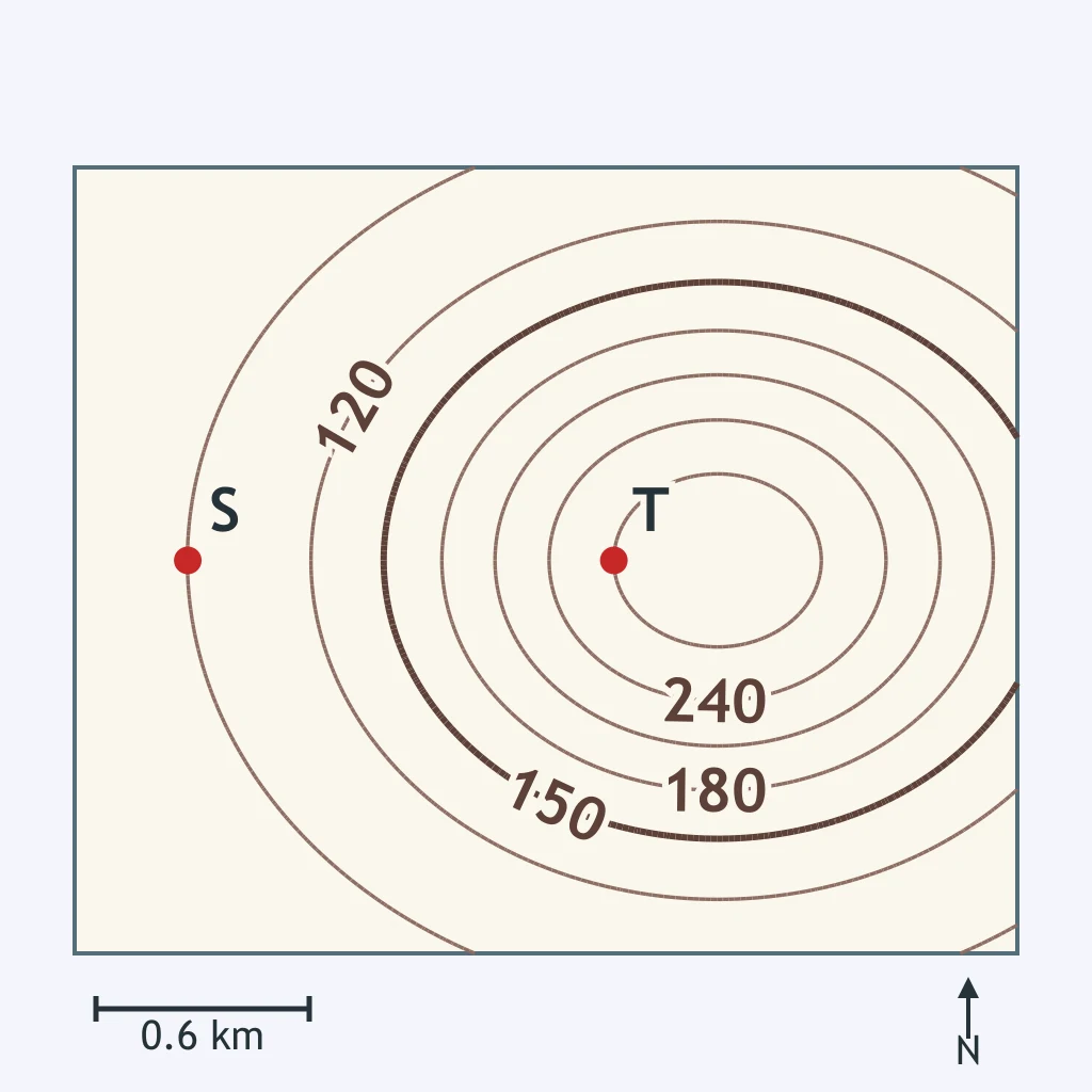
Calculate the gradient between U and V using the contour lines and the scale bar.
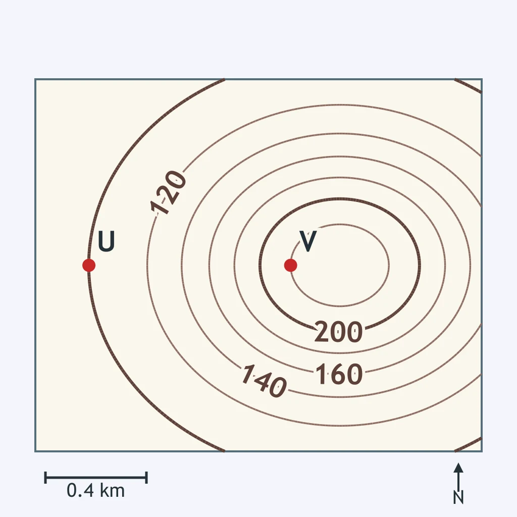
Using the contour lines and the scale bar, what is the gradient along WX?
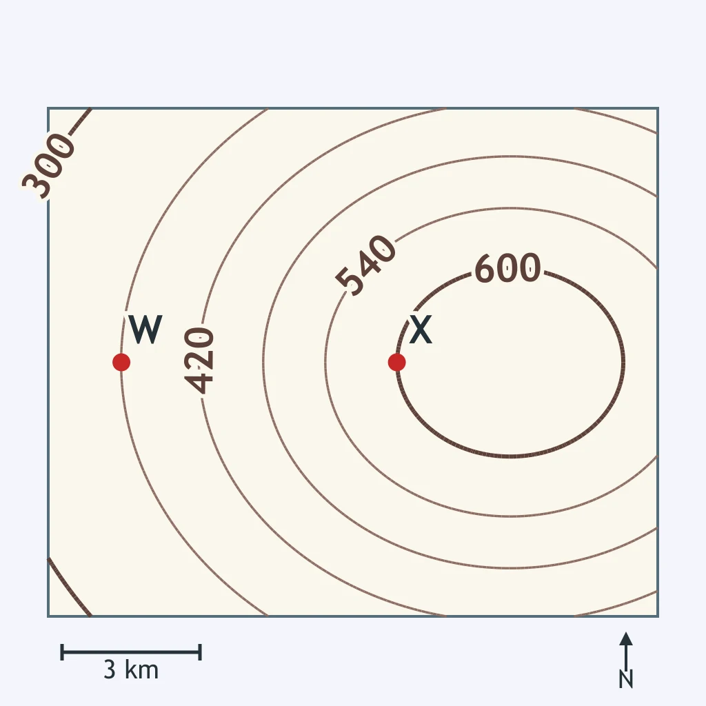
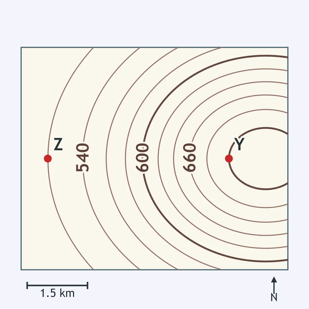
Use the contour lines and the scale bar. What gradient does line YZ represent?
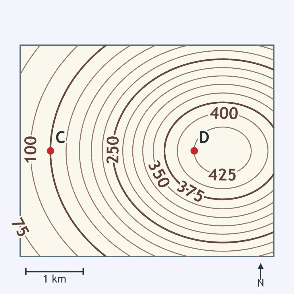
Use the contour lines and the scale bar. What is the gradient along CD?
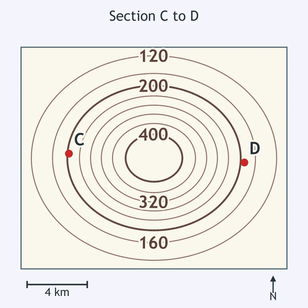
Trace the straight C-D section on the map. Which profile best matches the land surface?
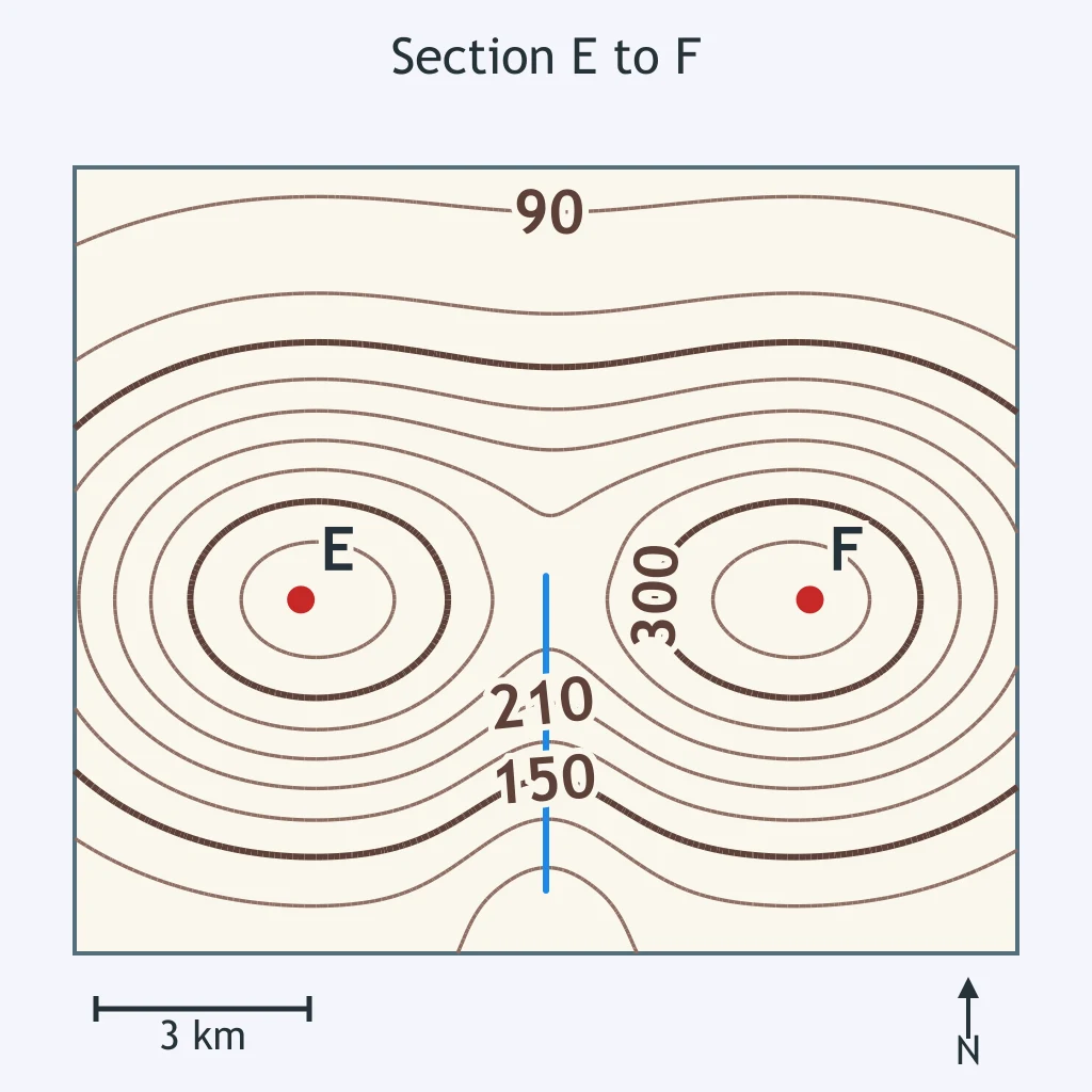
Which profile shape matches the E-F section on the map?
Use the G-H section line on the map. Which profile would show the correct overall trend?
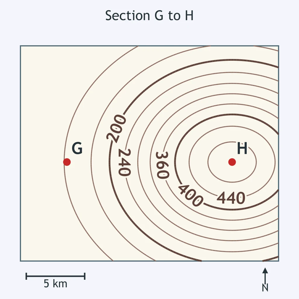
Which profile matches the section from I to J on the map?
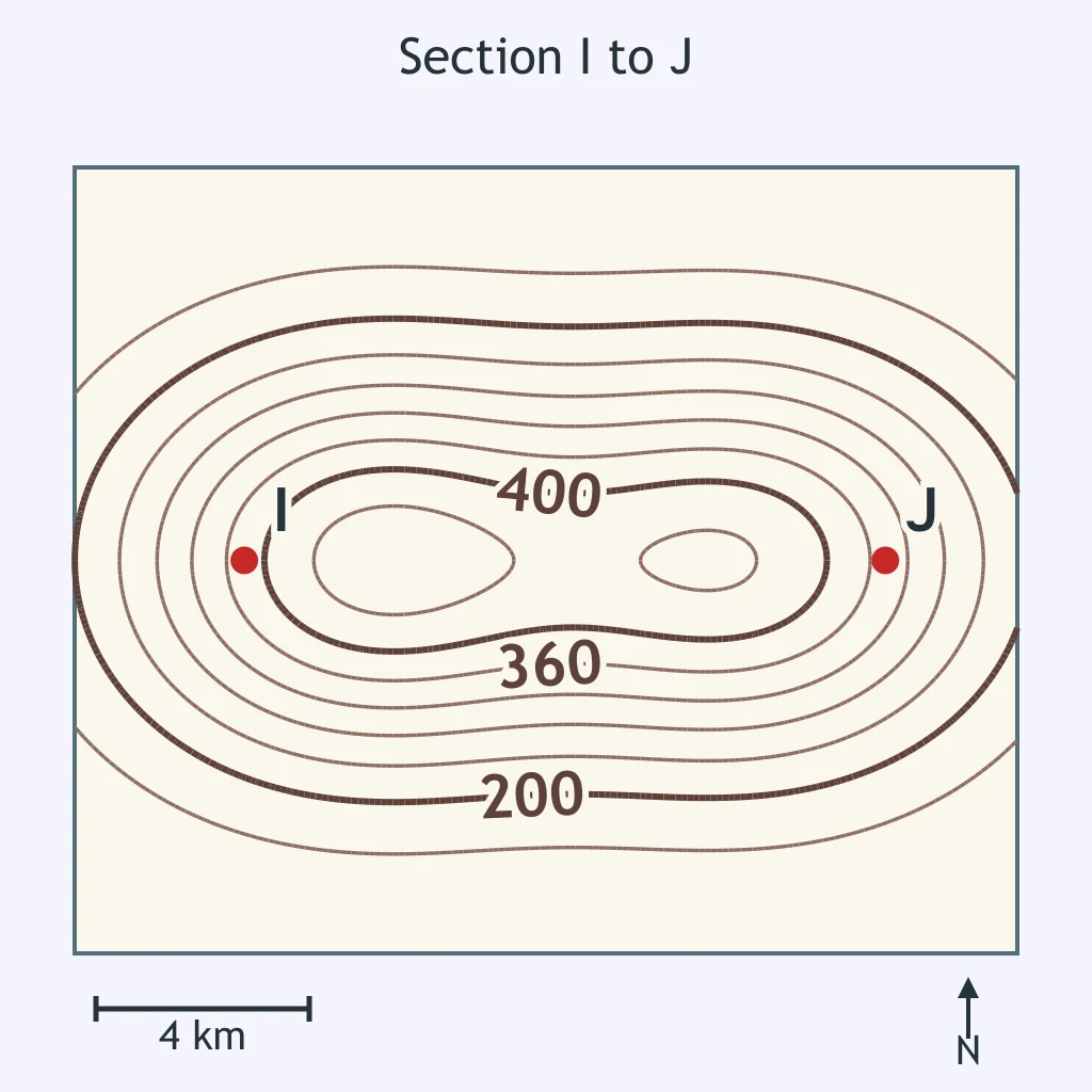
Which profile fits the section from K to L on the map?
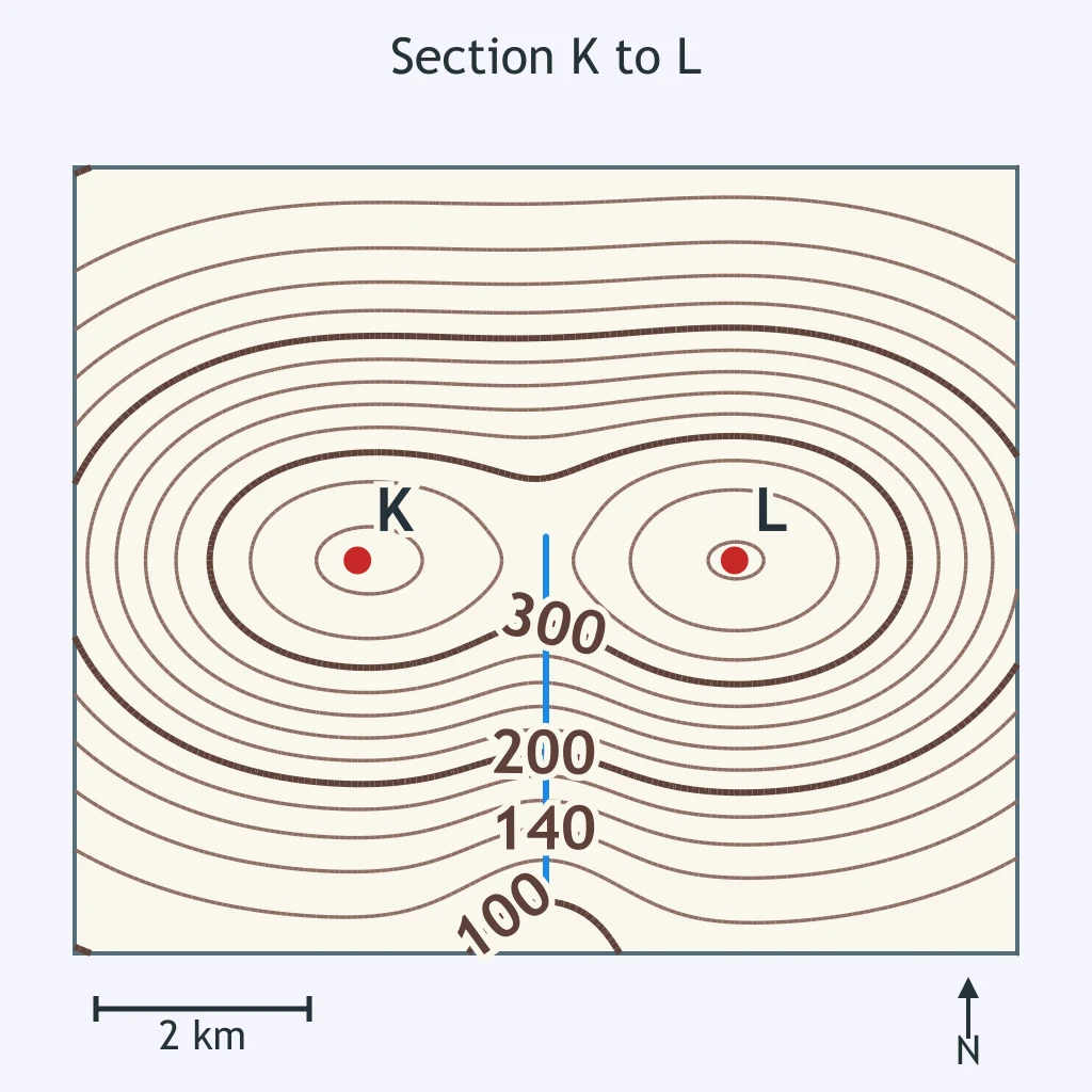
Which profile best fits the section from M to N on the map?
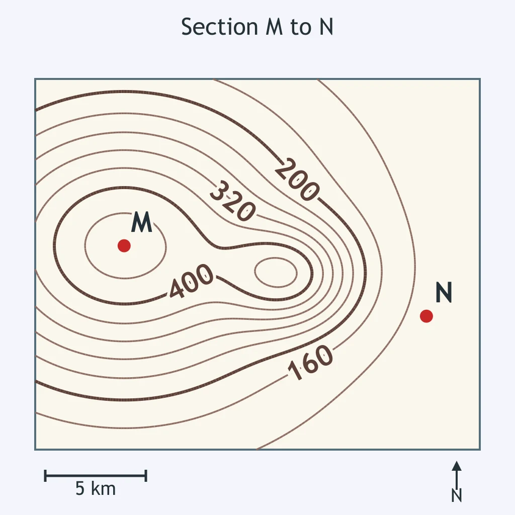
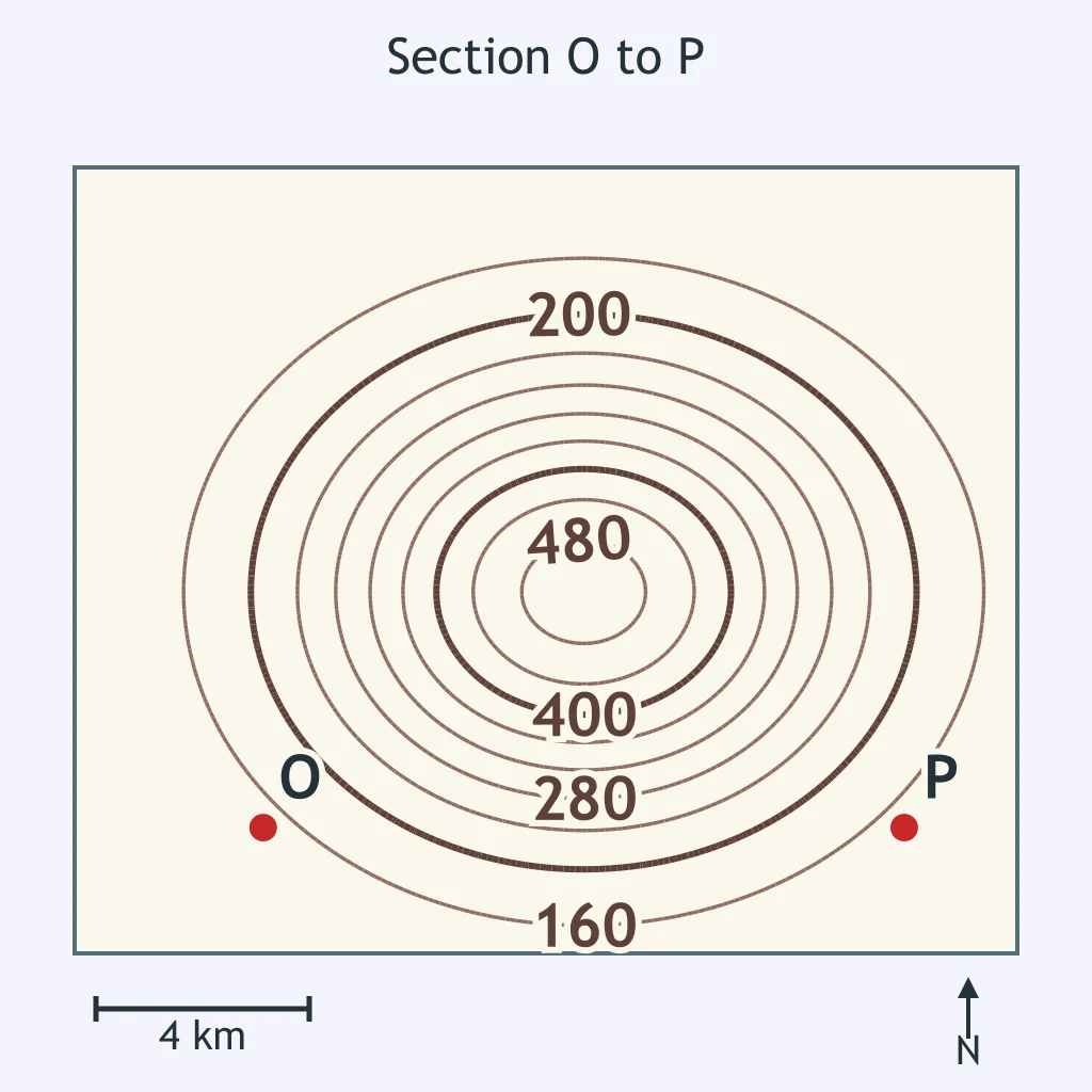
Which profile matches the section from O to P on the map?
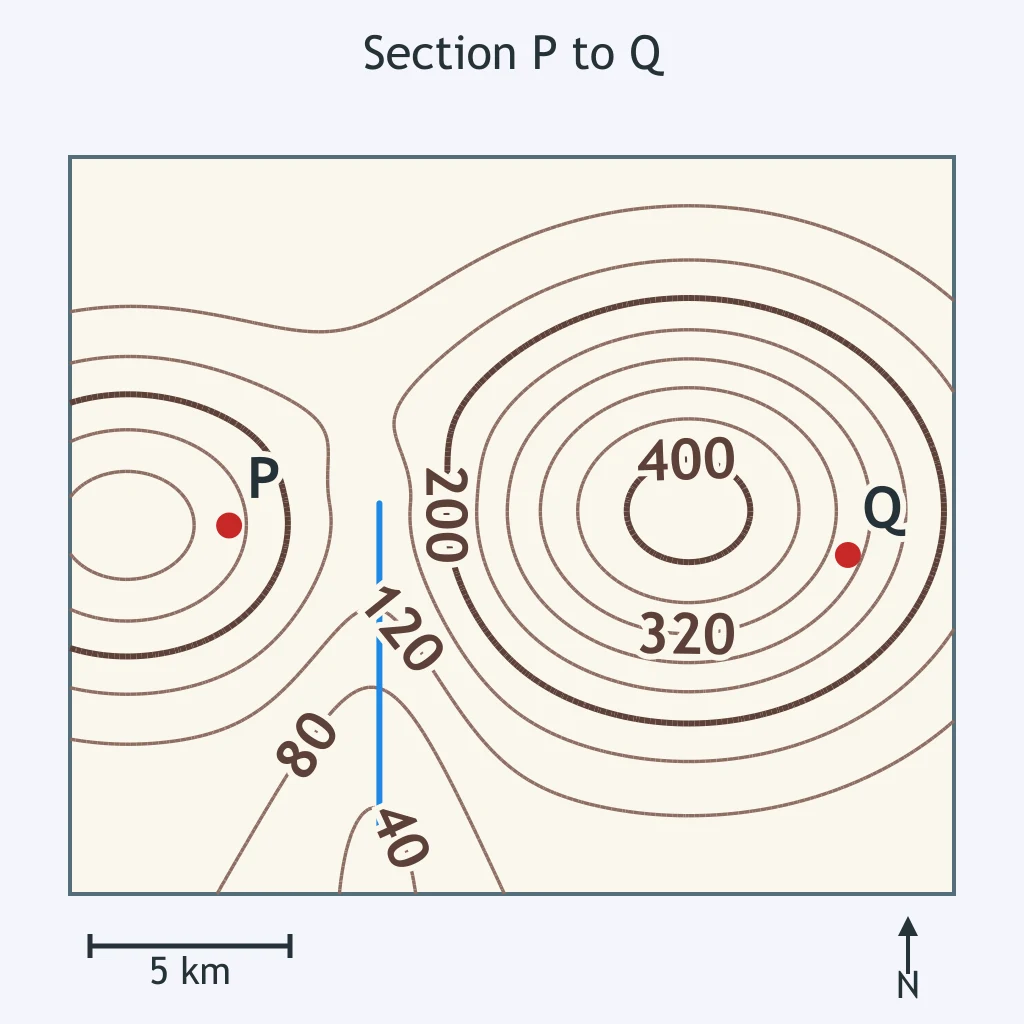
Which profile matches the section from P to Q on the map?
On the drawn profile, what elevation is plotted at 3 km?
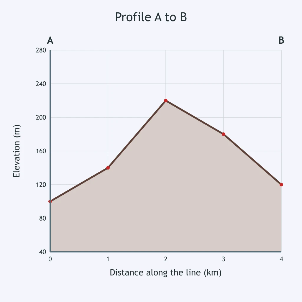
Read the profile graph. What elevation is shown at 1 km?
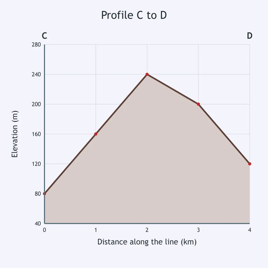
Use the drawn profile. What elevation is plotted at 4 km?
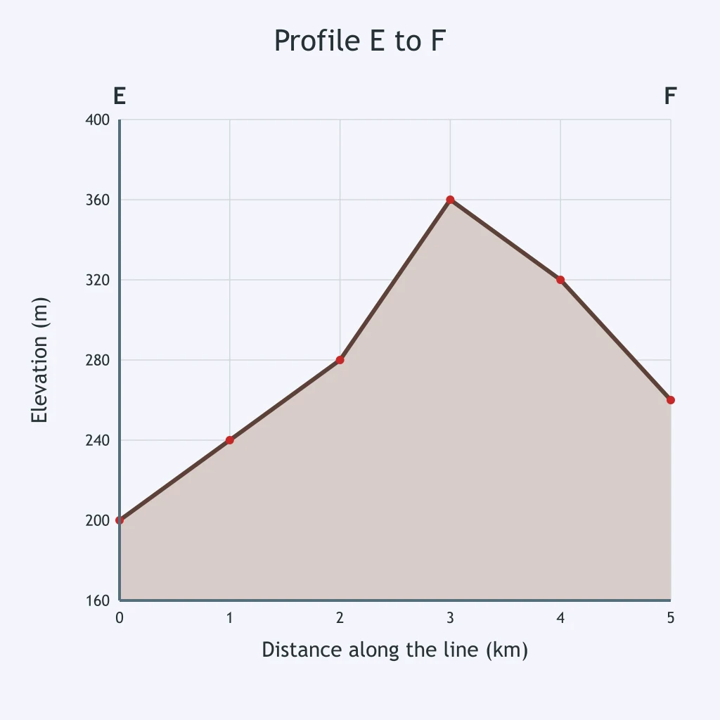
At 2.5 km on the profile, what elevation should be read from the graph?
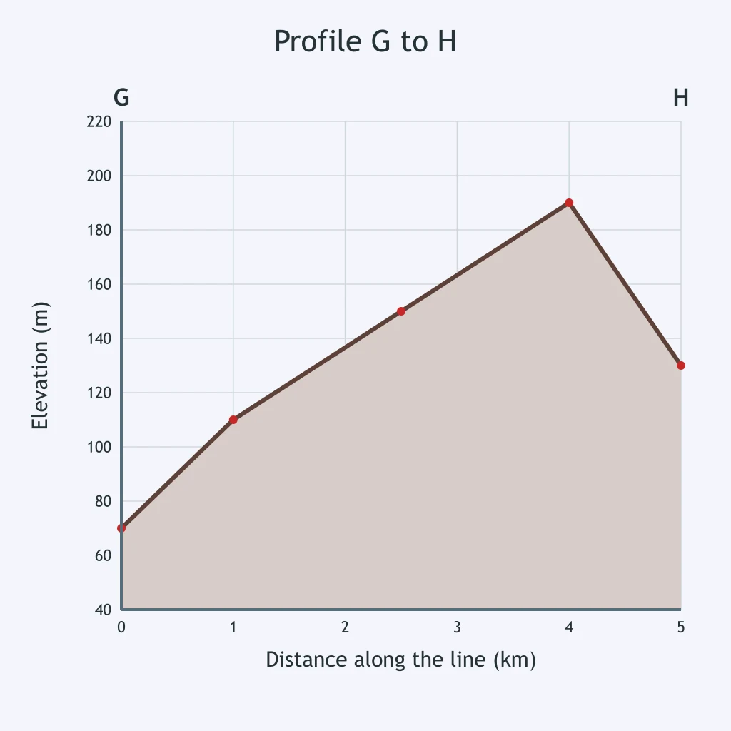
Look at the profile. What elevation is shown at 6 km?
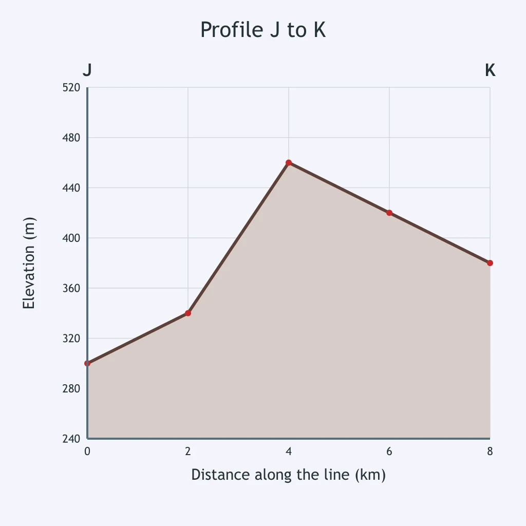
The profile is drawn with distance on the horizontal axis. What elevation is plotted at 1.5 km?
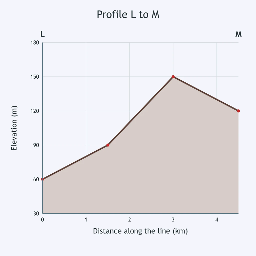
On the drawn N-P profile, what elevation is plotted at 5 km?
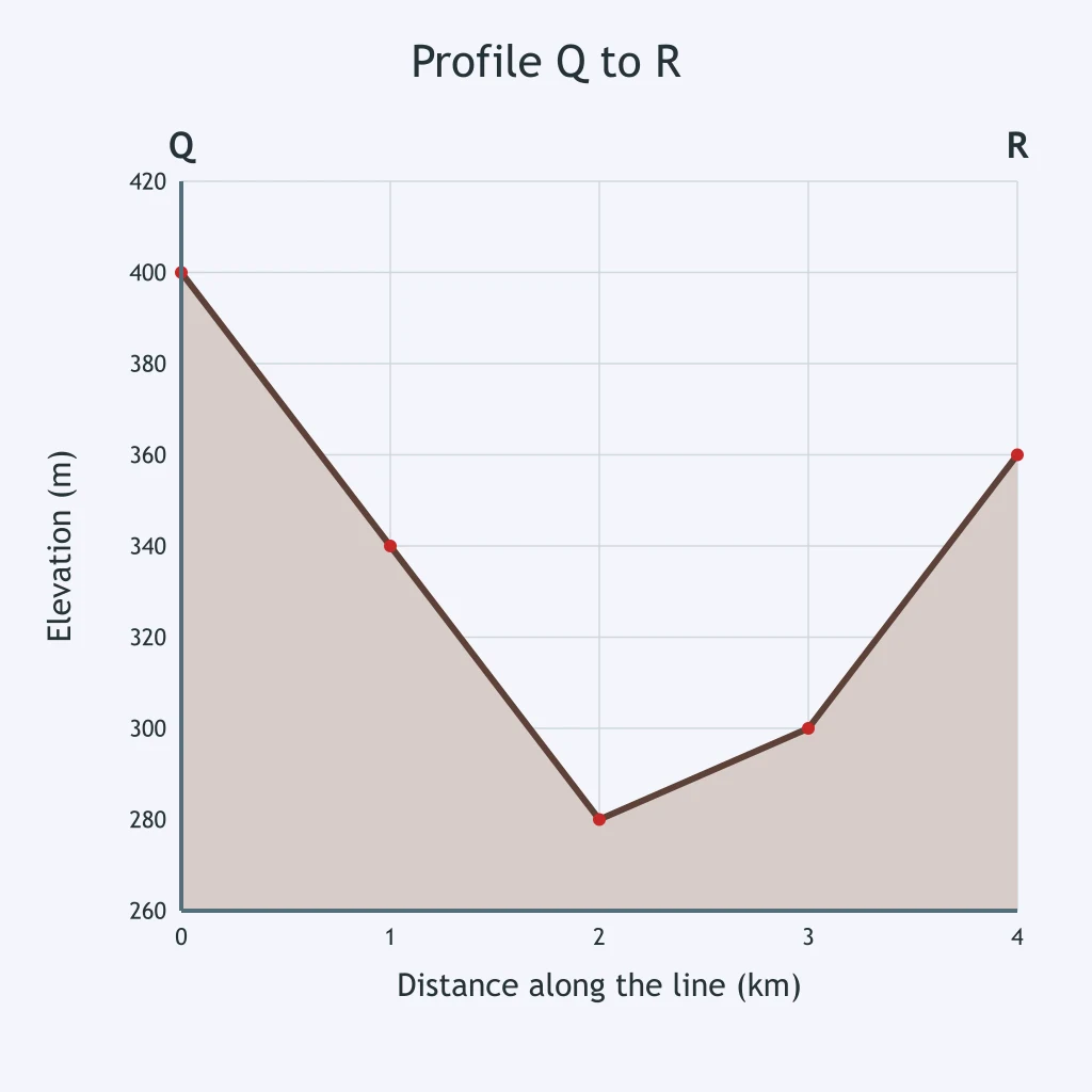
Read the Q-R profile. What elevation is shown at 2 km?
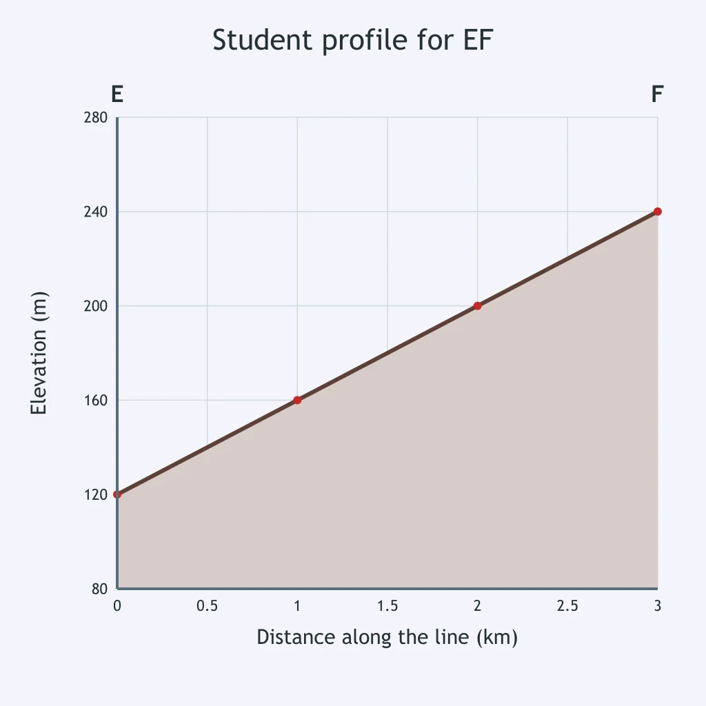
The map for EF crosses a stream valley halfway along, but the student's profile is shown. What error should be corrected?
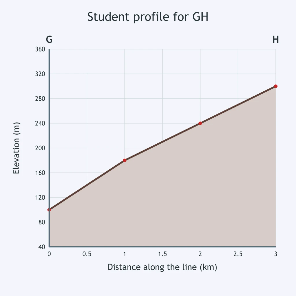
The map labels G at 300 m and H at 100 m, but the student's G-H profile is shown. What is wrong?
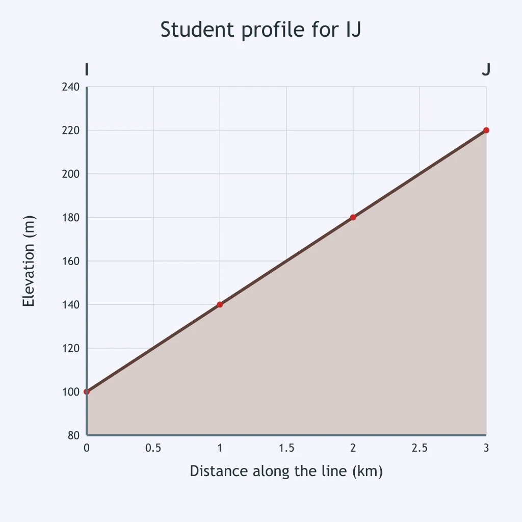
On the map, IJ crosses 100, 120, 140, and 160 m contours in order. The student's profile is shown. What mistake was made?
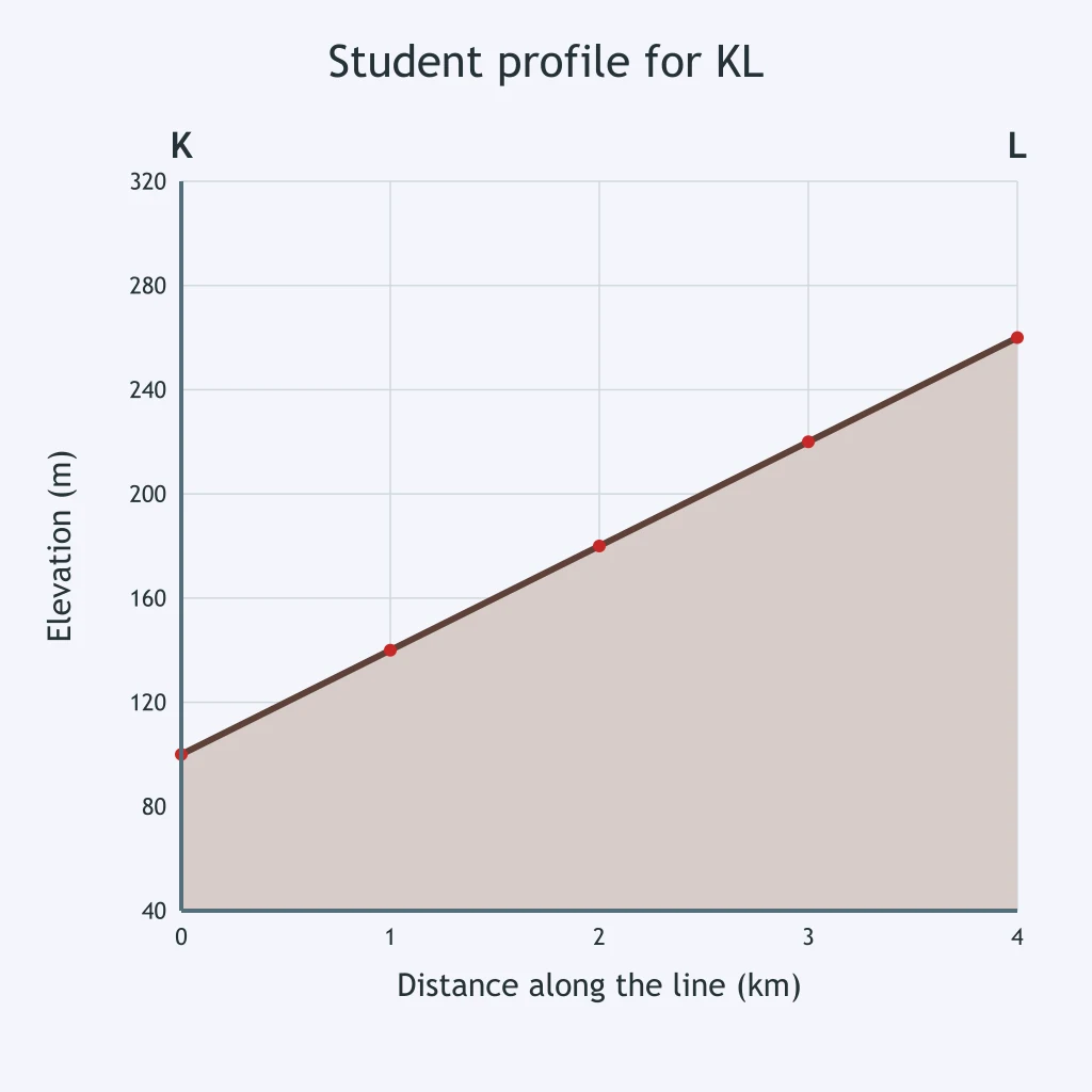
On the map, the contour crossings along KL are crowded together near L. The graph shows a student's profile for KL. What construction error does it show?
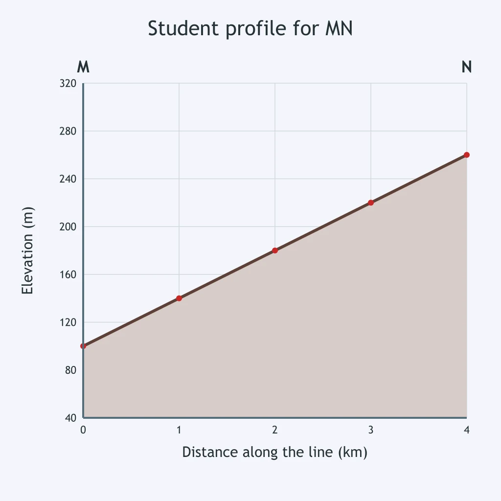
The map shows MN crossing a closed hilltop and then returning to lower contours, but the student's profile is shown. What is wrong?
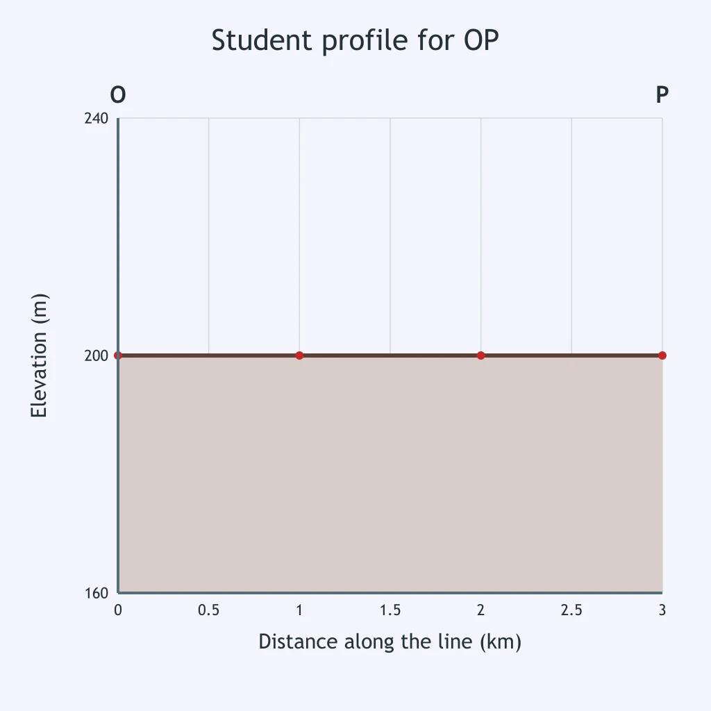
The map's OP line begins and ends at 200 m with a 120 m valley between them, but the student's profile is shown. What is wrong?
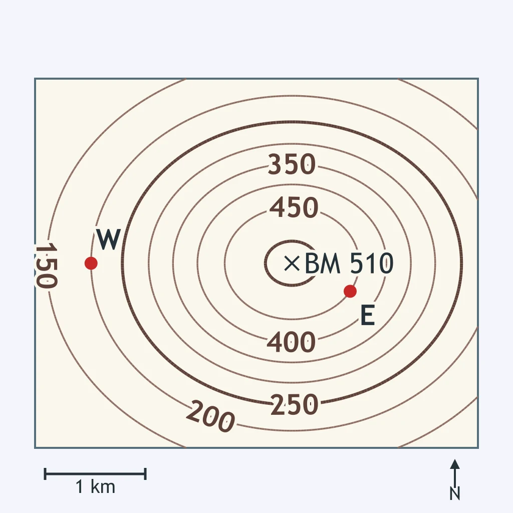
The west slope runs from the benchmark down to W, and the east slope runs from the benchmark down to E. Use the contours and the scale bar. Which gradient comparison is correct?
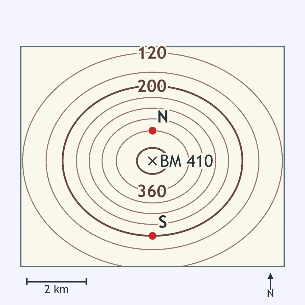
The north slope runs from the benchmark down to N, and the south slope runs from the benchmark down to S. Use the contours and the scale bar. Which slope has the greater gradient?
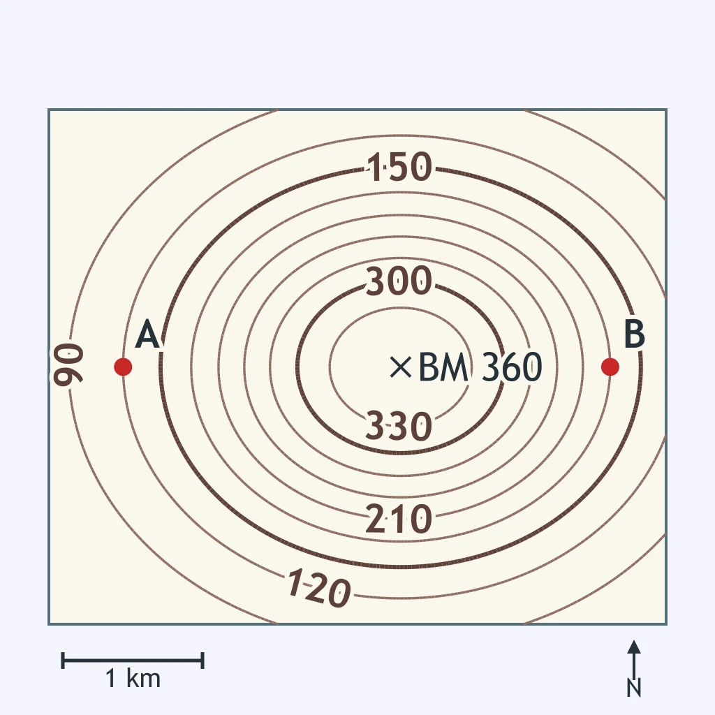
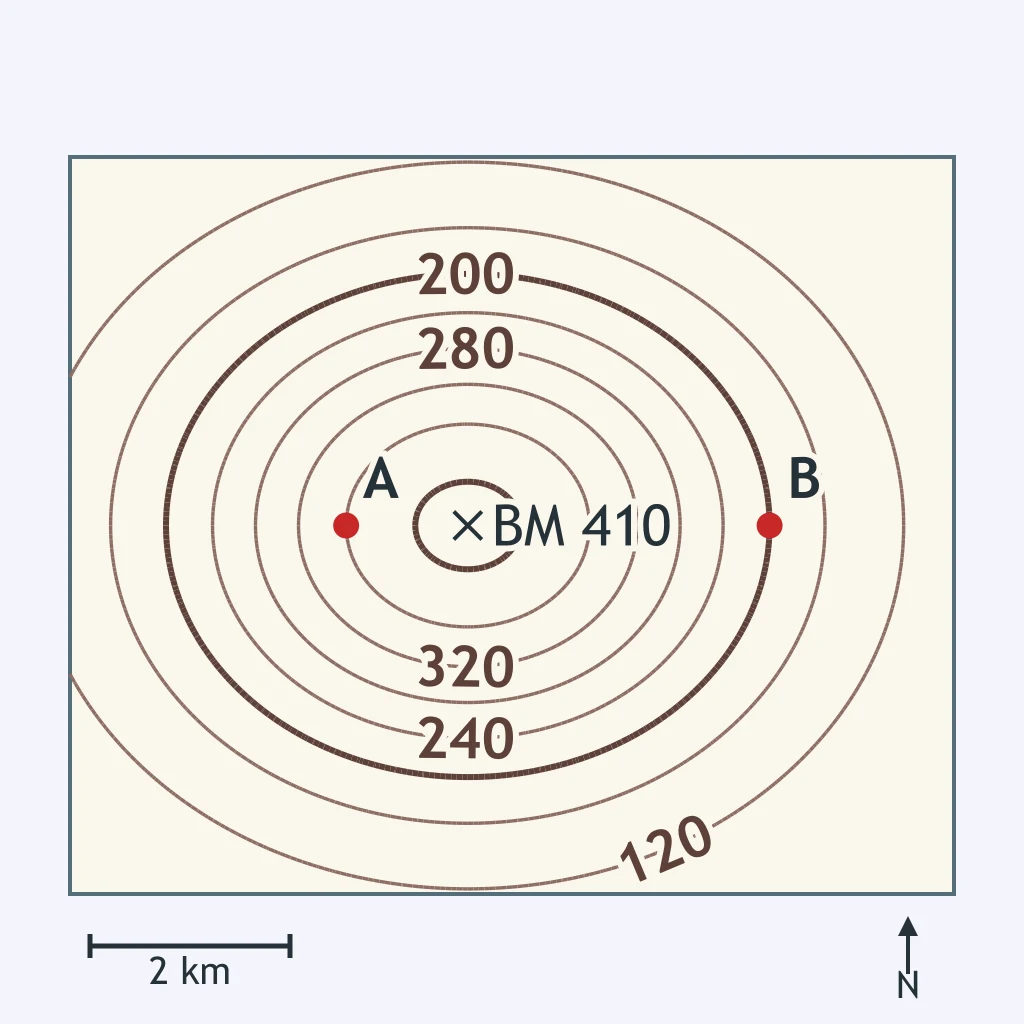
Slope A runs from the benchmark down to A, and slope B runs from the benchmark down to B. Use the contours and the scale bar. What conclusion is correct?
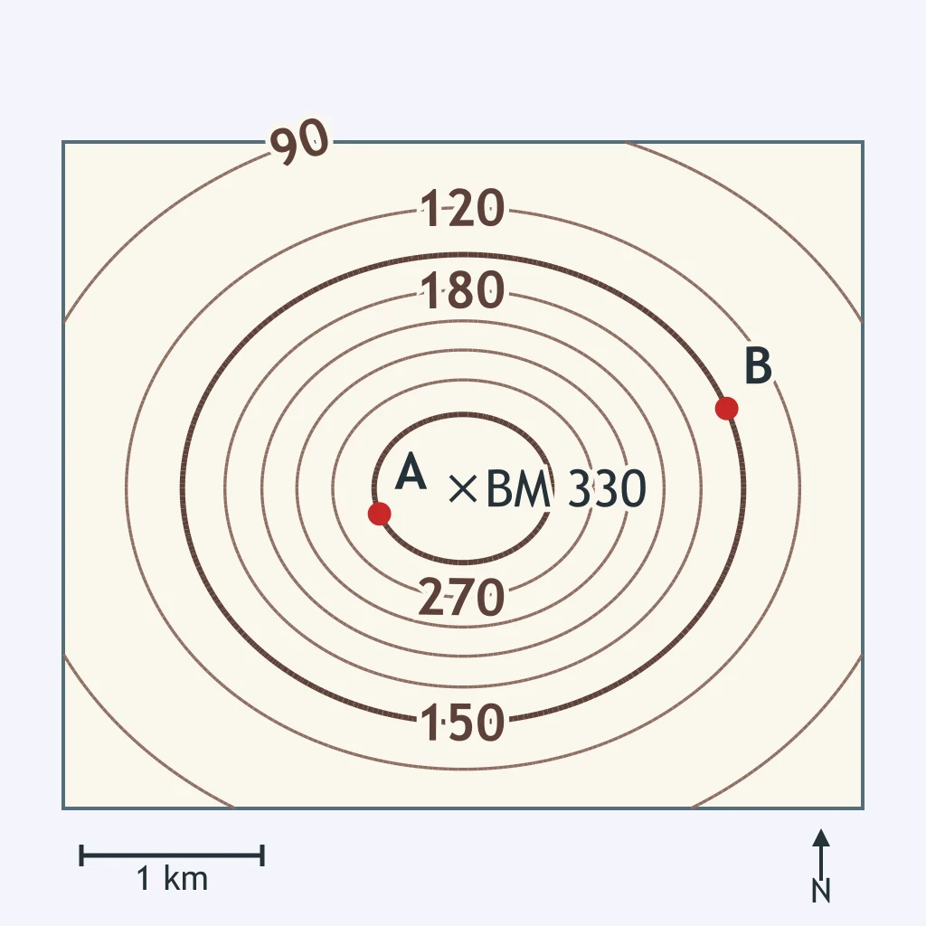
Trail A climbs from point A to the benchmark at the top, and trail B climbs from point B to the benchmark. Use the contours and the scale bar. Which trail has the greater gradient?
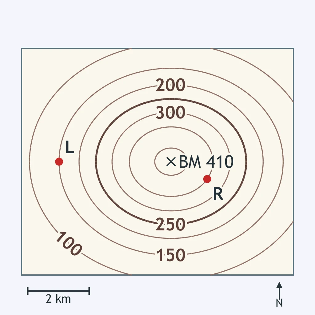
The left slope runs from the benchmark down to L, and the right slope runs from the benchmark down to R. Use the contours and the scale bar. Which comparison is correct?
Slope A runs from the benchmark down to A, and slope B runs from the benchmark down to B. Use the contours and the scale bar. Which statement is correct?
Crack the passcode before the zombies get in.
Answer, then swat bugs for bonus points.
Race through questions at your own speed.
Same question on every screen. Fastest wins.

Pick a tile, answer, hit bonuses and steals.
Mapping Review
40 questions