Loading
by BlastRoom
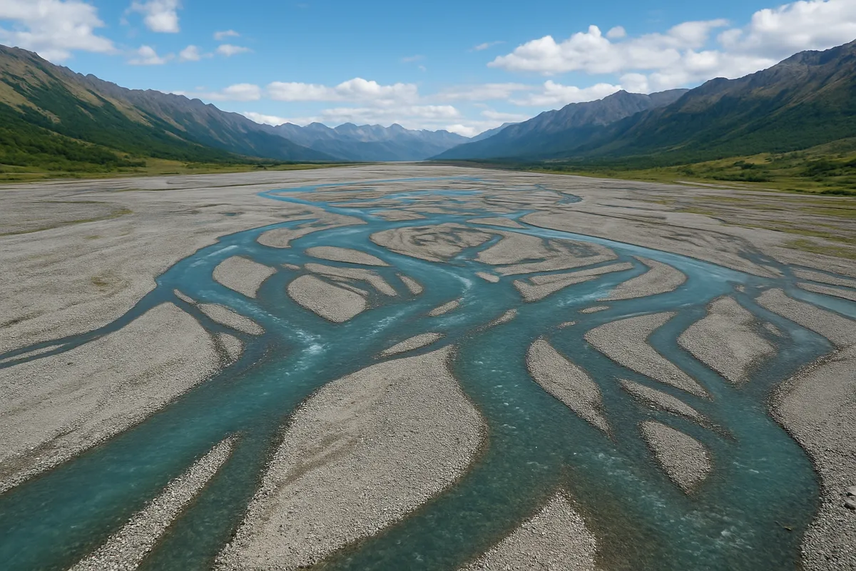
Classify drainage patterns, name parts of a stream system, and compute watershed and channel measurements.
#earth_space_science
40 questions
One question set, multiple game modes. Tap any game to see it in action. Not sure which to pick?
Answer to place stones and capture territory.
Outrun the snow together.
Earn blasts, then hunt the other team.
Answer to earn energy, then climb.

The class blasts through walls together.
Bid on mystery lots. Most money wins.
Sell tours. Nice, standard, or a total scam.

Answer, restock, and serve the rush.
More correct answers pulls the rope your way.
Answer, then shoot down the alien wave.
Answer, then tap to leap the frozen ridge.
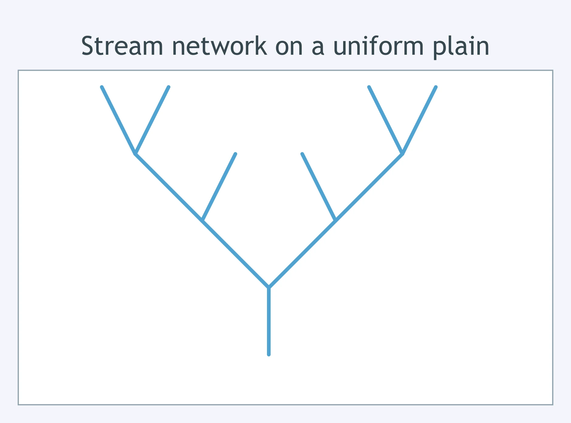
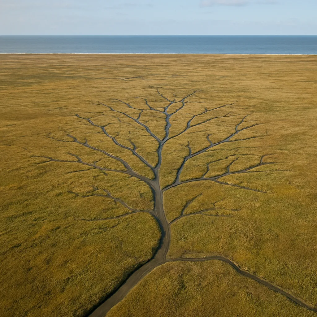
A network of streams spreads across a plain of uniform shale bedrock, branching repeatedly at acute angles like the limbs of a tree, with no ridges controlling their course. Which drainage pattern is shown?
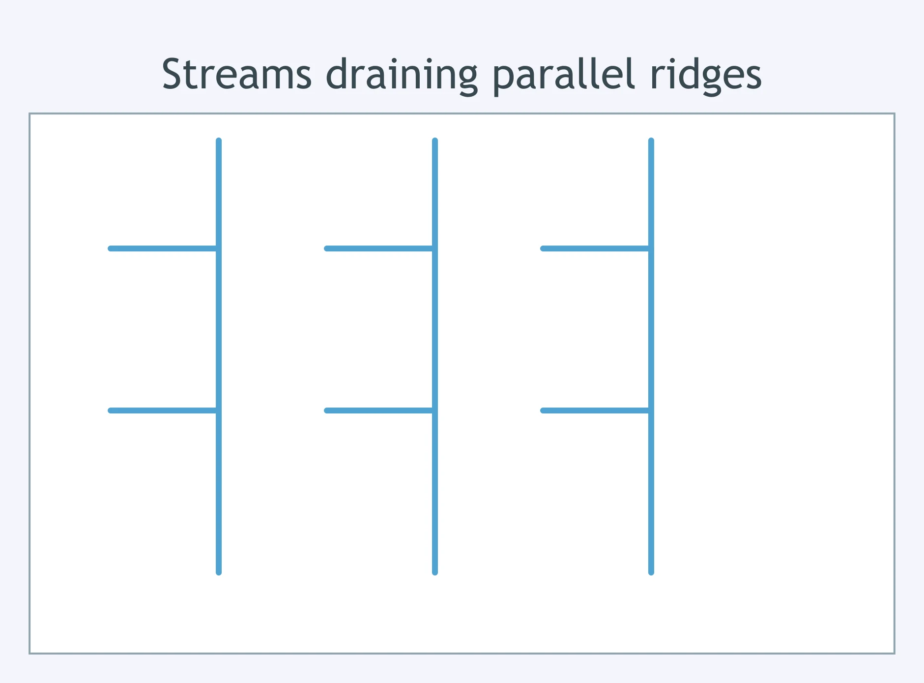
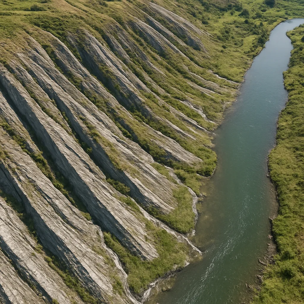
In the Appalachian Ridge and Valley province, short tributaries run down the sides of long parallel ridges and enter the main river at nearly right angles inside the narrow valley. Which drainage pattern does this describe?
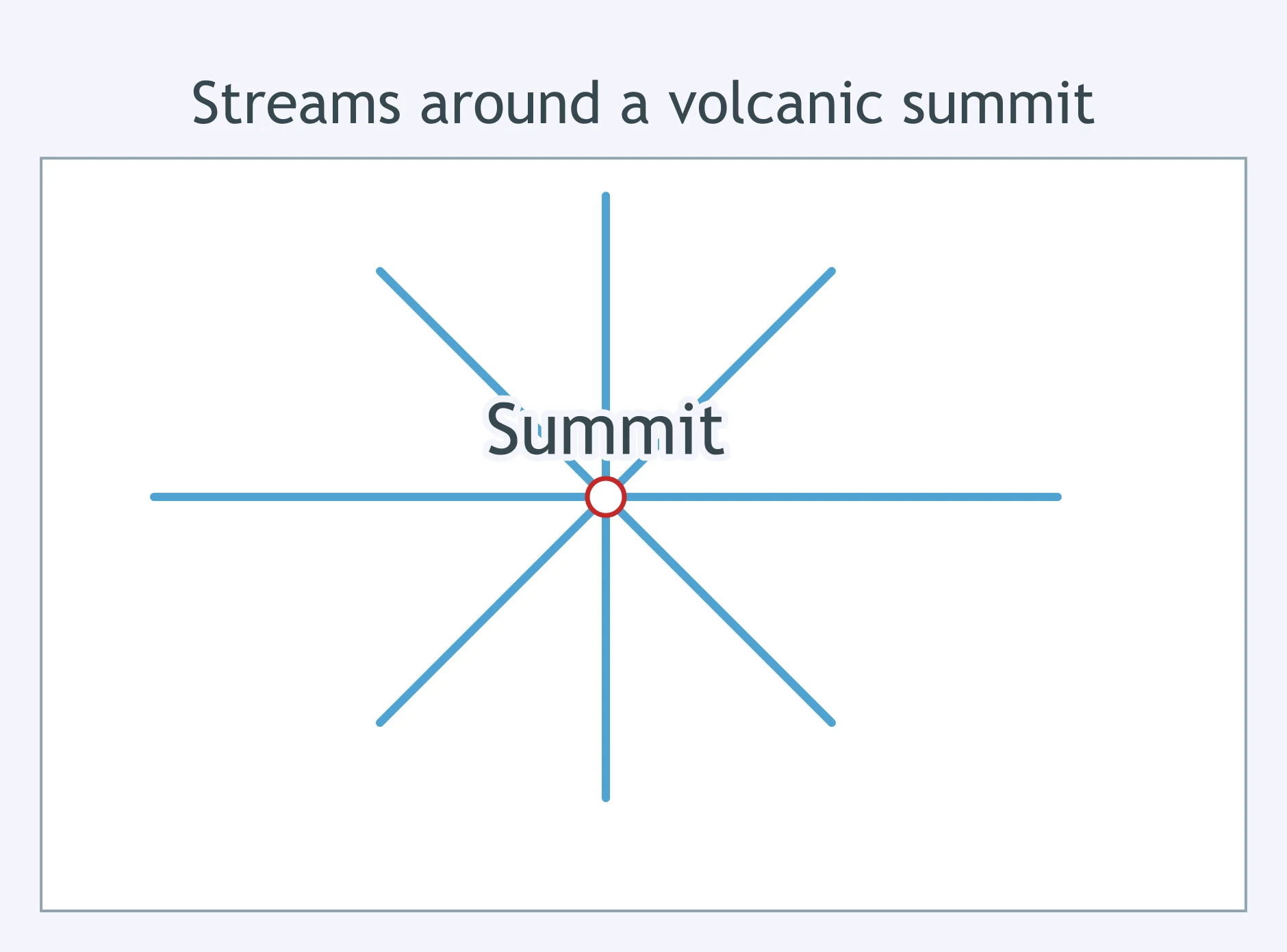
On the slopes of Mount Rainier, several streams begin near the summit and flow straight downhill in every direction, like spokes leading away from the hub of a wheel. This network is an example of which drainage pattern?
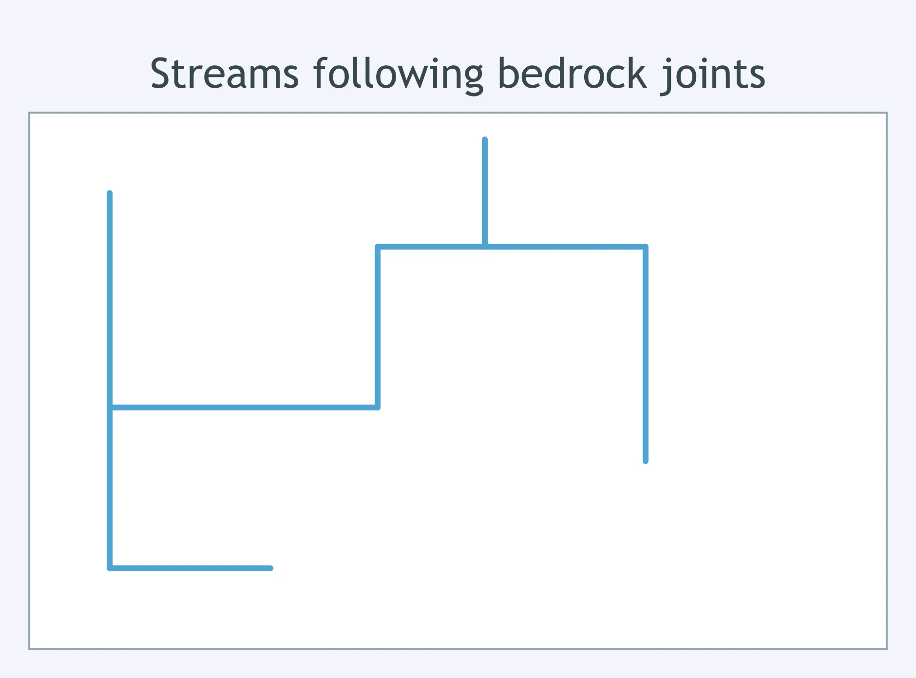
In parts of the Adirondack Mountains, streams follow a grid of joints in the crystalline bedrock, running in straight segments and bending at sharp right angles instead of curving smoothly. Which drainage pattern classification fits this network?
Across much of the Amazon basin's lowland rainforest, thousands of small tributaries join larger channels at irregular acute angles, with no single rock structure controlling the network. What is this branching network called?
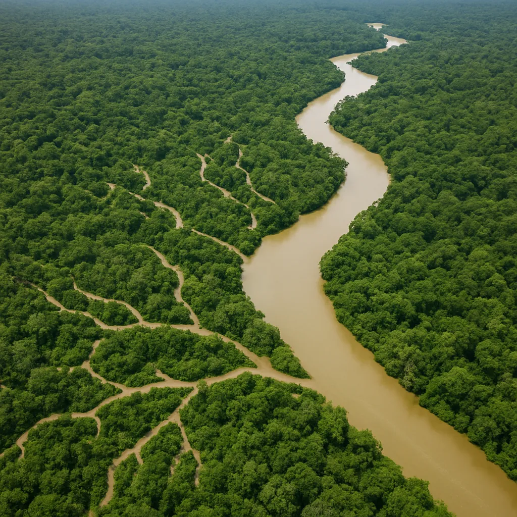
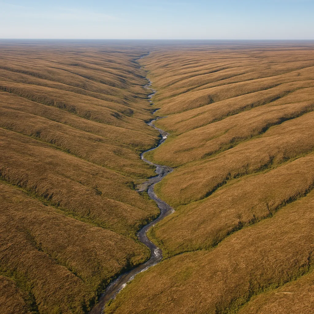
In a belt of folded sedimentary rock, long straight tributaries flow down the flanks of parallel ridges and join a main channel at right angles inside the valley between two ridges. Which drainage pattern does this valley system show?
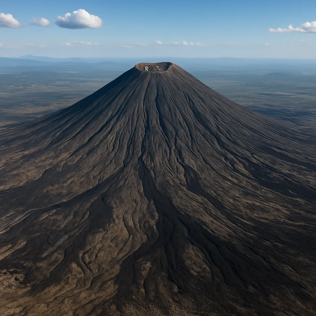
Around an isolated volcanic cone, streams flow outward from the summit down every side of the slope, none of them joining until they reach the flat ground at the base. Which drainage pattern best fits this network?
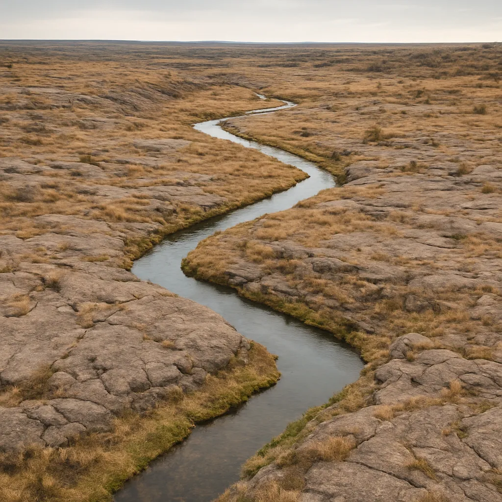
On a plateau of jointed granite, a stream runs east for a stretch, turns sharply north, then turns sharply east again, tracing the straight-line fractures in the rock. What drainage pattern does this describe?
On a flat coastal plain, a stream splits upstream into finer branches that meet at gentle angles, like the veins of a leaf. What ground condition best explains this branching pattern?
Where tilted sandstone and shale layers have eroded into alternating ridges and valleys, short streams enter a main valley stream at right angles. Why does the main stream run along the valley between two ridges?
A field beside the Ohio River sheds every drop of rainfall that falls on it into that river. This field lies within which of the following for the Ohio River?
Rain falling on the west side of a ridge in the Rocky Mountains flows toward the Columbia River, while rain on the east side of the same ridge flows toward the Missouri River. This ridge is best described as a
Sugar Creek joins the larger Wabash River rather than reaching the ocean on its own. What is Sugar Creek, relative to the Wabash River?
During spring snowmelt, the flat land bordering the Red River regularly fills with several feet of standing water before draining away. This flat bordering land is the river's
Where the Colorado River historically entered the Gulf of California, its sediment load built a broad, fan-shaped deposit of new land at the river's mouth. This landform is the river's
A former meander bend of the Brazos River was cut off when the river carved a new, straighter channel, leaving the old curved bend filled with standing water and disconnected from the main flow. What landform is this?
Where a steep mountain stream in the Sierra Nevada emerges onto a flat valley floor and abruptly slows, it deposits coarse sediment in a spreading, cone-shaped mound at the base of the mountain. What is this landform called?
The Snake River begins as small trickles of snowmelt high in the mountains of Yellowstone National Park, above any point where a tributary joins it. This point of origin is the river's
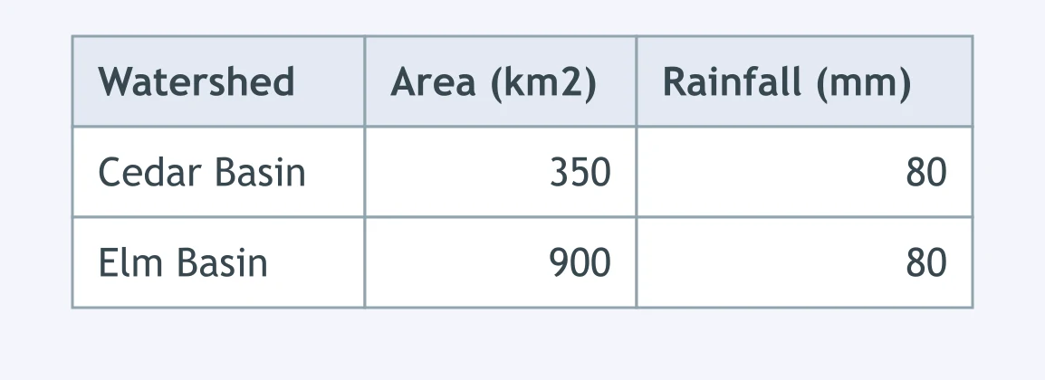
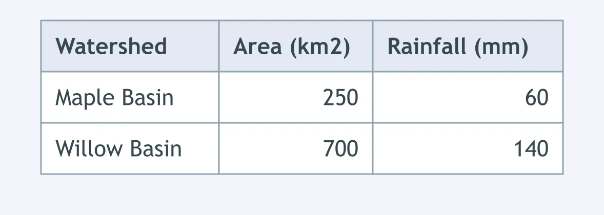
The table shows the drainage area and the rainfall from the same storm for two watersheds. Which basin's river carries the greater discharge during this storm?
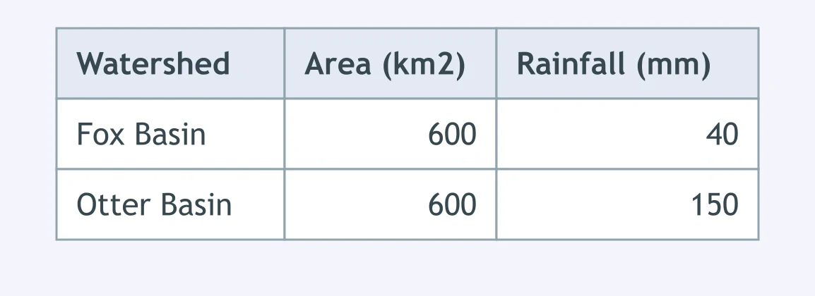
The table shows the same drainage area but different storm rainfall totals for two watersheds. Based on these numbers, which basin's stream is discharging more water right now?
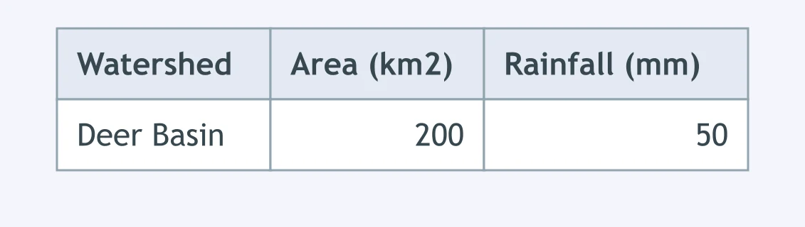
The table shows one storm's rainfall total for the Deer Basin watershed. Every square kilometer that gets 1 millimeter of rain collects 1,000 cubic meters of water. About how much water fell on the whole watershed?
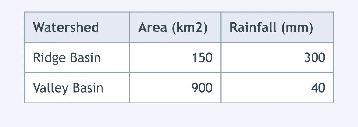
The table gives the area and the rainfall from the same storm for two watersheds. Based on these figures, which watershed collects the greater total volume of storm water?
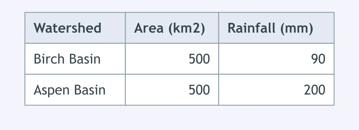
Birch Basin and Aspen Basin cover the same drainage area, but a storm drops different rainfall totals on each, as the table shows. A town at the outlet of which basin should plan for the larger flood discharge?
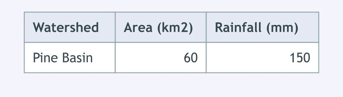
Using the same rule, that 1 square kilometer receiving 1 millimeter of rain collects 1,000 cubic meters, find the total rainfall volume over the Pine Basin watershed shown in the table.
The table shows the drainage area and average annual rainfall for two watersheds. Over many years, which basin's river channel is most likely to have widened the most from its greater total flow?
Two first-order streams join to form a single channel, and no other tributary joins until the next confluence. What is the order of the channel below their junction?
A first-order stream joins a second-order stream at a confluence, and no other tributary joins immediately below it. What is the order of the channel below this junction?
In a river network, two second-order streams join, and the channel below that junction receives no further tributaries before reaching gauging station R. What is the order of the channel at station R?
Two third-order streams merge into a single trunk channel, and the river reaches the sea without gaining any further tributaries below that point. What is the order of the trunk channel at the river's mouth?
A drainage basin is described overall as "third order." This label refers to the
Use the contour map of Cedar Creek. Which direction does the creek flow?
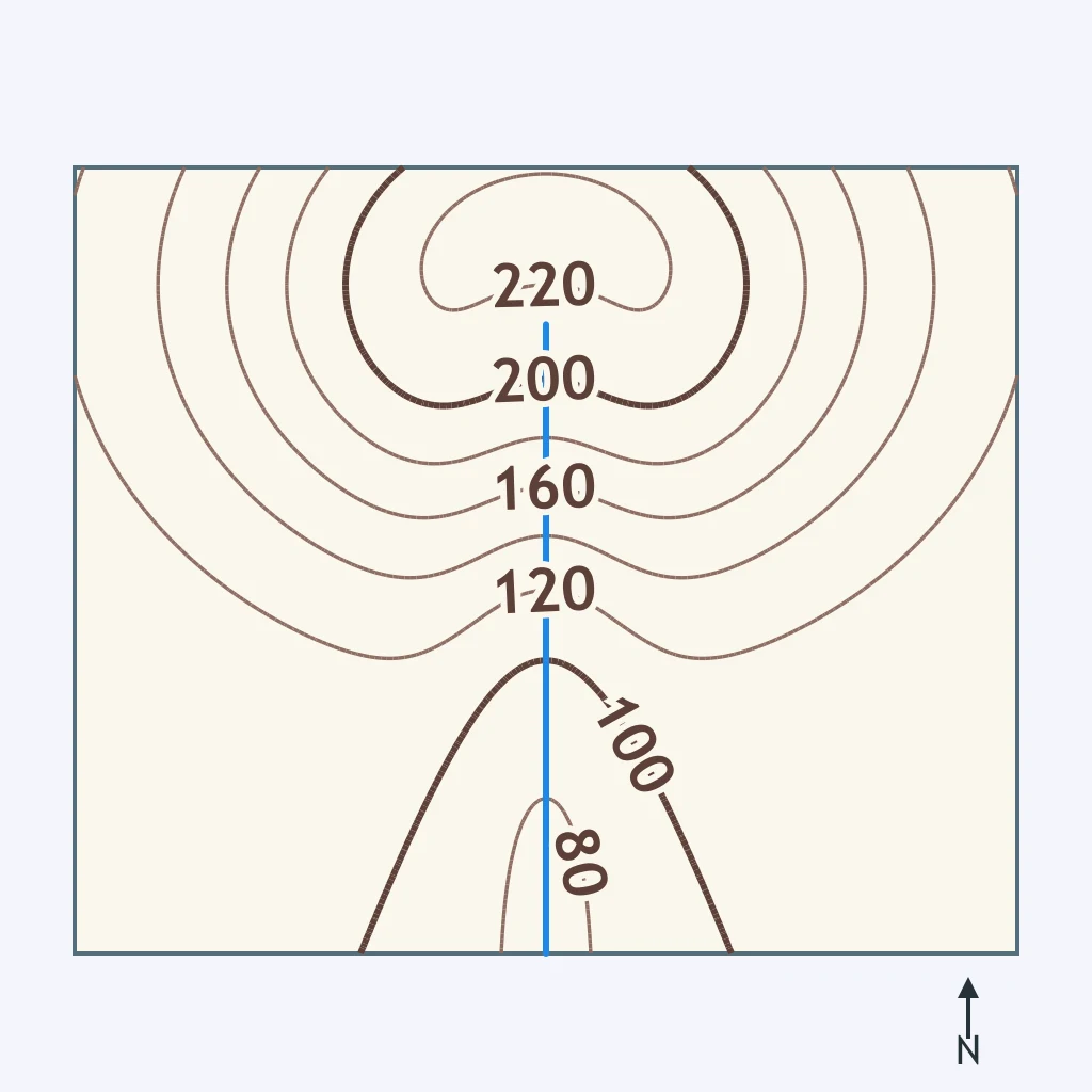
Look at the topographic map. Toward which compass direction is Beaver Run flowing?
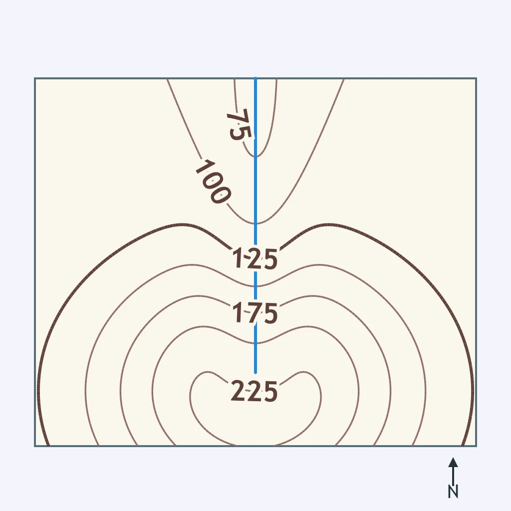
The map shows Otter Creek cutting across the contour lines. What direction is the creek's current headed?
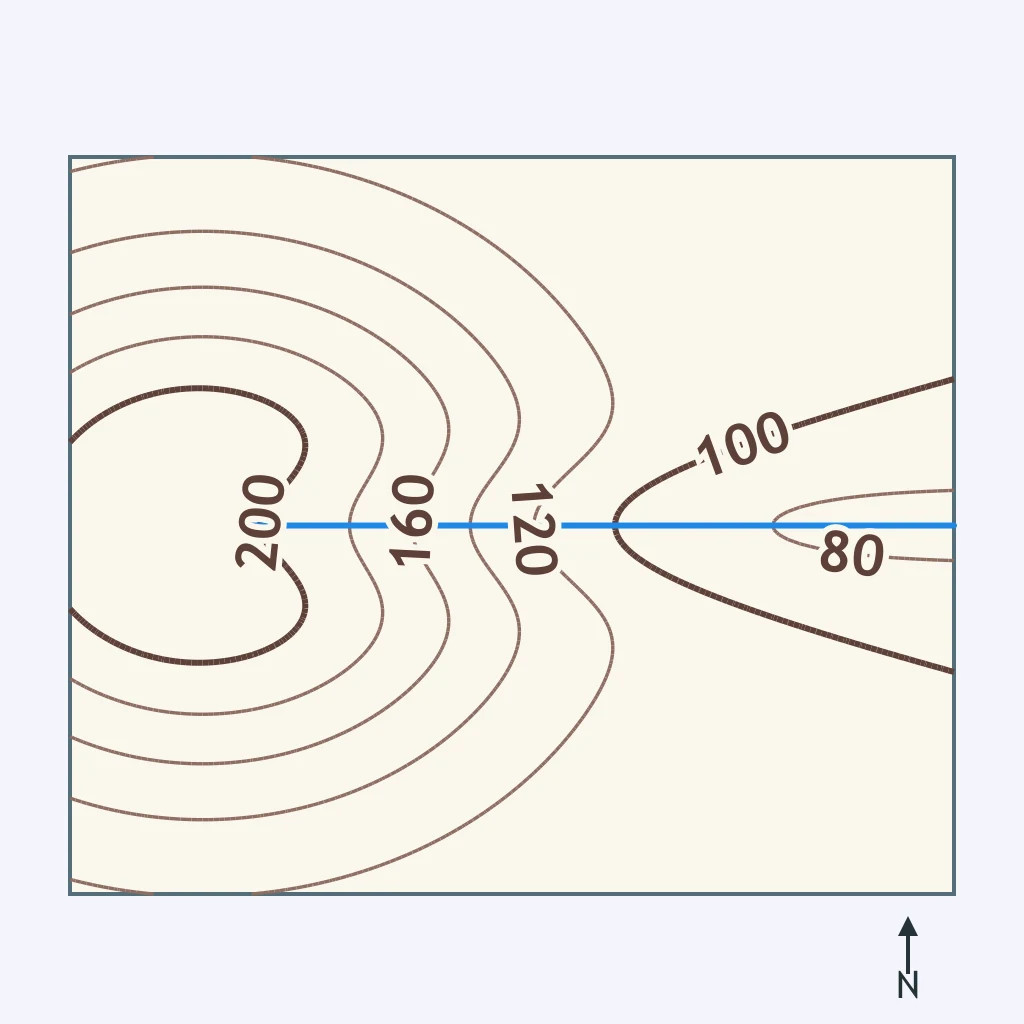
Based on the contour pattern around Fox Creek, in which direction is the water moving?
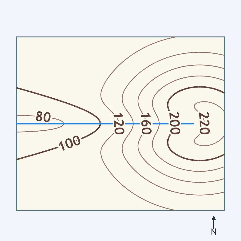
Study the contour lines that cross Deer Run. Which way does the stream flow?
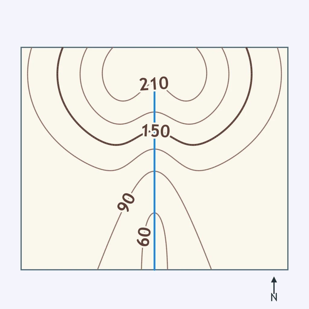
According to the topographic map, what direction does Sugar Creek flow?
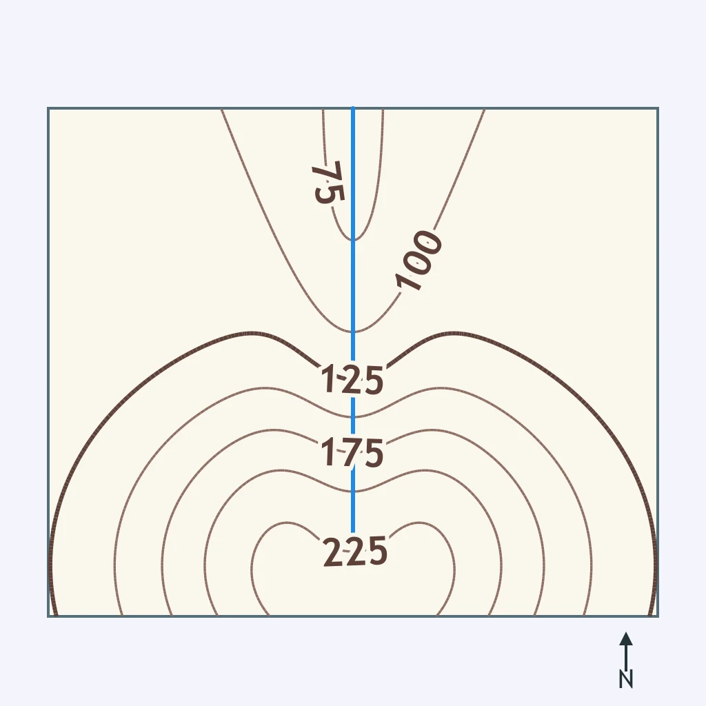
A stream channel is 6 meters wide and 1.5 meters deep, as shown, and the water moves at 4 meters per second. What is the stream's discharge?
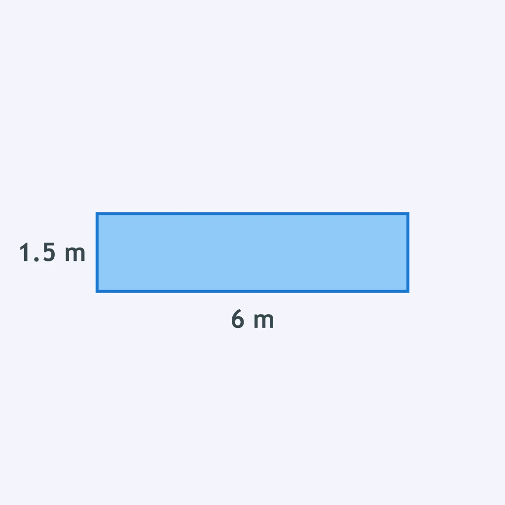
The figure shows a stream channel's width and depth. If the water flows at 2 meters per second, how much water does the stream discharge each second?
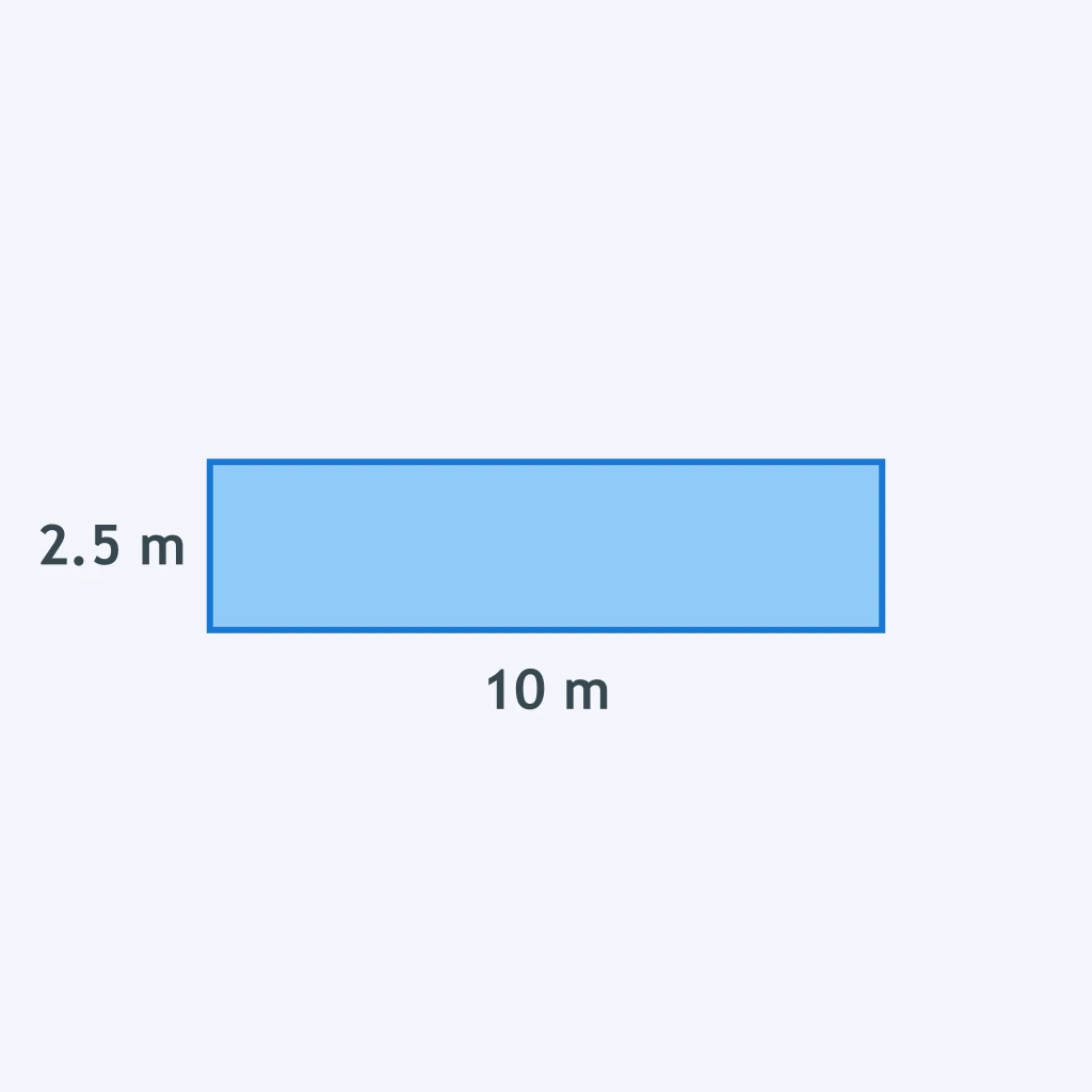
The pictured channel carries water at 1.5 meters per second. How many cubic meters of water pass this cross section every second?
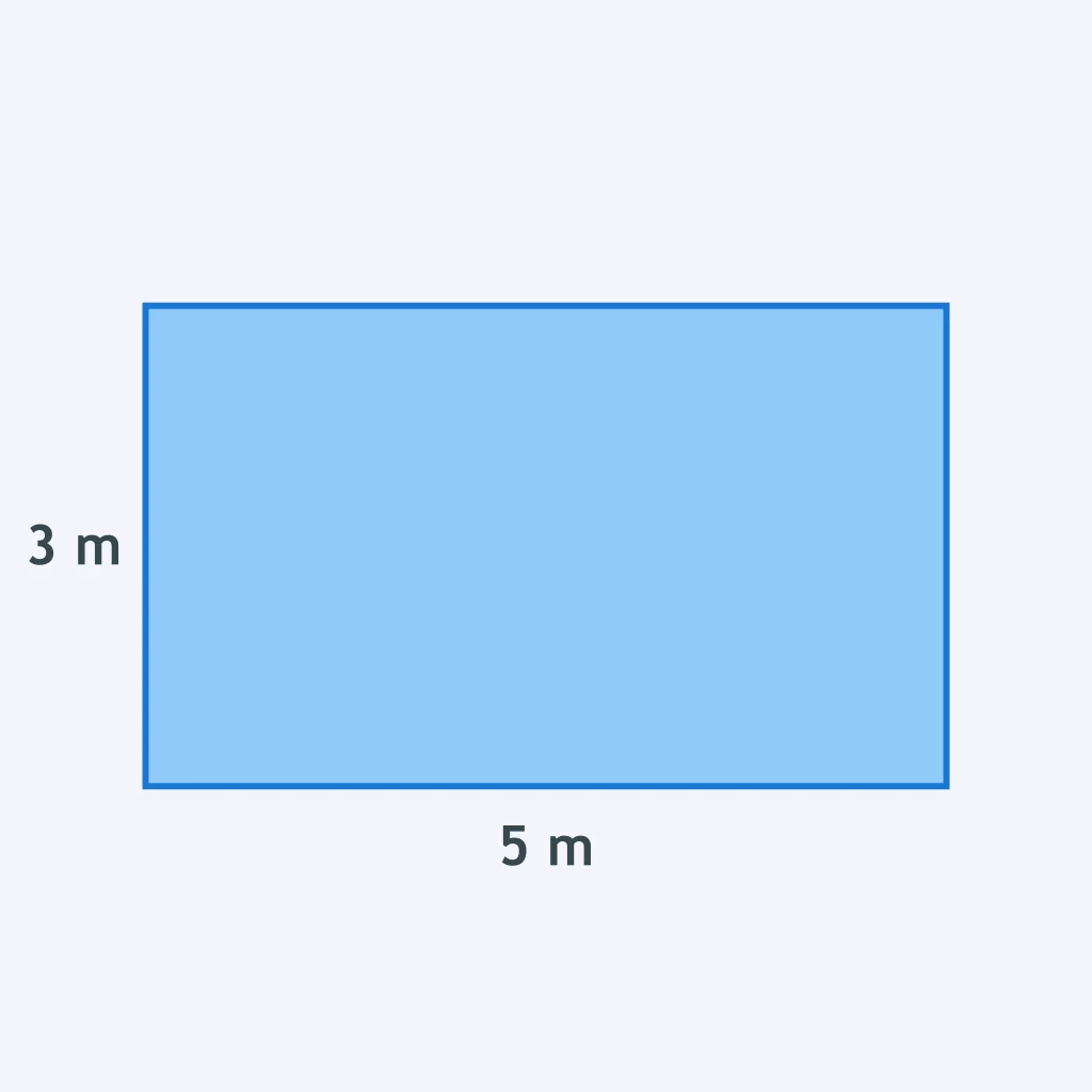
Water in the channel shown moves at 2.5 meters per second. What discharge does this give the stream?
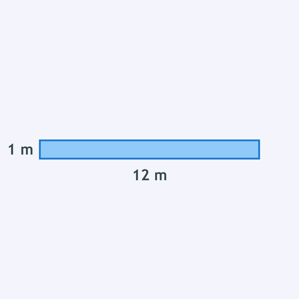
Crack the passcode before the zombies get in.
Answer, then swat bugs for bonus points.
Race through questions at your own speed.
Same question on every screen. Fastest wins.

Pick a tile, answer, hit bonuses and steals.
Watersheds and Floods
25 questions