Loading
by BlastRoom
How farm country is laid out, and the three systems used to cut it up.
#us_hs_human_geography
30 questions
One question set, multiple game modes. Tap any game to see it in action. Not sure which to pick?
Answer to place stones and capture territory.
Outrun the snow together.
Earn blasts, then hunt the other team.
Answer to earn energy, then climb.

The class blasts through walls together.
Bid on mystery lots. Most money wins.
Sell tours. Nice, standard, or a total scam.

Answer, restock, and serve the rush.
More correct answers pulls the rope your way.
Answer, then shoot down the alien wave.
Answer, then tap to leap the frozen ridge.
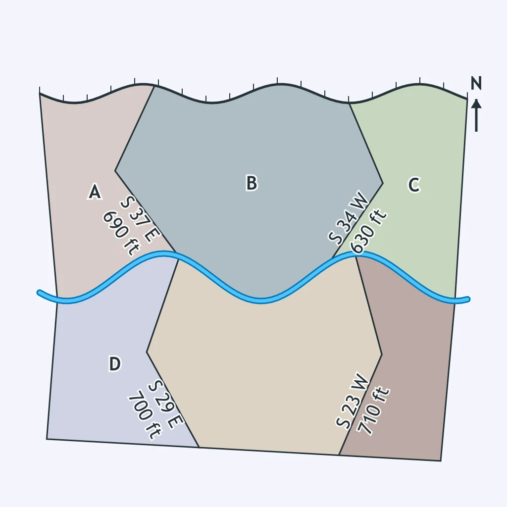
Use the parcel layout in the figure. Which land survey system most likely produced it?
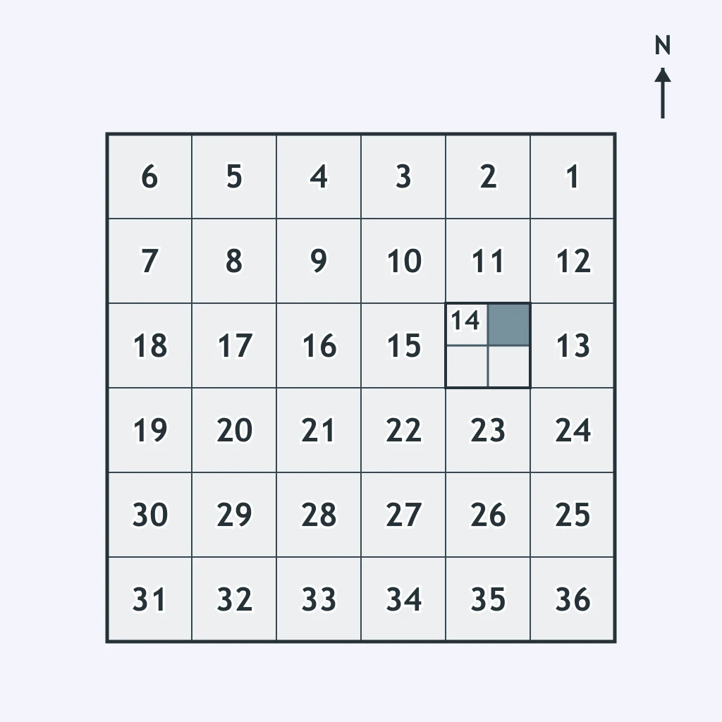
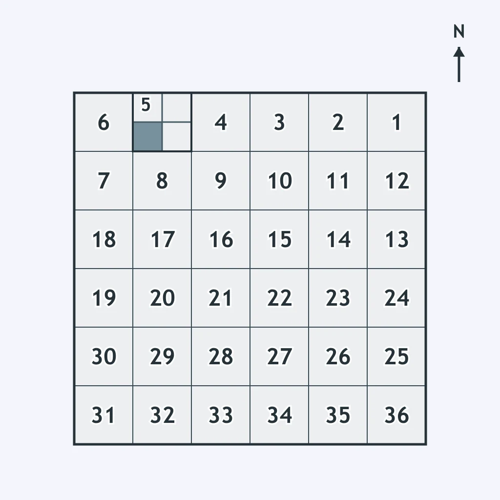
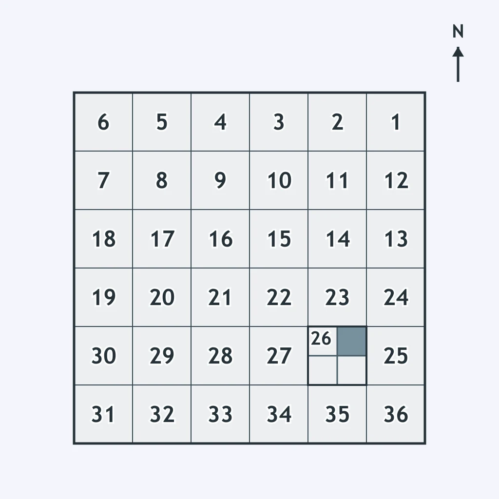
The figure shows a numbered square grid with one section shaded. Which system divided land this way?
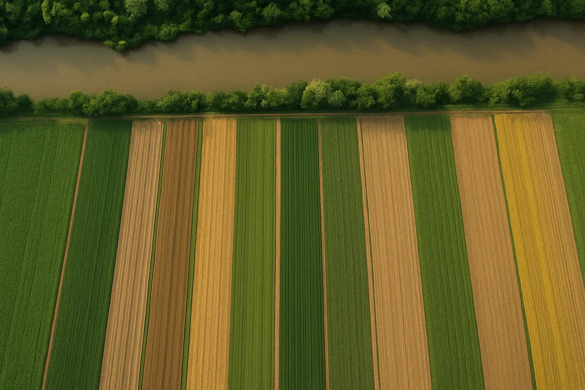
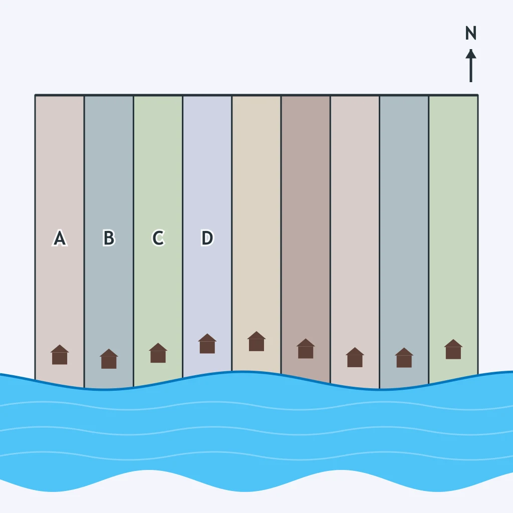
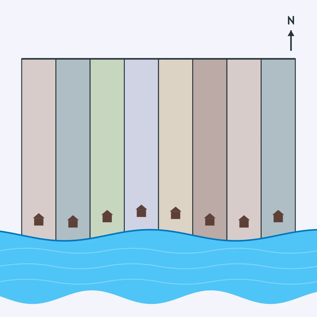
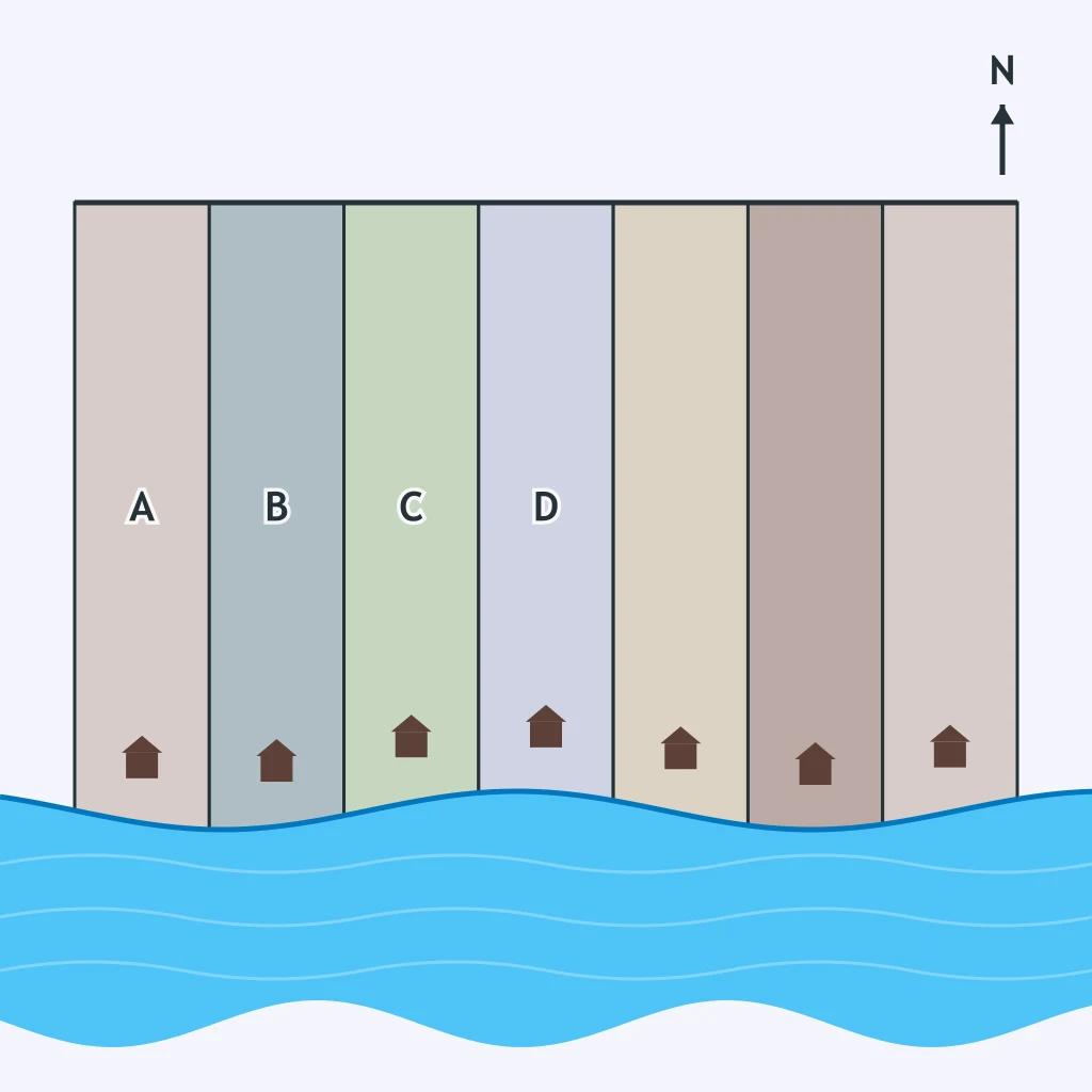
In the figure, each narrow parcel touches the same waterway and stretches inland. Which survey system made that field pattern?
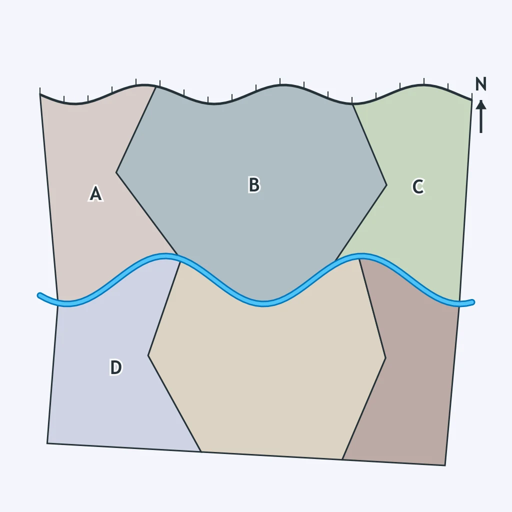
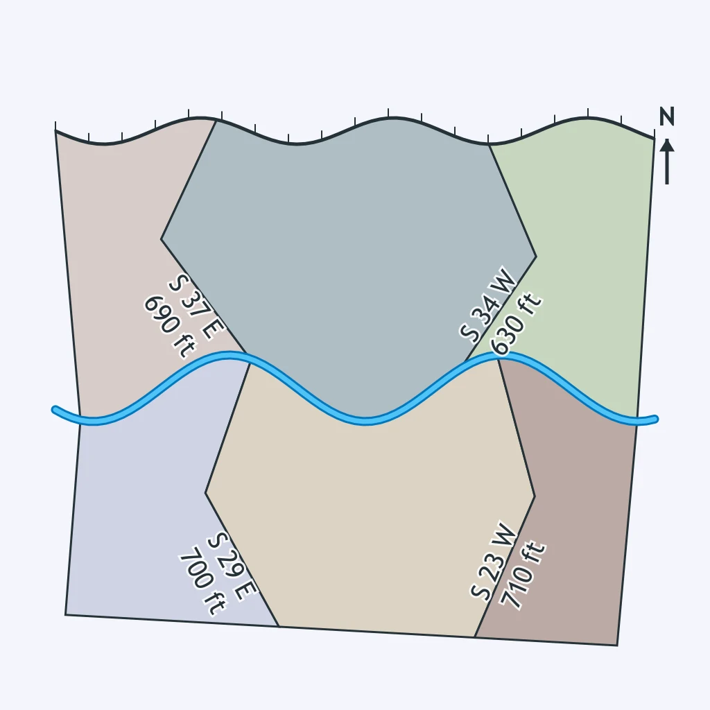
Look at the parcel boundaries. Which survey system is shown by the uneven shapes and non-grid edges?
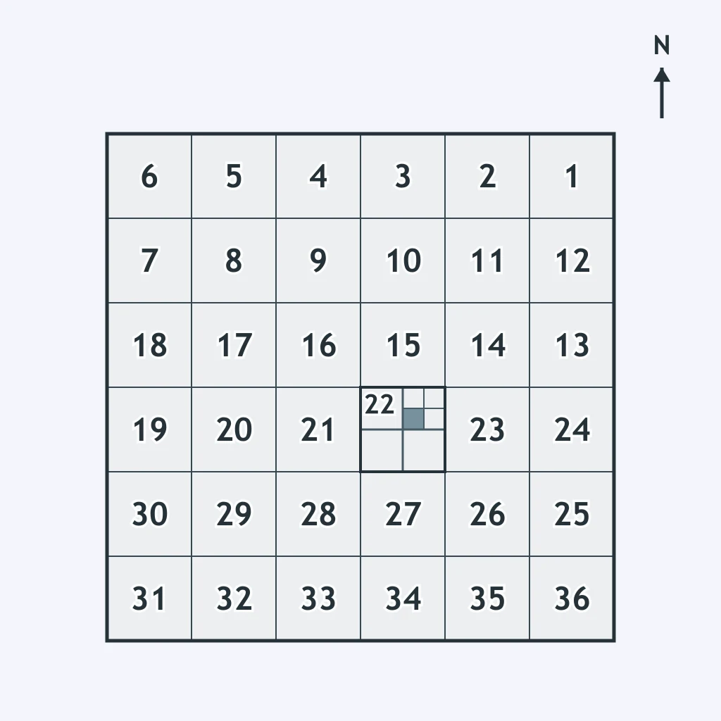
The figure divides land into square sections numbered across a township. Which survey method does this represent?
Study the field layout. Which survey system best explains the repeated strips running back from the water?
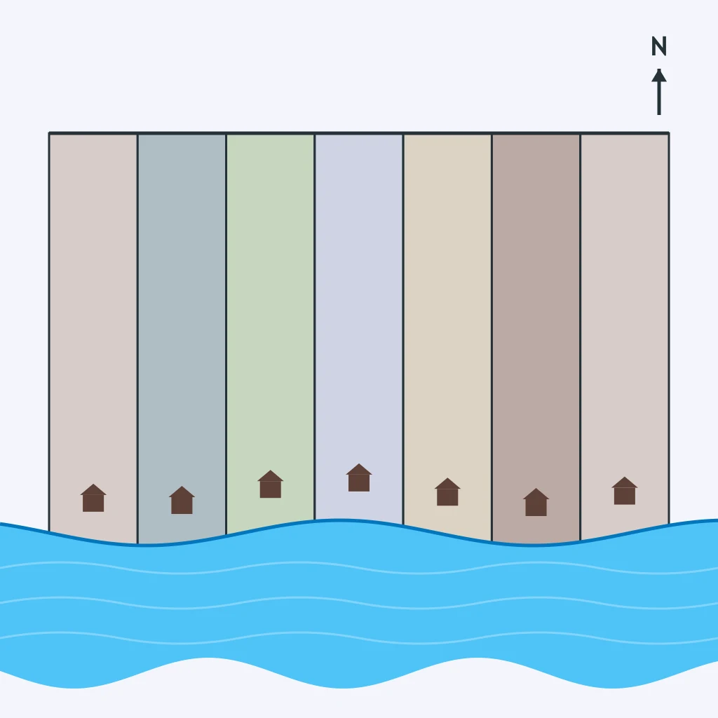
Which survey system is indicated by parcels whose borders bend around natural features rather than forming equal squares?
The shaded part lies inside a numbered square section. Which survey system created that kind of legal land description?
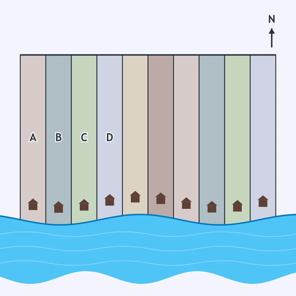
A map shows farms as long, parallel ribbons with equal frontage along a river. What survey system is being used?
Which survey system fits a land map where each parcel has a unique outline and no repeated geometric pattern?
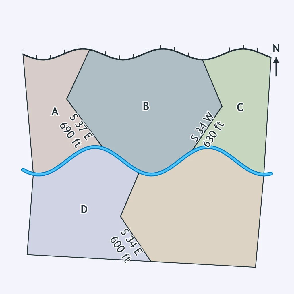
Under the township-and-range survey system, farmhouses are typically spread across separate farms rather than gathered in one hamlet. Which rural settlement pattern does that show?
If houses stand in a compact village while surrounding fields are worked outside it, what rural settlement pattern is present?
Homes line up along the shared water frontage shown in the figure, with fields extending behind them. Which settlement pattern is shown?
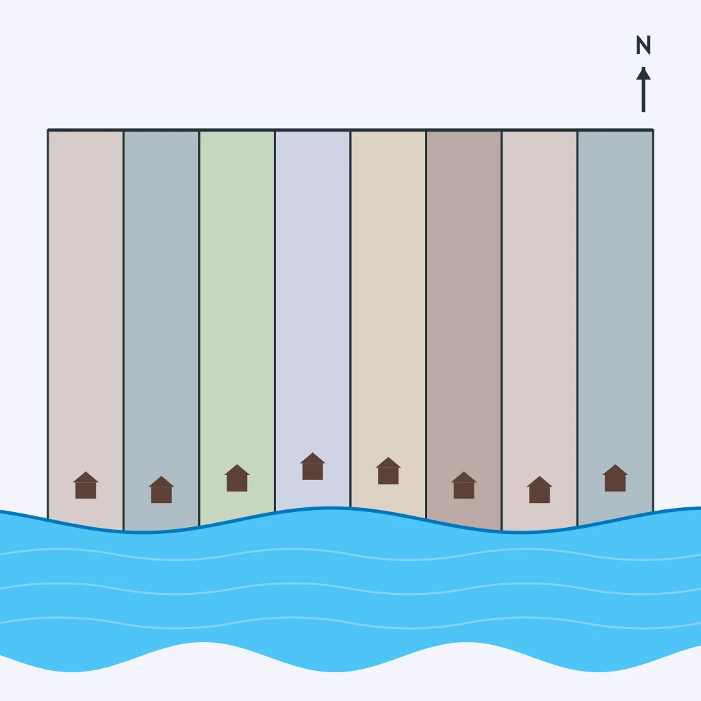
A farm district has isolated houses, each surrounded by its own fields and no central village. Which pattern best names it?
The figure suggests farms sharing one corridor of access. If homes are placed along that corridor, which settlement pattern results?
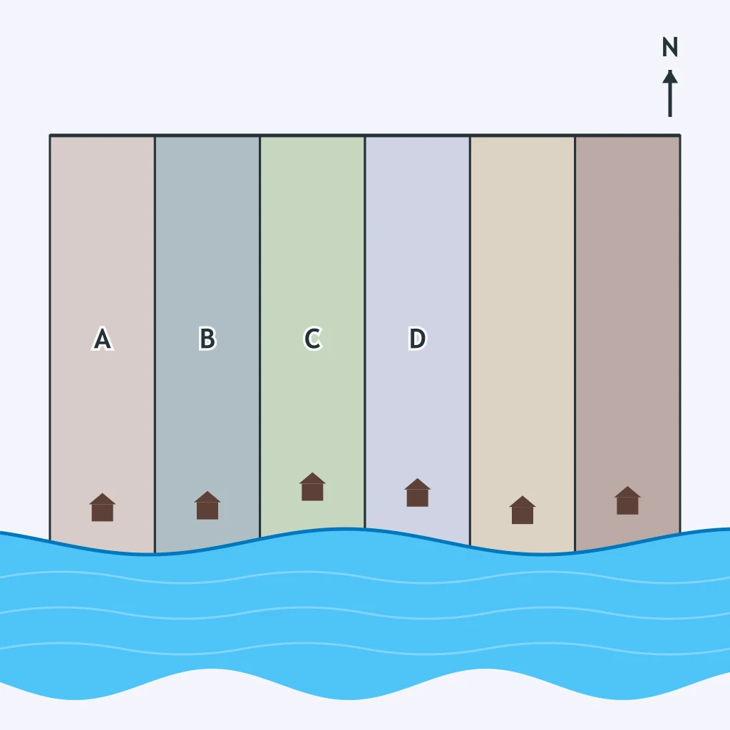
In many medieval European villages, families lived close together near a church and walked out each day to farm fields around the village. Which benefit did this clustered pattern give?
The Homestead Act of 1862 required settlers to live on and farm their own claim for five years before they owned it. Which rural settlement pattern did that rule encourage?
Houses are grouped at a crossroads while each family's fields lie spread out around the village. Which drawback does this clustered pattern create?
French settlers along the St. Lawrence River divided farms so families had access to the river. Which survey system did they use?
Much of the land west of the Appalachian Mountains was surveyed under the Public Land Survey System. Which system is that?
In colonial New England, property descriptions often referred to stones, trees, and streams. Which survey method matches that history?
Spanish and French settlement near waterways in Louisiana often produced narrow farms running inland from bayous. Which system was used?
A county in the Midwest is divided into regular square sections before farms are sold. Which survey system shaped that landscape?
Early settlers in parts of the Atlantic seaboard wrote deeds using boundary walks from one marker to the next. Which system was this?
A buyer wants to describe a farm as a quarter of a numbered section in a township. What does the survey system make easy?
A river community wants every farm family to reach the water for transport and irrigation. Which result does its field system support?
A land office needs to sell many similar parcels quickly across a new territory. Which feature helps most?
A deed says a boundary runs from a stone wall to a large oak, then along a creek. Which problem can this kind of survey cause over time?
Farmers in a ribbon-like settlement all want contact with the same road or canal. What does the survey layout make possible?
A government surveyor wants parcel descriptions that can be located without knowing local landmark names. Which system best serves that goal?

Supranationalism and International Organizations
30 questions

Centrifugal and Centripetal Forces
30 questions

Political Patterns and Processes: Mixed Review
70 questions

Introduction to Agriculture: Climate, Intensive and Extensive
35 questions

Agricultural Hearths and the First Agricultural Revolution
30 questions
Crack the passcode before the zombies get in.
Answer, then swat bugs for bonus points.
Race through questions at your own speed.
Same question on every screen. Fastest wins.

Pick a tile, answer, hit bonuses and steals.