Loading
by BlastRoom
Naming the kind of map in front of you and saying what it is good for.
#us_hs_human_geography
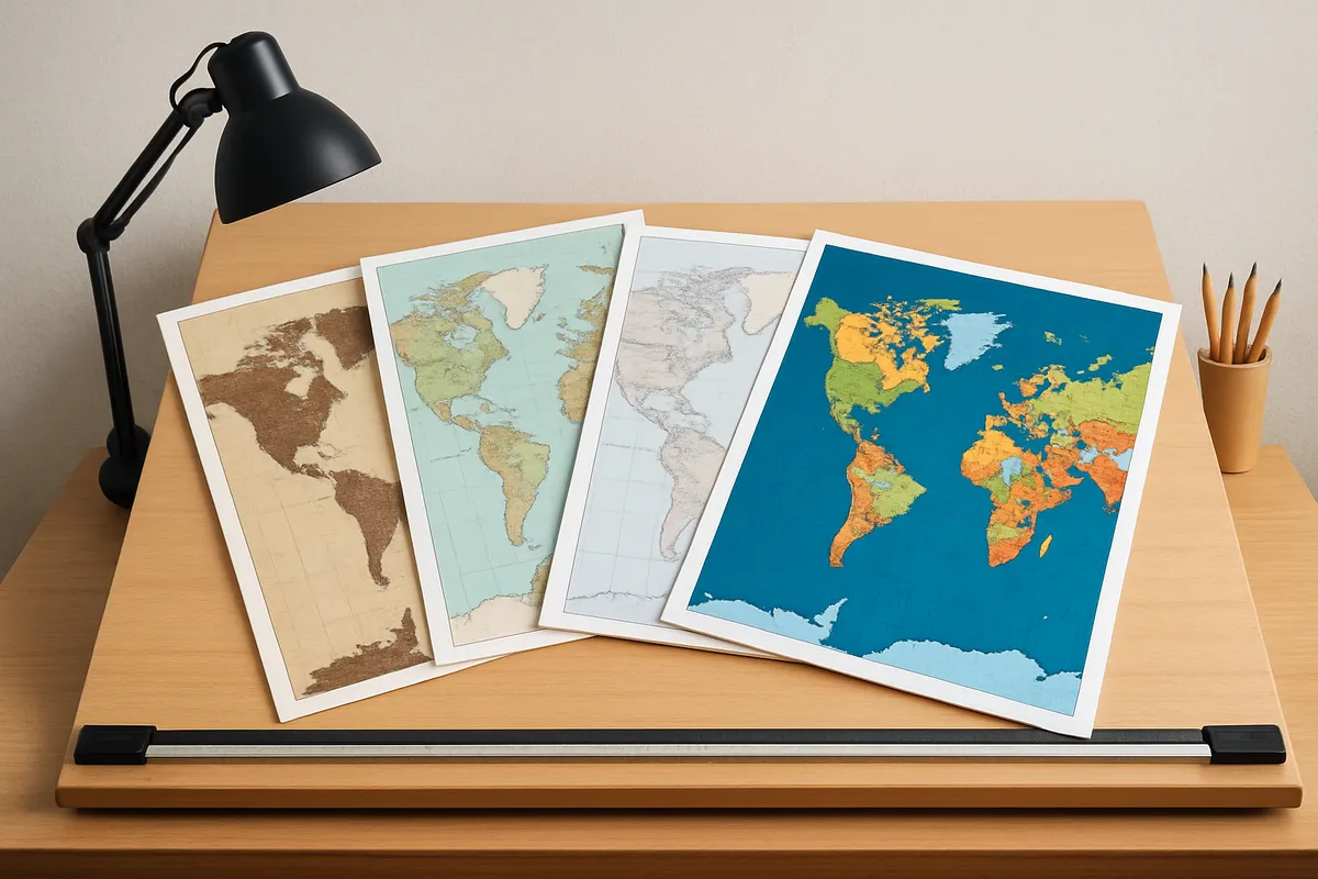
35 questions
One question set, multiple game modes. Tap any game to see it in action. Not sure which to pick?
Answer to place stones and capture territory.
Outrun the snow together.
Earn blasts, then hunt the other team.
Answer to earn energy, then climb.

The class blasts through walls together.
Bid on mystery lots. Most money wins.
Sell tours. Nice, standard, or a total scam.

Answer, restock, and serve the rush.
More correct answers pulls the rope your way.
Answer, then shoot down the alien wave.
Answer, then tap to leap the frozen ridge.
A map shades each state darker or lighter according to the percentage of residents born outside the United States. Which map type is this?
Use the map. Which map type is shown?
A port map draws a circle at each harbor, with larger circles for higher annual tonnage. Which map type is it?
Which type of map resizes each region so its area matches its population rather than its land area?
Use the map. Which map type is shown?
A weather map draws curved lines connecting places with the same air pressure. Which kind of map is this?
Use the map. Which type of map is shown?
A mapmaker is making a choropleth map that shades each state. Which data is the best fit for this kind of map?
A farm map places one small mark for every 100 cattle in the area where the cattle are raised. Which map type is this?
A map of airport passenger totals uses circles sized by value at each airport instead of shading the counties around them. Why is that the better choice?
A cartogram sizes each state by its number of seats in the US House of Representatives. How would Wyoming look compared with a regular map?
Use the map. Which map type is shown?
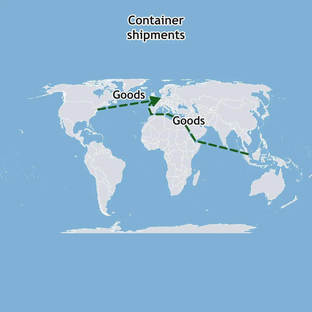
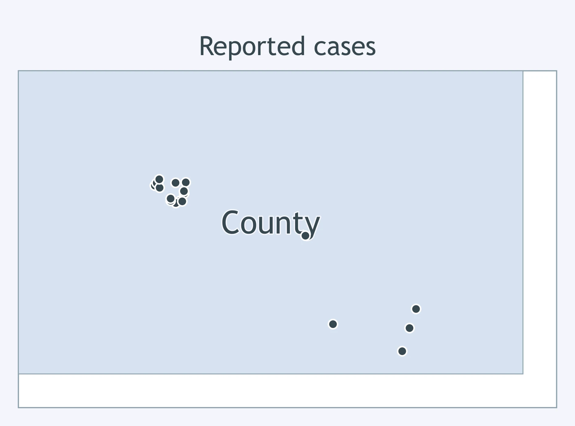
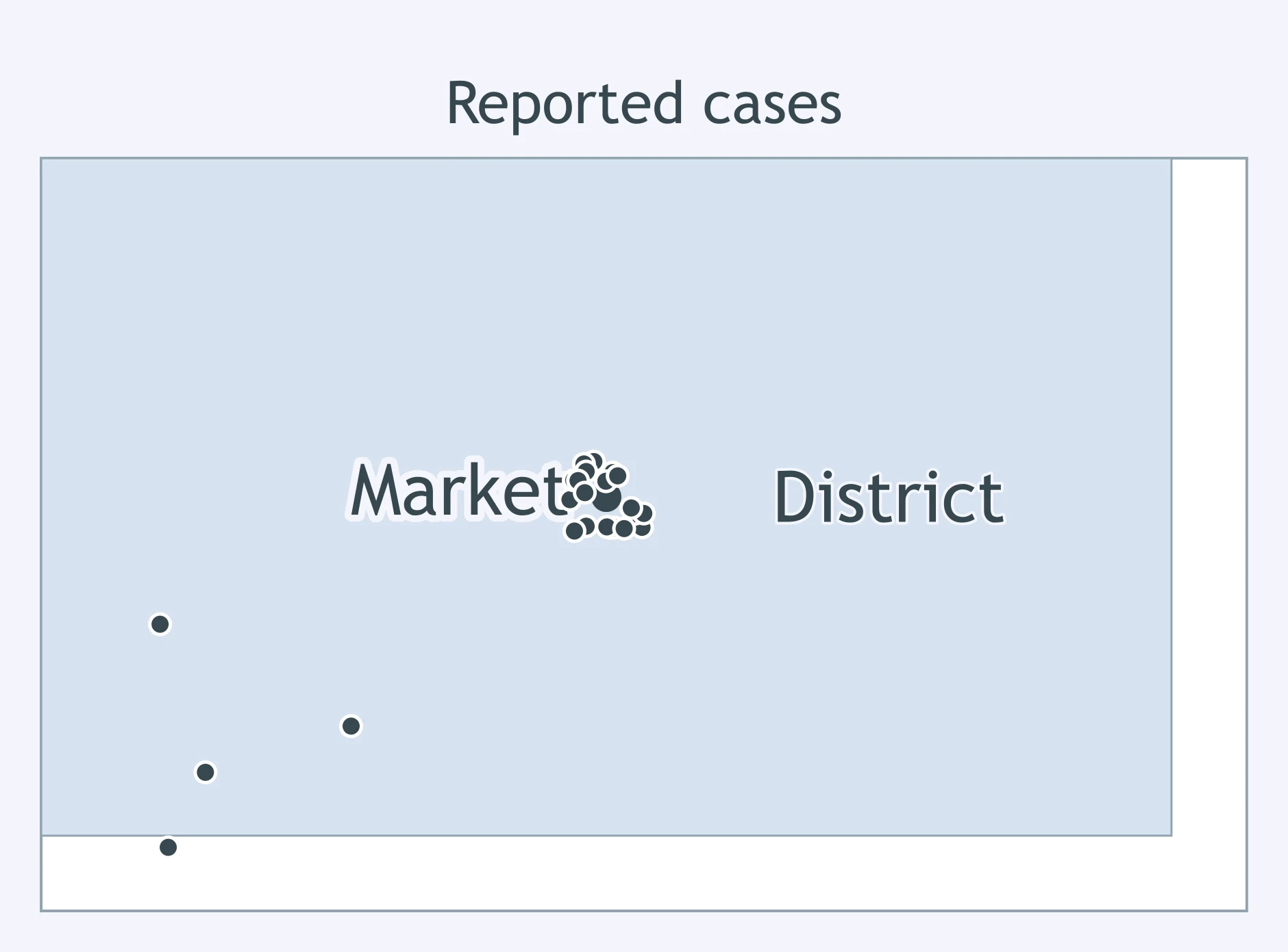
A health team wants to publish the exact spots where last month's cases occurred, one mark per case. Which map should it use?
A planner wants to compare median household income by census tract using darker shading for higher values. Which map type is best?
Which map best compares total populations of cities while keeping the cities at their actual point locations?
Which map would make countries with larger GDP occupy more page space even when their true land areas are smaller?
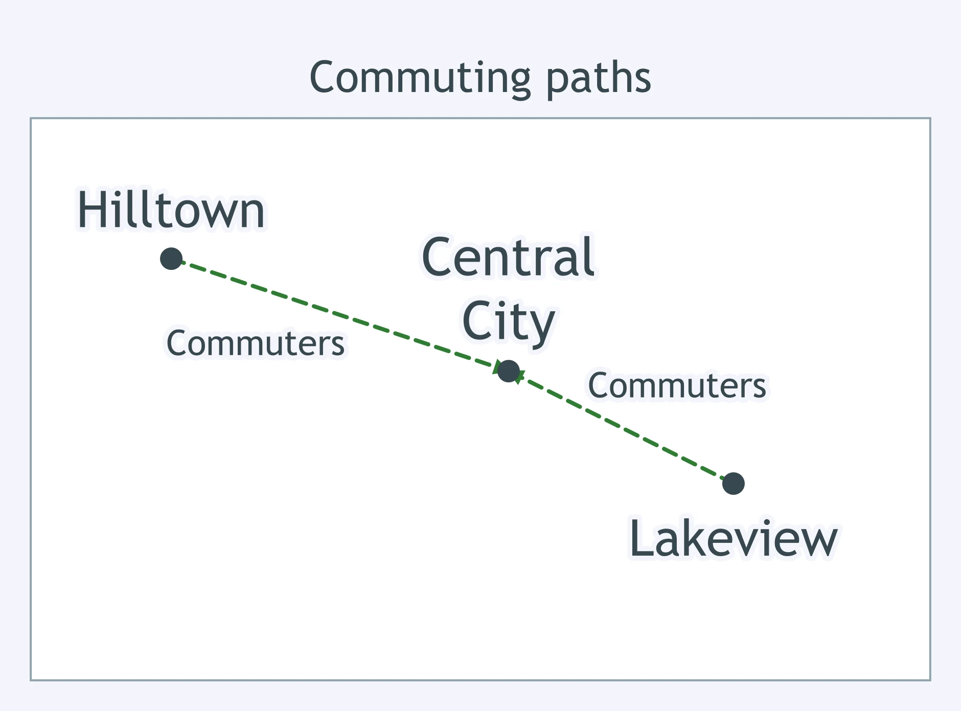
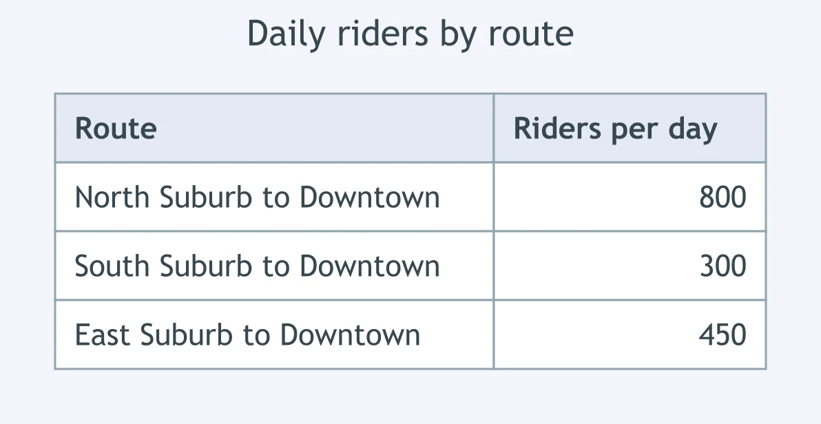
Use the table. A transit agency wants to map these riders as arrows between each suburb and downtown, with heavier routes drawn stronger. Which map should it use?
An emergency manager needs to map predicted storm-surge height as a continuous surface, with lines joining equal heights. Which type fits?
A traveler needs roads, city names, state borders, and lakes, not one mapped theme. Which type is best?
A school district wants to shade each attendance zone by the percent of students with broadband at home. Which map type is best?
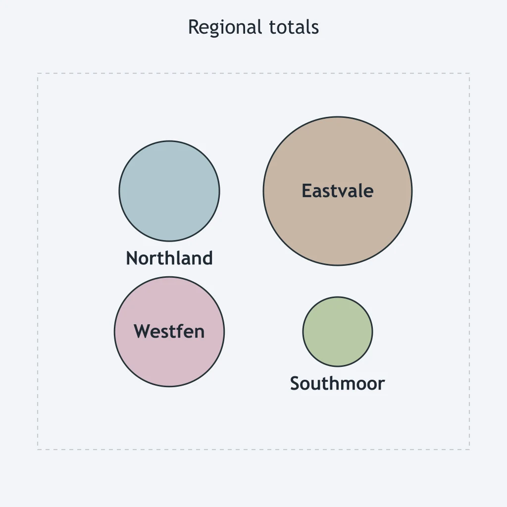
Use the cartogram figure. Which comparison is supported?
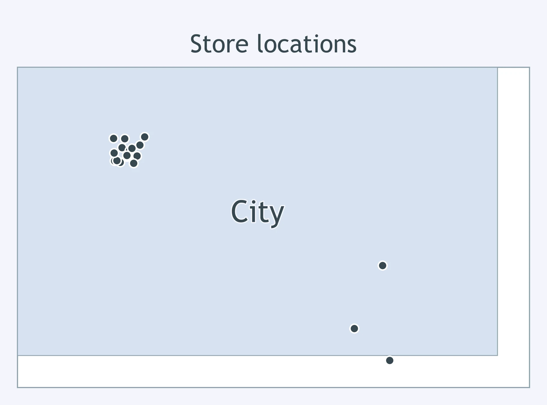
Use the dot map figure of store locations. Which statement is supported?
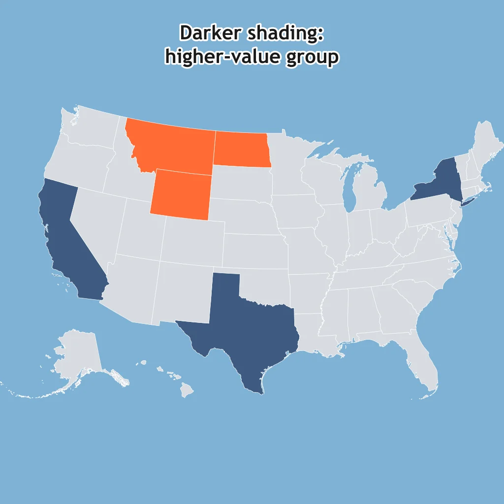
Use the shaded state map. Which listed state is in the higher-value group?
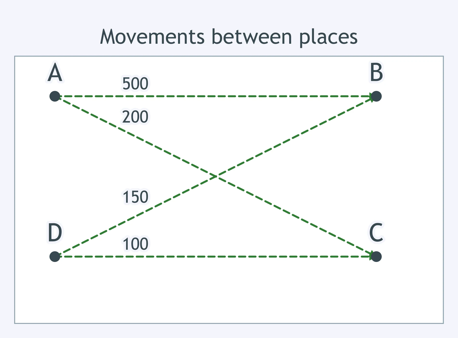
Use the flow-map figure. Which route carries the largest movement?
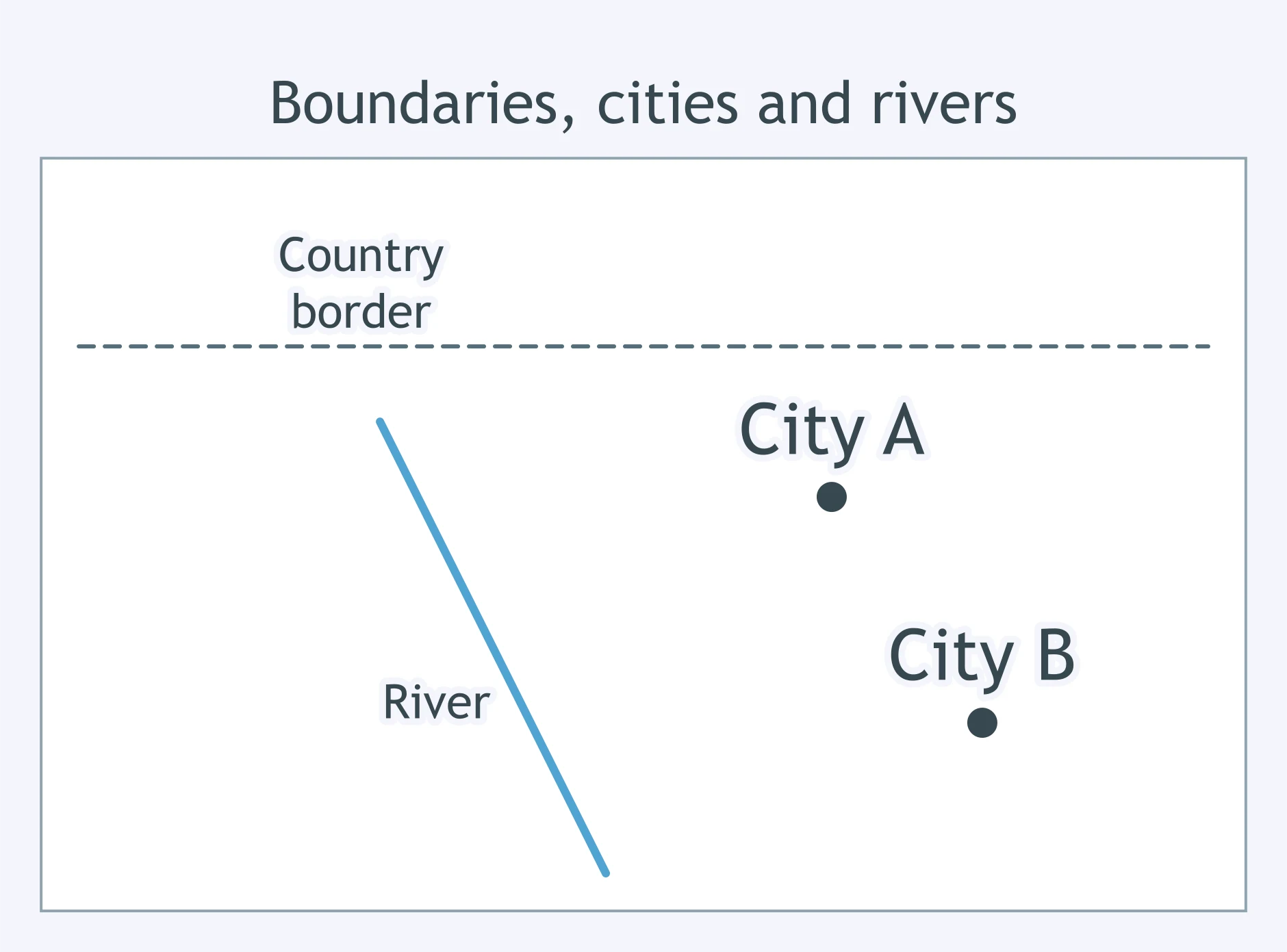
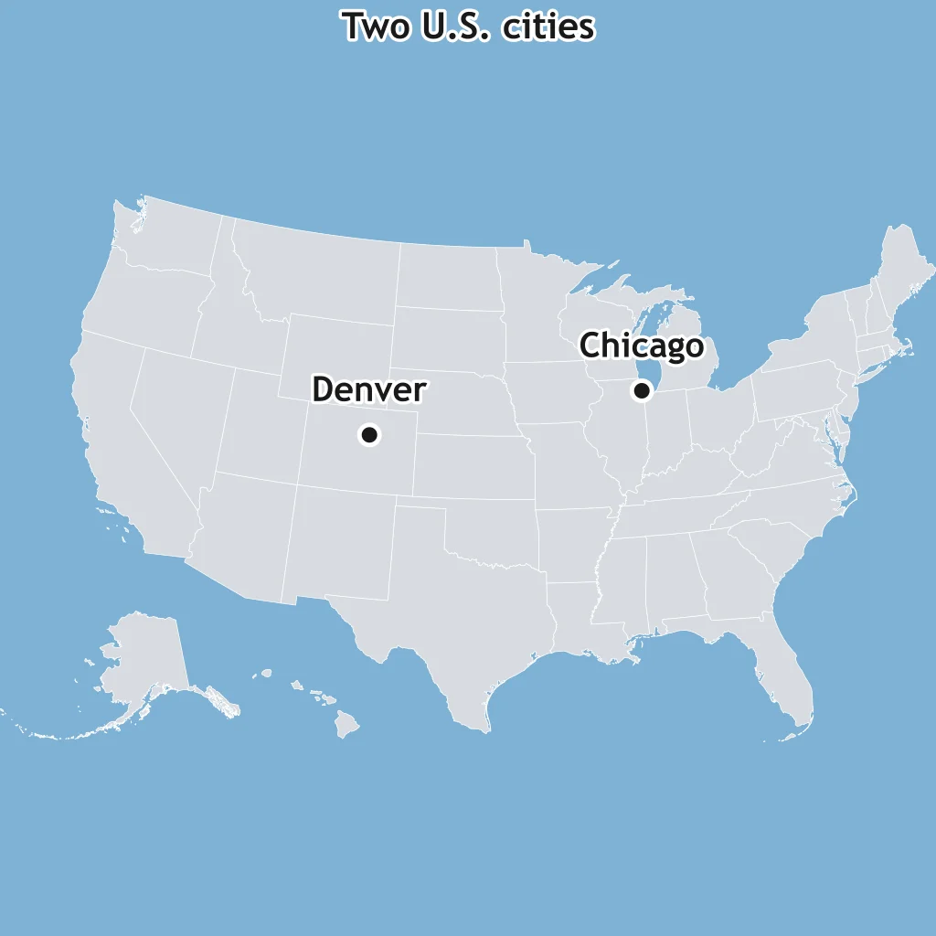
Use the reference map. Which comparison is supported?
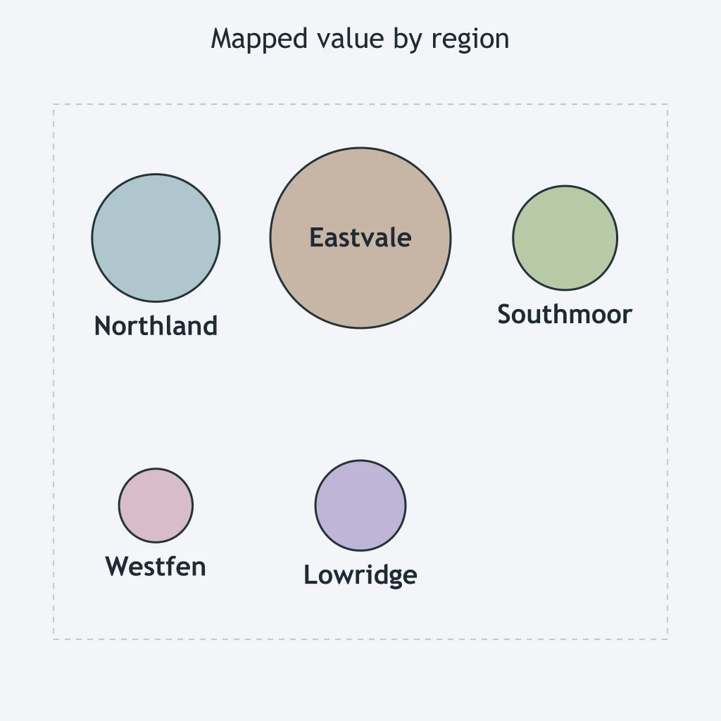
Use the circle cartogram. Which region represents a larger value than Northland?
Use the dot-distribution figure. Which pattern does it show?
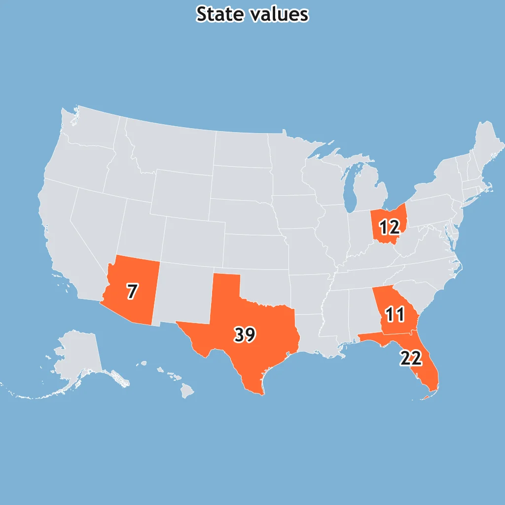
Use the state-value map. Which listed state has the highest printed value?
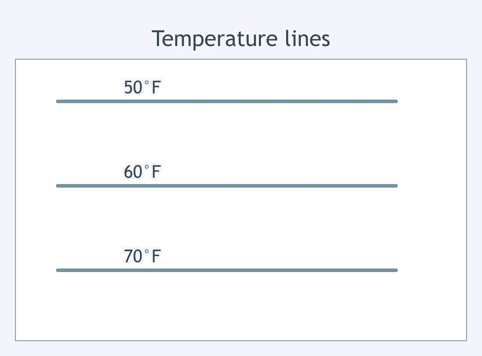
Use the isoline figure. Which statement is supported about temperature?
A cartogram resizes countries by share of world population. What does a reader give up compared with a standard reference map?
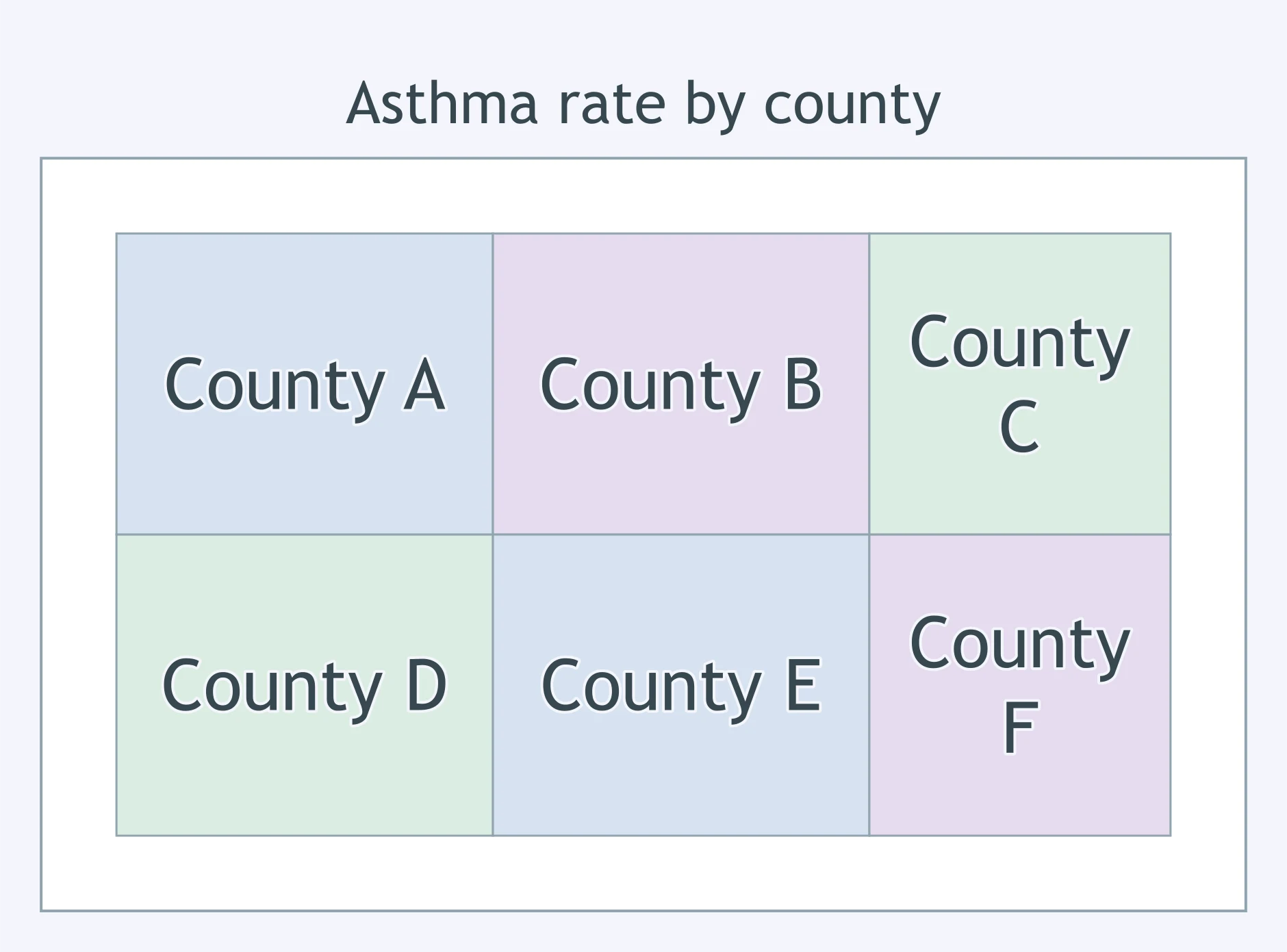
A county choropleth shades each county by asthma rate. What limitation should a reader remember?
A dot distribution map uses randomly placed dots inside counties, one dot for 100 farms. What detail does it give up?
A graduated symbol map draws large circles over cities for total sales. What tradeoff can large symbols create?
An isoline map smooths temperatures into lines of equal value. What is a limitation?
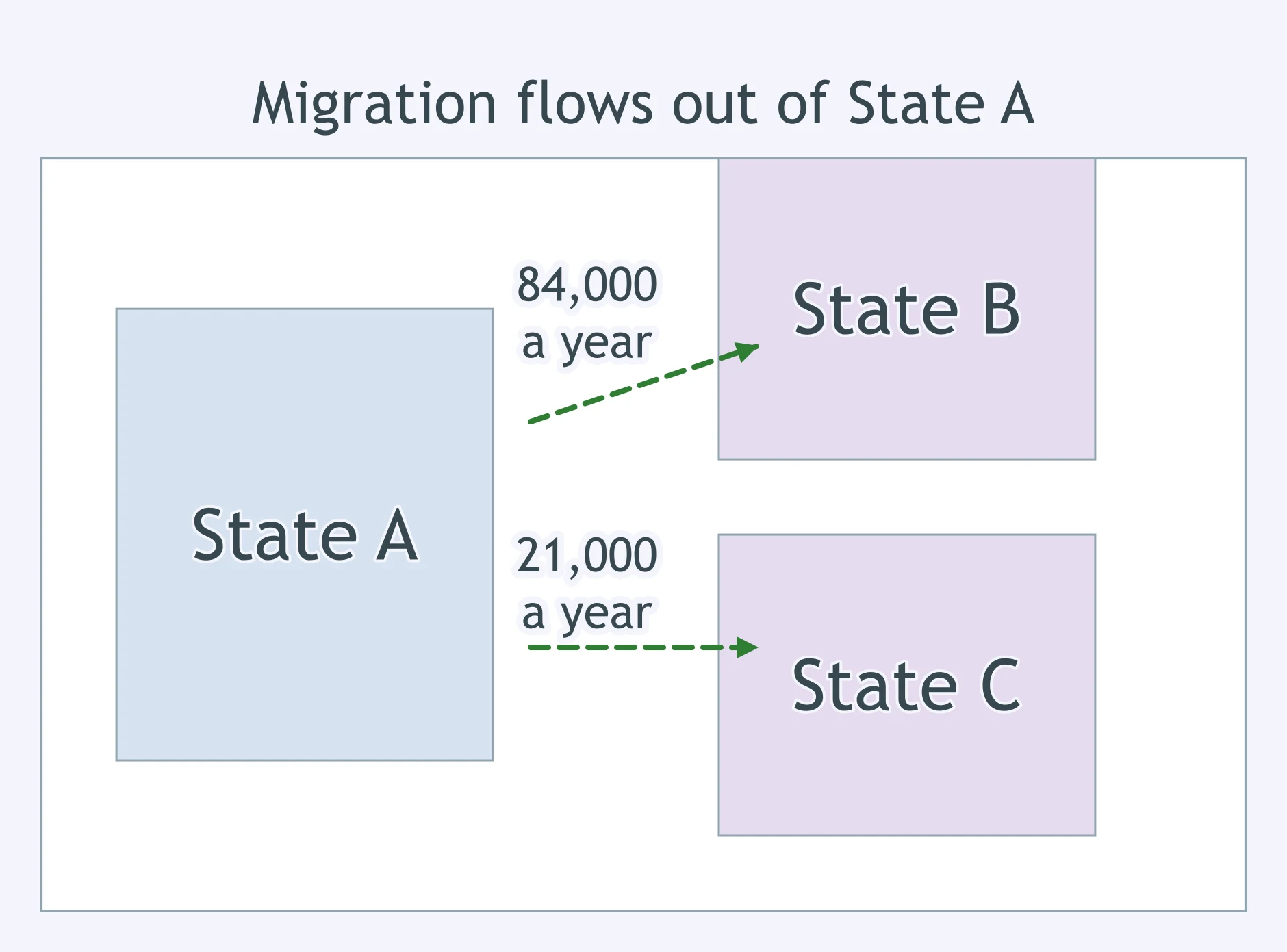
Use the map. A flow map like this one simplifies migration between states into a few arrows. What does it usually give up?
Map Projections: Mercator, Peters, Robinson and Goode
25 questions
Map Scale and Scales of Analysis
30 questions
Geographic Data: GIS, GPS, Remote Sensing and the Census
35 questions
Spatial Concepts: Location, Site, Situation, Space and Place
35 questions
Distance Decay, Friction of Distance and Time-Space Compression
30 questions
Crack the passcode before the zombies get in.
Answer, then swat bugs for bonus points.
Race through questions at your own speed.
Same question on every screen. Fastest wins.

Pick a tile, answer, hit bonuses and steals.