Loading
by BlastRoom
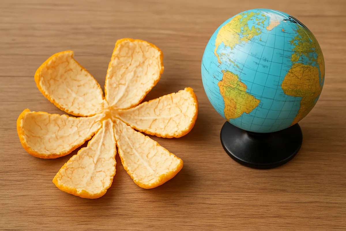
Which property a projection keeps and which it sacrifices.
#us_hs_human_geography
25 questions
One question set, multiple game modes. Tap any game to see it in action. Not sure which to pick?
Answer to place stones and capture territory.
Outrun the snow together.
Earn blasts, then hunt the other team.
Answer to earn energy, then climb.

The class blasts through walls together.
Bid on mystery lots. Most money wins.
Sell tours. Nice, standard, or a total scam.

Answer, restock, and serve the rush.
More correct answers pulls the rope your way.
Answer, then shoot down the alien wave.
Answer, then tap to leap the frozen ridge.
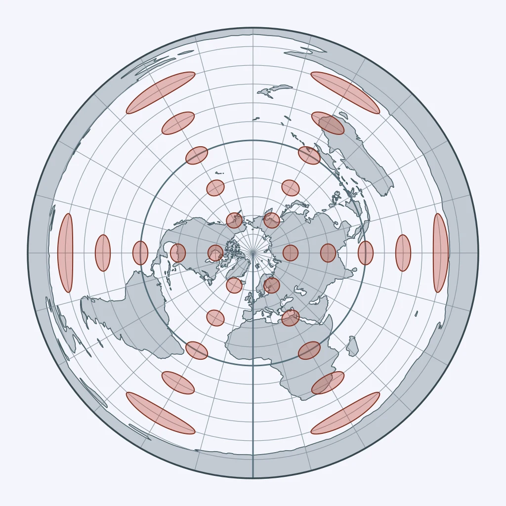
Use the figure. What projection is shown?
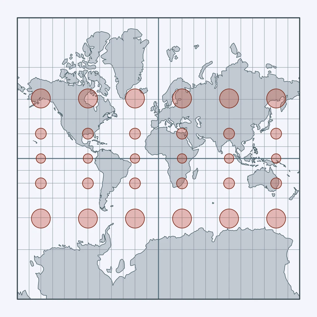
Use the figure. What projection is shown?
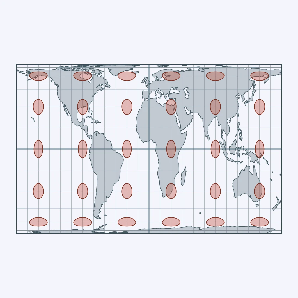
Use the figure. What projection is shown?
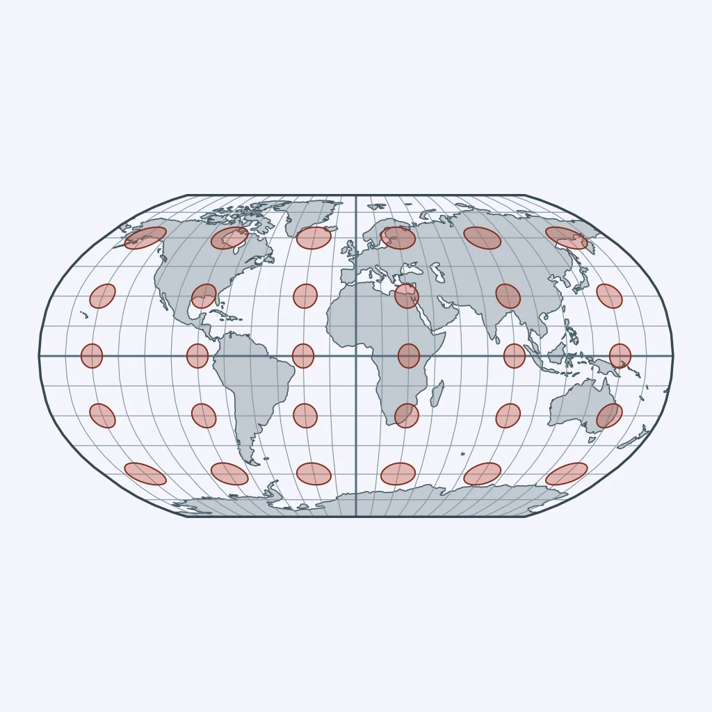
Use the figure. What projection is shown?
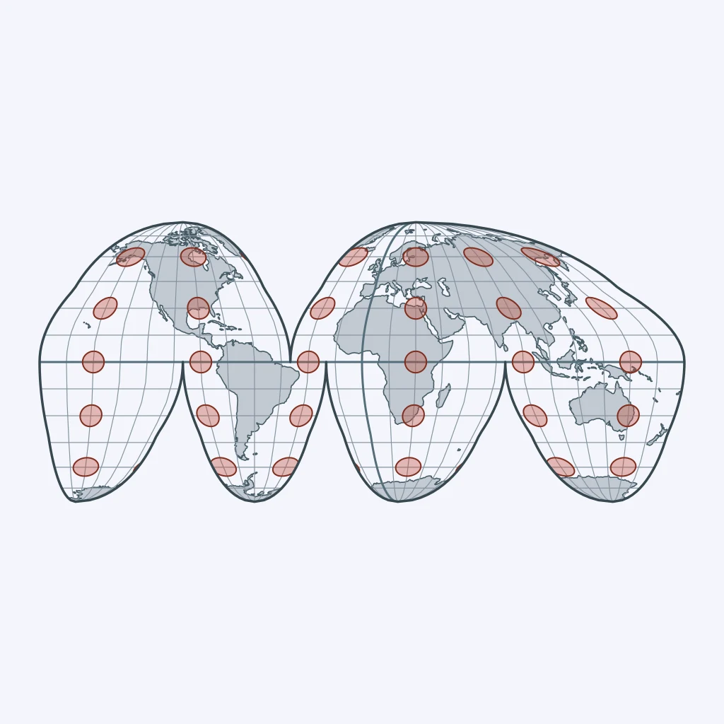
Use the figure. What projection is shown?
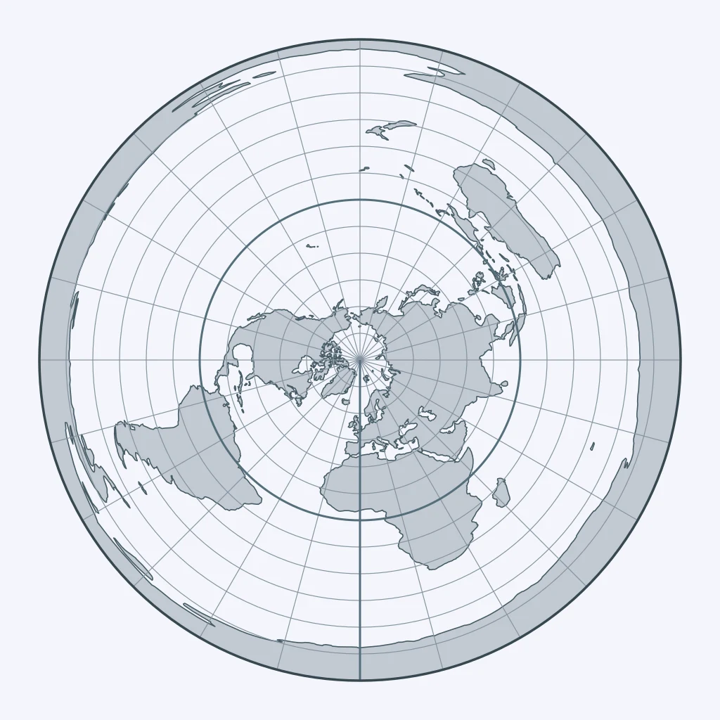
Use the figure. What projection is shown?
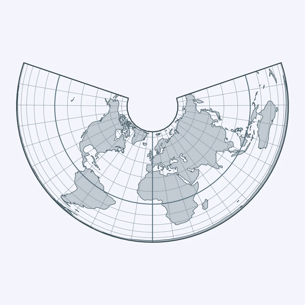
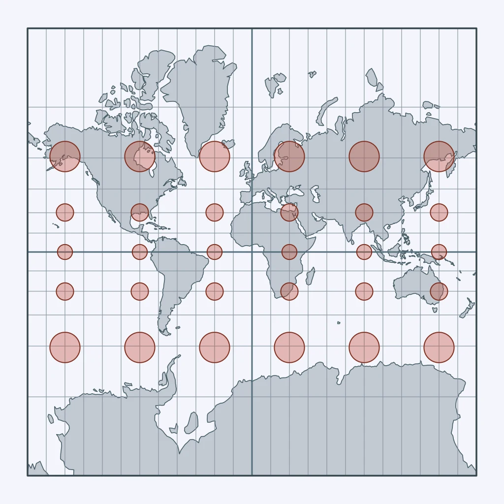
Africa is about 14 times larger than Greenland, yet on one common world map the two look about the same size. Which projection is it?
Which projection preserves land area but interrupts the map through the oceans?
A navigator uses a world map where a constant compass bearing plots as a straight line. What property is preserved, and what is sacrificed?
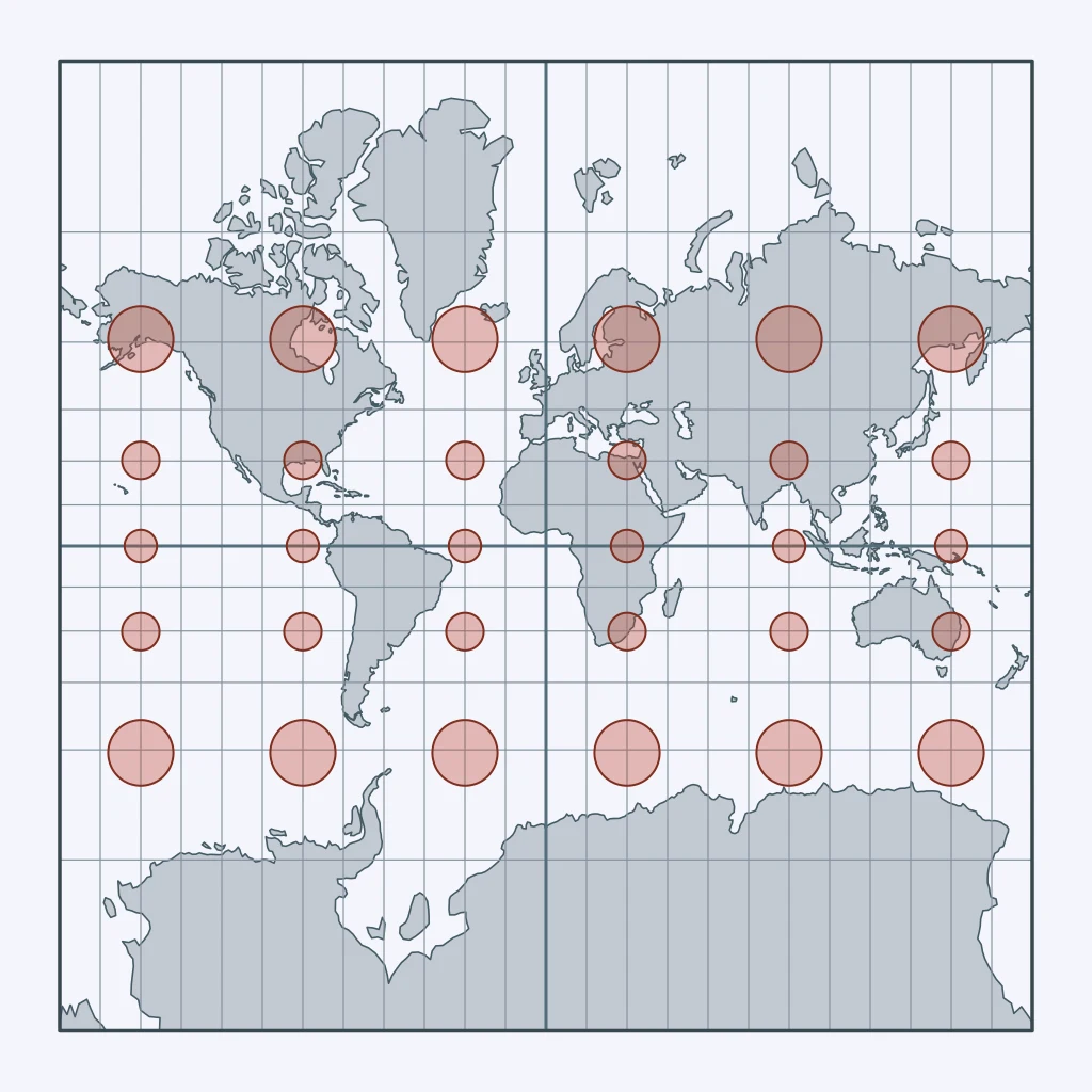
Use the figure. Compare the Tissot circles across latitudes. What property is preserved, and what is sacrificed?
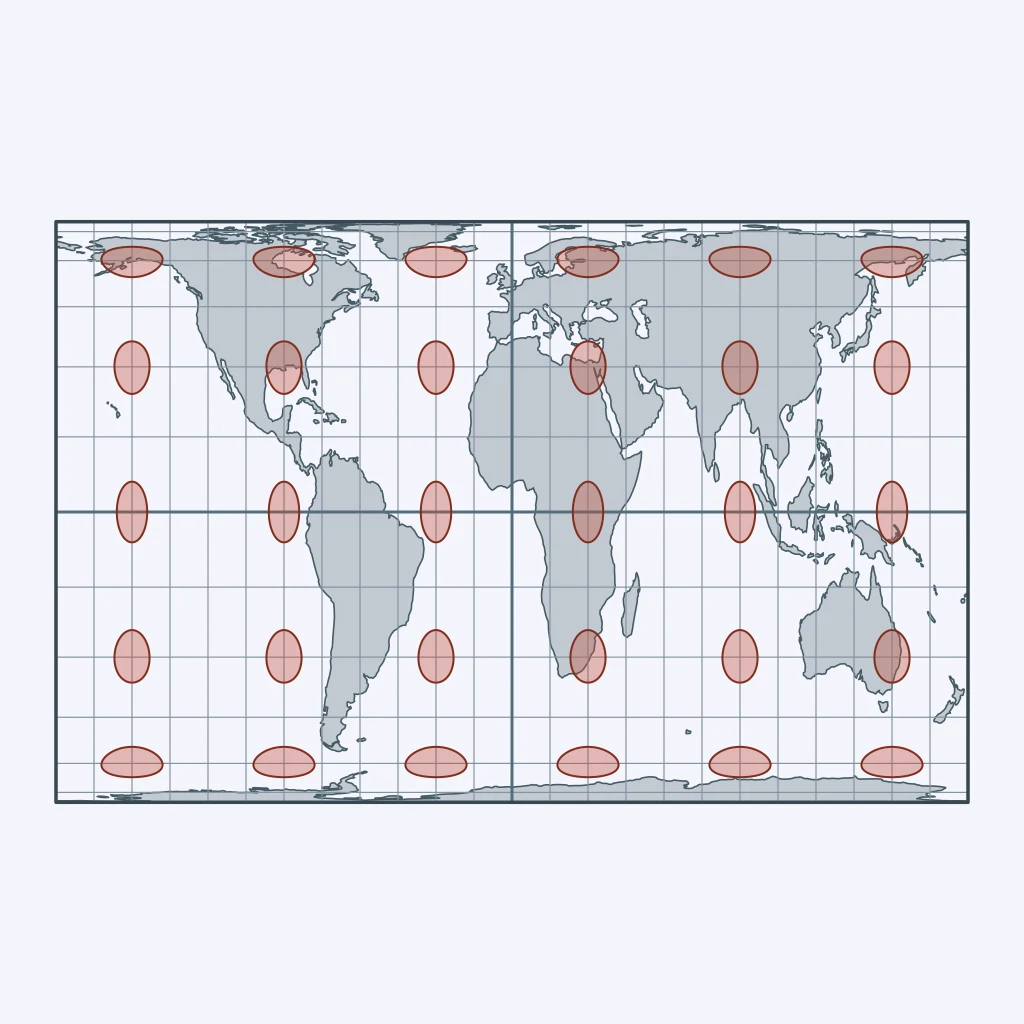
Use the figure. Compare the shapes of Africa and South America with their sizes. What tradeoff is shown?
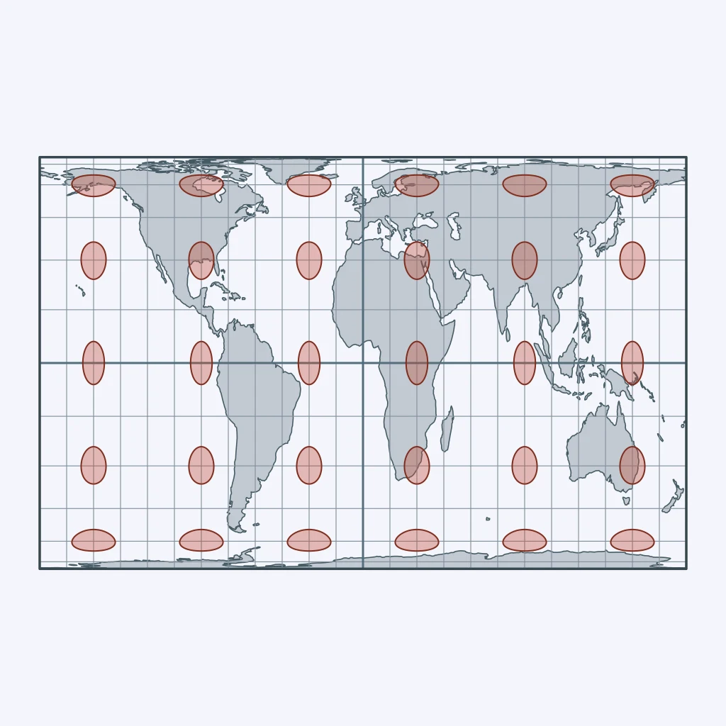
Use the figure. Compare the Tissot circles across latitudes. What property is preserved, and what is sacrificed?
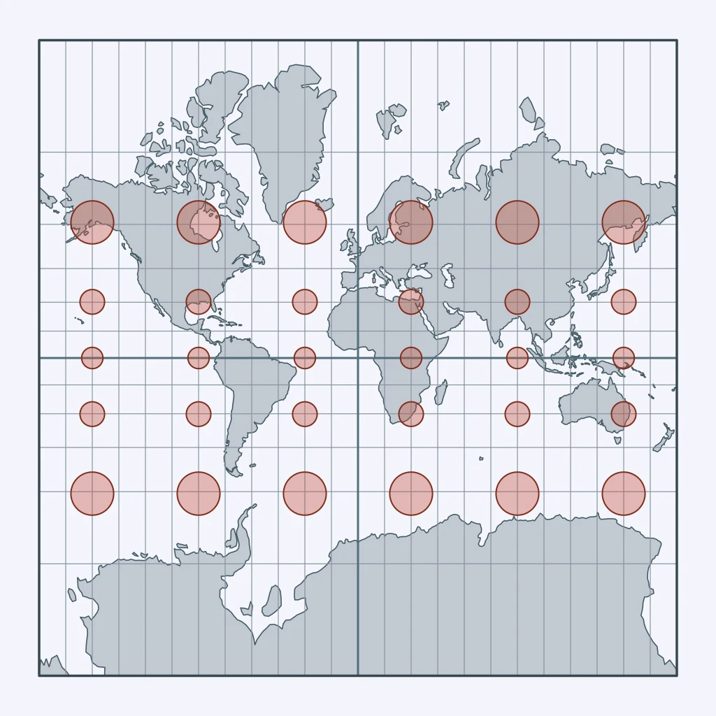
Use the figure. What tradeoff does this projection make?
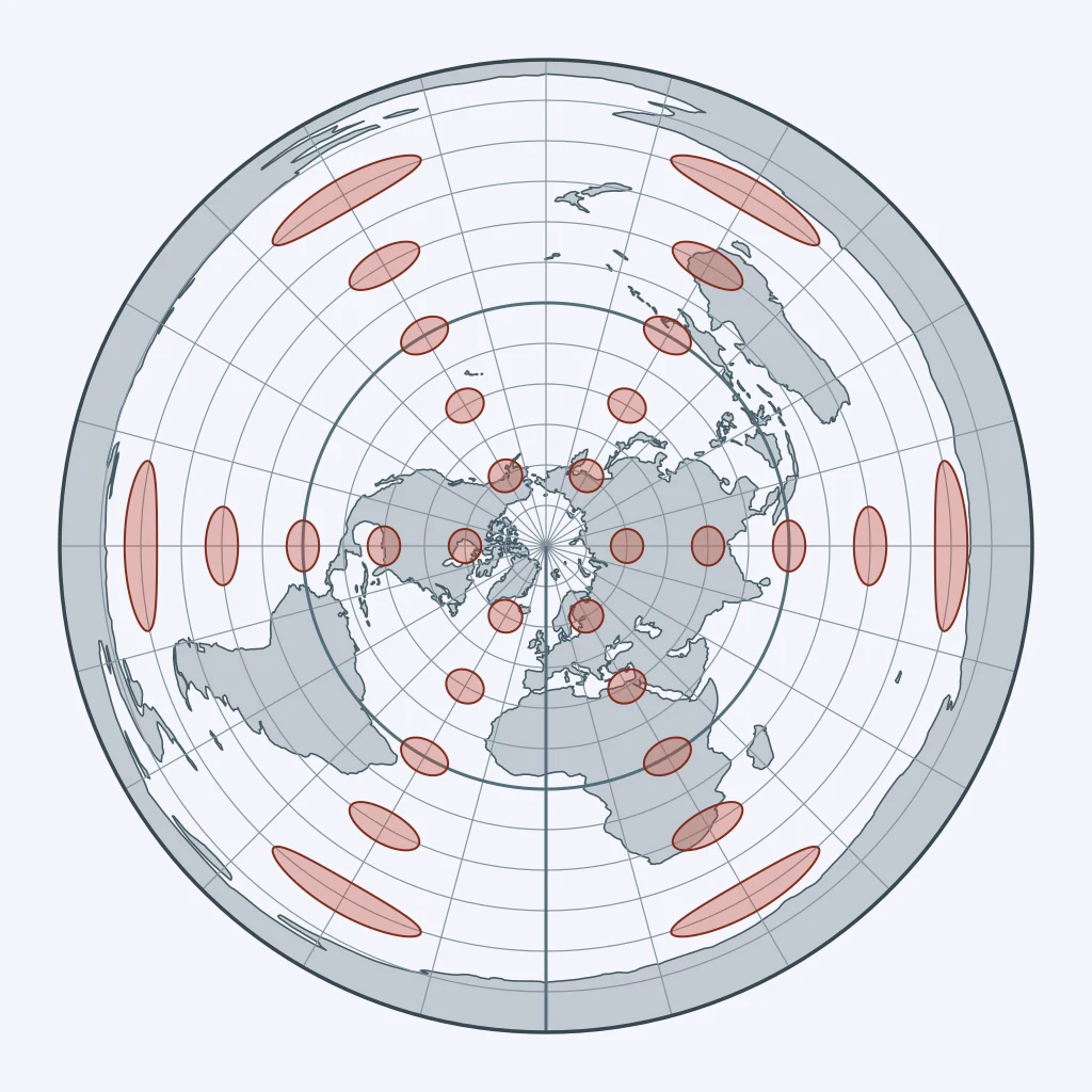
Use the figure. What is the main tradeoff of this projection?
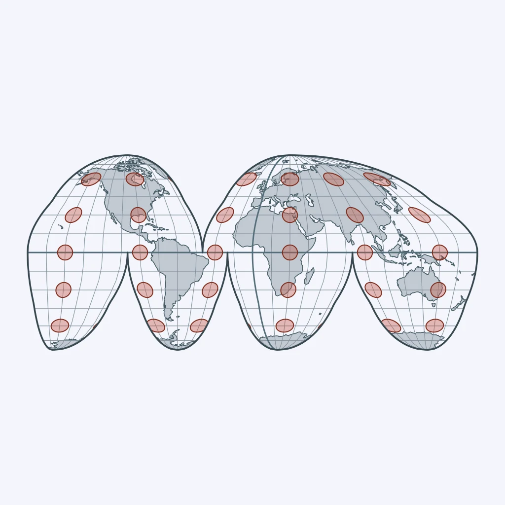
Use the figure. What tradeoff does this projection make?
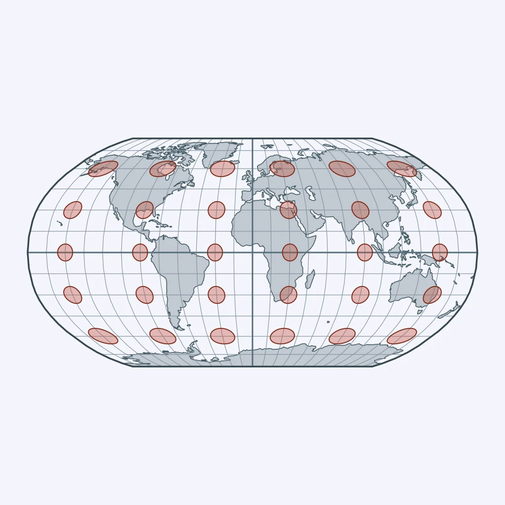
A textbook map must compare the land area of rainforest regions across continents. What projection best fits that purpose?
A classroom wall map needs a general view of the world with no extreme visual distortion, not exact navigation or exact area. What projection best fits?
The Goode homolosine projection places most of its cuts in the oceans. Why?
A polar communication map must show accurate bearings from a station at the center. What projection best fits?
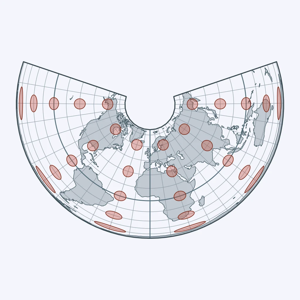
A regional map of the United States needs low distortion across a wide midlatitude zone. What projection best fits?
A marine chart must let sailors draw a constant compass course as a straight line. What projection best fits?
Every flat world map distorts the globe in some way. What is the best explanation?
Use the figure. Where is area distortion greatest on this map?
Use the figure. On this conic map, where does distortion generally increase most?
Use the figure. On this map centered on one point, where is distortion usually worst?
Maps and Map Types: Reference, Thematic, Choropleth, Dot, Cartogram and Flow
35 questions
Map Scale and Scales of Analysis
30 questions
Geographic Data: GIS, GPS, Remote Sensing and the Census
35 questions
Spatial Concepts: Location, Site, Situation, Space and Place
35 questions
Distance Decay, Friction of Distance and Time-Space Compression
30 questions
Crack the passcode before the zombies get in.
Answer, then swat bugs for bonus points.
Race through questions at your own speed.
Same question on every screen. Fastest wins.

Pick a tile, answer, hit bonuses and steals.