Loading
by BlastRoom
Students assess hazard risk from maps and data and choose practical preparation steps.
#earth_space_science
40 questions
One question set, multiple game modes. Tap any game to see it in action. Not sure which to pick?
Answer to place stones and capture territory.
Outrun the snow together.
Earn blasts, then hunt the other team.
Answer to earn energy, then climb.

The class blasts through walls together.
Bid on mystery lots. Most money wins.
Sell tours. Nice, standard, or a total scam.

Answer, restock, and serve the rush.
More correct answers pulls the rope your way.
Answer, then shoot down the alien wave.
Answer, then tap to leap the frozen ridge.
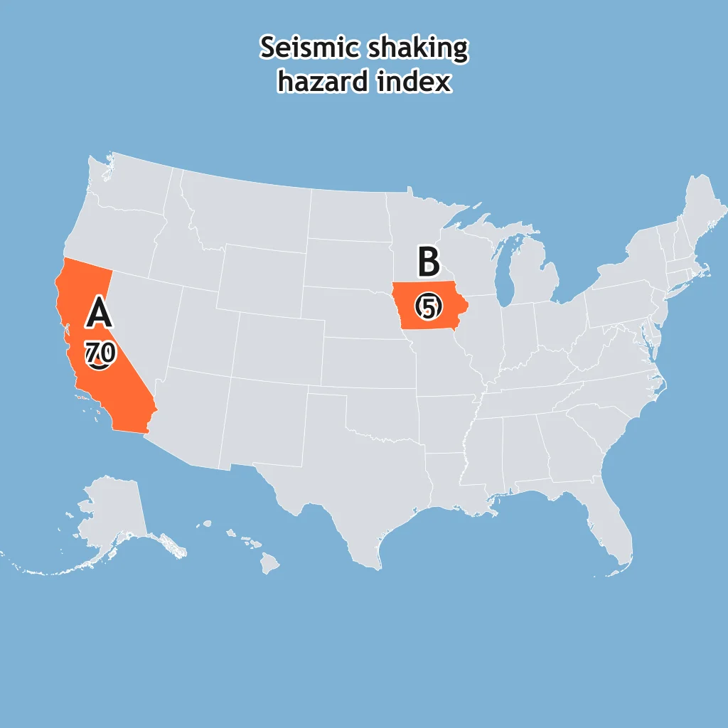
Use the seismic hazard map. Town A and Town B are marked. Which building-code choice fits the mapped shaking hazard?
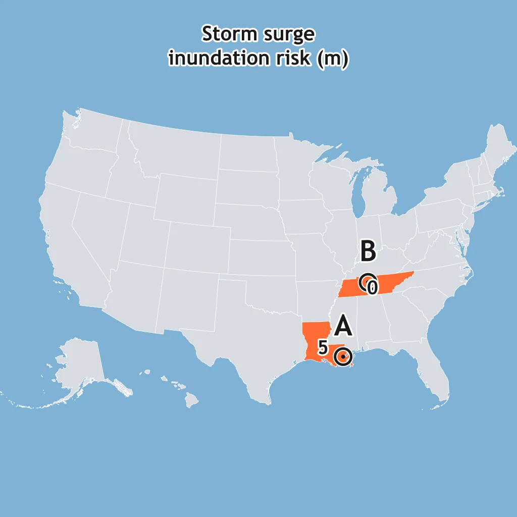
Read the storm-surge map for the marked towns. What should an emergency manager infer about evacuation planning?
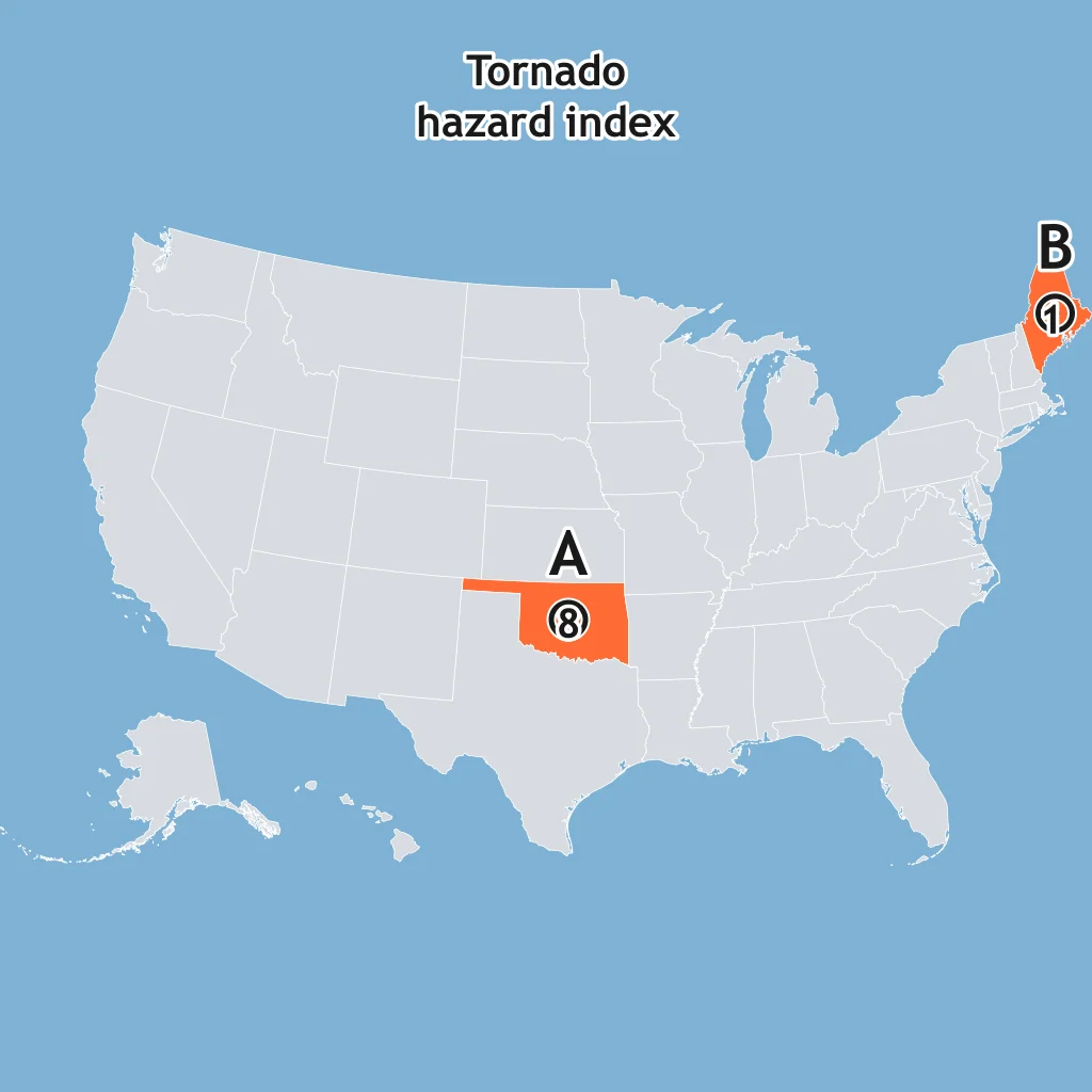
Use the tornado risk map. Which town should put the higher priority on community tornado shelters?
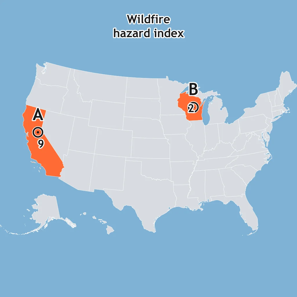
On the wildfire hazard map, Town A and Town B are marked. Which zoning choice follows from the map?
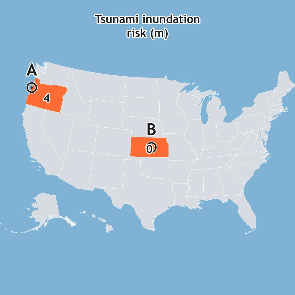
Use the tsunami hazard map for the marked towns. Which statement best matches the map?
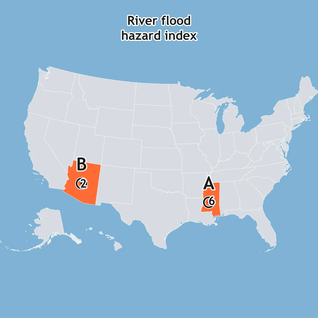
Read the river-flood hazard map. Which town should place critical equipment above expected floodwater first?
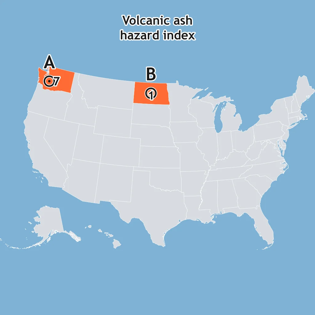
Use the volcanic-ash hazard map. Which town should stock masks and protect air filters first?
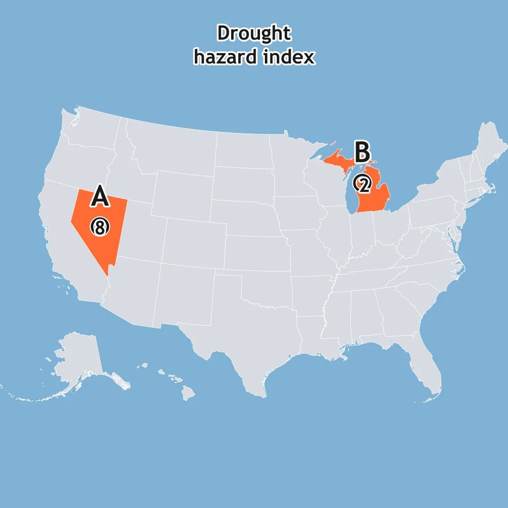
Read the drought hazard map for Town A and Town B. Which town should prioritize backup water supplies?
A coastal city wants to reduce loss of life from storm surge without relocating the city. Which preparation most directly addresses that hazard?
A hospital is in a high seismic-hazard zone. Which mitigation best reduces damage from strong ground shaking?
Homes in a dry forested wildland-urban interface face wildfire risk. Which preparation most directly reduces structure loss?
A subdivision is proposed on a steep slope with old landslide scars. Which preparation most directly reduces landslide losses?
A town downwind of an active volcano expects ashfall during an eruption. Which preparation best matches that hazard?
A school is inside a river floodplain. Which mitigation most directly reduces flood damage to its utilities?
A community in tornado country is designing a new school. Which preparation best reduces student injury during a tornado warning?
An outdoor stadium has frequent summer thunderstorms. Which plan best reduces lightning risk for spectators?
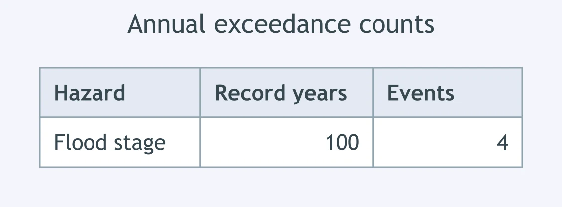
Use the table. What is the recurrence interval for the flood stage, using record years divided by event count?
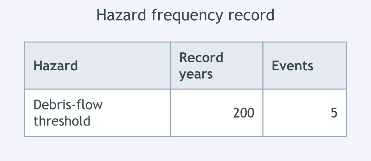
Use the table. What is the annual probability of the debris-flow threshold, using event count divided by record years?
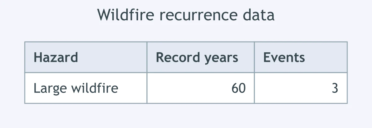
Use the table. A wildfire has the listed recurrence record. What is its recurrence interval?
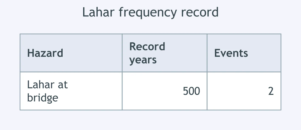
Use the table. What annual probability is shown for a lahar reaching the bridge?
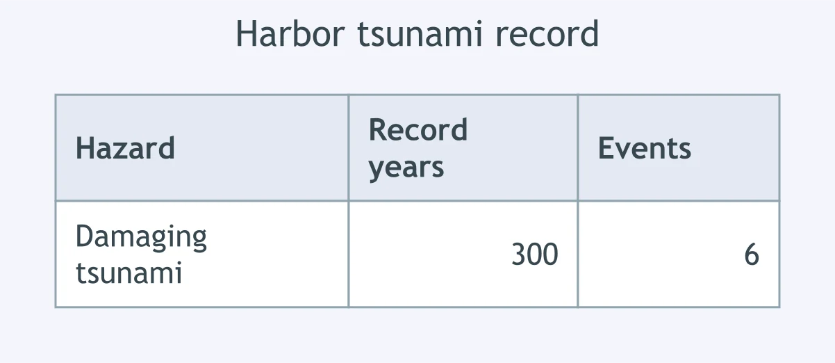
Use the table. What recurrence interval is shown for a damaging tsunami at the harbor?
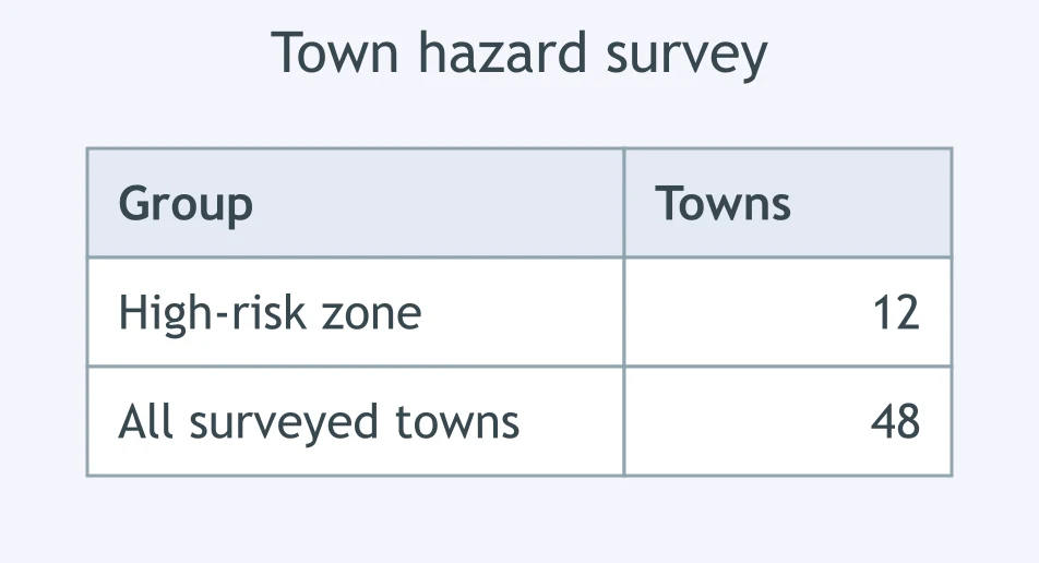
Use the table. What percent of surveyed towns are in the high-risk zone?
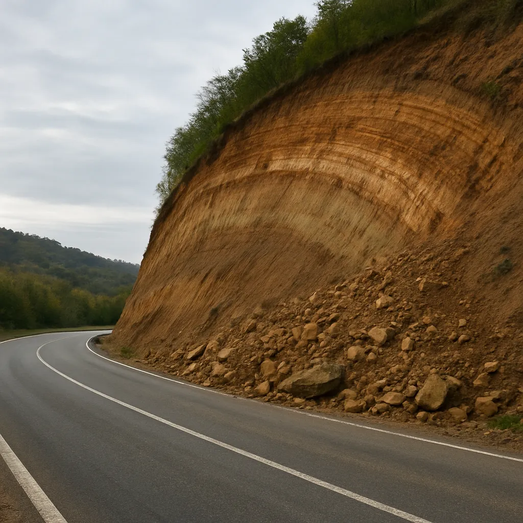
A photo shows loose, broken rock piled at the base of a steep road cut, spilling toward the road. Which hazard is shown?
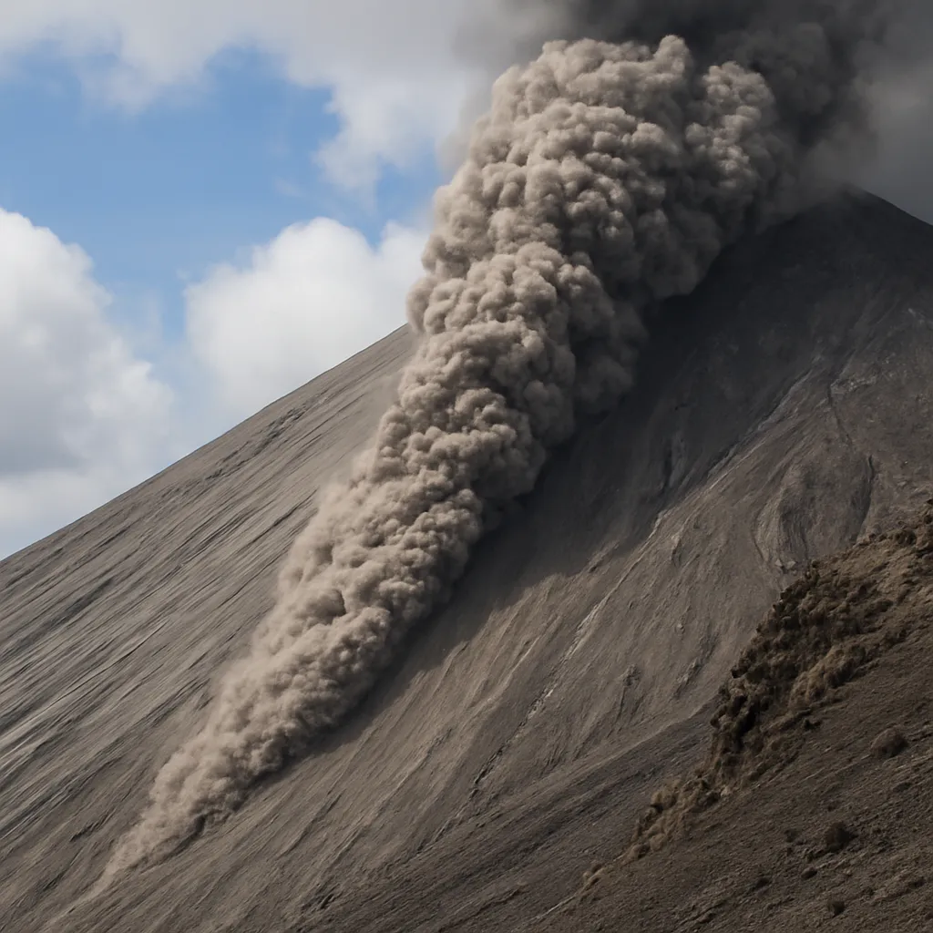
An image shows a gray, turbulent ash cloud racing down a volcano flank. Which volcanic hazard is shown?
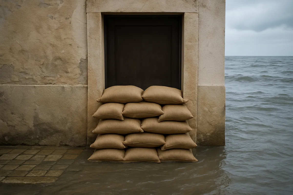
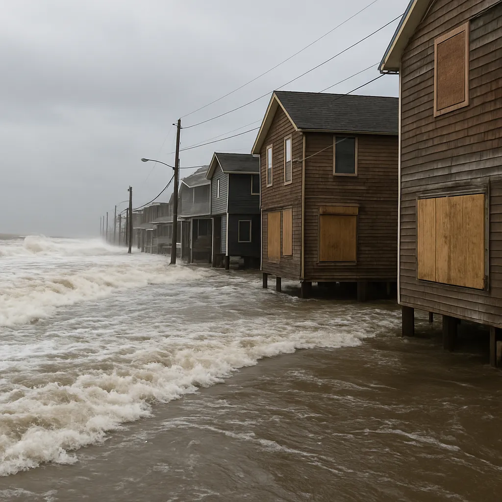
A scene shows seawater pushed inland across a coastal street during a hurricane. Which hazard is shown?
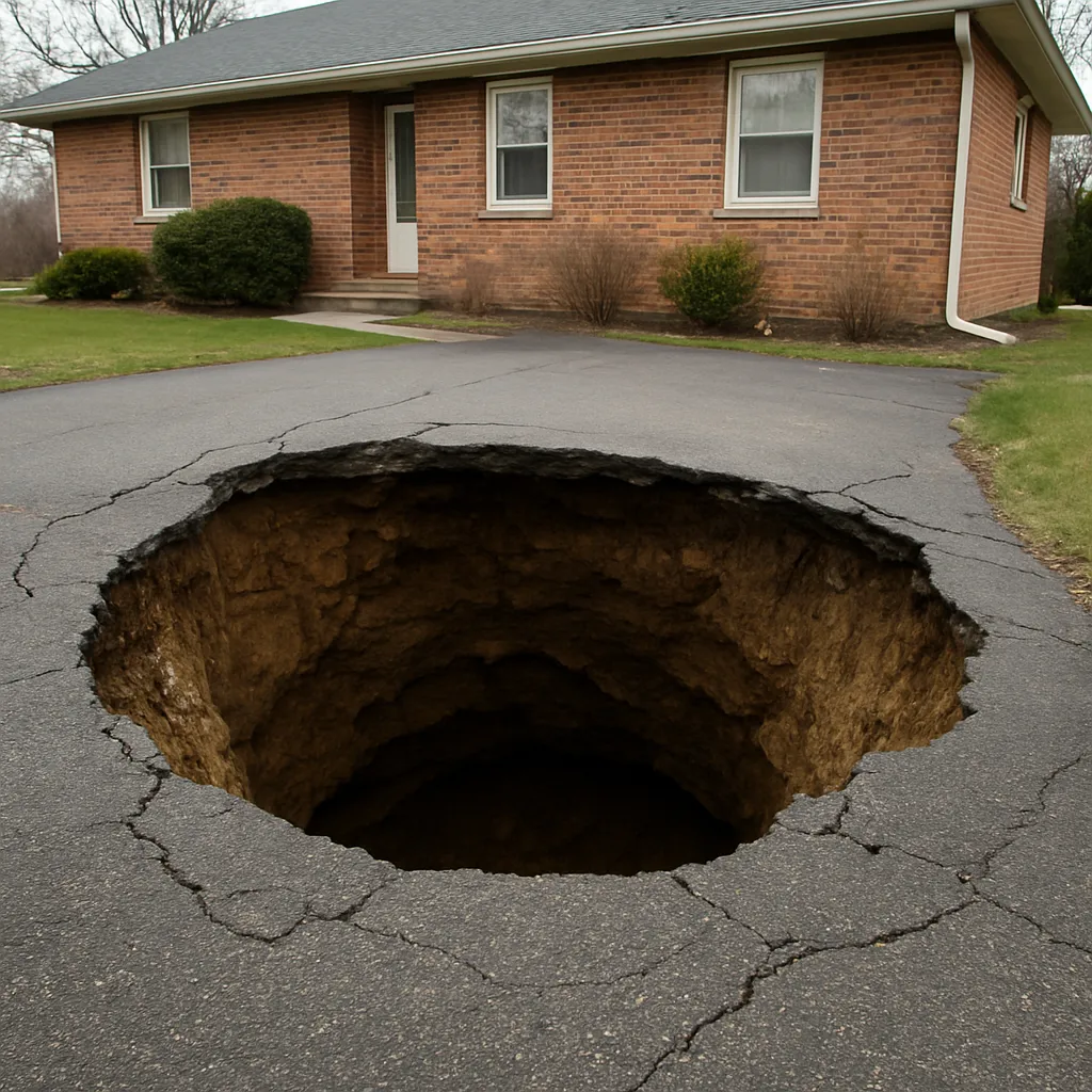
A photo shows a circular collapse hole opening in limestone ground and swallowing part of a driveway. Which hazard is shown?
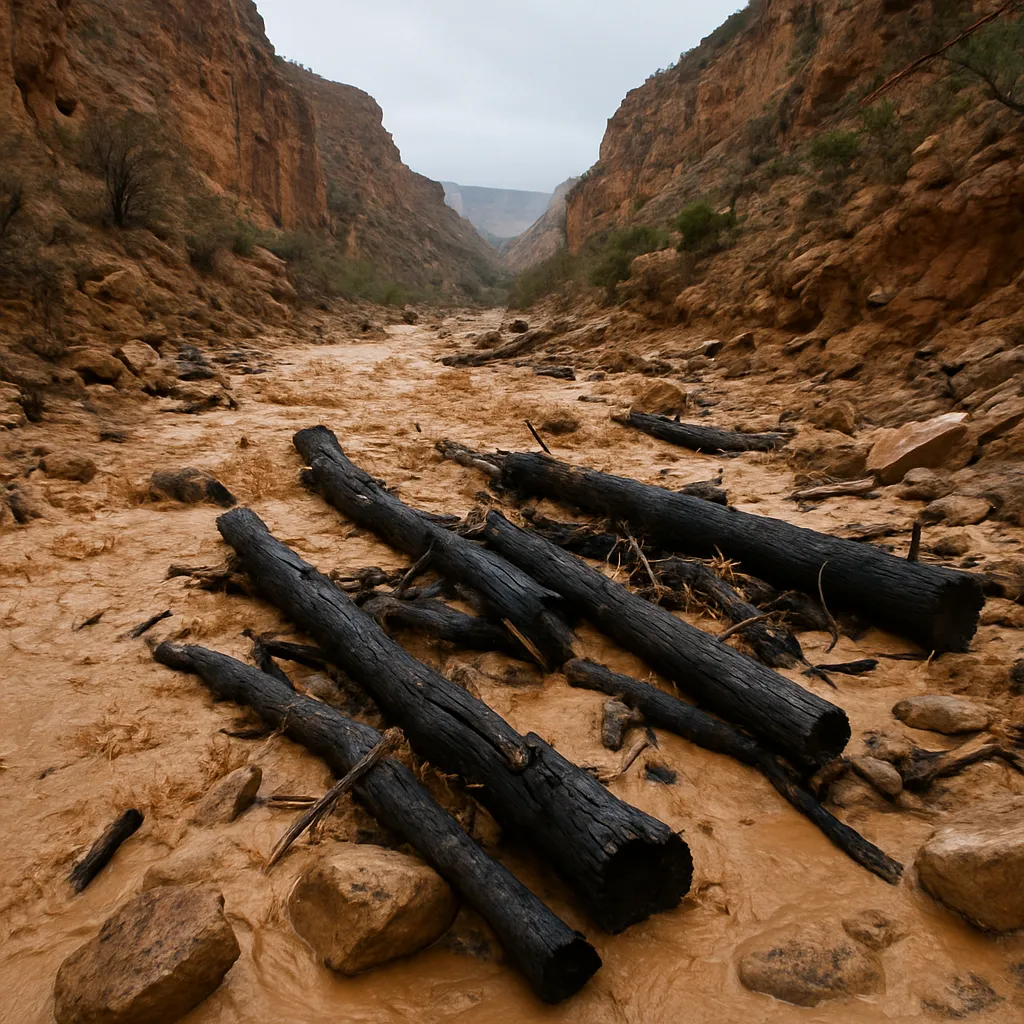
An image shows muddy water, boulders, ash, and burned logs rushing down a canyon after heavy rain. Which hazard is shown?
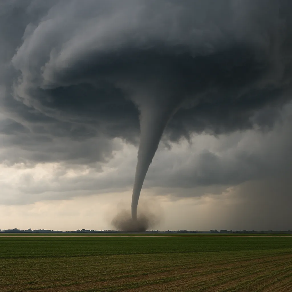
A scene shows a funnel-shaped rotating column reaching from a thunderstorm cloud to farmland. Which hazard is shown?
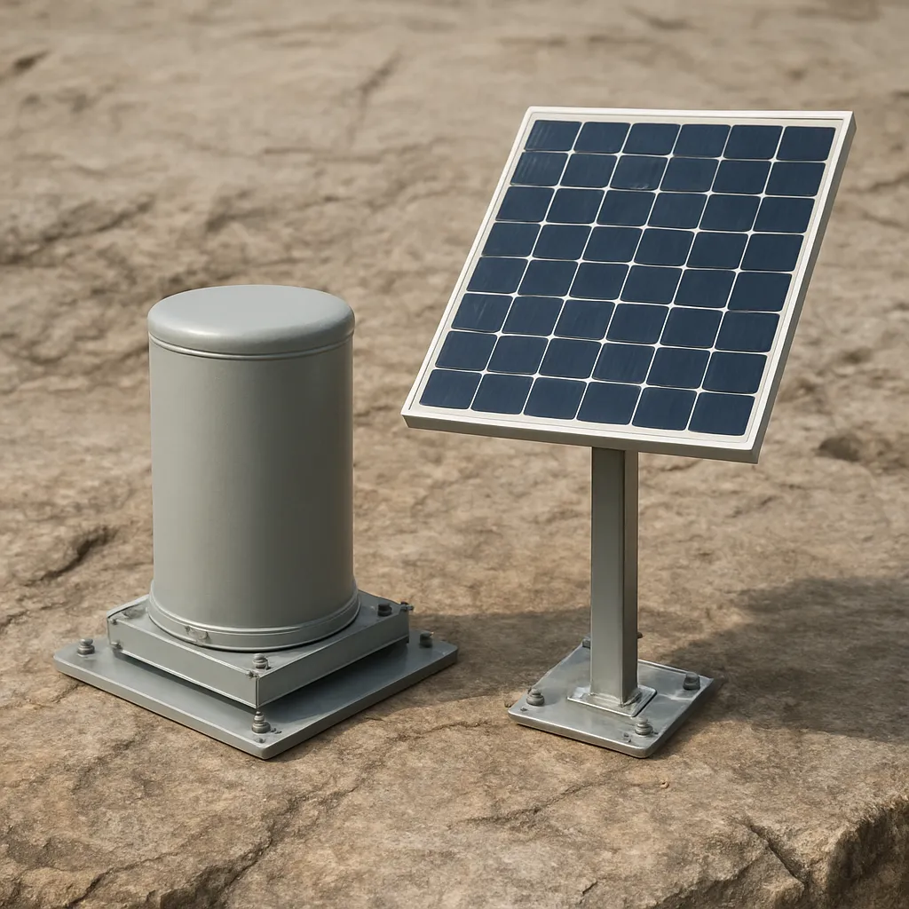
The instrument shown is anchored to bedrock and records ground motion before damaging waves arrive. Which warning system uses it?
A buoy system includes a seafloor pressure recorder and relays signals by satellite. Which hazard warning system uses it?

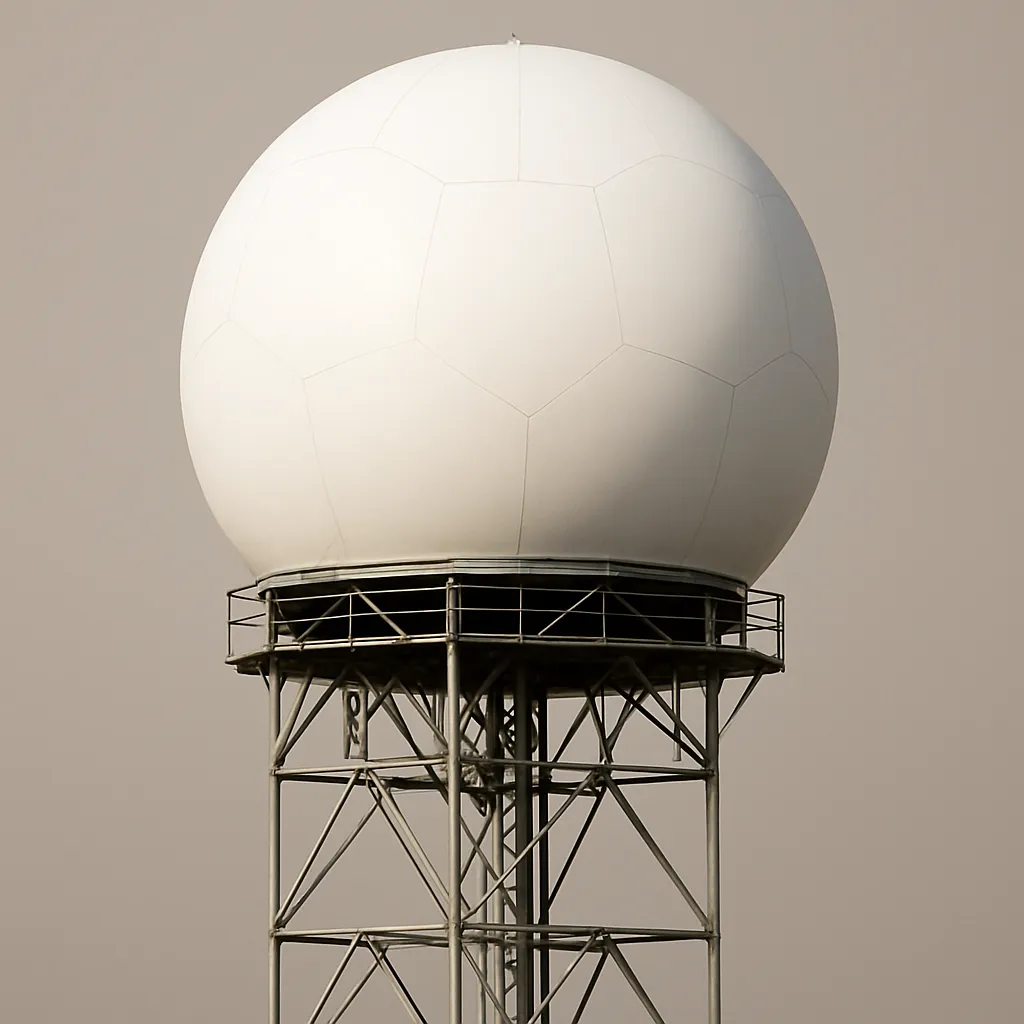
The instrument shown sends radio waves into storms and measures motion toward or away from the antenna. Which hazard can it help warn for?
A sensor box in a volcanic river valley detects ground vibrations from moving mud and rock. Which hazard is it built to warn about?

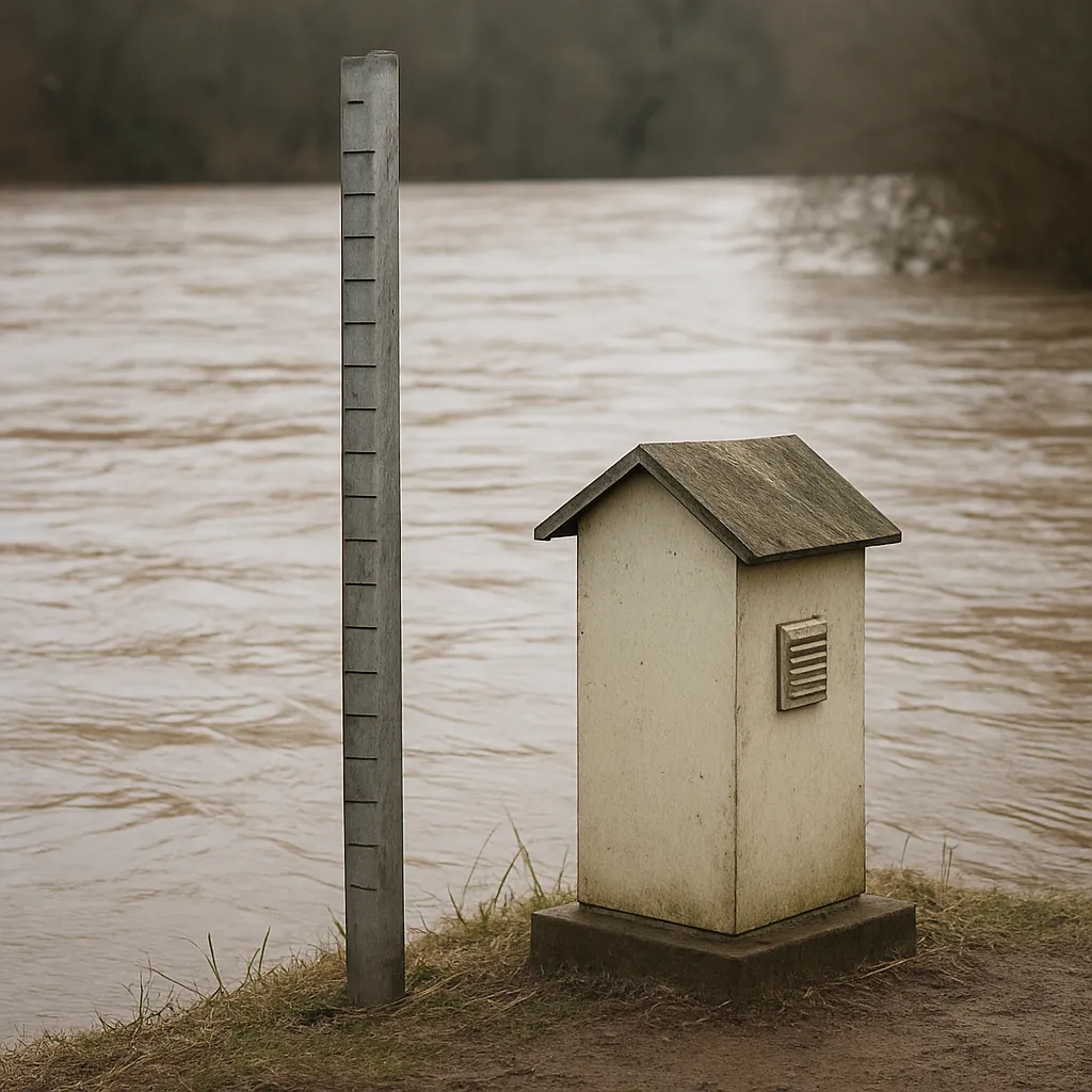
The instrument shown measures river stage and transmits real-time data used by forecasters. Which warning does it support?
A satellite repeatedly images spiral cloud bands, cloud-top temperatures, and an eye over warm ocean water. Which hazard is it monitoring?

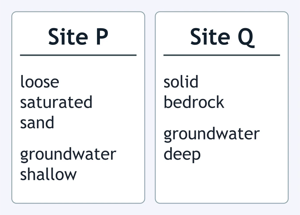
Use the site comparison. During a magnitude 6.5 earthquake, which site has greater liquefaction risk?
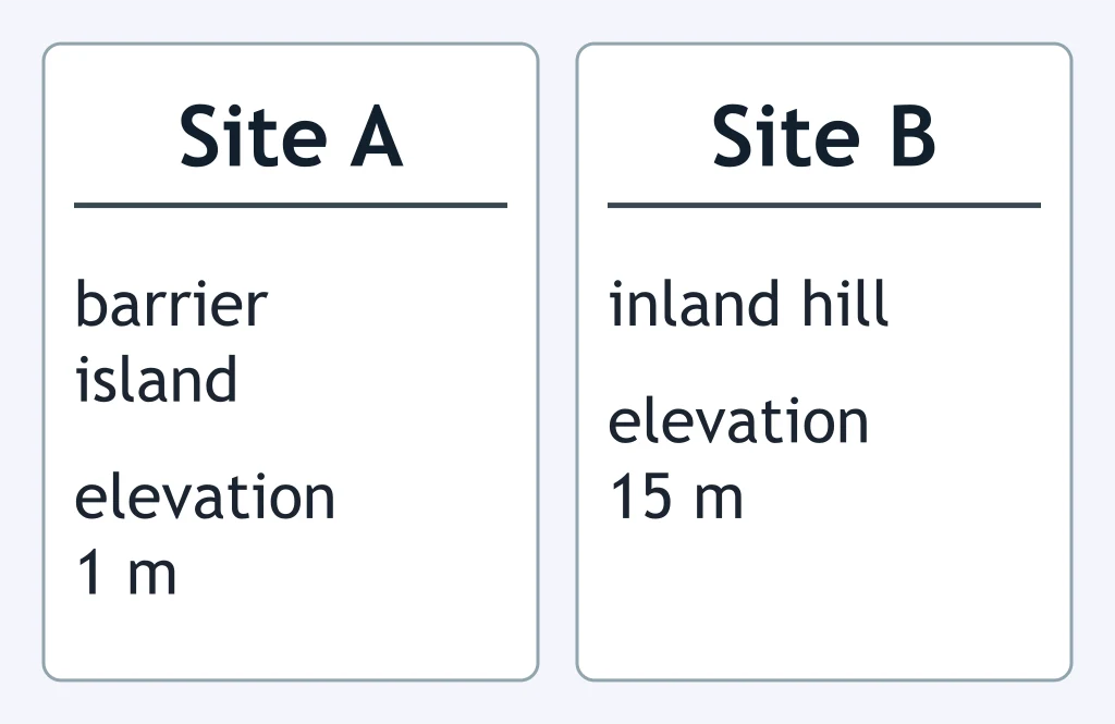
Use the site comparison. If a hurricane makes landfall nearby, which site has higher storm-surge risk?
Home P has dry brush against wood siding. Home Q has cleared space and a fire-resistant roof. Which home has greater wildfire risk, and why?
After heavy rain, Site A is a steep slope with tilted trees and cracks. Site B is flat bedrock. Which site has greater landslide risk?
Factory A is inside the 100-year floodplain next to a river. Factory B is on a high terrace above it. Which factory has higher flood risk?
Town A sits in a valley draining a glacier-covered stratovolcano. Town B is on a ridge above the valley. Which town has greater lahar risk?
Crack the passcode before the zombies get in.
Answer, then swat bugs for bonus points.
Race through questions at your own speed.
Same question on every screen. Fastest wins.

Pick a tile, answer, hit bonuses and steals.
Earth Science Cumulative Review
60 questions