Loading
by BlastRoom
A cumulative review of the US and Canada, Latin America, Europe and Russia.
#us_hs_world_geography
50 questions
One question set, multiple game modes. Tap any game to see it in action. Not sure which to pick?
Answer to place stones and capture territory.
Outrun the snow together.
Earn blasts, then hunt the other team.
Answer to earn energy, then climb.

The class blasts through walls together.
Bid on mystery lots. Most money wins.
Sell tours. Nice, standard, or a total scam.

Answer, restock, and serve the rush.
More correct answers pulls the rope your way.
Answer, then shoot down the alien wave.
Answer, then tap to leap the frozen ridge.
Five connected freshwater lakes straddle the United States-Canada border and drain east to the Atlantic through one river. What river is it?
The main continental divide of western North America follows this high mountain system from New Mexico into Canada. What range is it?
Old, eroded mountains run along eastern North America from Alabama toward Newfoundland. What mountain system is this?
A huge river system drains the central United States and carries water south to the Gulf of Mexico. What river is its main stem?
Old exposed bedrock surrounds much of Hudson Bay and covers large parts of eastern and central Canada. What physical region is this?
A broad interior grassland lies east of the Rockies and stretches from Texas into the Prairie Provinces. What region is it?
The Mississippi River empties into a warm water body south of the United States and east of Mexico. What water body is it?
Denali, the highest peak in North America, rises in this mountain range in south-central Alaska. What range is it?
A large shallow inland sea in northeastern Canada connects to the Atlantic through Hudson Strait. What is it called?
The world's largest river by discharge crosses equatorial South America and empties into the Atlantic. What river is it?
A long mountain chain runs down the western edge of South America beside the Pacific Ocean. What is this range?
One of Earth's driest deserts lies along northern Chile and the nearby Pacific coast. What desert is it?
Fertile temperate grasslands cover much of eastern Argentina and Uruguay. What are they called?
Tropical grasslands in the Orinoco River basin of Colombia and Venezuela flood seasonally. What are they called?
A high, cold plateau between branches of the Andes in Peru and Bolivia includes Lake Titicaca. What is it called?
The Antilles arc around this sea between Central America and northern South America. What sea is it?
Mexico's long mountain systems include western and eastern chains that frame the central plateau. What system is this?
The narrow land bridge connecting Central America to South America is crossed by a major canal. What landform is it?
A high mountain arc crosses south-central Europe through Switzerland, Austria, northern Italy, and nearby countries. What range is it?
A broad lowland runs from northern France across Germany and Poland toward western Russia. What is it called?
This river begins in the Alps, flows through Germany and the Netherlands, and reaches the North Sea. What river is it?
A major European river flows east and southeast through or past several capitals before reaching the Black Sea. What river is it?
Norway and Sweden occupy most of this northern European peninsula. What peninsula is it?
Spain and Portugal share most of this peninsula in southwestern Europe. What peninsula is it?
Southern Europe borders a large sea connected to the Atlantic by the Strait of Gibraltar. What sea is it?
A mountain range forms much of the natural border between France and Spain. What range is it?
Southeastern Europe projects toward the Adriatic, Aegean, and Black seas. What peninsula is this?
A low, worn mountain range runs north-south in Russia and is commonly used as the Europe-Asia divide. What range is it?
A flat, swampy lowland east of the Urals is drained by the Ob and Irtysh rivers. What region is it?
The deepest freshwater lake on Earth lies in southern Siberia. What lake is it?
High mountains between the Black Sea and Caspian Sea include Mount Elbrus. What range is this?
The world's largest inland body of water is salty and borders Russia, Kazakhstan, Turkmenistan, Iran, and Azerbaijan. What is it?
A high snowy range crosses Kyrgyzstan and southeastern Kazakhstan north of the Tarim Basin. What range is it?
A once-large lake between Kazakhstan and Uzbekistan shrank after rivers feeding it were diverted for irrigation. What feature is it?
Portuguese is official in Brazil, while Spanish is official in most neighboring Latin American countries. What best explains this pattern?
French has official status in Quebec, unlike most other Canadian provinces. What best explains that cultural landscape?
A family leaves a remote village with few jobs and moves to a city with universities and hospitals. In migration terms, the city services are a ___.
Roman Catholicism is widespread in much of Latin America. What geographic process most directly spread it there?
Most people in Russia live west of the Urals, while Siberia has low population density. What best explains this distribution?
A population pyramid for a wealthy European country has a narrow base and many middle-aged and older people. What does that pattern show?
Many Quechua and Aymara speakers live in Andean highland communities today. What best explains this language pattern?
Islam spread across much of Central Asia over time along trade routes, migration paths, and political connections. What process is this?
A group of European countries lets goods, capital, services, and workers move freely across borders, and many share the euro. What arrangement is this?
Canada, the United States, and Mexico lower many tariffs on goods traded among them under a regional agreement. What kind of arrangement is this?
Russia earns major export revenue from oil and natural gas. Why can this make the economy vulnerable to world energy prices?
Many Central Asian countries have no ocean coastline. What development challenge can this create?
A chart compares countries using life expectancy, schooling, and income per person. What development measure is it using?
A country's GDP per capita is reported for comparison with neighbors. What does GDP per capita measure?
An Andean family grows potatoes and maize mainly to feed its own household, with little surplus for sale. What type of agriculture is this?
Software design, university research, and data analysis in cities such as Toronto or Berlin belong mainly to what economic sector?
Australia, Oceania and Antarctica: Physical Features and Map Location
40 questions
Australia, Oceania and Antarctica: Countries, Capitals and Map Location
28 questions
Australia, Oceania and Antarctica: Population, Culture and Religion
30 questions
Australia, Oceania and Antarctica: Government, Economy and Development
30 questions
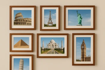
World Landmarks and Wonders
Crack the passcode before the zombies get in.
Answer, then swat bugs for bonus points.
Race through questions at your own speed.
Same question on every screen. Fastest wins.

Pick a tile, answer, hit bonuses and steals.
30 questions