Loading
by BlastRoom
A cumulative review of Southwest Asia and North Africa, Sub-Saharan Africa and Asia-Pacific.
#us_hs_world_geography
50 questions
One question set, multiple game modes. Tap any game to see it in action. Not sure which to pick?
Answer to place stones and capture territory.
Outrun the snow together.
Earn blasts, then hunt the other team.
Answer to earn energy, then climb.

The class blasts through walls together.
Bid on mystery lots. Most money wins.
Sell tours. Nice, standard, or a total scam.

Answer, restock, and serve the rush.
More correct answers pulls the rope your way.
Answer, then shoot down the alien wave.
Answer, then tap to leap the frozen ridge.
A long, narrow sea separates the Arabian Peninsula from northeast Africa and opens to the Indian Ocean through Bab el-Mandeb. Which sea is it?
Oil tankers leaving the Persian Gulf pass through a narrow waterway between Iran and Oman before reaching the Gulf of Oman. Which strait is this?
Which desert covers much of the southern Arabian Peninsula and is also called the Empty Quarter?
A mountain chain crosses Morocco, Algeria, and Tunisia and helps separate Mediterranean coastlands from the Sahara. Which range is it?
Which river flows north through Sudan and Egypt to the Mediterranean and supports irrigated farming along its valley?
A shallow gulf between Arabia and Iran is bordered by major oil and natural gas fields and is a key tanker route. What is it called?
The name Mesopotamia means land between rivers; in modern Iraq, which two rivers form that core lowland?
A human-made waterway across Egypt lets ships move between the Mediterranean Sea and the Red Sea without sailing around Africa. Which waterway is it?
A semi-arid grassland belt runs along the southern edge of the Sahara, where drought and overgrazing can speed desertification. What is this belt called?
A humid lowland region in central Africa, drained by the continent's second-longest river, has one of the world's largest tropical rainforests. Which region is it?
Eastern Africa has a long zone of deep lakes, steep escarpments, and volcanoes where the crust is pulling apart. What landform system is this?
Which large lake borders Uganda, Kenya, and Tanzania and is a major source area for the White Nile?
A broad semiarid desert region spreads across Botswana and nearby parts of Namibia and South Africa. Which desert is it?
The Namib Desert is on Africa's southwest coast but is extremely dry. Which physical process helps explain that pattern?
A central African station has warm temperatures all year and heavy rainfall in every month. Which climate zone does that pattern show?
Much of East Africa has tall grasses, scattered acacia trees, and distinct wet and dry seasons. Which biome is this?
Which highland region in the Horn of Africa gives the Blue Nile much of its water and is cooler than nearby lowlands because of elevation?
Which mountain range forms South Asia's northern barrier and includes the world's highest peaks?
Which river crosses northern India and Bangladesh before joining a large delta on the Bay of Bengal?
Pakistan's main river begins near the Himalayas and flows southwest to the Arabian Sea. Which river is it?
A triangular plateau covers much of peninsular India south of the Indo-Gangetic Plain. What is this plateau called?
Moist summer winds from the Arabian Sea drop heavy rain on India's west coast when they rise over which mountain range?
Winds reverse in summer, drawing moist ocean air onto South Asia and bringing months of heavy rain. What is this seasonal wind system called?
Which desert lies near the India-Pakistan border and is also called the Great Indian Desert?
Bangladesh's coast is flat delta land where major rivers meet the Bay of Bengal. Why do cyclones cause severe flooding there?
A river rises on the Tibetan Plateau and flows east across China to the sea near Shanghai; it is Asia's longest river. Which river is it?
Which river carries yellow-brown loess sediment across northern China and is often called the Yellow River?
Which river flows from the Tibetan Plateau through mainland Southeast Asia and forms a large delta in Vietnam?
Which cold desert covers parts of northern China and southern Mongolia?
Japan and Indonesia have frequent earthquakes and volcanoes. What plate-tectonic setting best explains this?
A broad marginal sea is bordered by southern China, Vietnam, the Philippines, and Borneo. Which sea is it?
A large island is shared by Indonesia, Malaysia, and Brunei and contains equatorial rainforest. Which island is it?
Which high plateau north of the Himalayas is the source region for several major Asian rivers?
Which coral reef system lies off northeastern Queensland and is the world's largest?
Australia's interior is sparsely settled and arid. Which climate factor helps make the Outback dry?
A warm sea lies east of Queensland and west of Vanuatu and New Caledonia. Which sea is this?
Which mountain range runs along eastern Australia and affects rainfall between the coast and interior?
Which mountain chain runs along New Zealand's South Island and creates a rain shadow to the east?
Which physical feature covers nearly all of Antarctica and stores most of Earth's freshwater ice?
Many low islands in Micronesia are ring-shaped coral islands around lagoons. What are these islands called?
Many Sub-Saharan African borders run in straight lines that divide language groups. What explains that present pattern?
Bangladesh has very high population density on the Ganges-Brahmaputra Delta. Which geographic factor helps explain this pattern?
Several Persian Gulf countries have small citizen populations but large shares of foreign workers. What pull factor explains much of this migration?
Indonesia has the world's largest Muslim population, far from Southwest Asia. Which process best explains Islam's spread there?
On steep hillsides in parts of South and Southeast Asia, farmers cut level steps for rice paddies. Why use terraces?
Country A has longer life expectancy, more schooling, and higher income per person than Country B. What does that show?
A population pyramid has a very broad base and a narrow top. What present demographic pattern does it show?
Why can landlocked countries such as Nepal or Laos face higher transportation costs for trade?
Many Pacific island states have small land areas but maritime claims over large surrounding waters. Why are exclusive economic zones important?
Singapore became a major port city where ships move between the Indian Ocean and the South China Sea. Which location factor explains its growth?
Australia, Oceania and Antarctica: Physical Features and Map Location
40 questions
Australia, Oceania and Antarctica: Countries, Capitals and Map Location
28 questions
Australia, Oceania and Antarctica: Population, Culture and Religion
30 questions
Australia, Oceania and Antarctica: Government, Economy and Development
30 questions
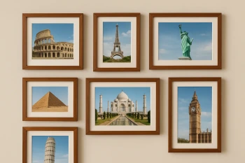
World Landmarks and Wonders
Crack the passcode before the zombies get in.
Answer, then swat bugs for bonus points.
Race through questions at your own speed.
Same question on every screen. Fastest wins.

Pick a tile, answer, hit bonuses and steals.
30 questions