Loading
by BlastRoom
Identify major U.S. physical regions, landforms, waterways, and climate-resource patterns.
#geography#us_grade_8_social_studies
40 questions
One question set, multiple game modes. Tap any game to see it in action. Not sure which to pick?
Use the map. The marked point lies in a broad, mostly flat grassland east of the Rocky Mountains that slopes gently eastward and is drier than the Central Lowlands. Which region is it?
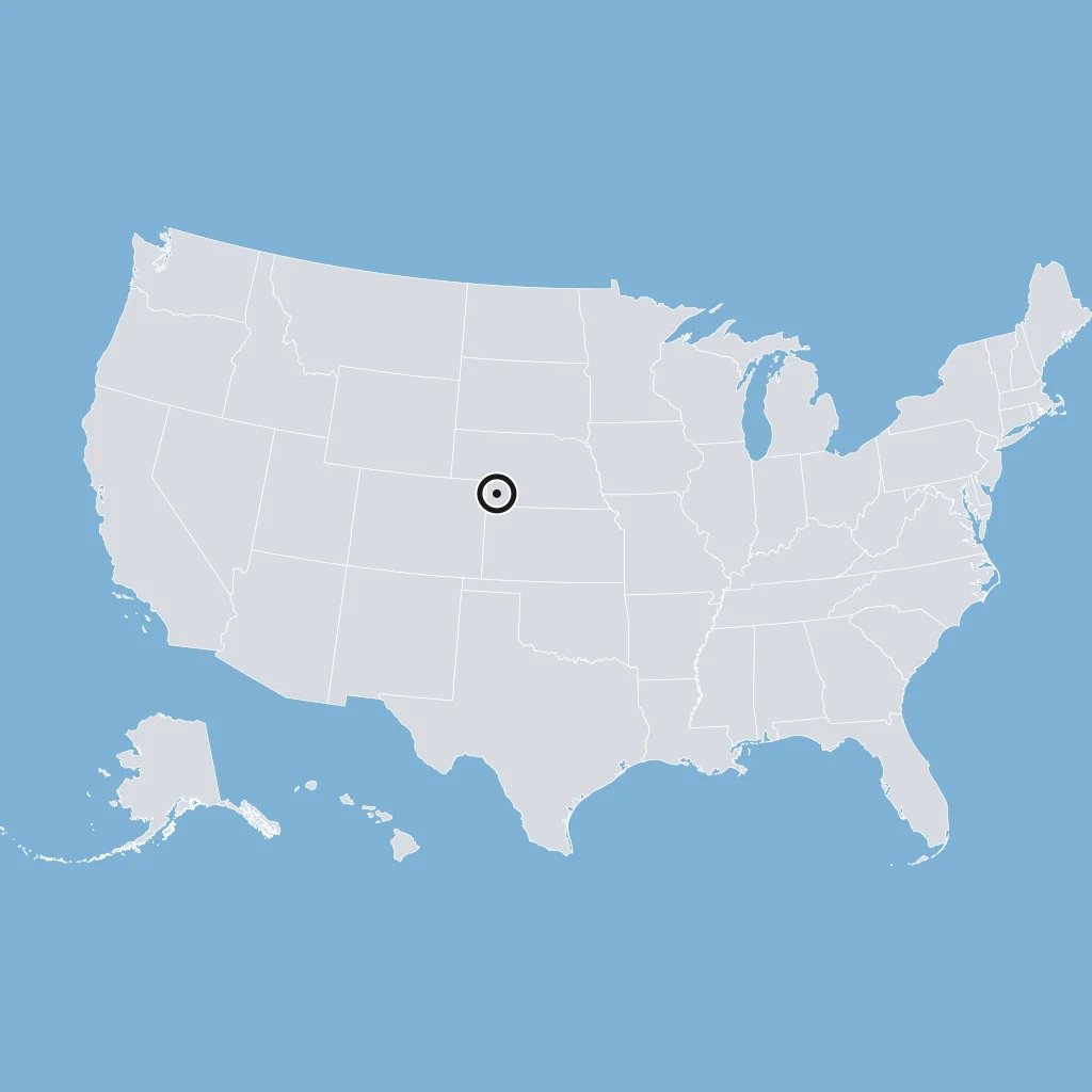
Use the map. The marked point lies in the flattest U.S. physical region, which follows the Atlantic and Gulf coasts with low land, wetlands, and gentle slopes toward the sea. Which region is it?
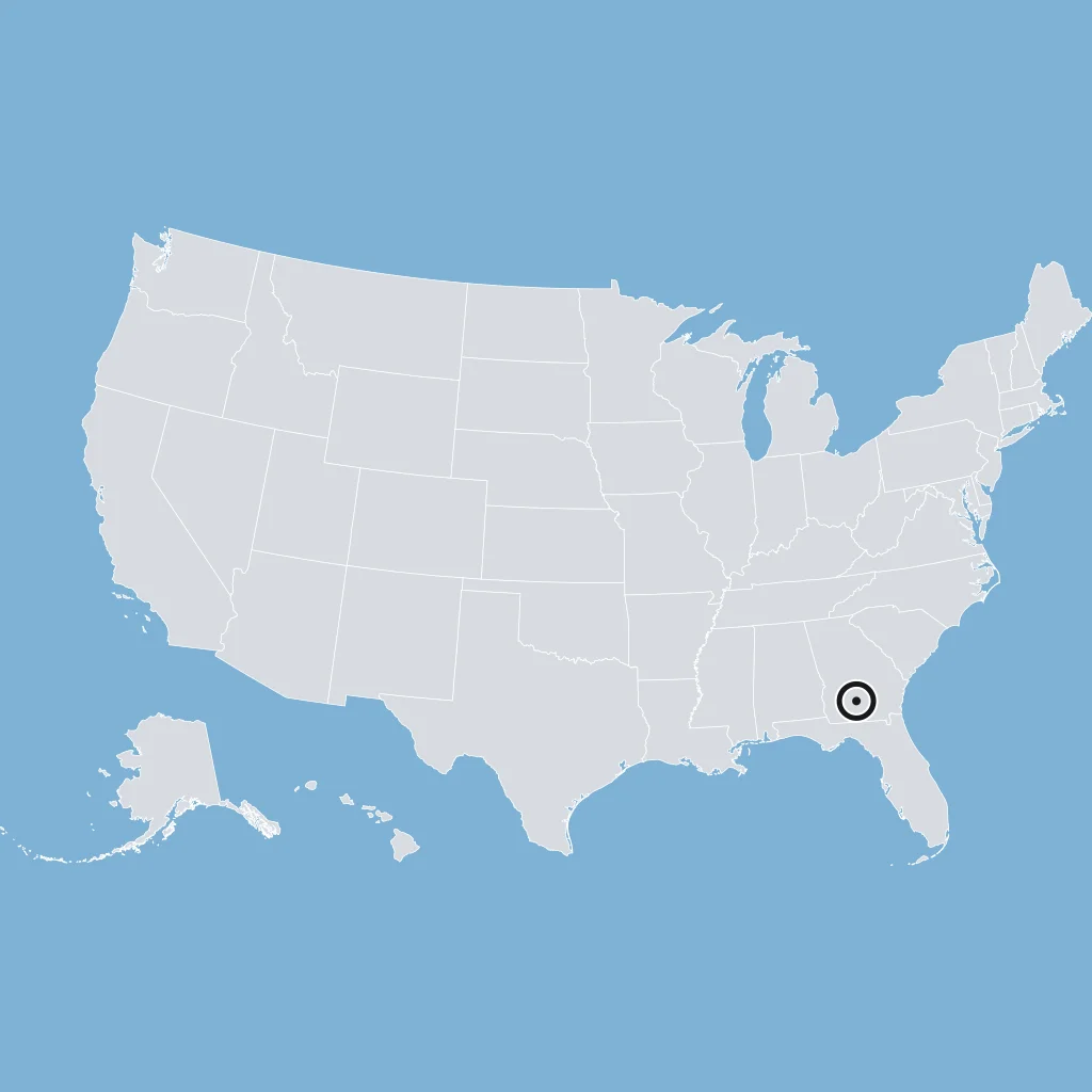
The Allegheny and Cumberland highlands lie west of the Valley and Ridge in Pennsylvania, West Virginia, Kentucky, and Tennessee. Which region includes them?
Use the map. Around the marked point, dry valleys and many north-south mountain ranges alternate across Nevada, western Utah, and nearby states. Which region is it?
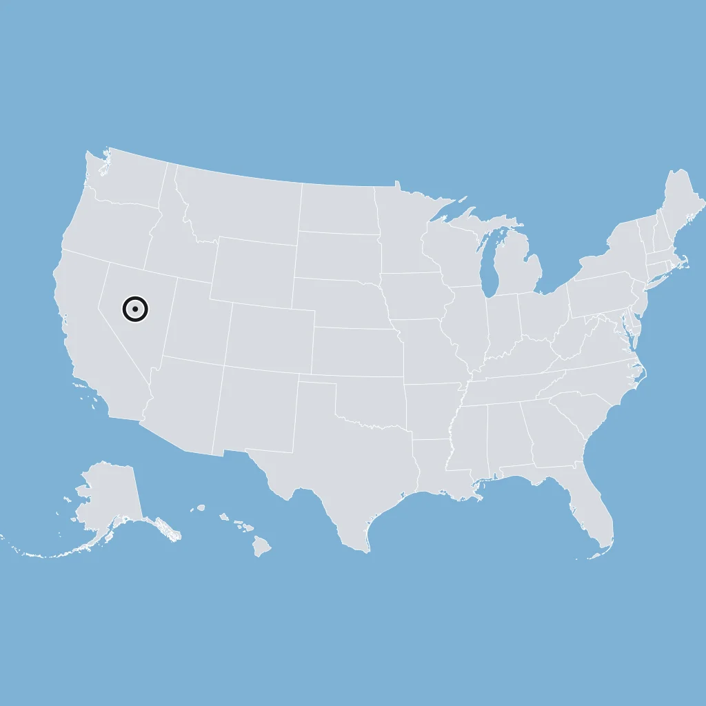
Massive high mountain ranges stretch from Canada to central New Mexico and form a rugged barrier west of the plains. Which region is described?
High, dry land around the Four Corners, where four states meet, has mesas, buttes, and canyons cut by rivers. Which region is described?
Use the map. The two marked points lie in a young mountain belt along Washington, Oregon, and California that includes Cascade volcanoes and the Sierra Nevada. Which region is it?
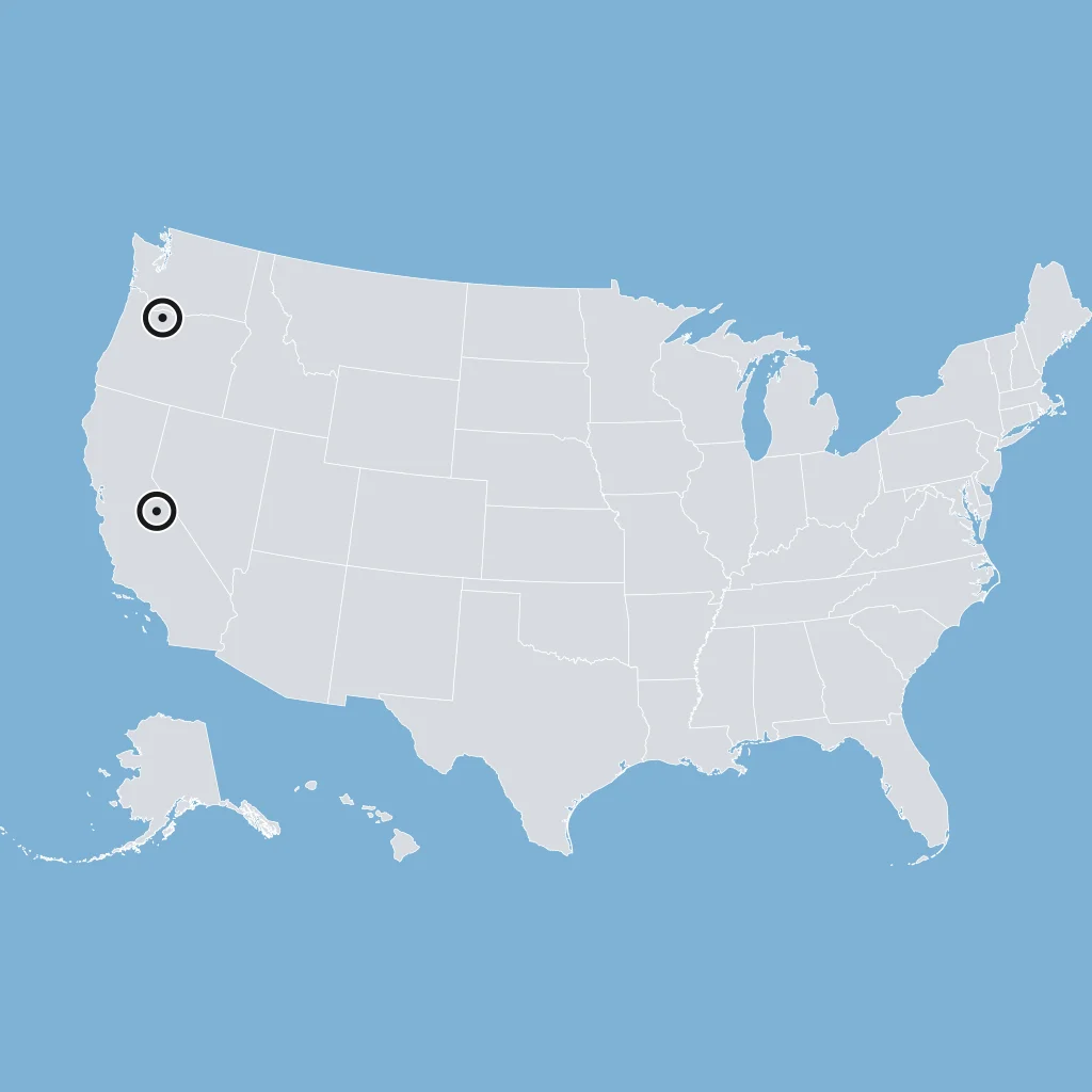
Folded rock layers form long, parallel mountains with narrow lowlands between them in a belt just west of the Blue Ridge, through Pennsylvania, Virginia, and Tennessee. Which region is described?
Rolling uplands with weathered rock lie east of the Blue Ridge and west of the Atlantic Coastal Plain. Which region is described?
Use the map. The marked point lies in an inland western region between the Sierra Nevada and the Wasatch Mountains, where streams drain into salty lakes or evaporate. Which region is it?
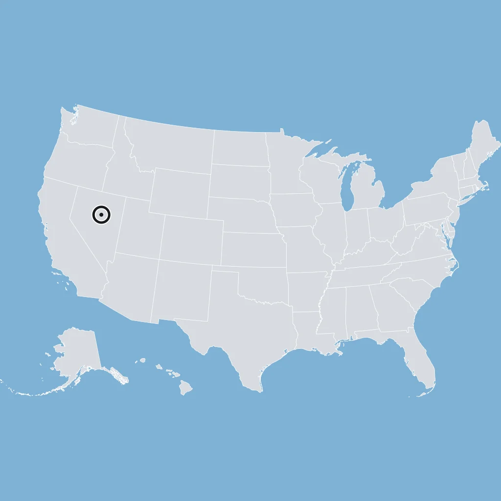
A narrow western region includes coast ranges and lowland troughs such as Puget Sound and California's Central Valley. Which region is described?
Thick basalt lava flows cover a northwestern plateau across eastern Washington, eastern Oregon, and Idaho. Which region is described?
Low mountains, springs, caves, and dissected plateaus lie mainly in Missouri and Arkansas, north of the Ouachita ridges. Which region is described?
A mountainous belt from Pennsylvania southwest to Georgia includes the highest peak east of the Mississippi River. Which region is described?
This old eastern mountain chain extends from northern Georgia and Alabama toward Canada and includes the Blue Ridge and Great Smoky Mountains. Which feature is described?
Use the map. The river drawn begins at Lake Itasca in Minnesota and flows south through the central United States toward the Gulf Coast. Which water body is it?
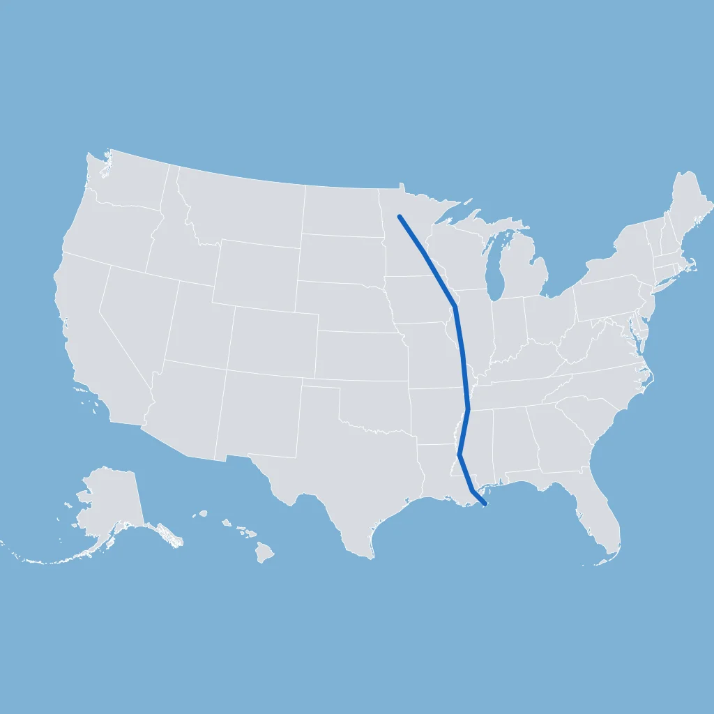
A river starts near Three Forks, Montana, crosses the northern plains, and joins the Mississippi near St. Louis. Which water body is described?
This river forms at Pittsburgh where the Allegheny and Monongahela meet, then flows to the Mississippi at Cairo, Illinois. Which water body is described?
Five connected freshwater lakes along the U.S.-Canada border were shaped by glaciers and link the Midwest to the Atlantic by waterways. Which feature is described?
Use the map. The river drawn rises in the Rocky Mountains, crosses the Colorado Plateau, and carved the Grand Canyon. Which water body is it?
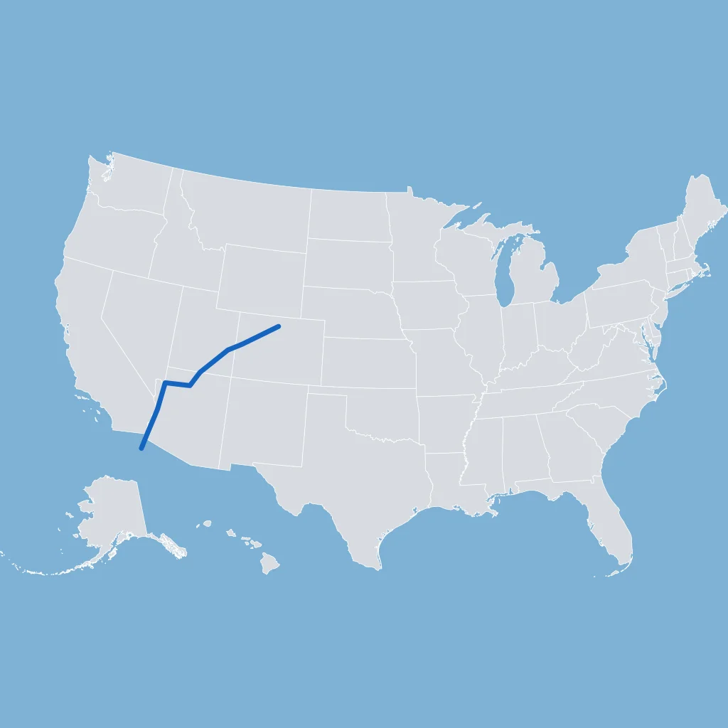
A river flows from Colorado through New Mexico and then marks much of the Texas-Mexico border. Which water body is described?
This river system dominates the Pacific Northwest and reaches the Pacific Ocean near Astoria, Oregon. Which water body is described?
Use the map. The marked point lies in a mountain range along eastern California, west of the Basin and Range and east of California's Central Valley. Which feature is it?
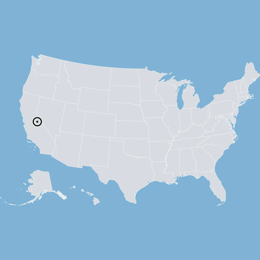
Fresh and salt water mix in this large estuary on the Mid-Atlantic coast, fed by rivers such as the Potomac. Which water body is described?
Shortgrass prairie and semiarid conditions support cattle ranching and dryland wheat farming across much of this central region. Which region fits best?
Fertile prairie soils and glaciated plains helped make corn and soybean farming important in the Midwest. Which region fits best?
Use the map. Coal beds in sedimentary rocks made the marked northwestern part of the Appalachian Mountains a major coal-producing area. Which region fits best?
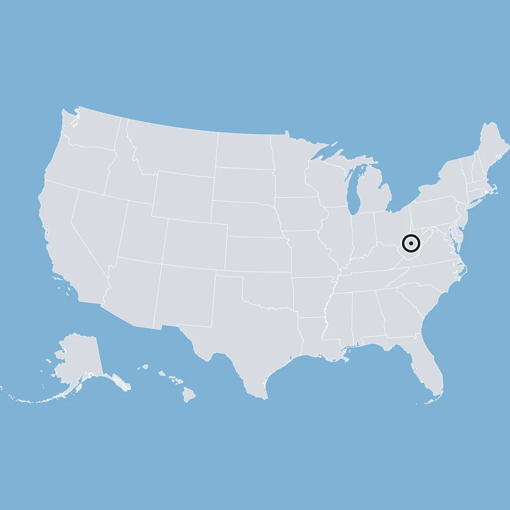
Offshore oil wells, shrimp boats, and sugarcane and rice farms are important in the low, wet lands of southern Louisiana. Which region fits best?
Mild, rainy ocean air, thick Douglas fir forests, salmon fisheries, and ports such as Seattle are most closely tied to which western region?
Scarce rainfall, desert plants, and mining towns built on silver and copper deposits are common across this dry region centered on Nevada. Which region fits best?
Visitors to Grand Canyon, Zion, and Arches national parks bring tourism money to this high, dry region, where water is scarce. Which region fits best?
Moist Pacific air drops heavy snow on the western slopes of these high ranges, leaving dry rain shadow lands to the east in Nevada and eastern Oregon. Which region fits best?
A physical region lies west of the Great Plains and east of the Basin and Range and Colorado Plateau. Which region is it?
In the 1930s, drought and plowed-up grassland let strong winds strip topsoil from farms in Kansas, Oklahoma, and Texas, creating the Dust Bowl. Which region was hit hardest?
Rivers drop over rapids and waterfalls where the Piedmont meets the Atlantic Coastal Plain, and cities such as Richmond grew there. What is this boundary called?
A dry western province lies east of the Sierra Nevada and west of the Colorado Plateau and Rockies. Which region is it?
A low, flat region stretches from Long Island to Texas, east of the Piedmont and south of the Ozark and Ouachita highlands. Which region is it?
Use the map. The marked point lies in a level interior region between the Appalachians and the Great Plains that includes the Great Lakes area. Which region is it?
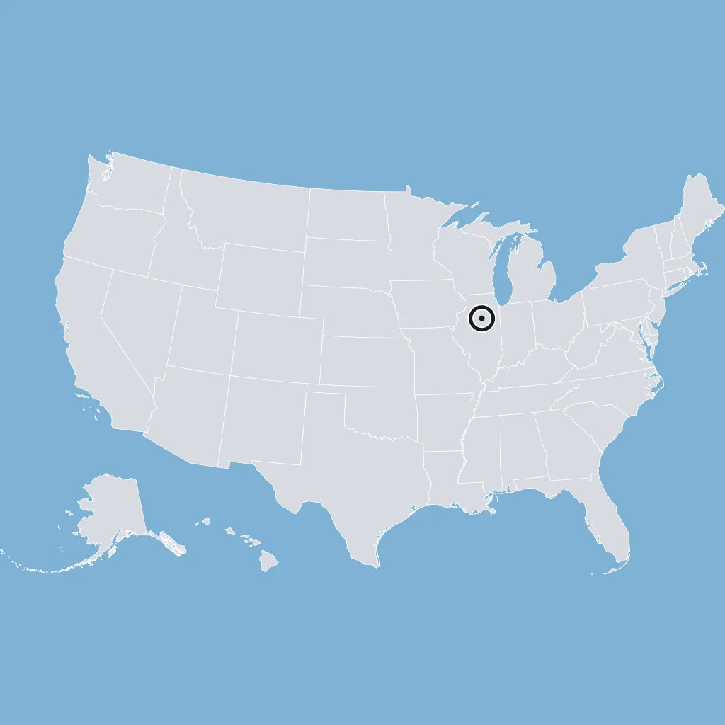
A region lies south and west of the Rocky Mountains and east of the Basin and Range. Which region is it?
A mountain belt runs from Washington through California, just inland from the Pacific Border region. Which region is it?
Crack the passcode before the zombies get in.

Pick a tile, answer, hit bonuses and steals.
Human-Environment Interaction in US History
20 questions