Loading
by BlastRoom
Societies, trade, and religions of East, Central, and Southern Africa from 500 to 1450.
#world_history
30 questions
One question set, multiple game modes. Tap any game to see it in action. Not sure which to pick?
Answer to place stones and capture territory.
Outrun the snow together.
Earn blasts, then hunt the other team.
Answer to earn energy, then climb.

The class blasts through walls together.
Bid on mystery lots. Most money wins.
Sell tours. Nice, standard, or a total scam.

Answer, restock, and serve the rush.
More correct answers pulls the rope your way.
Answer, then shoot down the alien wave.
Answer, then tap to leap the frozen ridge.
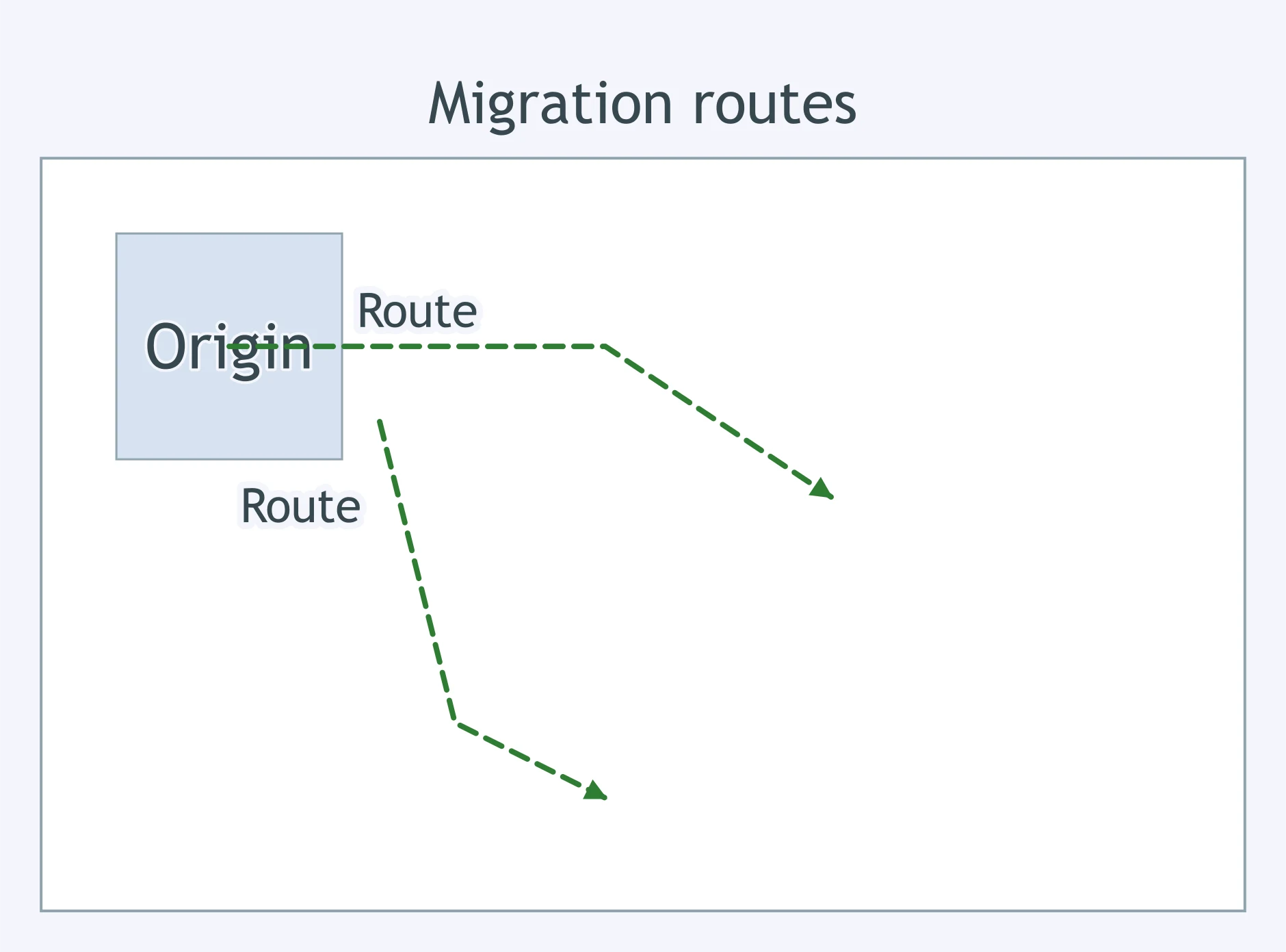
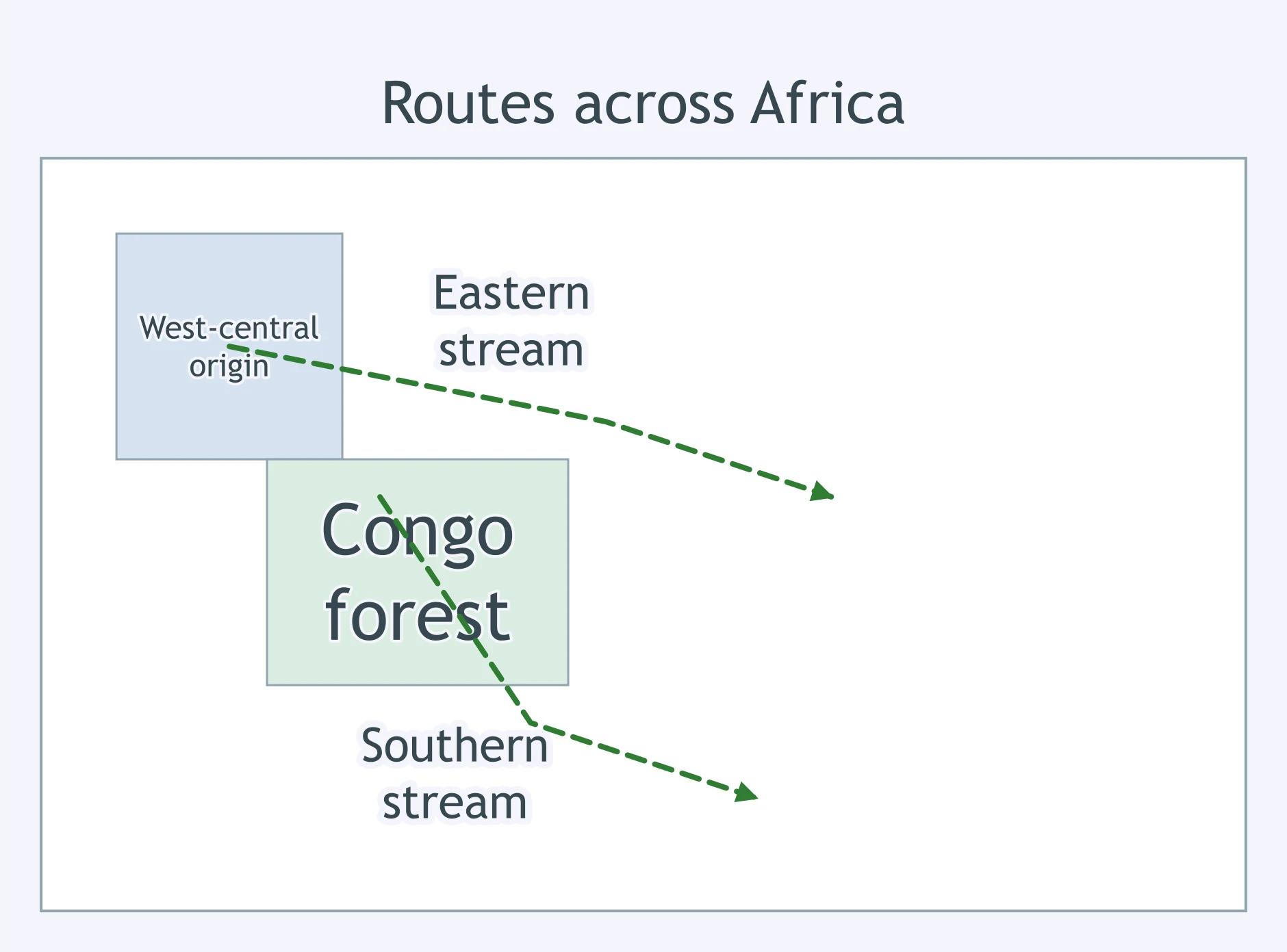
Read the migration sketchmap. From the origin area, which two directions do the main arrows chiefly follow?
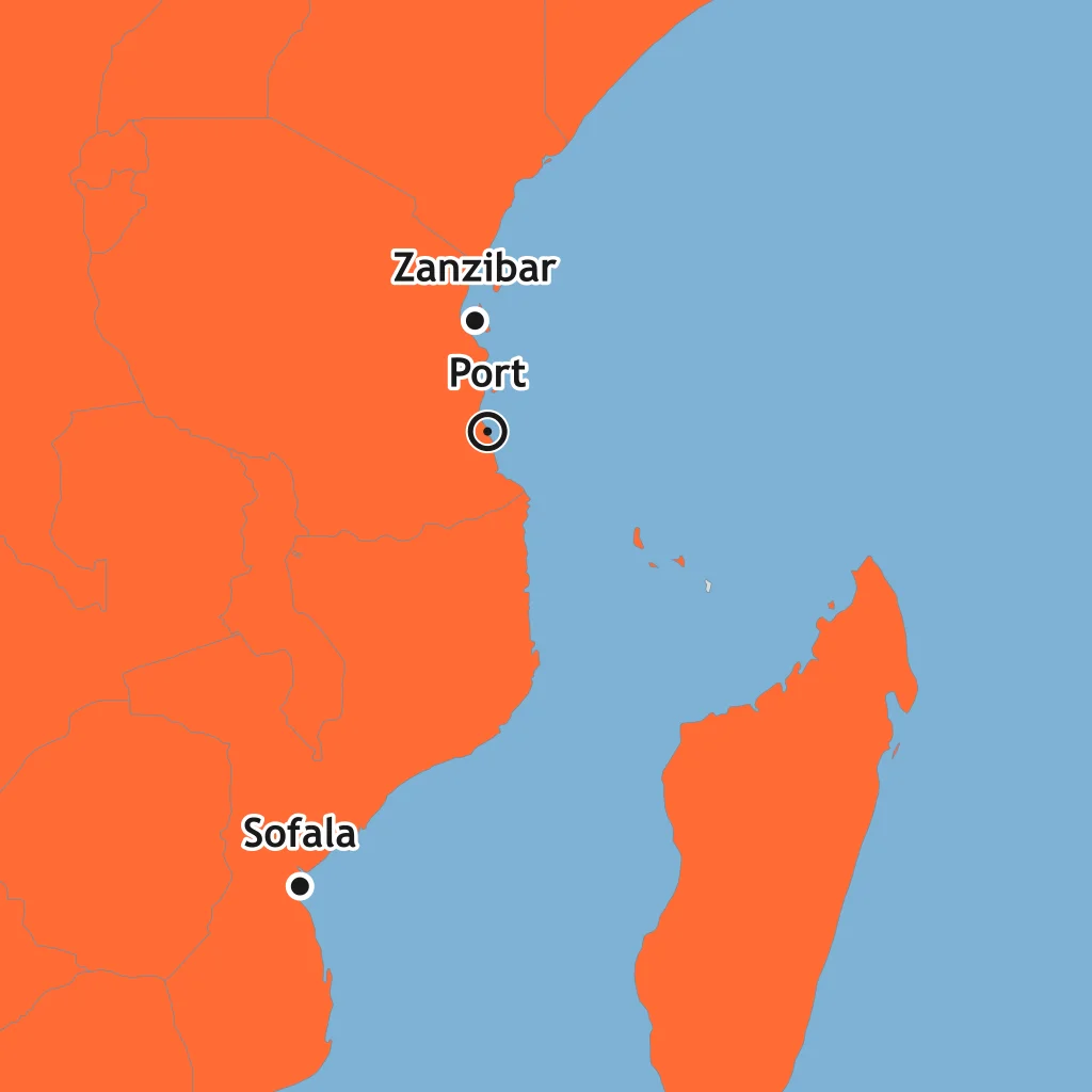
Use the coast map. Which Swahili port is marked on the island off southern Tanzania, south of Zanzibar?
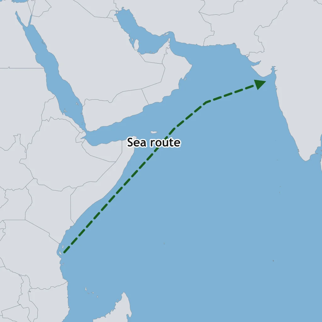
Use the route map. Which trade network does this route belong to?
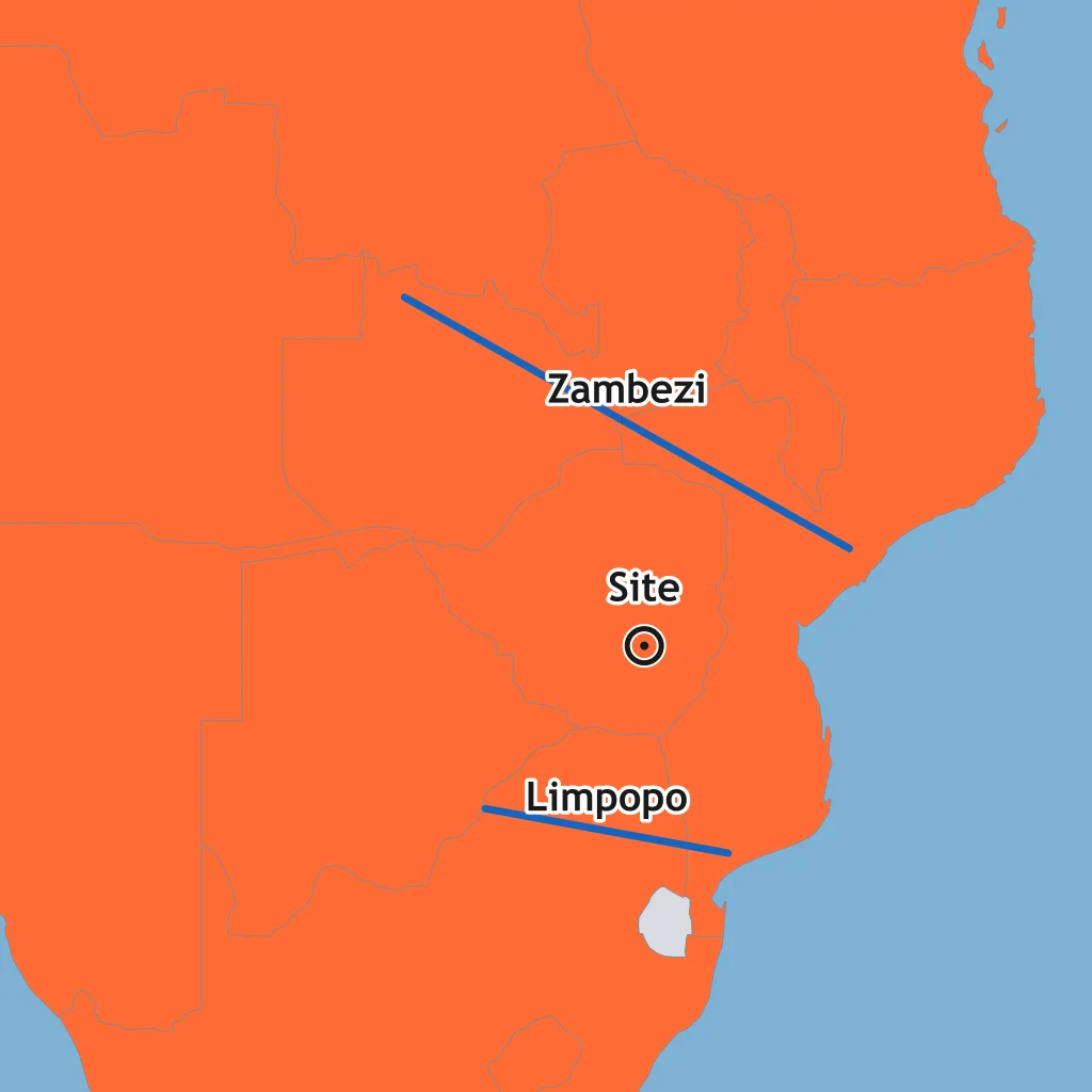
Use the river map. Which state is shown at the site between the Zambezi and Limpopo river systems?
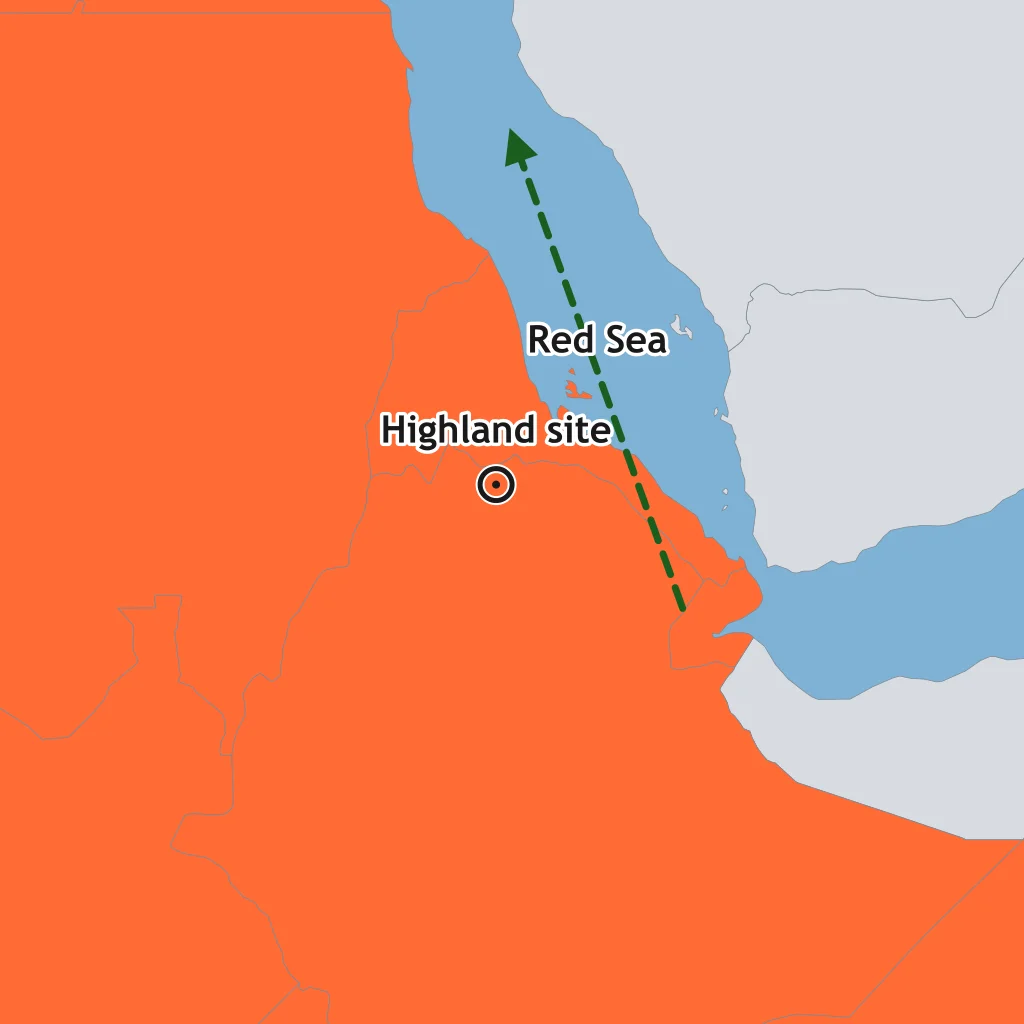
Use the map marker in the northern Horn of Africa near the Red Sea. Which early Christian kingdom does it show?
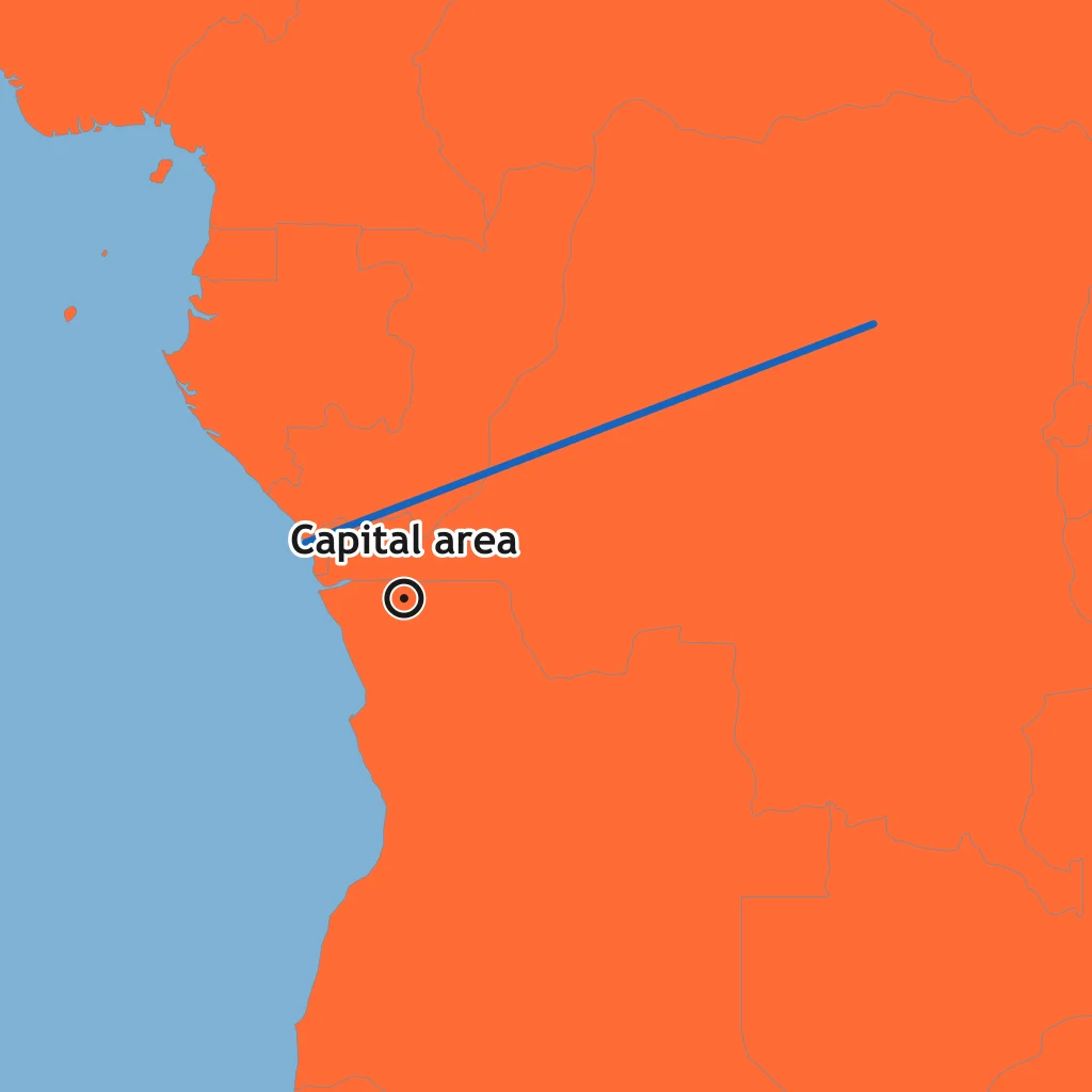
The map marks a capital area south of a major river's mouth near the Atlantic. Which kingdom is being located?
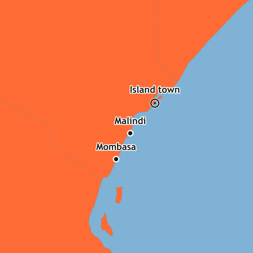
Use the coast map. Which Swahili settlement is marked on the island north of Mombasa and near Malindi?
Read the route map. Which historical process best fits arrows from a west-central origin through the Congo basin toward eastern and southern Africa?
Speakers of related languages spread from the Cameroon-Nigeria border region over many centuries. Which technology helped them clear land and farm?
Which language family was spread widely by the Bantu migrations?
As Bantu-speaking farmers entered new regions, what usually moved with them?
Which statement best describes Bantu-speaking migrants' contact with earlier inhabitants such as foragers and herders?
Bantu-speaking farmers in wet forest and lake regions adopted a crop that had come from Southeast Asia across the Indian Ocean. Which crop was it?
A coastal town grew wealthy by taxing merchants, receiving gold and ivory from inland, and buying Asian goods. What kind of state was it?
Which pair lists goods commonly moving from the African interior to Swahili coast merchants?
Swahili developed on the East African coast. Which description best explains the language?
By the 1200s and 1300s, many wealthy merchant families in Swahili ports adopted which religion?
Why were monsoon winds important to Swahili merchants?
Which statement best compares Swahili city-states with many inland kingdoms?
In Aksum, coins and inscriptions from King Ezana's reign show a turn toward which religion?
The Zagwe king Lalibela is associated with eleven churches cut into living rock. Which faith were they built to serve?
Which written language is strongly associated with Aksum and later Ethiopian Christian manuscripts?
How did Aksum's location help shape its early history?
A large stone-walled city flourished around 1300 on the southern African plateau. Which economy helped support it?
Which people are most closely associated with building and occupying Great Zimbabwe?
Archaeologists found Chinese and Persian ceramics and Kilwa coins at Great Zimbabwe. What do these finds show?
Why was Great Zimbabwe largely abandoned by about 1450?
When Portuguese ships reached the Congo River region in the late 1400s, what kind of polity did they encounter?
What did Kongo ruler Nzinga a Nkuwu do in 1491 after contact with the Portuguese?
Which Kongo ruler expanded Christian rituals and education among nobles in the early 1500s?
Crack the passcode before the zombies get in.
Answer, then swat bugs for bonus points.
Race through questions at your own speed.
Same question on every screen. Fastest wins.

Pick a tile, answer, hit bonuses and steals.
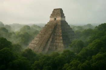
The Maya
20 questions