Loading
by BlastRoom
A mixed review across maps, data, spatial concepts, scale and regions.
#us_hs_human_geography
60 questions
One question set, multiple game modes. Tap any game to see it in action. Not sure which to pick?
Answer to place stones and capture territory.
Outrun the snow together.
Earn blasts, then hunt the other team.
Answer to earn energy, then climb.

The class blasts through walls together.
Bid on mystery lots. Most money wins.
Sell tours. Nice, standard, or a total scam.

Answer, restock, and serve the rush.
More correct answers pulls the rope your way.
Answer, then shoot down the alien wave.
Answer, then tap to leap the frozen ridge.
A city wants to shade each census tract by median rent so high and low values can be compared across the city. Which map type fits?
A transit agency wants to show how many commuters move each morning between suburbs and job centers, with thicker lines for larger volumes. Which map type fits?
A report wants U.S. states resized so states with more farm output appear larger than states with less farm output. Which map type fits?
Hikers need one map that shows trails, streams, roads, elevation contours, and place names for navigation. Which map type fits best?
A textbook wants students to compare the true land areas of Greenland and South America. Which projection choice best serves that purpose?
A marine navigator wants straight plotted lines to keep constant compass bearings across an ocean route. Which projection is most useful?
A classroom wall map needs a readable world view with overall shape and area distortion balanced rather than one property perfectly preserved. Which projection fits?
A visitor needs a downtown map showing individual blocks, street names, parks, and landmarks for walking directions. Which map choice fits best?
A linguist wants each province colored by the dominant language family, using categories rather than numerical rates. Which map type fits?
A trade report's flow map of export routes uses lines of different widths. What does a wider line usually show?
A map uses scale . Two towns are 3 inches apart on the map. What ground distance separates them?
A map uses scale . Two points are 2.5 inches apart on the map. What is the ground distance?
A map's bar scale says 1 inch equals 4 miles. Two towns are 3 inches apart on the map. What is the ground distance?
A map uses scale . A road segment measures 4 inches on the map. What ground distance does it represent?
On a map, 6 inches represents 12 miles on the ground. What verbal scale matches that map?
A researcher studies housing segregation within one city and needs patterns that a citywide average would hide. Which scale of analysis is most useful?
Coffee shops look evenly distributed in a city total, but a neighborhood map shows most are near the university. What changed?
A report first compares fertility rates among countries, then compares rates among neighborhoods within one metropolitan area. What shift occurred?
A city street map covers fewer square miles but shows more detail than a state highway map. Compared with the state map, what is its scale?
A data table averages census tracts into counties, then averages counties into states. What happens to the scale of analysis?
A hiker's GPS receiver shows its exact coordinates at a trailhead. How does the receiver find that position?
A geographer must map a wildfire burn scar across a remote forest without visiting the whole area. Which data source fits best?
A public-health team wants to overlay bus stops, income data, and supermarket locations to find underserved neighborhoods. Which tool fits?
A planner needs age, household size, and income counts for small areas of a city. Which data source best fits?
A coastal scientist compares aerial images from 1990 and 2025 to measure shoreline retreat. Which method is being used?
A survey crew walks to sample sites and stores each site's latitude and longitude as a waypoint. Which tool is most directly used?
Emergency managers need the fastest ambulance route while accounting for road closures and bridge limits. Which tool is best?
A campus planner wants to know which areas students perceive as safe or unsafe after dark. Which data collection method fits best?
A county uses GIS to find every building within 500 feet of a river. Which GIS operation draws that zone around the river?
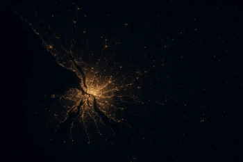
Researchers use satellite images of nighttime lights to compare places around the world. What do brighter areas most likely indicate?
A weather station is listed at 39.7° N, 105.0° W. Which location term describes that information?
A town grew because it sits where a canal, rail line, and highway meet. Which term best describes that locational advantage?
A settlement's flat land, deep natural harbor, and sandy soil are being described. Which term fits those physical traits?
Residents describe a neighborhood by its murals, food traditions, music venues, and local identity. Which term fits this description?
The library is described as two blocks east of the courthouse and across the river from the train station. Which term fits?
A port is built on a sheltered bay and also lies midway between two major shipping markets. Which pair names those facts in order?
A warehouse's location is given as 500 West Market Street. Which location term best describes that address?
A river town thrived as a steamboat stop, then declined after a new railroad bypassed it. Which part of its location changed?
A map notes the open gap between two houses and the arrangement of streets between them. Which vocabulary word names that gap and arrangement?
A new highway strip has the same chain stores, signs, and parking lots as thousands of others across the country. Which concept describes this loss of local character?
A pizza shop's delivery orders drop off as customers live farther away. Which change would most likely weaken that distance decay?
A new bridge replaces the ferry to a clinic and cuts the trip from 60 minutes to 15. What happens to the friction of distance for that trip?
A design team in different cities uses video meetings and shared files to finish work without weeks of travel. Which concept fits?
Housing prices on adjacent blocks are more alike than prices in neighborhoods many miles apart. Which idea does this illustrate?
Mobile banking saves many customers a drive to a branch, but rural residents without reliable internet cannot use it. What does this show about time-space compression?
Free video calls let a student talk with relatives on another continent about as often as with friends in town. Which pattern does this technology weaken?
A 20-mile mountain road takes longer to travel than a 40-mile freeway route. Which concept explains why miles alone are not enough?
A corner store gets many visits from nearby apartments but few from the far edge of town. Which change would most weaken this distance decay?
A district has 80 bus stops in 40 square miles, and most stops sit in one downtown cluster. Which statement is correct?
A farming area has 45 wells in 15 square miles, arranged at even intervals along straight rows. Which statement is correct?
A valley has 24 farms in 8 square miles, all lined up along the river. Which statement is correct?
Two counties each have 60 stores in 20 square miles. In one county the stores are in one mall, and in the other they are spread along main streets. What differs?
A rural township has 100 houses in 25 square miles, scattered fairly evenly across the area. Which statement is correct?
A wind farm has 36 turbines in 9 square miles, arranged in evenly spaced rows and columns. Which statement is correct?
A school district has fixed legal boundaries, while a radio station's listening area weakens with distance from its transmitter. Which comparison is correct?
Residents disagree about where “Upstate” begins, and its boundary changes depending on whom you ask. What kind of region is this?
A commuter rail system links suburbs to a central downtown station, and ridership fades beyond the stations. What kind of region does it form?
A dry valley uses canals and pumps to support orchards despite limited rainfall. Which human-environment idea best fits?
A writer claims a society's economy was fixed entirely by its hot climate, leaving people no meaningful choices. Which theory is the writer making?
A city limits groundwater pumping so withdrawals stay below the aquifer's yearly recharge. Which concept is the city applying?
Distance Decay, Friction of Distance and Time-Space Compression
30 questions
Patterns of Distribution: Density, Concentration, Dispersal and Pattern
25 questions
Human-Environment Interaction: Environmental Determinism, Possibilism and Sustainability
30 questions
Regions: Formal, Functional and Perceptual
30 questions
Population Distribution: Where People Live and Why
Crack the passcode before the zombies get in.
Answer, then swat bugs for bonus points.
Race through questions at your own speed.
Same question on every screen. Fastest wins.

Pick a tile, answer, hit bonuses and steals.
35 questions