Loading
by BlastRoom
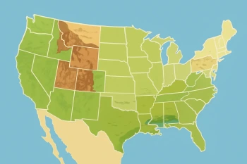
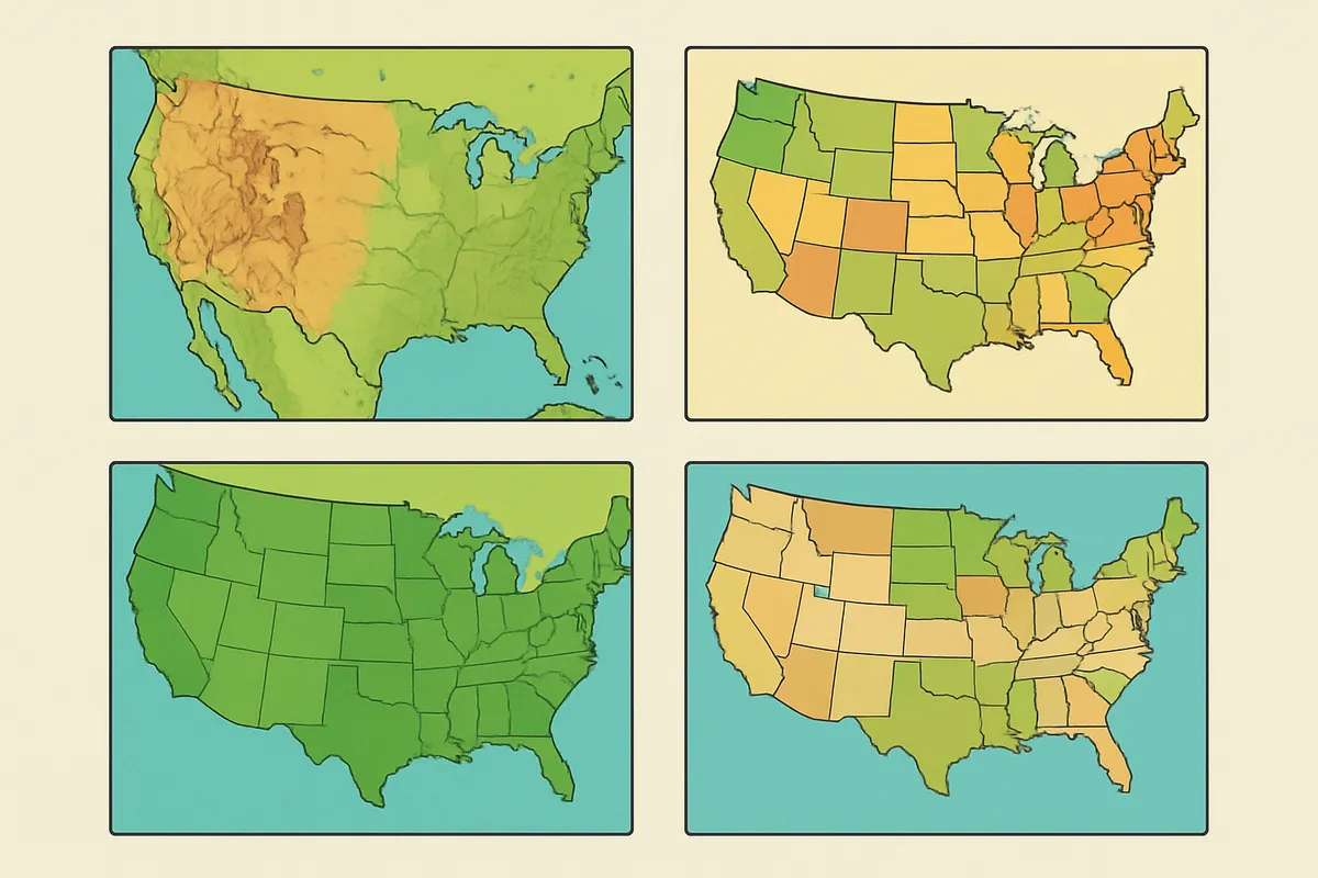
Tell physical, political, and thematic maps apart and read the parts of a map.
#geography#maps#us_grade_4_social_studies
40 questions
One question set, multiple game modes. Tap any game to see it in action. Not sure which to pick?
Answer to place stones and capture territory.
Outrun the snow together.
Earn blasts, then hunt the other team.
Answer to earn energy, then climb.

The class blasts through walls together.
Bid on mystery lots. Most money wins.
Sell tours. Nice, standard, or a total scam.

Answer, restock, and serve the rush.
More correct answers pulls the rope your way.
Answer, then shoot down the alien wave.
Answer, then tap to leap the frozen ridge.
A class is planning a trip across the country and wants to see where the mountain ranges, plains, and rivers lie along the route. Which kind of map shows those landforms?
A student needs to find the borders between states and the location of each state capital. Which kind of map should she use?
A map of the United States is shaded darker in the places where more rain falls each year. What kind of map is this?
A geologist studying where landslides might happen needs to see the steepness of mountain slopes and the shape of the valleys below them. Which kind of map should the geologist use?
A factory owner wants to compare which regions of a country make cars, clothing, or electronics. Which kind of map would show this?
A newspaper prints a world map where the countries that signed a new trade agreement are shaded green and all other countries are gray. Which kind of map is this?
A physical map would most likely leave out which detail?
Which kind of map would best show how a disease has spread from region to region over several months?
Which kind of map would show where forests, grasslands, and deserts are found across a region, based on the plants that grow there?
A political map would most likely leave out which detail?
Why are neighboring states or countries usually shown in different colors on a political map?
On a physical map, what do the different land colors usually show?
A road map is most useful for planning a driving route.
Which map would best show tomorrow’s rain, snow, or temperatures?
Which type of map focuses on one special topic, such as crops, languages, or population?
A map showing where most people live in a state is a type of thematic map.
On a political map of a state, what does a star symbol usually mark?
Which map type often uses contour lines to show elevation and land height?
A historical map can show how borders or settlements looked in the past.
Which map would you use to compare which regions are usually hot, cold, wet, or dry over many years?
Which map would show where a state has coal, oil, forests, or minerals?
A political map often uses a different color for each state or country so the borders are easy to see.
Which map would be best for finding the way to a friend’s house a few blocks from your school?
Which map would show how many people live in different parts of the United States?
A product map might show where corn, wheat, or apples are grown.
Which map would best help a hiker understand steep and flat areas?
Which map type would show the route of an explorer’s journey long ago?
A weather map and a climate map show exactly the same kind of information.
A physical map uses green for low land and brown for high land. Where would you most likely see brown on this map?
A map shows state borders and capitals, and it also uses colors to show mountains and plains. Which two kinds of map does it combine?
A thematic map can use colors or symbols to explain its theme.
Which map would best show where earthquakes are most common?
You are using a road map to plan a trip. Which part of the map helps you figure out how many miles it is between two cities?
A population map of a state from 1950 and one from today would look exactly the same.
On a population map, what do the darkest shaded areas usually show?
Which map would show where different languages are spoken?
A road map is usually better than a physical map for finding an exit number on a highway.
A student wants to compare a town’s borders in 1900 with its borders today. Which two maps should she use?
Which map of the world would most likely need the fewest changes after 100 years?
A street map of one town shows more small details than a road map of the whole country.
Crack the passcode before the zombies get in.
Answer, then swat bugs for bonus points.
Race through questions at your own speed.
Same question on every screen. Fastest wins.

Pick a tile, answer, hit bonuses and steals.
Introducing Latitude and Longitude
40 questions