Loading
by BlastRoom
Reading a culture off the buildings, fields and place names it leaves behind.
#us_hs_human_geography
35 questions
One question set, multiple game modes. Tap any game to see it in action. Not sure which to pick?
Answer to place stones and capture territory.
Outrun the snow together.
Earn blasts, then hunt the other team.
Answer to earn energy, then climb.

The class blasts through walls together.
Bid on mystery lots. Most money wins.
Sell tours. Nice, standard, or a total scam.

Answer, restock, and serve the rush.
More correct answers pulls the rope your way.
Answer, then shoot down the alien wave.
Answer, then tap to leap the frozen ridge.
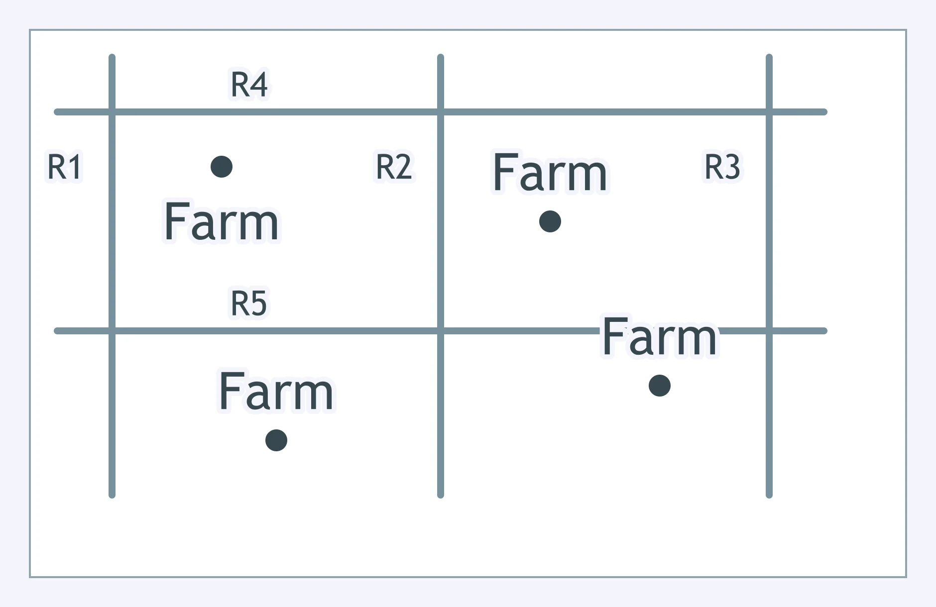
Use the map. Which settlement imprint does this land division pattern record?
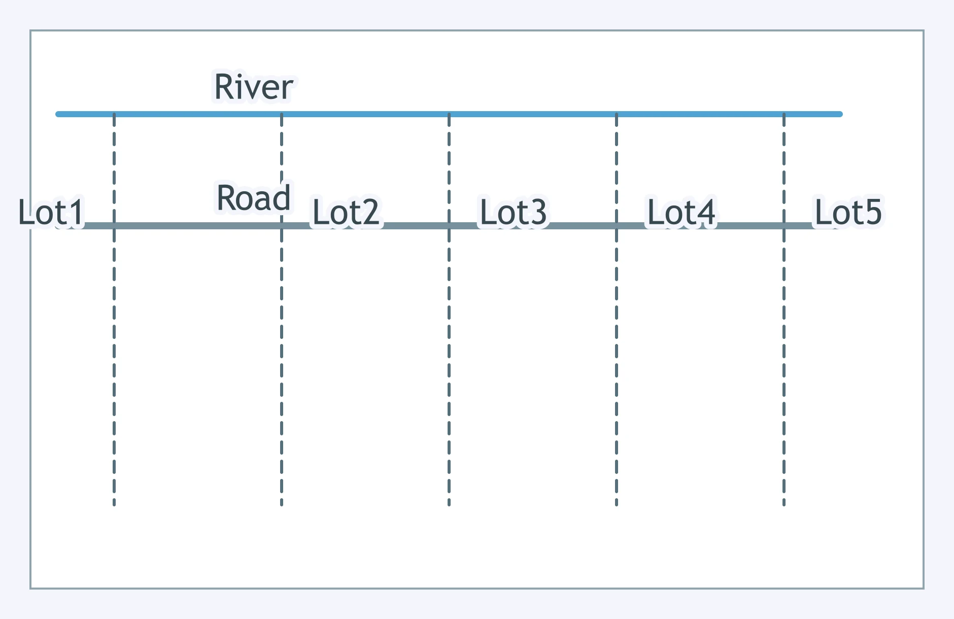
Use the map. Which survey tradition shaped this landscape?
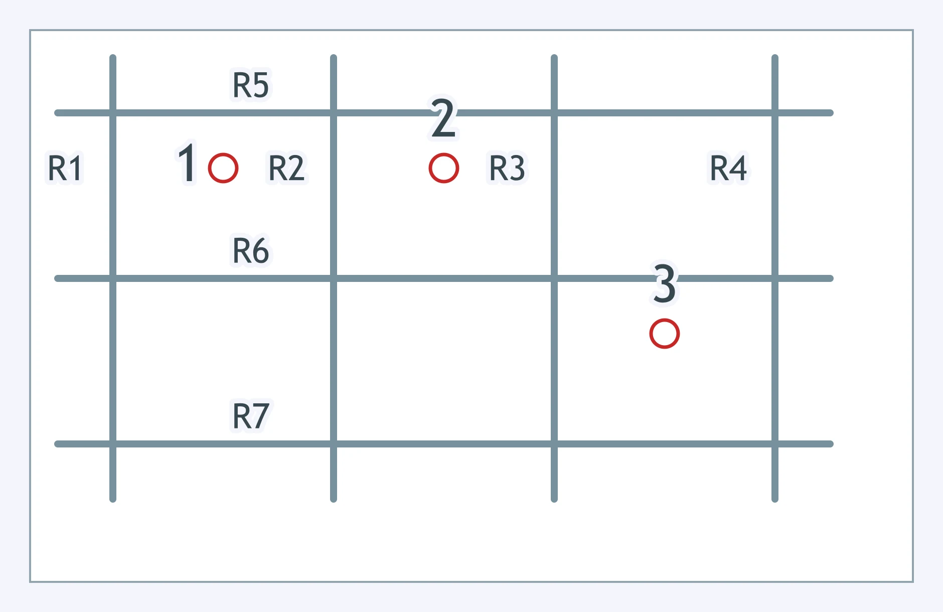
Use the map. Which land survey imprint is shown?
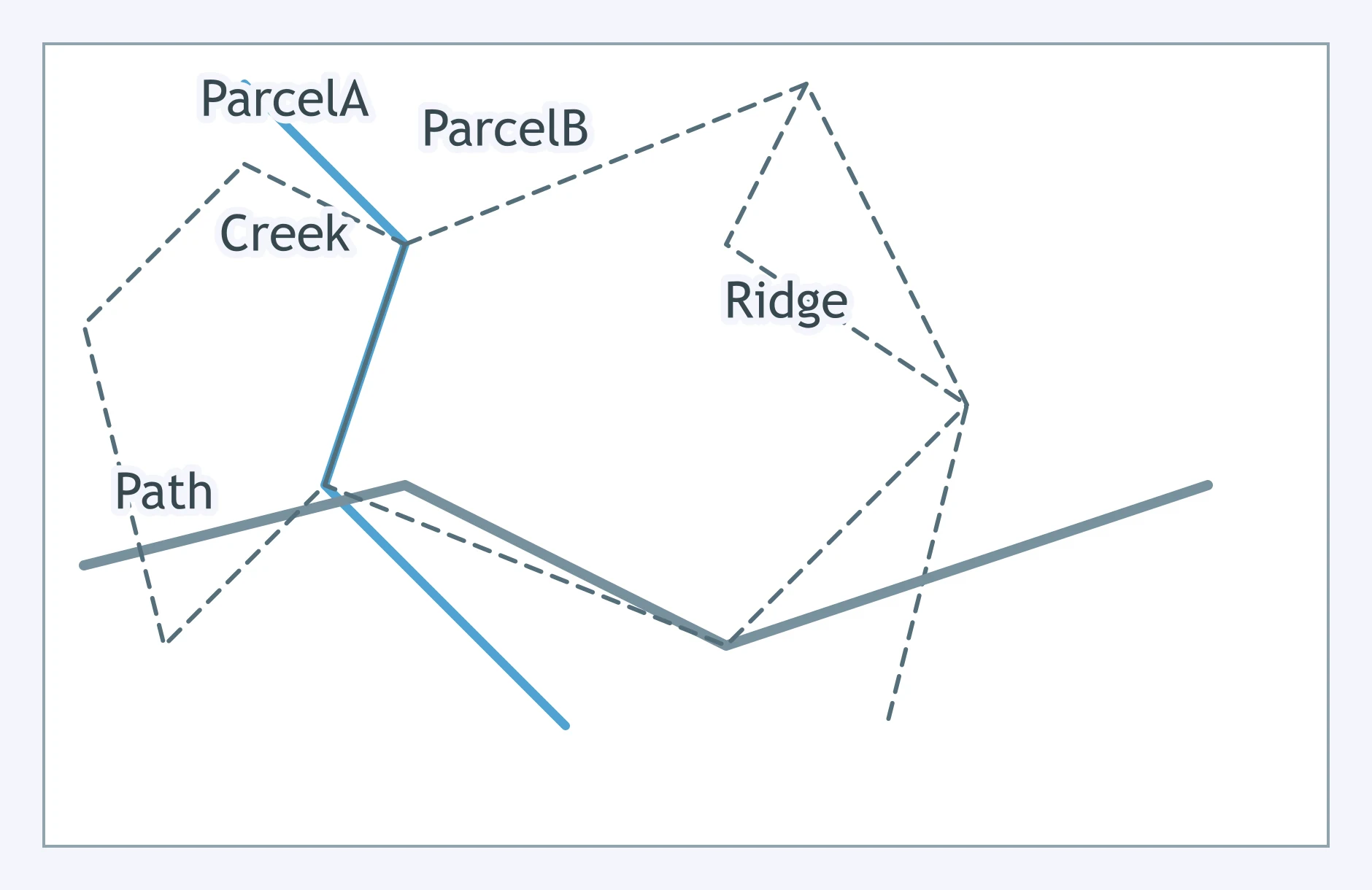
Use the map. A church, government hall, and market face a central square, with streets extending outward. Which settlement imprint is most evident?
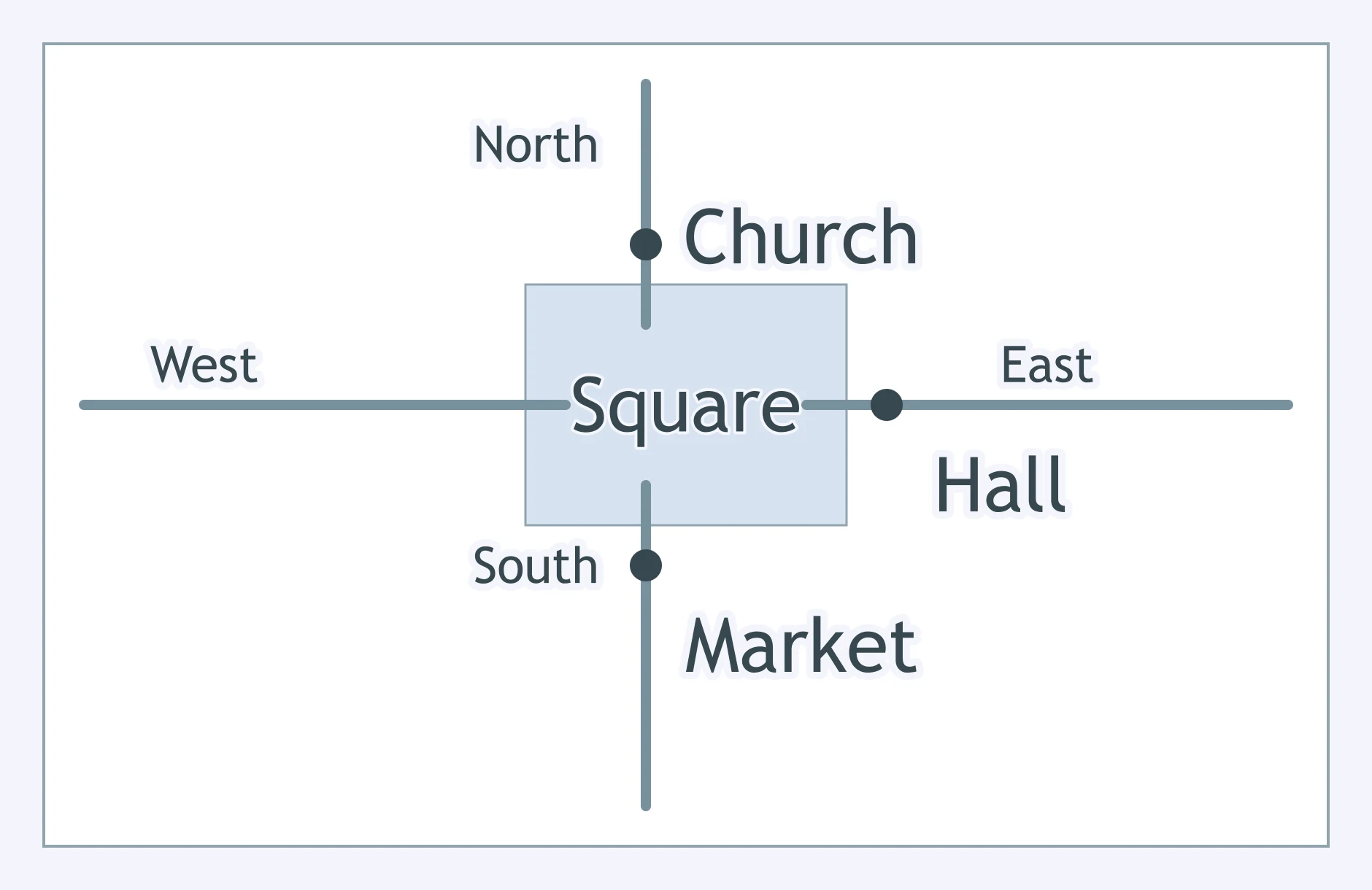
Use the map. A meetinghouse and school border a grassy common, and house lots cluster nearby. Which cultural imprint does the layout suggest?
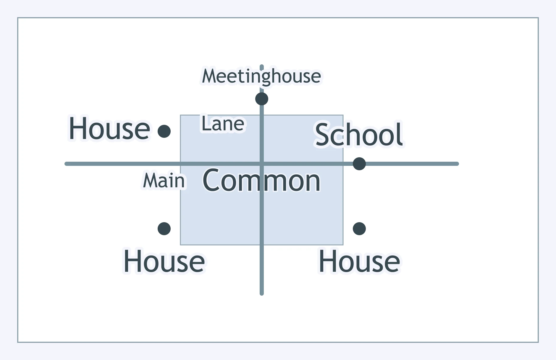
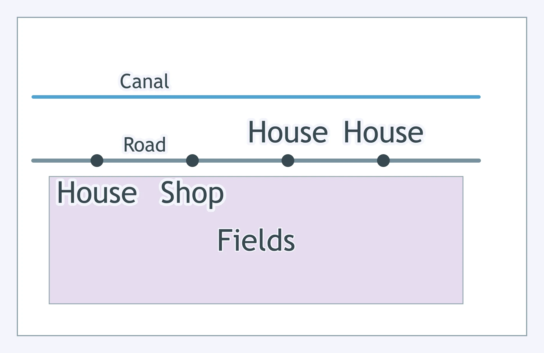
Use the map. Which settlement pattern is shown?
Use the map. Which settlement pattern best fits the figure?
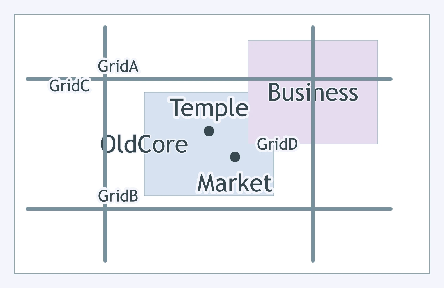
Use the map. A temple and older market sit inside a newer street grid and business district. Which concept explains the layered occupation?
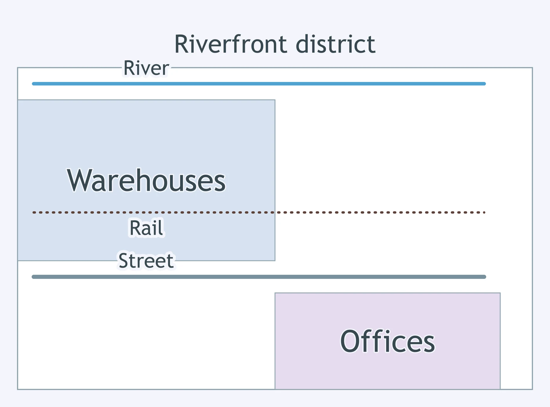
Use the map. A riverfront warehouse district is crossed by rail lines, while newer offices fill the blocks inland. What process does this layering show?
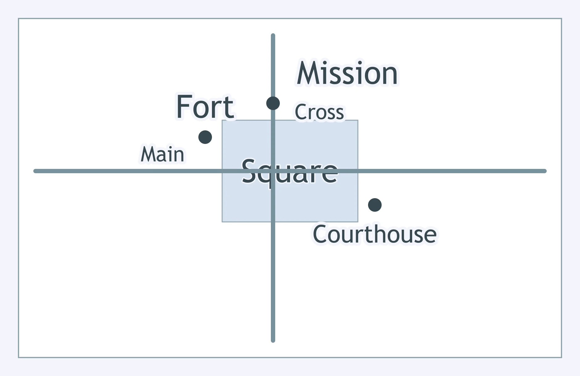
Use the map. A fort, mission, and later courthouse stand around the same square. Which landscape idea does the figure illustrate?
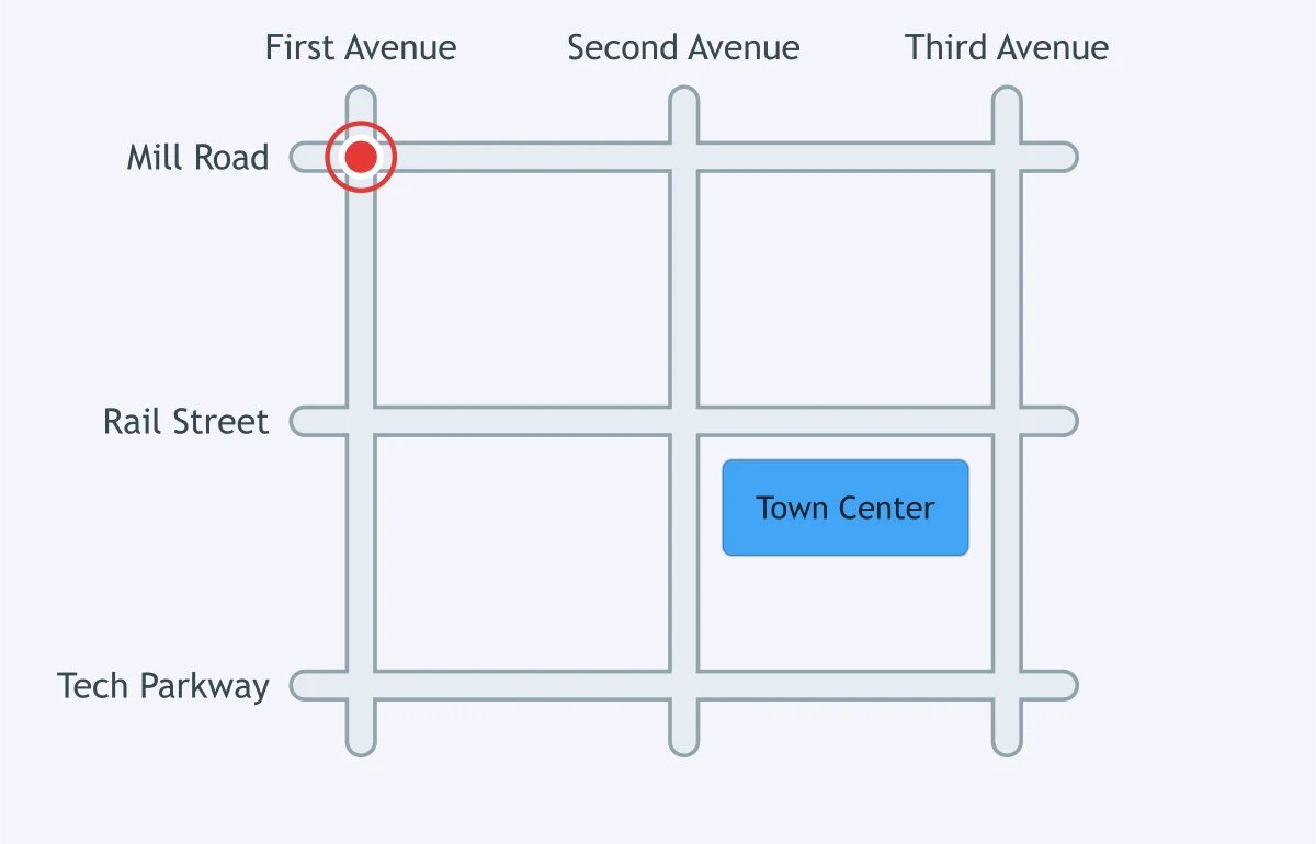
Use the map. Streets named Mill Road, Rail Street, and Tech Parkway cross the same town center. What does this naming pattern most likely record?
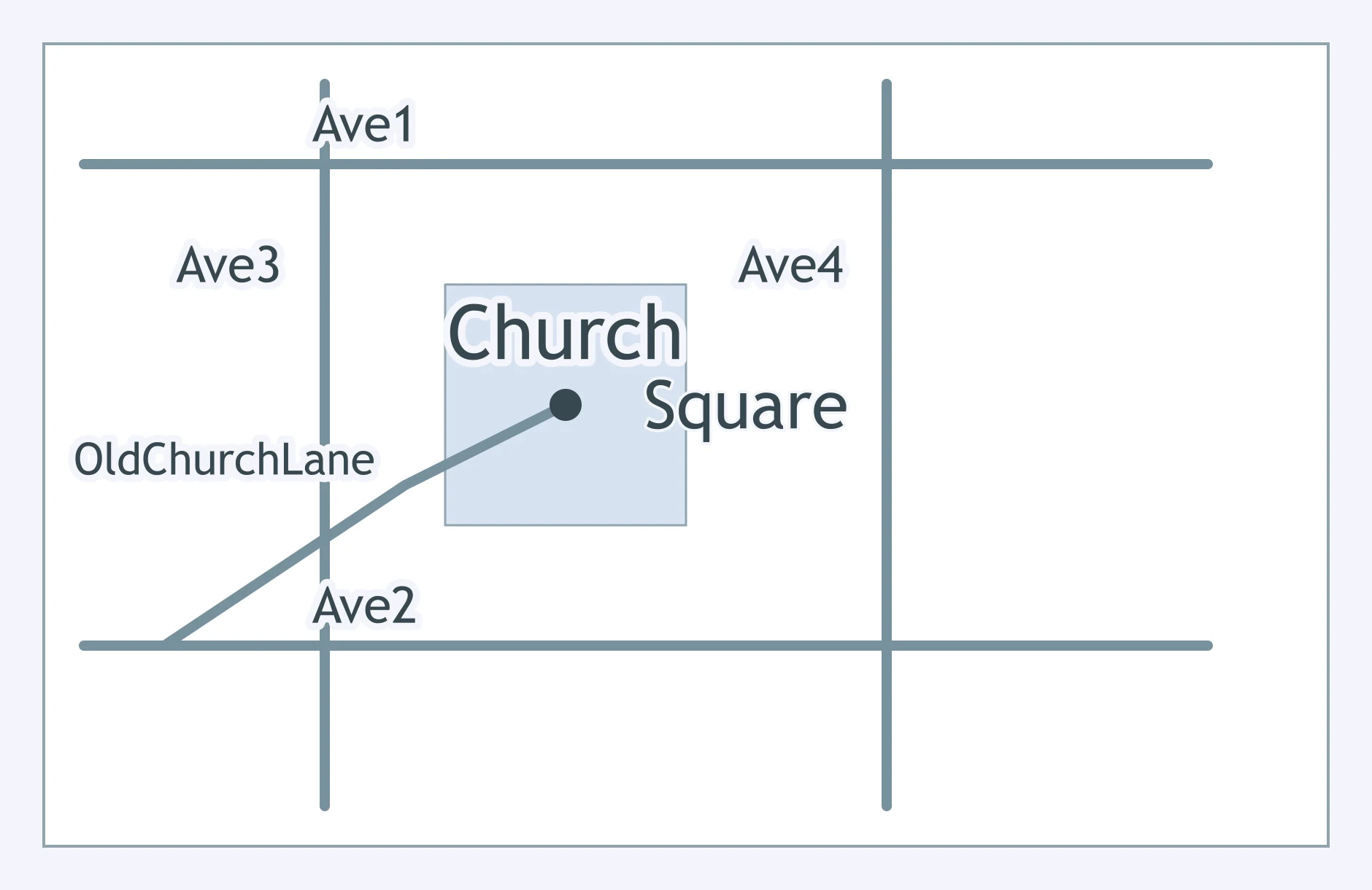
Use the map. Old Church Lane curves into a square, while newer numbered avenues form a grid around it. Which interpretation is strongest?
New Braunfels and Fredericksburg in Texas have German names. What does this kind of toponym most likely record?
Many towns in the US Southwest are named San José, Santa Fe, or Corpus Christi. What past feature do these names reveal?
A city changes the name of a major street after independence to honor a national leader. What does the new toponym mainly show?
In 1664, the town of New Amsterdam was renamed New York. What does this toponym change show?
Baton Rouge takes its name from a red pole that early explorers saw marking a boundary between hunting grounds. What does the name preserve?
A neighborhood called Little Italy keeps that name even after many residents have moved away. What does the toponym most directly preserve?
A former colonial capital has streets named King, Queen, and Governor. What past relationship is most likely recorded in those names?
A mountain town named Silverton grew beside nineteenth-century mines. What does the toponym most likely record?
A place called Two Rivers sits where two streams meet. What type of information does this toponym carry?
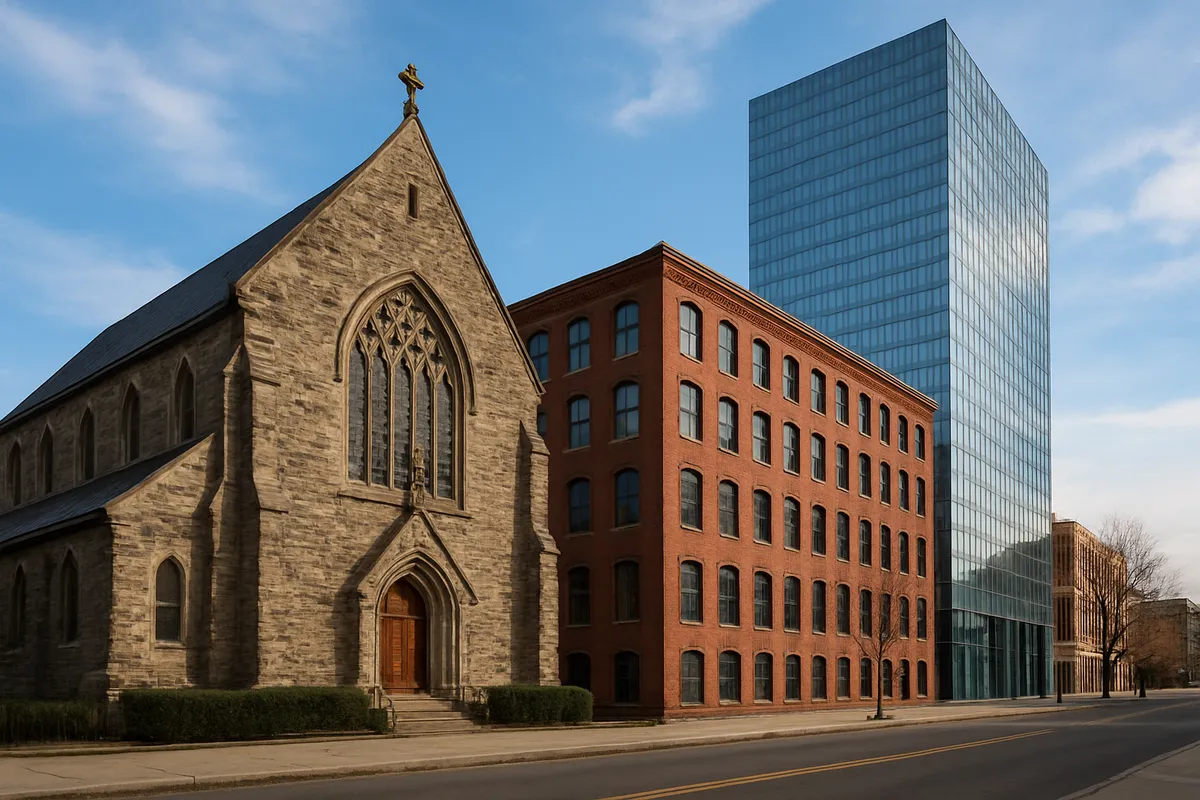
A cathedral rises on the site of an earlier temple, and government offices later surround the same square. Which concept names this layering?
An old rail depot becomes a food hall, while the tracks remain as a walking trail. Which process does the landscape show?
A mosque, a colonial courthouse, and glass office towers stand on adjoining blocks in one capital city. Which geographer introduced the term sequent occupance for layers like these?
A road follows an old Indigenous trail, passes a colonial fort, and ends at a modern airport. What does this sequence show about the corridor?
A city's old walls still shape ring roads after the walls are removed and suburbs grow beyond them. What does this persistence show?
A plantation house, tenant cabins, and a modern museum share one site. What does the museum add to the site's layers?
A Roman street grid remains under medieval lanes and modern storefronts in one town center. Why does this center look so different from a new suburban strip?
A hillside is cut into flooded terraces managed by village water councils. What does this landscape most clearly reveal?
Barns, churches, and houses built in a distinctive regional style appear across a valley settled by one migrant group. What does this reveal?
A commercial strip has the same chain stores, signs, and parking lots as strips hundreds of miles away. What cultural pattern does it show?
A settlement clusters homes around a temple complex, with processional paths leading to shrines. What does the arrangement reveal?
A desert village has thick-walled houses, shaded courtyards, and narrow lanes. What does the built landscape show?
A neighborhood displays bilingual storefront signs, ethnic grocery stores, and houses of worship tied to one immigrant community. What does it reveal?
In a planned capital, broad avenues radiate from government buildings and monuments. What does this built form most directly express?

Voluntary Migration: Chain, Step, Transhumance and Guest Workers
35 questions

Effects of Migration: Remittances, Brain Drain and Enclaves
30 questions
Population and Migration: Mixed Review
70 questions

Introduction to Culture: Traits, Complexes, Material and Nonmaterial
30 questions
Folk and Indigenous Culture
30 questions
Crack the passcode before the zombies get in.
Answer, then swat bugs for bonus points.
Race through questions at your own speed.
Same question on every screen. Fastest wins.

Pick a tile, answer, hit bonuses and steals.