Loading
by BlastRoom
Explore geological evidence, modern measurements, and predictions of plate movement.
#plate_tectonics#matatag_science_10
20 questions
One question set, multiple game modes. Tap any game to see it in action. Not sure which to pick?
On a world map, most earthquakes and active volcanoes form narrow belts. What do these belts mainly trace?
Which process best explains the magnetic-band pattern shown on opposite sides of the ridge?
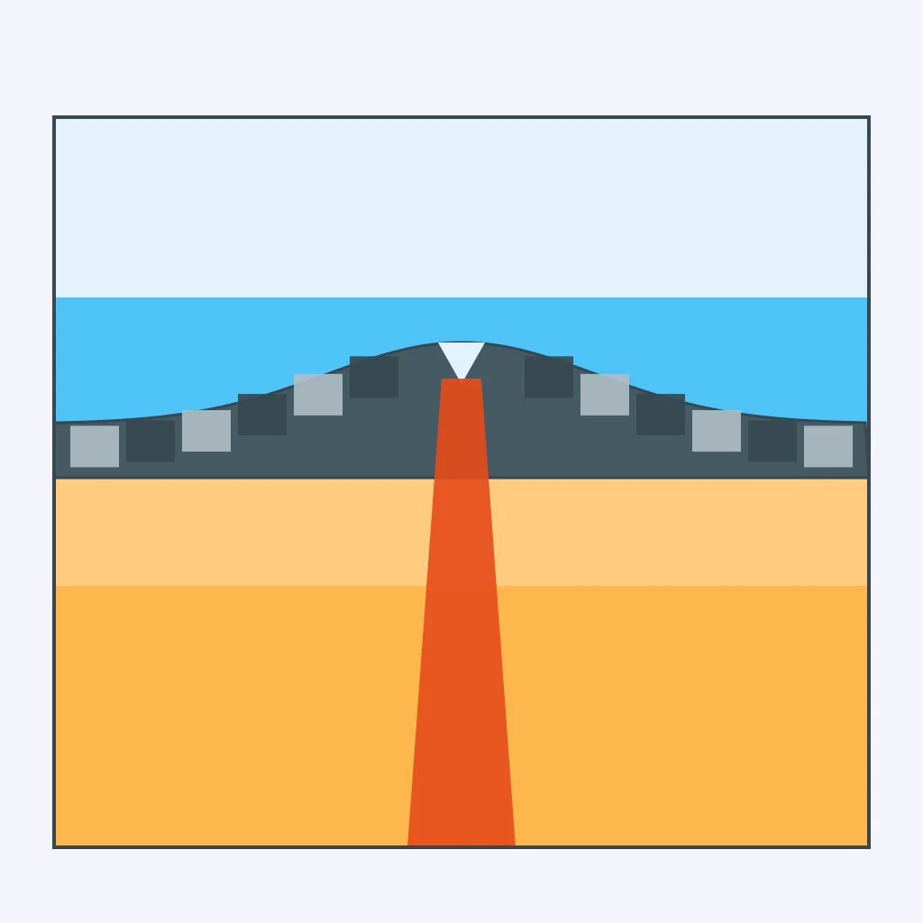
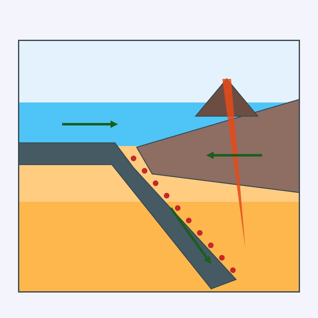
Which process explains the earthquake pattern in this cross section?
Ancient rocks preserve the direction of Earth's magnetic field. Which past condition can scientists estimate from its inclination?
Which fossil finding most strongly supports a former connection between South America and Africa?
Which pair's matching continental margins helped support continental drift?
Which plate interaction produced the Himalayas?
Rock layers in a mountain belt are bent into arches and troughs. Which stress most directly explains this pattern?
Which scientific field studies Earth's size, shape, gravity field, and precise surface locations?
A station in Batanes receives timing signals from orbiting transmitters to determine its location repeatedly. Which technique does it use?
Widely separated radio telescopes observe the same distant celestial source to measure changes in station separation. Which technique is this?
Scientists compare the phase of satellite radar observations taken before and after an earthquake in Luzon. Which technique maps the resulting surface changes?
The original GRACE mission tracked tiny changes in separation between two orbiting spacecraft. What did these changes reveal?
An instrument attached to a pier in Manila records how high the water stands relative to the pier. Which instrument is it?
A ground station times light pulses reflected by retroreflectors on an orbiting spacecraft. Which method determines the distance?
Which technique directly measures the distance from an orbiting instrument to the ocean surface to determine sea surface height?
An instrument precisely tracks a freely falling test mass at a station in Leyte. Which local quantity does it determine?
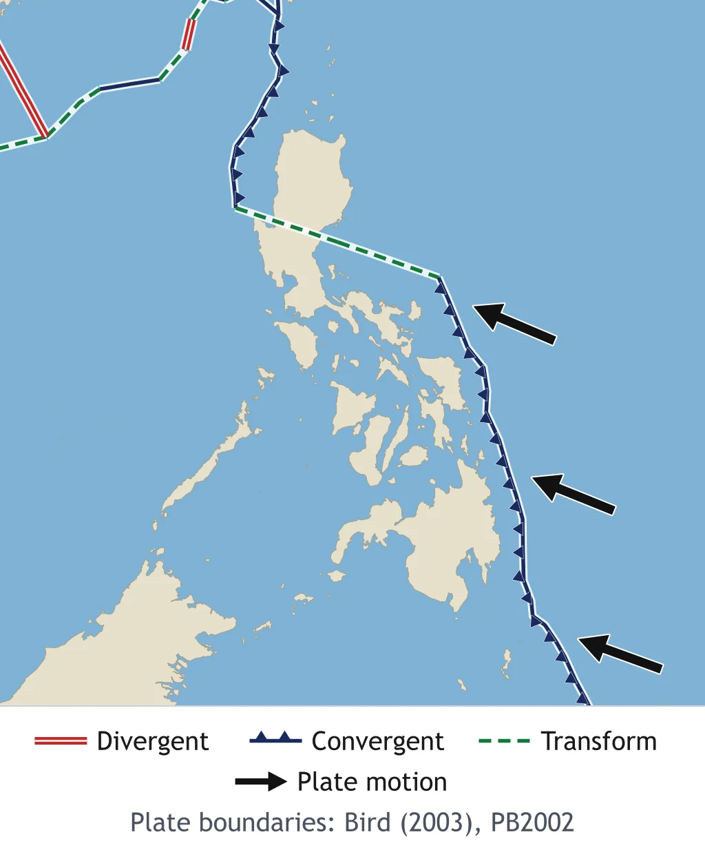
The map shows Philippine Sea Plate motion relative to the Sunda Plate, with north at the top. Which general direction do the arrows indicate?
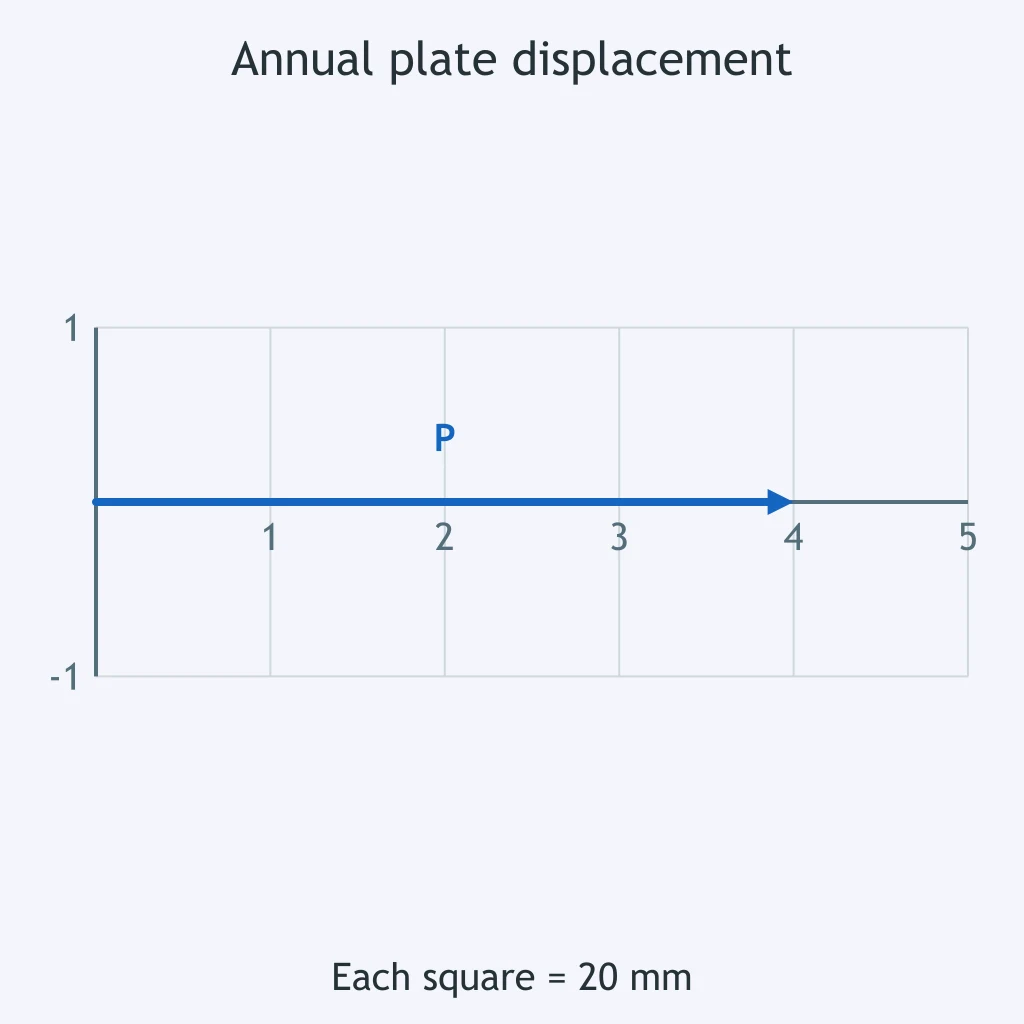
The arrow shows one year of movement. If this rate stays constant for 50 million years, how far would the plate travel?
Why is extending today's plate velocity insufficient to determine the exact shape of the Philippine archipelago 50 million years from now?
Crack the passcode before the zombies get in.

Pick a tile, answer, hit bonuses and steals.
Convergent Boundaries, Trenches and Mountain Ranges
20 questions