Loading
by BlastRoom
Explore Philippine tectonic settings, plate movements, landforms, and geological hazards.
#plate_tectonics#matatag_science_9
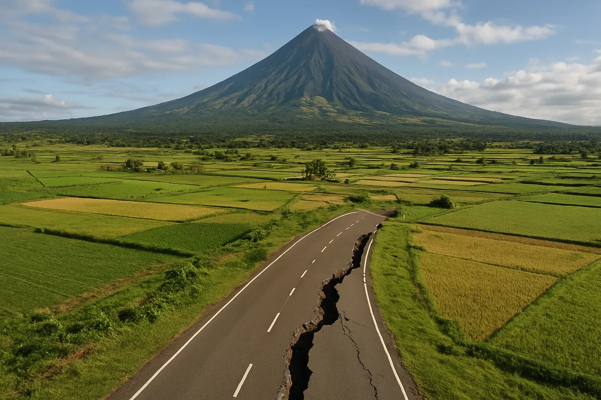
20 questions
One question set, multiple game modes. Tap any game to see it in action. Not sure which to pick?
Which geological belt includes the archipelago and much of the ocean rim shown?
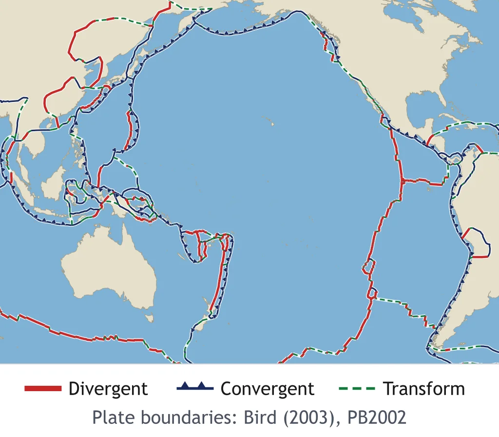
Which tectonic plate occupies the region marked A?
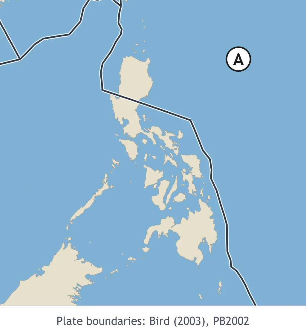
Name the orange-highlighted trench east of Samar and Mindanao.
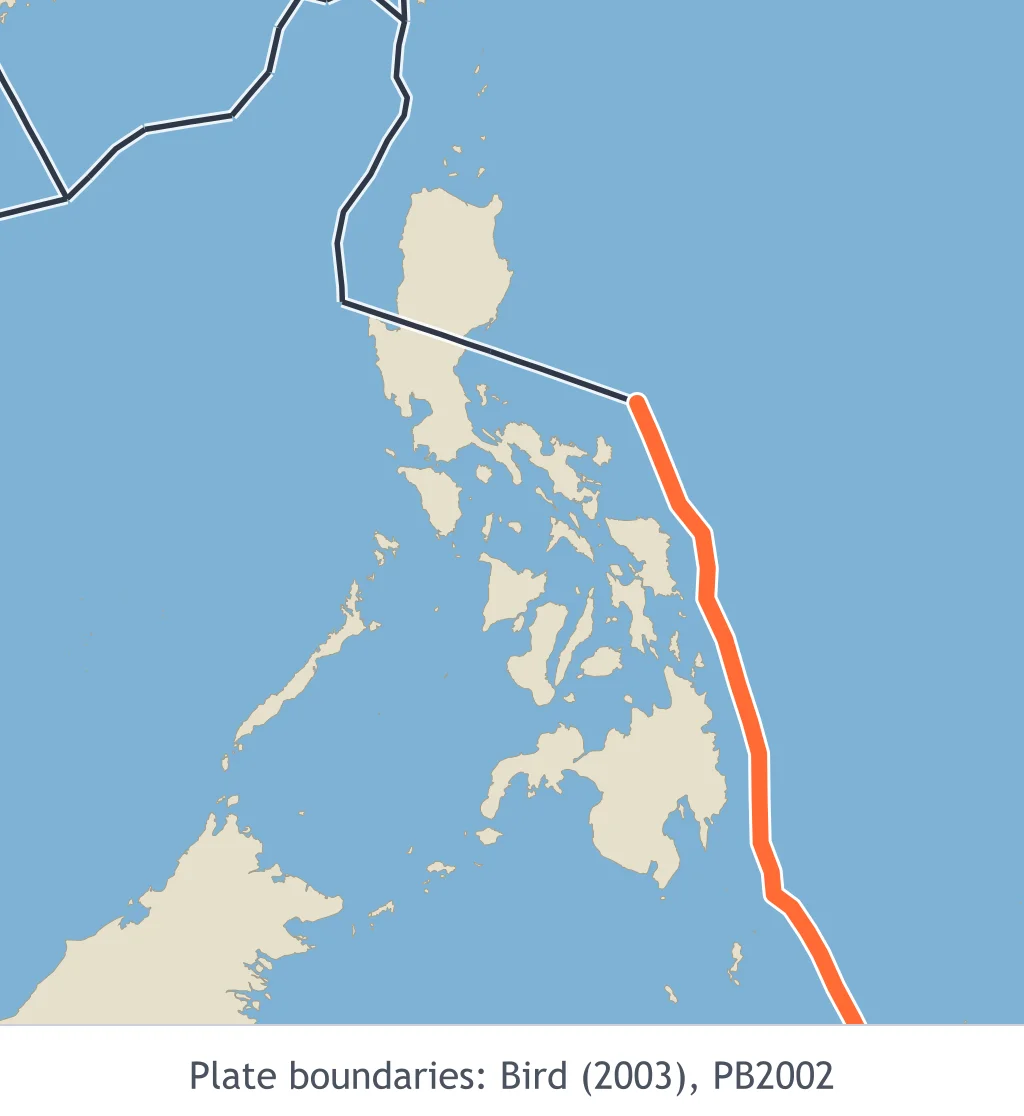
Which mapped pattern best supports the presence of active plate boundaries around the Philippines?
What motion mainly occurs along the Philippine Fault Zone?
In the common seven-major-plate classification, which listed plate is a major plate?
Which property is mainly used to distinguish major from minor tectonic plates?
Which interaction does the model represent?
What is expected as the two blocks in this model meet?
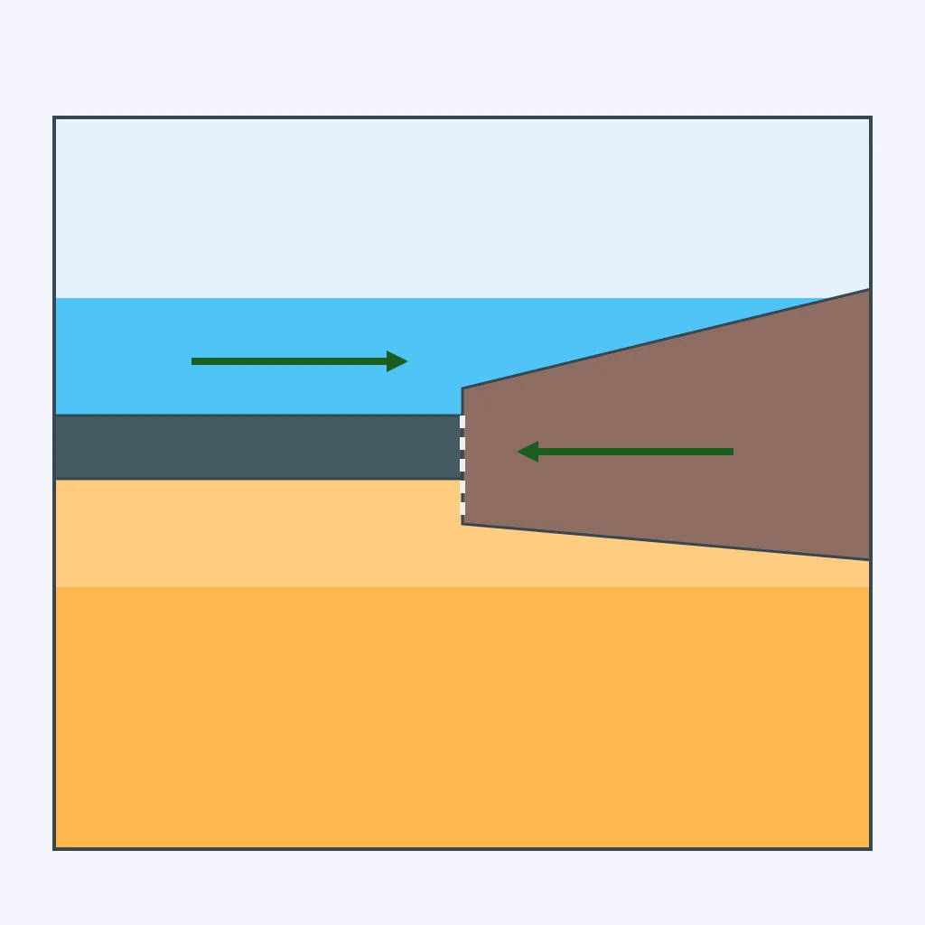
What interaction built the Himalayas?
Which type is represented in this model?
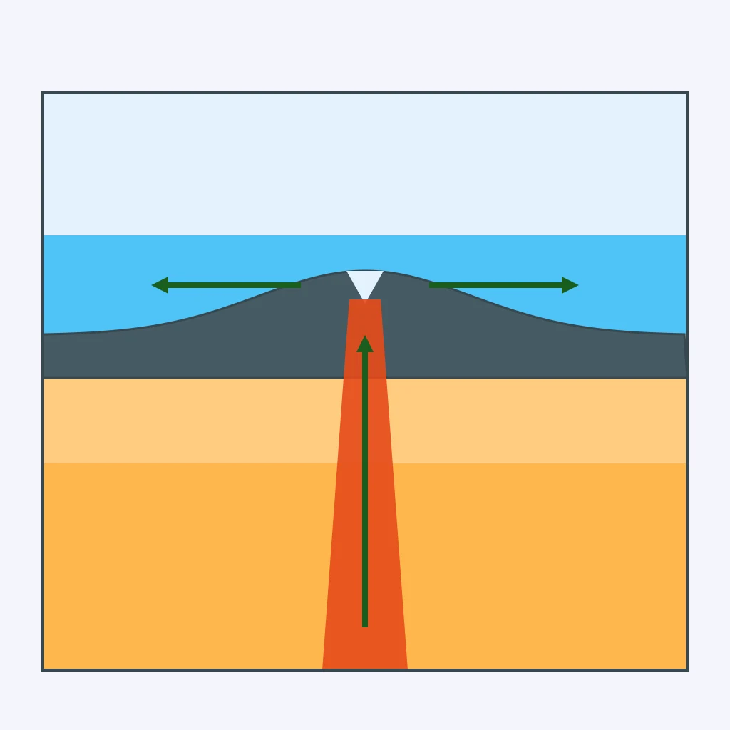
At the Mid-Atlantic Ridge, how is additional seafloor produced?
A continent is slowly being pulled apart. What surface feature is likely to develop?
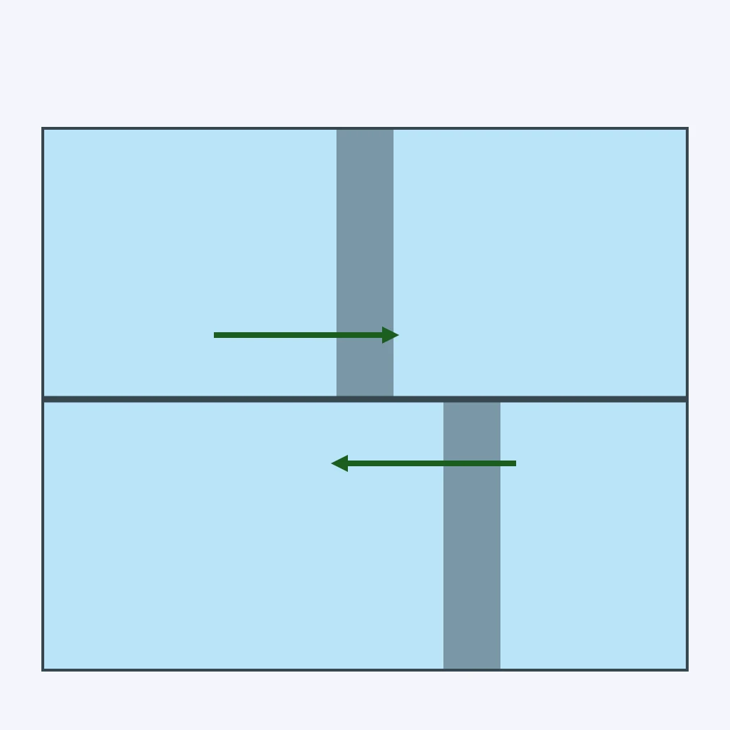
Classify the motion shown in this overhead model.
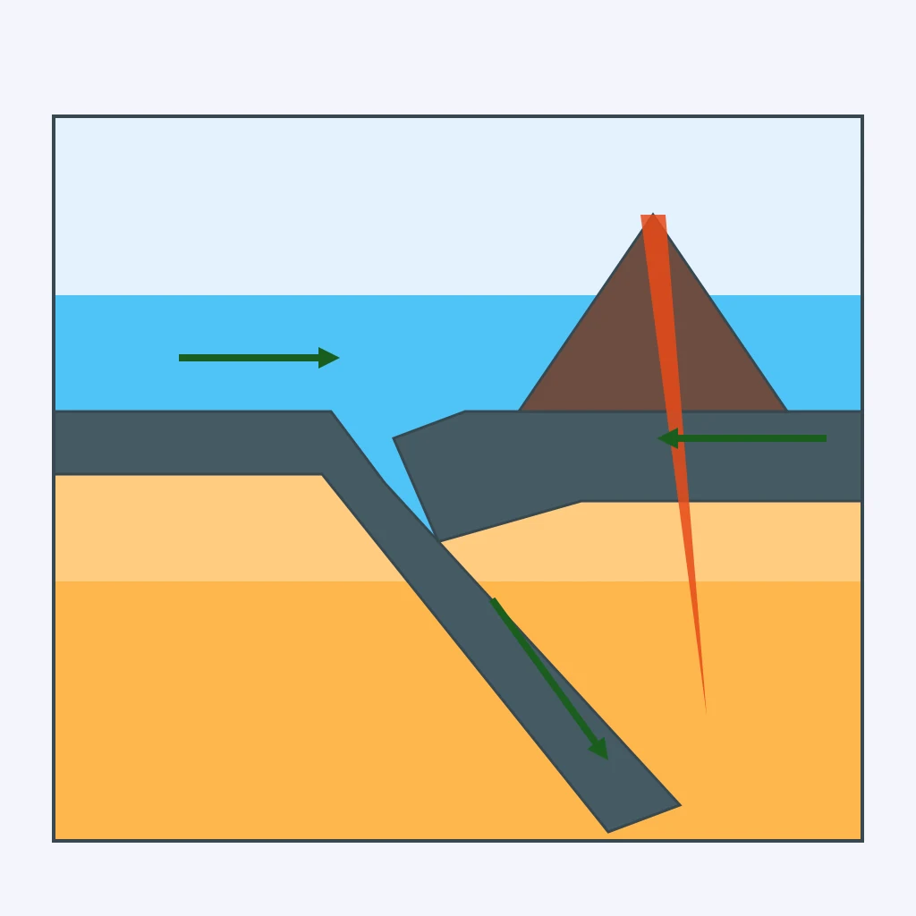
At the orange-highlighted trench west of Luzon, what happens to oceanic lithosphere?
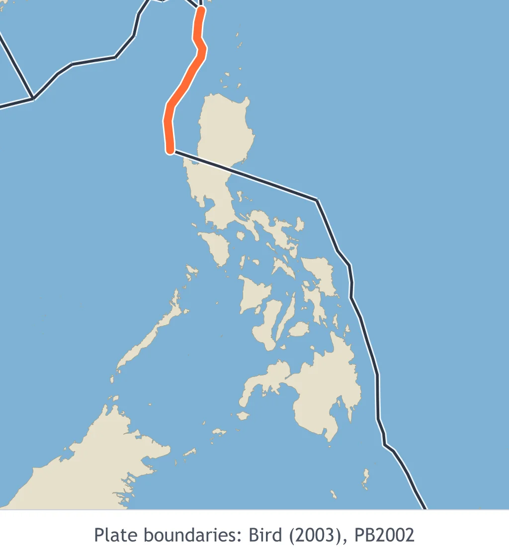
A large earthquake occurs beneath the sea. Which fault movement is most likely to generate a tsunami?
Fine volcanic particles cover roofs and crops after an eruption near Mayon. Which hazard is occurring?
After an eruption, heavy rain mixes loose volcanic debris into a fast-moving slurry down a river channel. What is this hazard called?
Which volcano produced the major 1991 eruption in Luzon?
For a coastal town, which planning concerns can maps of active faults and offshore trenches most directly inform?
Crack the passcode before the zombies get in.

Pick a tile, answer, hit bonuses and steals.
Term 1 Summative Review 2
40 questions