Loading
by BlastRoom
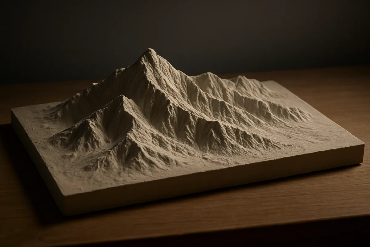
Read elevation and relief maps to compare height and describe terrain.
#geography#us_grade_4_social_studies
40 questions
One question set, multiple game modes. Tap any game to see it in action. Not sure which to pick?
Answer to place stones and capture territory.
Outrun the snow together.
Earn blasts, then hunt the other team.
Answer to earn energy, then climb.

The class blasts through walls together.
Bid on mystery lots. Most money wins.
Sell tours. Nice, standard, or a total scam.

Answer, restock, and serve the rush.
More correct answers pulls the rope your way.
Answer, then shoot down the alien wave.
Answer, then tap to leap the frozen ridge.
An elevation map key shows brown above 6,000 feet, tan 2,000-6,000 feet, and green below 2,000 feet. Mesa Point is brown. About how high is Mesa Point?
A map key shows purple above 8,000 feet, red 4,000-8,000 feet, yellow 1,000-4,000 feet, and green below 1,000 feet. Lake Camp is green, and Ridge Camp is red. Which camp is lower?
On one map, the darker color is lower: dark blue below 1,000 feet, medium blue 1,000-3,000 feet, and pale blue above 3,000 feet. Blackwater is dark blue. What is its elevation?
A relief map key shows red highlands above 5,000 feet, orange uplands 2,000-5,000 feet, and green lowlands below 2,000 feet. Pine Ridge is orange. How high is Pine Ridge?
A map key shows brown above 7,000 feet, tan 3,000-7,000 feet, and green below 3,000 feet. Elk Peak is brown, Dry Valley is green, and Cedar Hill is tan. Which place is highest?
A relief map shades red above 8,000 feet, orange 3,000-8,000 feet, and yellow below 3,000 feet. Summit Camp is orange. About how high is Summit Camp?
A map key runs from dark to light: darkest gray 0-500 feet, light gray 500-2,000 feet, and white above 2,000 feet. Port Bend is darkest gray. What elevation band is Port Bend in?
On an elevation map, purple means above 5,000 feet, blue means 1,000-5,000 feet, and yellow means below 1,000 feet. Canyon Rim is blue. About how high is Canyon Rim?
A map key shows brown above 2,500 feet, tan 500-2,500 feet, and green below 500 feet. Lakeshore is green, Ridge is tan, and Peak is brown. Which place is highest?
A map key lists pale yellow 0-1,000 feet, tan 1,000-4,000 feet, and brown above 4,000 feet. Cedar Basin is tan. What elevation band contains Cedar Basin?
A map legend says green means low elevation, yellow means middle elevation, and red means high elevation. Dune Flats is yellow. What does yellow tell about Dune Flats?
A relief map key shows dark orange above 7,000 feet, orange 3,000-7,000 feet, and cream below 3,000 feet. Fire Lookout is dark orange, and Mill Creek is cream. Which place is higher?
On a map where darker means lower, dark brown is below 800 feet, tan is 800-2,000 feet, and pale yellow is above 2,000 feet. Prairie Lake is dark brown. About how high is it?
A map key lists blue below 500 feet, green 500-2,000 feet, tan 2,000-6,000 feet, and brown above 6,000 feet. High Desert is tan. What is its elevation band?
An elevation map shows Trailhead in green, Campground in tan, and Mountain Pass in brown. The key says green below 2,000 feet, tan 2,000-5,000 feet, and brown above 5,000 feet. Which place is highest?
A map key shows green coastal plain 0-500 feet, yellow Piedmont 500-1,500 feet, and brown mountains above 1,500 feet. A town is in yellow. About how high is the town?
A relief map key shows green flat lowlands, yellow rolling hills, and brown rugged mountains. Pine Valley is brown. What is the land like at Pine Valley?
On a shaded relief map, smooth pale areas are flat plains, bumpy shaded areas are hills, and steep dark ridges are mountains. County Seat is in a smooth pale area. What terrain is there?
An elevation map shows a broad green area below 1,000 feet along a river at River City, tan hills to the west, and brown mountains farther west. What is the land like at River City?
A relief map key marks orange as a high, flat plateau, red as a canyon with steep sides, and green as a low plain. Red Rock is orange. What landform is Red Rock on?
A coastal relief map shows tan beach, green coastal plain, and brown mountains. Bay Farm is in the green area behind the beach. What terrain does Bay Farm have?
On a map where dark color is lower, dark blue means low flat basin, light blue means rolling upland, and white means high mountains. Shadow Basin is dark blue. What terrain is there?
A relief map shows closely packed shaded ridges at North Pass, wide smooth green land at South Field, and gently wavy tan land at Center Hill. Which place is mountainous?
A relief map key says a tan tableland is high and flat with steep sides. Sage Table is in the tan tableland area. What landform is Sage Table on?
An elevation map shows Willow Creek on green land with brown land on both sides. The key says green is lower land and brown is higher land. What terrain is at Willow Creek?
A relief map key says yellow is rolling hills, green is flat plains, and brown is mountains. Wheat Farm is yellow. What is the land like at Wheat Farm?
A relief map key shows green low plain, tan high flat plateau, and brown steep mountains. Desert Mesa is tan. What terrain is at Desert Mesa?
On a map where the darkest color is lowest, dark purple means lowest flat shore, medium purple means hilly upland, and pale purple means highest ridge. Harbor Point is dark purple. What terrain is there?
On a relief map, the Ozark area is covered with many small, rounded patches of shadow, while the Delta area has no shading at all. How should the Ozark area be described?
A shaded relief map shows long, sharp lines of shadow crowded around Eagle Gap and no shading around Lake Camp. What is the land at Eagle Gap like?
An elevation map shows mountains above 6,000 feet between Town A and Town B, while a valley route stays below 2,000 feet. What would this likely mean for wagon travel?
Brown mountains are west of a green lowland plain. A river starts in the brown area and reaches the green plain. What direction would the river most likely flow?
A farming family reads a map showing a broad, flat valley below 1,000 feet and nearby steep slopes above 5,000 feet. Where would crop fields likely be easier to make?
An elevation map shows a settlement site on low green land beside a harbor, while inland brown mountains rise steeply. What likely helped people settle near the harbor?
On a map where dark gray is lowest, dark gray means below 500 feet, light gray means 500-3,000 feet, and white means above 3,000 feet. A road can cross a dark gray plain or a white ridge. Which route is easier?
A relief map shows a pass through a mountain range. For travelers crossing the range, what does the pass provide?
A relief map shows a plateau higher than nearby plains but broad and flat on top. What does that relief suggest about travel on the plateau top?
A map shows one town site in a narrow canyon with steep sides and another on a broad plain. What could the canyon's steep sides make harder?
Brown mountains are north of a green plain. A stream begins in the mountains and reaches the plain. What direction would the stream most likely flow?
An elevation map shows Low Town at 500 feet and High Town at 8,000 feet in the same area. What is most likely true about their weather?
Crack the passcode before the zombies get in.
Answer, then swat bugs for bonus points.
Race through questions at your own speed.
Same question on every screen. Fastest wins.

Pick a tile, answer, hit bonuses and steals.
Natural Hazards and How People Respond
40 questions